West Seattle, Washington
02 Thursday
 (April photo of encampment, taken by an Arrowhead Gardens resident)
Back on Tuesday, we told you about reports of cleanup activity on the east side of Myers Way, though people and vehicles remained visible in the northeasternmost encampment area, on state/city land. We had asked local and state departments/agencies for updates. We’ve also gone back the past two days and seen no signs of further activity; this morning, the “no parking” signage along the city stretch of the street was gone. Meantime, a statement was sent to us and others, including Arrowhead Gardens resident groups and the Highland Park Action Coalition; it indicates that any further activity is still in the planning process. The statement is from Brian Nielsen, WSDOT Northwest regional administrator, who explains that he is “responsible for overseeing all aspects of state right of way within the Region”:
Dear Arrowhead Gardens Senior Living community and Myers Way neighbors,
I want to share with you information and next steps as it relates to the encampments on Myers Way. The Washington Department of Transportation (WSDOT), Washington State Patrol, King County Regional Homeless Authority and the City of Seattle collectively agree that this site is our top multijurisdictional site to address. Operational teams are coordinating a site resolution plan.
Our teams are working together to determine next steps to address the site and those living there unhoused. This work requires a multi-agency approach as the encampment is spread across both WSDOT and City property and we know from experience that close coordination is the best way to resolve these sites for the short and long term. Actions currently underway include:
Site stabilization
WSDOT, in coordination with partners, will assess the location to determine where we might make changes to better manage ingress and egress to the site to prevent further growth and better manage access.
The City of Seattle is onsite providing litter picks and trash mitigation at this site several times a week.Outreach, Housing, and Shelter – KCRHA will:
Assess housing and shelter availability and options within the current system.
KCRHA’s outreach providers are onsite regularly to engage and work with the people experiencing homelessness, ensure connections with services and prepare for housing when resources become available.Outreach staff will also provide assistance to ensure that any barriers to housing, such as obtaining identification documents, are addressed ahead of time so that people may move into housing immediately when resources become available.
Housing and shelter outreach at this site are in alignment with state legislature requirements that WSDOT and its partners in Right of Way Safety Initiative work to “transition persons residing on state-owned rights-of-way to safer housing opportunities, with an emphasis on permanent housing solutions,” and that the housing offered is a “meaningful improvement over the individual’s current living situation” and “well-matched to an individual’s assessed needs.”
Although the circumstances and conversation regarding the encampment are challenging, I am committed to sharing the parameters in which our agency operates transparently. I also very much appreciate your concerns and understand that you have questions. Please know that we hear your concerns and are working with urgency. We are not currently in a position to share a definitive timeline for site resolution, but we would like to provide timely updates for your community as they are available. I will share more information next week.
City Councilmember Lisa Herbold had said last week that the resolution was “planned.” But we haven’t heard back from her office, the city’s homelessness-response spokesperson, or the state regarding exactly what it was that happened this past Tuesday. Meantime, no arrest reported yet in the Myers Way murder and assault cases from earlier this month.
 (WSB photo from aftermath of 2016 West Marginal crash blamed on racing)
Less than a week after the latest meeting between city officials and Alki/Harbor neighbors concerned about street disorder and dangerous driving, a new proposal is in the works. City Councilmember Lisa Herbold is introducing a bill that would open the door to automated speed-enforcement cameras on Alki Avenue, Harbor Avenue, and West Marginal Way by designating them as “racing zones,” along with a few other areas of the city. This is a new use of enforcement cameras, authorized by the State Legislature. From the summary of Council Bill 120600:
As authorized by recent changes in Washington State Law (RCW 46.63.170), this legislation authorizes the expansion of camera enforcement to detect speed violations in walk areas, public park zones, hospital zones, and restricted racing zones. This legislation also designates the specific racing zones where camera enforcement is authorized, including:
Alki Avenue SW between 63rd Ave SW and Harbor Avenue SW.
Harbor Avenue SW between Alki Avenue SW and SW Spokane St.
West Marginal Way SW between SW Spokane St and 2nd Ave SW.
Sand Point Way NE between 38th Ave NE and NE 95th St.
NE 65th St between Sand Point Way NE and Magnuson Park.
Roadways inside Magnuson Park including, but not limited to, NE 65th St and Lake Shore Dr NW.State law (RCW 46.63.170(1)(d)(ii) requires an equity analysis that evaluates livability, accessibility, economics, education, and environmental health when identifying camera locations using this new authority.
Councilmember Herbold’s legislative assistant Newell Aldrich tells WSB that this would give SDOT the “authority to install speed cameras, but not immediately: “There are steps that must be taken in the state law before installing cameras, e.g. an equity analysis.” Previously, speed-enforcement cameras were only allowed in school zones, and the city is already pursuing doubling those (from 35 citywide now, to 70). Aldrich says the racing-zone camera proposal will be the subject of a briefing one week from tomorrow, 9:30 am June 20th, in the Transportation and Seattle Public Utilities Committee, whose chair Councilmember Alex Pedersen is co-sponsoring it. A vote could happen in mid-July. Meantime, we’re seeking some followup information, such as the potential cost of these cameras (which of course would be revenue generators as well) and whether they’d be in use 24/7, not just “racing” hours (West Marginal has been much-discussed as a speeding zone around the clock).
 (WSB photo, May 30)
After a murder and other incidents, “resolution” is planned for the encampment on the east side of the north end of Myers Way, according to City Councilmember Lisa Herbold. From her newest weekly newsletter:
… On May 31st, I requested that the King County Regional Homelessness Authority consider this location for its State-funded work removing encampments in State Right of Way. The funding supports shelter and services to people living at a site. I’ve also learned that last week the Executive [mayor] also reached out to WSDOT (which owns most of the land under the encampment), also recommending the site for joint resolution. I was told that the decision was made recently to move forward with that joint resolution at Myers Way, which I fully support.
Because this work is supported with blended funding, both from the State Right of Way program, King County Funding, and City of Seattle funding, the LEAD Policy Coordinating Group, of which I am a member, also has to agree that LEAD should take on the project. The City contract for LEAD services requires resources focused on geographic areas. So, we have LEAD resources specifically focused on South Delridge and Highland Park, you may remember the work they did at the Rosella Building in December and the Roxbury/Delridge Triangle before that. The Myers Way/Arrowhead Gardens area is not currently included as a focus area, but that will hopefully change. On Friday, I requested that LEAD refocus its District 1 specific work to Myers Way. I hope to have an outcome of that request to report out next week.
The City’s Unified Care Team, which responds to encampments, reports it’s been a complex site for the City to work in for several reasons: because the majority of the site is not City property, and the site has challenging topography and requires an in-depth safety plan that take into consideration EPA regulations in run-off areas, soil saturation levels that affect use of heavy machinery used in site resolutions, and land inclines and soil shifting.
Nonetheless, the UCT has been on site providing trash mitigation and geo cleans for RVs; along with 3-4 visits per week from outreach workers who also mitigate fire hazards and conduct needs assessments for residents.
It’s been a month since Arrowhead Gardens residents met with city reps (WSB coverage here) who agreed that removal of the encampment was needed, but had no firm commitments. That was three weeks before the shooting that killed 35-year-old Reginald Moore.

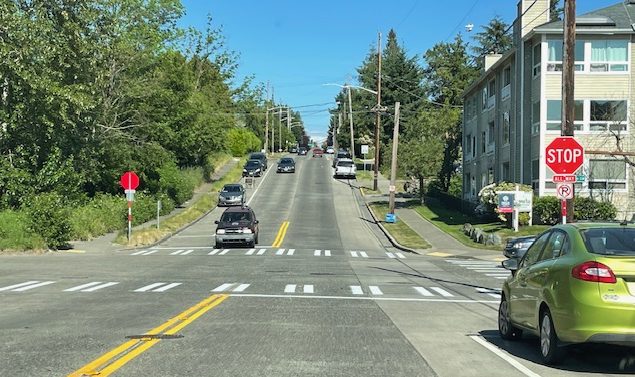
4:47 PM: Thanks for the tip! That’s one of two new stop signs on 44th SW where it meets SW Findlay [map]. This is just west of California/Findlay, where SDOT installed a pedestrian-activated “half-signal” last October. The reader who emailed us about this earlier today said “yield” signs had been there previously, adding, “Not sure why the change – no recent increase in accidents or near-misses. Also, when traveling north on 44th, the new stop sign is obscured by a tree.” Same tree that’s in our photo, but the sign only comes into view when you arrive right up to it. We have a question out to SDOT about the rationale for the installation.
6:50 PM: SDOT spokesperson Ethan Bergerson responded, “This was a standalone project. The new stop sign is intended to enhance safety and provide clarity for people traveling through this intersection.”
 (WSB photos. King County Sheriff Patti Cole-Tindall at Greenbridge event)
Greenbridge Plaza (8th SW just south of SW Roxbury) is one of five places where Public Health Seattle & King County is giving away 100 gun lockboxes right now as part of a Gun Violence Awareness Day event.


As noted in our daily preview and calendar, the giveaway is happening until 5:30 pm, in partnership with YMCA Alive and Free. PHSKC’s announcement explains:
Safe firearm storage is the best way to reduce the risk of unintentional shootings and injury, and prevent firearms from being stolen and misused by others. In order to help increase safe firearm storage, Public Health runs the Lock It Up program. Everyone who owns firearms can take action by locking up their guns. For more information about gun lockboxes and related resources, visit Public Health’s Lock It Up program webpage.
That page includes a list of retailers where storage/locking devices are available if you miss today’s giveaway.
Thanks for all the tips! Multiple emails alerted us to the new all-way stop configuration for 25th/Trenton, with marked crosswalks, on the northeast edge of Westwood Village. We asked SDOT about it; their reply: “This is a new all-way stop. The goal is to improve safety for everyone but especially pedestrians. There are a relatively large number of pedestrians crossing, including high school and middle school students. The new stop signs will also help transit make the left turn from Trenton to 25th.” It’s been five years since pathway improvements were built just north of the intersection.
 (WSB photo, Tuesday morning)
As reported here Tuesday, part of the under-construction 4-story apartment building at 5952 California SW fell onto the property next door during windy weather Monday night. No one was hurt, but the fallen material did some damage. A complaint was subsequently filed with the city Department of Construction and Inspections. We asked SDCI if an inspector had been to the site, and if so, what was the result. Here’s what spokesperson Bryan Stevens tells WSB today:
We completed a site visit yesterday morning and saw that most of the fallen material had been removed and cleaned up. Some damage occurred to the neighboring property and was actively being repaired by the builder. We spoke with the contractor from the site, and they increased their temporary bracing to ensure the wall framing is supported per best practices.
The Washington State Dept. of Labor & Industries has been contacted and will be visiting the site to do an investigation of worksite safety and best practices.
We went back to the site Wednesday and took this photo:

Side note: While checking SDCI’s website, we noticed this is Building Safety Month.
(April photo of encampment, taken by an Arrowhead Gardens resident)
By Tracy Record
West Seattle Blog editor
The growing encampment in the woods east of the north end of Myers Way [map] is currently the Southwest Precinct‘s second-highest call-generating location, police say. And that’s a major reason why it’s high on the priority list for a future site cleanup.
That’s what a room packed with dozens of concerned residents at Arrowhead Gardens – the senior-living complex across the street from that encampment – heard from a panel of city reps in a meeting Monday afternoon. You can see it in its entirety in the video below, recorded and provided by AG resident John Walling.
Resident Diane Radischat facilitated the meeting, with a city panel including Southwest Precinct Crime Prevention Coordinator Jennifer Danner and Operations Lt. Dorothy Kim, the precinct’s City Attorney liaison Joe Everett, Tom Van Bronkhorst from the city’s homelessness-response-focused Unified Care Team, and another UCT rep, Marta Idowu, the Civil Rights Advisory Commission Liaison for the Mayor’s Office.
Danner began with a reminder of when to call 911: “SPD is very data-driven … we rely on our community to make sure the data is accurate … if you see any kind of criminal or suspicious activity, we want you to report it.” She said that in many cases, the “data” – records of 911 calls – doesn’t match what they hear at meetings like this, and indeed as the meeting went on, several people mentioned incidents that they hadn’t called in at the time.
But it was stressed that aside from criminal or suspicious activity, SPD is not the agency to call just to report an unauthorized encampment’s existence.
 (SDOT camera image)
Discussions of the hole that shut down the state-owned ramp from the West Seattle Bridge to Highway 99 (reopening tomorrow) have swerved into concerns about the condition of the city-owned Spokane Street Viaduct. (That’s the formal name for the east half of the West Seattle Bridge, from Highway 99 to I-5.) Those concerns also came up during the 2 1/2-year repair closure of the west half of the West Seattle Bridge. The eastbound Spokane Street Viaduct, not part of the repair project, did close for work including pothole repairs multiple times during those 2 1/2 years, and SDOT did deck scanning for a more extensive assessment. Then in July of last year, the city announced it had received a $5 million federal grant to resurface the entire eastbound side of the SSV. At the time of that announcement, SDOT told us that resurfacing would happen in “the next few years.” So we asked last week where that plan stands, and got this answer today from SDOT spokesperson Ethan Bergerson with a somewhat speedier timeline: “We are currently in the design phase of this project, and anticipate starting construction as soon as next year. The construction work will address the frequent overlay issues that we have been encountering on the eastbound lanes of the Spokane St Viaduct.” The eastbound lanes are on the original 1940s-built SSV structure; the westbound side was built a decade-plus ago to widen it
 (WSB photo, Wednesday)
2:52 PM: Six days after that hole forced the Washington State Department of Transportation to close its ramp connecting the eastbound West Seattle Bridge to northbound State Highway 99, here’s the latest:
As reported over the weekend, crews poured concrete on Saturday, and now it’s curing. WSDOT spokesperson James Poling explained why the schedule remains the same as announced last week (which would reopen the ramp by this Saturday): “The concrete curing process requires our offsite materials lab breaking test concrete cylinders from the pour at certain time benchmarks (24 hours after pour, 48 hours after pour, etc.). Once a test cylinder reaches a strength to safely reopen traffic, the bridge ramp will reopen. The timetable remains the same at this time as our crews await a test cylinder to pass that strength benchmark.”
Meantime, since there was initially much public confusion over who’s accountable for the ramp, and some commenters said they had filed ramp-pothole reports with the city, we asked the Seattle Department of Transportation if they’d received such reports about the state-owned ramp and what happened to them. Spokesperson Ethan Bergerson replied, “When the public reports a pothole which is outside the city limits or not on SDOT’s right-of-way, it will be routed to the correct transportation agency. Over the past few months, we notified WSDOT of several public reports of potholes in this location.” We’ll follow up on that, as WSDOT had said previously they weren’t aware of the hole – at least at the magnitude that forced last Tuesday’s closure.
4:28 PM UPDATE: Just got another update – the ramp concrete “has cured more quickly” than expected, and the ramp will be open by 5 am tomorrow (Tuesday).
 (WSDOT photos)
The Washington State Department of Transportation says its crew made more progress today toward repairing and reopening the ramp between the West Seattle Bridge and northbound Highway 99. It’s been closed since Tuesday night, when a 5′ x 4′ hole in the 64-year-old ramp caused tire blowouts for at least five drivers. WSDOT’s latest update: “Today we’ve poured concrete. It usually takes a few days for this type of concrete to cure properly in order to safely reopen the ramp.”

We’ll find out on Monday if that’s altered the schedule – originally announced as 10 days, which would mean reopening by next Saturday. In the meantime, your options for getting to Highway 99 are the 1st Avenue South Bridge or via the 1st Avenue exit on the eastbound bridge, leading you into SODO, where you can get onto 99.

That map from SDOT shows where work is expected to start soon for pedestrian improvements at Roxbury/Olson [map], which have been in the works for at least three years. The city has sent notices to people in the area, but it’s a busy corridor, so many others who use it need to know too. From the SDOT advisory:
This work will include:
-A new pedestrian signal on the northwest side of the intersection
-Shifting the crosswalks across SW Roxbury St so they’re better aligned
-Curb bulbs that extend the sidewalk corners for people walking on the south side of the intersection
-Curb ramps for improved ADA (Americans with Disabilities Act) accessibility
Once work begins, it is expected to last six months, SDOT says, with work hours primarily 9 am-3 pm on weekdays. They’ll have flaggers to help with lane closures. Here’s the full construction notice.
 (WSB photos, noontime today)
When we went over today for another look under the damaged ramp to Highway 99, we arrived just as that crew was ascending to the ramp’s underside. It’s been two days now since a 5′ x 4′ hole in the ramp took out tires on at least five vehicles before WSDOT ordered it closed. It’s a state-owned structure, as is Highway 99, to which the ramp leads from an exit on the eastbound West Seattle Bridge. WSDOT spokesperson James Poling tells WSB that repairs remain on schedule – that’s the schedule announced yesterday, 10 days, which would mean the work is expected to be done by May 13th. He says the lift we photographed carries workers 38 feet up from ground to ramp. So what exactly is happening now? Poling replied, “Most of the concrete removal is now complete. The next repair step is building forms underneath the deck and sealing the space between the girder webs. This will take about 36-48 hours.”

As we reported yesterday, the ramp was built in 1959 and last inspected in August 2022. It remained open to traffic during the West Seattle Bridge’s two and a half-year closure, still accessible via a ramp from surface Spokane Street, except for a week-plus closure to repair a deck hole about 100 feet from this one.
P.S. We found more information about the ramp via this inventory map – including its official name, E-N Ramp, and confirmation that its inspection schedule is every two years
 (WSB file photo from past Bike To School Day)
If you’re on the roads and/or sidewalks tomorrow (Wednesday, May 3rd), expect more multi-modal traffic heading to and from local schools. Genesee Hill Elementary parent Dave points out that it’s Bike/Walk/Roll To School Day and wanted us to share this reminder again: “Drivers, please keep an extra eye out for students biking and walking to school tomorrow, May 3rd. Students will be coming from all directions between 7:30-7:45 AM and arriving in the parking lot on Dakota St.” Any other schools participating? Let us know (or post a comment) – thank you!

We got multiple messages Thursday afternoon from people wondering about the smaller boxes that have replaced the previously standard larger boxes outside both of West Seattle’s post offices. After verifying the change (our photo above shows the one outside the Westwood Village post office), we asked regional USPS spokesperson Kim Frum about it today. Her answer, in short: These smaller boxes are more secure. The long version:
The increase in crime throughout the country over the past several years has resulted in escalating criminal incidents against United States Postal Service (USPS) employees and the mail. Every postal employee deserves to work in safety and to be free from targeting by criminals seeking to access the public’s mail. In an increasingly challenging environment, the USPS and the United States Postal Inspection Service (USPIS) are highly focused on protecting postal employees and property and ensuring the secure delivery of the nation’s mail and packages.
Recognizing these ongoing safety threats, we have been – and will continue to- implement an engaged, robust nationwide initiative to harden blue collection boxes, enhance collection box key and lock technology and institute dual authentication for change of address protocols. These measures not only protect the integrity of the mail but offer additional safeguards for our carriers and other employees. Furthermore, USPS and USPIS are partnering with federal and local authorities to enforce the laws and bring criminals to justice.
We will continue to adapt to evolving security threats and implement expanded measures to safeguard our employees and preserve the security of the mail that our customers expect and deserve.
The Postal Service will be releasing and implementing additional preventative, protection, and enforcement measures later this spring.
While we don’t know about specific measures involving these two mailboxes, this type of box isn’t entirely crime-resistant – as evidenced in Admiral back in January.
In West Seattle Crime Watch this afternoon:
EARLY MORNING THIEF: Kristina sent the security-camera image and report from a neighborhood east of Lincoln Park:
This person came onto our property at 4:06 am today and stole an OUTGOING package from our mailbox. They then used a flashlight to go through the back of our truck parked in our driveway. We have heard from several neighbors that their vehicles were broken into as well. We are on 46th Ave SW, between Austin and Kenyon Streets.
This was reported to police; the preliminary tracking number is T23008999.
PREVENTION ADVICE: Southwest Precinct Crime Prevention Coordinator Jennifer Danner has sent a newsletter with advice on deterring two types of crime that are particularly prevalent in our area right now – auto theft and commercial burglaries. Read it here.
Last week we heard from Taylor about a malfunction with the flashing beacon signal for the crosswalk on California at Genesee. They reported it to SDOT, and it got fixed. But now we’ve heard from Jesse that it’s broken again: “Just a heads up, the pedestrian crossing signal at California and Genesee isn’t working. I’ve reported it to the city, but if people want to cross they should probably go a block either way to do so safely.” (Besides the Find It Fix It app, you can report transportation-related trouble via 206-684-ROAD or, after hours, 206-386-1218.)

After last weekend’s work, SDOT says it’s “nearly” done installing the 2-way protected bike lane along an almost-half-mile stretch of West Marginal Way SW north of the Duwamish Longhouse – jersey barriers are up and lane markings are painted. We drove alongside it this afternoon for a closer look:

Reminder signage is in place at driveways not only on the bike-lane side but also on the northbound side of West Marginal, where the pre-existing Duwamish Trail crosses. It’s been more than two years since SDOT proposed the bike lane, eventually deciding to hold off on installation until after the West Seattle Bridge reopened last September.
 (Mayor’s Office photo)
Southwest Pool in West Seattle is expected to be part of a program announced by Mayor Bruce Harrell today. Registration will open May 16th for Swim Seattle, described as “a new drowning-prevention and youth aquatics initiative.” Here’s the city news release, sent following a launch event at Rainier Beach Pool:
Swim Seattle is a new initiative that will combine the efforts of YMCA, Public Health—Seattle & King County, Associated Recreation Council, Washington State Parks, No More Under, Seattle Children’s, and the University of Washington to remove barriers to learning to swim and to eradicate disproportionate drownings among youth of color.
In 2023, Swim Seattle will begin as a pilot by providing a year of free lessons to a cohort of 250 youth, prioritizing access to those who cannot afford lessons, while also providing workshops to support children and their families in becoming comfortable swimmers and water safe.
“Teaching children how to swim and be safe around water is an important lesson that will serve them for years to come,” said Mayor Harrell. “For far too long, lack of access to swim lessons and water safety education has put children and families of color at a disproportionate risk of drowning. Swim Seattle will address these disparities by offering free lessons to the children who need them most, removing the barriers that have prevented many youth and families from accessing swim lessons and offering culturally responsive workshops so they have the tools they need to stay safe in and around the water. Programs like this will help every child, from every neighborhood, access opportunities to learn and grow, promising a safer future for our entire city.”
“Swim Seattle is a promise that, together with our partners, and any interested investor to come, the Department of Parks and Recreation will not stop until we can eradicate the barriers to learning to swim and erase the needless risk and harm to our children. While we are starting small, with phased and implemented pilot programs to study effective outcomes, we know a program like Swim Seattle cannot wait, and drowning disparity data amongst white children and children of color implores us to act now. Swimming is an essential life skill that must be taught to all children, and Swim Seattle will ensure that all those living in a city surrounded by water can enjoy that water safely,” said AP Diaz, Seattle Parks and Recreation Superintendent.
“Water safety is a critical part of childhood development,” said Loria Yeadon, President and CEO of the YMCA of Greater Seattle. “Unfortunately, many historical and generational barriers prevent children (especially children of color) from accessing swimming lessons, including cultural barriers, systemic inequalities, and lack of transportation. We still feel the effects of those barriers today. At the Y, we are breaking barriers to swim safety and fun by offering programs designed to make swim lessons accessible, affordable, and culturally responsive. Water safety is for all and our collective responsibility, and we are excited to join the Swim Seattle collaboration to ensure that every child learns how to swim and stay safe around the water.”
“Water safety is a fundamental life skill that every child should have the opportunity to learn. Swim Seattle is doing its part to ensure that children in our community have access to quality swim lessons, regardless of their financial circumstances. By working together, we can ensure that every child has the chance to swim safely and confidently in our state’s beautiful bodies of water,” said Chezik Tsunoda, Executive Director of No More Under.
“We all have some connection to the dangers of drowning. And we all can help improve this devastating problem. Numbers show that water safety is a critical public health and public safety issue. Swim Seattle invests in our children’s futures and will save lives in the long run,” said Tony Gomez, Manager of Injury Prevention for Public Health-Seattle & King County and one of the co-leads for the Washington State Drowning Prevention Network.
Registration for the first cohort will begin May 16, online, in-person at Seattle pools, and via phone (206-684-8020). Lessons will begin in summer 2023 at pools throughout the city, and workshops for families will be monthly on topics such as skincare and haircare when swimming, addressing fears of water, and water safety practices.

We stopped by the Southwest Precinct after the first hour of today’s Drug Take-Back Day dropoffs – one box was filled and a second well on the way. Left to right above are Betsy Cruz from the DEA, SPD Officer Taylor Vergara, and Crime Prevention Coordinator Jennifer Danner. All you have to do is walk into the meeting room right off the precinct’s public parking lot (2300 SW Webster, just west of Delridge) and drop your unwanted, no-longer-needed, and/or expired medication. They have some swag too, while supplies last. As featured in our calendar and preview list, this continues until 2 pm.
P.S. If you missed it, as commenter “Auntie” notes, there are multiple West Seattle year-round dropoff spots too – you can look them up by zip code here.
 (WSB photo, December 24, 2022)
By Tracy Record
West Seattle Blog editor
It wasn’t the first time a West Seattle Junction business had been hit by crime, but the crash-and-grab attempt at Menashe and Sons Jewelers on Christmas Eve was the most jolting, in multiple ways.
That shop and others have taken individual steps toward fortification in the meantime, and the West Seattle Junction Association has been increasingly focused on security strategies in addition to what’s already in its portfolio – from parking to planters, festivals to flags. Now it’s planning a major move: Hiring private security patrols.
WSJA executive director Chris Mackay tells WSB, “We signed a contract with Praetorian to have 6 patrols a night on both foot and car to cover the entire Junction 7 nights a week from 9 pm to 5 am. We may increase these hours in response to incidents.” The patrol personnel will start as soon as next week and will not carry guns.
That’s not all Mackay says WSJA is doing: “We are addressing better lighting, creating a phone tree for businesses, creating a cheat sheet for merchant of ‘who to call,’ and directing businesses toward help with locks and gates. Everything is under way now.” Regarding lighting, “All city lights which were out have been called in through Find It Fix It.” Mackay also spoke with the Parks Department, which committed to increased lighting in Junction Plaza Park at 42nd/Alaska.
She adds, “I am also taking to SPD to get more presence from Community Service Officers.” CSOs are uniformed civilian SPD personnel who currently work citywide as community liaisons and problem-solvers.
DATA: SPD crime stats are not broken out between businesses and individuals, but looking at the West Seattle Junction stats on the SPD dashboard so far this year, through the end of March, 11 robberies, 12 aggravated assaults, 43 burglaries, and 107 larceny/theft incidents were reported. Compared to the totals for all of last year, robberies are slightly up, burglaries are about the same, and both aggravated assaults and larceny/theft reports are down. Last year in turn was up from 2021 totals, especially in aggravated assaults, which went up more than 60 percent from 2021 to 2022, and larceny/thefts, which increased 25 percent between the two years.
 (SDOT photo)
We just heard from SDOT this afternoon that the new signal at 12th/Holden is complete and should be in operation by now:
We have installed two pedestrian crossing signals (slated to be activated today), curb ramps, and a crosswalk, and painted the roadway. This project provides another controlled crossing at SW Holden St for people walking or biking along 12th Ave SW. There will be “new signal ahead” signs to alert drivers of the new signal. This signal at 12th Ave SW is also intended to be part of the Highland Park/Riverview Neighborhood Greenway. Signage on this is to come at a future phase of work.
The flashing lights at 11th Ave SW and SW Holden St will remain.
The 11th/Holden beacon was originally planned for removal until community pushback.

Several people have asked about that RV that’s partly atop the curb along the northbound lane of California SW near SW Othello on Gatewood Hill. According to what officers told dispatch a short time ago after someone called in to report it, the RV was involved in a collision earlier this morning. @SDOTTraffic mentioned it briefly at 5:41 am. No injuries, as SFD was not dispatched; no other details available.

| 37 COMMENTS