West Seattle, Washington
06 Monday
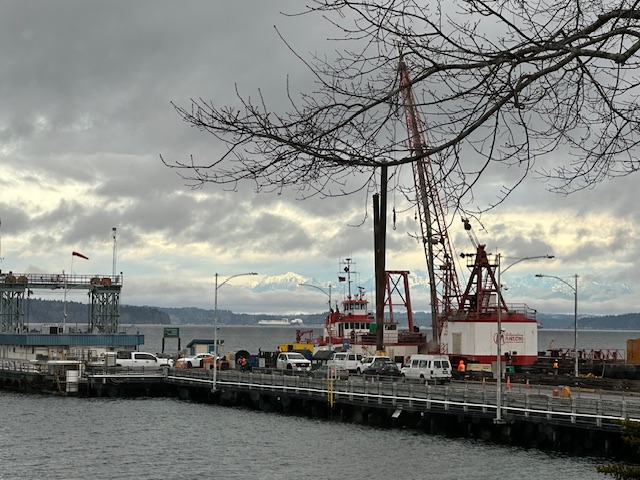
Thanks to the texter who sent that photo, wondering what’s up with the crane alongside the Fauntleroy ferry dock. We took the question to Washington State Ferries, and a spokesperson replied:
The crane at our Fauntleroy dock is part of a planned maintenance project at the terminal.
Manson Construction towed a derrick barge, a material barge, and a small tug to the site to begin repairs that started (today) and are expected to last about a week. The work includes driving two steel H-piles at the north and south edges of the timber trestle to replace deteriorated timber piles, adding structural steel, making repairs to the bridge seat and replacing damaged rub timbers along the south wingwall.
Most of the work won’t affect customers. However, there may be brief impacts when a new steel beam is installed, including possible single-lane vehicle loading on the transfer span or temporary vehicle weight limits.
We’ll keep a close watch on the work and coordinate with the contractor to limit any disruptions to service.
The old dock has to be kept in good working condition at least five more years; the current timeline for design and construction of its replacement is 2028-2031.
Checking the Washington State Ferries alert page to see if there’s been any change in the projection that Fauntleroy-Vashon-Southworth will be down to two boats until at least Tuesday, we see the system now has three boats out of service on Seattle (including West Seattle) routes: Seattle-Bainbridge is down to one boat because 28-year-old M/V Tacoma broke down; Seattle-Bremerton was already down to one boat because 52-year-old M/V Walla Walla is out of service; and Fauntleroy-Vashon-Southworth remains down to two boats because 46-year-old M/V Kittitas needs repairs. So if you’re planning to go just about anywhere via WSF any time soon, be aware they’re running on a much-reduced fleet right now – already below the number of vessels considered the desired baseline (currently 14 are in service per the real-time map). The alert page has links to the alternative schedules currently in use.
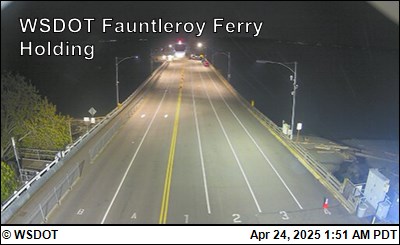
(‘Live’ image from WSF camera at Fauntleroy terminal)
In this morning’s traffic/transit/weather roundup, we mentioned that the Triangle Route was down to two ferries. WSF now says that’ll last at least until Tuesday:
The #1 vessel, Kittitas, is out of service due to necessary vessel maintenance. The route will be on two-boat service until further notice. Early this morning, Friday, Jan. 2, we discovered damage to an oil seal in the vessel engine room. We expect repairs to be completed early next week.
Fauntleroy/Vashon/Southworth service through Tuesday, Jan. 6:
Friday, Jan. 2: As of 11:20 a.m., we are now running the two-boat schedule with the #1 Cathlamet and #2 Sealth. Please expect some delays during this schedule change.
Saturday, Jan. 3 and Sunday, Jan. 4: Regular weekend two-boat schedule.
Monday, Jan. 5 and Tuesday, Jan. 6: Alternate weekday two-boat schedule.
 (Reader photo sent by CJ, December 14)
By Tracy Record
West Seattle Blog editor
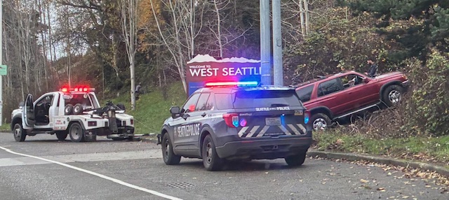
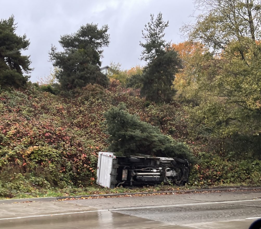
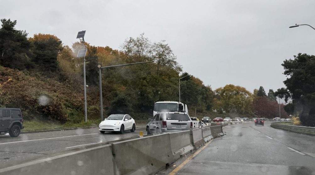
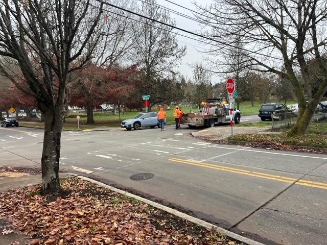
Is it the drivers’ fault or the pavement’s fault? The discussion reignites almost every time we report a crash toward the southwest end of the westbound West Seattle Bridge, in the general area of the pullout near the two remaining “Walking on Logs” sculptures and the “Welcome to West Seattle” sign. The “drivers’ fault” faction says people are just driving too fast. The “pavement’s fault” faction blames an inconsistency in the road surface right in that spot.
 (Reader photo sent by Mike, October 26)
We don’t have hard-and-fast data on crashes at this location – the SDOT collision map is neither comprehensive nor (location-wise) precise, and our archives are not necessarily comprehensive either, nor is publicly visible data: The SFD 911 log will show a collision only if there was a dispatch for injuries, and the SPD police-data map if the crash was reported by a 911 caller. Plus, there’s no functioning traffic camera in that spot, so for visuals, we’re reliant on reader photos. But our archives alone show more than a dozen mentions of crashes in that spot just this year.
 (Reader photo, October 24)
Back in February, we sought and reported on SDOT’s response to our inquiry about whether any action was planned regarding this area. A department spokesperson said at that time that they planned “to add safety enhancements to encourage drivers to approach the curve at a safer speed” and then might evaluate pavement work if that didn’t help. The timeline given was “this year.”
 (Reader photo, OMarch 24)
So now we’re at the end of “this year.” After more crashes in mid-December, we asked SDOT for an update. Here’s how they responded this time:
Based on recent crash activity and additional review, we will be installing two near-term safety enhancements to improve driver awareness of the curve:
-curve warning signs, and
-raised pavement markers to enhance visibility for approaching drivers.The work orders have been issued.
This represents a slight change from what was discussed earlier this year. While reflective markings on the existing guardrail were previously mentioned as a potential third treatment, that option is still under internal evaluation.
As we shared in February, our pavement engineers and Vision Zero team have also been evaluating longer-term solutions to improve traction in this area, including either grinding the top layer of pavement or installing a high-friction surface treatment. Those options remain under consideration and would need to be scheduled further out, taking into account resources, weather, crew availability, and traffic impacts.
We’ll continue to monitor conditions at this location and assess whether additional measures are recommended.
Some pavement work was done in that area during the 2020-2022 West Seattle Bridge closure, as we reported, and showed, in this story about a visit to the work zone toward the end of bridge-repair work.
 (Mid-December photo by Jerry Simmons)
One week into winter, Washington State Ferries will launch its winter schedule tomorrow. Here’s what WSF says will change:
Our winter sailing schedule starts Sunday, Dec. 28 and lasts through March 21, 2026. There will be schedule changes for two routes:
-The Seattle/Bremerton route will run a revised winter schedule due to terminal construction.
-The Fauntleroy/Vashon/Southworth route will switch to the two-boat weekend schedule used each winter.As a reminder, the Anacortes/San Juan Islands will continue with the fall schedule. This same schedule now runs in the fall, winter, and spring, moving the route to an improved, two-season schedule.
All other routes will operate on their regular winter schedule, available online now.
Looking ahead to New Year’s Eve, one week from Wednesday, Metro and various other transit agencies/services are going fare-free. Here’s the announcement:
King County Executive Girmay Zahilay announced today that Metro will join other regional transit agencies to provide free rides this New Year’s Eve, Dec. 31. Riders can travel without paying fares on King County Metro, Sound Transit, Community Transit, Everett Transit, Pierce Transit and the Seattle Streetcar as part of their holiday celebrations.
“Leaving the driving to us is becoming as great a New Year’s tradition as celebrating at the Space Needle,” said Executive Zahilay. “No matter where you plan to ring in the new year, you have access to free transit options to get you there!”
Regional transit agencies will operate on specific schedules to accommodate fare-free New Year’s Eve and riders are encouraged to check times beforehand.
The free Metro rides will continue until 3 am New Year’s morning. Details are here, including information on this week’s transit schedules too (as noted in our morning traffic roundup, Metro is on a Sunday schedule for Christmas Day and the Water Taxi won’t run that day).
 (File photo of M/V Kaleetan, by Gary Jones)
In Washington State Ferries‘ latest weekly update, WSF recapped that the Triangle Route, in its second week of 2-boat service, won’t be back to three boats “until another vessel is available.” That’s likely going to be a while, as one of its oldest boats, M/V Kaleetan (assigned currently to the San Juans), is undergoing emergency repairs that the weekly update says are likely to take until “late December.” As WSF boss Steve Nevey said in his own weekly update, “We need new boats.” The first of its next round of new boats isn’t expected to be ready until 2030. Meantime, WSF has set the date for its next online systemwide community meetings, which usually start with a variety of updates and then spend a significant amount of time on Q&A. They’ll have afternoon and evening versions of the same meeting on Wednesday, January 21: “WSF leaders will recap 2025, share updates on new boats and construction projects, and take questions from the public.” You can register for the noon meeting here, or the 6 pm meeting here. (Here’s our coverage of the most-recent one, back in October.)
 (Access during construction)
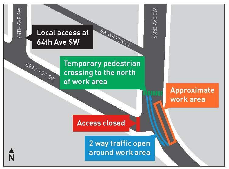
Last month, when SDOT announced it would proceed with additions promised for its Alki Point Healthy Street (Beach Drive and Alki Avenue west of 63rd), it didn’t have a date beyond “as soon as later this year.” This afternoon, SDOT sent an update saying work will start “as soon as the weekend of December 20,” for the 63rd/Beach Drive crossing features. Here’s the plan for the 63rd/Beach work:
As soon as the weekend of December 20th, we’ll begin installing intersection upgrades at 63rd Ave SW and SW Beach Dr. Crews will install new accessible curb ramps and a new flashing pedestrian crossing sign. Work is expected to occur over a three-week period, with some pauses between phases like demolition and pouring new concrete. We plan to work on one side of 63rd Ave SW at a time to minimize traffic impacts.
During the work, you can expect:
-Primary work hours from 9 AM – 3 PM, Monday-Sunday. Crews may set up or take down equipment outside of these work hours. Crews will not work on December 25 or January 1.
-Temporary sidewalk, crosswalk, and lane closures.
-Access to Beach Dr SW at 63rd Ave SW will be closed while crews are working. Local access will remain open via 64th Ave SW. Access will re-open outside of working hours.
-Traffic shifts around the work area on 63rd Ave SW. Traffic will remain open in both directions with the assistance of flaggers.
-Relocated pedestrian crossing across 63rd Ave SW north of the work area.
-Signed detours for pedestrians and protected pedestrian walkways around the work areas.
Other planned additions won’t be installed until next year, according to today’s SDOT update, because they need drier weather.
The potential downsides of temporarily increasing Highway 99 tunnel tolls during the FIFA World Cup would outweigh the benefits. That’s what Washington State Transportation Commission members just decided, so the idea is dead; we mentioned last week that this was on their agenda for today. Two possibilities were studied – a 50-cent surcharge or a one-dollar surcharge, potentially in effect June 1st through July 15th of next year. The higher of the two would raise about $1.6 million dollars, and that could help cover $2 million in extra maintenance costs. But commissioners were told that tunnel revenue under current rates would cover that cost just fine (they had seen an earlier presentation showing that the tunnel’s finances are in fairly good shape). And they also were told that increased tolls were likely to lead to more drivers diverting to surface streets, leading to more traffic trouble. So they voted unanimously to scrap the idea. (The WSTC is responsible for setting tolls and ferry fares on state facilities. The whole temporary-toll-increase idea came up because the Legislature told the commission to study and consider it.)
Early tomorrow, Washington State Ferries‘ M/V Chelan “will go out of service for maintenance, repairs, and inspections,” WSF says. They don’t have a boat to replace it on the Fauntleroy-Vashon-Southworth run, so the Triangle Route will be down to two boats for a week or so. (The two-boat schedules are linked from the WSF Alerts page.)
Last June, after months of controversy over City Councilmember Rob Saka‘s espousal of removing a centerline curb on Delridge Way, he and Mayor Bruce Harrell announced the curb would stay and three other projects would be done instead. The biggest of those projects is about to start:

SDOT says work could start as soon as this Friday (December 5) on the 22nd/Delridge turnaround. From the flyer it’s sent to nearby residents:
New Turnaround at Delridge Way SW and 22nd Ave SW
As soon as Friday, December 5, the Seattle Department of Transportation (SDOT) will start construction at Delridge Way SW and 22nd Ave SW in the Delridge neighborhood at the request of City Councilmember Rob Saka pursuant to a budget investment passed by the Full Council. We will reconfigure the triangle at Delridge Way SW and 22nd Ave SW by building a 24-foot wide turnaround on the north side of the triangle connecting the two streets (see map). This will improve circulation for people driving in this part of the Delridge neighborhood. Please note this project will remove the existing informal parking in this triangle and add landscaping within the triangle area south of the street segment.
The other two projects involve signage; together, all three cost $500,000, according to SDOT, a quarter of what the original plan was budgeted for.
For Metro, today is Mark McLaughlin Day, a tribute to the driver murdered on the job on the day after Thankgiving in 1998, including a 4 pm moment of remembrance for drivers if they can stop safely. Here’s the system alert:
Metro bus service will pause for a moment of reflection and remembrance for transit operator Mark McLaughlin at 4 pm today.
Metro operators will honor the legacy of operator Mark McLaughlin, who died tragically while driving Route 359 in 1998. Operators throughout the system will pause for a moment of silence at 4 pm today to honor Mr. McLaughlin. Operators participating in the annual remembrance will stop only where and when it is safe to do so. Operators will not pause service if they are traveling on highways or on roadways where there is no place to safely pull over.
This Metro Matters post from two years ago has the backstory.
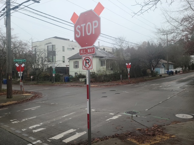
Thanks for the tip and photos! A reader reports that the intersection of 26th SW and SW Genesee is now an all-way stop, after SDOT installed signs on Genesee today:
This comes five-plus years after a community controversy over a different plan to calm traffic at that intersection: In 2020, SDOT announced a sudden plan for “diverters” at this intersection and 26th/Brandon; after neighborhood pushback, they shelved the idea in March 2021, and that’s the last time the word “diverters” appears in our archives. 26th SW is a greenway through the area.
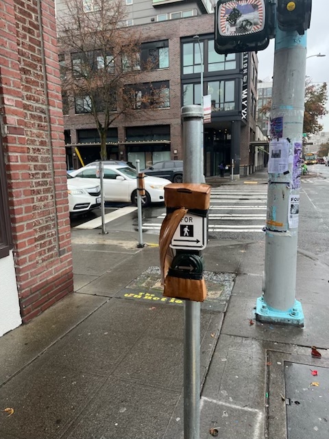
Starting right after an SDOT crew left California SW and SW Alaska on Saturday morning, people started asking us about the then-covered-up pushbuttons they installed on all corners. Some worried these were “beg buttons” meaning the intersection would stop being automatically cycled “Walk All Ways.” An explanation wasn’t available over the weekend, but we just got this reply from SDOT spokesperson Mariam Ali:
What you’re seeing are new Accessible Pedestrian Signal (APS) push buttons being installed to meet ADA standards. These provide audio and tactile cues to help people who are blind or low-vision know when it’s safe to cross. The cardboard covers are just temporary — crews keep them in place until all APS units are ready to be activated at the same time.
We’re also replacing some vehicle signal heads and overhead signs while crews are onsite, but none of this changes how the intersection operates. The California/Alaska all-walk “scramble” will continue to activate automatically. We are not switching to push-button (“beg button”) operation or making any other timing or operational changes.
Our crews will also be doing this same type of work at California Ave SW & SW Oregon St — upgrading APS push buttons and replacing vehicle signal heads and overhead signage. That work may begin once the Alaska intersection is complete, possibly early next year, weather depending.
Some other intersections already have the APS buttons – just a block east, 42nd SW and SW Alaska, for example.
SDOT has just announced the timeline for previously promised changes/additions on the Alki Point “Healthy Street” – Beach Drive and Alki Avenue’s stretches west of 63rd SW – and vicinity. These are basically what it announced early this year would be the “next steps.”

That SDOT graphic summarizes what’s ahead:
We’re excited to announce that we’ll soon begin making upgrades to the Alki Point Healthy Street at 63rd Ave SW and Beach Drive SW. These upgrades will enhance safety, accessibility, and make it easier for people to cross the street. They include:
-New accessible curb ramps, crosswalk, a flashing pedestrian / bike crossing sign at the intersection of 63rd Ave SW and Beach Dr SW.
-Two new accessible parking spaces and two new passenger loading zones near the intersection of Beach Dr SW and 63rd Ave SW. These will be on the north side of Beach Dr SW just west of the intersection at 63rd Ave SW and on the west side of Beach Dr SW just south of the intersection at 63rd Ave SW.
-An extension of the walking and rolling path on Beach Dr SW to 63rd Ave SW that will include wheel stops and a painted edge to match the existing path.We expect to begin installing these upgrades as soon as later this year. During installation you can expect some temporary parking restrictions, sidewalk and travel lane closures, and construction equipment staged in the work area. We expect work to occur during daytime hours. Design details are subject to change as we finalize design and prepare for construction. We’ll share more information about what you can expect once the work is scheduled.
As also mentioned in the previous update, a painted mural will be installed in the walking/rolling lane – here’s the design concept:

As previously announced, the artist will be Angelina Villalobos, who’s created other murals in the area, including this one.
P.S. One thing mentioned early this year but not mentioned in either today’s announcement or on the project webpage – consideration of possibly making the Beach Drive stretch one way. We’ll follow up to see if that idea is still under review or permanently scrapped.

Just back from Alki, where we checked on the 60th/61st/62nd SW speed-bump project. As of noon, two speed humps (no cut in the middle) are newly installed on 60th SW, south of Stevens.
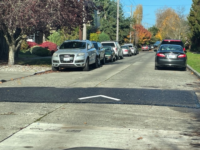
We saw two SDOT trucks in the area but it wasn’t clear where crews would work next. The installation was delayed by the rainy weather. In all, the plan was for 11 new bumps in all on the three streets, between Alki Avenue and Admiral Way – speed humps on 60th and 62nd, cushions (the type with space between them) on 61st.
More than a week has passed since SDOT‘s tentative start date for installing 11 new speed cushions/humps on 60th, 61st, and 62bd SW between Alki Avenue and Admiral Way, but as we’ve been noting in daily traffic/weather/road work roundups, no sign of work. They always warn that it’s weather-dependent, but at this point in the year, the rainy days tend to outnumber the non-rainy days, so we asked SDOT if they’re considering shelving it until spring, No, replied a spokesperson, they’re still planning on installation: “I’m told crews cannot do speed cushions in the rain and so the weather is the reason you haven’t seen them out there. The ‘no park’ signs are being pulled for now, but crews are hoping to start construction next week. That said, I can’t give a set date because the work continues to be weather-dependent.” (The “no parking” signs were marked to expire yesterday.)
The photo and report from Delridge Way SW and SW Alaska were sent by Shane:
Wanted to write as I didn’t see it mentioned on the road work today … it looks like the city (finally) put in an official crosswalk by the Delridge Playfield. It’s just paint and a couple signs but it’s still much clearer to cars that this is an official crosswalk now and hopefully is a step toward real pedestrian safety improvements along this road!
(The median was already there, but without crosswalk markings.) Customary reminder – this corner and others were/are crosswalks even without paint.
Going into the busy Friday afternoon commute period, the Fauntleroy-Vashon-Southworth ferry route remains down to two boats. M/V Sealth went out of service this morning, in need of repairs, and it’s at the WSF Eagle Harbor facility (Bainbridge Island) to get worked on, so M/V Issaquah and M/V Cathlamet are on the 2-boat schedule (timetables are linked here). Compounding matters, the South Vashon route (Tahlequah-Point Defiance) had some cancellations this morning too.
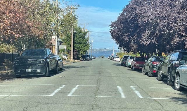
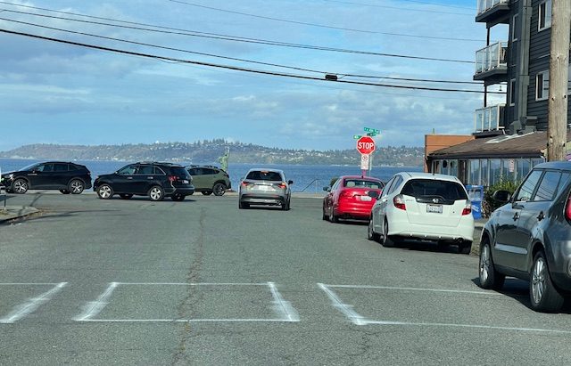
Before the sun went away, we got over to Alki for a look at exact locations for some of the about-to-be-installed Alki cross-street speed bumps between Alki Avenue and Admiral Way. The three photos here are the three northernmost cushions planned for 61st SW.
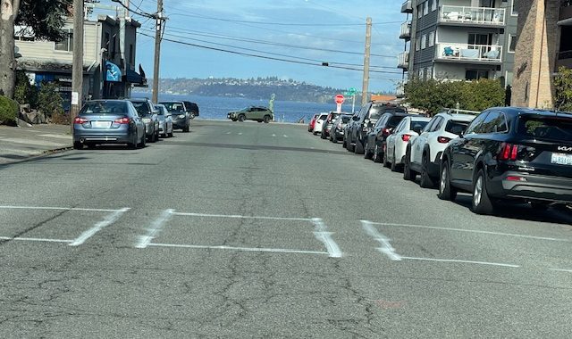
These last two are barely half a block apart, just south of Alki Avenue.
Here’s the full three-street rundown per a followup question SDOT spokesperson Amy Abdelsayed answered for us today:
There will be 11 speed humps/cushions: four speed humps on 60th Ave SW, four speed cushions on 61st Ave SW, and three speed humps on 62nd Ave SW. Speed cushions are being installed on 61st Ave SW to accommodate the bus route.
As reported here last week, SDOT says installation could start as soon as Wednesday; it’s expected to be complete within four days of when work starts.
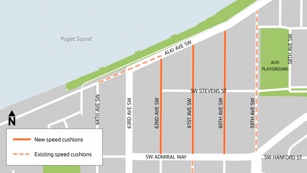
1:49 PM: We first showed you that map back in August, when SDOT confirmed where it’s planning to add speed cushions on 60th, 61st, and 62nd SW in the heart of Alki. After a reader spotted the first preparatory outlines this week, we asked SDOT for an update on the construction timeline. They say installation will start as soon as next week (Monday, October 20 and beyond), weather permitting, and hope to provide us more details shortly. Here’s the original construction notice.
2:39 PM: Update from SDOT spokesperson Mariam Ali: “The start of construction has been pushed to Wednesday, October 22, due to rain … Construction is expected to last about four days total across all three streets, with each block impacted for roughly one day. The schedule will continue to be weather dependent since wet conditions prevent asphalt work.” Sidewalks are expected to remain open but drivers might have to detour during “active construction.”
(WSF recording of Wednesday’s Community Advisory Group meeting)
By Tracy Record
West Seattle Blog editor
A long journey has come to an end for the Community Advisory Group that has been a sounding board for the Fauntleroy ferry-terminal replacement project.
The group was convened four and a half years ago as Washington State Ferries navigated the process of determining a concept for the new dock, and included members from all three communities on the route – Fauntleroy, Vashon, and Southworth. WSF brought them together online last night one last time, 10 months after their previous meeting (WSB coverage here).
Nicole McIntosh, who returned earlier this year to the role of terminal-engineering director, introduced the meeting and thanked the group members for their contributions and said they hope to continue collaborating with them as the project moves forward.
Facilitator was Laura LaBissonier Miller. She turned it over to WSF’s Hadley Rodero for a timeline update (previewed here on Tuesday), with design/construction expected 2028-2031.
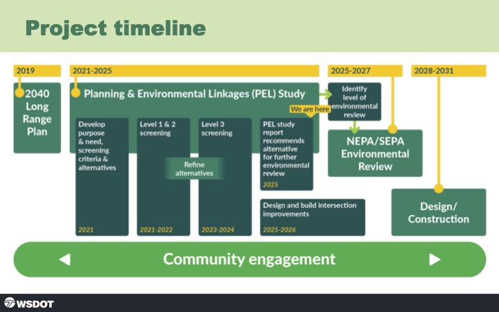
A key document discussed at the meeting was the PEL (Planning and Environmental Linkage) report – which led to the decision to settle on a version of “Alternative B,” longer and narrower than the current dock, holding up to 155 cars (almost twice as many as the current dock).
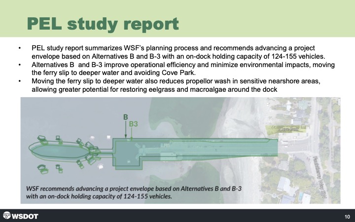
They believe this will minimize impact to Cove Park, north of the dock, among other attributes.
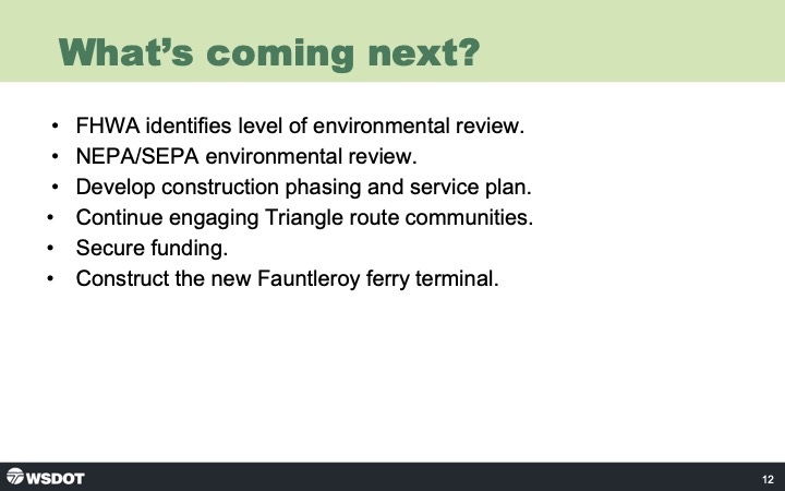
What’s next – environmental review, but they don’t know yet exactly what level of it. Community engagement will be part of it and WSF promises to go above and beyond the bare minimum required.
They’re also working to “secure full funding” for the project (for which $100 million is budgeted for starters – in a question later, they reiterated that this project so far is state-funded so they’re not expecting the federal-funding chaos to affect it).
Q&A ensued. First question: CAG member Susan Frith asked, How will they determine what the final design will hold, since right now it’s a range of 124 to 155? WSF’s Charles Torres said the difference is four lanes versus four-plus lanes, which could help WSF staffers sort – but “we don’t want to overbuild,” he noted.
CAG member Judy Pickens asked if they’ve learned more about what will happen with a dock stretching further out “into the weather.” Short answer, not much; Torres said the initial response was “it’s probably going to be fine, we’re only going out another 240 feet or so.”
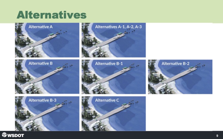
CAG member Justin Hirsch says he’s more worried about underbuilding than overbuilding, and had a process question: Do they have to wait for a determination of the level of environmental review before they settle on a footprint, whether B or B-3?
Environmental consultant James Gregory said they’re working on a hybrid of the two rather than expecting the final design will be either B or B-3. So when will they have to settle on a capacity? Hirsch pressed. Not an exact timeline but at some point during the “early part of the NEPA chapter” – the forthcoming environmental review. But once they get there “there’ll be pros and cons to this decision, it won’t be a slam dunk.”
Another question, from CAG member Scott Harvey: Wasn’t the WSF standard for new docks to be one and a half times the vehicle capacity of the boats they serve? (If so, that would be at least 180 vehicles, since the Triangle Route’s standard is 124-vehicle vessels.) McIntosh says that’s just a guideline, and they have to work with the communities that are home to their terminals.
Pickens asked about communication going forward, and when they’d ask for feedback. Rodero said WSF will use public meetings, email updates, the other ways they’ve been communicating most recently. But, she then asked, would this group be interested in advisory-group type involvement going forward? There was no conclusive reply, but Rodero promised to share the “draft commmunication plan” for next phases of the project when it’s available.
Group member Mardi Clements wondered about the difference in required pile-driving between B and B-3 – “is there a big difference in the number of piles and how many are we talking about?” Torres said that’s not finalized yet but somewhere slightly more than 100, and they’ll need two seasons of in-water work.
Why no second slip? was asked in a written question. That’s been suggested but hasn’t been studied; it could result in a smaller trestle, but what they are more likely to do is build something, Torres said, that “does not preclude it.”
There was also an update on the intersection project that’s set to be built before the new terminal: Mark Bandy provided it, with more new visuals beyond the one with the short update sent earlier this week. He said they’ve been working on completing the design and working with the city. They’re going out to bid soon and hope to start construction “early next year.”
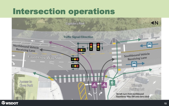
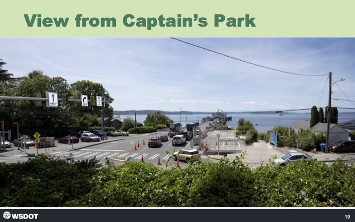
Bandy recapped the traffic flow plan – including no left turn onto the dock from northbound Fauntleroy Way. They hope to have it all fine-tuned by next year’s summer peak-traffic season. He also pointed out that the design has the fewest number of poles – but it’s still a view obstruction in some spots.. He showed renderings of how the setup will look, looking out from Captain’s Park uphill, and toward it from the dock.

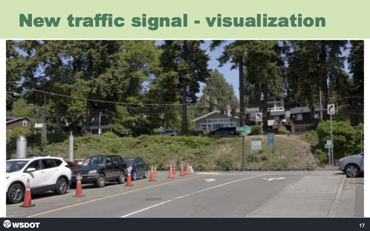
The pole will not have another street light because they’ve determined that the ones already near the intersection provide enough light.
In Q&A on that, Pickens pointed out that culvert construction will complicate things in the area next year, and also wondered how people coming downhill are supposed to get to the dock if they can’t make a left turn. Bandy said they did talk through the left-turn issue with the city and they settled on 24/7, so peole will either have to find a different route or else figure out how to u-turn or loop further north.
Frith suggested that it would make sense to at least allow left turns during “low-traffic times.” Clements said a signage change will be needed because up around 35th, people are pointed that way to get to the dock. She said her garage door/driveway near the dock are a popular U-turn spot and she can only imagine that getting worse.
Will the new signal have transit prioritization? The project team wasn’t clear, though the new signal certainly would capable of it. Also revealed:
The parking lot at the east end of the dock will be a bit smaller.
Next came a real-estate update, specifically the white house on the Cove Park beach north of the dock.
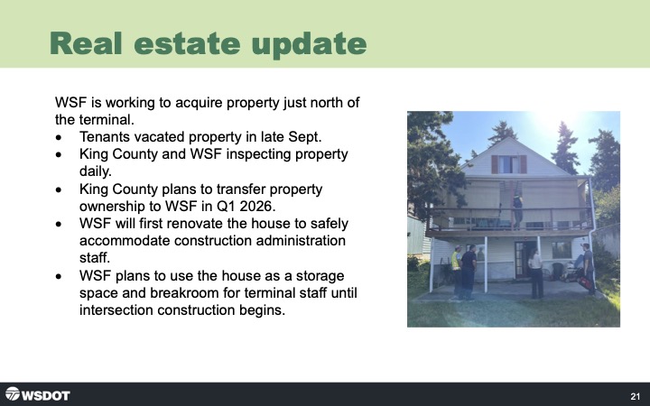
“We are working to acquire it.” The tenants have vacated it and security is checking daily to be sure squatters don’t come in. King County will transfer ownership to the state early next year, and then the house will be renovated for construction administration, storage place, maybe a break room, ways to. keep it occupied ‘and keep people out of it that we don’t want in it.’
What’s next: They’re promising a community update when the next phase of environmental review starts.
Final questions included: When will the PEL report be finalized? In the next month or two. Rodero said it’s not likely to look much different from the draft report just circulated, but they’ll “share it out” when ready.
And with that, plus another round of thanks to the advisory-group members, their long and winding road … route … on this project ended. “It’s pretty impressive what you all accomplished together,” observed McIntosh.
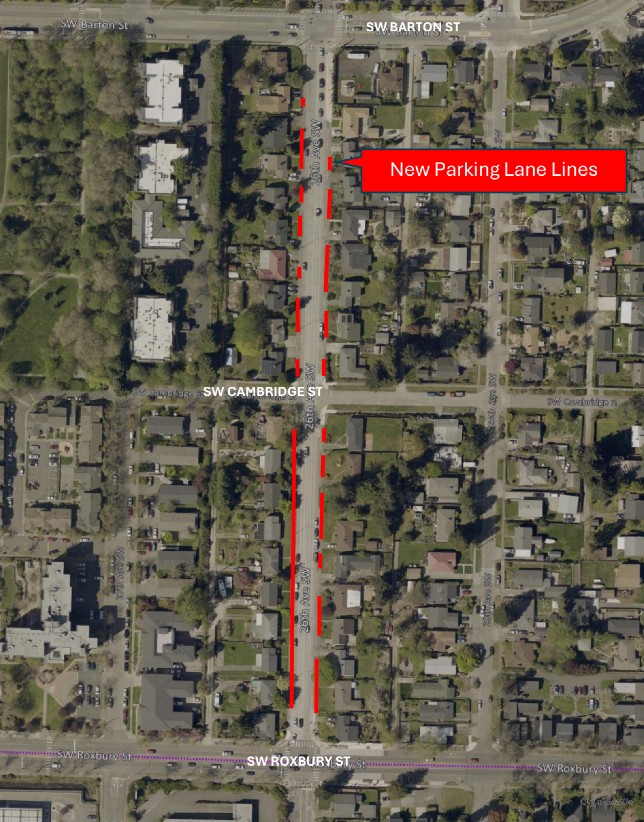
Thanks to Rick for the tip. Residents along 26th SW between SW Barton and SW Roxbury, just south of Westwood Village, recently got notification of a “traffic-calming” feature SDOT plans to install: Parking-lane lines. The map above, from the official notice that we requested and obtained from SDOT, shows where they’ll be painted. The notice explains:
On 26th Ave SW between SW Barton St and SW Roxbury St, we will install parking lane lines. These changes to the street will slow traffic and make the street safer for people walking, rolling, and biking.
We are planning to begin to install these improvements before the end of the year. We anticipate this work to be completed over a couple of weekends. Please note this work is weather dependent and subject to change.
The funding for this, SDOT says, is coming from not the current Seattle Transportation Levy, but its predecessor, Move Seattle.
| 3 COMMENTS