West Seattle, Washington
31 Saturday
If your holiday evening plans include a trip on the Fauntleroy-Vashon-Southworth ferry route, take note of this Washington State Ferries announcement:
Due to lack of crew, the last trip for the #2 M/V Kitsap is the 6:15 p.m. Fauntleroy to Vashon, no Southworth traffic will be loaded.
The 6:40 p.m. and 7:05 p.m. Vashon to Southworth and back to Vashon sailings have been cancelled
The M/V Salish will resume the #2 schedule at 7:25 p.m. out of Vashon.
You can check lines via the WSF terminal cams.

No summer hiatus for the Fauntleroy ferry-dock replacement project. It’s still in the planning stage, working toward a decision on the size and shape of the replacement. The project’s Community Advisory Group has been waiting for results of traffic studies, which could show how technology advances in ticketing could affect the vehicle flow – for example, some group members have asked, could the new dock be smaller if Washington State Ferries used Good To Go! electronic passes to eliminate the need for most vehicles to stop at toll booths. That information is expected at the next meeting, just announced for Tuesday, July 16, 6 pm, online (first meeting since March). You can register here to observe; there’s no public-comment period, but you can send feedback any time to FauntleroyTermProj@wsdot.wa.gov. The project’s Technical Advisory Group will be meeting two days later, 1 pm July 18, also online (register here to watch). Construction of the new dock isn’t expected to start before 2027.

King County Road Services reminds us that today is the 10th anniversary of a momentous day in local transportation history – the opening of the rebuilt South Park Bridge. Our photo above is from the grand-opening party, held on Sunday, June 29, 2014, a day before the full opening to traffic. The bridge opened exactly four years after its predecessor was closed for safety concerns; when its closure was announced, there was no guarantee a new one would be built, as funding hadn’t been finalized, and community tumult resulted. But a few months later, full funding was announced, and construction started half a year after that. Final cost of the bridge, which is a King County structure, was $175 million.
On Tuesday (July 2), city councilmembers are expected to vote on one last round of potential changes to the transportation levy intended to go to voters in November. The council committee reviewing and refining the levy is chaired by District 1 Councilmember Rob Saka, who announced his latest proposed revisions today. Checking the detailed documents for West Seattle specifics,  you’ll see one addition: A tribute to Steve Hulsman, the 66-year-old West Seattle man killed in a collision with a driver on Marine View Drive last December. Mr. Hulsman’s brother-in-law John Good had been talking to the city about ceremonially renaming the section of street where he died; instead, he told us this morning, Councilmember Saka decided to propose, as spelled out in the amendment document, a “Protected Bike Lane project in West Seattle to be named in honor of Steve Hulsman.” The document does not specify a location; the only potential PBL project for West Seattle named in the levy is Highland Park Way SW, but the levy calls for many other to-be-identified-later safety projects around the city. Good showed us email from Councilmember Saka offering also to sponsor a proposal for a “secondary street naming” in memory of Mr. Hulsman, while saying that would take more time.
As for the rest of Saka’s latest levy revision, it still contains the West Seattle specifics we’ve previously mentioned – projects for 35th SW between Alaska and Morgan, Fauntleroy Way between 35th and Alaska, Olson/1st/2nd, plus sidewalks for SW Brandon between 26th SW and 30th SW, and transit-corridor work for sections of SW Oregon and SW Alaska in The Junction. Saka says his final proposal would result in a $1.55 billion levy, same as his previous proposal. Here are the categories into which that would break out:
i. $160.5 million for Vision Zero, School and Neighborhood Safety;
ii. $423 million for Street Maintenance and Modernization, including no less than $350 million for Arterial Roadway Maintenance;
iii. $221 million for Bridges and Structures;
iv. $151 million for Transit Corridors and Connections;
v. $193 million for Pedestrian Safety, including no less than $111 million for New Sidewalks and Sidewalk Alternatives and no less than $34 million for Sidewalk Safety Repair;
vi. $100 million for Signals and Operations;
vii. $113.5 million for Bicycle Safety;
viii. $66.5 million for People Streets and Public Spaces;
ix. $69 million for Climate and Resiliency, including no less than $32 million for
electric vehicle charging infrastructure;
x. $45 million for Freight and Goods Movement; and
xi. $7.5 million for Good Governance & Equitable Implementation Initiative
In the first year, council documents say, Saka’s version would cost the owner of a “median assessed value” home $499, compared to $467 for the mayor’s original $1.45 billion version. Other councilmembers’ amendments include a counterproposal from Councilmember Tammy Morales, totaling $1.7 billion, which would equal $546 in the first year for that “median value” homeowner. (The city says that’s an $804,000 assessed value, and that the expiring levy is costing a median-value homeowner $288 this year.) The meeting at which the final amendments will be discussed, and votes taken, is Tuesday at 9:30 am, and includes a public-comment period, as noted on the agenda (where all the proposed amendments are linked, too). Other ways to get comments to the council are listed here.
 (Monday night image from SDOT camera, via X/Twitter)
Monday evening, after reader tips (thank you!), we reported on the West Seattle low bridge being unusable to all surface traffic for two-plus hours. SDOT promised a followup explanation, and here it is:
The Spokane Street Bridge (also known as the West Seattle Low Bridge) was stuck from approximately 5:30 – 8:00 pm on June 24 due to a technical issue with the bridge’s tail locking mechanism.
The tail lock is the equipment that locks the bridge in place so that cars, bikes, and people can safely travel across it (it is called a “tail lock” because it is located where the two sides of the movable bridge meet in the center of the waterway, referred to as the “tail span” of the bridge). A specialized maintenance crew was called in to help diagnose and fix the problem and determined that the issue was likely caused by the bridge spans drifting slightly during the raising and lowering process, causing sensors to detect a misalignment in the locking mechanism.
We are currently working on a series of projects to maintain and modernize the Spokane Street Bridge. This includes a variety of investments to repair or replace the bridge’s control system, electronics, and mechanical parts. While much of this work has already been completed, there are ongoing plans for more repairs to address the bridge’s tail locking mechanism and other related parts.
Our moveable bridges operate with complex mechanical and electrical equipment. Though they are rare, issues with these systems can happen. When an outage occurs, our roadway structures crew and engineers work as fast as possible to restore service to the traveling public. A detailed explanation of our standard procedures to respond to bridge malfunctions is available on this webpage.
 (WSB photo: Ferry at Fauntleroy dock, Sunday night)
By Tracy Record
West Seattle Blog editor
Shortages again factored into many explanations at today’s Washington State Ferries systemwide community meeting, first of two online sessions (the second is at 6 pm Tuesday), as they did during the winter meetings.
Shortage of boats and shortage of crew were just two of the shortages mentioned this time, but some things are improving, if slowly, insisted new WSF boss (aka assistant secretary of transportation) Steve Nevey:
 (Zoom screengrab of new WSF boss Steve Nevey)
“A year ago, we were in crisis … (now) we’re in recovery.” One example: Two weeks ago, Nevey said, the system had an entire week with no sailing cancellations caused by crew shortages. Overall, according to stats he showed from the first five months of the year, compared to the same time last year, the cancellation trend is down:

Nevey suggested the improvement is likely to continue as extra state funding is about to kick in for scheduling extra crew on boats so that they don’t have to cancel a sailing if someone can’t make it to work. And starting today, while the Fauntleroy-Vashon-Southworth officially remains on a two-boat schedule, they are adding a “bonus boat” (or “ghost boat”) on weekdays to make unscheduled sailings, helping the regularly scheduled boats stay on time. This is the plan for the “next several months.”
As for the two regularly scheduled boats – during the Q&A that took up more than two-thirds of the meeting, someone asked when the Triangle Route schedule would finally be rewritten, since it’s expected to take a few more years for the third boat to permanently return. That’s where another shortage came in: WSF executive John Vezina explained that WSF still hasn’t been able to hire a new service planner to work on writing a better two-boat schedule. First they opened a hiring proccess, he said – and they couldn’t find anyone. Then they tried again, found a qualified candidate – who was going to take the job but changed their mind. Now, Vezina said, they’re in the process of finding a “consultant” who can take on the schedule, and they’re supposed to get help from a WSDOT service planner. Even with that, Vezina said, it’ll probably be a year or so before a new two-boat Triangle Route schedule can be in place. He added that they actually have funding now for two service planners, so that if one leaves in the future, they won’t be entirely without one – but they still need to hire the first one before they can hire a second.
Two other personnel challenges affecting the Fauntleroy-Vashon-Southworth run came up: First, the Vashon dock cameras are currently down, because the WSDOT employee who works on cameras is “out on family leave” (and apparently has no backup), and second, traffic-control officers at the Fauntleroy dock aren’t consistently available because they’re generally area law-enforcement officers on overtime, and the short staffing at agencies including the Seattle Police Department leave few available and/or interested for those kinds of assignments.
WSF’s Nicole McIntosh talked about their efforts to recruit for other jobs, including work to increase maritime-career awareness among high-school students, plus a new effort called MITAGS in which they’re taking applications for a class of 12 recruits to start on the path toward becoming licensed deck officers. They’ve been to job fairs around the country, too, she said. In Q&A, someone asked if the system staffing is still hampered by the dismissal of employees who refused to comply with vaccination requirements during the pandemic. McIntosh said that WSF had lost 120 employees but in the past year alone has hired more than 180, so their overall staffing has more than bounced back; plus, it was noted, as of a year ago, those employees are eligible to return if they’re interested.
As for the boat shortage, introductory remarks recapped that WSF is in the process of seeking one or two builders for its new hybrid-electric ferries, two of which will be available in 2028 if the process proceeds as hoped, two more in 2029, and the fifth in 2030.

Meantime, the system keeps running with boats as old as 65, and some boats for which parts aren’t even made any more – sometimes WSF employees make their own parts, Vezina noted. The WSF manager in charge of electrification, Matt von Ruden, fielded questions including how much of an environmental savings the hybrid-electric ferries would really bring. 76 percent less greenhouse-gas emissions, he said. Twice, persistent questions about “wouldn’t it be faster to just build diesel ferries?” No, said WSF execs, because they have a design, funding, and directive to build hybrid-electric boats; even if the directive changed tomorrow, they’d be “a year behind.” Other questions about the future new boats included battery safety – that was explained in minute detail – and capacity (160 cars).
MISCELLANEOUS: If you’re interested in ridership trends, it’s not back to pre-pandemic levels yet (that’s the green line, while the red line is this year so far):

And here’s the by-the-numbers slide with which the meeting opened:

IF YOU’RE WONDERING ABOUT THE FAUNTLEROY TERMINAL PROJECT: It wasn’t mentioned in the presentation (though it got a brief mention in the winter meetings), and we didn’t hear anything about it in the Q&A (although we missed a few minutes in the last half-hour of the meeting).
TO ATTEND TUESDAY’S MEETING: It’s scheduled for 6 pm, online; go here to register for the link.
Tuesday morning, the City Council meets again as the Select Committee on the 2024 Transportation Levy, still working to finalize a package to send to voters this November. At this meeting, councilmembers will consider amendments to the mayor’s proposal. District 1 Councilmember Rob Saka, who chairs this committee as well as the regular Transportation Committee, has already announced his “chair’s amendment,” which would increase the levy’s cost by $100 million, to $1.55 billion; how it does that is detailed in this council-staff memo. Saka is now also proposing his own amendment that would restore the 35th SW and Fauntleroy Way repaving projects that were in the mayor’s draft levy proposal (which we reported here in April), then were scaled back or removed in the mayor’s final proposal (as we reported here in May).
Saka’s amendment would restore the full 35th SW Alaska-to-Morgan repaving project (much of 35th south of that was repaved last decade), and Fauntleroy Way repaving between 35th and Alaska “to keep roadway functional during light rail station construction.” We asked Councilmember Saka about this at Saturday’s Morgan Junction Community Festival; he said that while the mayor had made an “executive” decision to scale back 35th, community feedback led Saka to propose “legislatively” restoring it to the levy plan. He’ll need the support of a majority of his council colleagues, as is the case with the other amendments proposed – so far the agenda for Tuesday morning’s meeting also includes links to amendments from Councilmembers Tammy Morales, Sara Nelson, and Dan Strauss, plus a vice-chair’s amendment from Councilmember Joy Hollingsworth. The meeting includes a public-comment period (as do most council meetings); the agenda explains how to participate, either remotely or in-person at City Hall (you can also email the council any time – that info is here). This is the committee’s second-to-last scheduled meeting; they’re due to finalize the levy plan next month.
Three Washington State Ferries notes:
TONIGHT: On the Fauntleroy/Vashon/Southworth route, M/V Kitsap is sailing at a reduced capacity for the rest of the night, 300 people maximum, because of a crew shortage.
SUNDAY: The systemwide summer schedule takes effect tomorrow. For the Triangle Route, that means two things, WSF says:
Beginning with our summer schedule, we will operate an unscheduled third ferry weekdays on our Fauntleroy/Vashon/Southworth route when crewing and a vessel are available.
This boat will sail around the other two scheduled vessels to help move more riders and keep the two-boat schedule on time.
(Also) an added roundtrip sailing between Vashon and Fauntleroy midday on Fridays.
MONDAY/TUESDAY: Another reminder that WSF’s systemwide updates/Q&A community meeting will be held in two online sessions, noon Monday and 6 pm Tuesday, with duplicate presentations. Registration to get the link for either (or both) is here.


SDOT wants to replace the outside downhill lane of the Highland Park Way hill with a protected bicycle lane (1st rendering above), an expanded multi-use path (2nd rendering above), or both (bike lane first, expanded path later). Today’s the final day for this survey asking what you think. SDOT says it’s received almost 2,000 responses as of Thursday. We first reported on the proposal a month ago; back in 2020, SDOT proposed an uphill bicycle lane on the hill, then tabled that. Funding for a protected bike lane on HP Way is mentioned in one of the project lists in the proposed transportation levy currently under City Council review.
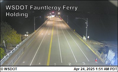
Washington State Ferries says that “due to the lack of an Oiler,” it will take M/V Kitsap out of service after the 6:15 pm Fauntleroy to Vashon sailing. After that, all #2 sailings are canceled for the rest of the night; M/V Kittitas will remain in service. (You can use Vessel Watch to check its location while you’re waiting.)
 (SDOT camera image, 2023)
It’s been three months since we last asked SDOT about the upcoming resurfacing project for the eastbound side of the east half of the West Seattle Bridge, officially known as the Spokane Street Viaduct. SDOT had told us in March that the project would likely happen this summer – and summer’s about to officially start. As of yesterday morning, the project website hadn’t been updated since we inquired in March, so we asked about the status. Spokesperson Mariam Ali replied, “We’re working with the construction contractor to determine the schedule. We will update you when specific dates are chosen, but at this point it looking like construction may begin in the late summer or fall of 2024.” (Concurrent with that reply to us, the project website was updated.) According to the city’s bidding website, the contractor chosen for the work is Combined Construction, which bid just under $7.5 million. The same company resurfaced part of the rest of the bridge during its 2020-2022 closure, as well as the Andover pedestrian-bridge earthquake-resistance work three years ago. SDOT says the Spokane Street Viaduct work, whenever it starts, will require five weekend closures.
Though the Sound Transit Board is still at least a few months away from its final decision about a West Seattle light-rail route, the city is moving full speed ahead on its share of the plan – designing how the areas around the likely station locations will change. Latest example: A new survey asks you to take a look at the “street-concept plan” for the three station areas in West Seattle.

The survey link first appeared on X/Twitter; after spotting it there, we asked SDOT for more information. Spokesperson Mariam Ali says SDOT is working on the street-concept plan with the Office of Planning and Community Development, “in consultation with Sound Transit” and incorporating previously received community feedback. Before you start the survey, in which you can give feedback on street concepts for one, two, or all three station areas, she offered a little more context:
What Are Street Concept Plans? Street concept plans illustrate how streets could look in the future with specific improvements, such as trees and landscaping, distinct paving options, relocated curbs, and features like benches or unique lighting. To learn more about how SDOT uses Street Concept Plans, visit Seattle Streets Illustrated.
What’s Happening in West Seattle? SDOT and OPCD are creating a street concept plan for the areas around the future light rail stations in West Seattle. This plan provides a vision and guidance for how streets will look and function when light rail opens. The concepts included in the street concept plan will be used to develop designs for future projects that enhance walking, biking, and transit access around these station areas.
Community Involvement: Community members are encouraged to provide feedback through a survey. This feedback will help refine the vision for these streets. Additionally, more information about the plan, the City’s role in advancing light rail in West Seattle, and the option to sign up for an email listserv can be found on the City’s West Seattle and Ballard Link Extension webpage.
If you don’t have time to answer it now, we recommend saving the link and taking a look when you can spare a bit of time – the concepts have many proposed features, such as a vehicle-free “plaza” section of 42nd SW by the Junction station entrance. What you’ll see aren’t full station designs – just the concepts for key streets/intersections nearby.
ADDED WEDNESDAY: If, like one commenter, you’d like to see the images without answering the survey (yet), we asked SDOT, and they’ve sent this PDF version of the survey, images included, replies not required. Also, there’s now a webpage from which the survey is linked – and there’s word of two opportunities to talk with SDOT in person this weekend, one at Roxhill Park at Saturday, another at the Farmers’ Market on Sunday.

For the second consecutive summer, Outdoors for All has brought adaptive-cycling alternatives to the Alki Point Healthy Street area – Beach Drive along Constellation Park – for free tryouts. They’re there today until 2 pm, with equipment meant to facilitate riding for people with disabilities or other challenges such as balance issues. The organization describes its year-round fleet as follows:
· Handcycles for individuals with limited or no leg movement
· Recumbent and therapy trikes for those who need more stability
· Hand and foot powered cycles for children
· Tandem cycles for individuals who want a guide while riding
· Standard 2-wheeled bicycles and Striders

For today’s event, no RSVP needed – just show up!
 (Photo courtesy Outdoors for All)
“We can get almost anyone on a bike,” says Outdoors for All, which is coming back to West Seattle this Sunday (June 9) for another adaptive-cycling demonstration, with free test rides. Outdoors for All, which is partnering with SDOT for the free event, says it’s “for people with disabilities or anyone that can’t ride a 2-wheeled bike due to balance issues.” They’ll be there 10 am-2 pm Sunday, with trikes, handcycles, and tandems, free of charge to take for a ride. No need to register in advance: “Riders can complete their liability waiver and registration at the event.” Outdoors for All came to the same location last August for a similar event.
SDOT has added another West Seattle community-meeting appearance at which reps will discuss the recently announced plan to replace a downhill driving lane on the Highland Park Way hill with a bike lane, a multi-use path, or both. If you want to hear about the plan and/or ask questions, be at the online meeting of the District 1 Community Network, 7 pm Wednesday (June 5). The Zoom link is in the agenda. Also note that the survey about the proposal remains open until June 15.

Thanks to David Hutchinson for that photo. As reported here, SDOT said last week that it would start installing the permanent features of the Alki Point Healthy Street as soon as Saturday, and indeed, David tells us, they’ve been out there all weekend, including placement of concrete wheel stops for the new 10-foot walking/rolling/biking lane alongside the waterside sidewalk by Constellation Park. The photo above is from this morning; we just went over – the crew’s gone now, and this is what we saw looking northward on Beach Drive from 64th:

David also sent this photo of Saturday work on the Alki Avenue stretch west of 63rd:

That hasn’t been discussed as much as the Beach Drive stretch, but that spot is where a “cul-de-sac” is being set up, per the project page, “to give drivers an opportunity to turn around before the ‘street closed’ sign.”
ORIGINAL THURSDAY NIGHT REPORT: As a City Council committee led by District 1 Councilmember Rob Saka continues reviewing the proposed transportation-levy renewal/expansion, Saka has released results of his survey about levy priorities. We published the participation link back in early April. He told his email-newsletter list today that more than 1,800 people took the survey; here’s how that broke out geographically:

Here’s how he wrote about and showed the results:
Of the high-level survey responses, the categories of “Street Repaving” (including filling potholes!), “Bridge Maintenance and Repair” (not surprising given the extended closure of the West Seattle bridge!) and “Safe Crossings, More and Accessible Pedestrian Signals, Better Lighting, Safe Routes to Schools” tied for the top combined first, second, and third choices of respondents.
I do understand that the categories of Personal Safety, Pedestrian Lighting at Stops, and, More Transit Routes & Stops, and New Sidewalks also ranked high and is strongly corroborated by the many qualitative comments.
And while other categories may not have ranked as high, they will likely be included in the final proposed Transportation Levy package – all which will be ultimately for the voters to decide on this Fall’s ballot.
The graph below shows the categorization of some of the major qualitative comments received. I read the many comments which, together with the quantitative survey results, will help inform my Office and guide my decisionmaking as we move forward together.
Soon, I will be sharing my draft “Chair’s Amendment” to the Mayor’s proposed Transportation Levy renewal package and this information will be available on Council’s website.
In the meantime, Councilmember Saka notes that one public hearing and four other meetings – all of which also include public-comment periods – remain for levy consideration:
June 4, 9:30 AM | Committee Meeting
June 4, 4:30 PM | Second Public Hearing
June 18, 9:30 AM | Committee Meeting
July 2, 9:30 AM | Committee Meeting
July 9, 2:00 PM | Full Council Meeting – Final Adoption of Proposed Levy Package to go before Voters in November 2024 General Election
Agendas explain how to comment, and will appear on this page when posted.
ADDED FRIDAY AFTERNOON: A new council memo details key points of Saka’s aforementioned levy amendment, though the specific text is not yet available.
 (SDOT current/future cross-section comparison, from project webpage)
For the first time since SDOT announced last Friday that it would proceed with the Alki Point Healthy Street plan, adding a few features, we’re hearing from the group that had been fighting the plan. Alki Point For All says it wants to clarify that the SDOT changes did not constitute a compromise. Here’s their statement:
Last week the Seattle Department of Transportation (SDOT) announced that it is proceeding with construction at Alki Point, with changes based on community feedback, including ours. To clear up any confusion caused by that announcement, the changes are not responsive to our concerns. SDOT has not addressed the substantive issues we have raised regarding the harmful impact of this project on social equity, safety, and marine education and conservation. At a recent meeting we encouraged SDOT to consider solutions that would better meet the needs of the wider community, while still achieving its goals. The small cosmetic changes announced last week bear little resemblance to the ideas we proposed, as described below.
1. Transformative Art. We encouraged SDOT to consider street art as way to organically slow traffic and increase safety. Bloomberg Philanthropies has proven this concept in projects all over the country: Asphalt Art Initiative and Asphalt Art Safety Study. We suggested that local artists like the Youngstown Arts Collective could be engaged to create the design. In piloting this approach, Alki Point could serve as a model for other Healthy Streets, and bring communities together rather than dividing them. Instead, SDOT will add decorative art to their existing design — missing the point, and the opportunity.
2. Welcome Signs. We proposed replacing the Street Closed signs with signs that said “Welcome to Constellation Marine Reserve. Go Slow.” The goal of that change was to alert drivers they are entering a special place, and encourage (or require) them to slow down, while at the same time welcoming the public to use a public space. SDOT liked our idea for “Welcome” signs, but plans to install them in addition to, not instead of, the Street Closed signs. It’s hard to imagine a more confusing message: welcome, and stay away.
3. Bus Parking. SDOT’s solution is insufficient for the need—the spaces they’ve identified are too small. When students come to Alki Point for field trips, the number of busses can range from two to nineteen. We recommended that SDOT contact schools to determine the actual need.
4. Time / Area Closures. Instead of a permanent “rolling” lane, we proposed using time and area closures such as car-free Sundays. Shorter temporary closures would be safer for people who want to recreate in the street, and allow more people to access the area year-round. That suggestion was ignored.
In October 2022, SDOT announced its preferred design for Alki Point, which called for the loss of five parking spaces on Alki Ave SW. In December 2023, the agency revealed its final design, which for the first time included the addition of a “rolling” lane and the loss of 62 parking spaces along the west side Beach Drive. These significant changes were made too late for public comment, without stakeholder notification or engagement, and in violation of their own guidelines for Healthy Streets.
SDOT has broken faith with its constituents in both how its decisions were made and how they are described. This latest announcement is more of the same. We expect more from a city that values transparency and accountability in governing. Nearly 1800 people have signed our petition asking the Mayor to halt this project.
So beyond this statement, what does the coalition plan to do? we asked on followup. Spokesperson Donna Sandstrom replied, “We are considering our next steps. Our goal in writing this was to set the public record straight – SDOT’s announcement created a false impression that they were responsive to community feedback. They were not. For now we are still encouraging people to sign our petition. We’re working on a website and reaching out to the people who came to our meeting. We see this as the first leg of a relay. We didn’t achieve our first goal of halting construction, but we are confident that this wrong will be righted in the long run.” She says the group also is heartened that City Councilmember Rob Saka has pledged to evaluate the project in the fall. Meantime, SDOT said earlier this week that construction of the permanent features, including a walking-and-rolling path replacing waterfront parking spots, will resume as soon as this Saturday (June 1).

Five days after SDOT announced it would add “features” to the Alki Point Healthy Street plan, it’s announced a new construction start date:
As soon as Saturday, June 1, crews will resume installation of the permanent treatments for the Alki Point Healthy Street. This work includes:
-A 10-foot-wide shared walking/rolling space
-Three ADA parking spaces
-Stop controls at intersecting streets
-Pavement markings, parking signs, and striping the public parking lotUnauthorized on-street parking located within 20 feet of intersections will be removed for new installation. Please visit the project webpage for more information on design elements.
The plan includes two “public parking lots” – along Benton, north of the stormwater-treatment plant, and the existing one by the lighthouse. Meantime, the fate of one Healthy Street location in West Seattle has yet to be decided – Delridge-Highland Park.
![]() One year ago, SDOT released its “top-to-bottom review” of the Vision Zero program, concluding that Vision Zero wasn’t making progress toward its goal of zero deaths and serious injuries on Seattle streets by 2030 because too little action was being taken. One year later, the trend has yet to reverse, and SDOT’s newly released Vision Zero Action Plan Update calls again for more to be done. SDOT reps explained what that will detail as the spotlight guests at this past Thursday’s West Seattle Transportation Coalition meeting.
One year ago, SDOT released its “top-to-bottom review” of the Vision Zero program, concluding that Vision Zero wasn’t making progress toward its goal of zero deaths and serious injuries on Seattle streets by 2030 because too little action was being taken. One year later, the trend has yet to reverse, and SDOT’s newly released Vision Zero Action Plan Update calls again for more to be done. SDOT reps explained what that will detail as the spotlight guests at this past Thursday’s West Seattle Transportation Coalition meeting.
SDOT’s David Burgesser opened by saying it’s all put in perspective by remembering the humanity of each victim – the 1,700+ people seriously hurt and ~228 people killed since the program’s launch in 2015 (update: four this week alone, with deadly crashes in North Seattle and downtown in the hours before the meeting, and another downtown on Friday night, plus one as we wrote this story). A majority of the victims are those most vulnerable, he said – people walking, rolling, or riding.
The updated plan, he said, focuses on 22 strategies, and 80+ actions, most of which, he said, “fall within the safer roads/safer speeds category.”

Part of the plan also seeks better data – for example, while the city has many data dashboards, it does not have one for Vision Zero, but Burgesser said they are working on that. Two sections of the update also call for better correlation of SFD and SPD data from collision responses.
The WSTC meeting discussion didn’t dive into West Seattle specifics, so we browsed the Action Plan Update looking for them. What we found were mentions of some projects already planned or even under way. One was completion of the Terminal 5 Quiet Zone, safety improvements meant to enable trains serving T-5 to (mostly) avoid horn use. (A port rep in attendance at the meeting said the Quiet Zone work should be complete within a few months – that’s a bit behind what was estimated last fall, and way beyond the original plan for it to be done before the first modernized T-5 berth opened.) Another was to “Develop an updated plan to improve the safety of bridge expansion joints, railings, and barrier types for people biking, rolling, and walking,” and the soon-to-begin Admiral Way Bridge seismic-strengthening project was designated for that work. West Seattle light rail, though it’s not planned to launch until 2032, got a mention too: “Develop station access plans for future light rail stations and enhance the experience and quality of existing facilities that connect people walking, biking, and rolling along and across major transit corridors,” with a “2024 target” listed as “Develop a priority list of station access projects for the West Seattle Link Extension stations that can be supported with available station access funding from Sound Transit.” And it’s likely some West Seattle locations will eventually be part of citywide plans like these:

In Q/A, WSTC’s Deb Barker said she had recently visited Australia and learned that it too was having what she termed “abysmal” results despite working under Vision Zero. (We later found this story about that.) She asked Burgesser for an example of where it’s working. New Jersey communities were cited in response – no fatalities in 7 years in Hoboken (population 60,000), for example. (We found this recent story verifying that.) Why a three-year plan? That’s meant to give them an opening for “one more pivot” before 2030 if needed.
ALSO AT THE WSTC MEETING: Kate Nolan from the Northwest Seaport Alliance – the cargo-shipping authority for Seattle and Tacoma – talked about their zero-emission truck program; we weren’t able to watch that section of the meeting, but the full video will eventually be up on the WSTC YouTube channel (now at youtube.com/westseattletc). Asked how many vessels are using shore power now that it’s available at both T-5 berths, she said “about half” was what she’d most recently heard. … Board elections were postponed until the next meeting, July 25, to give time for recruitment efforts; there’s been a lot of attrition in the past year-plus, so lots of room to get involved – email info@westseattletc.org to find out more.
Tomorrow (Saturday, May 25) you have one more chance to talk with SDOT reps in person about the Highland Park Way hill project – a proposal to remove one downhill motor-vehicle lane and replace it with a protected bike lane, an expanded multi-use path, or (eventually) both. SDOT will be at the Delridge Farmers’ Market (9421 18th SW) 10 am-2 pm Saturday. Meantime, as we reported yesterday, attendees at this month’s HPAC meeting had some questions the SDOT reps were unable to immediately answer – so we sent some of those questions to the department, and got answers late today, as follows:
WSB: “What are the cost estimates of the three options? … And how much money has been spent so far on this very early stage of the project?”
SDOT: “We are engaging the community to shape the scope before we develop draft cost estimates for the options. Generally speaking, Option 1 (protected bike lane) has fewer construction needs since it removes a travel lane and adds concrete barriers. Option 2 (multiuse path) has more complex construction needs since it involves moving a curb line, potential drainage work, and a wider landscape buffer and path. So far, we have spent $145,000 for this project.”
WSB: “(SDOT reps at the meeting) had the current car traffic data. What is the most recent bicycle usage and pedestrian usage data for that section of HP Way?”
SDOT: (Provided table as seen below)

“We plan to collect additional data this summer.”
WSB: “It’s oft-cited ‘if you build the infrastructure (for riders) they will come.’ So it was asked (at the meeting), what is the bicycle usage data for other semi-new lanes in West Seattle, like the Delridge lane post-Delridge rechannelizing?”
SDOT: “We have not measured the bicycle usage on Delridge since the project was completed. We do have data from the West Marginal Way SW Safety Corridor Project, gathered from August-October last year:
“·Weekday bike volumes have increased by 144% from an average of 103 bikers before the project was installed to an average of 251 daily bikers. Weekend bike volumes have increased by 53%.
“·The number of people walking or using a mobility assistance device (like a wheelchair or accessibility scooter) increased significantly, 96% on weekdays and 91% on weekends.
“Here are a few local and national studies showing the effect of bike lanes:”
seattle.gov/documents/Departments/SDOT/About/DocumentLibrary/Reports/NE65thSt_Evaluation_Report_91620-1.pdf
trec.pdx.edu/research/project/583/Lessons_from_the_Green_Lanes:_Evaluating_Protected_Bike_Lanes_in_the_U.S._
nacto.org/2016/07/20/high-quality-bike-facilities-increase-ridership-make-biking-safer/
Those aren’t all the questions HPAC attendees had, just the ones we asked SDOT in followup, so watch for more info from HPAC. Meantime, whatever you think about the project, you can also comment – June 15 is the deadline – via this survey, or via email at HighlandHolden@seattle.gov, or via voicemail at 206-900-8741.
 (WSB photo from last week, Beach Drive alongside Constellation Park)
1:57 PM: Another update in the longrunning saga of the Alki Point Healthy Street (both Alki Avenue and Beach Drive west of 63rd SW) – just in from SDOT, a few more changes to the plan:
We’re moving forward with Alki Point Healthy Street upgrades, based on robust community input over the past several years.
We paused the installation briefly to meet with marine mammal and environmental stewardship stakeholders and listen to their concerns. Construction is now expected to begin as soon as June.
This Healthy Street offers a unique space for community members to walk, bike, and roll while taking in views of Elliott Bay and West Seattle’s Alki Beach and marine reserve.
Newest features in response to community feedback include:
*Welcome signs
*Additional load zones that can be used by school buses
*Inviting community artwork celebrating nature
*Adding parking time restrictions and guidelines on more nearby streets to make it easier for visitors to find a space.Previously announced additions based on community requests:
(One of the ‘nearby locations’ for public parking. Photo by David Hutchinson)
*A 10-foot path along the beachfront separated from people driving,
*Three new ADA-accessible parking spaces,
*New public parking signs and guidelines at two nearby locationsToward the end of the year, we’ll share an evaluation with vehicle speeds, foot traffic, and parking use, and include a user experience survey.
We’re following up with SDOT to ask exactly where the loading zones and parking-time restrictions are planned to go.
6 PM: Here’s what SDOT sent in response to our questions:
*We will explore adding loading or other special event zones large enough for school buses on Beach Dr SW near 63rd Ave SW.
*We will add parking signs and paint parking guidelines in the parking lot near the Alki Point Lighthouse to make it clear that this is a free public parking lot. There will be a 4-hour parking time limit except for one ADA parking space.
*We will be adding 4-hour parking signs on the east side of SW Benton Pl, and adding parking guidelines to clearly define the parking spaces as separate from the roadway.
The last two seem to refer more to the “previously announced additions” than the “newest features,” so we’ll be looking to clarify further with SDOT after the holiday weekend.

By Tracy Record
West Seattle Blog editor
The proposal to replace one downhill driving lane on the Highland Park Way hill with either a protected bicycle lane or expanded multi-use path is mostly about slowing down speeding drivers. That was made clear by an SDOT rep who was at last night’s HPAC meeting to talk about the plan.
The SDOT reps led by James Le were also there for Q&A, but more than a few questions went unanswered aside from “I’ll have to get back to you on that.”
First, if you are reading this before Thursday evening, you have another opportunity to go try to get answers in person, 4-8 pm tonight at Highland Park Corner Store (7789 Highland Park Way SW). That was supposed to be the last in-person event for now, but SDOT has just added another one this Saturday – more on that at the end of this story.
Backstory on the proposal: In 2020, SDOT had a plan for a bike lane on the Highland Park Way hill, but put it on hold. The concept re-emerged in a 2022 application for federal funding. Two weeks ago, SDOT formally announced a plan for a downhill bike lane and/or expanded path along about half a mile of the hill.
In the announcement of this plan on May 10, SDOT also opened a survey, which they tell us today has already brought in almost 1,000 responses. We don’t know how the opinions are going on that, but last night, with about two dozen people attending the online meeting, HPAC did an informal survey of its own:
 (Zoom screengrab)
That “straw poll” had one option not in the SDOT survey or project plan – improving the existing path without removing a driving lane. Le was asked repeatedly if SDOT would consider an option that keeps the current motorized-vehicle-lane configuration, and Le eventually said, “Let me throw that back at you – how would you (slow traffic) without removing a lane?” He had repeatedly referred to traffic-slowing as a prime goal of the project, citing SDOT data showing that while the posted speed limit is 25 mph, hill traffic averages 43 mph, so, he said, “we have to redesign the roads.” The hill has too much “capacity,” he contended, which would be reduced by removing a driving lane. He cited 49 collisions of note in five years, including head-ons and sideswipes.
The danger of head-on collisions is one reason not to remove a lane, some attendees countered, saying that the lane reduction would mean nowhere to get around an obstacle, and asking if there was any consideration of a barrier between the two directions as a safety measure. Le said SDOT had considered “some barrier options” but none seemed feasible, so the lane removal is a “self-enforcing design.” One attendee said they were “strongly in favor” of that, and disagreed with other attendees’ contention that the single downhill lane would be a “chokepoint,” observing that drivers coming off Holden, for example, are in one lane as they turn onto the hill. That attendee was one of the few who identified themselves as riders, and also voiced support for the project providing a better connection for riders headed toward Georgetown.
Even if the hill seems to have “too much capacity” now, other attendees said, it should be preserved in case of access trouble such as a repeat of the West Seattle Bridge closure, which turned the Highland Park Way hill into a lifeline in and out of West Seattle for 2 1/2 years as the 1st Avenue South Bridge became the major detour route. “It’s a vital connector,” stressed one attendee. Le’s answer to concern about another West Seattle Bridge closure was, “I don’t think that will happen” – since the WS Bridge is expected to last its full lifespan following the repairs that reopened it in September 2022.
The questions that went unanswered included the cost/budget for the project. The SDOT reps said they didn’t have those numbers, repeating that it’s very early in the design process, and there’s no funding yet beyond “early design,” explaining that future funding would depend on what option they eventually decided to pursue. Attendees pressed the question of how much money is allotted so far, but that wasn’t answered. Nor was a question about how many bicycle riders and pedestrians use the hill path now. (We’ve sent those and other followup questions to SDOT’s media team today.) There also was a concern about how the bike path would be maintained, given that others – such as the relatively new one on Delridge – have been observed with leaves, broken glass, and other debris.
One attendee, identifying herself as a pedestrian as well as driver, said she wanted to see “traffic calming that is actually calming,” fearing the lane removal will be the opposite, invariably resulting in more road rage. What about stationing a police officer on the hill full time? asked another attendee. Le thought that would be “very expensive.” Also suggested: A “holistic” look at the traffic situation in Highland Park, considering all the changes implemented during and after the bridge closure, including the HP Way/Holden intersection work and all the “Home Zone” neighborhood traffic-calming installations.
Eventually the discussion ebbed and HPAC co-chair Kay Kirkpatrick ran the informal “straw poll” shown above. Le said all the feedback – including the HPAC meeting – would be compiled in a report that would be out midsummer or so. No date has been given for a final decision or for construction.
WHAT’S NEXT: As noted above, SDOT plans to be at Highland Park Corner Store tonight, 4-8 pm, and the project outreach team just told us this morning that they’ve added one more in-person tabling event for Q&A and feedback, this Saturday (May 25) at Delridge Farmers’ Market (9421 18th SW), 10 am-2 pm. The survey is open until June 15, and the project page offers an email address and voicemail line you can also use for feedback and/or questions. And though it’s not an official project-related event, the proposal is expected to be discussed at tonight’s West Seattle Transportation Coalition meeting too (6:30 pm online, connection info here).
ADDED FRIDAY NIGHT: We took some of the unanswered questions to SDOT post-meeting; here are the answers.


| 1 COMMENT