
West Seattle, Washington
28 Tuesday
Just received these notices from SDOT:
-This weekend, SDOT will be paving Myers Way S between Olson Place SW and 2nd Ave SW. The road will be closed to all vehicles except transit from 7 a.m. Saturday, May 20 to 7 p.m. on Sunday, May 21.
-On Saturday, May 20, SDOT will be performing sidewalk construction at Chelan Ave SW and W Marginal Way SW to build a new curb ramp.
The Legislature says Washington State Ferries needs to generate a certain amount of revenue. Now the Washington State Transportation Commission, which sets fares, has to decide how to raise fares to meet the requirement The WSTC has opened a survey with questions for you; you can answer them here. Its results will be used to shape a fare proposal that’ll be made public next month.
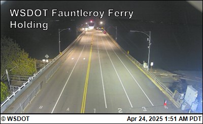
From Washington State Ferries:
Due to lack of crew, the final sailing for the #2 Cathlamet will be the 5:55 p.m. Fauntleroy to Vashon departure. The #1 Kittitas will remain on the #1 boat schedule for the remainder of the night.
If that changes, WSF will update here.
 (SDOT photo, January)
Four months have passed since a leaky cylinder was removed from the West Seattle low bridge (officially known as the Spokane Street Swing Bridge). Soon after that, the bridge reopened to surface traffic after a three-week closure. But the bridge has been running without that cylinder ever since, and that means it takes longer to open and close for maritime traffic; a post-reopening briefing noted that other cylinders would be removed for refurbishment one at a time. So what’s happened since then? We asked SDOT, whose spokesperson Ethan Bergerson replied:
We’re continuing to work on overhauling the damaged cylinder that was removed in January. This involves dismantling the cylinder and conducting a forensic evaluation of each of the parts to determine if there are any modifications that we can consider to improve the life of the cylinder. It will likely be a few months before we complete this overhaul and reinstall this cylinder. When we reinstall the repaired cylinder, we will also remove a cylinder which is currently in service so that we can complete an overhaul of that one as well.
Over the next five days, some other work is planned that will affect maritime traffic (but not vehicles/pedestrians/bicyclists) – here’s the SDOT advisory on that:
Between 1 AM Saturday, May 13 and 1 AM Wednesday, May 17, maritime vessels will have limited access under the Spokane St Swing Bridge to navigate the Duwamish Waterway. We do not expect impacts to people driving, walking, or biking.
During this time, only the east span (side) of the bridge will swing open and closed for maritime vessels on the Duwamish Waterway. We’ve been communicating with the U.S. Coast Guard about this work, which will limit when some larger vessels can pass through.
This work is necessary for us to perform service and inspection on one of the bridge’s hydraulic pumps. The bridge has three hydraulic pump units at each pier to push hydraulic fluid to the bridge’s cylinders, allowing the cylinders to lift and swing the bridge open and closed.
We’re completing maintenance on all the hydraulic pump units for both piers in 2023. We’re starting with the west side of the bridge and will return later in 2023 to work on the east side.
This city webpage chronicles the ongoing work.
 “We’re in the enviable position where people want more transit. But – we’re unable to give it to them.”
So said Metro‘s general manager Michelle Allison toward the end of a just-concluded media briefing with early warning of route suspensions planned for the next twice-yearly “service change,” on September 2nd.
One West Seattle route is on the list – Route 55, which is scheduled for only six trips a day now, five in the morning, one in the afternoon (its schedule was officially reduced last September). “Scheduled” is the key word here – as riders know, Metro has been frequently canceling trips. Allison said the point of suspending more routes – 32 of the current 156 system-wide – is to improve reliability so that by the time they get to September, “the schedule IS the service,” not just an aspirational plan.
Here’s the full list of what they’re planning now for a September 2nd change. And needless to say, currently suspended routes aren’t in the plan for restoration – that would include long-suspended West Seattle Route 37. We asked how they can be certain that this round of suspensions will put them on the road to reliability. Allison, who took over as Metro GM earlier this year, said they believe they’ve done enough analysis and “daylighting” of personnel and supply-chain reality, that they have an accurate picture of what they can reliably deliver. She added that what’s on the schedule starting September 2nd is roughly equal to what, with ongoing trip cancellations, they’re actually delivering now.
Again, the changes announced today – and other forthcoming adjustments – won’t officially be part of the schedule as of September 2nd – so until then, Route 55 is still, technically, operational.

TUESDAY REPORT: Seen in The Junction today – SDOT crews repainting road markings. Warmer weather this time of year tends to launch a lot of work like this that couldn’t be done during the cold, rainy season, so be extra watchful, and be aware you may need a few extra minutes to get where you’re going.
ADDED WEDNESDAY: We asked SDOT for some context. Spokesperson Ethan Bergerson replied:
Each year, we repaint over 1,500 crosswalks across Seattle to keep markings bright and visible. This work requires dry weather, and so as you guessed the spring and summer is re-painting season. This is made possible thanks to funding from the voter-approved Levy to Move Seattle.
This year, we’re repainting about 160 crosswalks in Seattle City Council District 1. Our signs and markings crew have already completed roughly 125 of these crosswalks, and have about 35 crosswalks left to paint.
 (SDOT camera image)
Discussions of the hole that shut down the state-owned ramp from the West Seattle Bridge to Highway 99 (reopening tomorrow) have swerved into concerns about the condition of the city-owned Spokane Street Viaduct. (That’s the formal name for the east half of the West Seattle Bridge, from Highway 99 to I-5.) Those concerns also came up during the 2 1/2-year repair closure of the west half of the West Seattle Bridge. The eastbound Spokane Street Viaduct, not part of the repair project, did close for work including pothole repairs multiple times during those 2 1/2 years, and SDOT did deck scanning for a more extensive assessment. Then in July of last year, the city announced it had received a $5 million federal grant to resurface the entire eastbound side of the SSV. At the time of that announcement, SDOT told us that resurfacing would happen in “the next few years.” So we asked last week where that plan stands, and got this answer today from SDOT spokesperson Ethan Bergerson with a somewhat speedier timeline: “We are currently in the design phase of this project, and anticipate starting construction as soon as next year. The construction work will address the frequent overlay issues that we have been encountering on the eastbound lanes of the Spokane St Viaduct.” The eastbound lanes are on the original 1940s-built SSV structure; the westbound side was built a decade-plus ago to widen it
 (WSB photo, Wednesday)
2:52 PM: Six days after that hole forced the Washington State Department of Transportation to close its ramp connecting the eastbound West Seattle Bridge to northbound State Highway 99, here’s the latest:
As reported over the weekend, crews poured concrete on Saturday, and now it’s curing. WSDOT spokesperson James Poling explained why the schedule remains the same as announced last week (which would reopen the ramp by this Saturday): “The concrete curing process requires our offsite materials lab breaking test concrete cylinders from the pour at certain time benchmarks (24 hours after pour, 48 hours after pour, etc.). Once a test cylinder reaches a strength to safely reopen traffic, the bridge ramp will reopen. The timetable remains the same at this time as our crews await a test cylinder to pass that strength benchmark.”
Meantime, since there was initially much public confusion over who’s accountable for the ramp, and some commenters said they had filed ramp-pothole reports with the city, we asked the Seattle Department of Transportation if they’d received such reports about the state-owned ramp and what happened to them. Spokesperson Ethan Bergerson replied, “When the public reports a pothole which is outside the city limits or not on SDOT’s right-of-way, it will be routed to the correct transportation agency. Over the past few months, we notified WSDOT of several public reports of potholes in this location.” We’ll follow up on that, as WSDOT had said previously they weren’t aware of the hole – at least at the magnitude that forced last Tuesday’s closure.
4:28 PM UPDATE: Just got another update – the ramp concrete “has cured more quickly” than expected, and the ramp will be open by 5 am tomorrow (Tuesday).
 (WSDOT photos)
The Washington State Department of Transportation says its crew made more progress today toward repairing and reopening the ramp between the West Seattle Bridge and northbound Highway 99. It’s been closed since Tuesday night, when a 5′ x 4′ hole in the 64-year-old ramp caused tire blowouts for at least five drivers. WSDOT’s latest update: “Today we’ve poured concrete. It usually takes a few days for this type of concrete to cure properly in order to safely reopen the ramp.”

We’ll find out on Monday if that’s altered the schedule – originally announced as 10 days, which would mean reopening by next Saturday. In the meantime, your options for getting to Highway 99 are the 1st Avenue South Bridge or via the 1st Avenue exit on the eastbound bridge, leading you into SODO, where you can get onto 99.

That map from SDOT shows where work is expected to start soon for pedestrian improvements at Roxbury/Olson [map], which have been in the works for at least three years. The city has sent notices to people in the area, but it’s a busy corridor, so many others who use it need to know too. From the SDOT advisory:
This work will include:
-A new pedestrian signal on the northwest side of the intersection
-Shifting the crosswalks across SW Roxbury St so they’re better aligned
-Curb bulbs that extend the sidewalk corners for people walking on the south side of the intersection
-Curb ramps for improved ADA (Americans with Disabilities Act) accessibility
Once work begins, it is expected to last six months, SDOT says, with work hours primarily 9 am-3 pm on weekdays. They’ll have flaggers to help with lane closures. Here’s the full construction notice.
 (WSB photos, noontime today)
When we went over today for another look under the damaged ramp to Highway 99, we arrived just as that crew was ascending to the ramp’s underside. It’s been two days now since a 5′ x 4′ hole in the ramp took out tires on at least five vehicles before WSDOT ordered it closed. It’s a state-owned structure, as is Highway 99, to which the ramp leads from an exit on the eastbound West Seattle Bridge. WSDOT spokesperson James Poling tells WSB that repairs remain on schedule – that’s the schedule announced yesterday, 10 days, which would mean the work is expected to be done by May 13th. He says the lift we photographed carries workers 38 feet up from ground to ramp. So what exactly is happening now? Poling replied, “Most of the concrete removal is now complete. The next repair step is building forms underneath the deck and sealing the space between the girder webs. This will take about 36-48 hours.”

As we reported yesterday, the ramp was built in 1959 and last inspected in August 2022. It remained open to traffic during the West Seattle Bridge’s two and a half-year closure, still accessible via a ramp from surface Spokane Street, except for a week-plus closure to repair a deck hole about 100 feet from this one.
P.S. We found more information about the ramp via this inventory map – including its official name, E-N Ramp, and confirmation that its inspection schedule is every two years
 (WSB photos)
3:26 PM: The day after that “gaping hole” opened in the ramp from the eastbound West Seattle Bridge to northbound State Highway 99, the Washington State Department of Transportation, which owns the ramp, says it’s likely to stay closed at least 10 days. We first reported on the hole starting at 6:41 pm Tuesday evening, when police suddenly found themselves dealing with multiple drivers pulled over on 99 because the hole had punctured their tires. The ramp was closed a short time later, and WSDOT crews responded. Today they are working both on and beneath the ramp; we checked out the scene at ground level. One task there is to set up a debris-containment area:

That’s both for debris that already has fallen from the hole, measured at 5 feet by 4 feet, and anything more generated by assessment and repair work. It’s a hard-hat zone, emphasizes WSDOT spokesperson James Poling, who tells WSB that crews on the ramp have been checking other areas around this one today to ensure they’re stable, and so far haven’t found anything notable. We talked with Poling at the scene below the ramp at noontime (as well as twice by phone). He says the state built this ramp in 1959 (same year as completion of the now-demolished Alaskan Way Viaduct to which it connected). We’re awaiting answers from WSDOT to questions such as when it was last inspected and what the regular inspection schedule is, as well as whether they’d had reports about this hole before, as WSB commenters say they’ve seen it for weeks.

This hole is not in the same spot on the ramp as the one for which the ramp was closed for repairs last year, says Poling – it’s about 100 feet from that one. (Added: This February 2022 WSB story includes a slide with three images of that hole.) That brings up another clarification this ramp was NOT closed during the West Seattle Bridge’s 2 1/2-year-long repair closure – except for the repair work a year ago, it remained open to traffic, accessible via eastbound Spokane Street. Poling says that while they are still working on a timeline estimate, they are certain this is not going to be a West Seattle Bridge-magnitude length closure. He’s expecting to have another update and some answers for us later today, and we’ll update this story.
DETOURS: If you need to get to northbound 99, use the northbound 1st Avenue South Bridge, or the 1st Avenue South exit from the eastbound West Seattle Bridge/Spokane Street Viaduct, then head north and connect to NB 99 in SODO.
IF YOUR VEHICLE WAS DAMAGED: WSDOT provided this link for filing a claim.
4:30 PM UPDATE: Just talked again with WSDOT’s Poling. He says 10 days is now the official expected duration of the closure – no longer “at least” 10 days, just “10 days.” He says crews right now are preparing for the repairs by chipping away at “unsuitable” – failed – concrete around the hole, and from there “it’s a standard bridge-deck repair.” He says the ramp was last inspected in August of last year, and while he doesn’t know its regular inspection schedule, he says it’s at least every two years. Poling also says that WSDOT maintenance crews were not previously aware of this hole – he said an emergency closure would have resulted if they had been.
 (WSB file photo from past Bike To School Day)
If you’re on the roads and/or sidewalks tomorrow (Wednesday, May 3rd), expect more multi-modal traffic heading to and from local schools. Genesee Hill Elementary parent Dave points out that it’s Bike/Walk/Roll To School Day and wanted us to share this reminder again: “Drivers, please keep an extra eye out for students biking and walking to school tomorrow, May 3rd. Students will be coming from all directions between 7:30-7:45 AM and arriving in the parking lot on Dakota St.” Any other schools participating? Let us know (or post a comment) – thank you!
Last week we heard from Taylor about a malfunction with the flashing beacon signal for the crosswalk on California at Genesee. They reported it to SDOT, and it got fixed. But now we’ve heard from Jesse that it’s broken again: “Just a heads up, the pedestrian crossing signal at California and Genesee isn’t working. I’ve reported it to the city, but if people want to cross they should probably go a block either way to do so safely.” (Besides the Find It Fix It app, you can report transportation-related trouble via 206-684-ROAD or, after hours, 206-386-1218.)

After last weekend’s work, SDOT says it’s “nearly” done installing the 2-way protected bike lane along an almost-half-mile stretch of West Marginal Way SW north of the Duwamish Longhouse – jersey barriers are up and lane markings are painted. We drove alongside it this afternoon for a closer look:

Reminder signage is in place at driveways not only on the bike-lane side but also on the northbound side of West Marginal, where the pre-existing Duwamish Trail crosses. It’s been more than two years since SDOT proposed the bike lane, eventually deciding to hold off on installation until after the West Seattle Bridge reopened last September.
4:23 PM: Warmer weather brings more road work. SDOT says crews will be working on the shoulder of the westbound West Seattle Bridge for the next three days – Tuesday, April 25th, through Thursday, April 27th – between 7 am and 2 pm each day. The announcement was brief so we have an inquiry out asking what exactly they’ll be doing.
8:44 PM: Just heard back from SDOT: This will be a “lane closure for onsite inspection of the high bridge. We have been doing these inspections since reopening the bridge to make sure the structural behavior of the bridge is in good condition.”
 (Photo tweeted by U.S. Coast Guard)
6:17 PM: We’re mentioning this because (a) west-facing West Seattleites might see emergency vessel/helicopter traffic as a result, and (b) the Fauntleroy-Vashon-Southworth ferry route might get busier because of it: A Washington State Ferries boat has run aground while traveling from Bremerton to Seattle. U.S. Coast Guard vessels are at the scene where M/V Walla Walla is grounded in Rich Passage along the south side of Bainbridge Island near West Blakely [vicinity map]. It happened around 4:30 pm, WSF says, adding that initial indications are that “generator failure” was a factor. The Seattle-Bremerton run is out of service until further notice because of the mishap, as Walla Walla (50 years old) was the only boat on the run. No injuries reported, per the Coast Guard.
6:39 PM: The state Ecology Department says neither hull damage nor pollution has been detected so far. … One of the passengers stuck aboard tweeted that they’re “waiting to abandon ship but not clear how yet.”
7:50 PM: As noted in comments, Kitsap Transit has two of its foot ferries standing by to help get the passengers off the Walla Walla.
8:29 PM: And the Coast Guard says that’s happening right now:
 (Photo tweeted by U.S. Coast Guard)
10:46 PM: The Coast Guard says the passenger evacuation is wrapping up and: “The rising tide will assist during the slated removal of the vessel from the shoal water. Peak high tide is at 3:23 am.”
ADDED SUNDAY: The boat indeed was refloated on the early-morning high tide and moved to Bremerton, where people were able to go retrieve their vehicles later in the morning. The Bremerton-Seattle run is being handled today by M/V Issaquah so the Walla Walla could be evaluated.
 (SDOT photo)
We just heard from SDOT this afternoon that the new signal at 12th/Holden is complete and should be in operation by now:
We have installed two pedestrian crossing signals (slated to be activated today), curb ramps, and a crosswalk, and painted the roadway. This project provides another controlled crossing at SW Holden St for people walking or biking along 12th Ave SW. There will be “new signal ahead” signs to alert drivers of the new signal. This signal at 12th Ave SW is also intended to be part of the Highland Park/Riverview Neighborhood Greenway. Signage on this is to come at a future phase of work.
The flashing lights at 11th Ave SW and SW Holden St will remain.
The 11th/Holden beacon was originally planned for removal until community pushback.
 (Triangle Route ferry photographed from Lincoln Park by Theresa Arbow-O’Connor)
Thanks to Tom for the tip via this comment. Washington State Ferries now says they don’t expect to restore three-boat service on the Fauntleroy-Vashon-Southworth run before next month. That’s a change from what WSF said when they announced M/V Cathlamet was returning to service, and also from the Service Restoration Plan‘s projection of trial 3-boat service in early April. The problem, says WSF spokesperson Ian Sterling, remains staffing: “We’re still too short-handed to reliably go to three-boat service. However, we anticipate that by May, the staffing situation will have improved enough to allow us to trial full service, thankfully.”

That’s the stairway between 37th and 38th SW at SW Findlay, recently renovated. It’s one of seven stairway projects in West Seattle scheduled for 2023-2024, according to SDOT‘s Greg Funk. We checked in with him after reader Desiree emailed to report that she’d spotted a notice for one of the upcoming projects, for Bonair at Halleck (here’s the notice). Funk says work should start in mid-to-late summer because right now they’re “in the process of getting a power pole moved before we can start. Other West Seattle stairway projects ahead for 2023-2024:
California Dr SW-SW Cambridge (40% completed)
SW Hudson St-40th Ave SW (Rail upgrade only. Estimated start Nov-Dec)
50th Ave SW And SW Admiral Way (2024; notice)
21st Ave SW & SW Dakota St (2024; notice)
SW Roxbury and Marine View Dr SW (2024; notice)
The stairway-maintenance webpage – which Funk says will be updated with these projects soon – notes that the city has more than 500 stairways in all.

Thanks for the tips. Readers noticed changes last week in the sequence at California/Alaska (aka Walk-All-Ways) – as Tala, for one, described it, “It used to be walk all ways after the Eastbound traffic signal. Now it’s walk all ways after the North / South traffic signal.” We asked SDOT about the change, and got the reply from spokesperson Ethan Bergerson today:
Last week, we optimized and upgraded traffic signal equipment at several West Seattle intersections. While doing this, we also adjusted walk signal timing to give people more time to cross the street and sometimes made other enhancements for pedestrian safety such as making walk-signals turn on automatically without pressing a button or adding pedestrian-first walk signals which give people a head start before cars get a green light.
Here is a list of all the locations where we have made adjustments:
California Ave SW & SW Genesee St
California Ave SW & SW Oregon St
California Ave SW & SW Alaska St
42nd Ave SW & SW Oregon St
42nd Ave SW & SW Alaska St
35th Ave SW & SW Edmunds St
News of this work apparently also explains why a few of those intersections had malfunctions last week. If you’re still noticing problems – at any of these, or any other, signalized intersections – you can report to SDOT, 206-684-ROAD during business hours, 206-386-1218 after-hours.
Genesee Hill Elementary has one, Roxhill Elementary has one, and now Lafayette Elementary is going to test a “School Street.”

Thanks to Anthony for the tip. “School Streets” are an SDOT program that prioritizes walking, biking, and rolling on a section of a street by a school from 7 am to 5 pm on days school is in session. For Lafayette, SDOT is going to start a month-long test on Wednesday, April 19th, for the section of SW Lander that runs along the south side of the school, between California and 45th SW (part of which already has a “streatery” for The Good Society). From the “School Streets” FAQ:
What does this mean for people getting to school?
– When possible, walk, roll, or bike with your child to school
– If you must drive to school, try parking a block or two away and finishing the trip on foot
– Students provided with district transportation or with mobility needs can access the blockWhat does this mean for drivers?
– People driving who need to get to home and businesses on a School Street are still able to drive on these streets. Drivers should use caution and yield to people.
– People enjoying the street should be mindful of drivers trying to get to homes as well
SDOT collected traffic data before the test and plans to collect data during the test. Here’s the notification flyer. Feedback is welcome at HealthyStreets@seattle.gov and by phone at 206-900-8760.
Neighbors on 36th SW south of Providence Mount St. Vincent recently noticed an SDOT crew marking the street for future greenway construction that was a surprise to some. Checking WSB archives, we found a mention five years ago that a Camp Long-vicinity greenway “spur” was possible as part of what was referred to at the time as “Phase 3” of the 35th Avenue SW Safety Project. That reference also suggested SDOT would be talking with neighbors in advance of any such construction, which apparently hasn’t happened yet, so we asked about it. Here’s the reply from SDOT spokesperson Ethan Bergerson:
We’re extending the West Seattle Neighborhood Greenway on 36th Ave SW to create safer spaces for walking, biking, and rolling in West Seattle. This extension will connect to Camp Long Park via 35th Ave SW, using the recently built traffic signal at 35th Ave SW and SW Dawson St.
Construction is expected to begin by early summer and finish later in the summer (crews visited the neighborhood this past weekend to make pre-construction markings on the pavement). We will send construction notices in the mail before the actual construction work starts.
The extension was listed in our 2021 Bike Master Plan update, and is part of a multi-year, multi-project approach to create safer spaces for walking, biking, and rolling in West Seattle. The end result will look similar to other Neighborhood Greenways, including:
-Speed humps / cushions to ensure drivers travel at a safe speed
-Stop signs for cross-street traffic
-Bike lane markings on the street
-Wayfinding and neighborhood greenway signs
Here’s a map of the project zone.
| Comments Off on WEEKEND ALERTS: Road, sidewalk work in West Seattle