West Seattle, Washington
28 Thursday
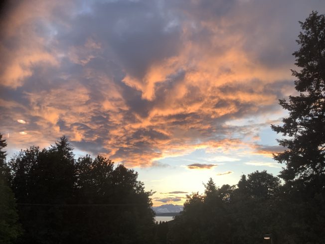
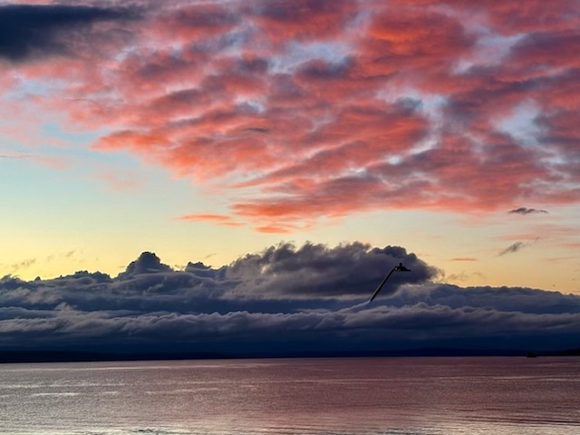
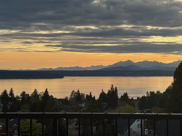
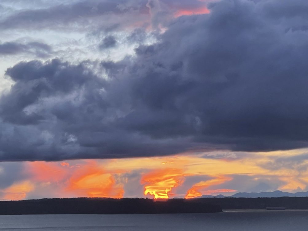
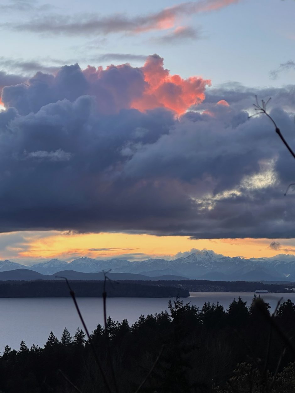
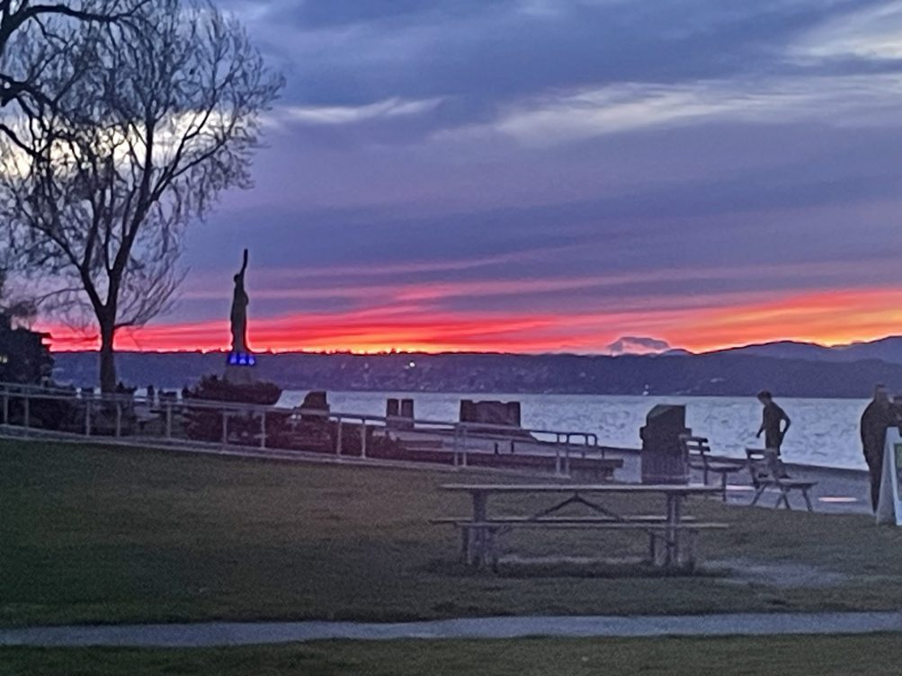
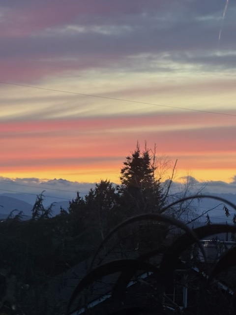
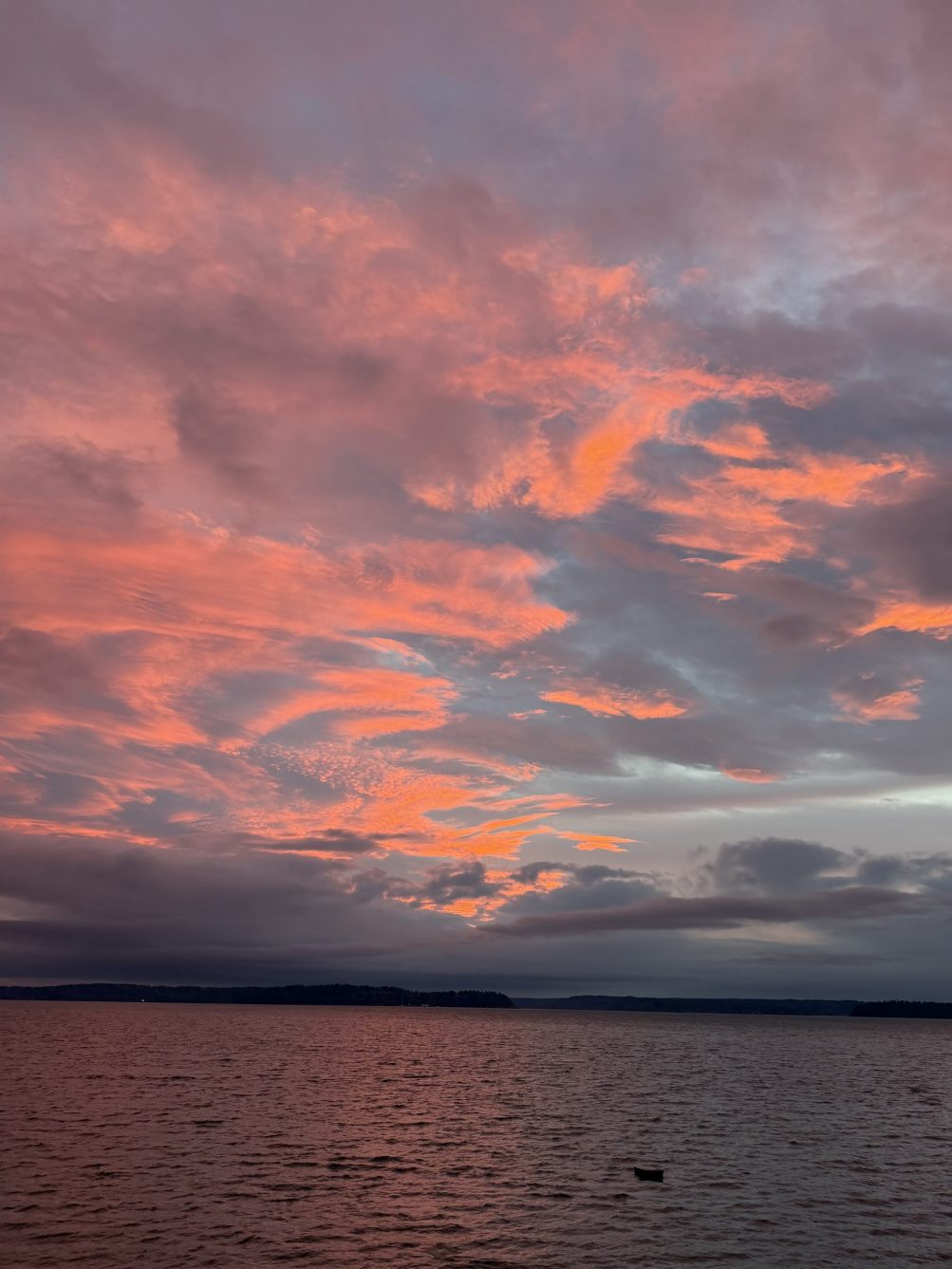
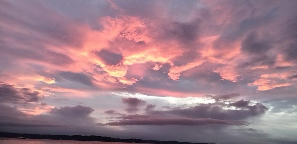
Thanks for the photos of what was a vivid but short-lived burst of color during tonight’s sunset! Above, Steve Heck‘s view from The Kenney; below, how Curry Gibson saw it:
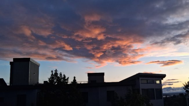
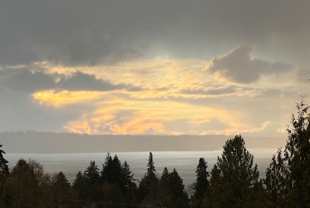
(added) Bob Burns sent this as seen from Alki:
Tonight’s official sunset time was 8:52 pm; the latest sunset time of the year will be 9:11 pm, starting June 22 and continuing for a week.
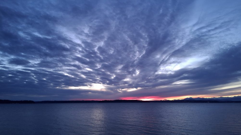
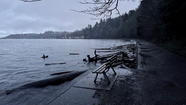
Thanks to Kathleen for the photo from Friday night. Hard as it is to believe after today’s beautiful sunshine, the forecast is still predicting rain and wind for the Memorial Day holiday. The National Weather Service says rain’s most likely in the pm, and that the wind could gust up to 23 mph, so batten down your barbecue …
8:35 AM: 2-vehicle collision reported southbound at 16th/Barton.
Earlier:
6:01 AM: Good morning! Welcome to Wednesday, April 29, 2026.
WEATHER + SUNRISE/SUNSET
Sunny, high in the mid-60s. Sunrise was at 5:55 am; sunset will be at 8:19 pm.
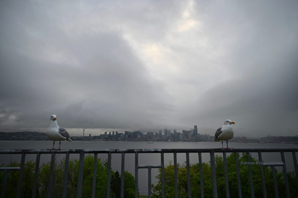 (Tuesday morning photo by Theresa Arbow-O’Connor)
TRANSIT TODAY
Metro buses – Regular schedules.
West Seattle Water Taxi – Now on “summer” schedule, with extra Friday/Saturday/Sunday runs including later-night schedules Fridays and Saturdays.
Washington State Ferries – Fauntleroy/Vashon/Southworth route still on a two-boat schedule with a third, unscheduled boat, but was canceling some very early-am sailings today, so check WSF’s alert page for updates. That’s also where you’ll find a summary of fare changes starting Friday (May 1). And note work at the Fauntleroy dock this week could affect ferry users.
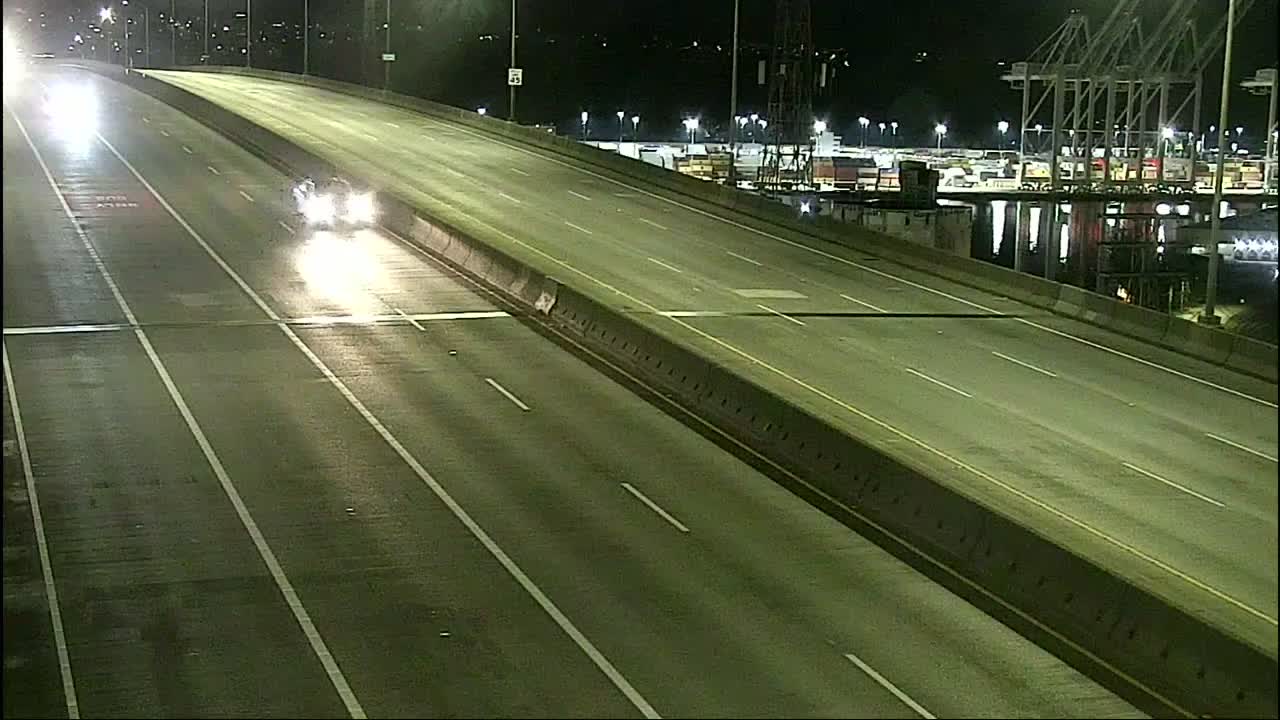
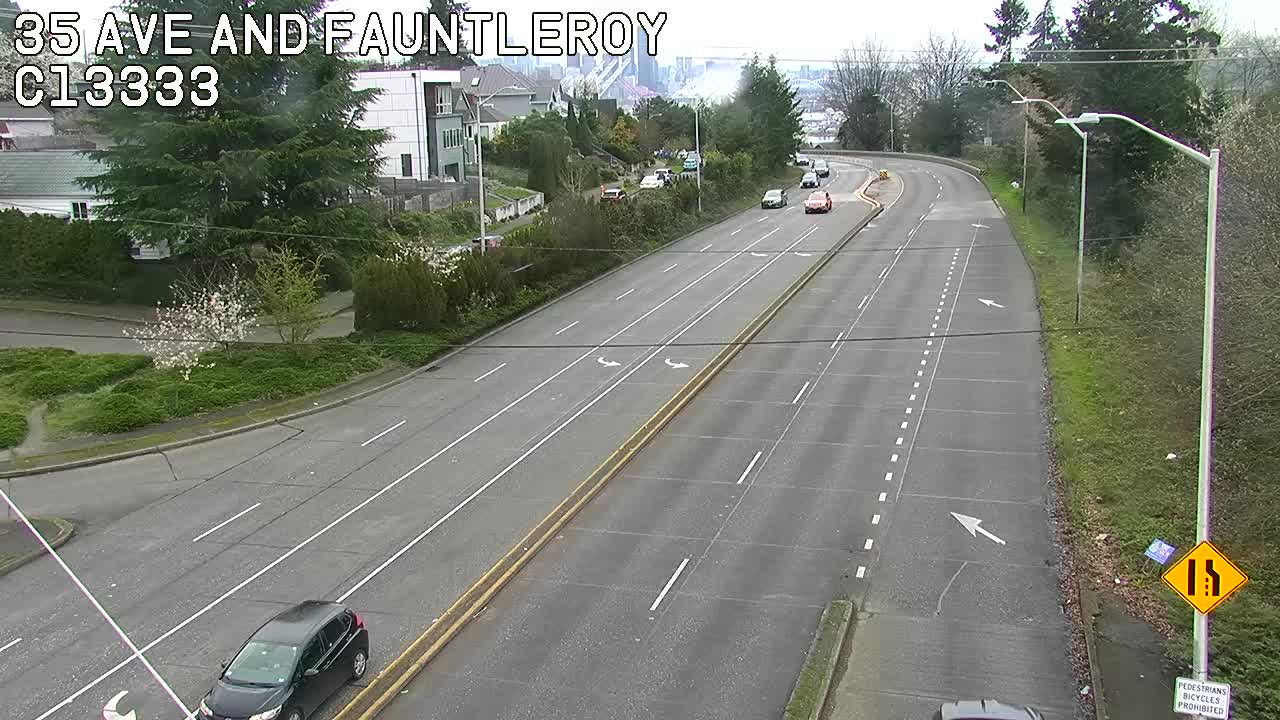
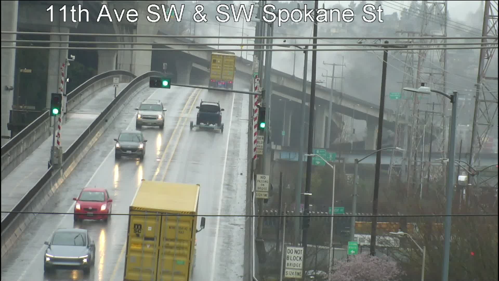
SPOTLIGHT TRAFFIC CAMERAS
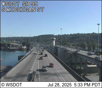
High Bridge – Here’s the main camera, followed by the Fauntleroy-end camera:
Low Bridge – Here’s the westward view. Also note, maritime-opening info is available via X (ex-Twitter):
1st Avenue South Bridge (25 mph speed limit):
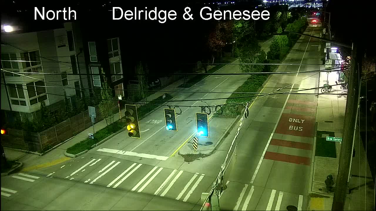
Delridge cameras: In addition to the one below (Delridge/Genesee), cameras are also at Delridge/Juneau, Delridge/Henderson, Delridge/Oregon, and video-only (so you have to go to the map), Delridge/Holden and Delridge/Thistle.
MORE TRAFFIC CAMS: All functioning traffic cams citywide are here (including links to live video for most); for a quick scan of West Seattle and vicinity-relevant cameras, see this WSB page.
See trouble on the bridges/streets/paths/water? Please text or call our hotline (when you can do it safely, and after you’ve reported to authorities if they’re not already on scene) – 206-293-6302. Thank you!
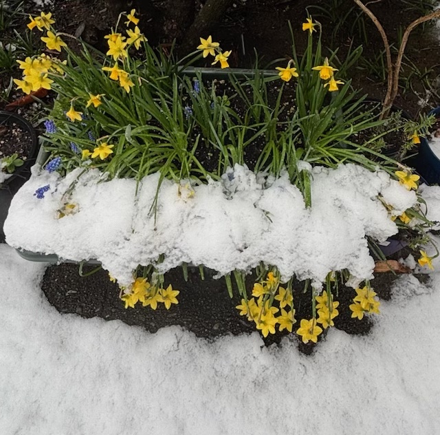
The National Weather Service has our area under a Frost Advisory weather alert for tonight, suggesting the temperature could get down to freezing. However, the actual forecast is for a low in the 40s, and this morning’s low was 43, so you might not need to panic about your plants.
… some of your West Seattle neighbors did!
Above is a photo sent by Chris Frankovich; below, from Wyatt:
Today’s official high was 72 degrees, and tomorrow’s forecast to be at least a dozen degrees cooler, with the possibility of rain returning.
Thanks to Carrie Brown for the westward view of our Saturday night sunset. The high today hit 68 at the airport – eight degrees above normal – but nowhere near the record for this date, which was 89 degrees back in 2016. The forecast suggests two more days of partly sunny, almost-70-degree weather, before the chance of rain returns.
3:27 PM: Thanks to Mike for the tip. We’ve already had one round of “chunky rain” and the National Weather Service has an alert out for at least the next half-hour saying more could be headed this way: “Winds in excess of 30 mph and half-inch hail” are possible.
3:50 PM: Just got a bit more hail/graupel/ice pellets here in Upper Fauntleroy, but nothing close to a half-inch.
6:05 PM: The NWS confirms reports of a water-spout sighting off Magnolia during all this.
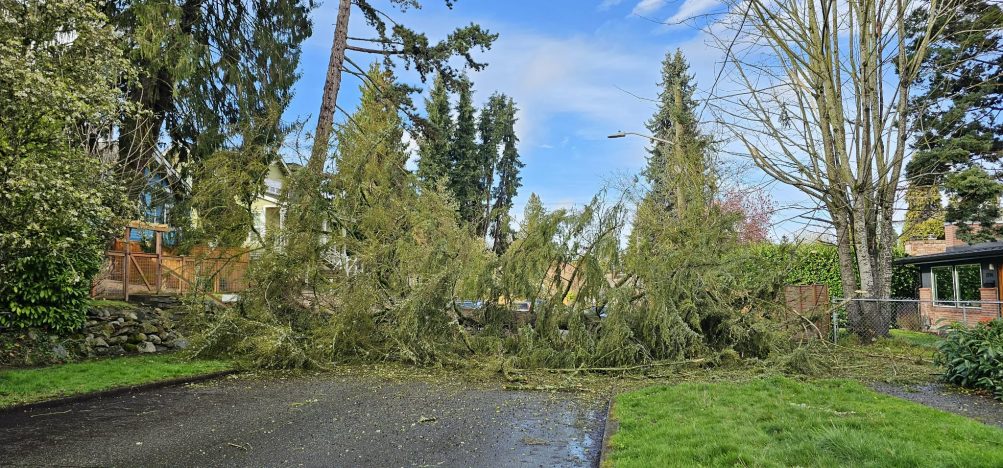
Thanks to Meagan for the initial picture and tip about that tree down across 18th and Holden on this breezy day. As we wrote this, we got another photo, from Erika, who says the tree is between Holden and Kenyon:
Meagan mentioned the tree taking down wires; no power outages mapped in the area so far.
6:02 AM: Good morning! Welcome to Thursday, March 19, 2026. (Spring arrives tomorrow morning!)
WEATHER + SUNRISE/SUNSET
Same forecast as the past few days: Rainy, breezy, mid-50s high. Sunrise at 7:13 am; sunset at 7:20 pm.
 (Wednesday photo by Bob Burns)
TRANSIT TODAY
West Seattle Water Taxi – Regular West Seattle service, winter schedule through April 10.
Washington State Ferries – Check WSF’s alert page for any changes to the 3-boat schedule. Schedule changes starting Sunday – Fauntleroy-Vashon-Southworth gets 3 boats on weekends too.
Metro buses – Regular weekday schedule and routes.
SPOTLIGHT TRAFFIC CAMERAS
High Bridge – Here’s the main camera, followed by the Fauntleroy-end camera:
Low Bridge – Here’s the westward view. Also note, maritime-opening info is available via X (ex-Twitter):
1st Avenue South Bridge (fully open but 25 mph speed limit):
Delridge cameras: In addition to the one below (Delridge/Genesee), cameras are also at Delridge/Juneau, Delridge/Henderson, Delridge/Oregon, and video-only (so you have to go to the map), Delridge/Holden and Delridge/Thistle.
MORE TRAFFIC CAMS: All functioning traffic cams citywide are here (including links to live video for most); for a quick scan of West Seattle and vicinity-relevant cameras, see this WSB page.
See trouble on the bridges/streets/paths/water? Please text or call our hotline (when you can do it safely, and after you’ve reported to authorities if they’re not already on scene) – 206-293-6302. Thank you!
(Earlier snow reports: Early morning … morning commute … late morning and afternoon)
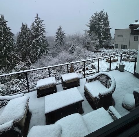
5 PM: One week until spring and that photo just texted to us tells the story – a day full of end-of-winter snow. It’s still barely above freezing, but the National Weather Service insists tomorrow will get to the mid-40s. If you’re planning to brave slushy roads and head out tonight, we didn’t publish a highlight list today but there are options in the WSB Weet Seattle Event Calendar. Updates to come – thanks to everybody who’s shared photos and updates – text 206-293-6302 or email westseattleblog@gmail.com – thank you!
TRAFFIC INFO: The 1st Avenue South Bridge is now fully open … wherever you’re headed, the city’s traffic cams are here.
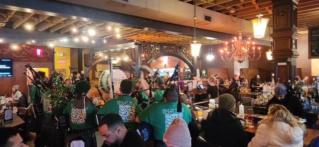
5:53 PM: One of the events on our calendar for tonight, the Cascadia Pipe and Drum Band‘s pre-St. Patrick’s Day West Seattle pub crawl, is definitely on. Our photographer just caught up with them inside their very crowded first stop, Talarico’s; their schedule for the rest of the night is in our calendar listing. (More in a separate story later.)
6:52 PM: Also in The Junction, thanks for the tips on this crash (and for the photo):
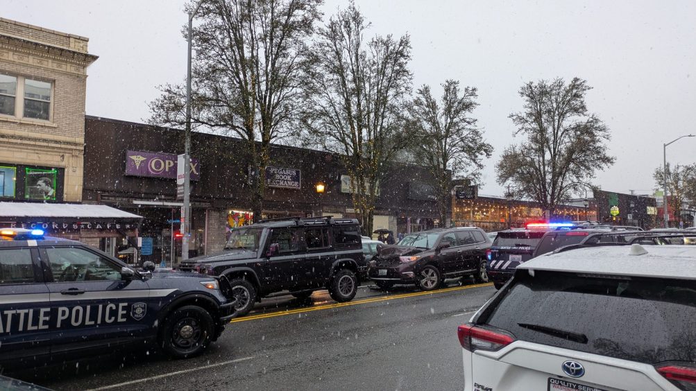
SFD’s response closed out quickly, so apparently no serious injuries, but onlookers said it appeared up to four drivers were involved. … (added) Shortly thereafter, SFD was called back because one person realized they might have suffered a head injury.
7:25 PM: The California/Alaska live traffic cam shows this is still blocking part of the street, but at least one tow truck is on scene.
8:24 PM: Back to the snow itself – Tim and Bradi Jones sent this pic:
9:27 PM: From the NWS (caps are theirs):
…RECORD DAILY MAXIMUM RAINFALL SET AT SEATTLE-TACOMA WA AIRPORT…
A RECORD RAINFALL OF 1.15 INCHES WAS SET AT SEATTLE-TACOMA WA AIRPORT TODAY. THIS BREAKS THE OLD RECORD OF 0.7 INCHES SET IN 1961.
…RECORD DAILY MAXIMUM SNOWFALL SET AT SEATTLE-TACOMA WA AIRPORT…
A RECORD SNOWFALL OF 3.0 INCHES WAS SET AT SEATTLE-TACOMA WA AIRPORT TODAY. THIS BREAKS THE OLD RECORD OF 1.7 INCHES SET IN 1955.
 (Reader photo, texted from North Admiral)
9:16 AM: Snow’s still falling as the commute period ends and we’re getting word of some closures/changes, so we’re launching this separate report. We’ll add to the following lists as needed, in addition to adding other photos/updates. (Info/photos to share? Text 206-293-6302 or email westseattleblog@gmail.com – thank you!)
CLOSURES (update 1:20 pm)
-Stay ‘n’ Play at Arbor Heights Community Church
-West Seattle Golf Course
-Kennedy High School in Burien closing at 10:30 am
-Summit Atlas middle/high school closing at 12:30 pm
-Westside School closing early: Preschool–2nd Grade: 1:30 pm; 3rd–4th Grade: 1:45 pm; Middle School: 2:00 pm. No after-school programming, including EDP and athletics.
CHANGES
-Delayed opening for Delridge Community Center, 11 am
10:14 AM: Texter says the downed tree on SW Webster west of 35th SW is still blocking the street … Another texter says they have 3″ of snow on the ground in Highland Park.
10:29 AM: First school closure, added to closure list above – texter reports (and website verifies) that Kennedy Catholic HS in Burien (attended by many West Seattleites) is closing at 10:30 am and canceling all after-school/evening events.
10:58 AM: Wires/tree trouble continues a road closure at 52nd Place SW and SW Genesee [map] … Caroline sent this pic from Westcrest Park with a different tree reminder:
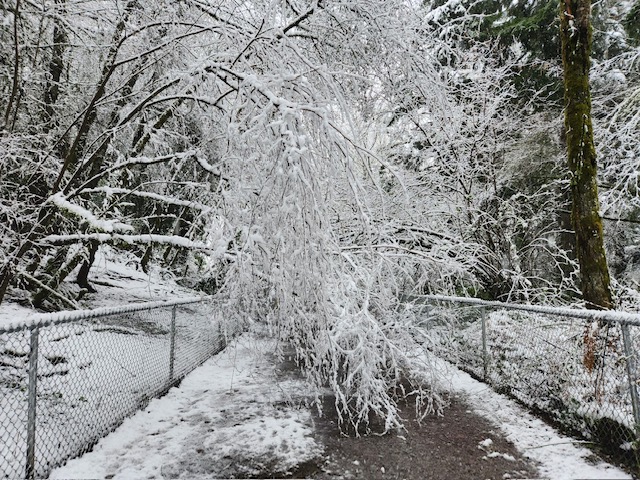
She says tree branches on the lower, wooded Westcrest loop are “laden with snow and actively falling across the trail.” Good reminder to avoid being out in wooded areas while this wet almost-spring snow is still falling and bringing down trees/limbs.
11:42 AM: Police were just dispatched to another tree-fallen-on-road, this time 6500 block of 18th SW [map]. … Also, a tree down in the 8100 block of Delridge Way SW [map].
12:04 PM: Still snowing steadily! The National Weather Service‘s mid-morning “forecast discussion” expected the snow level to rise to 1,000′ (double the city’s highest elevation, which is at 35th/Myrtle) by now, so no word yet how soon this will turn to rain.
12:54 PM: Still snow, although we noticed the half-inch or so that had built up atop our fence has melted. Meantime, yet another tree branch vs. wire, with some street blockage, just reported in the 10000 block of 35th SW.
1:20 PM: We’ll continue to update here – just added another school’s early closure above – but we’re also going to add a few news stories atop the site before we start an afternoon weather report.
1:30 PM: Tree down and blocking part of the street at Dumar/Orchard. … And a few minutes after that, we got a reader report that a tree is down across Fairmount about a quarter-mile uphill from Harbor Avenue SW.
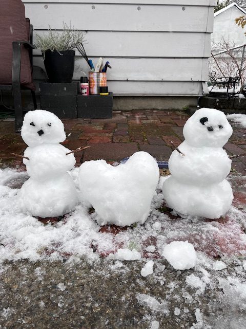
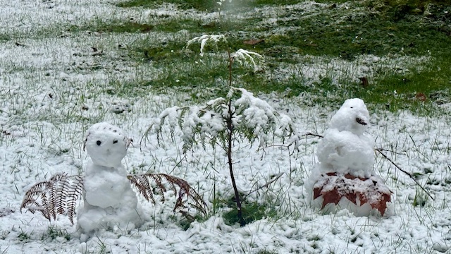
2:44 PM: It’s finally turned to mostly rain. So go build in the snow before it’s gone!
 (Photo sent by K Smith)
4:34 PM: The snow has picked back up again, though the National Weather Service continues to downplay it.
7:59 AM: Thanks to everyone for snow reports in comments! (We’ll have a gallery later too.)
Also thanks for the report on the wires-down call at 14th/Barton involving a tree fire.
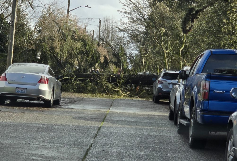
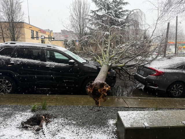
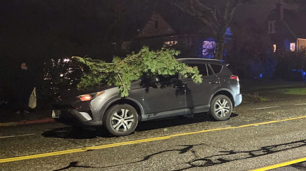
8:36 AM: Tree down on cars by LA Fitness (thanks for the tip and photo):
8:51 AM: Tree down in 3500 block of SW Webster, per police radio, blocking the street.
9:03 AM: Steady snow up here now.
Earlier:
5:57 AM: Good morning! It’s Friday, March 13, 2026, fifth day of the repair closure for the northbound 1st Avenue South Bridge. The South Park Bridge is a major detour route:
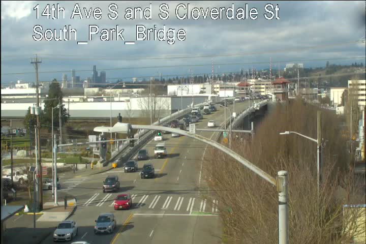
The West Seattle low bridge too.
SLUSHY WEATHER
As noted a few hours ago, the oft-predicted “rain/snow mix” tipped the latter way for some, so beware of lingering slush. But at least where we are, the rain seems to be in charge again. The forecast says the mix may continue this morning, with some fog – high in the low 40s. Sunrise is at 7:26 am; sunset at 7:12 pm. One week until spring!
MORE SPOTLIGHT TRAFFIC CAMERAS
High Bridge – Here’s the main camera, followed by the Fauntleroy-end camera:
Delridge cameras: In addition to the one below (Delridge/Genesee), cameras are also at Delridge/Juneau, Delridge/Henderson, Delridge/Oregon, and video-only (so you have to go to the map), Delridge/Holden and Delridge/Thistle.
CHECK WEATHER/TRAFFIC VIA MORE TRAFFIC CAMS
All functioning traffic cams citywide are here (including links to live video for most); for a quick scan of West Seattle and vicinity-relevant cameras, see this WSB page.
TRANSIT TODAY
West Seattle Water Taxi – Regular West Seattle service, winter schedule.
Washington State Ferries – Check WSF’s alert page for any changes to the 3-boat schedule.
Metro buses – Regular weekday schedule and routes. (Note that buses usually traveling the NB 1st Avenue S. Bridge are using the South Park Bridge, but no missed stops, Metro told us.)
See a problem on the bridges/streets/paths/water? Please text or call our hotline (when you can do it safely, and after you’ve reported to authorities if they’re not already on scene) – 206-293-6302. Thank you!
2:27 AM: Thanks to the reader who just sent this video – snow falling “just north of Highland Park.” Rain up here as far as we can tell, but the forecast is for a mix. We’ll see what the next few hours bring!
2:34 AM: Now it’s snowing here in Upper Fauntleroy too.
8:40 PM: We’re in the heart of the Wind Advisory now, with the alert still in effect until 6 am, and just heard about a downed tree – in Fairmount Ravine, at Fairmount and Belvidere [map]. Avoid the ravine for now (good advice for any heavily treed area during high wind).
 (Added: WSB photo)
9:33 PM: Now there’s a response for a tree limb that fell onto a car at 35th SW and SW Elmgrove, blocking the southbound lane of 35th.
9:51 PM: Added a photo. No injuries reported.
11:14 PM: Also a tree down in North Admiral – in a comment below, Bill reports, “The 1900 block of 46th Ave SW is blocked by a large tree limb across the street and both sidewalks.”
12:43 AM: Police were dispatched a little while ago to check out trees reported down at 4th SW and SW Cambridge.
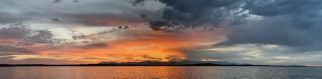
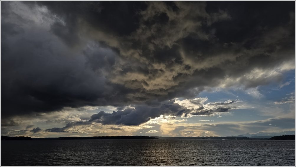
Clouds staged a double feature this afternoon, both dark and bright. The first two photos are from David Hutchinson – the very dark wall of clouds to the east, eventually followed by a thinner dark line to the west:
At sunset, they also made room for a burst of color – Brooke Gosztola is one of the photographers who caught that:
Penny photographed this pink breakthrough:
And April K caught the colors fading:
Following all that, we’re already in the 30s, and a rain/snow mix remains a possibility until early afternoon, the forecast says.
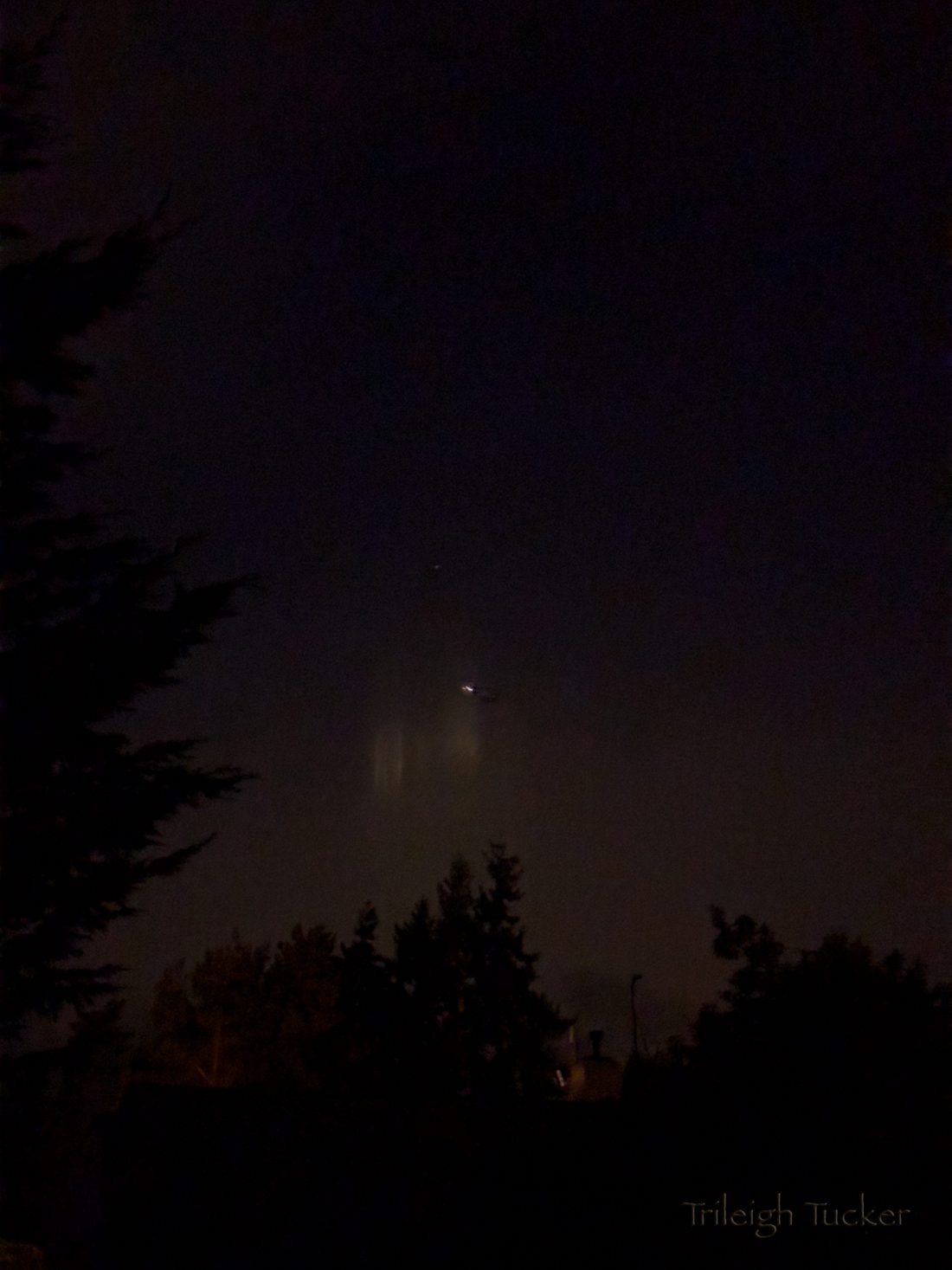
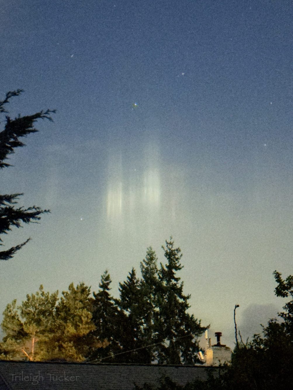
Also from the early-morning beat, the photos and report were sent by Trileigh Tucker:
When I woke up this morning and wandered into our kitchen to make tea, I looked out the window to see if there were any stars—and saw this unusual display to the west! These are “light pillars,” and form when the atmosphere is cold enough that any moisture in the air freezes into flakes. Since “flakes float flat,” they act as little mirrors that bounce surface light to our eyes, which we perceive as vertical pillars. Wikipedia does a good job of explaining them.
I think this is the first time I’ve found them “in the wild”! It was a pretty exciting way to start my day, science/nature nerd that I am.
The first photo shows them as I saw them (the plane flying past them helped the camera to focus in the dark), and the second (one was) automatically lightened by my phone and shows more detail.
 (Photo sent by Ian)
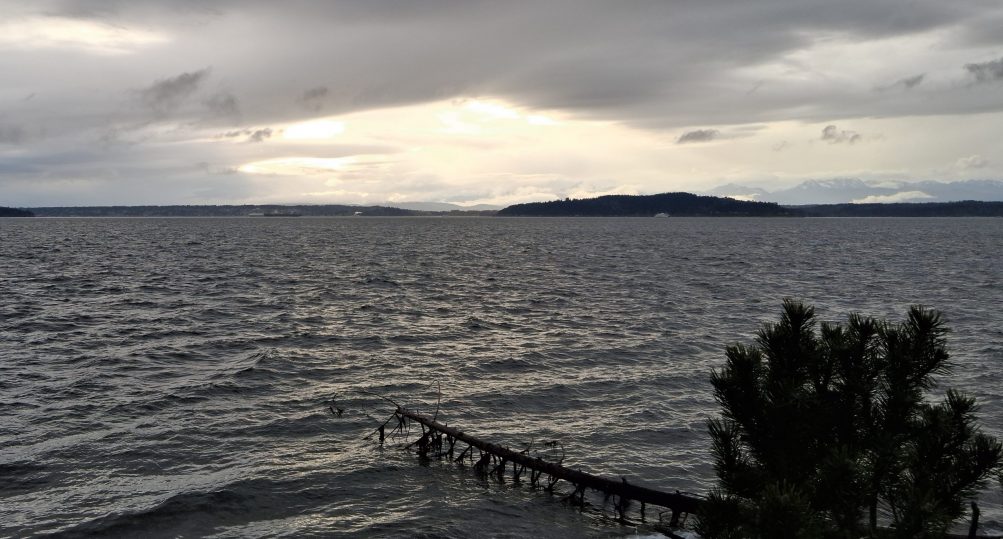
Snow-coated Mt. Baker – 140 miles away – was in clear view from Alki this afternoon. If the forecast holds, we might finally see a bit of snow here before the week’s out. No advisories or alerts, but the National Weather Service‘s forecast suggests a rain/snow mix is possible in just about any daypart from Monday night until next Saturday. The NWS Forecast Discussion says snow levels could be down to 200 to 500 feet – which includes much of the peninsula – by Tuesday. But the qualifier phrase “little to no accumulation expected” appears in the forecast too.
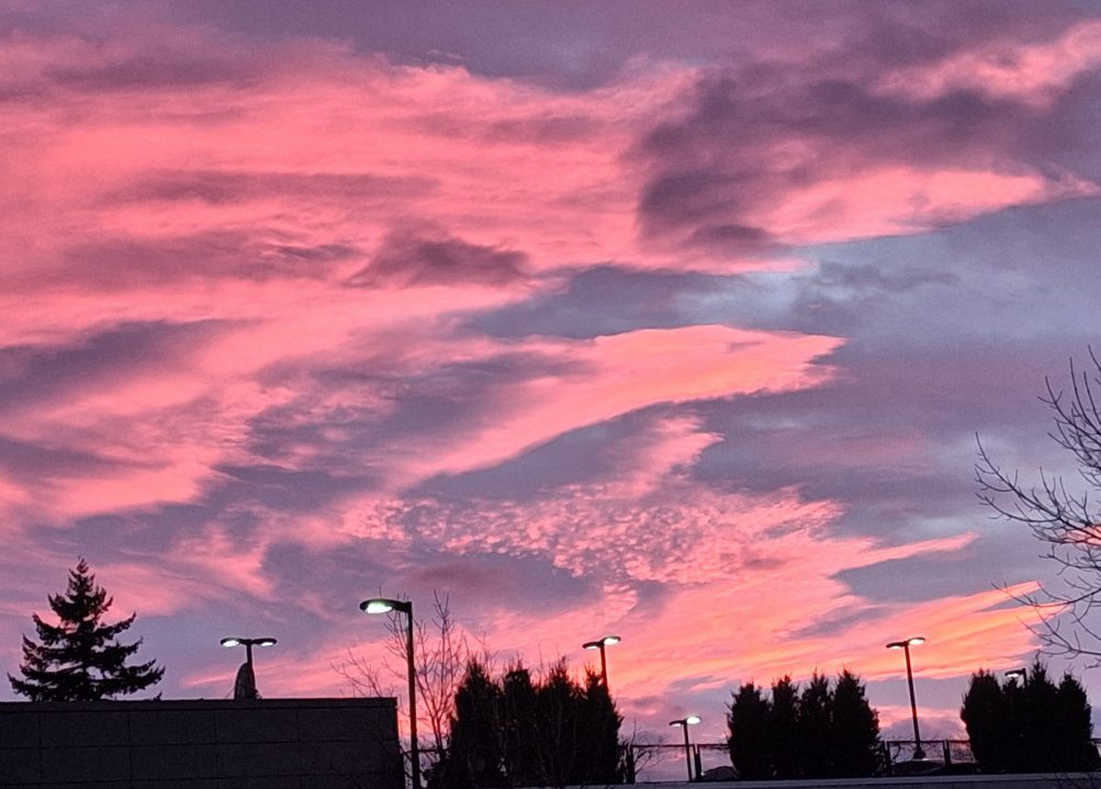
Thanks for sending the sunset photos – a peek of pink on Valentine’s night – the top photo is by Bob Burns, the one below is from Greg Moore.
(added) This one’s via text from Arbor Heights:
This sunset was also notable as the first one after 5:30 pm (5:31, to be exact) as we roll toward spring, now less than five weeks away – Friday, March 20. Before then, the clock will “spring forward” when Daylight Saving Time returns in just three weeks, at 2 am March 8 (meaning, among other things, that the sunset that night will be at 7:04 pm).
 (Photo by James Bratsanos)
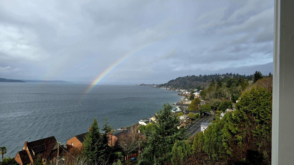
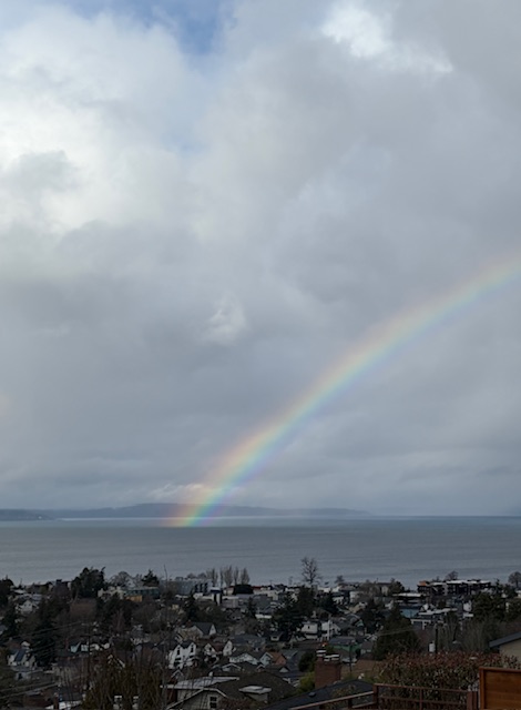
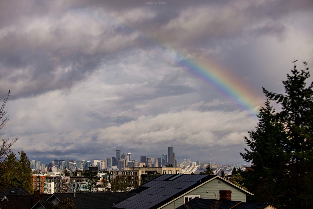
1:10 PM: Today, the mythical pot of gold at the end of the rainbow is apparently underwater – or afloat – judging by the rainbow photos we’ve received (thank you!).
 (Reader photo via text)
Meantime, the National Weather Service says the weather’s warming up – Tuesday through Friday, the highs are predicted to be in the upper 50s!
3:24 PM: One more view, from Jerry Simmons, showing “the other end” of the rainbow:
Thanks to James Bratsanos for the photo of tonight’s sunset, notable not just for its beauty, but – as we’ve been noting in our weekday weather/traffic roundups – because it’s the last one in the 4 pm hour until next fall. Tomorrow’s official sunset time is 5 pm. Meantime, the National Weather Service has issued another Cold Weather Advisory alert for midnight to 9 am. The NWS did the same thing last night, saying the temperature could get down below 25 degrees; the official overnight low was 31. Separate from the advisory, tonight’s forecast low is 32.
One more “week ahead” preview – this time, what’s in two types of forecasts:
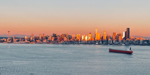
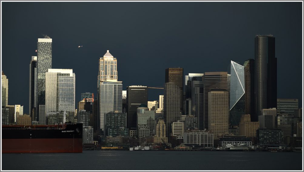
SUN’S NOT DONE: Jen sent that photo of tonight’s sunset reflected off the downtown skyline. It’s a reminder that precipitation doesn’t return to the forecast until Thursday. Sunshine is expected tomorrow; then clouds are expected tp start their comeback, but “a chance of rain or snow” doesn’t appear until Thursday night. Temperatures are likely to remain in the normal range – upper 40s highs, upper 30s lows.
KING TIDES’ FINAL APPEARANCES: The morning high tides will be above 12 feet all week, peaking at 12.6 feet on Thursday, Friday, and Saturday mornings (January 22-24), then again on February 2nd, 3rd, and 4th, with the highest high tides dropping below 12 feet entirely by late March.
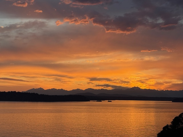
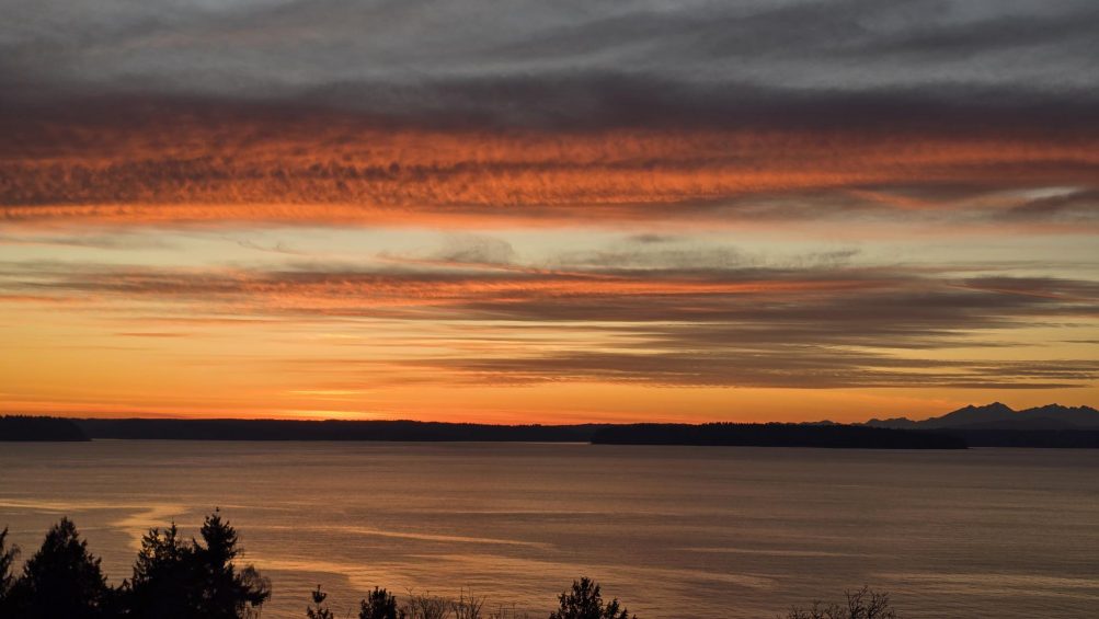
You didn’t have to be by the water to see tonight’s pastel-pink sunset. Bob Burns took the top photo from near Admiral Safeway. But we did get water views too, this one from Carol Ann:
And this one from Chris:
Thanks as always to everyone who sends photos – westseattleblog@gmail.com unless it’s breaking news, in which case you can text us at 206-293-6302. The sunset show comes at the start of a warmer week, with highs near or above 50 in the forecast every day. (Today’s high was 52, four degrees above tomorrow; tomorrow is expected to be in the mid-50s!)

Thanks to Mark Erskine for the photos! This is what Lincoln Park‘s shore looked like at high tide shortly after 7 am, at 13.0 feet the highest predicted high tide of the year (along with next December 26).
The actual water level was a bit higher than predicted, according to this NOAA chart, but nothing calamitous. Tomorrow’s predicted high tide is almost as high as today’s – 12.9 feet at 7:43 am.
| 1 COMMENT