West Seattle, Washington
07 Tuesday
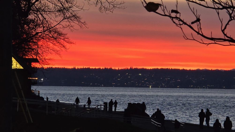
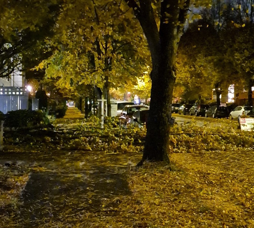
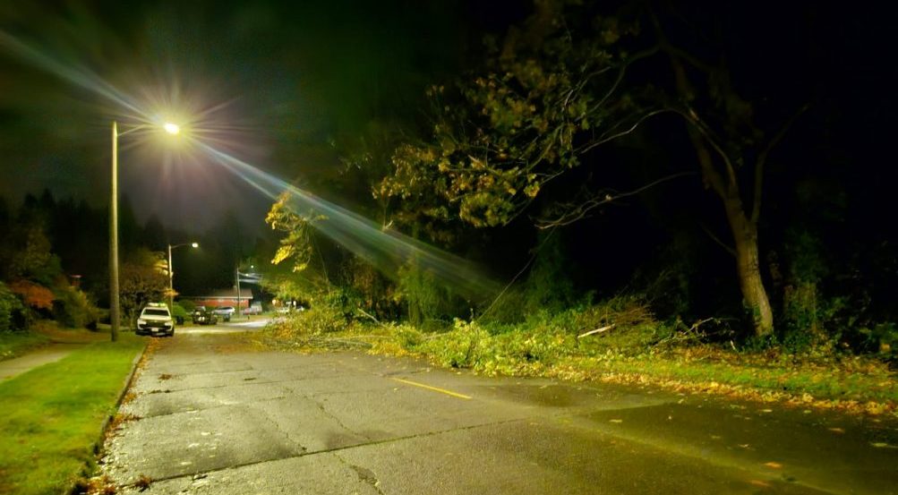
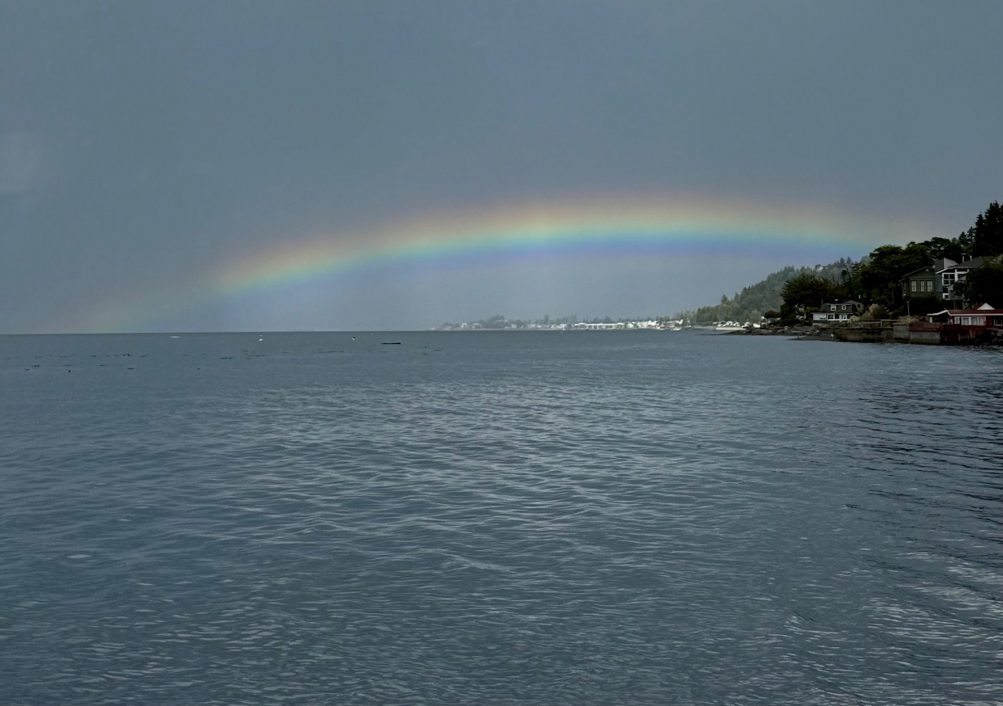
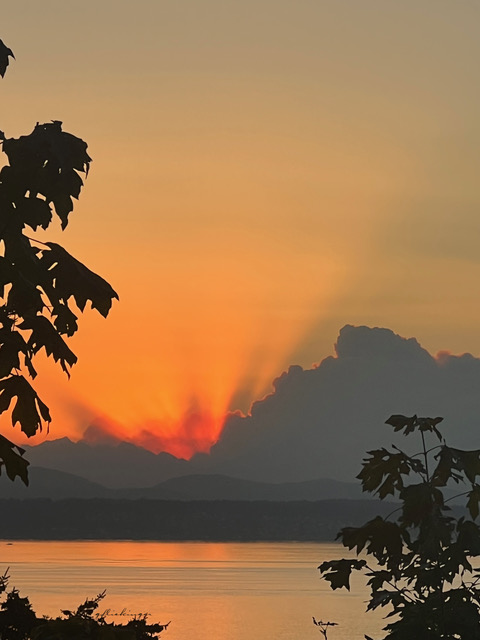
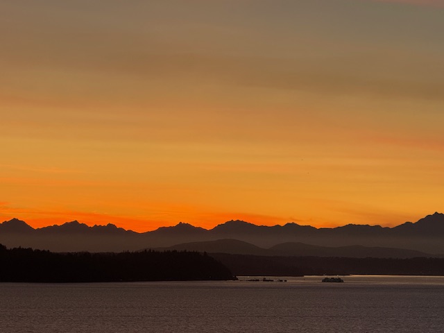
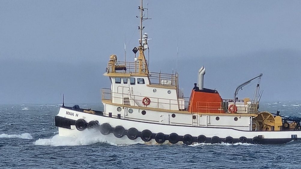 (First two photos by James Bratsanos)
4:08 PM: A bit of a headwind for that tug on Elliott Bay, as seen above – but we’ve escaped without too much overall weather drama here on the peninsula this afternoon, and the sun and blue sky have made appearances.
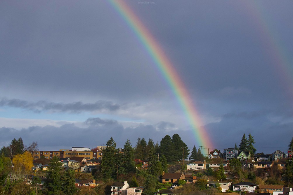
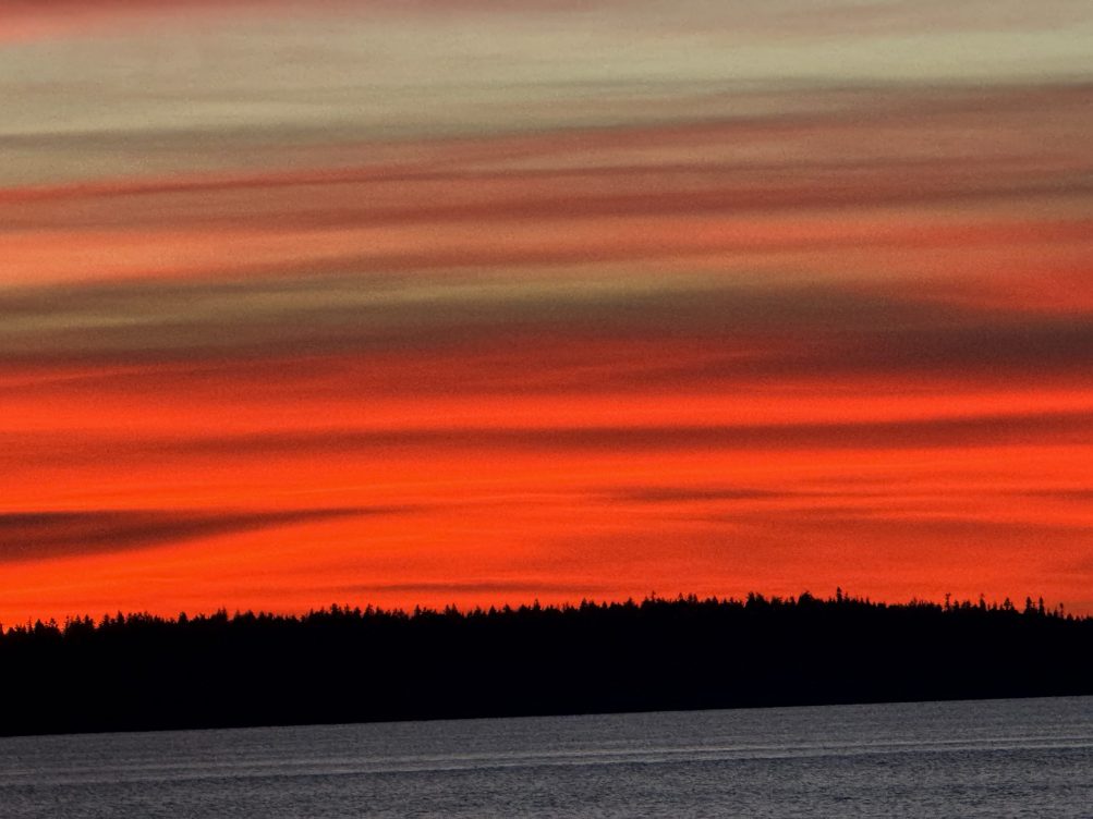
Even a rainbow:
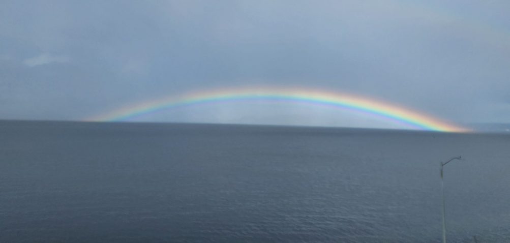
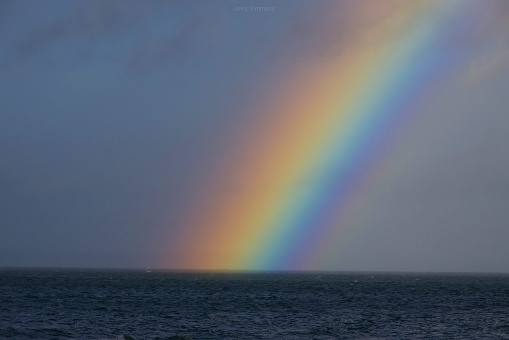 (Photo by Jerry Simmons)
But as we first mentioned in the morning traffic/weather watch, there’s another wind alert for Tuesday pm. This afternoon it was downsized from a High Wind Watch to another Wind Advisory – and it’ll kick in a little earlier, 4 pm tomorrow, with maximum gusts possibly around 45 mph. (Read the new version here.)
ADDED 6:42 PM: We’ve had it easy compared to people along flooded rivers around Western Washington. King County leaders and weather authorities held a mid-afternoon briefing after the Green River levee breach; WSB contributor Anne Higuera watched it in case of information relevant here too – here’s her summary:
Impacts from the relentless rainfall of the last week aren’t letting up, with a levee breach on the Green River this morning (shown above in King County Sheriff’s Office aerial video), water ponding on some approaches to the West Seattle bridge and a traffic tangle for anyone heading south of 405 into the Kent Valley, where a portion of Highway 167 is closed. And there’s more: Wind advisories for today and tomorrow and more rain in the forecast through the end of the week. At a news conference this afternoon about the levee breach, King County Executive Girmay Zahilay called it a “very serious and emerging situation.”
Repairs are already under way on the Desimone levee, near Olympic Avenue South in Tukwila. The King County Department of Natural Resources and Parks had been monitoring that area, so when a stream of water started flowing out, they were able to act quickly to order evacuations and start working on a fix. “It’s not typical to have these levees have this much water behind them for this long, which is why we’re paying close attention,” said Director John Taylor. Right now the county is using a variety of resources, from National Guard troops to drones and the county’s Guardian One helicopter, to monitor levees throughout the area for potential trouble spots. No one was injured in the breach, and those who evacuated should stand by, says county Emergency Management Director Brendan McCluskey. “Once we can safely let people go back in, we’ll let them know.”
For everyone else, the standard warnings apply, to not drive through standing water or on roads that are closed, and to take common-sense steps given the conditions. “We are not done with this event yet,” said Reid Wolcott with the National Weather Service. “This is one small event in a greater disaster going on across the Pacific Northwest.” Wolcott, who is an NWS warning coordination meteorologist, pointed to the current Wind Advisories calling for gusts up to 45 mph. “That does not sound like a lot, but our soils are not normally this saturated. We have a very high risk of trees coming down.” There’s also an active flood watch issued, along with a special weather statement about potential landslides.
The website www.kcemergency.com will be updated with any new alerts from King County’s Office of Emergency Services. Seattle’s Office of Emergency Management has not issued any alerts since last August.
6:13 AM: Texter warns of much water in eastbound WS Bridge outside lane to 99 ramp.
6:30 AM: Another texter reports police with a possible stalled car blocking the ramp to NB 99.
6:38 AM: SDOT says the ramp has reopened.
Earlier:
6:00 AM: Good morning! It’s Monday, December 15, 2025.
WEATHER + SUNRISE/SUNSET, WITH TWO WIND ALERTS
The National Weather Service now has two wind alerts for our area:
*Wind Advisory still in effect until 10 pm tonight, with a chance of sustained 20-30 mph southwest wind, gusting to 55 mph
*High Wind Watch for 7 pm Tuesday through 10 am Wednesday, with possible sustained southwest wind 25 to 45 mph, gusting as high as 65 mph
*Meantime, in the forecast – rainy with a chance of pm thunderstorms, windy, high in the upper 50s.
Sunrise will be at 7:51 am; sunset at 4:18 pm.
TRANSIT TODAY
Washington State Ferries – WSF says the Triangle Route will continue on two boats for up to two more weeks. WSF’s alerts page has the details; Vessel Watch will show you which boat is where.
Metro buses – They’re on the regular weekday schedule and routes in our area.
West Seattle Water Taxi – regular West Seattle service, fall/winter schedule.
SPOTLIGHT TRAFFIC CAMERAS (Note – SDOT’s system is having trouble as of 6 am)
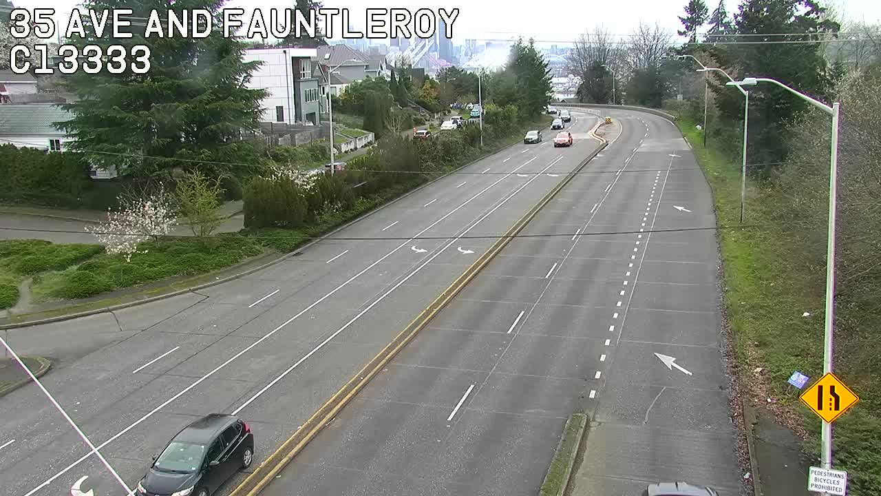
High Bridge – Here’s the main camera, followed by the Fauntleroy-end camera:
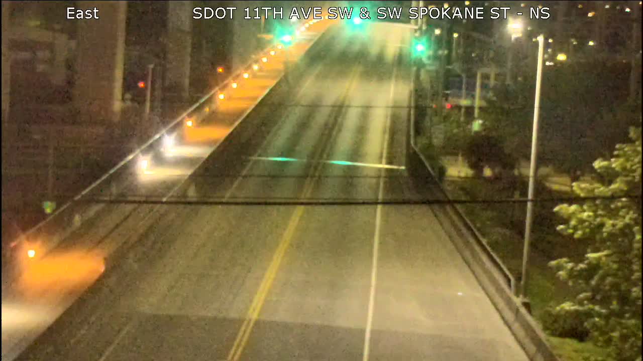
Low Bridge – Here’s the view looking west. Also note, maritime-opening info is again available via X (ex-Twitter):
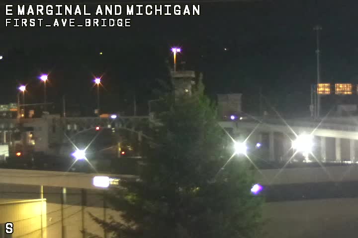
1st Avenue South Bridge:
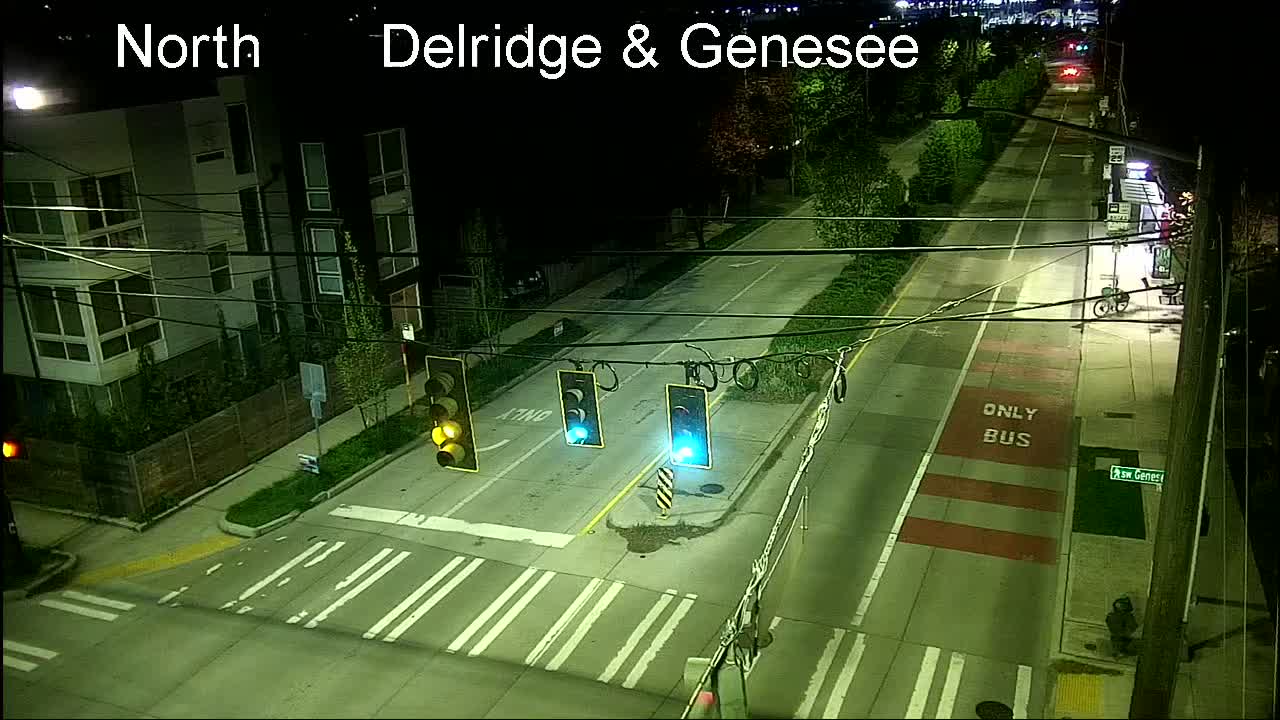
Delridge cameras: In addition to the one below (Delridge/Genesee), cameras are also at Delridge/Juneau, Delridge/Henderson, Delridge/Oregon, and video-only (so you have to go to the map), Delridge/Holden and Delridge/Thistle.
MORE TRAFFIC CAMS: All functioning traffic cams citywide are here (including links to live video for most); for a quick scan of West Seattle and vicinity-relevant cameras, see this WSB page.
See a problem on the bridges/streets/paths/water? Please text or call our hotline (when you can do it safely, and after you’ve reported to authorities if they’re not already on scene) – 206-293-6302. Thank you!
Another Wind Advisory alert from the National Weather Service – this time, for 10 pm tonight (Sunday, December 14) through 10 pm Monday. The NWS alert advises expecting south winds 20 to 25 mph with gusts 45 to 50 mph. And it adds, “Given the very saturated ground, expect that impacts may be more widespread than normally associated with these particular wind speeds.” Charge everything!
SIDE NOTE: Tonight marks the 19th anniversary of the 2006 Hanukkah Eve Windstorm – which threw thousands of West Seattleites out of power for days, us included.
Perla sent that photo of a tree down on 48th SW between Eddy and Beach Drive. She says it came down a few minutes after 9 and just missed her and her husband. She’s reported it to 911.
While much of the regional buzz has been about possible heavy rain, the National Weather Service says it’s time to be ready for another potential round of wind. The NWS has a Wind Advisory alert out for our area from 8 pm tonight to 8 pm tomorrow (Wednesday, December 10). Right now they’re forecasting sustained south-to-southwest wind from 20 to 30 mph, with gusts up to 40 mph.
 (Friday evening photo sent by Greg Snyder – downed madrona limb on Charlestown Hill west of 46th)
Check your trees for loose limbs and charge your devices – another windstorm might be on the way, this time with advance notice. The National Weather Service has announced a Wind Advisory alert for our area for 7 am to 10 pm tomorrow (Monday, December 8). The NWS prediction is for sustained “south winds 15 to 25 mph with gusts up to 45 mph.”
Thanks to everyone who has sent photos!
Matt and Meagan were at Constellation Park as the “king tide” arrived around sunbreak, with gusty wind still lingering from last night’s windstorm. That led to some wave action:
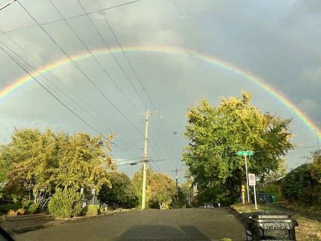
The rain returned for a while today but broke off for afternoon sunbreaks, which is when Jerry Simmons photographed this rainbow:
The forecast says rain isn’t likely to return until late tonight, which is good news for the Hometown Holidays Night Market (4 pm) and Tree Lighting (6 pm) about to start in The Junction!
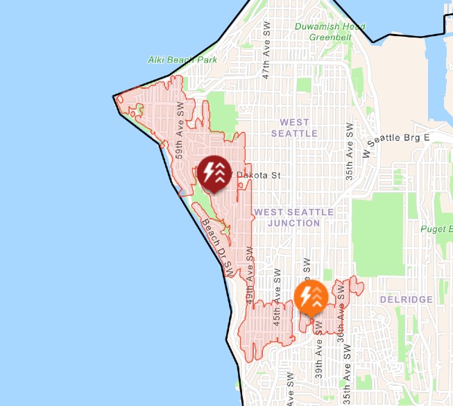
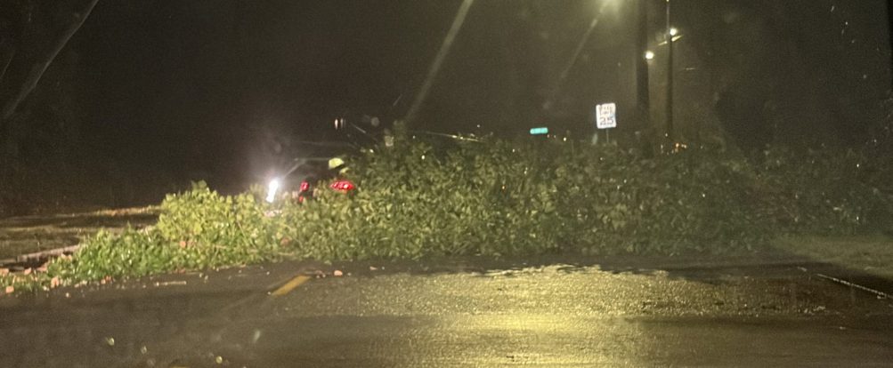
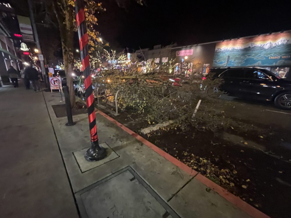
5:48 PM: More than 4,900 homes and businesses are out of power right now, mostly in northwest West Seattle. Not sure yet about what’s to blame – multiple trees have just been reported down, including one at California/Alaska in The Junction blocking part of northbound California.
 (Thanks to Amy for the photo – she says “It hit a row of Lime bikes but nothing else”)
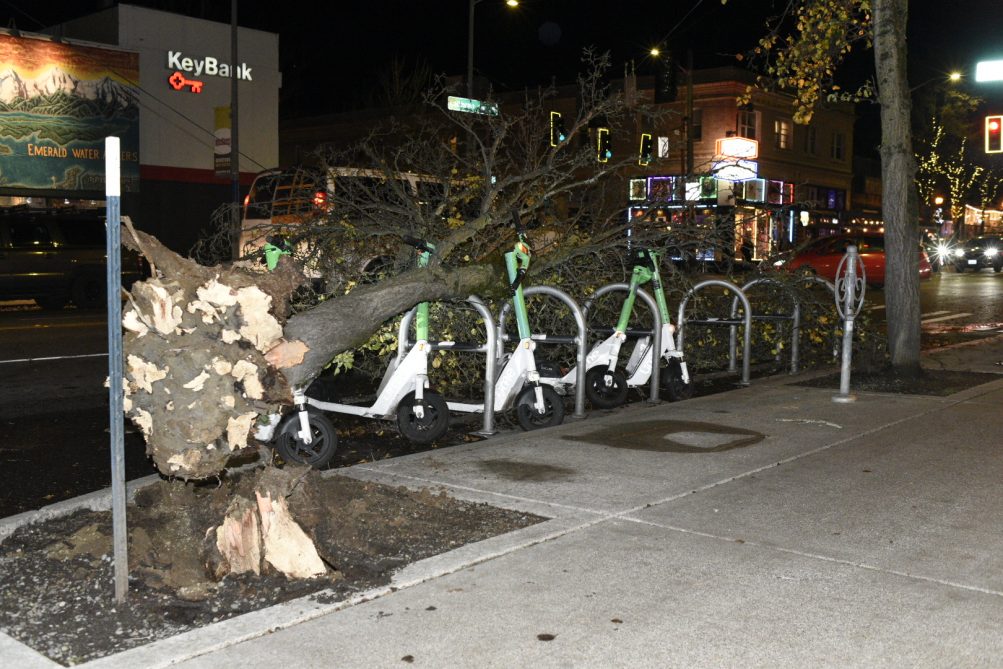 (Added: WSB photo by Oliver Hamlin, showing the aforementioned Lime bikes)
Updates to come.
5:54 PM: Police radio indicates the outage is likely related to a tree down in the Admiral area. (Exactly where, we don’t know – nothing telltale on the SFD or SPD logs.) You’ve probably noticed the wind kicking up big time this evening – the National Weather Service did not have our area under an alert for that, though.
6:20 PM: The wind has calmed somewhat, at least up here.
6:42 PM: A commenter points out that the NWS has belatedly posted a Wind Advisory alert, timestamped 6:10 pm, in effect until midnight.
7:41 PM: Several notes/comments suggest this originated somewhere in this area uphill from south Alki.
7:57 PM: Our archives say this is the 15th West Seattle outage this year affecting 100 or more customers. Half were blamed on falling trees. We also had a few caused by drivers hitting poles, an unfortunate bird, an unexplained pole fire, and the most recent one before this, 3,000 customers on November 23, was blamed on “a broken cross-arm.”
8:43 PM: Still out. Remember, don’t open your refrigerator/freezer – the air temp will stay low for hours. How many hours? Here’s the federal advice.
9:51 PM: No updates; fifth hour now. The customers out in West Seattle are now more than two-thirds of those out SCL-wide.
10:03 PM: Yma points out in comments that the Wind Advisory has been extended to 3 am. It’s also now suggesting top gusts could reach 55 mph, 10 mph above the previous forecast.
10:50 PM: Saw a flicker, hoped it meant some were getting restored, and indeed, the SCL map says the power’s back on for most. Fewer than 100 are still shown as out.
ADDED MONDAY: City Light tells us they think tree limbs took out the power but were unable to zero in on exactly where.
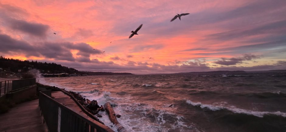
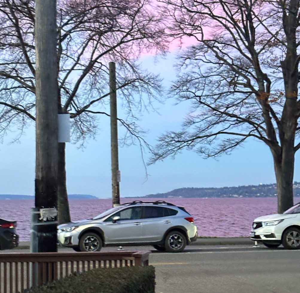
This sunny Sunday was bookended by beautiful color – deep pink at sunset, as shown in James Bratsanos‘s photo above and Carol Ann Joyce‘s photo below:
(added) Note the pink-tinged water off Alki in Sara Walsh‘s photo:
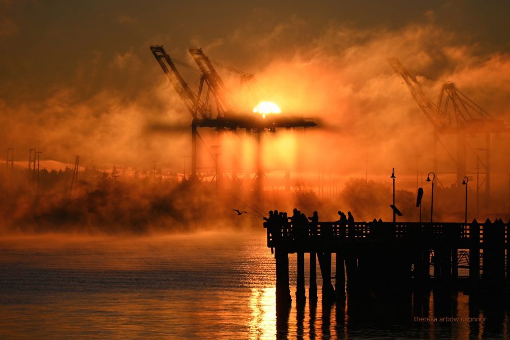
And the sunrise put on a show too, accompanied by fog – Theresa Arbow-O’Connor was there to photograph it:
The more typical Northwest autumn gray may be back for Monday – the National Weather Service says rain could resume as soon as tomorrow morning.
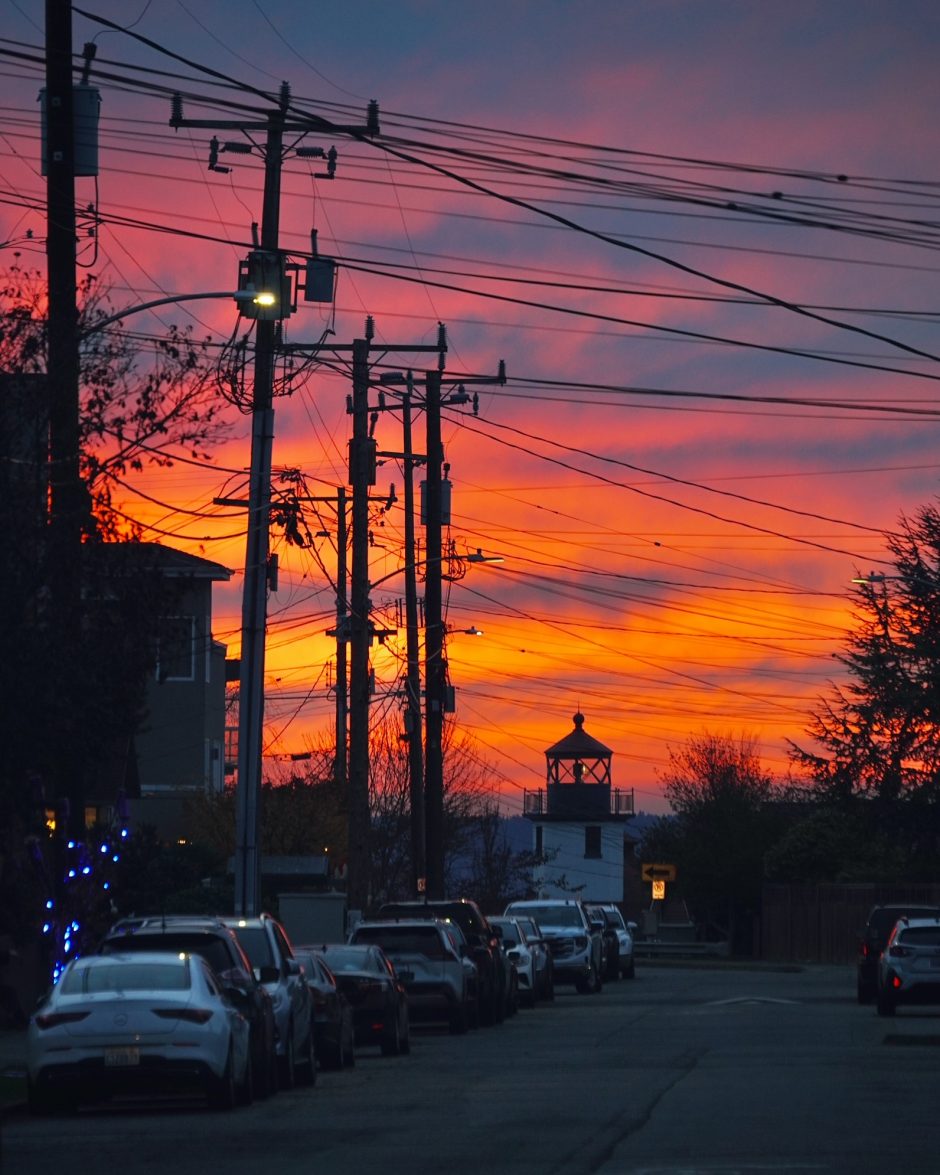
It was such a spectacular sunset, even wires couldn’t ruin it! The photo of tonight’s sunset, looking toward Alki Point Lighthouse, is from Steven Rice. Forecast for the week ahead suggests we won’t see much of the sunny weather that graced this weekend – with a near-record high today (63, just one degree below the record-for-this-date 64) – maybe some sun on Tuesday, otherwise rain. (Which is needed, a we’re still 6+ inches below normal for the calendar year.)
4:07 PM: For the second consecutive weekend, the National Weather Service has our area under a Wind Advisory alert. A Flood Watch was already in place for the entire county; now it looks like Seattle is in for strong wind, too. From the alert:
South winds 10 to 20 mph, with gusts up to 45 mph, expected.
The alert is currently scheduled to be in effect 9 am to 5 pm Saturday, but the time frame can change as meteorologists get a closer look, so get going with your charging and anything else you need to do to be ready.
10:20 PM: The NWS has shifted the advisory’s window earlier, to 5 am to 2 pm. The sustained winds are now expected to be 15 to 25 mph, with gusts still possible to 45 mph.
EARLY SATURDAY: Another revision – now 5 am to 1 pm.
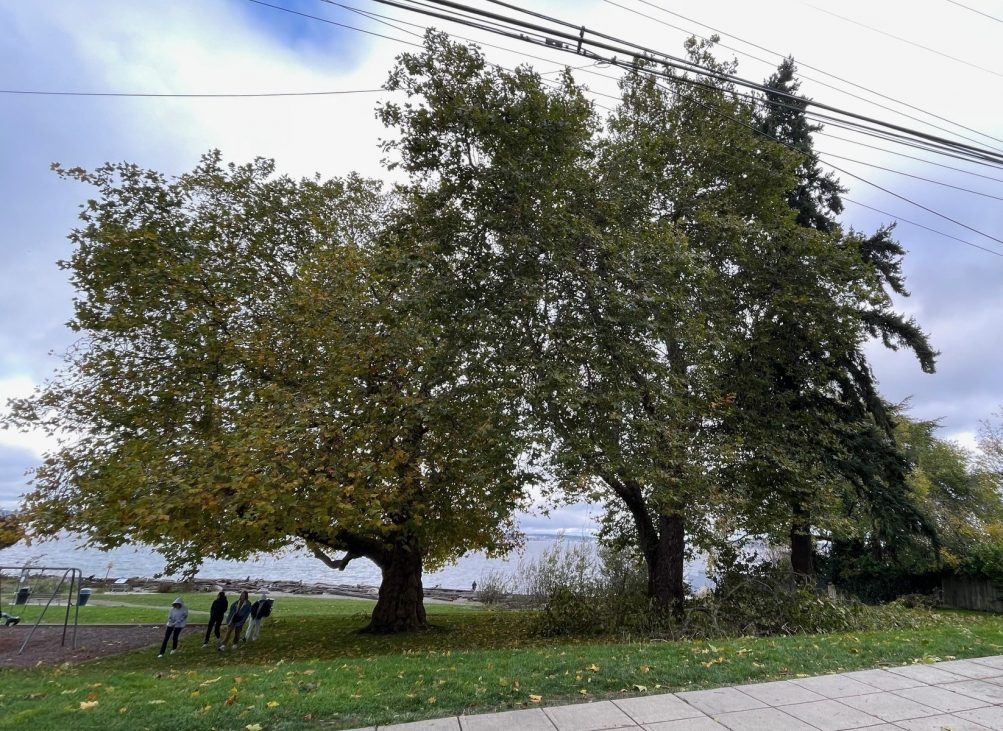
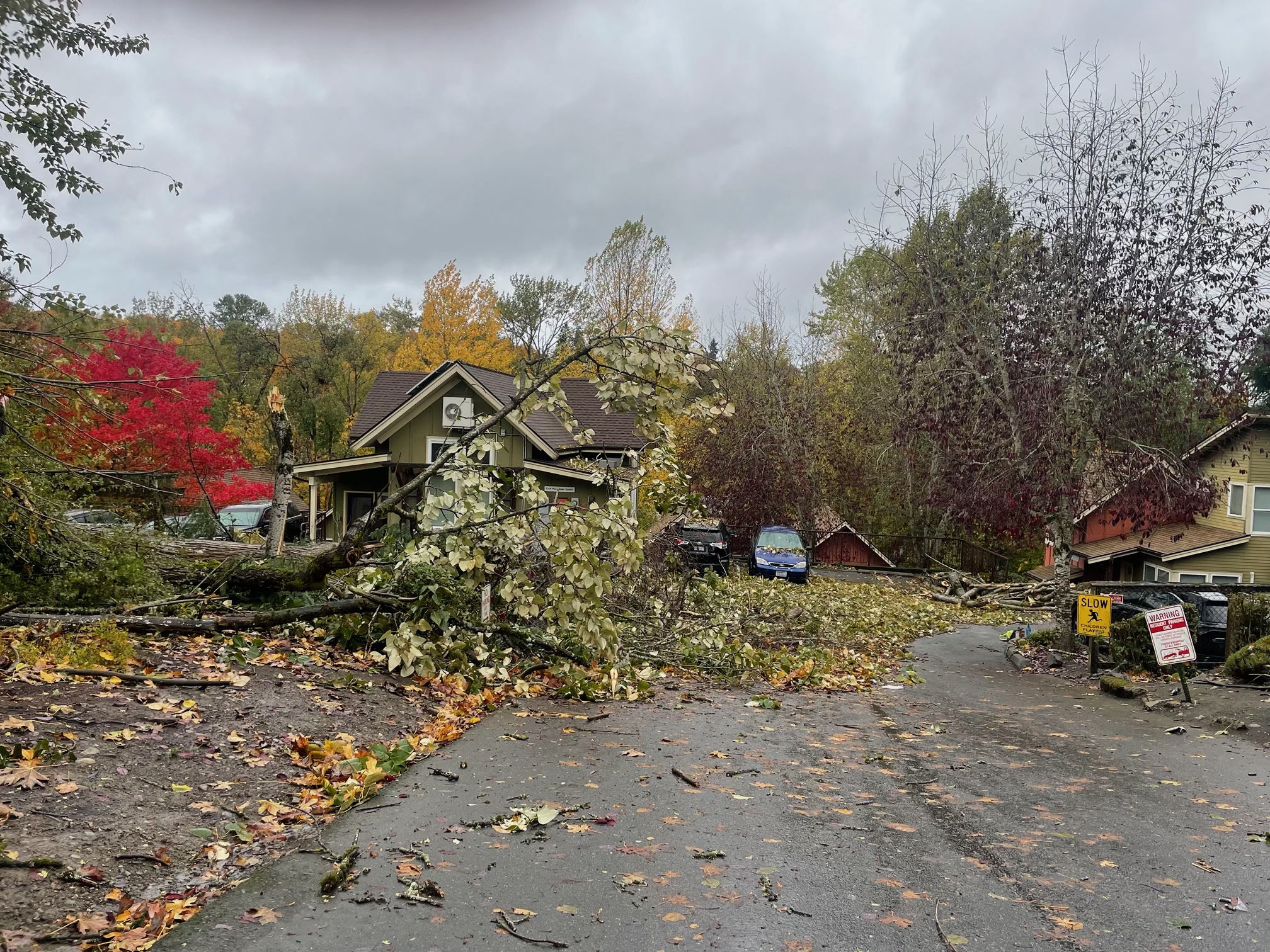
Seattle Parks crews still have a lot of cleanup to do after the weekend windstorm. Our photo above shows Lowman Beach Park‘s biggest trees, which we checked out on Monday after a commenter mentioned those trees had lost limbs in the storm. It appeared – at least when we went by – that the northernmost tree had taken the brunt of that. Afterward we asked Parks for any stats on how many damaged or downed trees they were dealing with; spokesperson Rachel Schulkin told us today, “We have over 50 work orders related to downed trees or branches in parks citywide.” If you see tree trouble or any other Parks problem that you think might not yet have been reported, the department’s maintenance hotline is 206-684-7250.
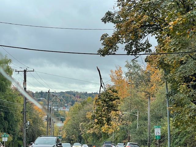
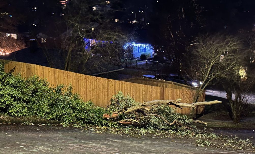
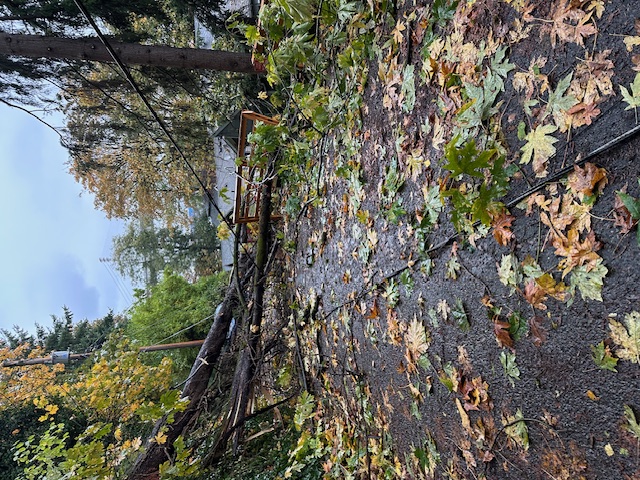
3:39 PM: It’s hard to fully appreciate the precarious dangling status of that branch on a wire/cable over the center of the Admiral Way hill without driving/riding under it, as we did (photo taken by passenger) this afternoon. We mentioned it in our as-it-happened windstorm coverage overnight, and it’s one of multiple trouble spots lingering today, with cleanup yet to come. Not seen in our photo, the cones and signage beneath it. If you know of other trees still blocking roads, aerially or otherwise, please let us know if you can so we can check on their status before the am commute – thank you!
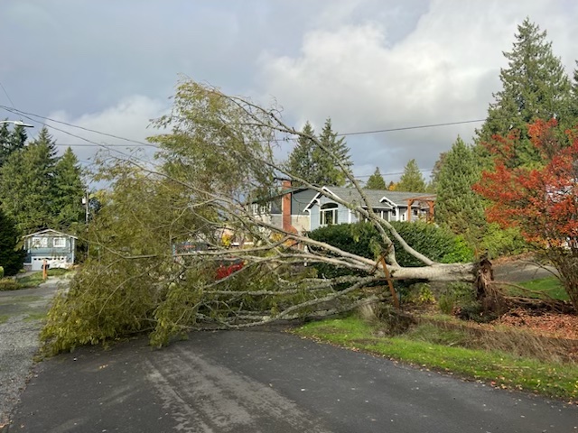
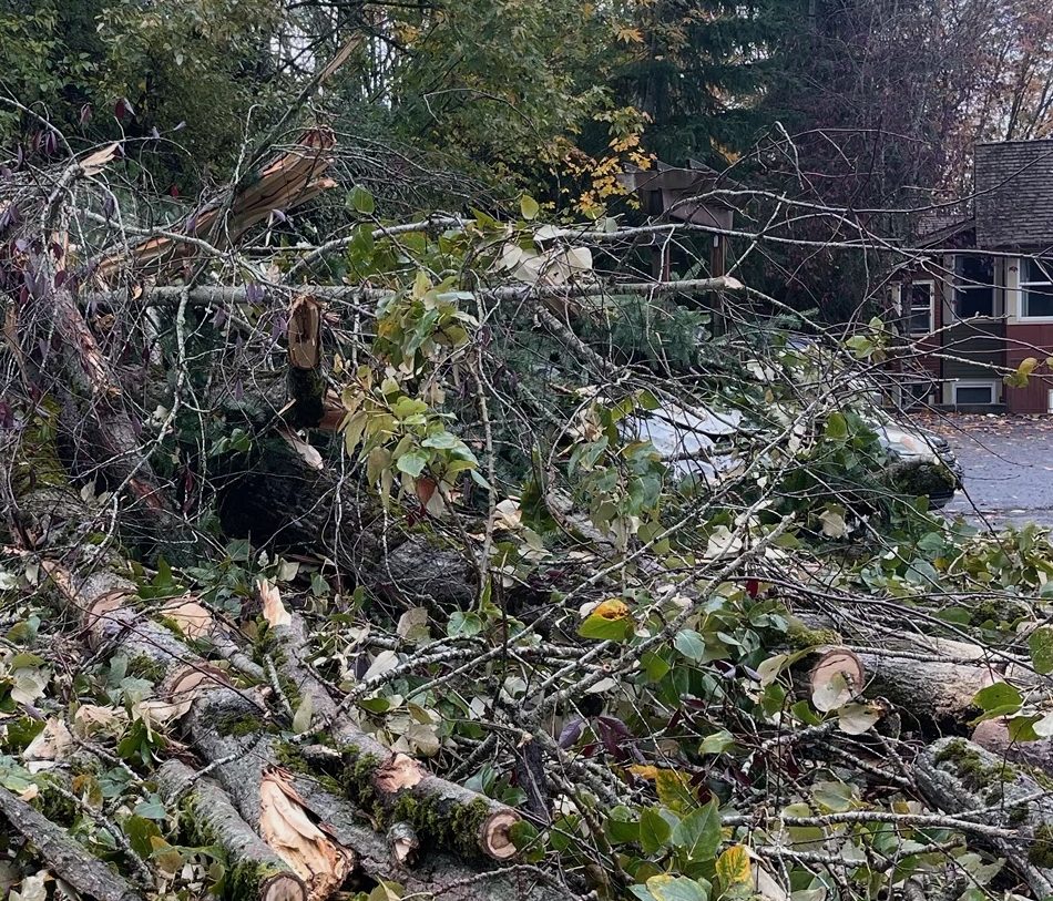
5:52 PM: Two readers sent photos of the tree above, in the 9700 block of 42nd SW in Arbor Heights. … Below, not a major traffic hazard, but a look at another downed tree we mentioned last night:
The tree on 21st that fell last night was in the driveway at Croft Place. Damaged multiple cars. You can see one under it if you zoom in on the third photo.
7:07 PM: Sent by Megan – trees still down in the 4000 block of 18th SW:
There are still 2 fallen trees blocking 18th Ave SW since 9:30 pm last night. This is a one-lane road and the only access. Every house after the trees, like mine, cannot leave. We called 911 last night because the trees also took down power lines. I called again a few hours ago and were told our case was called in but no idea when help will come.
ADDED: Sent Sunday night by Nathan:
Just wanted to warn parents and kids heading to Gatewood Elementary in the morning that there is a tree down and leaning on a power line on the West side of 44th Ave SW, near Myrtle – across from the school. We’ve alerted SCL but they have yet to respond.
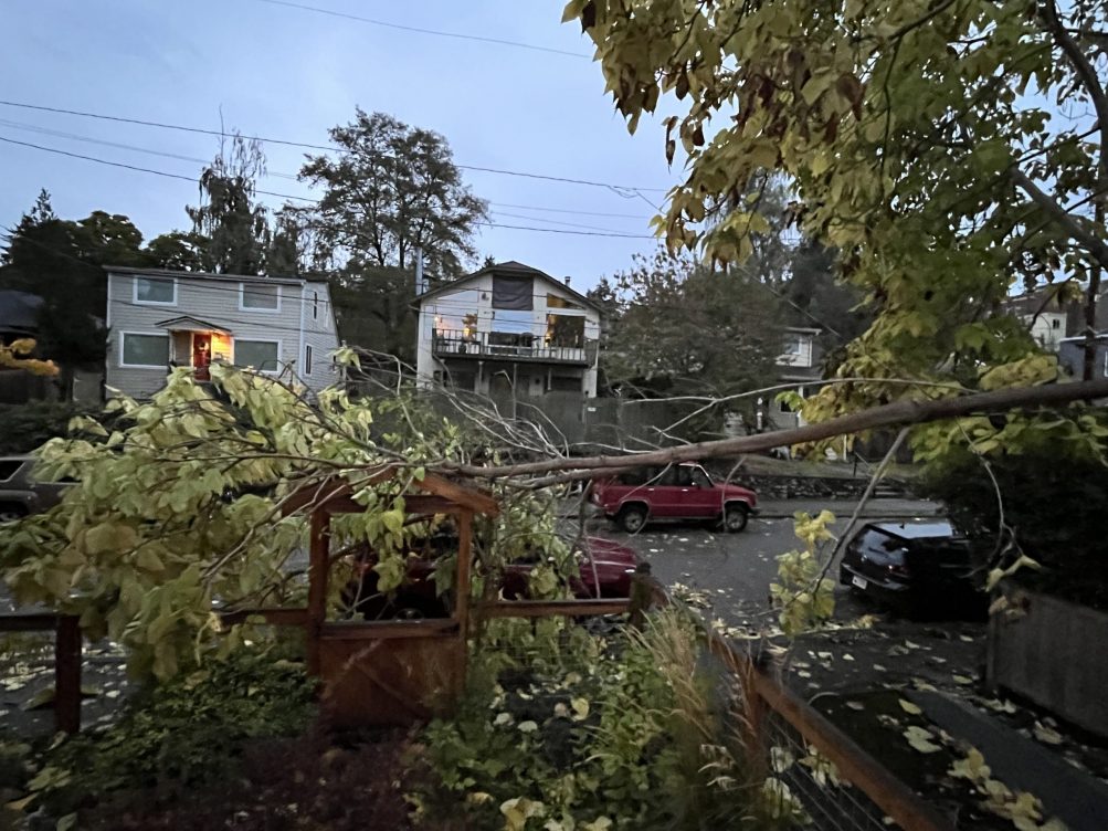
7:35 PM: Thanks to Sarah for first word of the first significant outage in West Seattle since the Wind Advisory kicked in this afternoon: A tree is down on a line at 45th SW and SW Hemlock [map], a couple blocks east of Lincoln Park, and 117 homes are out of power.
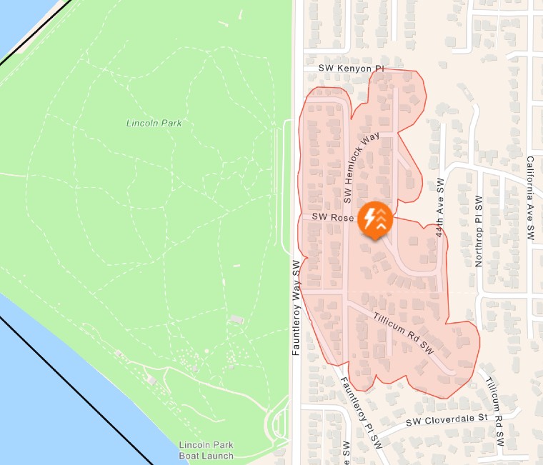
Police are blocking off streets in the area, which is along a set of “switchbacks” used as a cut-through from California SW to Fauntleroy Way SW.
7:48 PM: Not West Seattle, but we just got a tip and a question about this: Just south of White Center, the Ambaum Boulevard curves are blocked by a fallen tree, so if you have to head south, find an alternate route (like 1st Avenue S.).
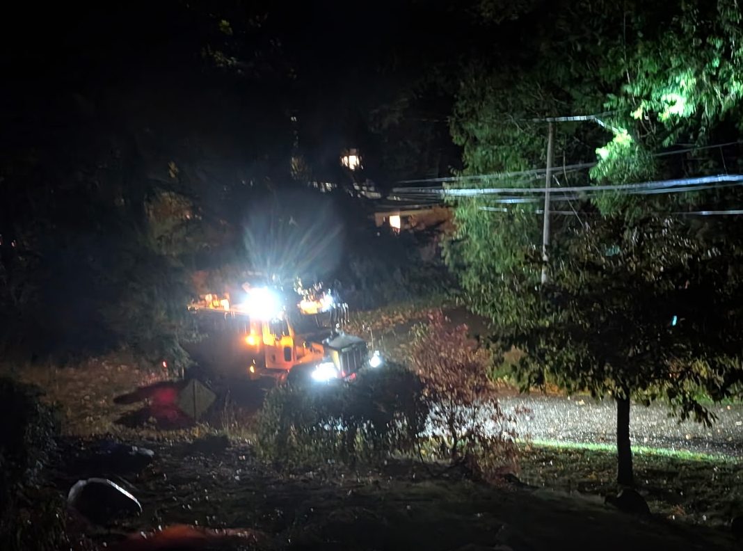
8:54 PM: Sarah sent the pic of a City Light truck in the vicinity. This remains the only outage of note in West Seattle, and throughout its service area, City Light only has a bit more than 1,000 customers are out, although the wind is starting to sound more fierce outside.
9:07 PM: And in fact, police were just dispatched for a reported tree into a house in the 8300 block of 46th SW.
9:28 PM: Just got another texted report, a tree down at 26th SW and SW Juneau in North Delridge. (Police report no injuries or damage, just blocking Juneau at 25th.) No other outages mapped yet, though a texter at 28th SW and SW Thistle reports losing power, and the wind continues to roar where we are (on a hill over Lincoln Park, southwest exposure).
9:40 PM: Added reader photo of 25/26/Juneau tree above. Not far from there, SFD is now responding to someone stuck in their car after a possibly live wire came down on it. … In Admiral, another “wire down” call at Fairmount and Belvidere, “sparking quite a lot” per dispatcher. … Tree down on High Point Drive per dispatch; brief outage near 35th/Avalon per texter … And another dispatch for a tree down in a front yard somewhere on 42nd SW … SFD says the person stuck in their car is out safely but a tree/wire is pulling down a pole so they’ll be blocking off 26th SW and SW Findlay vicinity.
9:57 PM: Even more trees/limbs down – dispatch just ticked off several, including 30th SW and SW Kenyon, California SW and SW Alaska, 4800 block SW Spokane, California Avenue and California Way … Texter says a tree’s down on SW Orchard near Home Depot, “cops on scene clearing,” and that the nearby signal on Delridge is out. … North end of Fairmount now has a 22-home outage … Texter says 26th SW and SW Roxbury signal is flashing red all ways … 4000 block of 18th SW, tree down, per dispatch … Tree into wires in 4700 block of 47th SW …

10:14 PM: SCL map now shows 145 out in Westwood/Sunrise Heights (above) and 9 out on Beach Drive.
10:30 PM: Tree down in 6700 block of 21st SW is reported to have hit at least two cars, per SPD.
10:46 PM: More trees down, per dispatcher – Admiral Way and SW Spokane; 2700 block Alki Avenue.
11:17 PM: The wind has calmed considerably, at least here in Upper Fauntleroy, and no new “tree down” reports in the past half-hour plus.
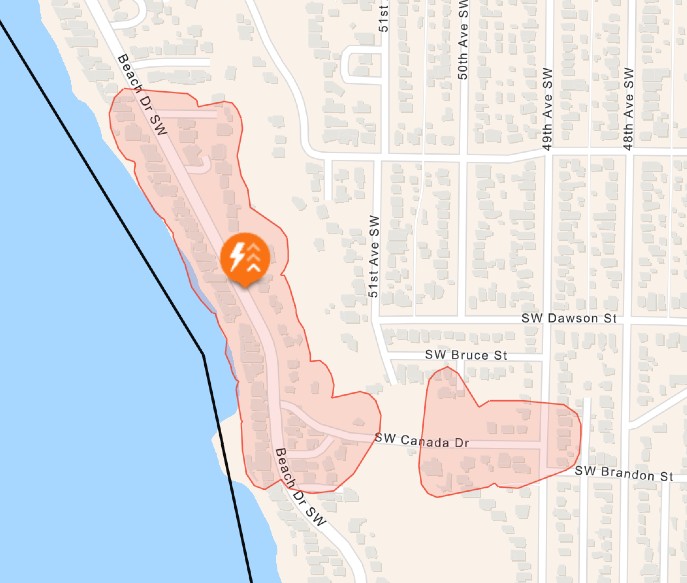
The Beach Drive power outage, meantime, now maps at 80 homes (screengrab added above). City Light is up to 34,000+ customers out around its service area, so repairs might take a while.
11:35 PM: Dispatcher reports trees down at California SW and SW Raymond north of Morgan Junction, and California Way and Harbor SW.
12:17 AM: According to police on the scene, the California/Raymond tree is blocking the southbound side of California. (Photo added above, sent by Adam.)
12:36 AM: Wire hanging low over Admiral Way on approach to eastbound West Seattle Bridge – that’s how dispatch described it, and while typing this, we got a text from Dan, who called it in and says it’s a tree branch hung up on the wire about a quarter of the way down the hill; another wire reported down outside a home at Marine View Drive and SW 102nd.
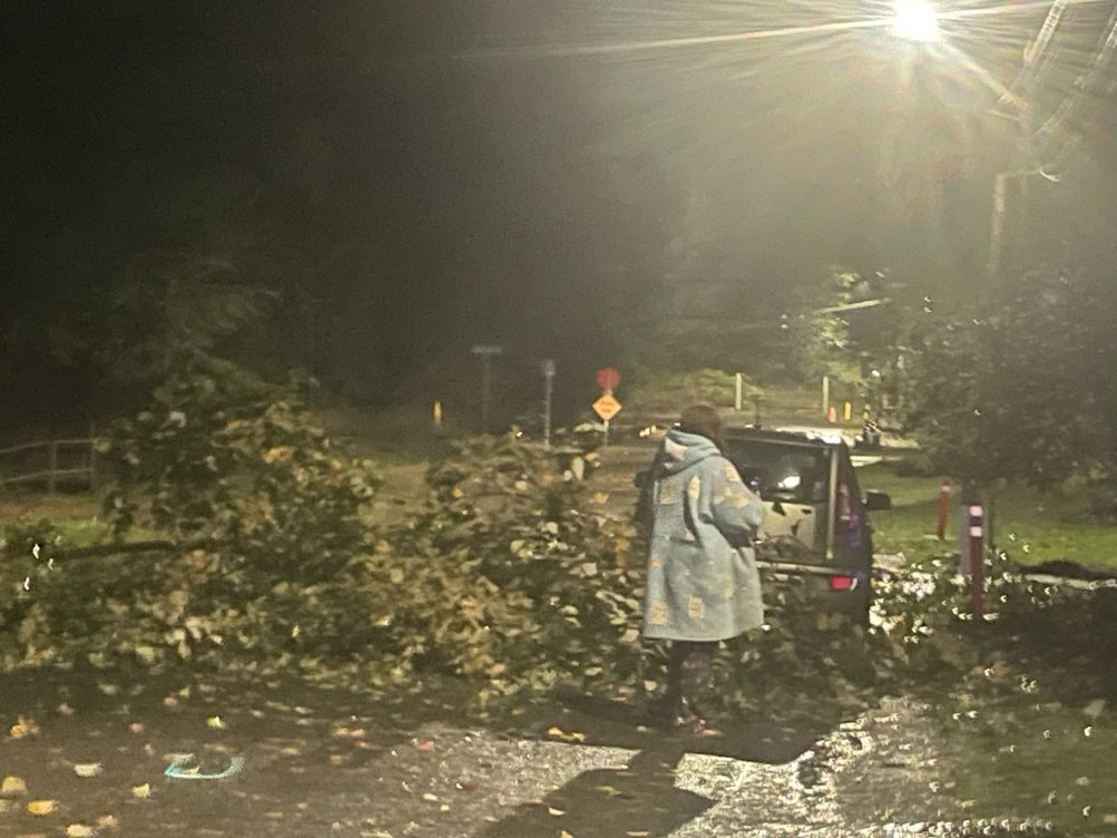
1:36 AM: Lots of cleanup ahead once this calms down. Here’s a texted photo from 48th SW and SW Holly:
2:32 AM: Another tree-down dispatch, this time for 20th/Holden. Meantime, checking SCL’s map, none of the local outages appear to have been resolved yet.
9:38 AM SUNDAY: According to the SCL map, the 117-customer outage near Lincoln Park is resolved but the 145-customer outage in Westwood/Sunrise Heights is not, nor is the 22-customer outage near the north end of Fairmount.
The National Weather Service has our area under a Wind Advisory alert starting at 1 pm today, continuing through 5 am Sunday. They’re expecting “southeast to southwest winds 15 to 30 mph, with gusts 35 to 45 mph expected at times.” We’ll be tracking any resulting trouble as always – if you have anything to report, once you’ve notified authorities, we’re at 206-293-6302, text or voice.
Two sights sent by readers a short time ago:
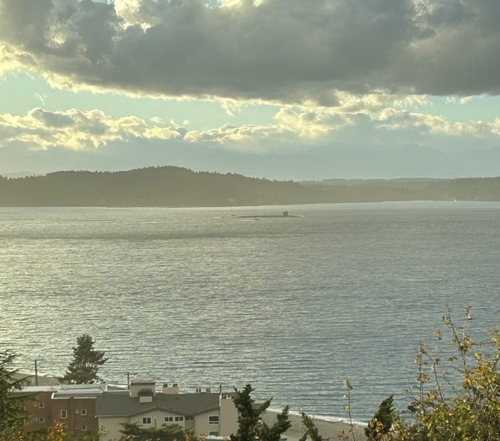
SUBMARINE: A texter sent that photo of a submarine as it passed Alki Point, headed toward Bremerton.
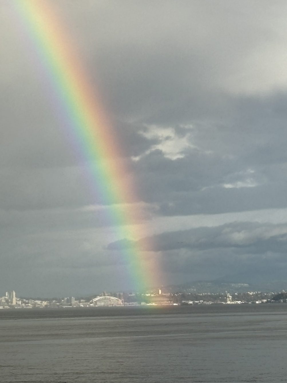
RAINBOW: While the Mariners are playing right now at Toronto, their stadium back here at home is receiving a rainbow. Thanks to Kelly Malloy for the photo! This follows an unexpectedly sunny afternoon, but more rain is likely on the way.
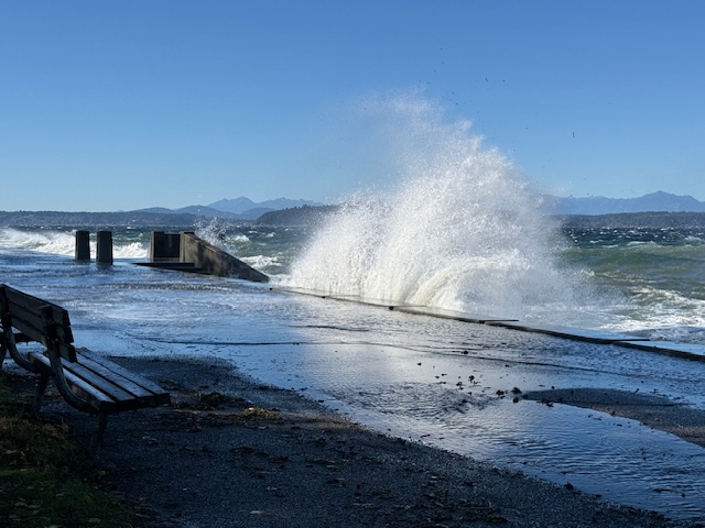
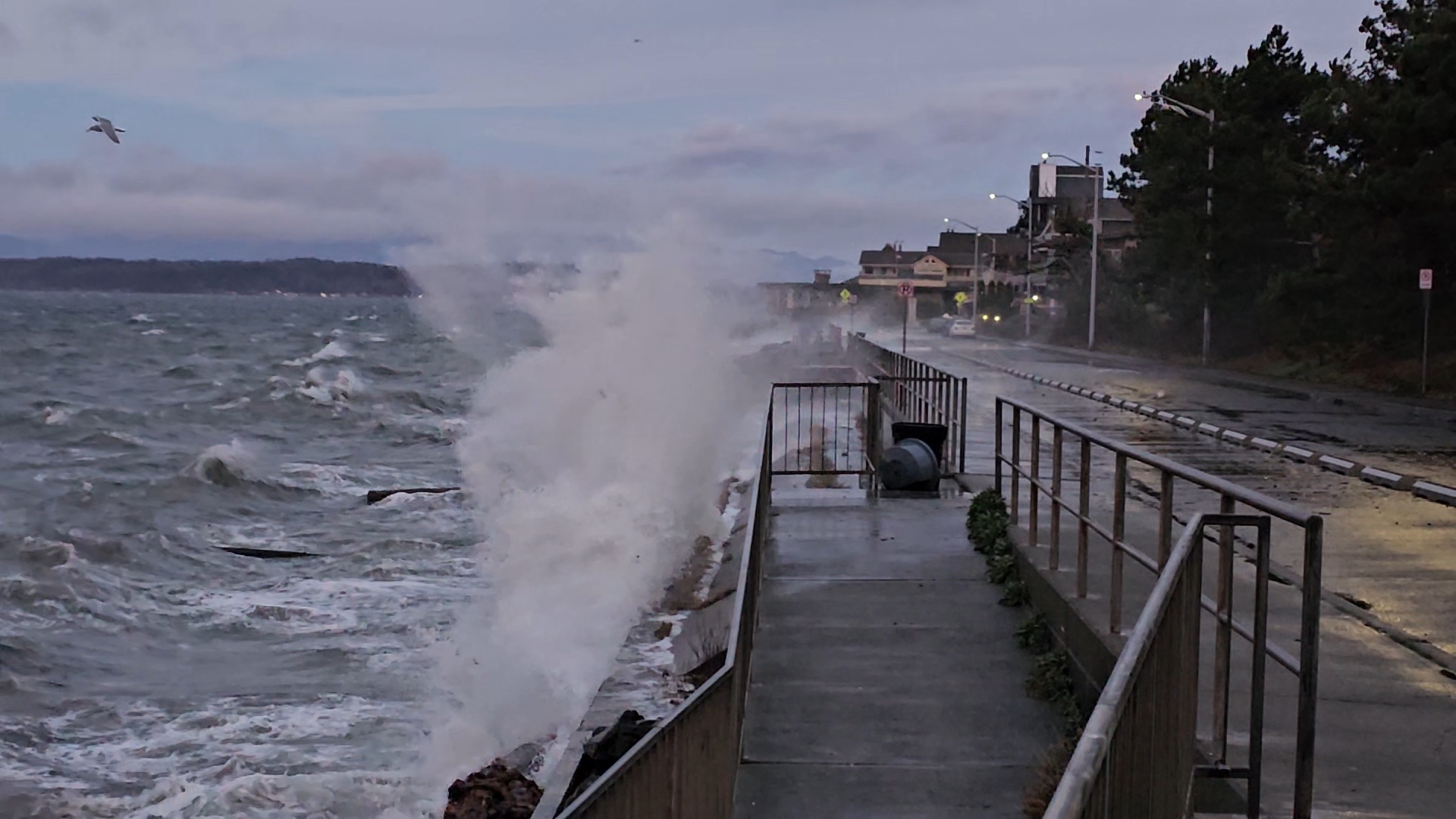
Thanks to Keri for the photos! Today’s north wind brought a classic scene on the Alki promenade – dramatic waves hitting the seawall.

A similar north wind is in the forecast for tomorrow too. Meantime, the wind is a challenge on the open Sound just past Alki – the Vashon Island Water Taxi has canceled trips for the rest of today because of the wind. (The West Seattle Water Taxi is still running – it sails in more-protected waters.)
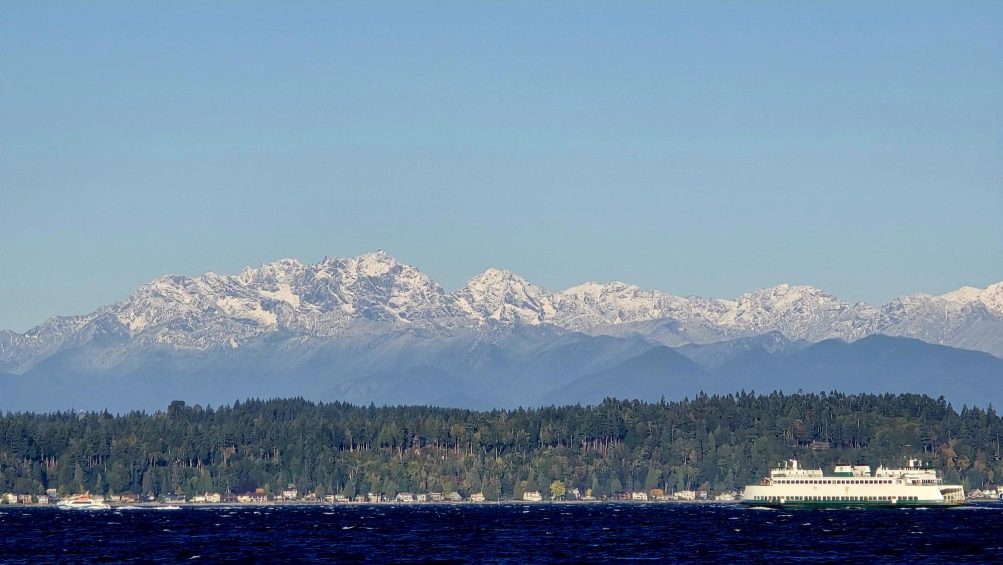
Thanks to James Bratsanos for the view of the snow-dusted Olympic Mountains peaks seen from Alki after the weekend storm clouds lifted and departed. It’s not snowing low enough for skiing (the Stevens Pass cameras verify that) yet, but it gives us a reason to remind you that this year’s West Seattle Ski Swap is less than two weeks away. Mountain to Sound Outfitters (3602 SW Alaska; WSB sponsor) presents the Ski Swap across the street at the West Seattle VFW Hall (3601 SW Alaska), and this year’s swap starts with seller dropoffs on Friday, October 24, 2-5:30 pm (snowboards and other snowsports gear, not just skis), then two days of shopping, 10 am-5 pm Saturday and 10 am-4 pm Sunday, October 25-26. If you’re interested in selling, go here to register before pre-swap Thursday (October 23).
 (Added: Photos by Mark Dale)
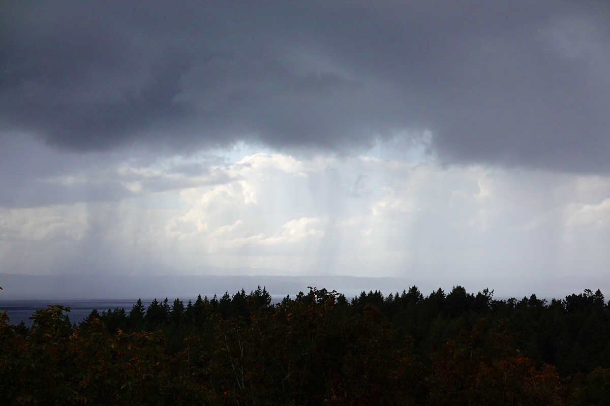
Yes, that was thunder – and a lot of it – rolling through the area these past few minutes. The National Weather Service says thunderstorms are possible for much of the afternoon.
Thanks for the photos! Between the sunbreaks and showers, that rainbow showed up. Katie S. sent the photo above and says, “Watched this beautiful rainbow today at Lincoln Park. It lasted a long time.” The photo below is from Gene Pavola, a bit further north:
The National Weather Service forecast says we might get a thunderstorm this afternoon. (The NWS says it’s working through the shutdown, aside from a few things.)
ADDED: Thanks to everyone who added pics in comments. Also, Kathleen emailed this one from Highland Park:
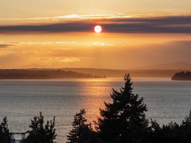
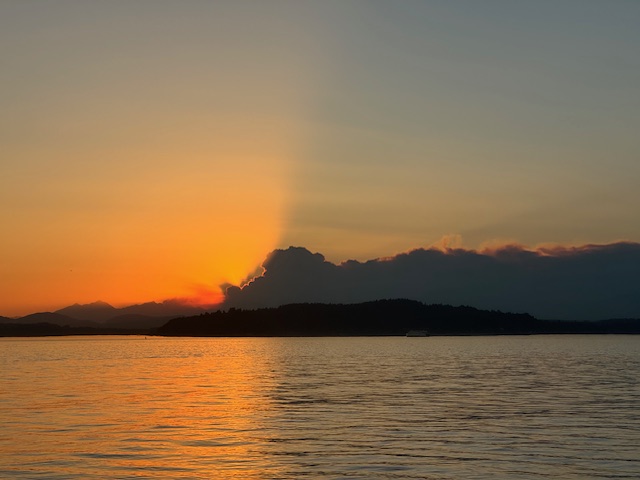
Again tonight, the setting sun was framed by a layer of wildfire smoke over the Olympics – this time, a band of smoke, rather than the billowing clouds we saw last night. The photo above is from Michael Burke; the one below, from Carol Ann Joyce:
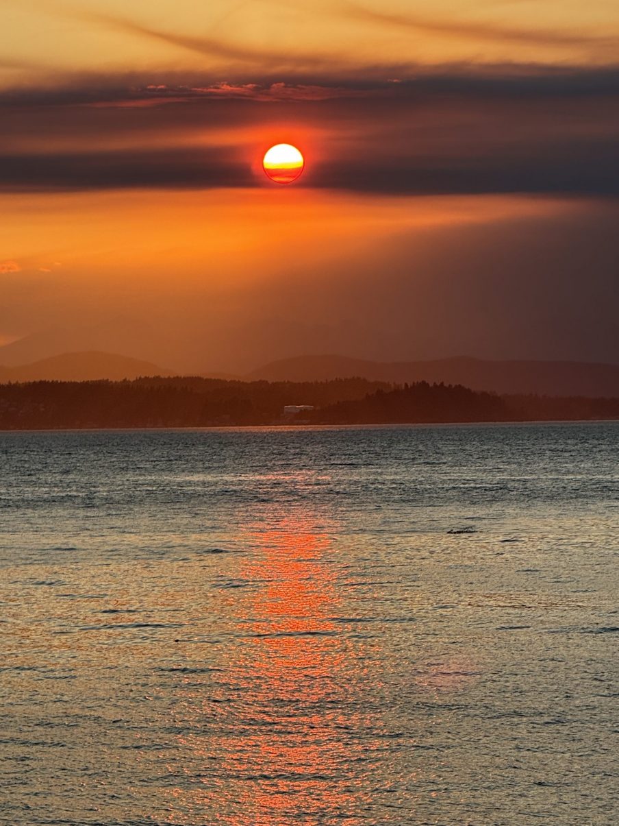
Good news for the smoke and fire – rain is expected this weekend. (The sun is due back in time for a potential appearance at Alice Enevoldsen’s fall-equinox sunset watch Monday night.)
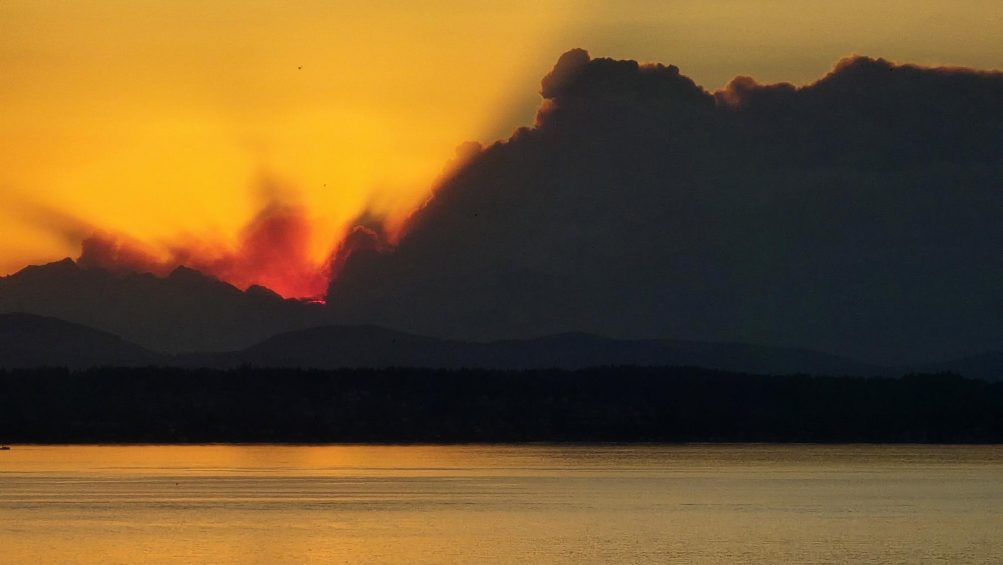
Thanks for the views of tonight’s sunset, extra-dramatic with billowing clouds. We’ll admit we don’t know whether they’re clouds of smoke or just clouds, but it was quite a view either way. The photo above is from James Bratsanos; below, a wider view from Wyatt:
And this one’s from Chris Frankovich:
Today’s high at Sea-Tac tied a record for this date, 91; tomorrow, we’re supposed to be back in the 70s.
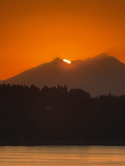
ADDED: Gretchen Flickinger sent this view of the “enhanced” Olympics:
6:03 AM: Good morning! It’s Tuesday, September 16, 2025 – fall officially arrives in six days.
WEATHER + SUNRISE/SUNSET TIMES
Summery forecast today – sunshine and a high in the low 80s, with some smoke possibly blowing in tonight. Today’s sunrise will be at 6:48 am; sunset will be at 7:18 pm.
 (Monday sunset, photographed by Chris Frankovich)
ROAD WORK
–59th SW in Alki is closed for a month by the school-construction zone (thanks to the reader who confirmed the closure happened as announced).
-“Natural drainage” construction toward the east end of Sylvan Way is scheduled to resume, but it hadn’t started as of EOD Monday.
TRANSIT TODAY
Metro buses – On regular schedule and routes today.
Washington State Ferries – WSF has three-boat service on the Triangle Route, with M/V Kittitas, M/V Issaquah, and M/V Sealth. Vessel Watch will show you which boat is where.
Water Taxi – Regular West Seattle service; summer/early fall schedule, with later runs on Friday and Saturday nights.
SPOTLIGHT TRAFFIC CAMERAS
High Bridge – Here’s the main camera, followed by the Fauntleroy-end camera:
Low Bridge – Here’s the view looking west. Also note, opening info is again available via X (ex-Twitter):
1st Avenue South Bridge:
Delridge cameras: In addition to the one below (Delridge/Genesee), cameras are also at Delridge/Juneau, Delridge/Henderson, Delridge/Oregon, and video-only (so you have to go to the map), Delridge/Holden and Delridge/Thistle.
MORE TRAFFIC CAMS: All functioning traffic cams citywide are here (including links to live video for most); for a quick scan of West Seattle and vicinity-relevant cameras, see this WSB page.
See a problem on the bridges/streets/paths/water? Please text or call our hotline (when you can do it safely, and after you’ve reported to authorities if they’re not already on scene) – 206-293-6302. Thank you!
| 2 COMMENTS