West Seattle, Washington
03 Wednesday
That video from the nonprofit No More Under explains why they are offering a free program at the West Seattle YMCA (WSB sponsor) this summer – to save lives. Here’s what to know, in case it can help your family, or that of someone you know:
No More Under is partnering with the West Seattle YMCA to offer free 5-day swim and water safety lessons this summer, starting June 29th. These programs are designed for families who may face financial, cultural, or systemic barriers to traditional aquatics programs.
Program Details:
-Dates: Monday, June 29th to Friday, July 3rd. Afternoons and Evenings.
-Location: 3622 SW Snoqualmie
-Ages: 5-18 years old
Please follow the next steps to register:
1) Create a (free) account with the YMCA.
2) Enroll for ONLY ONE class (time slot) here: bit.ly/WestSeattleYMCASummer2026
By Torin Record-Sand
Reporting for West Seattle Blog
Thursday night’s Southwest Precinct Advisory Council spotlighted current public-safety issues for West Seattle – especially looking toward a busy summer season, not only the usual safety concerns on Alki, but also the large amount of visitors expected to come to Seattle from all over the world for the FIFA World Cup soccer matches. SPD leadership from both the West Seattle/South Park precinct and downtown headquarters joined SWPAC community lead Ella McRae and other community reps for the meeting held at Delridge Community Center.
Southwest Precinct commander Captain Krista Bair began the meeting with an update on crime statistics for both the city and the precinct. Year to date, she said there was a 5% crime increase for the city overall compared to last year, though the SW Precinct jurisdiction is down 6%. There were, however, two areas with a specific uptick in activity: both Highland Park and High Point have seen an increase in gunire incidents, with 34 incidents of shots fired year to date in the precinct area. “We believe Highland Park is being used as a shooting range, as it’s got a major greenbelt. High Point, we don’t know what’s going on.” She noted that, regarding gun violence, the precinct is continuing to collaborate with various city administrators, agencies, and other departments within SPD including the Gun Violence Reduction Unit to work on tackling the problem.
She continued with a discussion on the directed patrols that SPD has set up to focus on hot spots such as the (currently closed) shelter and parkin the 35th and Alaska area, Don Armeni Boat Ramp, West Seattle’s two largest high schools, and other areas. While she noted the ongoing success of these programs, with short staffing for SPD, she said more involvement from the community on resolving crime issues would be helpful. “SPD is continuing to hire and get more officers on the street, but until we do that, we gotta do what we can with what we have – it’s a team effort, we really need you guys to come up with some ideas as well.” she said. “In all of West Seattle, including South Park, we have at any given time about 10 officers working that whole area. That is not ideal.” She emphasized that for community issues which are not emergencies, it is best for community members to utilize alternative resources, such as the non-emergency line, or submitting videos to the SPD website.
Next, SPD Captain Dan Nelson provided an update on ongoing preparations the department is taking for the upcoming FIFA World Cup. He said the city is expecting 750,000 extra tourists. The games will start on June 15th, and last until July 6th, and during this time many new precautions are being put into place, mostly in the Stadium District. He said SPD’s main goals are enhanced patrols for highly crowded areas, an emphasis on preventing crowd injuries and deaths, and facilitating, coordinating, and keeping fan activity lawful.
Captain Nelson also emphasized that the increase in patrols around the stadium area would not take away from other precincts in the city, especially at a time when SPD is facing staffing issues (as Capt. Bair had noted earlier). “None of the officers around the stadium area are pulled from other parts of the city,” he said. Much of the response would come from mutual aid provided by other state and federal agencies. (He also noted the federal agencies coming to assist with the area would not involve ICE in any capacity.)
Some discussion on preparation returned to the issue of Mayor Katie Wilson‘s policy on keeping surveillance cameras off by default for the World Cup (recently covered here when District 1 City Councilmember Rob Saka called for Wilson to turn them on). Captain Nelson clarified that, despite the policy, the cameras still can remain an important tool. “Wilson’s vision is they will remain off without a credible threat, but they can be turned on a moment’s notice when needed.” he said.
He said that more information can be found on SPD’s website, which has a full page dedicated to their efforts for FIFA.
When it was time for comments from community leaders and members, those mostly focused on ongoing issues with homelessness in West Seattle. Specifically, members brought up issues with an increased presence in areas near the Alaska Junction, and ongoing issues with RV encampments near Puget Ridge. The response from SPD officials was that the increased presence was not related to FIFA preparations, and as always, they were continuing to look into it. Unfortunately, they noted, there was not much they could do with the returns of encampments or RVs. “The problem as you’ve seen is when they leave and then they come back – we don’t have the capability to prevent them from coming back, except when you report it to us.” said Precinct Captain Bair. She noted the difficulty of removing encampments surrounded the fact that they involve multiple agencies, such as Parks and SDOT, and responses had to be prioritized not just for West Seattle but across the city. She recommended, all the same, that if neighbors are concerned about ongoing matters they should continue to report it – daily, if need be.
Other community discussion centered around ongoing issues with street racing, crime, and general traffic on Alki and Harbor Avenue – including hotspots like Don Armeni. Members of the community were concerned that, especially with the upcoming World Cup, there would not be enough resources to deal with these problems. Captain Nelson noted that they are working on plans for this. “As far as coming up for strategies, we are organizing additional officers for the area. We can definitely pivot and come up with a coordinated response.” he said.
The meeting also featured an appearance by Cindy Wong, who is the relatively recently hired Deputy Chief of Staff for SPD. She introduced herself as a long-time Seattle resident and government participant, who most recently had worked for former Mayor Harrell’s cabinet as chief of his public safety team. She said that coordination between city agencies is a major responsibility of hers.
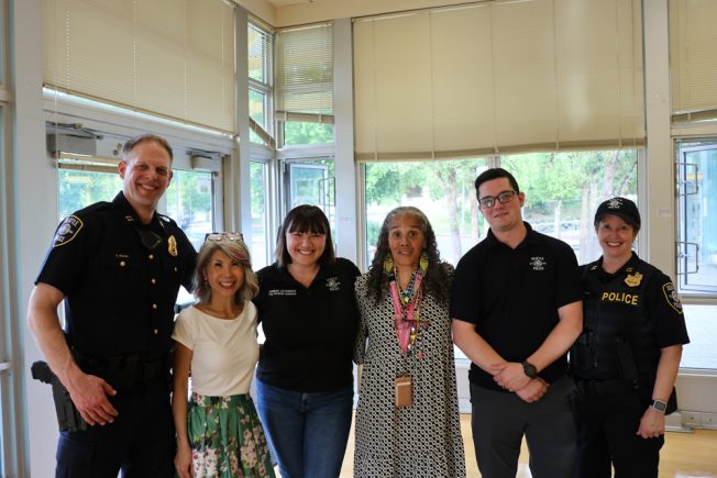 (WSB photo: From left, Capt. Dan Nelson, Cindy Wong, Jennifer Satterwhite, Ella McRae, Matt Brown, Capt. Krista Bair)
Also of note: This was the last West Seattle meeting for Matt Brown, who has served as Crime Prevention Coordinator for the Southwest Precinct while Jennifer Satterwhite was on maternity leave. With her return, he will become a Crime Prevention Coordinator for the West Precinct downtown.
WHAT’S NEXT: The SWPAC meets every few months; we’ll publish the announcement when the next one is finalized. Meantime, one key date for neighborhoods is a little over two months away – this year’s Night Out is Tuesday, August 4, and you can register your block party now for clearance to close your (non-arterial) street.
By Tracy Record
West Seattle Blog editor
![]() The HPAC meeting usually rotates locations but this time, the community coalition for Highland Park, Riverview, and South Delridge met online, with co-chair Kay Kirkpatrick facilitating.
The HPAC meeting usually rotates locations but this time, the community coalition for Highland Park, Riverview, and South Delridge met online, with co-chair Kay Kirkpatrick facilitating.
SOUTHWEST PRECINCT POLICE: Precinct commander Capt. Krista Bair first reminded everyone that the Precinct Advisory Council community meeting is tomorrow. Then she addressed the 18th SW gunfire response concerns reported and discussed here. Capt. Bair said she looked at the call and “we had people answer up on the radio … within nine minutes,” and also noted there were multiple case numbers, primarily 26-145289. The call came out around 10:20, she said, and police recovered four shell casings. Several officers were in the area and were pointed in a certain direction while trying to tell dispatch what people were telling them, she added, so the scene might have seemed somewhat chaotic. She mentioned officers being called back for more casings, and she reaffirmed that those are considered evidence, like fingerprints – “the bullet gets used, and when it gets used by a gun, the gun makes a ‘fingerprint’ on that casing,” so casings are sent to analysts who might be able to match multiple shootings to the same gun. She said you’re hearing about more casings or damage because “more trigger switches” are being used.
She also pitched the Connect Seattle voluntary registry for private security cameras so that if investigators are looking for cameras in a certain place, they’ll know who has them (though even if you’re registered, you are not obliged to turn over your video). “Surveillance cameras are the number one tool for catching (criminals),” she emphasized. An attendee asked if SDOT cameras are accessed during pursuits. Police can ask, she said, but “they don’t give up that footage easily … you may even need to (get) a search warrant.”
A Riverview resident who said it was their first time at an HPAC meeting was concerned about property crime potentially linked to unsanctioned area encampments and wanted to know how to report concerns such as abandoned or illegally parked vehicles. Find It Fix It was discussed; Capt. Bair explained that an online report labeled as “closed” does not necessarily mean “resolved,” though she wishes it did. She also explained the Unified Care Team‘s regular meetings and how encampments are evaluated for sweeps. The bar is high, she noted. Another attendee said that one problem with filing Find It Fix It complaints is that there’s no standalone category for an unauthorized solo camper, if they’re not part of a group meriting the “encampment” label. She also talked about the Delridge city-owned site where a shooting happened at an encampment last month before it was finally cleared. Capt. Bair said she got fairly testy in a discussion of that before the clearance: “Why can’t I just send my officers over now, there are no-trespassing signs up everywhere.” She said she was told, because it had been allowed so long, they couldn’t just suddenly move in without warning. So outreach came in quickly and the site was cleared. And, Capt. Bair said, they told neighbors “if you even see one tent, report it immediately” so the camp wouldn’t be re-established.
She also mentioned that the precinct has a new second-in-command, Lt. Pat Daly; his predecessor Lt. Nate Shopay is now working with an assistant chief downtown. Community liaison Officer German Barreto, she said, is now working with the chiefs too.
The discussion segued to what was planned to be the next major topic anyway, the future changes planned on the Highland Park Way hill, meant to slow traffic. What about enforcement? Capt. Bair said there’s just not enough personnel to do that consistently. An attendee expressed concern because of friends who were seriously injured in DUI crashes on the hill. Capt. Bair noted the department “doesn’t even have a DUI unit any more,” though there are a few officers with that focus, and they do work out of the Southwest Precinct sometimes. She also said the city does have data that would show whether impairment or speeding is the major cause of life-safety issues on the hill – probably SDOT.
That segued into Kirkpatrick talking about HPAC’s views of the project, which would convert one downhill driving lane into foot/bike space. They’re asking SDOT to “slow down” on the project, she said, and provided the letter sent to SDOT’s acting director Angela Brady:
Acting Director Brady,
We are writing regarding the 2026 early design options for the Highland Park Way SW Connection Project with an urgent request: Hit pause on this project until SDOT can make a genuine commitment to work in collaboration with the community on design and to elevate their aim to accomplish a project that provides quality, multimodal infrastructure on Highland Park Way that will serve our fast-growing community for decades to come.
In 2024 SDOT did robust community outreach on this corridor and we do not feel that the current designs are responsive to that feedback or account for concerns communicated within their report. This letter outlines our concerns and asks for next steps.
Safety concerns that are not addressed in 2026 early design options:
To slow driving speeds and reduce accidents, SDOTs proposal forces all downhill traffic left, directly adjacent to uphill drivers speeding up a road with 11% grade, rounding a blind curve without any plans to install a median barrier. This proposal does not support reduction of sideswipe accidents which are the most common type on the route (SDOT Volume & Crash Data). Instead, drivers are being forced to become traffic calming devices, endangering themselves, their families and their personal vehicles. We feel strongly that a physical center barrier is essential to delivering a safe project.
Current design accommodations for the two un-signaled entry and exit points on the hill – SW Othello neighborhood & Pioneer Industries – appear to us to be little more than an afterthought rather than a proposal that fully considers the challenges our neighbors will face entering and exiting Highland Park Way, when there is an unbroken flow of downhill traffic during commute hours. At a recent meeting with SDOT, residents of the SW Othello neighborhood walked away feeling their safety concerns were unheard. This design process should be an opportunity to address these safety concerns as well as the lack of pedestrian infrastructure on the north (uphill) side of the road, despite three active bus stops.
Rather than expanding and improving bike infrastructure using available City owned land, we see in the current design multiple risks for unsafe interactions between pedestrians and cars, pedestrians and bikes, cars and cars, and buses with bikes.
As we know from recent history, Highland Park Way is one of only three regional routes for entry and exit to all of Southwest Seattle both during normal operations AND times of extreme emergency. It also runs through a landslide zone where on the upside slope and moving slides and trees significantly blocked traffic lanes on at least 2 occasions in the past nine years.
We have concerns over the community engagement process and lack of response to community feedback:
Despite having at least two team members specifically tasked with public engagement, the Highland Park Way SW Connection project team has been notable for their lack of followup and communication with the community during the timespan of this project to date. Emails are not answered, deadlines are not met, and requests for information are met with FOIA request requirements instead of simple direct conversations.
As you consider our safety and community process concerns, please also keep in mind the gateway nature of this route as an entry point to the Highland Park, Riverview and South Delridge neighborhoods. Projects like this are an opportunity to reflect our values with the infrastructure investments we make.
Our vision is that Highland Park Way be re-considered as- Highland Parkway – a greener, gentler entry/exit/connection to this area. The Duwamish Greenbelt it bisects is a vast City owned space and park for future generations, supporting rich natural habitat, and providing easy access to trails that provide respite from the urban environment. This space promises to be a resource increasing in importance and value over time with swelling population density.
We note the thoughtful design and landscaping solutions SDOT recently rolled out on the beautiful, functional East Marginal Way Corridor Improvement Project, and nearby Georgetown to South Park Safety Project. We are asking for the same consideration for our chronically underserved neighborhoods, which have been historically red-lined and lack attention to our urban infrastructure.
Again, please “push pause” to give our community an authentic voice in the decision making and prioritization and let’s together develop a Highland Parkway that is an elegant and functional roadway for all, pedestrians, bikers and drivers.
We believe that SDOT engineers are up to this task. Please give them your direction and support!
Thank you,
Kay Kirkpatrick & Barb Biondo, Co-Chairs
One other toic:
GLASSYARD COMMONS: Will local campers get priority when the RV/tiny-house site at 7201 2nd SW opens? Some, as Kirkpatrick said, and as we have heard at briefings. Another attendee recapped what site operator LIHI had said at the community meeting about the site (WSB coverage here), that if they only opened it to local RVs, then RV residents from around the region would flock here to be in queue. Kirkpatrick also mentioned some concerns about the Cloverleaf Village tiny-home site now planned in South Park in a “toxic industrial zone.” The meeting ended with a wide-ranging discussion about how to hold the city accountable for ensuring camping problems don’t get out of control, and ensuring that sanctioned campsites are distributed equitably – a concern inflamed by the fact two of the first new sites, both Glassyard Commons and Cloverleaf Village, and existing tiny-house village Camp Second Chance, are relatively close to each other: “It feels like it’s all coming down in our direction,” including the unsanctioned camps that set up like satellites around sanctioned sites.
NEXT MEETING: Watch hpaction.org for updates.
 (WSB photos)
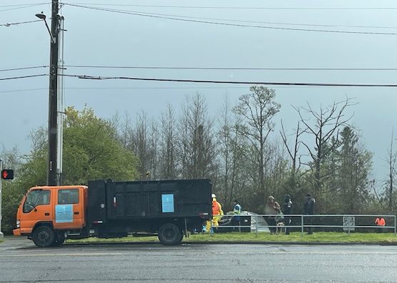
11:58 AM: Detroit Avenue SW in southeast West Seattle [map] is blocked off at both ends – north and south – this morning while city crews sweep an encampment area in the West Duwamish Greenbelt.
Most of the work was under way out of view from the street but city trucks were in sight. We didn’t see any of the posting notices but a nonprofit volunteer who told us about the sweep says they listed a wide area to be cleared, between SW Kenyon and SW Myrtle, adjacent to an area that holds a variety of mostly industrial businesses. We’ll be asking the city for post-sweep information including how many people were living there.
4:58 PM: Here’s the statement we obtained from the city’s Human Services Department: “The Unified Care Team (UCT) engaged with eight people at this site. No vehicles were found on site. UCT referred one family and two individuals to available shelter.” We also asked about how pets are handled in sweeps, having received a question about that: “Pets are considered when identifying appropriate shelter referrals. UCT Outreach also connects pet owners to support services that can provide supplies and medical care, as needed.”
(Added: Seattle Channel video of today’s Public Safety Committee meeting, including Saka’s call)
11:48 AM: With the first FIFA World Cup match in Seattle now less than three weeks away, the city’s surveillance-camera policy is back in the spotlight. District 1 City Councilmember Rob Saka wants Mayor Katie Wilson to change her mind about what to do, and not do, with cameras in the Stadium District as the matches approach, and has sent this news release:
Today, Councilmember Rob Saka (District 1), Vice-Chair of the Public Safety Committee, called for Mayor Wilson to allow the Seattle Police Department’s Real-Time Crime Center to turn on its closed-circuit television (CCTV) cameras in the Stadium District ahead of the World Cup. Councilmember Saka’s request comes after the Mayor’s announcement on March 19 to willingly not use the installed cameras unless there was a “credible threat.” The Stadium District is in Councilmember Saka’s district.
“Security cameras play a critical role in the investigation of crimes, including unthinkable mass casualty events. I know this firsthand as a runner in the 2013 Boston Marathon. I had just crossed the finish line waiting at the family meetup location two blocks away when the planted bombs exploded,” said Councilmember Saka. “Ultimately, it was security camera footage and the technology that allowed investigators to quickly trace the attackers’ movements and catch them before they could strike again with another mass casualty event.”
“We have this same technology available in Seattle today. In May, we were able to use cameras to arrest suspects in a savage beating of a 77-year-old man downtown – suspects who could’ve gotten away and done it again. I strongly urge Mayor Wilson to turn on existing cameras in the Stadium District for the upcoming World Cup events. Activating these cameras could help deter attackers by showing that Seattle Police Department can identify them, while empowering authorities to quickly investigate if an incident occurs. With Seattle on the world stage, lives are at stake. Our city should not vacillate over some murky and confusing “credible threat” standard, which could do more harm than good even if properly implemented. Mayor Wilson must do the reasonable thing and use this existing tool with robust safeguards and privacy controls that are among the best in the entire nation,” concluded Councilmember Saka. …
Here’s our report on what the mayor said about these cameras (and others) on May 19. After receiving Councilmember Saka’s news release today, we asked the mayor’s office for her response, and will add whatever we hear back. The first Seattle match is scheduled June 15th.
Also of note, safety/security during the World Cup events in Seattle is one of the topics announced for Thursday’s Southwest Precinct Advisory Council community meeting, 5 pm (May 28) at Delridge Community Center (4501 Delridge Way SW).
5:13 PM: For the record, the mayor’s office has acknowledged our request for comment, but hasn’t yet provided the response.
9 AM WEDNESDAY: The response came in this morning via mayor’s-office spokesperson Jonah Spangenthal-Lee:
Mayor Wilson continues to consult public safety officials regarding circumstances that might warrant use of the expanded set of cameras during the FIFA World Cup. We appreciate councilmembers’ perspectives, and those will be part of ongoing discussions.
With regard to credible threats: Identifying a credible threat involves multiple experts from federal, state, and local agencies monitoring and assessing various streams of information. In collaboration with one another, they weigh incoming intelligence and jointly recommend whether to elevate security operations. Mayor Wilson’s decision whether to activate the Stadium District cameras will be informed by this group’s recommendation.
 As announced last month, tonight’s the official start of beach-fire season at Alki. Here are the rules published by Seattle Parks:
Starting Friday, May 22, 2026, beach fires will be permitted at designated fire pits at Alki Beach and Golden Gardens seven days a week on a first come, first served basis. Bringing your own fire pit is not allowed, and no propane fire pits/rings are allowed.
-Fires must be extinguished by 10 p.m.
-Fires allowed 7 days a week starting Friday, May 22 through Tuesday, September 7.
-Staff will be on-site to manage and assist with putting out fires at 10 p.m.
-Parking lot gates will be locked and the park will close at 10:30 p.m. for summer hours.
-Please only burn clean (natural, bare, dry cord-wood) wood and douse your fire completely before leaving.
-Light a fire ONLY in one of the installed fire containers
-Use only clean, dry firewood
-Please douse your fire with water, not sand
-Fires are not allowed during air pollution alerts; we will post sign
-Please don’t remove any materials from the park, beach or dunes
-Please dispose of trash and ashes in the containers provided for each. (SMC 18.12.260)
-Be considerate of others–please, no loud or amplified music! (SMC 18.12.170)
-Remember, no alcohol or smoking are allowed, and parks are drug-free zones.
-Beach fire rules are outlined in detail in the Seattle Municipal Code section 18.12.270 and in our Beach Fires Policy.If you see an illegal fire, call 911. For current burn ban and air quality questions, contact Puget Sound Clean Air Agency.
Fire pits at Golden Gardens and Alki are unlocked by 5:30 p.m. Please extinguish all beach fires (using water, not sand) by 10 p.m. in order to ensure that all fires are completely extinguished in ample time before the park’s closure.
Back before construction began on the Alki Elementary rebuild, much discussion – and even an appeal – centered on transportation and traffic issues. Now the new school is a few months from opening, and its traffic management plan is an agenda item for tomorrow morning’s monthly meeting of the Seattle School Traffic Safety Committee, a city-convened advisory committee. Its meeting is set for 8:30-10:30 am tomorrow (Friday, May 15), online and in person at City Hall, and the Alki traffic-management plan is on the agenda for ~10 am. The public is welcome at the meeting – room 370 at City Hall (600 4th Avenue) or online (find the link here). Other discussion items on the agenda include school-zone speeding and idling alongside schools.
The latest crash trouble at “the curve” toward the southwest end of the westbound West Seattle Bridge dates back some days now. But it led to questions about whether SDOT had decided what, if anything, further to do about the situation (which some claim is a pavement problem and others insist is a speeding-driver problem). So we asked for an update, and finally this week got the reply:
We’ve installed several safety treatments on the westbound West Seattle Bridge, including curve warning signs and enhanced pavement and reflective markings to improve visibility and driver awareness.
We’re also advancing additional improvements. Materials for the next set of treatments are expected to arrive later in May, and crews will move forward with installation once they’re on hand. With the upcoming FIFA-related construction pause in the public right-of-way, we’re prioritizing work that can be completed ahead of that window.
We’ll continue monitoring conditions and make further adjustments as needed to support safe travel along the corridor.
As for what the “next set of treatments” involves, that’s another followup.
By Tracy Record
West Seattle Blog editor
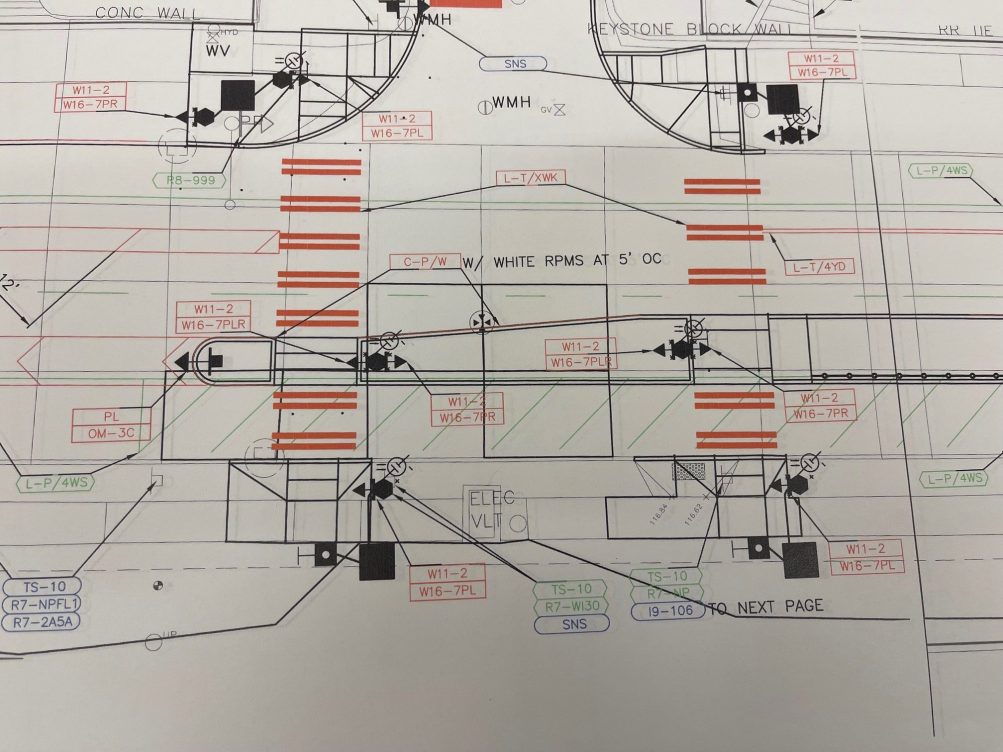
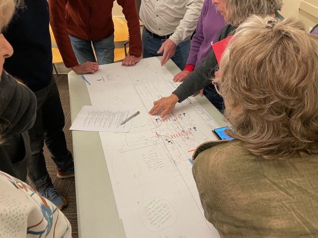
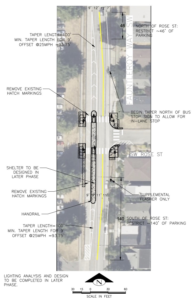
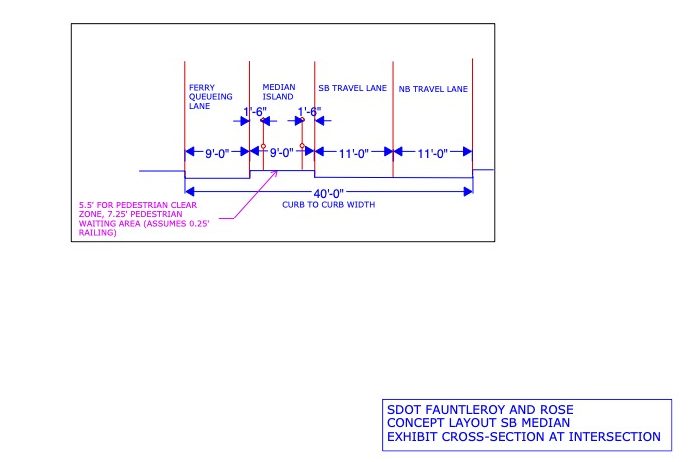
About 30 people gathered at Southwest Library Wednesday night to talk about SDOT‘s plan for a new crossing at Fauntleroy Way SW and SW Rose Street [map].
Most expressed the opinion that SDOT’s concept for the crossing – at the spot where the city removed a painted crosswalk 19 years ago – is overkill.
Most of the concerns centered on the raised median that is planned between the ferry holding lane alongside Lincoln Park and the southbound travel lane of Fauntleroy Way, though there was not a universal agreement on what might be better.
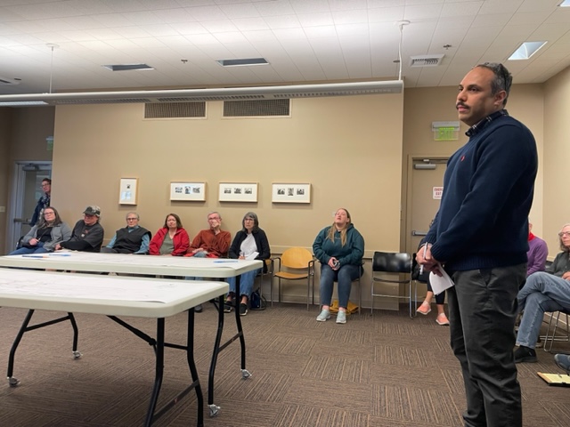
SDOT reps, including chief safety officer Venu Nemani, explained that this is a Transit Spot Improvement project, since the RapidRide C Line stops north of the intersection on the northbound side. They didn’t make a presentation, but rather talked to attendees, seated around the periphery of the room, until breaking into two groups to stand around tables with the sketched-out design, same one unveiled last fall:
At the start, Frank Immel of the Fauntleroy Community Association – which joined the Morgan Community Association in organizing the meeting – implored attendees not to “beat up” the SDOT reps, pointing out that while government is often criticized for “not doing anything,” this is a situation in which they responded to community concerns by “doing something.”
SDOT’s Ching Chan noted that this is a rare RapidRide stop without crossing improvements, and described this as a fairly simple project, “quick and low-cost,” and saying there hadn’t been “heavy engagement” with the community because this is about safety “and for SDOT safety is non-negotiable.”
Nemani said traffic data to help with decisionmaking about the intersection was gathered in fall of 2024. That became a point of criticism for some, saying that wouldn’t have been an accurate sampling of how busy the area can get with summertime ferry usage, park usage, etc.
Regardless of traffic-volume accuracy, Nemani noted that many drivers were going well over the 25 mph speed limit. Some area residents seized on that as a concern, worrying that some will zip right through what’s meant to be the holding lane when it’s not full, endangering the pedestrians on the new median, waiting to cross. “Ferry people” rushing to get to the dock were cited numerous times as a source of concern.
And that, Immel observed, is what makes this location different from other places in the city with raised-median crossings – this is the only residential neighborhood in the city with ferry traffic.
Some advocated for the other options Nemani said had been considered – a traffic signal activated by pedestrians, like the one a few blocks south on Fauntleroy, or flashing beacons without a median. He said analysis of the situation in light of the Manual of Uniform Traffic Control suggested it didn’t rise to the need for one of those other options. Then why did other intersections on Fauntleroy have pedestrian-activated signals? he was asked. He said repeatedly that he couldn’t speak for why past SDOT employees made the decisions they did.
Another thing about the median, he noted – it’ll enable more poles to be mounted with the flashing beacons, so the intersection will have more of them. (And if you’re wondering about parking, he said it will lead to the loss of eight spots along Fauntleroy.) For those worried that some drivers would use side streets to avoid this area, Nemani said they could add traffic-calming features to side streets to dissuade or at least mitigate that.
The concerns kept coming: What about the ferry-bound drivers who approach from the south and make U-turns to get into the line? What if a broken-down vehicle blocks the lane between the curb and the median? One person insisted, “The median is not necessary at all.” The meeting ended without a summary, but those on hand had received an hour and a half – 50 percent longer than the meeting’s expected length – to air their fears.
WHAT’S NEXT? Chan told us the feedback will be considered in their final decisionmaking. As for who has the final say, she said Nemani’s input would certainly carry weight. The plan would likely be finalized by midsummer and they hope to start construction by year’s end. We also asked about the project budget; though the cost wouldn’t be clear until they know exactly what they’re building, SDOT’s Aidan Bernal told us that right now the budget is ~$250,000.
Sent by EK:
Just wanted to get an alert out to our lady runners and bikers. This morning on Alki while my friend and I were riding, an older gentlemen wearing glasses with a salt/pepper beard riding a black bicycle was harassing a runner just past Marination. She told him multiple times to leave her alone and he would not. We stopped to help her and as soon as we did, he took off. This happened at approximately 0700 this morning.
EK says it was verbal harassment. As far as they know, police were not notified – they and the victim were “shook up.” (Be aware that if “harassment” entails threats, for example, it’s definitely a reason to call 911.)
In 2007, SDOT removed a marked crosswalk on Fauntleroy Way at SW Rose Street, mid-Lincoln Park.
Community members long lobbied to bring back a safer crossing, and SDOT long said they couldn’t/wouldn’t.
Then the department relented, and last year unveiled a design that was far more complex than a crosswalk, including a raised median between the ferry holding (outside southbound) lane and travel lanes. Here’s what they showed at the time:
 (SDOT-provided 2025 renderings above and below; see PDF versions here)
The Fauntleroy Community Association and Morgan Community Association have voiced concerns about the design, a regular discussion topic at recent meetings, and want to know what you think, so they have just announced a community forum with SDOT for this Wednesday (May 6), 5:30 pm at Southwest Library (9010 35th SW).
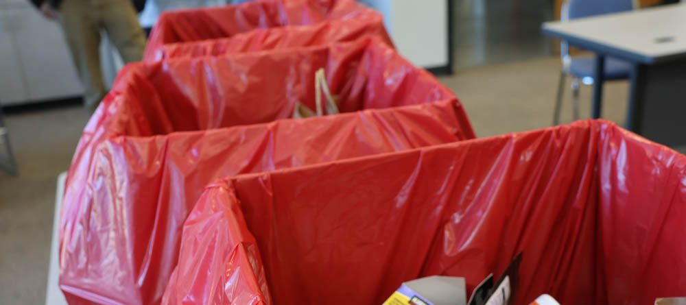 (WSB photo from Saturday, dropoff boxes in SW Precinct community room)
The total’s in from Saturday’s Drug Take-Back Day dropoffs at the Southwest Precinct. Crime Prevention Coordinator Matt Brown – one of three SPD personnel there when we stopped by – reports, “Thank you so much for all who participated! SW Precinct collected 155.36 lbs of expired medications (which was just barely less than the North Precinct at 156.1 lbs! We’ll get them next time in October). It was a fantastic turnout, and we really appreciated the way West Seattle responded.” Brown also notes that the next Southwest Precinct Advisory Council community meeting with police is tentatively set for May 28 – watch for a detailed announcement when confirmed.
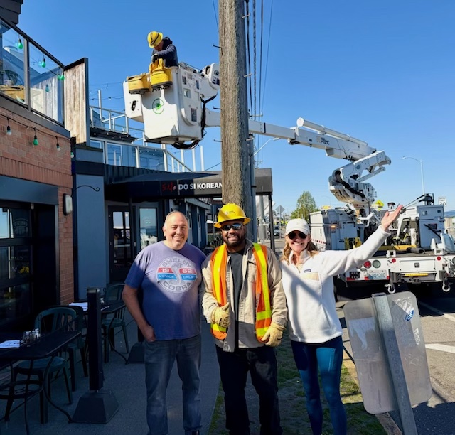
Back in March, as reported here, the Alki Community Council announced a city commitment to install “pedestrian-level” lighting outside businesses in the wake of a burglary wave. This weekend, the lighting is being installed.
The videos were sent by ACC president Charlotte Starck, who told WSB this morning:
Lights are going up on Alki Avenue between 63rd and … at Christos and Do Si. These are the LED daylight-activated to help prevent crime given (the burglaries). It’s a positive step as we advocate for a safer Alki. Petro Fotopolous is thrilled.
Fire Tacos got theirs yesterday and owner Erica loved it. Also, the (staffer at) the bike rental place liked the idea so he has better lighting in the evening when he closes.
But that’s not all the ACC is hoping for, Starck adds: “We are still waiting on SDOT to let us know if they will do anything to make the restaurant row stretch from 63rd to 57th safer, to slow down and deter the burnouts and sprinting and donuts in the pedestrian high-traffic areas.”
 (WSB photos)
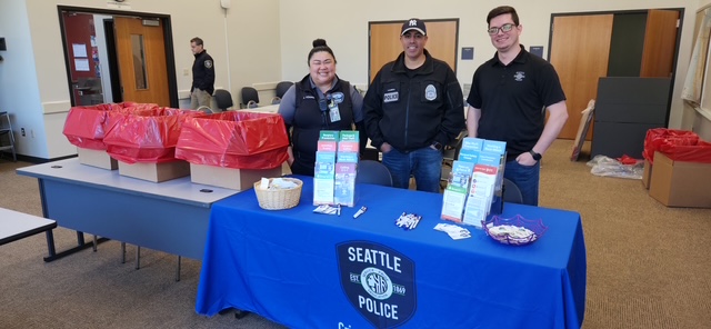
Another twice-yearly dropoff event happening right now – the Southwest Precinct community room (right off the public parking lot at 2300 SW Webster) is where to take medication(s) you need to dispose of, during Drug Take-Back Day. The boxes were filling up, but they’re ready to accept whatever you bring; expired and/or unneeded medication left in your home can be dangerous for a variety of reasons. This is continuing until 2 pm today.
(In our top photo are Community Service Officer Janice Young, Officer German Barreto, and Crime Prevention Coordinator Matt Brown.)
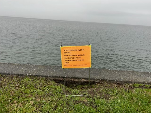
A texter wondered about the bright-orange signs that have popped up along the Alki seawall, and sent that photo. So we asked Seattle Parks, whose spokesperson Christina Hirsch responded:
SPR installed the signs last week. The erosion under the seawall occurs in random spots, creating suction that pulls soil out and forms these holes. We have worked with engineers over the years to address this issue, trying various methods. While the holes are small compared to the seawall and don’t pose a structural risk, they are large enough to be a safety concern for park visitors. We’ve previously put up signs and fencing, but they often get removed or ignored. This time, we’re using bright orange signs in hopes they’ll stay in place and be more visible.
We’re also implementing a new plan to fill the holes, starting next week, with the goal of completing the entire stretch between Alki and Don Armeni before Memorial Day. There are about 20 holes of varying sizes, and we’re optimistic this method will hold through the summer.
The drug-abuse problem is huge, but you can take small steps to make a difference. Here are two West Seattle events to know about:
KEEPING YOUTH SAFE: This community conversation is set for tomorrow night at Denny International Middle School (2601 SW Kenyon):
SW Seattle Youth Alliance and Westside HEY is inviting you to join us for our annual Key Leader event called Community Connections: A Dialogue in Prevention. This Thursday, April 23rd, from 5:30 pm – 7:30 pm at Denny International Middle School.
We will have a panel with our key leaders from our community, will have a training on vaping and marijuana youth prevention, and have discussions around health and safety in our community. We will have light refreshments and important conversations. We hope you can join us!
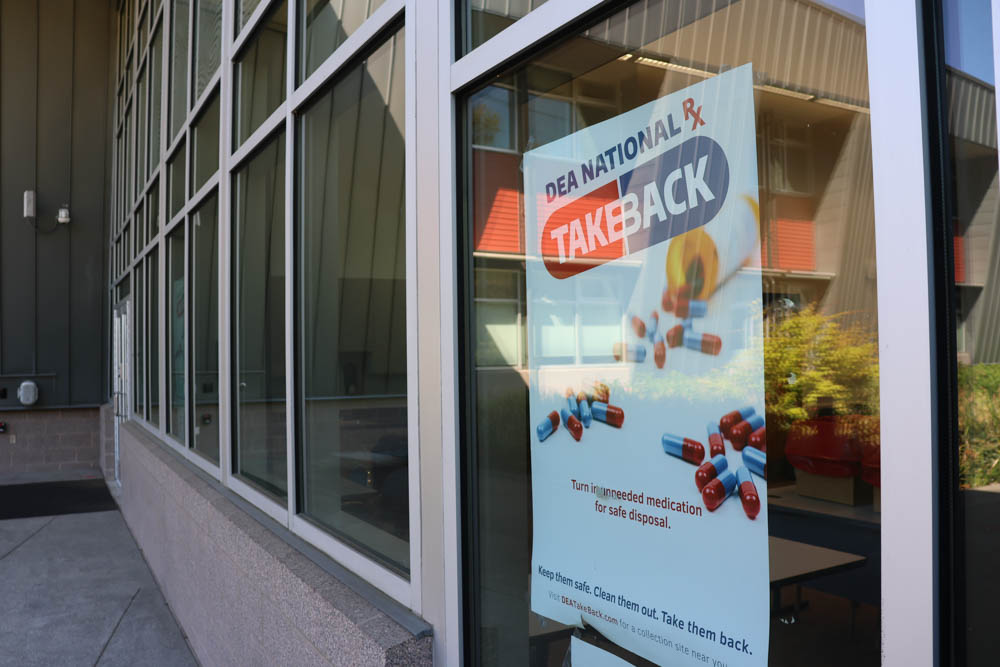
SAFETY AT HOME: Keeping unneeded, unwanted, and/or expired medications around your home is also a danger to people of all ages. If you need a convenient way to get rid of them, this Saturday (April 25) brings the semiannual Drug Take-Back Day dropoff event at the Southwest Precinct community room (2300 SW Webster), 10 am-2 pm – bring them in, throw them in the provided receptacle, and move on, no questions asked.
Thanks for the tips. SDOT crews are about to start work on curb ramps at 45th SW and SW Charlestown. That’s not necessarily remarkable, as they’ve been working on installing those all over the city, but some wondered if the work would be accompanied by more traffic calming, given that, for example, other intersections in the area have been converted to all-way stops. We asked SDOT and they said no, the scope only involves curb ramps, along with adjacent concrete repair.
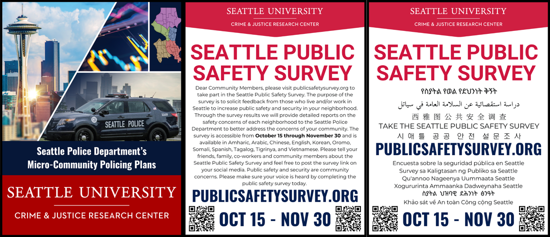
The results are in from the latest annual Seattle Public Safety Survey, conducted by Seattle University, which provides results – without personally identifying info/data – to SPD. Here’s how SU summarizes this year’s survey results (which included almost 1,300 responses from our area):
Results of the 2025 Seattle Public Safety Survey are in, with traffic safety, public-order crime, fear of crime, property crime, and laws, policies, and accountability among the top themes participants cited.
The Seattle Public Safety Survey is part of the Seattle Police Department’s Micro-Community Policing Plans, now in its 12th year, and has been administered annually by Seattle University’s Crime and Justice Research Center.
Traffic safety remains the top concern, continuing to rise in prominence in recent years. Participants frequently cited a sense of lawlessness on the roads and a lack of enforcement of safety violations across all types of vehicles, including electric bicycles and scooters.
One of the most significant findings this year is that community capacity rose to the second-highest concern, surpassing both police capacity and property crime for the first time in the survey’s history. This suggests that residents are not just concerned about police response to public safety issues, they are increasingly focused on whether the broader systems and services in place are able to respond effectively.
In addition to identifying top public safety concerns, the survey measures key public safety–related quality-of-life indicators including police legitimacy, social cohesion, informal social control, social disorganization, and fear of crime, at the citywide, precinct, and neighborhood levels. These measures allow community members, practitioners, and policymakers to assess the overall “public safety health” of the city and its 58 micro-communities and to use this data to inform and improve responses.Police legitimacy ratings — measured on a 100-point scale — declined in 2025 following a brief increase in 2024, which had marked the first improvement after a steady decline from 2020 to 2023. Ratings, which were above 60 in the early years of the survey (peaking at 64.4 in 2016), fell into the 40s and 30s in recent years, reaching a low of 38.7 in 2023, rising to 41.9 in 2024, and declining again to 38.8 in 2025.
Results of the survey will be presented in SPD Community-Police Dialogues on select Mondays from May through August via Zoom. Community members will have opportunities to engage with SPD personnel about the results and discuss public safety concerns at the precinct and neighborhood levels. Registration is available online, and full results can be found on the Seattle Police Department’s Micro-Community Policing Plans website.
The Seattle Public Safety Survey is one of the longest-running efforts in the country to systematically track community perceptions of public safety over time, providing a rare longitudinal view of how trust, fear, and public safety concerns evolve at the neighborhood level.
Southwest Precinct (West Seattle and South Park)-specific results start on page 56 of the results report.
SIDE NOTE: The Micro-Community Policing Plans mentioned above cover neighborhoods chosen because, at the time of this project’s inception, those are the areas that had active neighborhood organizations with which SU and SPD could partner. But the survey every year is open to all, and we (among others) usually announce it a few times to help get the word out when it’s open.
(Seattle Channel video of committee meeting; Vision Zero item starts 35 minutes in)
By Macey Wurm
Reporting for West Seattle Blog
SDOT‘s chief safety officer says so far this year, things are safer on Seattle’s streets.
Not safe enough, says District 1 Councilmember Rob Saka. The committee he chairs – Transportation, Waterfront, and Seattle Center – had the Vision Zero safety progra on its agenda this past Thursday, including a review of 2025 data and an overview of planned projects for 2026. The meeting was the day after Saka called for an audit of the program, as we reported here.
Addressing the audit during the committee meeting, Saka said, “Vision Zero is about saving lives and while we are seeing some real progress the tragic reality remains that too many people are still dying and suffering serious injuries on our streets.” He also called for a moment of silence for the two people killed in a wrong-way crash on Highway 509 south of the city last weekend.
Funding for Vision Zero and other safety initiatives is part of the eight-year $1.55 billion Seattle Transportation Levy passed by voters in 2024. The presentation during Thursday’s meeting was given by Venu Nemani, SDOT’s Chief Safety Officer and City Traffic Engineer.
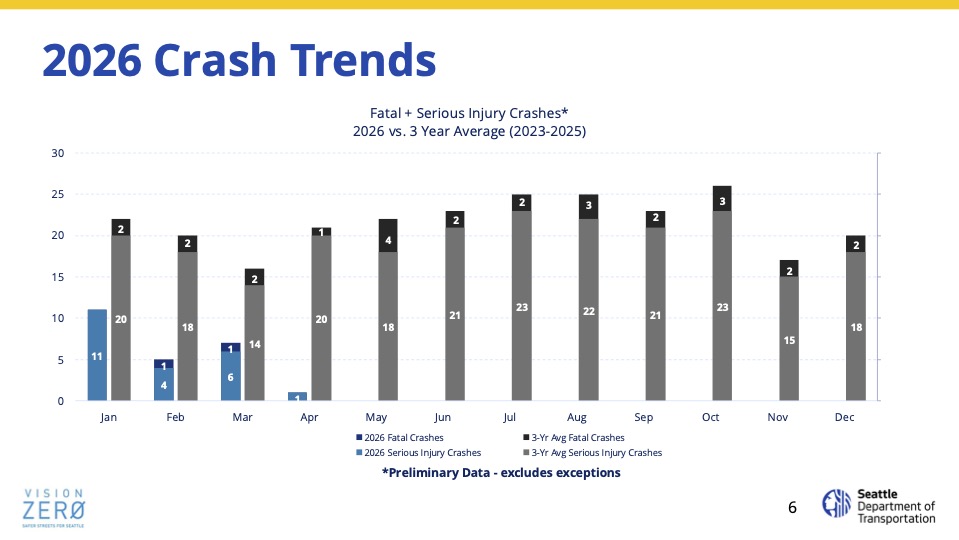
He noted that the first quarter of 2026 has brought fewer fatal collisions and fewer serious injuries compared to an average number from the past three years, and introduced some planned projects for the upcoming year.
These include four levy-specific deliverable goals– “safety upgrades on up to 12 corridors across the city, 40 high-collision locations, arterial traffic calming on 50 corridors, and pedestrian head-start signals at 280 intersections. Nemani added that a plethora of projects have been planned even in light of the construction timeline barrier provided by the FIFA World Cup coming to the city this summer.
Both Saka and citywide councilmember Alexis Mercedes Rinck voiced concern over SDOT improving their response timeline to traffic incidents involving fatalities or serious injuries. Saka wondered whether a 72-hour response model similar to that currently used for filling potholes could be implemented to make “immediate remediations” at collision sites.
Nemani explained that this would be difficult because it often takes much longer for SDOT to receive a police traffic-collision report – which is necessary for the department to fully understand the nature of the crash before beginning safety improvements.
“But I do understand the underlying need to have a more rapid response at locations that have had fatal collisions. I still don’t have all the specifics to share with you, but it is something that we are closely looking at,” Nemani said.
Councilmember Saka also addressed public comments that he heard at at the start the meeting, including what he called an “inference” that the city needed more bus lanes, bike lanes, and pedestrian-friendly improvements. He responded by declaring that he “fundamentally disagree(s)” that elected officials should “somehow be responsible for approving every safety project.” He noted the “Curby” controversy as an example, in which he was criticized for a $2 million proposal to remove a Delridge Way median preventing left turns to a preschool: “Every time that I’ve intervened in specific design decisions hasn’t gone too well. Even when I’ve fought for immigrant and refugee communities or kids, daycares, working families, some people have lost their natural minds. Even when we landed on a compromised solution to save Curby, still engendered passionate feelings.” Saka said.
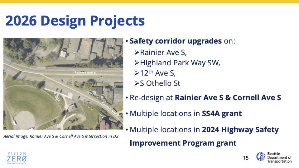
The only West Seattle project mentioned in Nemani’s presentation (here’s the full slide deck) – and briefly, at that – was the plan to convert the outside downhill lane on Highland Park Way to bicycle and pedestrian space:
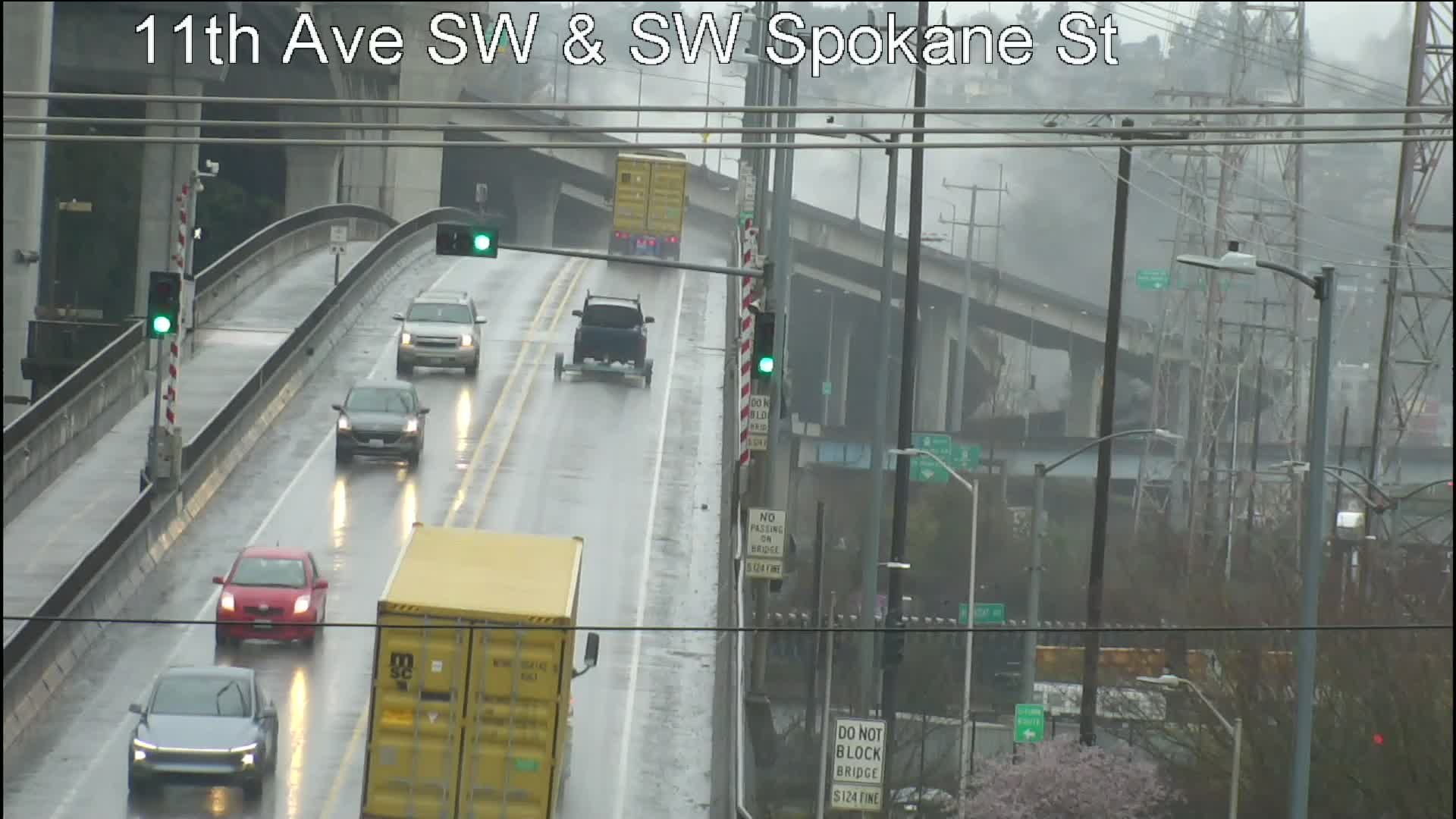
 (WSB photo, Wednesday morning, 35th/Edmunds)
As promised, we asked the city followup questions about the sweep on Wednesday in the encampment area east of 35th, from West Seattle Stadium to Camp Long. Here are the answers we received late today:
WSB: How much stuff was removed?
REPLY: “During the restoration, approximately 2.5 tons of debris were removed.”
WSB: How many people were connected with shelter?
REPLY: “(The Unified Care Team) connected five people with shelter and one with case management services.”
WSB: What’s next?
REPLY: “Planning is underway in coordination with multiple City departments to maintain the area so that it remains clean and accessible for public use.”
We also noted that there was no hint of the sweep plan when the city answered our inquiry last Thursday about plans for the site; the notice we showed on Monday said it had been posted Friday, so it was clearly in the planning phase when we inquired. The city’s response noted: “The UCT does not share specific resolution dates externally due to staff safety and possible changes in scheduling due to resource constraints.”
 (WSB photos)
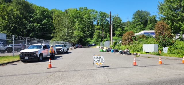
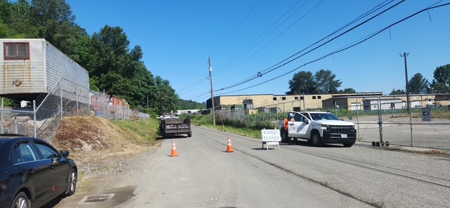
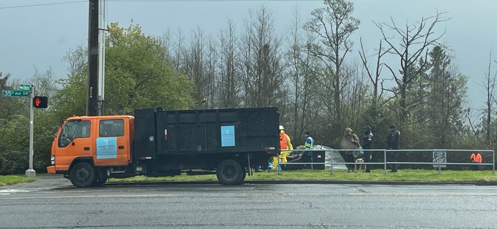
Back on Monday, we reported on the city notices posted to warn people to clear out of the encampment east of 35th, from the stadium to SW Brandon, by 9 am today, because of sweep plans. We just went over to check, and crews are indeed there now. We saw them from 35th/Edmunds (above) to Rotary Viewpoint Park (1st photo below) to the future dog park on the south side of the stadium lot (2nd photo below).
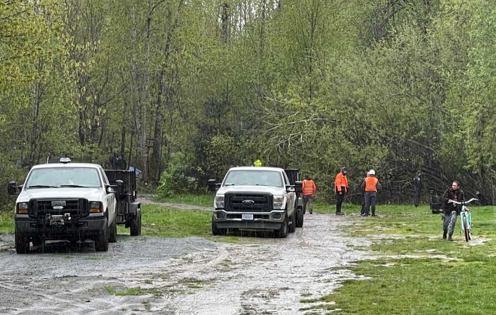
The encampment was reported to have extended into the woods to the east, and has been the site of trouble, most recently an assault that injured three people, with two hospitalized in critical condition, and an overdose death last week. As for the people who were camping there, when we went through a little while ago, people with filled carts on wheels lined the sidewalk on the north side of the stadium driveway. We’ll be checking with the city later in the day regarding how many people they contacted at the site. Also note, the outside northbound lane of 35th is currently coned off because of vehicles related to the sweep.
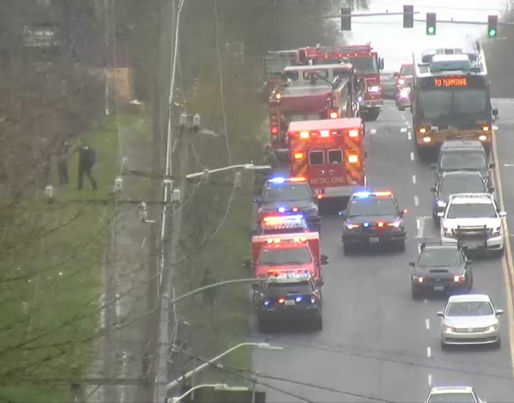 (March 29, emergency response at 35th/Alaska after assaults)
12:16 PM: We’re at City Hall, where District 1 Councilmember Rob Saka and staff just confirmed that a sweep is planned at the Rotary Viewpoint Park (etc.) encampment off 35th SW and SW Alaska this week. We were here for a new periodic media Q&A opportunity with councilmembers (Saka was one of two participants) when we got first word from Keith Hughes of nearby Westside Neighbors Shelter, currently closed for the season to overnight stays and closed TFN for other services because of renovation/repair work, He CC’d us on communication to th city expressing concern that temperatures are forecast into the 30s Wednesday night. This all follows recent incidents including an overdose death a few days ago and the recent assaults on three people. We’ll be looking for posted notices once we get back to the peninsula, and we’re checking with the city reps who did not mention any sweep plans when we inquired last week. If this indeed happens Wednesday, it would be one day before a neighborhood group is scheduled to meet for an update on the situation.
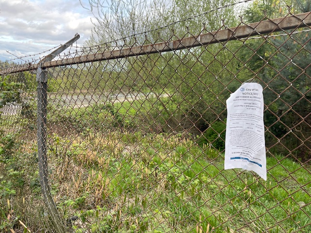
5:58 PM: Finally got a chance to go look for the notice(s). We saw one, shown above, on the fencing near the top of the driveway into/out of the stadium/golf course lot. It indeed announces a sweep for Wednesday morning (April 15) and lists a posting time of 2 pm last Friday – the day after city reps told us only that they were “actively monitoring” the site. Here’s a closer look at the notice:
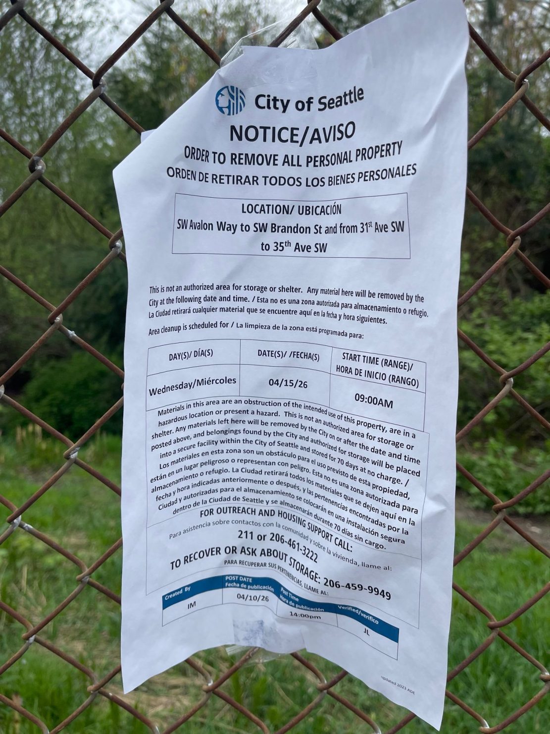
It lists the targeted area as Avalon to Brandon, 35th to 31st.
With the recent troubles for the state-owned 1st Avenue South Bridge – the bridge-decking cracks, then the mechanical trouble this week (still pursuing followup questions about that) – we wondered about the city-owned West Seattle low bridge’s status. It’s had various maintenance projects in the past few years, but still has periodic problems with the gates, among other things. So we asked SDOT if anything else was on the horizon for the low bridge (officially, the Spokane Street Swing Bridge). Short answer, yes. Long answer:
Our work to maintain and upgrade the West Seattle Low Bridge is ongoing. We have completed several major improvements over the past few years and are planning to continue working on additional upgrades to improve the bridge’s reliability and operations.
Over the past few years, we have completed several improvement projects including bridge strengthening work, earthquake safety upgrades, replaced and refurbished key mechanical components including the turn cylinders, upgraded the bridge’s control system, and installed an intelligent remote monitoring system.
In the near future, we plan to replace both vehicle barrier gates. We are waiting to receive the components for this project and do not yet have an exact estimate for when this work will occur. We will share more details about the schedule when we know more.
Other future projects in the coming years will likely include additional work on the bridge’s hydraulic systems and lock mechanisms and further improvements to the machinery that operates the bridge. We are in the process of designing this work and have not determined the exact timeline.
| 0 COMMENTS