West Seattle, Washington
23 Saturday
 (Snowy Olympic foothills photographed from West Seattle today by Marty Westerman)
After days of talk about extremely cold weather on the way, the National Weather Service has issued the first official alert about it: A Winter Weather Advisory, in effect 4 am Saturday through 4 pm Sunday. The advisory is as wide-ranging as the forecasts have been, saying: “Snow will most likely develop in showers and bands, leading to highly variable snow accumulations. The best timing for heavier snow is Saturday night into Sunday.” The forecast for this evening, meantime, says you might see a few flakes, but insists, “no snow accumulation.” (If and when you see snow, let us know where – text 206-293-6302 – thank you!) P.S. Here’s the newest safety info from the city. No official city-supported shelters in our idea, but if you can help with the emergency shelter at West Seattle’s American Legion Post 160, here’s how.

Thanks to Tom Trulin for the photo – another big tree down in Lincoln Park. Rain and wind kicked up for a while overnight. The weather’s not expected to get too dramatic for the rest of today or even tomorrow – still no alerts/advisories for our area. The National Weather Service‘s “forecawt discussion” should be updated again in a few hours, but in the meantime, it’s not projecting the temperature drop to start before Sunday, and the prospect of serious snow remains iffy.
P.S. If you encounter fallen trees or any other Seattle Parks maintenance problem, the after-hours number is 206-684-7250.
Yes, some snow is likely this weekend and beyond, says the National Weather Service, but not enough to even issue an alert (yet). The bigger forecast news is that it’s expected to be REALLY, REALLY COLD – colder than we’ve seen in a long time. The big cooldown is forecast to start on Sunday, with a high near 30 and a low possibly in to the upper teens; then Monday, Tuesday, and Wednesday, highs in the 20s, lows as cold as the lower teens. With all this ahead, the mayor led a briefing this afternoon, including a meteorologist who also stressed that the extra-cold air is the big news, a “rare event.” Here’s the video:
Managers from multiple departments/agencies – including SDOT, Seattle City Light, Metro, Seattle Public Utilities, Human Services – also were part of the briefing, and the roundup of reminders and resources is here, including info on how to keep pipes from freezing (and what to do if they do anyway).

Thanks to Carolyn Fitzgerald for the photo of the greeting her family created at Jack Block Park today. Winter arrived at 7:59 am, and the day was colder than normal – hitting only 37 degrees, nine degrees below the usual high. The forecast for this weekend still includes the possibility of snow – maybe as soon as Christmas Day – though the National Weather Service reminds us that it’s always difficult to accurately forecast snow around here; right now, the NWS says, if it does snow, it’s not likely to be much – “total snowfall Saturday through Monday only looks to be 1-3 inches for this entire period with not a single 6-hour block of snowfall exceeding a quarter of an inch.” No alerts yet, but it’s early. P.S. Snow or no snow, Sunday and Monday nights could drop into the 20s.
8:29 AM: Thanks for all the tips. Yes, it’s snowing, just about everywhere! So far, forecasters say it’s not expected to stick. But as @WestSeaWx notes – and as we mentioned in today’s traffic/weather watch – we’re likely to see more later this week. For today, however, this was NOT in the forecast.
8:50 AM: Just in case you’re missing it, some tweeted video:
Snow in Gatewood at 200'! @NWSSeattle @westseattleblog @WestSeaWx pic.twitter.com/df5PQgwFIR
— Michelle Arnson (@MEGArnson) December 20, 2021
We’re around 300′ and still seeing snow mixed with the rain. Sea level may not be seeing it at all, though – we have at least one “snowless” report, from Alki.
9:15 AM: Just rain now.
9:36 AM: For the record – and remember that this is likely to change – here’s what the National Weather Service is forecasting for the next appearance(s) of snow:
THURSDAY NIGHT…Rain likely in the evening, then rain and snow after midnight. Lows in the mid to upper 30s.
FRIDAY…Rain and snow in the morning, then rain at times in the afternoon. Snow level near 500 feet. Highs in the lower 40s.
FRIDAY NIGHT…Rain at times in the evening, then rain and snow after midnight. Snow level near 500 feet. Lows in the lower to mid 30s.
CHRISTMAS DAY…Rain and snow. Snow level near sea level. Highs in the upper 30s.
SATURDAY NIGHT…Snow. Lows in the mid to upper 20s.
SUNDAY…Snow in the morning, then snow likely in the afternoon. Highs in the lower 30s.
11:50 AM: As commenters note – and as we’ve seen here too – the flurries have returned, off and on

The Longfellow Creek bridge at SW Yancy, by the West Seattle Health Club, is open again tonight, after almost six days of blockage by trees/debris from last week’s windstorm (WSB coverage here). Two readers asked us about its status earlier today; by mid-afternoon today, Seattle Parks responded, work to clear it was completed.
Didn’t want to let this calendar date go by without a mention: It’s been 15 years since the Hanukkah Eve Windstorm – early on December 15, 2006 – left thousands in West Seattle without power for days, among more than 1 million around the region. This sign photographed at Highland Park Way and SW Othello five days later told the story:

Some pockets of West Seattle didn’t get their power back for almost a week. (Our Upper Fauntleroy neighborhood was out for more than three days.) But other areas had it tougher – more were out on the Eastside, and five died of carbon-monoxide poisoning in Burien – so WS didn’t get as much attention (that’s when, and why, our site started morphing to news coverage). Power crews came from far away to help – note what’s written on this truck we photographed in Alki:

Citywide media also reported that City Light was shorthanded pre-storm. Meantime, before the wind, a 2-inch downpour opened a sinkhole at the top of the SW Thistle stairway, among other damage:

Otherwise, trees came down (and at least one went up). For meteorological reminiscing, you can go here; for a regional recap, see HistoryLink.

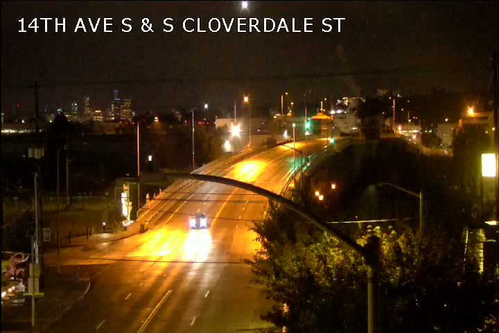
11:19 AM: Lincoln Park is just one of the places where the overnight windstorm took out trees. (Thanks to Mindi Katzman for the top photo!) That’s also the major cause of the outages that cut power to almost 5,000 people in West Seattle overnight (here’s our as-it-happened coverage). About 450 customers are still out, mostly in Gatewood/Upper Fauntleroy (WSB HQ included) – here’s a screengrab from the Seattle City Light map:

This also is the biggest outage still remaining in SCL’s entire service area. There are several other small pocket outages, including one affecting the West Seattle Health Club – trees came down along Longfellow Creek by the club (thanks to Mark Tiedemann for the photos):


The weather alert expired at 10 am as scheduled but it’ll still be breezy for the rest of the day. Storm-aftermath updates to come.
12:30 PM: Thanks for the tips! City Light has just returned to the 45th SW dead end south of Austin (which also was the problem location last time we lost power a few years back). Lines here go through a greenbelt.

They’ve gone into the greenbelt and chainsaw(s) can be heard.
2:15 PM: Heather reports via Twitter that the Admiral pocket is back. And the SCL map suggests part of “our” outage is restored – we are away from HQ so can’t confirm yet.
2:27 PM: Just arrived, and yes, after 11 hours, we’re back. Tallying the remaining outages now.
4:07 PM: Three spots in West Seattle still show as being out – the 49-customer pocket in Gatewood/south Morgan, 3 customers on Beach Drive near Cormorant Cove Park, and the Longfellow Creek tree trouble that took out West Seattle Health Club power.
 (Photo by Jerry Simmons)
If your nearest deciduous trees have any leaves left, they probably won’t by Saturday night. Weather watchers have been rumbling about an approaching storm for days, and now the National Weather Service has issued an official Wind Advisory alert for our area, in effect 7 pm Friday through 10 am Saturday: “South winds 25 to 35 mph, with gusts up to 55 mph expected.” Accompanying the wind: Heavy rain, according to the forecast. If you have cleanup to do before the storm arrives, Friday morning will probably be dry.

Thanks for the photo! That’s from Highland Park, one area that got a bit of slush as the latest bout of stormy weather moved through. According to @westseawx, what’s left of a “decaying convergence zone” is to blame. The National Weather Service, meantime, warns a bit of “tidal overflow” is possible along the shore, in tandem with the 12.7-foot high tide that peaked just before 9 am.

Thanks to Fred Hammerquist for the view of tonight’s sunset. By the time we get to the holiday on Thursday, we might not have anything resembling this – the Thanksgiving forecast so far predicts “rain at times” during the day, and heavier rain that night. Breezy, too.

Thanks for the photos of tonight’s splashy sunset! Above, that’s from Jan Pendergrass along Alki; below, from Kanit Cottrell in Gatewood.

This ended a dry day – and tomorrow promises to be another one. (With the rain total for the month close to twice the usual 4 inches, we can afford it.) Might be slightly frosty in the morning, so be careful if you have to head out early.
 (Beach Drive photo by Steyn Benade – @alwayslocalphotos)
The Wind Advisory alert that was previously set to expire at 4 pm has been extended into evening – the National Weather Service says wind “20 to 30 mph with gusts up to 40 mph” can now be expected until at least 7 pm.
 (Constellation Park photo by Jerry Simmons)
Earlier, we reported on two more downed trees on public property. We asked Seattle Parks what they’ve been dealing with – spokesperson Rachel Schulkin replies, “We had 10 tree failures over the weekend. We are responding to another 11 today. And have responded to over 66 tree failures this month so far.” (And again, that’s just on Parks property.)
All that rainwater has to go somewhere. Two of the places:
LONGFELLOW CREEK: Manuel sent this video of a leaping salmon along the Dragonfly Park stretch of the creek (south of SW Yancy):
‘LAKE SANISLO’: Part of the school‘s sprawling site was swamped when Amy and family decided to go paddling:

So far this month, the National Weather Service has measured almost 7 inches of rain … normal for this part of November would be just under 3.
(7:11 PM TOPLINES: Highland Park Way hill now open again … California Way has reopened…, Power fully restored … Wind alert extended into Monday afternoon)
In addition to the West Seattle Farmers’ Market closure, other updates:
WIND ALERT: It’s in effect through noon Monday, with south wind 25-35 mph and gusts up to 45 mph. (3:26 PM) The advisory is now extended, in effect until 4 pm Monday, with top gusts possibly 50 mph.

ROAD CLOSURE #1: California Way is closed (updated) west of Ferry, just uphill from Harbor Avenue. SDOT lists the cause as “wires down.” No power outage shown in the area, though. We don’t know if crews are on the scene so we’re heading over to look. (11:27 am: Can’t tell from either side of the closure, but we can confirm it’s still closed.) 1:50 PM UPDATE: SDOT says it’s reopened.
(added 12:41 pm) POWER OUTAGE, ANOTHER ROAD CLOSURE: Thanks for the tips! Power’s out in east West Seattle – hearing from Riverview/Highland Park for starters, The 8th/Roxbury traffic signal is out. … Tree’s down on Highland Park Way hiil and that’s the likely cause of this. Avoid the area. SFD and SPD are responding. … (12:49 pm) Mapped now. 2,200+ customers out. SPD is closing Highland Park Way, both directions.

Lights are out in the area too – including the W. Marginal intersection – as the outage also extends to South Park. (1:46 pm) Still out. Traffic on the detour routes is jammed so even if you’re thinking of trying to get to the 1st Ave. S. Bridge another way, wait if you can. (2:14 PM) Many customers have power back – the map shows 399 still out. (3:26 PM) Thanks to @nrdygrrl for this photo of the down-on-wires tree, via Twitter:

Road’s still closed. Here’s the map showing who’s still out of power.

(4:50 PM) HP Way still closed. No estimate on reopening.
5:59 PM: Seattle City Light says everyone who lost power now has it back.
7:11 PM: SDOT says Highland Park Way is now open again.
Other weather updates – roads, trees, power, etc. – 206-293-6302 voice or text – thank you!

1:50 PM: We don’t know when this happened – nor did the person who texted us about it – but a big tree is down in the Delridge Community Center park, and it’s a reminder that another deluge is on the way, according to forecasters. The National Weather Service says another inch of rain is possible tonight, and up to three inches Monday. Tonight through Sunday night, wind gusting up to 30 mph is possible too. If you’re in a slide-prone zone, a Special Weather Statement about slide risk remains in effect, too. So far this month, we’ve had more than five inches of rain, double what’s considered normal.
4 PM: Thanks to the nearby resident who texted to say it fell either Thursday night or Friday morning – they saw Parks workers taping it off on Friday.
(Updated 3:11 pm)
Our storm coverage continues, picking up from our morning updates (which included school closures):
WEATHER: Unsettled weather continues – as noted in our earlier coverage, that tornado warning some got last hour (depending on your cell service) was intended for Kitsap County, not us, but the Wind Advisory alert continues until 4 pm, and if you look to the west, very ominous skies. (Added 3:11 pm) There’ve been sunbreaks, too – Stewart L. got this photo during one of them:

TRANSPORTATION: Metro has canceled the 12:30 pm and 1 pm West Seattle Water Taxi runs because of the stormy weather. … Some traffic signals are still out in the areas that lost power this morning…. (3:01 pm update) The Water Taxi did return to its regular schedule.
 (Photo sent by David – SCL crew at work)
POWER OUTAGES: 823 residences/businesses are still out, mostly east of The Junction, according to the Seattle City Light outage map. There are a few small pocket outages, too, like 5 customers near 21st/Genesee on Pigeon Point. (1:43 pm update) Most are back on – now just a handful of single-digit pocket outages.
More updates to come …
(12:40 pm note, we are no longer updating this story – see our afternoon coverage here)
We’ve been covering the wind-related trouble in our morning roundup but now it’s time to break it out for updates.
WEATHER ALERTS: We’re under a Wind Advisory until 4 pm, with gusts up to 45 mph out of the south. … 11:57 AM: Some are getting a tornado warning but it’s for Kitsap County, not us. … 12:21 PM – The warning for Kitsap County has expired. Whether you got it or not depended on your cell provider – our AT&T phone got it, our Verizon phone didn’t, for example.
POWER OUTAGE UPDATES: More than 5,300 homes and businesses in West Seattle lost power at 7:40 am (here’s the SCL map).

This includes some traffic signals – treat any dark or flashing signalized intersection as an all-way stop. (9:12 am update) Some have their power back but 3,500+ homes/businesses are still out per SCL map. (9:35 am update) Getting reports of more power restoration – waiting for map to update. (9:44 am update) Map finally updated – now down to just under 900 customers still out. (10:12 am update) Down to 826. Adding updated SCL map below:

(11 am update) Still 826 out, mostly east of the heart of The Junction; SCL attributed outage to a tree.
SCHOOL CLOSURES/CHANGES:
Hope Lutheran School is closed for the day.
Holy Rosary hopes to start late – families are advised to stay home and wait for word. (10:06 am – CLOSED for the day)
West Seattle High School closed – this is the only SPS school in West Seattle affected so far
BUSINESSES/OTHER CLOSURES/CHANGES: Please text or call with updates – 206-293-6302
*Trader Joe’s in The Junction is without power and closed – (11:12 am update – REOPENED)
*QFC in The Junction closed (10:57 am update – REOPENED)
*Safeway in Jefferson Square closed (10:30 am update – REOPENED)
*West Seattle YMCA – closed (10 am update – REOPENED)
*Swedish clinic at 42nd/Alaska – closed
*Dr. Peter Yi‘s dental office – closed
*Senior Center of WS – closed
*Other Junction closures – mostly on the east side of California and eastward (zoom way in on SCL map); if outage continues past 10:30 am we’ll be making an in-person sweep

Thanks to David Hutchinson for photos from the shore south of Alki Point as this afternoon’s strong wind collided with this afternoon’s 12.1-foot high tide.

The wind will gradually ease tonight, but Saturday could be even windier, with 45-mph gusts forecast. ~12-foot high tides continue in the morning and early evening over the next few days.

It’s not just the streets and drains but also the sidewalks that should to be kept clear of all those leaves the wind and rain brought down (ever tried to use a sidewalk covered in slippery/mushy leaves?). If you have yard-waste pickup service, now’s the time to do it, because you can put out extra yard waste for no extra charge every collection day in November. From the city reminder:
If you do find that you have more leaves and yard waste than can fit in your food and yard waste cart, SPU has you covered! This November, SPU is providing FREE extra yard waste collection for household customers, up to 10 extra bags for every collection throughout the month. Simply set out your extra yard waste next to your food and yard waste cart on your collection day.
Extra yard waste must be contained either in kraft paper bags or placed in an extra container that is clearly marked to indicate it contains extra yard waste. Please make sure your extra yard waste collection bags or container only contain yard waste, not food waste. Fallen branches and twigs can be set out for extra collection as well. These can be tied into bundles up to 4 feet long by 2 feet in diameter and tied with fiber twine. Do not use wire, nylon cording, or plastic banding.
(Thanks to Eddie for reminding us about this!)

The forecast remains “breezy” through Wednesday, but not as windy as Sunday, so cleanup continues today. Above, Joel sent the photo of a tree that toppled in the 4100 block of Chilberg SW. But the worst toppling trouble in the area remains on East Marginal Way. Seattle City Light says 15 poles fell in the storm, closing part of East Marginal and blocking access to the South Park Bridge as a result.
The bridge and road might stay closed until “midday Tuesday” although SCL says they’re prioritizing the cleanup near the bridge’s east end in order to expedite the reopening. And if you’re wondering about the East Marginal poles that fell two years ago, here’s what City Light says:
These poles, located north of the stretch of poles that failed during a 2019 incident, were last inspected in August 2021. Three poles were identified for replacement and were in the process of being designed and permitted for replacement. As we clear the road, we are transferring the poles and equipment to a location for further inspection.
Meantime, SDOT has been out today sweeping leaf-deluged gutters – we saw this one on California SW in Gatewood:

They can’t be everywhere, though, so check on your nearest drain to ensure it’s not choked with all the leaves that have blown off th trees.
 (Harbor Avenue photo by Jerry Simmons)
Though you’ve probably been hearing/seeing a lot about stormy weather headed this way, note that our area is NOT in the warning zone. The forecast for tomorrow is windy, but not extraordinarily so – biggest effect is more likely to be more of those fall-color leaves coming off the trees. From the National Weather Service, here’s the city forecast:
SUNDAY…Windy. Rain at times in the morning, then rain likely late in the morning. Rain at times in the afternoon. Rainfall amounts a tenth to a quarter of an inch possible. Highs in the 50s to lower 60s. East wind 15 to 25 mph becoming south 15 to 30 mph in the afternoon.
SUNDAY NIGHT…Rain likely in the evening, then mostly cloudy with a chance of rain after midnight. Rainfall amounts less than a tenth of an inch likely. Lows near 50. South wind 10 to 20 mph becoming southeast after midnight. Gusts to 30 mph.
You can check the map here to see what areas of the state ARE under weather alerts.

Thanks to Jerry Simmons for this morning’s photo of clouds and the Cascades. This afternoon, dark clouds are gathering to the southwest, and if you were outside or had a window open this past half-hour, you probably heard thunder rumbling out that way. The National Weather Service says thunderstorms are possible through this evening – but what’s even more notable in the forecast is that the daytime highs for Monday and Tuesday might not get out of the 40s (“normal” high would be low 60s). Tuesday morning, the NWS warns, we might even see “areas of frost.”
| Comments Off on WEST SEATTLE WEATHER: First official alert about possible snow