West Seattle, Washington
27 Saturday

1:50 PM: We don’t know when this happened – nor did the person who texted us about it – but a big tree is down in the Delridge Community Center park, and it’s a reminder that another deluge is on the way, according to forecasters. The National Weather Service says another inch of rain is possible tonight, and up to three inches Monday. Tonight through Sunday night, wind gusting up to 30 mph is possible too. If you’re in a slide-prone zone, a Special Weather Statement about slide risk remains in effect, too. So far this month, we’ve had more than five inches of rain, double what’s considered normal.
4 PM: Thanks to the nearby resident who texted to say it fell either Thursday night or Friday morning – they saw Parks workers taping it off on Friday.
(Updated 3:11 pm)
Our storm coverage continues, picking up from our morning updates (which included school closures):
WEATHER: Unsettled weather continues – as noted in our earlier coverage, that tornado warning some got last hour (depending on your cell service) was intended for Kitsap County, not us, but the Wind Advisory alert continues until 4 pm, and if you look to the west, very ominous skies. (Added 3:11 pm) There’ve been sunbreaks, too – Stewart L. got this photo during one of them:

TRANSPORTATION: Metro has canceled the 12:30 pm and 1 pm West Seattle Water Taxi runs because of the stormy weather. … Some traffic signals are still out in the areas that lost power this morning…. (3:01 pm update) The Water Taxi did return to its regular schedule.
 (Photo sent by David – SCL crew at work)
POWER OUTAGES: 823 residences/businesses are still out, mostly east of The Junction, according to the Seattle City Light outage map. There are a few small pocket outages, too, like 5 customers near 21st/Genesee on Pigeon Point. (1:43 pm update) Most are back on – now just a handful of single-digit pocket outages.
More updates to come …
(12:40 pm note, we are no longer updating this story – see our afternoon coverage here)
We’ve been covering the wind-related trouble in our morning roundup but now it’s time to break it out for updates.
WEATHER ALERTS: We’re under a Wind Advisory until 4 pm, with gusts up to 45 mph out of the south. … 11:57 AM: Some are getting a tornado warning but it’s for Kitsap County, not us. … 12:21 PM – The warning for Kitsap County has expired. Whether you got it or not depended on your cell provider – our AT&T phone got it, our Verizon phone didn’t, for example.
POWER OUTAGE UPDATES: More than 5,300 homes and businesses in West Seattle lost power at 7:40 am (here’s the SCL map).

This includes some traffic signals – treat any dark or flashing signalized intersection as an all-way stop. (9:12 am update) Some have their power back but 3,500+ homes/businesses are still out per SCL map. (9:35 am update) Getting reports of more power restoration – waiting for map to update. (9:44 am update) Map finally updated – now down to just under 900 customers still out. (10:12 am update) Down to 826. Adding updated SCL map below:

(11 am update) Still 826 out, mostly east of the heart of The Junction; SCL attributed outage to a tree.
SCHOOL CLOSURES/CHANGES:
Hope Lutheran School is closed for the day.
Holy Rosary hopes to start late – families are advised to stay home and wait for word. (10:06 am – CLOSED for the day)
West Seattle High School closed – this is the only SPS school in West Seattle affected so far
BUSINESSES/OTHER CLOSURES/CHANGES: Please text or call with updates – 206-293-6302
*Trader Joe’s in The Junction is without power and closed – (11:12 am update – REOPENED)
*QFC in The Junction closed (10:57 am update – REOPENED)
*Safeway in Jefferson Square closed (10:30 am update – REOPENED)
*West Seattle YMCA – closed (10 am update – REOPENED)
*Swedish clinic at 42nd/Alaska – closed
*Dr. Peter Yi‘s dental office – closed
*Senior Center of WS – closed
*Other Junction closures – mostly on the east side of California and eastward (zoom way in on SCL map); if outage continues past 10:30 am we’ll be making an in-person sweep

Thanks to David Hutchinson for photos from the shore south of Alki Point as this afternoon’s strong wind collided with this afternoon’s 12.1-foot high tide.

The wind will gradually ease tonight, but Saturday could be even windier, with 45-mph gusts forecast. ~12-foot high tides continue in the morning and early evening over the next few days.

It’s not just the streets and drains but also the sidewalks that should to be kept clear of all those leaves the wind and rain brought down (ever tried to use a sidewalk covered in slippery/mushy leaves?). If you have yard-waste pickup service, now’s the time to do it, because you can put out extra yard waste for no extra charge every collection day in November. From the city reminder:
If you do find that you have more leaves and yard waste than can fit in your food and yard waste cart, SPU has you covered! This November, SPU is providing FREE extra yard waste collection for household customers, up to 10 extra bags for every collection throughout the month. Simply set out your extra yard waste next to your food and yard waste cart on your collection day.
Extra yard waste must be contained either in kraft paper bags or placed in an extra container that is clearly marked to indicate it contains extra yard waste. Please make sure your extra yard waste collection bags or container only contain yard waste, not food waste. Fallen branches and twigs can be set out for extra collection as well. These can be tied into bundles up to 4 feet long by 2 feet in diameter and tied with fiber twine. Do not use wire, nylon cording, or plastic banding.
(Thanks to Eddie for reminding us about this!)

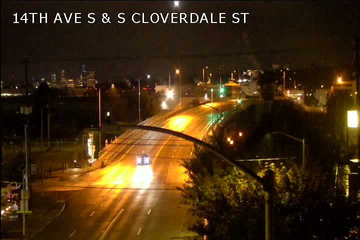
The forecast remains “breezy” through Wednesday, but not as windy as Sunday, so cleanup continues today. Above, Joel sent the photo of a tree that toppled in the 4100 block of Chilberg SW. But the worst toppling trouble in the area remains on East Marginal Way. Seattle City Light says 15 poles fell in the storm, closing part of East Marginal and blocking access to the South Park Bridge as a result.
The bridge and road might stay closed until “midday Tuesday” although SCL says they’re prioritizing the cleanup near the bridge’s east end in order to expedite the reopening. And if you’re wondering about the East Marginal poles that fell two years ago, here’s what City Light says:
These poles, located north of the stretch of poles that failed during a 2019 incident, were last inspected in August 2021. Three poles were identified for replacement and were in the process of being designed and permitted for replacement. As we clear the road, we are transferring the poles and equipment to a location for further inspection.
Meantime, SDOT has been out today sweeping leaf-deluged gutters – we saw this one on California SW in Gatewood:

They can’t be everywhere, though, so check on your nearest drain to ensure it’s not choked with all the leaves that have blown off th trees.
 (Harbor Avenue photo by Jerry Simmons)
Though you’ve probably been hearing/seeing a lot about stormy weather headed this way, note that our area is NOT in the warning zone. The forecast for tomorrow is windy, but not extraordinarily so – biggest effect is more likely to be more of those fall-color leaves coming off the trees. From the National Weather Service, here’s the city forecast:
SUNDAY…Windy. Rain at times in the morning, then rain likely late in the morning. Rain at times in the afternoon. Rainfall amounts a tenth to a quarter of an inch possible. Highs in the 50s to lower 60s. East wind 15 to 25 mph becoming south 15 to 30 mph in the afternoon.
SUNDAY NIGHT…Rain likely in the evening, then mostly cloudy with a chance of rain after midnight. Rainfall amounts less than a tenth of an inch likely. Lows near 50. South wind 10 to 20 mph becoming southeast after midnight. Gusts to 30 mph.
You can check the map here to see what areas of the state ARE under weather alerts.

Thanks to Jerry Simmons for this morning’s photo of clouds and the Cascades. This afternoon, dark clouds are gathering to the southwest, and if you were outside or had a window open this past half-hour, you probably heard thunder rumbling out that way. The National Weather Service says thunderstorms are possible through this evening – but what’s even more notable in the forecast is that the daytime highs for Monday and Tuesday might not get out of the 40s (“normal” high would be low 60s). Tuesday morning, the NWS warns, we might even see “areas of frost.”

Did you see the early-evening rainbow? Here are two of the West Seattle photos shared with us via Twitter – above from @kazzmere, below from @karinbeth in Delridge:

Lots of good news in the forecast and weather stats. With 2.31 inches of rain in September, an inch more than normal, we’re catching up from those ultra-dry summer months – now just two-thirds of an inch behind where we should be at this point in the year. More rain is expected off and on through Thursday – and sunshine next Friday, Saturday, and Sunday!

Wherever you were, that was a sunset to remember. Above, Stephen Nielsen photographed it from Lowman Beach; below, a texter was at Alki Beach:

But you didn’t have to be on the water – Mike Burns sent this view from The Junction:

On our way back from breaking news, WSB’s Patrick Sand stopped for this look at the Olympics from a viewpoint in Upper Fauntleroy:

And one more view from the beach – this one’s from Jen Popp:

Thanks to everybody who emailed, texted, and tweeted photos!
2:12 PM: Thunderstorms have arrived, and the National Weather Service says they’re likely for much of the afternoon:
Thunderstorms across central Puget Sound this afternoon. Heavy rain and thunderstorms will be possible over this area for the next few hours. When thunder roars, go indoors. #WAwx pic.twitter.com/bNFAN2Goc1
— NWS Seattle (@NWSSeattle) September 18, 2021
We’ll be monitoring for storm effects – power outages (just flickered here), etc. – if anything happens in your neighborhood, our hotline (voice or text) is 206-293-6302.
2:21 PM: And now there’s a sizable outage – almost 1,000 customers in Highland Park/southeast West Seattle. Some signals are out, too – Olson/Myers was just mentioned via emergency radio – remember, a non-functioning signal is a 4-way stop.

2:28 PM: The outage has expanded to another 2,000+ customers, including South Park – 3,235 total in what the map designates as two outages.
3:16 PM: Some texters are reporting the power’s back – the map tends to lag so we may not get the full picture on that for a few minutes. (added) Map has now updated – all 3,235 are shown as restored. (The map had suggested a 9 pm restoration estimate – remember that, as happened here, those are usually way off and not worth paying attention to – they are just guesses.) P.S. City Light says a fallen tree’s at fault.
4:45 PM: Forecast says there’s a chance of more thunderstorms tonight, and wind up to 25 mph too.
5:35 PM: Thanks for the tip. Another power outage started half an hour ago – 241 customers are out just north of The Junction:

7:50 PM: The outage north of The Junction is down to 114 customers, and is attributed to “equipment failure.” And now another outage – at least 20 customers along Fairmount Ravine, with a “transformer fire” response at Harbor/Fairmount.
Does your nearest street storm drain look like this …

,.. or like this?

If the latter (or worse), you have seven-plus hours of daylight left to clear it before all that forecast rain arrives tomorrow. You’ll be doing a big favor for those in and/or passing through your neighborhood – whenever you see major puddling in the street during/after a storm, invariably it’s because of a blocked storm drain.
 (WSB photo by Patrick Sand)
While the orcas didn’t get within orca range, while we were at Alki this evening, we did enjoy that golden view. The clouds that were moving in might bring a shower, maybe even a thundershower, overnight, forecasters say, so don’t be surprised if you hear that. (We’ve dodged so many shower “chances” in recent weeks, though, our expectations are low.)

Thanks for the photos from tonight’s sunset! Above, the view from Upper Fauntleroy, by Gabby (who’s 10!); below, a photo from James Bratsanos:

The forecast suggests change is on the way before the weekend – “chance of showers” returns to the forecast for Friday, Saturday, and Sunday.
 (Photo tweeted by Aaron)
11:14 PM: Though tonight brought another pink-globe sunset, if you observed closely, you could see the smoke wasn’t as dense as last night – the sun was visible all the way until it “touched” the Olympics.
 (Texted photo)
The air quality is better now, because the remaining smoke is “aloft” rather than down at ground level, according to the National Weather Service. So will tomorrow’s sunrise still be pink too?
 (Saturday sunrise photo by Marc Milrod)
The NWS says, “Elevated smoke will continue across the area tonight, then decrease from the west on Sunday.”
1:03 AM: Orange-red moon again tonight – Monica Zaborac sent the photo:


Smoke alert, heat alert – and now, a burn ban. Here’s the announcement from the Seattle Fire Department:
The City of Seattle has joined King County under a State 2 burn ban effective immediately. During a Stage 2 burn ban, any outdoor fire such as a backyard fire pit or campfire using chopped firewood or charcoal is prohibited.
Under the ban, any person with a recreational fire who fails to take immediate action to extinguish or discontinue when ordered or notified to do so can be charged with, up to and including, a misdemeanor. Seattle firefighters have also been directed to extinguish any illegal fires during this ban.
Manufactured portable outdoor devices are allowed, including barbecues and patio warmers that are used in accordance with the manufacturer’s instructions. Approved fuel devices – including those that rely on charcoal, natural gas or propane gas – are also allowed.
Seattle has experienced two large brush fires along I-5 this week, and the long spell without significant rainfall, the risk of fire in vegetated areas remains high. Let’s do all we can to reduce the risk of an unintentional fire:
• Follow the Stage 2 burn ban
• Safely discard any smoking materials (e.g. don’t snuff out in potted plants)
• Check your vehicle to make sure nothing could drag and create sparks while driving
• Avoid parking on dry grassy areas as hot components could start a fireCall 9-1-1 immediately if you see a brush fire so we can send crews right away.
 (Photo by David Hutchinson)
10:35 PM: Once the smoke started moving in at midday, you just knew the sun was going to turn that telltale pink before setting. The smoke is expected to linger through tomorrow; as noted earlier, the Puget Sound Clean Air Agency and regional public-health departments have issued an alert because of it. Checking the air-quality map tonight, most areas are in the “unhealthy for sensitive groups” range right now. As for the heat, today’s official high was 95, and tomorrow could see the mid-90s again. So far, though, Saturday is still looking like an improvement; the Excessive Heat Warning alert expires Saturday evening.
FRIDAY MORNING: Just in case you wondered … same thing for the Friday sunrise, Jerry Simmons shows us:


12:32 PM: Thanks to the texter who sent the photo of the hazy downtown skyline, seen from northeast-facing West Seattle. Yes, to pile on with the extra heat, wildfire smoke is arriving too. We’ve even had a few reports of ashfall. Click on “instant” at the upper right of this Puget Sound Clean Air Agency map and you’ll see pollution levels are on the rise. Per @westseawx, this is going to worsen tonight/tomorrow. You can explore the Washington Smoke Information site to see where fires are burning in our state; look more broadly at the West here; to our north, B.C. fire info is here.
1:55 PM: Now there’s an official alert, just out of the inbox:
This is a wildfire smoke alert from the Puget Sound Clean Air Agency and the local public health agencies of King, Kitsap, Pierce, and Snohomish counties. Air pollution is increasing due to wildfire smoke and may cause health problems.
Winds are bringing wildfire smoke into the Puget Sound region. We expect air quality to worsen today (Thursday) and reach levels UNHEALTHY FOR SENSITIVE GROUPS in many areas in the Puget Sound region. We expect smoke to continue or worsen on Friday. Some areas may have higher concentrations for short periods of time if additional smoke plumes move into the area. Smoke should begin to clear on Saturday.
Wildfire smoke can cause and worsen many health problems. …
This information was somewhat buried in the city’s list of “cooling centers”, so we’re mentioning it separately after hearing it’s catching people by surprise: The Southwest Library (9010 35th SW) is closed today and Friday because it’s not fully air-conditioned; Seattle Public Library staff have instead been moved so that fully air-conditioned libraries can be open today and tomorrow, including Delridge (5423 Delridge Way SW) and High Point (3411 SW Raymond), as mentioned in our preview list for today. (We’re checking with SPL regarding Saturday plans.)

Thanks to Eric Bell for the cooling photo, looking toward Luna/Anchor Park. Keep that scene in mind as the next heat wave rolls our way. The National Weather Service has kicked the alert level up to an Excessive Heat Warning, starting at noon tomorrow, continuing until 7 pm Saturday. The highest temperatures are expected Thursday and Friday, with highs in the 90s, but higher-than-usual humidity is in the warning too, and that will increase the impact. The city released a list of air-conditioned libraries, community centers, and senior centers with air conditioning, but the West Seattle options are few – we’ll be checking tomorrow to see if any locations/hours will be added.
ADDED WEDNESDAY: The list has been updated – now the Delridge and High Point libraries, both air-conditioned, will be open 10 am-6 pm Wednesday-Thursday-Friday. (Follow the link above.)

Thanks to Gene Pavola for the photo of tonight’s colorful sunset! Just in case you were wondering, the National Weather Service says that late-in-the-week heat is still on the way – the Excessive Heat Watch alert is still in effect starting Wednesday afternoon, but Thursday and Friday are expected to be the hottest days, in the 90s.
 (Saturday night photo by Bill Schrier)
The National Weather Service has our area under an Excessive Heat Watch alert for Wednesday afternoon through Saturday (August 11-14). So far the forecast highs aren’t near what we saw during that historic heat wave in late June, but we could get well into the 90s, and humidity will be elevated enough to make it feel hotter. Read the entire alert here; see the updated forecast here.
 (Photo sent anonymously from south of Alki Point)
Thanks for the photos! Fog on the water this morning hinted at what might be on the way – rain.
 (Photo by James Bratsanos)
The sky cleared up today, and sunshine’s in the forecast for tomorrow too, but what the National Weather Service calls “a weak front” arrives tomorrow night, with a chance of rain persisting through the weekend.
 (Photo by Gene Pavola)
Not only has it been drier than usual – we’ve had many days with warmer-than-normal temperatures, too, like today, with 88 for a high, nine degrees above usual.
| Comments Off on WEST SEATTLE WEATHER: Big tree topples, with another deluge on the way