West Seattle, Washington
19 Friday

The Olympics are finally getting the kind of snowcap you expect to see by now – Ann Anderson took the photo (and calls your attention to the Surf Scoters on the water – a rarer sight than they used to be). The newest forecast still suggests we might see a bit of snow at times this week, but no one’s predicting anything major, so far, and we’re not yet under any weather alerts. The first possibility of a little snow could be early tomorrow morning, with a possible snow-rain mix. Snow or no snow, temperatures will be below normal, too, so be ready for a wintry week.
 (Photo by Gene Pavola)
You’d have to call tonight’s colorful sunset something of a surprise. Less than an hour earlier, the all-day rain was still falling (two-thirds of an inch in the official Sea-Tac Airport gauge, according to the National Weather Service. Then suddenly – it stopped, and a gap appared between the clouds and the Olympics, soon allowing the sunset color through. Even if you had just a peek view, it was a sight to see:
 (Photo by Laurel Taylor @ High Point Library)
 (Photo by Eddie @ The Junction)
The forecast, meantime, suggests we might see some snow at some point next week. Almost every day starting Monday has a “chance” of snow, or rain/snow, in the prediction, and nighttime temperatures could get into the 20s (or colder), so any winterizing you’ve been delaying, now’s the time to get it done.

Though clouds swept back in this afternoon – including the lenticular cloud over Mount Rainier shown in Greg Snyder‘s photo, above – the National Weather Service says we can expect a sunny Thanksgiving Day. That’s especially good news if you’re going to join in any of the outdoor opportunities for the holiday morning that are featured atop our West Seattle Holiday Guide – and/or for safer traveling if you’re headed out to see family/friends. The rain could be back as soon as Friday.
 (Photo by Stewart L., from Harbor Avenue)
Another sunny day, after a spectacular sunrise – thanks for the photos! But change is on the way. The newest forecast suggests a chance of rain overnight, and is virtually certain of rain by Tuesday morning,
 (Photo by Mark Rhea, from Marine View Drive)
The National Weather Service notes that Saturday was the 12th consecutive dry day – and that date, November 19, is historically the wettest day of the year.
In addition to the big power outage, here’s what else the north wind did today:
Wind-fueled waves battered the Alki seawall this afternoon – an example of the choppy seas that led King County Metro to cancel the West Seattle Water Taxi‘s runs for this afternoon/evening. Thanks to Jeremy Barton for the video. And via text, here’s a tree that fell on Ferry Avenue SW, no traffic or power effects:

It could be breezy again tomorrow – here’s the National Weather Service forecast – with wind from the northeast. First, we have a clear, cold night ahead, maybe even into the upper 20s; Suzanne emailed us to suggest a reminder that you need to protect your pipes from freezing, earlier than most years. Here’s some advice.
Today’s high was 45, nine degrees below the normal high for this date, and the temperature’s heading lower. The newest forecast update says lows could be near freezing the next few nights, with daytime highs in the low 40s. In addition to the emergency shelter that’s now open at the West Seattle Veteran Center (3618 SW Alaska), there’s also a daytime warming center at the Salvation Army campus in South Delridge, 8 am-7 pm weekdays (9050 16th SW).
That’s what we saw at the north end of Emma Schmitz Memorial Overlook on Beach Drive a short time ago. The National Weather Service has a Wind Advisory in effect until 11 pm tonight, with wind out of the south, 25 to 35 mph and gusting to 45 mph, expected. This is all supposed to calm down somewhat by tomorrow. Today’s temperatures are in the upper 50s, but you’ll want to start thinking cold-weather preparation for next week – the extended forecast suggests a chance of rain/snow mix Monday night through Thursday, with sub-freezing nighttime lows.
ADDED FRIDAY NIGHT: More wave vs. seawall video – this time via Twitter:
More stormy weather from constellation park in west seattle. pic.twitter.com/W0wNPUrSfD
— richard ross (@wattorney) November 4, 2022
 (WSB file photo)
No, there’s no snow in the forecast, but SDOT crews need to do some test driving before it arrives, so they’re planning to do that tomorrow (Thursday, November 3rd). You might see snowplows on the streets as drivers test the equipment and familiarize themselves with plow routes, which you can see on this map. SDOT asks that while it gets ready for winter weather, you do the same, and has some suggestions here.

TUESDAY AFTERNOON: Thanks to David Hutchinson for the photo of a barely visible ferry passing Duwamish Head this morning. The fog has mostly made way for sunshine but it’s also lifted the veil on more wildfire smoke. The Puget Sound Clean Air Agency has issued another air-quality alert, in effect until 5 pm Thursday; the National Weather Service is still predicting rain to clear things up starting Friday afternoon. Meantime, be careful if you have to go outside; here are the latest air-quality readings, and here’s advice from AlertSeattle.
WEDNESDAY UPDATE: As Vid notes in comments, the alert has been extended until midnight Thursday night.

That’s the murky view of south Bainbridge Island from Emma Schmitz Memorial Overlook a short time ago. The wildfire smoke is back and expected to hang around a while. The Puget Sound Clean Air Agency has announced an air-quality alert, but it doesn’t officially kick in for King County until 5 pm Friday, despite all the smoke out there right now and the readings shown on this map. The alert is expected to stay in place all weekend. (Here’s the latest on the big wildfire that’s causing this.)
 (Tonight’s smoky sunset, photographed by James Bratsanos)
The current air-quality alert is still set to expire at midnight, though smoke from the Bolt Creek Fire continues to degrade our air quality. Puget Sound Clean Air Agency‘s Sunday update says “strong onshore winds” are expected to clear some of it out on Monday, and the forecast indeed says wind could be gusting up to 25 mph by Monday night.

Once again tonight, we have lower air quality because of smoke from the three-week-old Bolt Creek Fire, which continues to color the sky at sunset. The photo above is from Gene Pavola, with a state ferry; the one below is from David Hutchinson, with a Water Taxi:

Most stations on both the Puget Sound Clean Air Agency and PurpleAir maps are showing “moderate” air quality right now.
8:02 PM: Thanks to everyone who has sent photos of tonight’s “so long, smoke” sunset:

David Hutchinson‘s photo features sunset-watchers looking toward the Olympics, which were invisible behind the wildfire smoke at the same time a night earlier. Here’s a wider angle from Jan Pendergrass:

8:33 PM: Thanks to Mike Burns for the time lapse:
ADDED: From Greg Moore at Luna/Anchor Park:

And from Vicki Takahashi:


9:45 PM: Last night just before sunset, the reddened sun was visible through the smoke. Tonight, we took the photo above just before sunset, and nothing was visible looking west but the hazy outline of Blake Island. A few minutes later, here’s the view looking downtown.

The National Weather Service’s Air Quality Alert remains in effect through 6 pm Sunday, and the NWS expects things to start improving “late Sunday”; the Puget Sound Clean Air Agency says so too. But for now, tonight many areas are showing “unhealthy” air quality – either for “sensitive groups” or for everyone.
P.S. If not for the smoke, we’d be seeing a full moon tonight. The moon was in view last night/this morning before more smoke swept in, so as consolation, here’s this morning’s moonset, photographed by James Bratsanos:

11:33 PM: The moon is visible after all, and red-tinged – we’ve received a few photos including this one from Jerry Simmons:


3:54 PM: It’s what you don’t see in our early-afternoon photo from Upper Fauntleroy that tells the story – the Olympic Mountains would usually be the backdrop, but today all but their foothills are obscured by wildfire smoke. The Puget Sound Clean Air Agency says air around much of Puget Sound hasn’t reached “unhealthy” status yet but by tomorrow (Saturday, September 10th) it could be at “unhealthy for sensitive groups” status. Here’s the PSCAA map; here’s the PurpleAir map with more locations’ readings. The National Weather Service has issued an air-quality alert for 6 am Saturday to 6 pm Sunday, in effect for the four metro-area counties. Wondering where the fires are? Here’s a regional map. You’re also warned to take fire precautions here because it’ll be hotter, dry, and breezy – our area is also under a “red-flag warning” alert for that.
4:47 PM: A Stage 2 burn ban is in effect throughout our area. It’s explained here, but in short:
During a Stage 2 burn ban, any outdoor fire such as a backyard fire pit or campfire using chopped firewood or charcoal is prohibited. … Manufactured portable outdoor devices are allowed, including barbeques and patio warmers that are used in accordance with the manufacturer’s instructions. Approved fuel devices – including those that rely on charcoal, natural gas or propane gas – are also allowed.
The National Weather Service has just added two days to the Heat Advisory alert – originally set to expire tomorrow night, now in effect through Friday night. The NWS says temperatures will cool a bit on Thursday but then rise again Friday. Today’s official high at Sea-Tac was 90, so this year has tied the record for most 90-or-warmer days in a year, 12 … so far.
 (Sunday night sunset, photographed by Mike Burns)
For the fifth time since late July, the National Weather Service has issued a “Heat Advisory” alert for our area. This time it’ll be in effect noon Tuesday through 9 pm Wednesday. Today we’re already into the mid-80s, and the next two days could be just a few degrees warmer, but nonetheless this is hotter than usual for this time of year – normal high is 76.

Thanks to everyone who sent photos of tonight’s splashy sunset – hot pink on a not-so-hot night. The photo above is from David Delgado; the one below, from Ken Maier:

Though today’s high, 81, was only four degrees above normal, the next two days are expected to be notably warmer – then a big cooldown Friday.
 For the third consecutive week, a two-day heat wave is in the forecast, and it’s generated a Heat Advisory alert from the National Weather Service. The alert is for noon tomorrow (Wednesday, August 24th) to midnight Thursday night; temperatures could get into the low 90s. Because of the hot weather, the two local branches of the Seattle Public Library that are not, or not fully, air-conditioned will change their hours: The Southwest (9010 35th SW) and West Seattle/Admiral (2306 42nd SW) branches will both open early tomorrow, at 10 am, and will both be closed Thursday.
 (Photo by Jan Pendergrass)
You probably won’t be sad to hear that today’s clouds kept the official Sea-Tac high from hitting the 90s, which would have been a record-tying 12th day in the 90s in one year. It stopped at 87. The clouds did bring a colorful sunset – thanks to those who sent photos.
 (Photo by Carol Ann Joyce)
There was one record high at Sea-Tac – the highest low for this date, 68 degrees, previous record 61.
 (Added: Photo by Hana Alishio)
 >small>(Before this morning’s short-lived fog, sunrise colors – photographed by Stewart L.)
By this time tomorrow, we’ll be under another Heat Advisory alert, decreed by the National Weather Service with two days of 90s expected instead of one. The alert is for noon Wednesday through midnight Thursday night. If we really do see two days in the 90s, that’ll tie the record for 12 90-or-more-degree highs in a year (set in 2015),
Because of the forecast, the Seattle Public Library is already planning to open the two A/C-lacking local branches – West Seattle (Admiral) and Southwest – early on Wednesday and Thursday, at 10 am. (Early closure is likely but not yet announced – watch this page.) Anybody else with planned changes (businesses, etc.), please let us know – westseattleblog@gmail.com – thank you!
 (Photo sent Saturday by David White)
We might see 90-degree weather again this week. No alerts yet but the newest National Weather Service forecast suggests the high on Thursday could reach the lower 90s. Every other day this week has 80s as a possibility. “Normal” high right now would be upper 70s. The NWS says record number of 90+-degree days in a year is 12, set in 2015; if Thursday does get to 90 or higher, that would be the 11th this year.
6:03 AM: Good morning! It’s Tuesday, August 9th.
WEATHER
Today’s forecast is back closer to normal – sunny after some morning clouds, high near 80.
FERRIES, BUSES, WATER TAXI
Ferries: WSF is on the 2-boat schedule for Fauntleroy-Vashon-Southworth. Check here for alerts/updates.
Metro buses are on their regular weekday schedules; watch @kcmetroalerts for word of reroutes/trip cancellations.
The West Seattle Water Taxi is on its regular schedule.
ROAD WORK
The crews doing soil cleanup at the ex-encampment site along Andover between 26th and 28th were expecting to be back this morning/early afternoon, so Andover may be closed again.
BRIDGES AND DETOUR ROUTES
870th morning without the West Seattle Bridge. 33 days until the week SDOT hopes to reopen it.
Low Bridge: Automated enforcement cameras remain in use; restrictions are in effect 5 am-9 pm daily – except weekends; the bridge is open to all until 8 am Saturday and Sunday mornings. (Access applications are available here for some categories of drivers.)
1st Avenue South Bridge:
South Park Bridge – camera malfunctioning, as are a few others in eastern West Seattle (still no estimate on when they’ll be fixed)
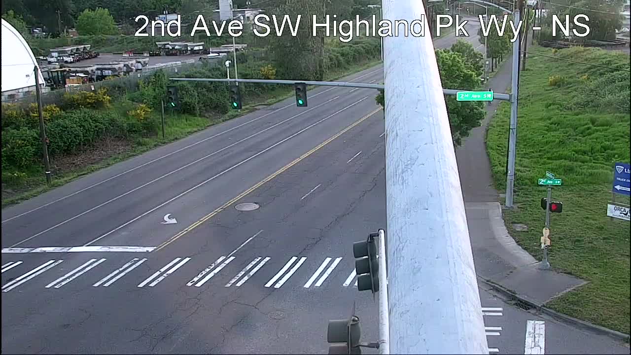
Highland Park Way/2nd SW (one of four recently installed cameras):
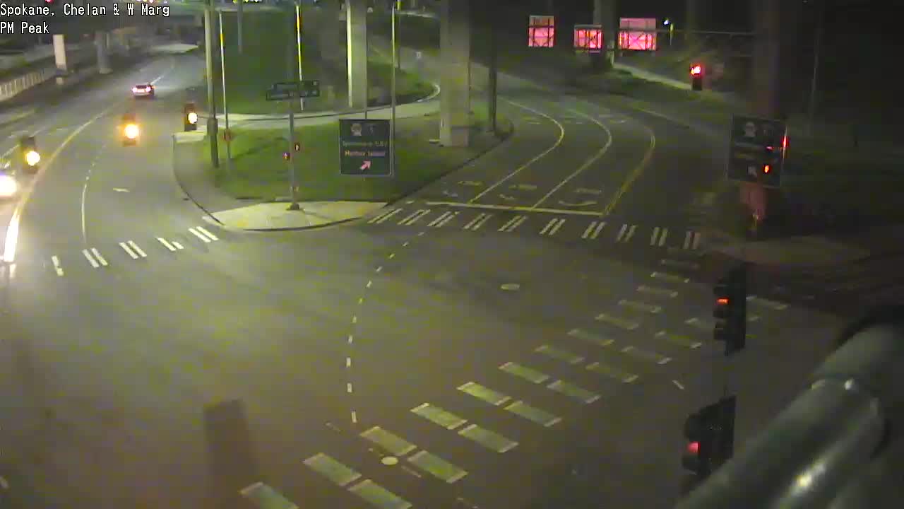
The 5-way intersection (Spokane/West Marginal/Delridge/Chelan):
Are movable city bridges opening for vessels? Check the @SDOTBridges Twitter feed; 1st Ave. S. Bridge openings are tweeted by @wsdot_traffic.
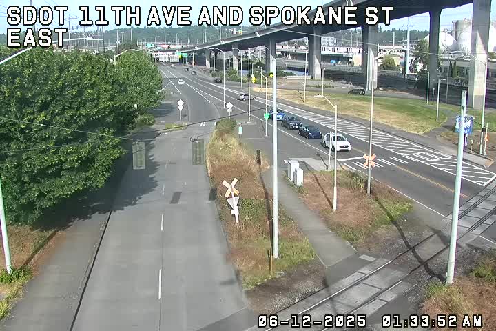
All city traffic cams can be seen here, many with video options; West Seattle and vicinity-relevant cameras are also on this WSB page
Trouble on the roads/paths/water? Please text or call us (when you can do so safely) – 206-293-6302.
| 2 COMMENTS