
West Seattle, Washington
14 Friday
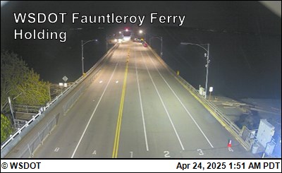
Early alert: If you have questions and/or concerns about Washington State Ferries, they’ve just announced the date for their next online systemwide community meetings:
As its busiest summer since 2019 comes to a close, Washington State Ferries is inviting the public to two virtual community meetings on Thursday, Sept. 10. Agency leaders will recap peak-season travel, share what’s ahead and take live questions from the public.
The meetings will also include updates on new hybrid-electric vessels, expanded on-board Wi-Fi, terminal construction and more. Most of each meeting will be reserved for questions from the audience.
WSF online community meetings information
When: 11 a.m. (register here) and 6 p.m. Thursday, Sept. 10 (register here)
Where: Online via Zoom
Prior registration is required for these virtual meetings. Each meeting will cover the same material and is designed to give participants the option to join the meeting that best fits their schedule. Participants will be able to ask questions and anyone can also provide comments ahead of time via email – wsfcomms@wsdot.wa.gov
After the meetings, video recordings will be available online on WSF’s community participation page.
 (WSB photos)
By Torin Record-Sand
Reporting for West Seattle Blog
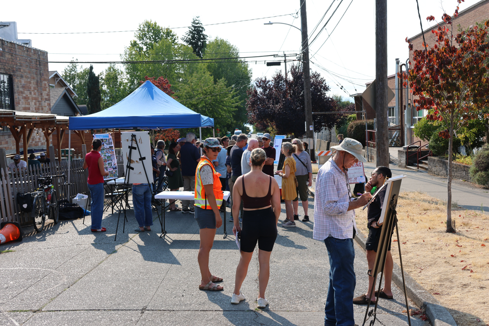
More than forty people came to small section of SW Lander Street west of California SW last night – between local businesses The Good Society and Seattle Yarn, and neighboring Lafayette Elementary – for an SDOT-convened “community design charrette.”
It offered a preview of what the street might look like in the near future, as the purpose of the gathering was for city officials to get feedback about their plans to close the street to vehicle traffic and turn it into a “People Street” within a year.
SDOT closed the small section of SW Lander for the evening, bringing together city reps and associated consultants and designers with community members to talk in-person about the best way to implement changes, and what they might like to see from the project.
The project is a part of the city’s People Streets and Public Spaces Capital Program, which seeks to transform various streets across the city into miniature public parks. Traffic is blocked off, and the designated area is transformed with various architectural improvements and amenities to encourage community gathering and engagement. This site, on SW Lander, is one of two in West Seattle that are currently part of the program; we’ve previously covered the other proposed project, on 18th Avenue SW, between Delridge Way and Southwest Barton (which also had a recent meeting). The city says its goal is to transform SW Lander into public space offering cleaner air as well as an overall sense of safety and security for students.
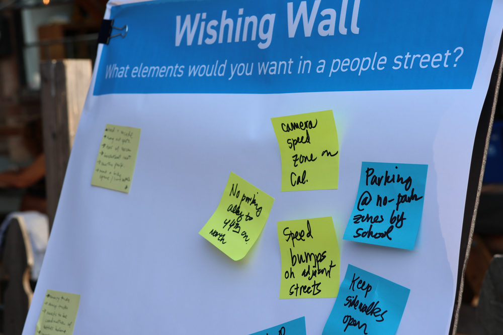
The meetings for both sites aimed at a very preliminary stage of the process, akin loosely to ‘brainstorming’ with the community in a more free-form atmosphere. No concrete designs were presented; instead, community members were asked to write sticky notes on poster boards asking for feedback on things such as desired features, and put stickers on stock photo ‘mood boards’ representing which features or visuals they would find the most appealing.
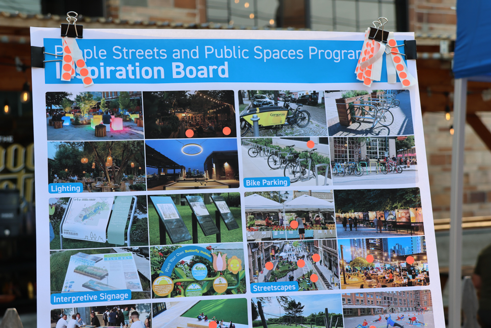
The feedback will be used by the city as an initial step before they begin a more formal design processs. Beyond the feedback process, other light activities were available for attendees as well, such as over-sized street board games and coloring books for kids; refreshments were also available, featuring fruit empanadas from the Salvadorean Bakery in White Center.
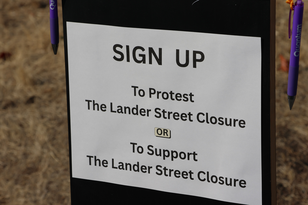
Despite the festival atmosphere, the project proposal did not come without controversy. In addition to what was provided by the city, some community members brought some of their own boards and posters to protest the proposed project. One board offered two sign-up lists, asking attendees to pick a side: “Yes, close Lander Street” or “No street closure”. The latter choice had garnered around 10 signatures already by 15 minutes into the gathering, while the former had no signatures at all in the early going.
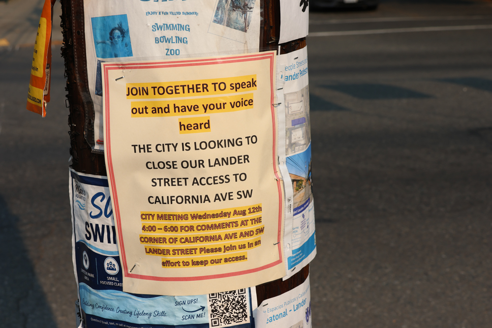
Another poster stapled to a local telephone pole called for neighbors to attend, framing the project as the city cutting off street access to California Avenue.
Words from attendees who spoke to us did not show much more positivity for the project either. “Well, this whole thing sucks!” said one of the attendees, an Admiral resident. “Congestion here is bad, and getting worse. Where are all the parents going to go to pick up their kids? […] The city is doing too much with too little, and too many people.”
People from local businesses and buildings in the block came to share their opinion too. Paul Cesmat, owner of the nearby Admiral Station apartments, came, also delivering a letter to city representatives from the owner of Financial Designs Insurance (in the same block) in absentia. Both of them expressed that the city’s plan would be negligent at best, actively harmful at worst – making it more difficult for emergency vehicles to access the school and commercial block, and increasing traffic congestion for the school: “In my 49 years here, there has never, ever, been an incident with a kid,” Cesmat said. He also expressed frustration with the city’s communication strategy. “There was no real mail notification to the neighbors; just some stuff stapled on the poles.” he said. “Neighbors had to communicate with each other to encourage turnout.”
According to SDOT, there will be more chances for the community to provide feedback through the design process, though dates are yet to be announced. The formal design process will begin this fall, with finalization of a plan expected next winter (early 2027).
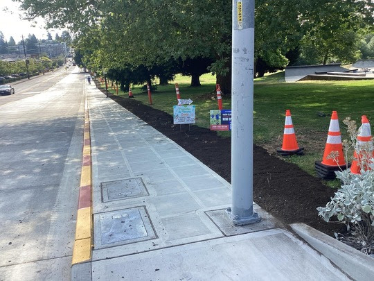
Last week, when SDOT announced the completion of the repaving project in the bus-layover zone on SW Barton alongside Roxhill Park, we learned that Metro wasn’t planning to return buses to their original routes until the spring “service change” next year – even though the Barton completion was announced weeks before the fall “service change” at the end of this month. We asked Metro if that was really true – that a five-month project would be done for seven months by the time it could be put to its intended use – and they said yes, as we reported last Friday. Then today, Metro spokesperson Al Sanders sent an update, saying the buses will likely return to Barton “within a matter of weeks” after all:
The final decision on when the stops will reopen is up to Bus Operations. Bus Operations has said that when they are notified by SDOT’s project team that the work is fully completed, preparations will begin on returning to those stops and ending the reroute.
There is no exact time, but it will likely be within a matter of weeks, depending on the information we receive from SDOT. While it might appear to the public the project is “done” and service can be restored, we want to ensure that our buses are not interfering with any final work that SDOT must complete in their construction zone.
Starting with last spring’s “service change,” the buses that used Barton were rerouted to Trenton because of the repaving work.
 (SDOT traffic camera image in aftermath of Sept. 14, 2024 crash)
In our coverage last week of three consecutive evenings’ low-bridge breakdowns, we noted that SDOT expected to have to close that bridge for repairs. They’ve just announced the dates – but note that only the driving lanes will be closed:
We will close the Spokane Swing Bridge (also known as the Low Bridge) to replace the barrier gate at the bridge’s west side. During this time, people will not be able to drive across the bridge. However, people will still be able to walk, bike, or roll across as we do our work.
When?
Between 7 am Saturday (August 22) and 4 am Monday (August 24)
Why?
As a result of the September 2024 vehicle collision, the entire barrier gate system has been having issues. We will be replacing the barrier gate at the west side of the bridge. We hope to replace the east side barrier gate in the coming months, as we work with the railroad companies to coordinate a time for the work. Stay tuned for more updates in the coming weeks.
This bridge is a crucial link across the West Duwamish Waterway, especially for people walking, rolling, and biking. Thanks to the entire West Seattle community and Low Bridge travelers for being patient.
 (SDOT photo)
4:31 PM THURSDAY: As we noted yesterday, Metro‘s next “service change” is coming up in late August – a time when adjustments are made to bus routes. But even though the SW Barton repaving work is done – early – in the bus layover zone by Roxhill Park, SDOT says buses won’t be using it for another seven months, longer than it was under construction. From the latest SDOT update:
Because construction finished earlier than planned, King County Metro (KCM) was not able to approve the bus service switch in time for the Fall Bus Service Change (which begins August 29). Metro plans to resume permanent bus service and reopen the layover zone in March 2027, restoring the previous stops on SW Barton.
We’re doublechecking that with Metro, which had told us earlier this week that no date was set for restoring bus service to Barton, yet.
ADDED 2:15 PM FRIDAY: We asked Metro spokesperson Al Sanders to explain. Here’s his reply:
King County Metro is very pleased the construction project on SW Barton St was completed in such a timely manner.
While SDOT has finished the project ahead of schedule, Metro’s preparation for the August 29 service change was underway as the work at the location was taking place.
Metro prepares its printed timetables and signage well in advance of each service change period. At the time these materials were finalized for the upcoming service change, the completion date for road construction on SW Barton St was not yet known.
The routes impacted by the construction project were kept on their current locations and stops to avoid the risk of planning service on a roadway that was not yet complete and to ensure customer-facing information remained accurate.
Returning now to the routes used prior to the construction project would require numerous rider alerts to explain detour information. This type of temporary signage could potentially create more confusion and is difficult to maintain during fall and winter weather.
Right now, riders know what to expect. Significant changes right before the service change would be disruptive and confusing. Making the change in March allows the best and most consistent customer information. Metro will send notification well in advance of the service change next March to our riders.
ORIGINAL WEDNESDAY REPORT: Twice a year, Metro has a major “service change” that usually affects dozens of routes. The next one has been announced for August 29, and while the announcement was headlined, “King County Metro announces major service expansion across King County,” West Seattle is going largely without additions/changes this time, with one exception: Route 987 to Haller Lake, paid for by Lakeside School, will now be going to Westwood Village instead of 12th/Cloverdale in South Park. Metro tells us that while the school funds this route, the public can ride it.
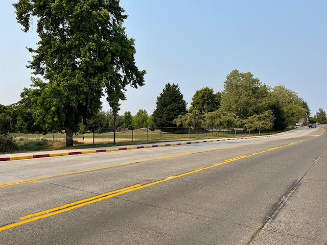
We also asked Metro spokesperson Jeff Switzer about a projected date for returning bus service to SW Barton by Roxhill Park/WWV, since the repaving project is mostly done, and the buses’ reroute was done in connection with the previous service change last spring. He replied:
Routes are still rerouted off of SW Barton Street, and we do not yet have an official return date for Metro service to SW Barton Street, but are working closely with our partners at SDOT. We are not planning for a return to SW Barton at the fall 2026 service change.
If you’re interested in the routes elsewhere that are changing as of August 29, you can find route-by-route info here.
ADDED THURSDAY AFTERNOON: We’ll publish a detailed story about this later, but SDOT now says that though the construction is over, the buses won’t move back until Metro’s March 2027 service change.
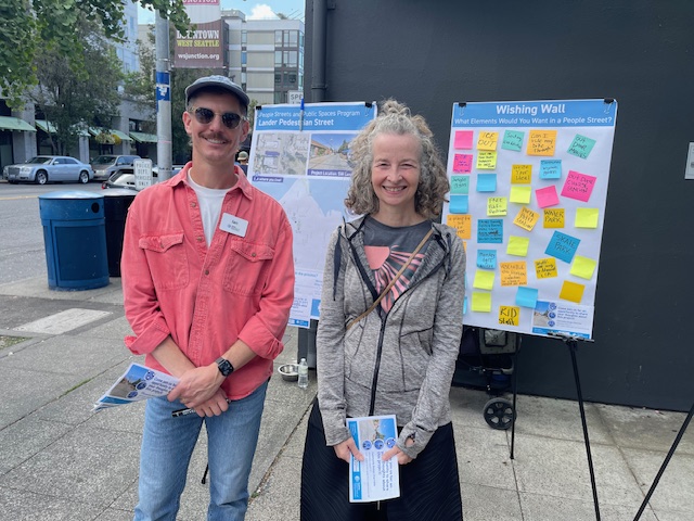
Ian and Nora from SDOT are at the KeyBank corner right now with information about Admiral’s planned Lander Pedestrian Street project. This is for the stretch of Lander between Good Society and Lafayette Elementary. The project is still in the very early stage – not even in the official design stage yet – but SDOT is trying to get word out about it, and this is part of the second phase of public events (here’s the flyer). Next one is Wednesday, August 12, 4:30 to 6:30 at the future project site – a “community design charrette.” We asked the SDOT team if the Good Society’s longtime “streatery” is staying, and they said yes. There’s general info about projects like this on this page of the SDOT website. P.S. If you don’t find them at the corner, they might be moving into a booth at the Farmers’ Market, they told us a short time ago.
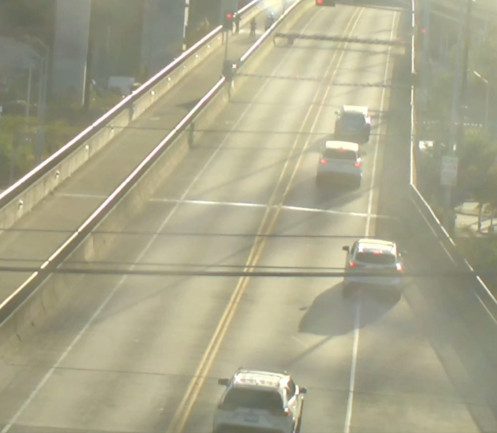 (SDOT camera screenshot during Wednesday night closure)
ORIGINAL REPORT, 3:53 PM: After two breakdowns in two days, SDOT says they know what went wrong with the West Seattle “low bridge” (aka the Spokane Street Swing Bridge) and are making plans to fix it. We inquired yesterday about the Wednesday evening trouble, and added on an inquiry about last night before receiving this response from SDOT covering both:
This week, there have been two unexpected closures of the West Seattle Low Bridge (also known as the Spokane St Swing Bridge) due to mechanical issues with the vehicle gate on the western side of the bridge. The gates did not respond to remote commands from the control tower.
We have plans to replace these gates and are working to schedule the installation. This work will likely require the bridge to be closed to motor vehicles and will take place during the weekend. We will announce the dates of construction once they are determined.
The low bridge has gone through a variety of maintenance and repair work in recent years, most recently during a May closure.
UPDATE, 5:51 PM: Just heard via police radio that it’s down for a THIRD straight night, though bicycles and pedestrians are being let through, vehicle gatesare down.
9:59 PM: According to @sdottraffic, it was back in operation as of shortly after 7 pm.
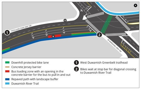
That map is from an SDOT announcement this afternoon that the department has finalized the design of the much-discussed Highland Park Way hill lane-conversion project and could start construction early next year. To describe the final design, SDOT offers these overview points:
Updated Design Highlights
-The curb will not be shifted along the full downhill section
-Semi-permanent concrete barriers will be used instead of a full curb shift to allow flexibility during emergencies
-Improved bike and pedestrian connections throughout the corridor
-New lane layout that maintains traffic flow, slows vehicle speeds, and reduces congestion near W Marginal Way SWFeatures That Remain from Previous Design
-One downhill lane removed beginning at SW Holden St
-Wider, repaved shared-use path with upgraded lighting
The SDOT map above shows the final design for the northeast end of the project zone, the intersection with West Marginal Way SW, which SDOT says now includes:
-Protected bike lane extends all the way to the intersection
-Downhill lane expands to three lanes (left-turn lane and two through-lanes)
-Center median removed to fit the new lane configuration
-One westbound left turn lane removed on W Marginal Way SW
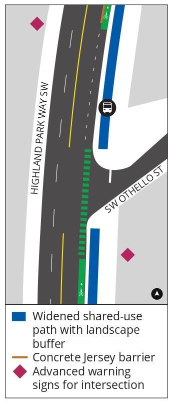
Other sections of the project are detailed, each with a map, on this webpage – here’s one of them, in an area that had been the subject of much discussion, where a residential street meets the downhill lanes:
SW Othello St Area
-Widened shared-use path
-Downhill protected bike lane with jersey barrier opening and bike pavement markings at intersection
-Single downhill travel lane
-Advanced warning signs for intersection
-No centerline markings to indicate turning movements
SDOT says construction will “begin as soon as February 2027.” The idea of removing a driving lane to install a bicycle lane dates back six years, though at the time it was proposed for the uphill side; it was eventually shelved, but resurfaced in a proposal for federal funding in 2022.
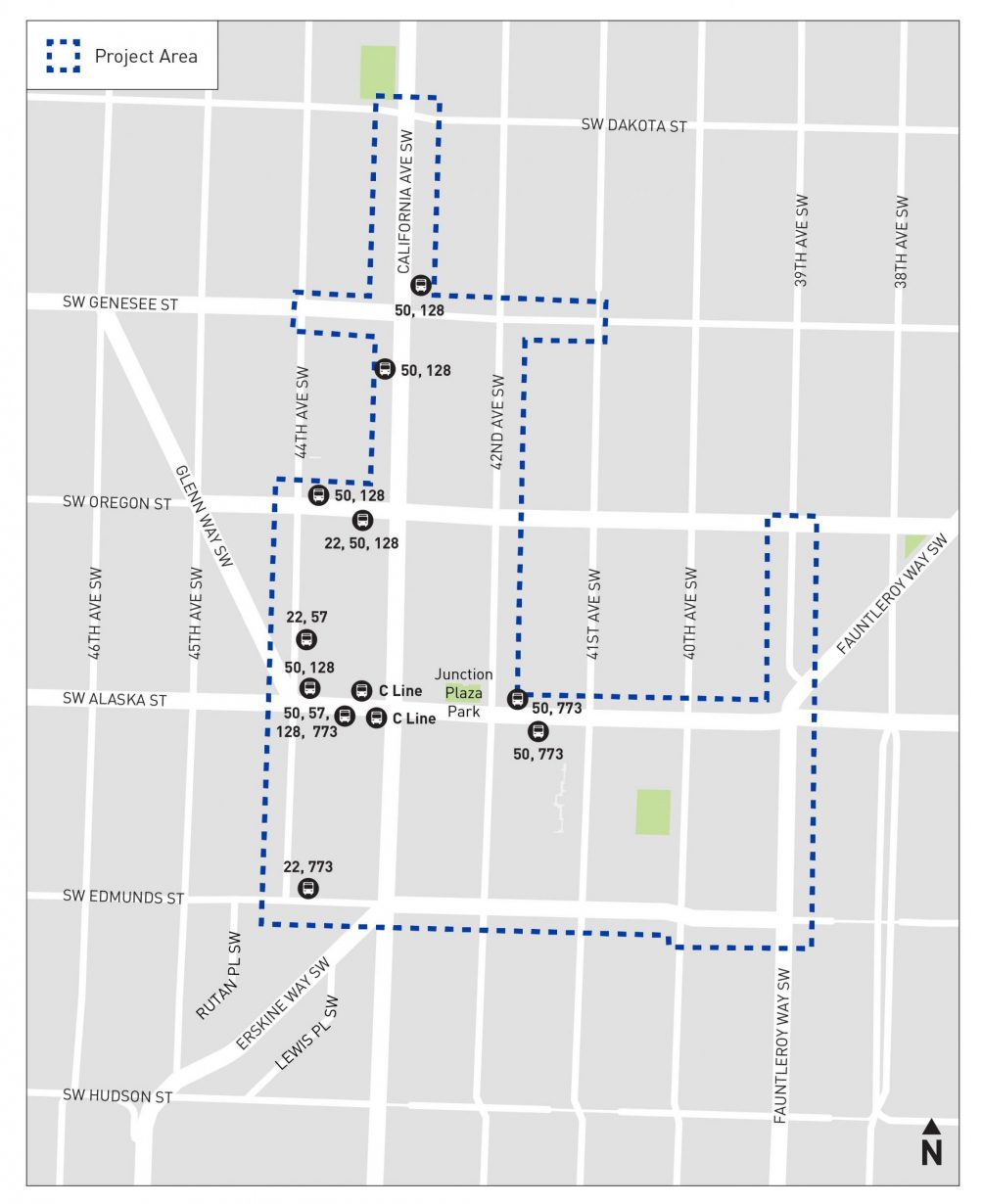
Three weeks after we first told you that SDOT is again studying the possibility of paid street parking in The Junction, here’s a reminder that their community surveys close tomorrow. If you haven’t responded already, you can go to the appropriate link to do that now:
There are three versions of the survey – for Junction businesses here, for West Seattle residents here, and for “visitors” here.
This is the first time in almost nine yearsthat SDOT has revisited the situation. Here’s how they’re evaluating it this time. Survey responses and other feedback, plus data about parking in The Junction and Triangle (the SDOT-provided map above shows the areas of focus), will result in what SDOT describes as “draft recommendations” that it’ll present sometime this fall. SIDE NOTE: Given that some local businesses famously fought paid street parking decades ago, we asked the West Seattle Junction Association whether its board has taken a position on this; short answer, no.
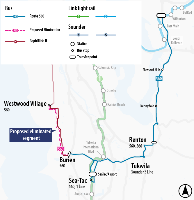
Sound Transit‘s proposed service plan for next year and beyond would drop ST Express Route 560 service to West Seattle, which among other things has been a way for people to get to the airport without transferring. The proposed change is mentioned in the Morgan Community Association‘s newest newsletter, and explained as follows on the ST website:
Route 560 would no longer serve stops in West Seattle, ending at Burien Transit Center. In turn, frequency between Burien and Bellevue would increase as follows:
Weekdays: Every 20 min (daytime), every 30 min (evenings)
Weekends: Every 30 min all day (double current service)
For trips between Westwood Village and Burien, King County Metro’s RapidRide H Line serves all current Route 560 stops in this segment. The H Line runs every 7-15 minutes on weekdays and every 15 minutes on weekends.Burien Transit Center will also be the future western end of the Stride S1 Line, which will replace Route 560 as early as 2028.
Passengers looking to go from West Seattle to Seattle-Tacoma International Airport can take the H Line to connect to Route 560. Passengers can also take King County Metro Route 60 to connect to the 1 Line.
ST is running a survey about this and other proposed service changes; you can go here to participate. Route 560 service to/from West Seattle is already less than it used to be; it used to run to The Junction from Westwood Village, but cut that section in 2013 while increasing frequency of its runs to/from Westwood Village. If the plan to drop West Seattle remains in the ST service-plan proposal, the ST Board would vote on it in November.
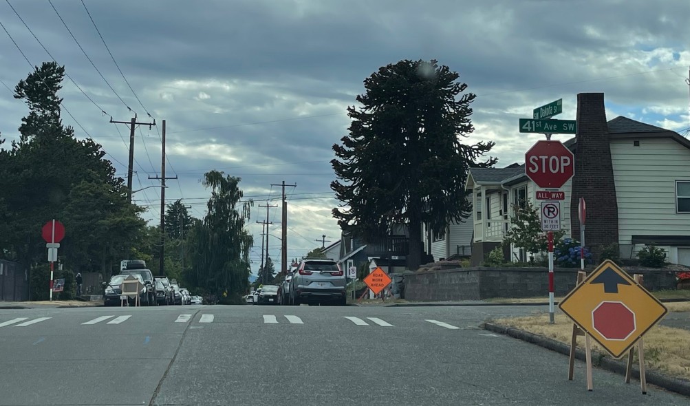
Thanks to reader tips, we’ve reported some recent projects in school zones, such as the 41st/Dakota all-way stop (photo above from last week) and the SW Holden speed bumps. Today, SDOT sent a list of “Safe Routes to School projects either recently completed or under construction this year at West Seattle schools … designed to make it safer and easier for students and families to walk, bike, and roll to school”:
Safe Routes to School Projects (already installed or will soon be constructed in 2026)
Madison Middle School
Convert temporary School Street on 45th Ave SW to permanent with trees, permanent signage, and painted bulbs
Install push-button flashing beacons, crossing islands, and curb bulbs at:
-California Ave SW and SW Hinds St (complete)
-California Ave SW and SW Spokane StRoxhill Elementary
Planted trees (complete) along SW Holden St near E.C. Hughes Park and Roxhill Elementary
Install speed cushions on SW Holden St between 34th Ave SW and 31st Ave SW
Install speed humps on 32nd Ave SW between SW Webster St and SW Kenyon St
Install all-way stops and marked crosswalks at :
-34th Ave SW and SW Kenyon St
-32nd Ave SW and SW Kenyon St
-34th Ave SW and SW Holden St
-32nd Ave SW and SW Holden StHoly Rosary School
All-way stop and marked crosswalks at 41st Ave SW / SW Dakota (complete)Our Lady of Guadalupe School
All way stop, marked crosswalks, and daylighting (i.e., clearly delineating how close to crosswalks people can park) at -SW Myrtle St / 34th Ave SW
Paint and post daylighting at SW Myrtle St / 35th Ave SWArbor Heights Elementary
All-way stops and paint and post daylighting at:
-SW 104th St and 37th Ave SW
-SW 104th St and 37th Pl SW
Paint and post daylighting at SW 105th St between 35th Ave SW and 39th Ave SHighland Park Elementary
All-way stops at:
-10th Ave SW and SW Cloverdale St
-10th Ave SW and SW Thistle St
-10th Ave SW and SW Trenton St
-11th Ave SW and SW Thistle St
-12th Ave SW and SW Cloverdale StFairmount Park Elementary
-Daylighting at Fauntleroy Way SW and SW Brandon StGenesee Hill Elementary
-Daylighting and marked crosswalks at SW Genesee St and 51st Ave SW (complete)Denny International Middle School
All-way stops and paint and post curb bulbs (which will be painted by Denny students and families) at
-27th Ave SW and SW Elmgrove St
-27th Ave SW and SW Kenyon St
The list does not mention the new speed-ticket cameras installed near Alki Elementary and West Seattle High School; we’re asking about their status.
ADDED: Here’s the SDOT reply on that:
The new cameras at Alki Elementary School have finished construction and will begin their required 30-day warning period at the start of the 2026-2027 school year before citations are issued.
At West Seattle High School, both cameras have already completed their required warning periods and activations. Citation enforcement will resume when school begins in the fall.
For the first time in almost a decade, SDOT is taking another look at potentially charging for street parking in the West Seattle Junction. The department announced here that it’s been studying Junction parking again, with possible outcomes including paid street parking. It’s also opened online surveys asking what you think about Junction (and Triangle) parking. Here are excerpts from SDOT’s explanation:
SDOT last studied parking in the Junction in 2017. Since then, the neighborhood has grown, including new housing, new businesses, more outdoor dining, increased food delivery activity, and changing travel habits.
Recent parking study data shows that on-street parking is often hard to find or completely full, especially along California Ave SW and nearby streets.
We’ve also visited the Junction multiple times to talk with people about how they get around.
We heard that while many people drive to the Junction, most people arrive by walking, biking, or taking transit. People shared mixed opinions about how easy it is to find available parking.
We are now asking people who visit, work, and live near the West Seattle Junction to share their feedback so we can better understand parking and loading needs.
Please take our survey by July 27.
We will use what we hear from the community, along with parking data, to develop possible recommendations.
In the fall, we will share draft recommendations with the community for additional feedback to inform a final plan.
…Potential changes could include:
*New time limits or paid parking to make sure customers can reliably find a parking spot
*Accessible parking spaces for people with disabilities
*Load zones for goods deliveries, food delivery services, and rideshare pick-up and drop-off
*Intersection daylighting to improve safety and visibility at crosswalks… Our goal is to make it easier to find parking by encouraging parking turnover. This helps more people access shops, restaurants, and services. We also want to address loading needs for businesses’ deliveries and quick stops.
See the SDOT map above for the project zone; the project website describes it as “California Ave SW from SW Edmunds St to SW Dakota St, SW Alaska St from Fauntleroy Way to Glenn Way SW, and surrounding streets. The project area also includes the West Seattle Triangle Area, including Fauntleroy Way SW from SW Edmunds St to SW Alaska St.” There are actually three versions of the survey – for Junction businesses here, for West Seattle residents here, and for “visitors” here. As noted on the project page, SDOT also will have reps available for Q&A at upcoming events including West Seattle Art Walk, Summer Fest, and the farmers’ markets.
BACKSTORY: Here’s our report on how the 2017 parking study turned out; here’s our report on how the one before that, in 2008, turned out. The Junction used to have privately owned lots with free-parking but that ended five years ago.
Thanks to David for the tip. SDOT has changed another intersection in West Seattle to a 4-way stop – this time, 41st SW and SW Dakota on the northeast edge of The Junction. It’s close to schools (Holy Rosary and Tilden), as are many of the newest 4-ways.
Washington State Ferries says that, after a day and a half out of service, M/V Kitsap will be back up and running tomorrow, so the Fauntleroy-Vashon-Southworth run will return to three-boat service in the morning. Kitsap will be the #3 vessel, WSF says.
3:18 PM: M/V Kitsap is out of service, and that’s led to some cancellations on the Fauntleroy-Vashon-Southworth state-ferry route. No ETA for its return. Check the alert page for updates.
6:24 PM: WSF says it’s expecting Kitsap to be out at least though tomorow so it “will operate the three-boat schedule with vessels #1 and #2.”
While the Seattle City Council reviews the mayor’s proposal to double the sales-tax share that buys more bus service from King County, their counterparts have just voted to approve a separate sales-tax increase to raise money for road repairs. The King County Council, meeting as the County Transportation District Supervisors, voted in favor of “a new 0.1% sales tax for King County that will raise approximately $100 million annually, with 87.5% dedicated to long-overdue investments in King County Roads,” according to the post-vote announcement. The rest would go to King County cities, Seattle included. But White Center and other unincorporated areas – in which the county is accountable for 1,500 miles of roads – will be the main beneficiaries.
Unlike the City of Seattle’s proposed sales-tax increase for transit, this county sales tax does not require voter approval. It will be collected starting January 1, 2027. Today’s yes votes included our area’s King County Councilmember Teresa Mosqueda, who said in a statement:
… Today’s action provides much needed relief for unincorporated roads, bike lanes and sidewalks to be built on the horizon. Whether a person is driving a vehicle, riding the bus, walking, rolling or biking – we all deserve to be safe and protected from undo injury or death due to failing roads infrastructure. Today’s vote keeps the majority of funding focused on investments in unincorporated areas while also investing in the transportation needs of our regional cities – creating a more connected, safe and accessible transportation infrastructure across our region. The measure also calls for the County to continue to pursue a robust Transit measure to complement this investment in roads with additional alternative modalities to driving.”
Through the end of this year, 0.15% of the sales tax you pay funds the voter-approved Seattle Transit Measure. That would double to 0.30% if the City Council and Seattle voters approve the renewal/expansion that Mayor Katie Wilson officially introduced this afternoon. She said it’ll make living in Seattle more affordable by enabling more people to “live car-free or car-light.” She acknowledged that raising the sales tax isn’t ideal but noted that it’s one of the few revenue-raising tools available under state law. Besides paying for more transit – 280,000 additional Metro bus trips a year, 100,000 more than the current measure funds – it also would pay for 22,000 free ORCA transit passes, more than double what the city provides now, said acting SDOT director Angela Brady during the announcement event at City Hall. The passes are now available to Seattle Promise scholars, low-income Seattle Preschool Program families, and Seattle Housing Authority residents. The measure’s renewal/expansion would also make those passes available to Housing Choice Voucher participants.
The mayor’s announcement says the Transit Measure isn’t just about buses: It also would “support the design and delivery of Sound Transit’s West Seattle Link Extension, Ballard Link Extension, and Graham Street Station.” The 0.30% sales tax would generate an estimated $138 million average per year for the 10 years of this measure, which is proposed to go to voters in November. Council review starts this Thursday and will be led by District 1 City Councilmember Rob Saka, who chairs the council committee that oversees transportation. We’ll add the specific text of the proposal when we get it; the slide deck for Thursday’s council meeting is now available, and we’ll add some highlights from that soon.
(Added Wednesday: WSF recording of meeting)
By Tracy Record
West Seattle Blog editor
If you’re interested in Washington State Ferries, you have another chance to join one of its systemwide online community meetings – tonight at 6 pm. We watched the first version of the meeting this afternoon – here’s how it unfolded:
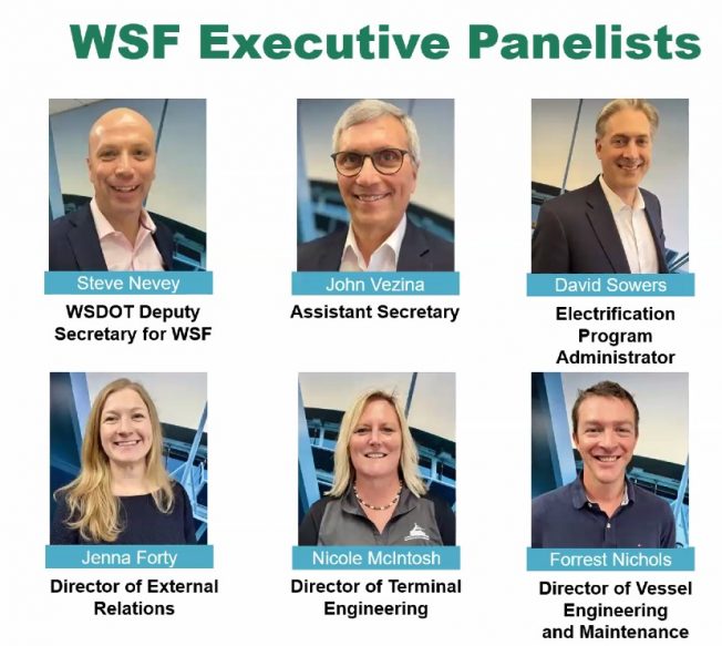
WHO WAS THERE: Above is the slide identifying the system executives participated. As for those in attendance, 60 people were reported to have signed in as the meeting began. They were polled about their routes of interest; Fauntleroy-Vashon-Southworth came in at 19 percent.
UPDATES: Ferries boss Steve Nevey was first up. He started with the system’s 75th anniversary on June 1 – that date in 1951 is when, he said, “the state decided to take over the service.”
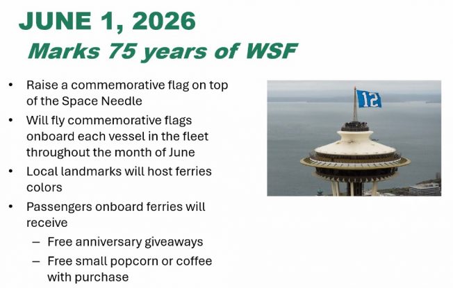
WSF has a variety of anniversary events planned including special flags to fly on the ferries and even one atop the Space Needle. Free small bags of popcorn and cups of coffee will be offered (with purchases) in the galleys on Monday, and various giveaways are planned throughout the month.
Next, he updated employment stats – deck and engine staffing are among the categories improving, Nevey said:
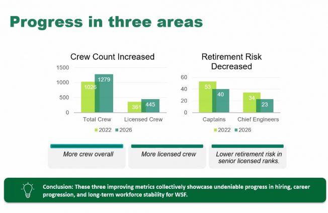
The percentage of “retirement risk” in key crew categories is down, too – among captains, from 53 percent to 40 percent; among chief engineers, from 34 percent to 20 percent. “We’re really encouraged by the way we’re trending in these areas. … I feel like we’re really getting our arms around our workforce issues.” Cancelled sailings because of short staffing are “way down,” he emphasized.
Next up, Jenna Forty on the updated Service Contingency Plan (read it here):
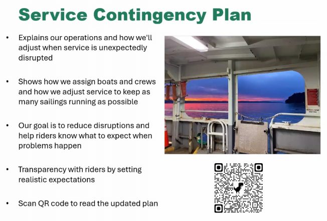
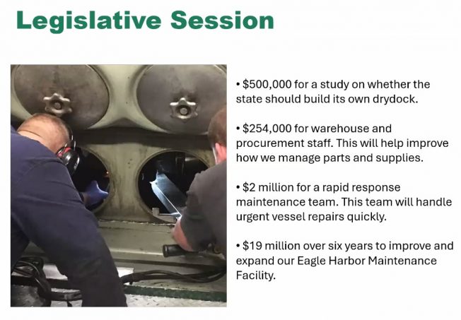
“With 21 vessels … we really don’t have a margin of error.” She didn’t get into specifics of the plan, just noting that it’s meant to help ensure riders know what to expect. She also had several notes from the Legislature’s session, including securing $2 million for a “rapid response” maintenance/repair team to get ferries fixed faster.
On to the World Cup plan, addressed by Forrest Nichols:
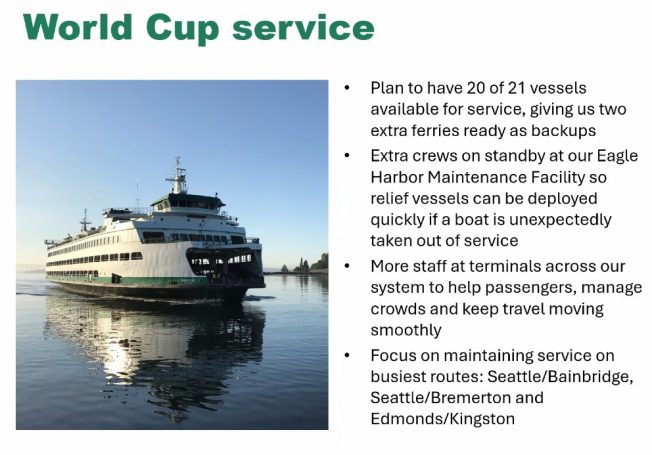
The summer schedule calls for 18 boats, so having 20 ready means they’ll have two on standby to quickly plug in, in case of unexpected trouble, Nichols said.
Next, David Sowers updated the system-electrification program, both terminals and vessels, stressing the need to push forward with what’s ultimately a system-modernization plan:
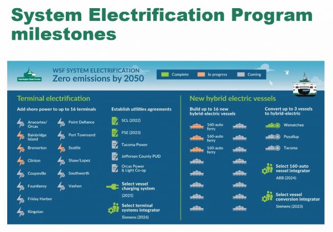
As for the new ferries being built in Florida, the next year will be spent finishing the design for the first vessel, and steel cutting will start in August 2027, with “that first boat arriving in Puget Sound in 2030.” WSF has issued a Request for Qualifications for its first terminal electrification projects, using the design-build process, and hopes to have one slip electrified as soon as 2029.
TERMINAL PROJECTS: Nicole McIntosh presented these updates. They included projects that were under way or recently completed. Only one Fauntleroy mention, and it was brief – she said the intersection project, where the dock meets Fauntleroy Way, is now advertising for bids and still expected to start work this fall.
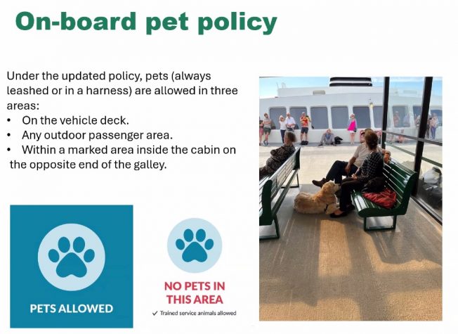
OTHER UPDATES: The system’s second-in-command, John Vezina, recapped the recently finalized pet policy.
He also said – without accompanying slides – that WSF had made a wrong choice of vendors for a ticketing-system update, and spent a lot of money in the process; how much, he said, they’ll be disclosing (“it’s all public record,” he said more than once), but in the meantime, they’ll be seeking a new partner. “We stopped, we’re reassessing.” (This appears to be a reference to the situation detailed in reports including this one.)
He switched gears to the state of trying to get wi-fi on boats and at terminals. They’re testing it “with T-Mobile and another partner” on M/V Chimacum for starters and will soon have a test at the Bremerton terminal too; others will follow, after an evaluation period at year’s end.
Q&A: This was the second half of the meeting, starting at 12:39 pm. (We’ve noted the Triangle Route-related questions in bold type.) First question: “Could ferry system be split into two parts, the San Juans and (everywhere else)?” Forty replied: “In short, no.”
Second question had to do with the reservation system, which doesn’t involve this area … Third question, how long will M/V Puyallup be on Bremerton route? Answer, it’s filling in while M/V Kaleetan is out for work that may not be complete until fall, but it will likely move back to Edmonds-Kingston in late June … Fourth question involved how they’re planning to ensure charging systems for vessels will work with their vessels; answer was technical … Fifth question, how will service be disrupted during Fauntleroy terminal construction? McIntosh said they’re working on that, nothing to say yet … Sixth question, canceled sailings info has disappeared from weekly updates, when will it return? They’re working on a data issue, was the reply … Sixth question comes up every time – when will the route to Sidney B.C. be restored? Nevey said the answer remains 2030 … Seventh question, classification of new vessels – SOLAS-compatible? Not likely, was the reply; WSF has only one that is, M/V Chelan … Eighth question had to do about budgeting and money that has to be spent on the electrification program and cannot be diverted elsewhere; Forty noted that the Legislature sets a lot of parameters for what WSF gets/can spend … Ninth question, what will the Triangle Route run for the World Cup time? They expect to keep three Issaquah-class ferries on the route through July … Tenth question was about electrification on a north route …
Eleventh question was about battery-fire concerns aboard an electrified boat; a regulatory process oversees everything, was the reply, and they have sensors and systems that would address that – the technology is “well established” around the world so standards for construction and installation of batteries have been refined. They don’t believe a fire “would go beyond the individual cell” as a result … Twelfth question was about a Bainbridge roundabout … Thirteenth was about fares, with a reiteration that the state Transportation Commission makes those decisions … Fourteenth was about World Cup service; WSF believes the plan outlined earlier in the meeting allows “more resources” to reduce or eliminate service disruptions … Fifteenth question had to do with verifying people’s eligibility for certain fare levels and the fact some discounted levels are not available via kiosks … Sixteenth was a Lopez Island reservations question … Seventeenth also involved the San Juan Islands … Eighteenth question, why can’t residents be prioritized for service/fares? Vezina said the Legislature sets the revenue levels that WSF must bring in – right now customers pay what amounts to 55 percent of the costs, and the other 45 percent comes from taxpayers, so fares and service have to be equal for everyone … Nineteenth question, what about integrating Good to Go with WSF? Forty said they’re looking at it, and also at possible integration with ORCA … Twentieth question, signage/announcements on the boats regarding civility “We Sail Together”; Vezina said it’s important because employees have been targeted by abusive language. Yes, it’s frustrating when something isn’t working well, but there’s no reason to do that to employees. “Showing gratitude to the people who show up each day to get you where you need to go” is appreciated, he added.
Twenty-first question was about San Juans service … Twenty-second question had to do with legally required loading procedures … and the meeting wrapped at 1:15 pm. You can get the link for the 6 pm meeting here; that same page will eventually have video from the meetings.
Two Washington State Ferries notes:
TICKETING TROUBLE: According to the WSF alerts/bulletins page, “Vehicle reservations, Wave2Go ticketing and terminal ticket sales and redemptions are offline due to a systemwide outage. … Please allow extra time for payment processing at your departure point.” No ETA for a fix. (6:45 PM: Working now, as of early evening, reports WSF.)
ONLINE MEETINGS TOMORROW: Two chances for updates and Q&A with WSF senior management tomorrow (Tuesday, May 26) during the periodic systemwide community meetings – both to be held online, noon and 6 pm. You can go here to get the link for participation in either meeting (or both, though they say the presentations will be identical).
 (WSF file photo)
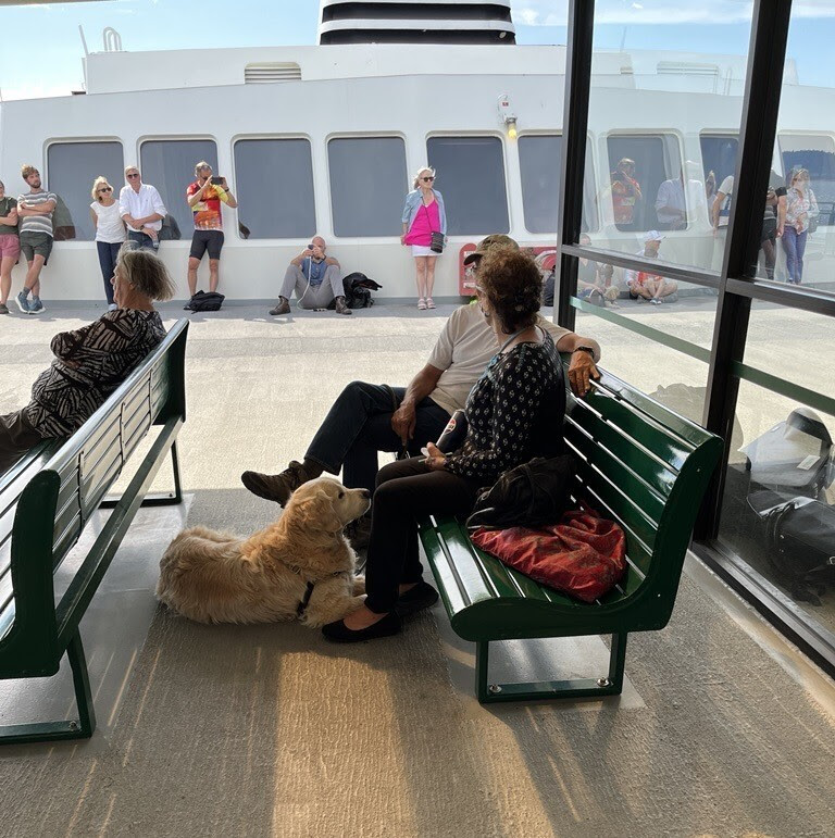
After a nine-month trial, Washington State Ferries‘ revised pet policy is about to be finalized. WSF announced the details and timeline today:
Updated pet policy
Just ahead of the holiday weekend, WSF will begin a six-week education and transition period to help people learn the new rules before they take effect on July 1. By that date, onboard signs will be installed showing where pets are allowed and not allowed. Pet waste stations also will be added, as owners are responsible for cleaning up after their animals.
Under the updated policy, pets are allowed in three areas:
-On vehicle decks
-In outdoor passenger areas
-In marked areas inside cabins on the opposite end from the galleyPets are not allowed in the galley or on passenger seating and tables. They also cannot stay inside the cabin on the galley end of the vessel. Pet owners may pass through this restricted area but must take the most direct route and not stop.
If a pet is not under control or is not cleaned up after, a crew member may ask the owner to move the pet to the vehicle deck or an outdoor area. Service animals are allowed in all areas, as required by law. Livestock must stay in proper enclosures at all times.
“Our updated pet policy builds on a trial that began last summer, when pets were allowed in most passenger areas except galleys and on indoor seats,” said WSDOT Deputy Secretary for WSF Steve Nevey. “We heard from employees and customers. Some supported the trial, while others had concerns about cleanliness, safety and enforcement. This updated policy strikes a balance by allowing pets in certain areas while addressing those concerns.”
Got questions? The systemwide online community meetings next Tuesday would be a good time to ask.
Two “People Streets/Public Spaces“ projects are planned in West Seattle – same ones mentioned here briefly after SDOT released a list of levy-funded 2026 projects – and drop-in informational events are planned at both in the next several days:
At 18th/Delridge, 9:30 am-11:30 am tomorrow (Saturday, May 16):
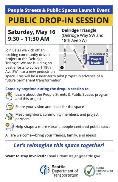
(Neighbors first mentioned this in a comment discussion after the recent shooting at an encampment on the city-owned land in the vicinity.)
The second one is 2:30-5:30 pm Tuesday (May 19) at The Good Society (California/Lander):
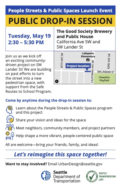
The stretch of Lander alongside Lafayette Elementary has history as a “school street,” which is what the flyer is alluding to by noting “past efforts.”
When WSDOT announced Monday that it would close the northbound 1st Avenue South Bridge all weekend again, starting this Friday night, though one area bridge – the West Seattle low bridge – already had an all-weekend closure planned, we asked SDOT if the latter was still on. We had already asked what time the low-bridge closure would start, as the original announcement was just “May 16-17.” Here’s the statement we got this afternoon with answers to both questions:
The Spokane St Swing Bridge (also know as the West Seattle Low Bridge) will be closed to all vehicles starting at 7 a.m. Saturday, May 16 and reopen by the morning of Monday, May 18. People on bicycles and walking will still be able to use the bridge, although there may be more bridge openings than usual due to the maintenance work.
We have been working closely with WSDOT to coordinate around their planned construction on the First Ave S Bridge. The work on Spokane St Swing Bridge will continue as planned because it is not a detour route for the First Ave S Bridge and the West Seattle High-Rise Bridge has enough capacity to carry the increased traffic volumes of people affected by both closures.
SDOT says it’s closing the low bridge to drivers so it can “replace the tail lock cylinder, motor, and hydraulic pump.”
| 0 COMMENTS