
West Seattle, Washington
11 Tuesday
 (Photo by Chris Frankovich)
A colorful end to a day blanketed in white. No new weather alerts currently but the temperature could be in the upper teens by morning, according to the updated forecast.
 (Photo by David Hutchinson)
You’ve probably heard talk that more snow might be on the way later in the week. The newest National Weather Service “forecast discussion” says it’s too soon to say for sure but it’s not likely before Friday.
 (Photo by Lynn Hall)
But in the short run, two sunny days are expected – so we might see more scenes like these. First: Our Tuesday weather/traffic/transit/schools/etc. watch will get going by 5 am.
TUESDAY SCHOOL ANNOUNCEMENTS SO FAR: Seattle Public Schools 2 hours late CLOSED … Holy Rosary 2 hours late … Seattle Lutheran HS, 10:30 am start … Hope Lutheran, 2 hours late … Westside School, 10:15 am start … Explorer West Middle School 2 hours late … Highline Public Schools, 2 hours late … South Seattle College, 11 am start … Our Lady of Guadalupe, 2 hours late … Holy Family, 2 hours late … A Child Becomes Preschool, 10:15 am start
 (2:45 pm photo, SDOT plow heading NB on California from Thistle)
2:04 PM: We’re starting our PM traffic/weather/etc. updates, as this was just announced:
 (Added: Seacrest photo by Matthew Olson)
WEST SEATTLE WATER TAXI CANCELED: North winds are still a problem at Seacrest, so no PM service.
Other transportation notes:
METRO STILL ON SNOW ROUTES: Check yours here.
SEE WHERE SDOT’S PLOWED/DEICED: Here’s the “winter response” map.
WSB TRAFFIC-CAM PAGE: See it here.
3:57 PM: Though the snow stopped falling earlier this afternoon, the weather has new hazards ahead – the temperature remains below freezing and is expected to drop into the low 20s overnight. The city has issued this alert about preventing your pipes from freezing.
Road-wise, the city alert map mentions a few closures in West Seattle – including Ferry between California and Harbor, and Lander from Admiral to 56th.
4:14 PM: FIRST SCHOOL ANNOUNCEMENT FOR TUESDAY – Seattle Public Schools is tentatively planning to open 2 hours late tomorrow, with buses on snow routes.
4:20 PM: Metro alert – the 57 that should have just left downtown is not running.
4:29 PM: New Metro alert – the 5:30 pm Route 56 to WS won’t run.
4:33 PM: Reminder that residential trash/recycling/composting pickup is delayed a day for everyone, all week – here’s the newest info from SPU.
4:46 PM: Holy Rosary School is tentatively planning to start 2 hours late Tuesday, no AM BASE, no AM preschool.
5 PM: Seattle Lutheran High School plans a 10:30 am start Tuesday. … Highline Public Schools will start 2 hours late. … Hope Lutheran will be 2 hours late … Explorer West Middle School will start at 10. (Again, check back early tomorrow morning in case there are changes.)
5:55 PM: Westside School will start at (corrected) 10:15 am Tuesday.
6:03 AM: Not related to the weather but many are asking, so – the TV helicopters over White Center are there because King County Sheriff’s Office deputies are trying to talk a domestic-violence suspect out of the Subway shop near 16th SW and SW 104th – we have updates on White Center Now.
6:46 PM: Here’s the West Seattle/Fauntleroy YMCA (WSB sponsor) current plan for Tuesday, from executive director Shalimar Gonzales:
Due to the freezing temperatures and driving conditions, we will delay our opening to 10am on Tuesday, February 5th at both West Seattle and Fauntleroy location. Below are some additional updates that may impact people’s visit to the Y:
All morning swim lessons are cancelled
Group Exercise classes will start at 11 am
WS Kids Corner will operate with limited staffing, Fauntleroy Kids Corner will be closed
7:29 PM: Be careful outside tonight, whether walking, driving, riding – multiple reports of VERY icy streets and walkways. … Also just hearing scanner traffic about police blocking all lanes at Delridge and Spokane, though we didn’t hear why.
ADDED 9:47 PM: More Tuesday school announcements:
–South Seattle College (WSB sponsor), “opening delayed until 11 am on 2/5/19. Classes starting before 11 am are canceled/offices are closed.”
–Our Lady of Guadalupe, “tentative 2-hour late start … no morning EDC or Spanish class.”
–Holy Family Bilingual School, tentatively planning 2-hour-late start, no AM preschool.
–A Child Becomes Preschool (WSB sponsor), delayed start, 10:15 am.
10:35 PM NOTE: With postseason high-school-basketball games canceled tonight, three local teams’ games have been rescheduled:
-Chief Sealth girls @ Cleveland, 7 pm Tuesday
-Chief Sealth boys @ Bainbridge, 5:45 pm Tuesday
-Winner of that game plays @ West Seattle 7 pm Wednesday
The WSHS girls are still scheduled to host Franklin at 7 pm Tuesday.
ADDED TUESDAY MORNING: Our new updated school list is in progress here.
 (Added: Scene photo shared by Ray in comments)
1:28 PM: Thanks for the tips about an emergency response in Arbor Heights. According to SFD radio communication, a 14-year-old boy was hurt in a collision with a car while sledding at/near 35th SW and SW 110th. His injuries were not believed to be life-threatening and he was described as “awake and alert,” but he is being taken to Harborview Medical Center. Streets are blocked near the intersection while police investigate.
ADDED TUESDAY MORNING, 8:04 AM: The driver is under investigation for possible DUI.
10:48 AM: SPD has posted the case on its blog-format “blotter”:
A 14-year-old boy sustained a head injury after he collided with a car while he was riding a sled down a hill in West Seattle yesterday. The 20-year-old driver of the car was later arrested and booked into jail for DUI.
On Monday, at approximately 1:00 pm, a Ford Focus was traveling southbound on 35th Avenue SW approaching SW 110th Street when the 14-year-old on the sled entered the intersection. The 20-year-old male driver of the Focus attempted to brake, but the vehicle continued to slide on the icy road and the Focus and sled collided, causing the injury.
The driver called 911 reporting the collision. Officers arrived, along with the Fire Department. The driver was evaluated at the scene and was later arrested for suspicious of DUI (marijuana). The 14-year-old was transported to HMC where he is recovering.
The driver of the vehicle was later booked into the King County Jail. This remains an active and on-going investigation.
Before we get to the part of the day where everyone will start looking ahead to tomorrow … some snowy scenes.

Greg Harrington sent that photo of a hummingbird, explaining, “This poor guy was under some cover on my back deck hoping the feeder won’t freeze.” Do remember to thaw some water for the birds, too. … From North Delridge, Joy Patman captured the beauty of Youngstown Cultural Arts Center against the snow:
(MONDAY SCHOOL INFO: Local closures/changes are ALL LISTED HERE)
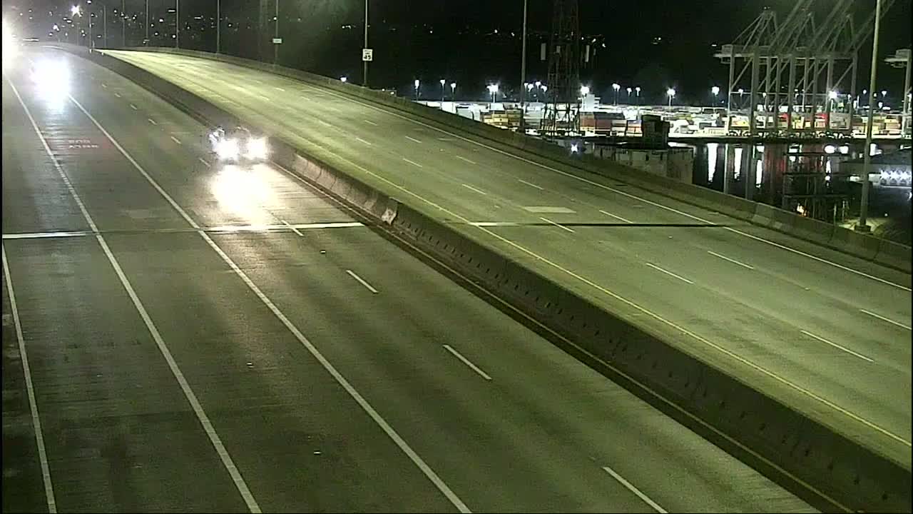

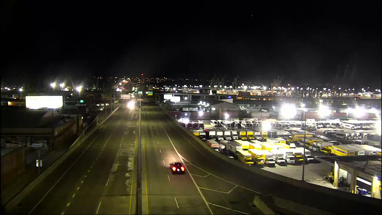
5:53 AM: Snow continued overnight. We’re under a Winter Weather Advisory until 10 am. Here are key links/updates for starters:
Transit/other transportation (updated 8:25 am)
METRO: All buses on snow routes – info here
RIDE2: Canceled today
HIGHWAY 99 TUNNEL: Open
WATER TAXIS: Some West Seattle runs canceled (Doc Maynard is sailing, per Water Taxi Watch); all Vashon runs canceled
SDOT WINTER WEATHER MAP: See it here (shows treated/plowed routes)
SDOT TRAVELERS’ MAP: The map we regularly feature
OUR TRAFFIC CAMS PAGE: Cameras particularly relevant to WS and vicinity
Other changes (updated 9:36 am)
No residential solid-waste pickup today, per Seattle Public Utilities – full details here
West Seattle/Fauntleroy YMCA: BOTH LOCATIONS CLOSED TODAY (2nd update)
Seattle Parks – some closures; here’s the roundup
Seattle Public Library facilities that usually open at 10 will open at noon (Southwest, Admiral); added – Delridge closed
Neighborcare High Point closed
City of Seattle: Here’s the latest
King County offices/services – some closed, some late (update)
We’ll keep adding to those lists and add incident etc. info below as the morning continues.
6:47 AM: Metro has sent two alerts about Route 37, saying the 5:48 and 6:44 trips didn’t run this morning. As noted above, all buses are on snow routes. And it’s still snowing.
6:53 AM: Just in via text – WEST SEATTLE WATER TAXI CANCELLATIONS: Because of high winds at Seacrest, the 6:50, 7:25, 8, 8:35, 9:10 runs have been canceled.
7:11 AM: We’re continuing to add to the lists above as info comes in – cancellation of residential trash (etc.) pickup for today is the latest change. Overall, in terms of getting around, remember that side streets generally are NOT plowed/treated – Michael reports the ones he’s been on are VERY icy – this is NOT the typical Seattle snow situation where the snow is followed almost immediately by warmer weather.
7:26 AM: Streets where the “closed” signs go up on days like these generally won’t show up on any official maps, so in general, beware West Seattle’s many hilly streets – for reasons like what Brian describes in this comment.
7:48 AM: Lots of reports of bus trouble this morning – see comments. And this photo’s just in from under the bridge:

7:58 AM: And a belated alert from Metro saying Route 55’s 6:31, 6:48, 7:30 trips didn’t operate.
8:41 AM: Now a Metro alert saying the 775 Water Taxi shuttle isn’t operating this morning. Update – 14 minutes later, Metro sent updates saying 773 and 775 WILL operate … If you’re even thinking about going out, please note that the wind’s blowing snow around and the temperature’s in the 20s, unlike the “typical” Seattle snow day on both fronts. Here’s a photo showing wind-fueled waves on the Alki promenade earlier (high tide was three hours ago), from Mike Livdahl:

(James Tilley sent one too – we tweeted it.) Thanks to everyone who’s sent other photos – we’ll be putting together a gallery a bit later, when we get past the commute (for those who absolutely have to) etc. period. … Just in, another update from the West Seattle/Fauntleroy YMCA (WSB sponsor) – now both locations are closed for the day.
8:58 AM: The Winter Weather Advisory has just been extended through 1 pm. Still snowing.
9:22 AM: Seattle Parks has posted its closures/changes list. See it here (also added to our list above).
11:11 AM: About 40 homes are without power since just before 11 am toward the end of Roxbury. A separate, larger outage in North Highline and North Burien south of there is going on six hours now. Updates on the SCL map … Still lightly snowing. We’re going to get a gallery going shortly but first, there are a few non-snow news stories we need to publish next. Thanks again for all the tips, reports, comments, and other info!
UPDATE – TUESDAY MORNING INFO: If you find this story while looking ahead to TUESDAY, see the top of our Monday PM updates for what’s been announced so far.
============================================================
EARLIER – MONDAY MORNING INFO: As the snow continued overnight, some changes and additions so far this morning. We’ll continue adding to this list (most recent update 8:29 am):
SEATTLE PUBLIC SCHOOLS: Closed today (update from last night’s announcement)
HIGHLINE PUBLIC SCHOOLS: Closed today (update)
SOUTH SEATTLE COLLEGE: Closed today, all classes/activities canceled (update)
SEATTLE LUTHERAN HIGH SCHOOL: Closed today (update)
WESTSIDE SCHOOL: Closed today
EXPLORER WEST MIDDLE SCHOOL: Closed today
HOLY ROSARY SCHOOL: Closed today, no BASE
HOPE LUTHERAN SCHOOL: Closed today
OUR LADY OF GUADALUPE SCHOOL: Closed today
HOLY FAMILY BILINGUAL SCHOOL: Closed today
WEST SEATTLE MONTESSORI: Closed today
KENNEDY CATHOLIC HIGH SCHOOL: Closed today
VASHON ISLAND SCHOOL DISTRICT: Now closed today (update)
Also:
A CHILD BECOMES PRESCHOOL: Closed today
FAUNTLEROY CHILDREN’S CENTER: Closed today
LEARNING WAY DAY CARE/SCHOOL: Closed today
COMMUNITY SCHOOL OF WEST SEATTLE: Closed today
WORLD KIDS ACADEMY: All locations closed today
COMETA PLAYSCHOOL: Closed today
WEST SEATTLE CO-OP PRESCHOOLS: All closed today
LITTLE PILGRIM SCHOOL: Closed today
Open:
TILDEN SCHOOL (as always – if you can get there safely!)
Thanks for these FYI’s as well
HIGHLINE COLLEGE: Closed today
UNIVERSITY OF WASHINGTON: Closed today
SEATTLE UNIVERSITY: Closed today
Earlier announcements are in our coverage from last night but what’s above supersedes whatever was announced last night. Please call/text us with additions at 206-293-6302.
(MONDAY SCHOOL CHANGES: Update – see separate story)
 (Added: 4:40 pm in Morgan Junction, photo from Tamsen Spengler)
FIRST REPORT, 3:10 PM: Thanks for all the reports! We’ve seen some of the first light snow ourselves, traveling on Roxbury after leaving a meeting. We’ve also seen evidence that SDOT has been out treating the roads. More coverage to come!
3:28 PM: We’re in The Junction and it’s a steady snow shower. Not yet sticking.

3:44 PM: In south Morgan Junction, it’s sticking on cars and planting strips/yards. Getting similar reports in comments and via Twitter from other areas.
4:32 PM: Continuing to snow lightly. The updated forecast projects about an inch tonight, maybe another inch tomorrow morning. We’ll be watching weather and traffic (roads are bare and wet now – see cameras here) throughout the night and into the morning – if you see something we should know about, our 24/7 hotline (text or voice) is 206-293-6302.


6:05 PM: While the roads were bare and wet just over an hour ago, when we took the picture above this line, that’s changed – at least on side streets:
7:31 PM: Driving home from a Super Bowl party? Be careful. Snow has stopped for now, and no major road problems are reported, but temps are close to freezing and we might see ice as they drop further. No official total yet but Kristina, near West Seattle Nursery, sends this measurement:

7:55 PM: Update from here in Upper Fauntleroy:
Snowing again. Plus @seattledot snowplow sighting pic.twitter.com/cwJE07PRAy
— West Seattle Blog (@westseattleblog) February 4, 2019
8:08 PM: New weather alert – Winter Weather Advisory saying at least another inch of snow is likely.
8:43 PM: Regarding buses – “Metro currently plans to pre-chain most of the bus fleet as a precaution prior to the AM commute. (But) We don’t yet know whether buses will shift to snow routes.”
9:16 PM: From the West Seattle/Fauntleroy YMCA (WSB sponsor):
WEST SEATTLE AND FAUNTLEROY DELAYED OPENING ON MONDAY: Due to the overnight weather advisory predicting 1-3” of snow, both our West Seattle and Fauntleroy locations will open at 9am on Monday. There will be no AM Kids Corner at Fauntleroy YMCA. All school based programs will follow the SPS weather schedule (no decision has been made by SPS yet).
9:23 PM: Now the school announcements are rolling in. We will start a separate story for these soon but first we’ll add them here:
Hope Lutheran School, closed, no preschool/extended care
Seattle Lutheran High School, 10:30 am start
Highline Public Schools, 2 hours late, morning/afternoon classes canceled for preschool and ECEAP.
Vashon Island School District, 2 1/2 hours late.
(NOTE: PLEASE SEE THIS NEW MONDAY MORNING LIST FOR SCHOOL INFO)
ADDED 10:06 PM: Seattle Public Schools, 2 hours late, buses on snow routes, other details here, including:
o door-to-door service. No preschool or Head Start. No out of district service. No taxi cab, therapy, partial day or shuttle transportation. No before school activities. Check with your school regarding athletic events. Check with your childcare provider about child care.
ADDED 10:21 PM: South Seattle College starts at 10 am. Classes scheduled to start earlier are canceled.
12:42 AM: No additions to the list yet.
5:04 AM: Changes are coming in, including SPS now CLOSED for today. We’re starting a list here. Call or text us at 206-293-6302 with school (and other) info.
The newest Special Weather Statement is still projecting snow showers as a possibility Sunday night into Monday:
There is a threat of lowland snow showers across Western Washington beginning Sunday afternoon in Whatcom county and spreading to the remainder of Western Washington Sunday evening as a cool and moist weather system tracks over the region. Snow levels will be close to sea level. Given the showery nature of this system, snow amounts will not be uniform with heavier accumulations possible in stronger showers. Showers will decrease Monday morning as the system exits south of the area.
Weather analyst Cliff Mass also thinks we’ll see some flakes.
5:35 PM: “For snow fans out there from the Puget Sound eastward, the … model solutions are not what you wanted to see for Sunday night.” So says the National Weather Service in its latest “forecast discussion,” and that’s why the NWS has lifted the weather advisory suggesting some Sunday night/Monday morning snow. It’s not entirely out of the realm of possibility, but the NWS thinks the moisture isn’t likely to meet up with the cold temperatures. By the way, tomorrow – when more than 100,000 people will be outdoors at the viaduct/tunnel celebration – is expected to be partly sunny!
6:31 AM SATURDAY: But wait! A new Special Weather Statement with a renewed projection of potential snow showers Sunday afternoon into Monday!

ORIGINAL REPORT, 12:07 PM: Thanks to John Laspina for the view of Mount Rainier, the Moon, and Venus early today. You might have heard some chatter so far about possible snow in a few days. There are no alerts so far but the National Weather Service “forecast discussion” says snow showers are possible toward the end of the weekend. And temperatures are dropping, whether moisture meets up with the cold air or not – highs in the 30s early next week.
ADDED 5:41 PM: The NWS warns it’s still too soon to know with any certainty what’ll happen: “Coldest air of the season arrives later on Sunday. Potential for some snow showers exists late Sunday into Monday across the area as a system slides to our south. However, it is still too early to determine amounts and location of the snow.”
FRIDAY MORNING: Now the NWS is out with a Special Weather Statement.

A magical midwinter sunset tonight – thank you all for sending photos! Above, from Bruce Easter; below, from Jim Spraker:

Next, from David Hutchinson, at Constellation Park:

He also captured Mount Rainier:

James Bratsanos caught the Olympics before they were gone for the night:

And one more view of the color at its peak, from Marc Fendel:

Thanks to everyone who sent photos; we were in a shades-drawn meeting room (covering the latest on light rail – full report tomorrow) and missed seeing it firsthand.
 As noted here previously, the next two mornings bring winter’s highest high tides, aka “king tides” – 13.1 feet both days (7:04 am tomorrow, 7:43 am Thursday). Though no major problems are anticipated, the National Weather Service nonetheless has issued a Coastal Flood Advisory for 5 am to 10 am, advising, “The combination of high astronomical tides, low atmospheric pressure and waves from onshore winds will result in minor coastal flooding Wednesday morning.” If you’re out at that early hour, let us know what you see (photos to 206-293-6302 or westseattleblog@gmail.com) – thanks!

The frosted fishing pier at Seacrest was the clearest photo we got of the slickness that caused some trouble around West Seattle on Monday morning. With a similar forecast for Tuesday, and patchy fog already out there with near-freezing temps tonight, you’ll want to be extra careful whether driving, riding, or walking. We asked SDOT what’s planned; spokesperson Dawn Schellenberg replied, “Our crews will be out tonight treating right-of-way as needed.” If you encounter an icy patch of public path/road that needs attention, call 206-684-ROAD. (And then please let us know so we can include it in our coverage, which will start again Tuesday at 5:30 am.)
Did you get to see the fog moving across the water this morning?

James Bratsanos shares the view above; Susanna Moore shares the view below:

Sunny days through Tuesday, says the National Weather Service!
Two notes about the aftermath of the windstorm that hit early this morning:

POWER-RESTORATION WORK CONTINUES: After almost 22 hours without electricity, hundreds on Harbor Avenue SW are back online as of about half an hour ago. They were working in two spots – California/Harbor (photo above) and across from the entrance to Jack Block Park – when we went through the area just after 10 pm. That was the biggest remaining pocket but hundreds are still out in eastern West Seattle, primarily parts of Puget Ridge, and as a result:
LATE START FOR SOUTH SEATTLE COLLEGE’S MAIN CAMPUS ON MONDAY: As announced tonight:
Due to a power outage, South Seattle College (West Seattle campus only) will have a delayed start until 10 a.m. on Monday, Jan. 7. All classes starting before 10 a.m. are cancelled.
Any other changes, cancellations, delays – please let us know so we can report them too.
MONDAY P.S. As reported here, the college is now closed all day.
Post-windstorm updates:

1:53 PM: That’s the reason Harbor Avenue SW is closed by Jack Block Park – as we first reported in a 3:33 am update during our overnight storm coverage, the wind (gusting up to 60 mph) took down a pole and wires. Bicycles and pedestrians were being allowed through when we walked in for the photo a bit earlier. The 300+ Seattle City Light customers out in that area represent the largest outage remaining on the map for West Seattle, but SCL still has more than 9,000 customers out in more than 100 separate outages around its service area, so its crews have a lot of work ahead. Some restoration work might temporarily lead to new outages, SCL explains (which has happened in parts of unincorporated North Highline, including North Shorewood, as crews work on a broken pole that handles three “feeders”).
5:17 PM: More than 500 customers are still out in West Seattle, including the 300+ in the Harbor vicinity, one of 100+ different outages remaining on the SCL map.
8:56 PM: New outage reported in Admiral area; we flickered in Fauntleroy.
12:30 AM: The National Weather Service says the gusts predicted in its High Wind Warning alert for our area are definitely on the way within the next few hours. They’ve already kicked up on the coast. We’ll be on watch as always; updates to come.
1:40 AM: It’s here. “Things are escalating quickly,” the NWS confirms.
1:51 AM: First outage reports are in, from Admiral. (update) 3,100+ customers in NE West Seattle – here’s a screengrab of the outage map:

2:05 AM: Also now 400+ further south.
2:15 AM: The NWS reports a 60 mph gust at Sea-Tac. (Its own HQ in North Seattle lost power and is on a generator now.) … Alki is part of another 4,000+ now out. Part of The Junction too. Updated map screengrab:

Remember that while SCL assigns estimated restoration times, those are in essence just guesses. Going on 50,000 customers now out service-area-wide (about 8,000 of those in West Seattle) so it’s going to be a while. Keep your fridge closed to maximize the amount of time what’s in there will be OK. (Other outage-related advice is here.)
2:51 AM: Top gusts so far around the region, including that 60 MPH at Sea-Tac, are listed here. Meantime, a traffic note: A crash on SB 99 just north of the West Seattle Bridge exit had someone pinned in their car so all SB lanes are blocked for a “rescue extrication” response. 2 people are hurt.
3:33 AM: The period of strongest wind was predicted to be “brief” – it’s been about two hours now, and it sounds a little calmer out there, so here’s hoping it’s peaked. Meantime, another traffic note: EM reports in comments that a pole and wires are down on Harbor Avenue SW by Jack Block Park, which is closed there as a result. … West Seattle power outages holding at ~8,000 customers. If you are awake when yours is restored, please let us know, in comments, or by texting our hotline (206-293-6302) – SCL doesn’t have an online public record of outages so reader reports are valuable for our archives; thank you!
4:03 AM: Power progress – part of the first big outage zone is back on; commenter in Luna Park reports restoration, and what was a 3,100+-customer outage including that area has now dropped to 1,900+. Another note: While we’ve focused on West Seattle outages, points south in North Highline/Burien are out too – City Light serves them, so you can check the same map. And if you’re curious about other areas, such as Vashon, the Puget Sound Energy outage map is here. (While PSE only provides gas service in our area, it’s the electric utility for many other communities.)
5:55 AM: Thanks for the updates! More power restored (see comments); now about 5,000 still out. … SFD has a “full response” headed to a house in the 2600 block of 38th SW, but it sounds like they’re downsizing, not a major incident.
6:05 AM: Most units are being dismissed from that call, now described as likely a “light fixture.”
8:28 AM: Now that it’s light, it’s on to storm aftermath. Looks like about 600 customers are still out, scattered around West Seattle, of 22,000+ service-area-wide. No reports of injuries – haven’t heard yet of any major damage in our area, but if you have any info to share, we continue to appreciate reports/tips, in the comments or whatever other way works for you – thank you! … Here’s a Weather Service explanation of why it got so windy, so fast.
11:44 AM: City Light warns that some people “in the south end” might lose power again for a few hours while they work on a complicated repair involving a “broken pole” where three feeder lines converge.
 1:30 PM: You know what to do – charge everything; the National Weather Service has announced a Wind Advisory for our area for 10 pm tonight through 10 am Sunday. Read it in full here. The NWS says this could bring “south to southwest wind 20 to 35 mph with gusts up to 50 mph.” And while advisories don’t always pan out, Michael points out (via an emailed tip – thank you!) that even weather analyst Cliff Mass is sounding the alarm, saying “it is highly probable that this will be a major wind event.”
7 PM: A short time ago, the NWS upgraded the alert to a High Wind Warning, saying the gusts could “briefly” reach 60 mph.

Thanks to Alex for sending that view of 2019’s first West Seattle sunset, as seen from Lincoln Park! Though New Year’s Eve (as shown here) and Day both featured beautiful, serene end-of-day views, there’s blustery weather in the forecast – Wednesday night, Thursday, and Friday all are expected to be breezy (no alerts in our area so far, though).
11:11 AM: Our first scene from this Saturday storm is from Constellation Park south of Alki Point, as high tide hit about half an hour ago. The National Weather Service’s Wind Advisory alert continues until 4 pm; if you’re affected by power problems, downed trees/limbs, etc., please let us know – text or call 206-293-6302.
2:54 PM: No real storm trouble reported. Rainbows, though!

Jim Borrow caught that view looking north from Alki around noon.
8:46 PM: Thanks to Jen Popp for this view from Beach Drive:

And Don Brubeck spotted these swimmers off Alki – sheltered from the wind:

Your chance to go into the water – briefly, if you prefer it that way – is of course coming up Tuesday!
 Though the New Year’s Eve forecast looks calm – looks like we have to clear a blustery hurdle before we get there.
The National Weather Service has a Wind Advisory up for 10 am-4 pm tomorrow (Saturday, December 29th). The wind is forecast to be “southerly 20 to 35 mph with gusts 45 to 55 mph.”
Get everything charged just in case!

… is that peek view of snow-capped Olympics, as photographed this morning by Chris Frankovich. The forecast isn’t completely placid — “slight chance of thunderstorms in the evening” tonight, for example — but otherwise “mostly cloudy with a chance of showers” through Christmas Eve, then a partly sunny Christmas Day with highs in the 40s. If you weren’t here last Christmas, this is what you missed:
 (Admiral area on 12/25/17, photographed by WSB’s Christopher Boffoli)
More than 2.5″ of snow for Christmas Eve/Day 2017 – which the National Weather Service said was the “first time in over 120 years of records Seattle had at least 1″ of snow on both Christmas Eve and Christmas.”
 (WSB photos by Patrick Sand)
Right about the time of today’s winter-solstice moment – just before 2:30 pm – the sun emerged to greet the newly arrived season. And it hung around long enough for squinting and sunglasses to be in order at NASA volunteer Solar System Ambassador Alice Enevoldsen‘s sunset-watch event at West Seattle’s Solstice Park.


The park has paths and markers that align with solstice/equinox sunsets, and the dozens in attendance were able to fully appreciate them today.
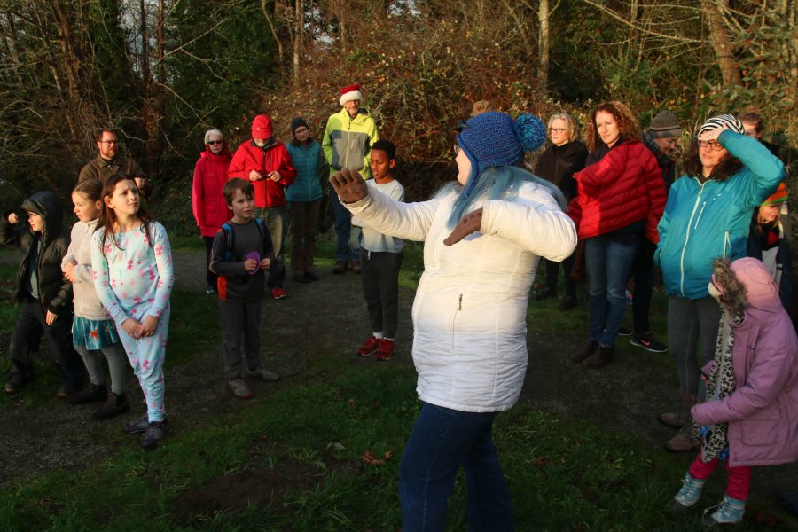
Sunset watch also means a lesson about the Earth, the Sun, and how the solar system works.


Now that the days are going to start getting longer – just a tiny bit at first, Alice noted when asked, so don’t get too excited yet – you can start looking forward to the spring equinox, just before 3 pm on Wednesday, March 20th, so plan on sunset watch with Alice a few hours later.
| 5 COMMENTS