West Seattle, Washington
18 Wednesday

Thanks for the photos capturing this multi-faceted stormy afternoon/evening! Above, Chris Frankovich photographed one of the approaching cloudbursts. Below, Wyatt was first to send a view of the full rainbow arch:
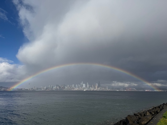
Next, Steve Pumphrey caught it from Duwamish Head:

Further west, Karen Carlson photographed it at Alki Statue of Liberty Plaza:

More to come.

Thanks for the photos of the beautiful sunset that concluded this warm Friday! The one above was sent by Carol Ann Joyce; below, from James Bratsanos:

And as the colors started to fade, Dave Gershgorn caught the clouds streaking the sky:

Tomorrow, like today, is forecast for a high in the mid-60s.

Rainbow sightings to the north late in the day! Above is from Kevin Stock, who explains, “We caught this photo of the Kittitas headed to Fauntleroy as we were docking at Vashon about 5 p.m. today.” The next view is from John-Michael Bennett III:

And from longtime WSB contributor Jason Grotelueschen at Walt Hundley Playfield:

Tomorrow’s likely to have some sunshine as well as some showers, according to the National Weather Service.

3:55 PM: The official regional alerts map for the National Weather Service is finally showing an alert for the possible “severe thunderstorms” that have been looming. The Severe Thunderstorm Watch alert is in effect until 9 tonight. That’s an upgrade from the “outlook” announced previously, but a “watch” is lower-level than a “warning,” which indicates some level of uncertainty. Of course, it’s important to prepare anyway! Seattle Public Schools is closing all buildings as of 5 pm and canceling after-school/evening activities. Updates to come.
5 PM: In case you’re nowhere near a window, but wondering … quiet so far, still partly sunny here. Regional radar shows the most intense storm cells currently in southwestern Washington.
 (Added: Photo sent by Christopher)
6:30 PM: Still quiet but folks at the HPAC meeting have commented on seeing people covering their cars along streets they traveled to get here; co-chair Kay Kirkpatrick said her goal is to gavel the meeting in an hour so everyone can get home before the (potential) storm.

7:10 PM: Radar shows some intense cells not far south of here. Whether they’ll move directly north over us, or skirt us by moving east, we should know before too long. In the meantime, it’s raining now, at least here in North Delridge…. Added above, a storm photo by David Hutchinson.
 (Added, lightning bolt photographed by Jerry Simmons)
7:38 PM: More thunder and lightning.
8:28 PM: That wave was over by the time we left Delridge Library around 8 – just light rain along the way. (No one’s reported hail so far tonight, 2″ or otherwise.)
ADDED FRIDAY NIGHT: Thanks to Mark in Arbor Heights for sending his video of a lightning bolt:
6:00 AM: Good morning! It’s Wednesday, March 26, 2025.
WEATHER + SUNRISE/SUNSET TIMES
After a record-for-the-date high on Tuesday (73), we’re looking at mid-60s today – but possibly accompanied by “severe” storms! Check here for updated alerts. Today’s sunrise/sunset – 6:59 am and 7:31 pm.
TRANSIT TODAY
Water Taxi – West Seattle service is back to normal.
Metro buses – Regular schedule.
Washington State Ferries – Regular service on the Triangle Route, with M/V Kittitas and M/V Cathlamet, plus M/V Sealth serving as the “bonus boat.”
ROAD WORK
-Utility crews have been working this wee on SW Holden west of 16th and on 16th north of Myrtle.
-In White Center, the 16th SW closure at 104th continues, with detours.
SPOTLIGHT TRAFFIC CAMERAS
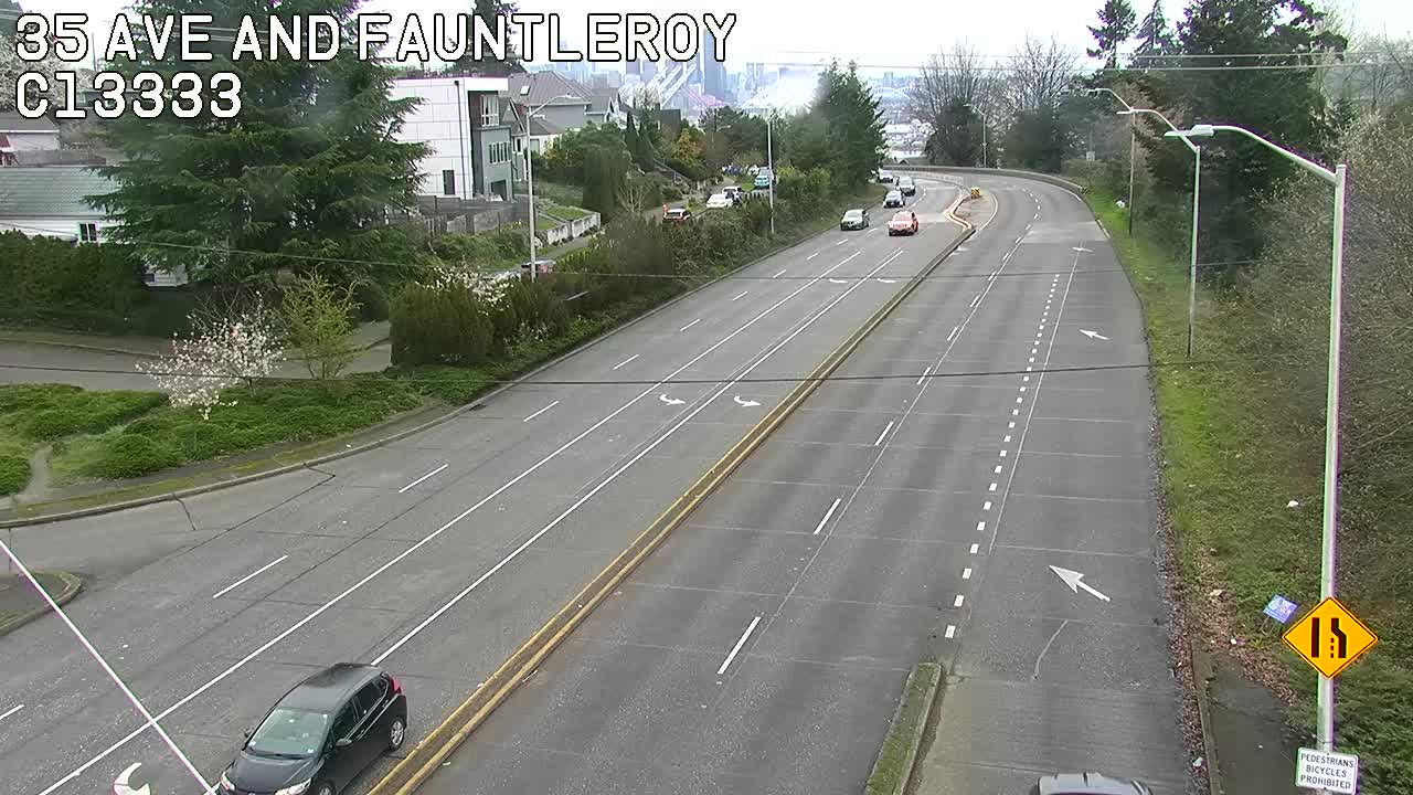
High Bridge – Here’s the main camera, followed by the Fauntleroy-end camera:
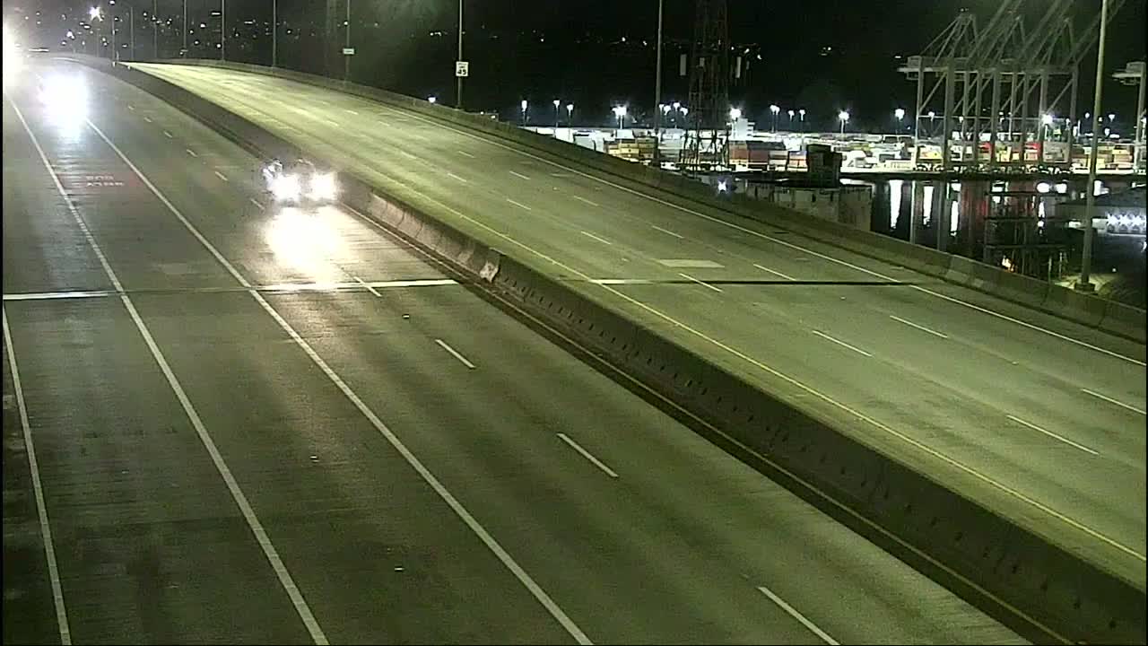
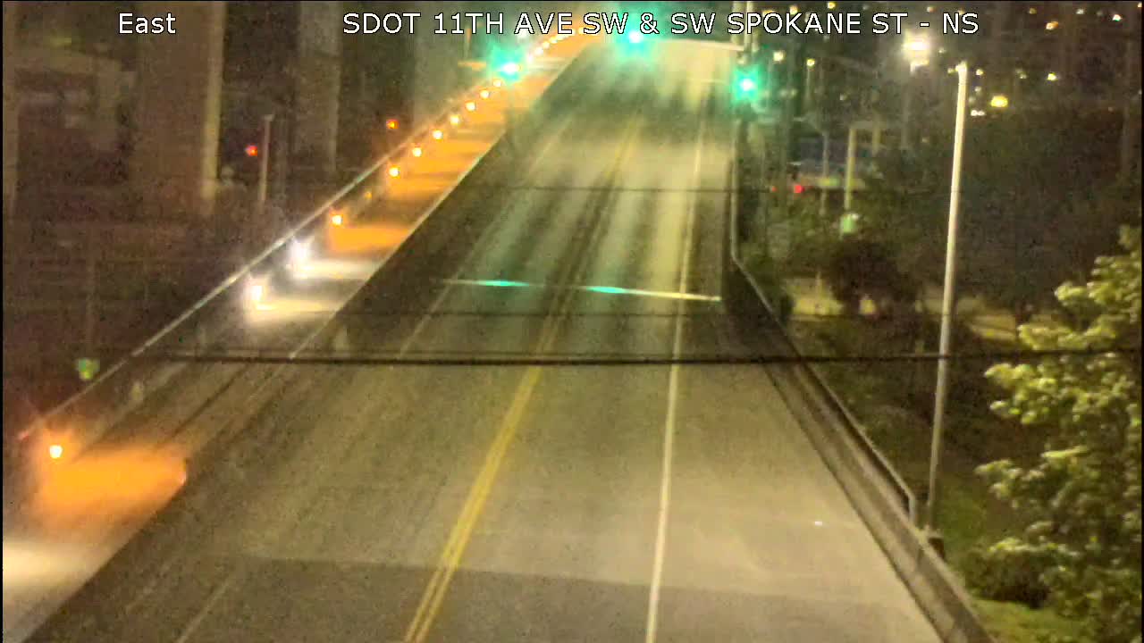
Spokane Street Viaduct – This view usually looks westward, with eastbound lanes at left and westbound lanes at right:
Low Bridge – Looking west:
1st Avenue South Bridge:
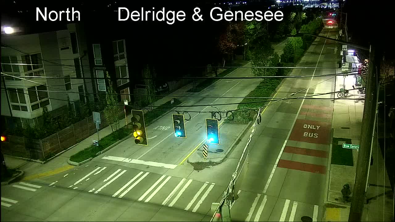
Delridge cameras: Besides the one below (Delridge/Genesee), cameras are also at Delridge/Juneau, Delridge/Henderson, Delridge/Oregon, and video-only (so you have to go to the map), Delridge/Holden and Delridge/Thistle.
MORE TRAFFIC CAMS: All functioning traffic cams citywide are here (including links to live video for most); for a quick scan of West Seattle and vicinity-relevant cameras, see this WSB page.
See a problem on the bridges/streets/paths/water? Please text or call our hotline (when you can do it safely, and after you’ve reported to authorities if they’re not already on scene) – 206-293-6302. Thank you!
 (National Weather Service infographic)
It might just miss us … or not. Thanks to Guy for the tip that the National Weather Service is beginning to get a bit clearer about the wild weather that might sweep through Puget Sound tomorrow afternoon. From the NWS’s latest “forecast discussion” – again, this is all for Wednesday:
* MID MORNING: An initial wave of moisture will move toward the Olympic Peninsula, and showers and embedded thunderstorms may develop west of the Puget Sound. The primary threats of this initial wave will be lightning and the potential for small hail/graupel. However, a large amount of uncertainty exists over the intensity of this precipitation and how far inland these showers will develop.
* EARLY AFTERNOON: Activity will decrease across western Washington with a lull in shower and thunderstorm activity midday. Southerly flow aloft will continue to advect warm air into the region, and daytime heating with some cloud clearing will allow the environment to become very unstable by the early afternoon. …
* AFTERNOON/EVENING: The offshore low will lift a vigorous front northward across western Washington throughout the afternoon and evening hours, bringing a round of strong to potentially severe thunderstorms across the region from the south moving northward. The primary threats of these storms will be hail and gusty winds alongside frequent lightning and locally heavy rain. The strongest storms are favored to develop east of the Puget Sound Wednesday evening along the I-5 corridor, potentially impacting the evening commute. The strongest storms that develop could become severe and capable of producing hail up to 2 inches or more in diameter, outflow wind gusts as high as 60 mph or more, and/or an isolated brief tornado.
The NWS usually updates its forecast discussions around 9 pm, so look for another update then.

12:35 PM: The foghorns have finally stopped sounding, after a murky morning! Thanks to everyone who sent photos. Above is Chris Frankovich‘s view of Alki from above; below, two views from James Bratsanos:


And two views looking east – first from Michael Reilly:

And from Greg Snyder:

As the fog clears, the promise of warmer weather has already been fulfilled – the temperature has already hit the mid-60s! Tomorrow is expected to approach 70 but showers are a possibility, too, so today’s the best day to get outside for a while if you can.
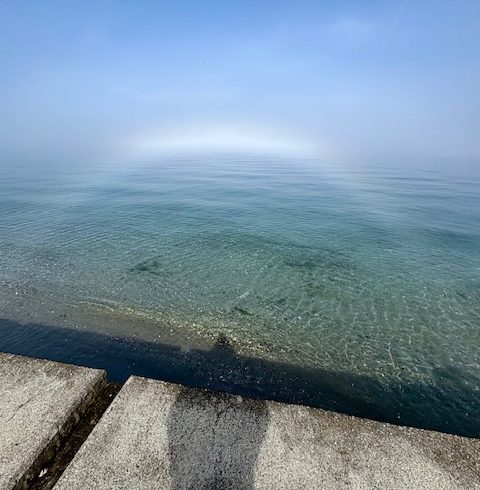
ADDED 1:50 PM: A sixth view – a “fogbow,” photographed by Curry Gibson:

The sun made a brief appearance before sunset tonight, and brought along rainbows visible from Alki – above, Nadiia‘s view; below, Stewart L‘s view:

From west-facing West Seattle, though, James Bratsanos‘ shot of the sky over Blake Island is about as good as it got:

A bit later, by actual sunset time – past 7 pm – Alice Enevoldsen‘s day-delayed equinox sunset watch was a washout even though the rain had finally stopped. She and her trusty Earth-on-a-stick prop were at Solstice Park, though, as she’s been at season-change sunsets for 15+ years:

It was breezy and in the 40s, a little more wintry than springy. But here’s hoping for seasonal weather when she returns for her summer-solstice sunset watch, 8:30 pm Friday, June 20.
P.S. Since Alice’s events usually include a preview of upcoming skywatching/stargazing events of note, we asked her if anything was imminent. Short answer: No, although we’re still awaiting the long-expected Corona Borealis explosion, and it might finally happen soon.
 (WSB photo, looking southwestward toward school and flagpole from 34th/Myrtle)
In our windstorm coverage last Tuesday, we mentioned that Our Lady of Guadalupe School had closed SW Myrtle between 34th and 35th – usually just a school-hours closure – because the stability of its flagpole was in question. The street has remained closed, and taped off, since then, while OLG determined whether the flagpole had to come down. Tonight, we checked back in, and the answer is “yes.” Dave from OLG tells WSB, “The pole needs to be taken down and we think that will occur on Thursday or Friday, and we will open the road at that point.” He says the flagpole eventually will be replaced.

In case you missed tonight’s vivid almost-spring sunset, we have three views. Above and below are from WSB contributing photographer Dave Gershgorn:

And this one is a reader photo sent by Kay Kendall:

Thanks to all who contribute photos, from sunset scenes to breaking news – westseattleblog@gmail.com if it’s not urgent, 206-293-6302 if it is!
Christine sent this followup to one of the downed trees noted here during Tuesday’s windstorm coverage, at Walnut and Manning:
Last night, I heard a chainsaw so I walked down to the latest Walnut Ave SW fallen tree. A man was cutting up the tree into firewood size logs.
He said he was on the way home to Gig Harbor and he had the chainsaw in his car from the wind events over there.
I think he had the help of the young neighbor who lives across from the house that almost had a tree fall on it. Very very nice. People could drive around the circle today.
SDOT will need to take down the tree and Seattle City Light will need to fix the wiring.

5:18 PM: As we head into evening, that’s the last major outage in not only West Seattle, but citywide, with the 1,600+ affected customers representing just under half the 3,800+ customers still out around Seattle City Light‘s entire territory. For earlier events, see our morning coverage here and midday/afternoon coverage here. Best news is that the wind has moved on, and we’re even expecting a break from the rain, tonight at least through Thursday – when the temperature could reach almost 60 degrees.
5:27 PM: As if by magic, a moment after we published this, the outage ended, and the SCL map now reflects that.
10:55 AM: The wind hasn’t entirely ebbed yet, but the official alert expired at 10 am and – at least in our observation – things are calming. Much of what we covered in our morning report has been resolved, so we’re starting fresh here with midday updates:
 (Photo sent by Taylor)
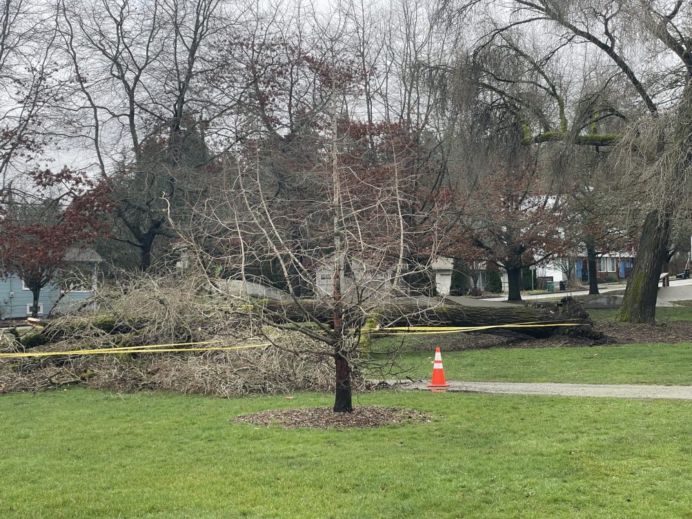
TREE TROUBLE: The major roadblocking trees (Delridge Way, Olson Place, Holden) have been cleared by SDOT, as noted in our earlier coverage. But others are still awaiting clearance – like the one in the photo above, in the park near Delridge Community Center, west of the skatepark (thanks to everyone who sent tips and photos). And here’s another downed park tree, with some backstory:
This tree is at Highland Park. The large downed portion is covering half the road on SW Thistle between 11th and 12th.
As seen in the photo, the city knows about it and has already put caution tape around it this morning.
This is a favorite climbing tree of many kids who visit this park.
Seattle Parks also reissued its reminder that forested parks are places to avoid during high wind, and in general, when the wind kicks up, stay out from under trees. … In South Admiral, a texter reports this tree partly blocking at Walnut/Manning:

POWER OUTAGES: Many power outages were triggered by trees – City Light crews have been busy all night and morning – Al sent this photo from 47th/Eddy:

The largest remaining West Seattle outages are 1,600+ customers on the central west side of the peninsula, and almost 500 in Puget Ridge/Pigeon Point/North Delridge (see the darker markers):

We’ll continue adding to this story in the hours ahead – in general, give yourself extra time if you have to go somewhere, because you might encounter a downed-tree detour, or an intersection that’s stop-all-ways because a sign’s down or a signal’s out.
11:43 AM: The North Delridge/Pigeon Point/Puget Ridge outage is down to 215 customers.
12:30 PM: A caller wants to alert you that the California/Charlestown light is out, though everything around it seems to have power.
1:44 PM: A texter says this is where City Light is working to remedy the Seaview/Fairmount Park outage – “tree on power lines at 37th/Raymond”:
SCL has arborists in the trees (no alley access), but it looks like it will be a little while longer.
3:36 PM: Watch for low-hanging wires/cables – they’re not all live wires, but they can be dangerous just the same. One reader texted about one over the road at 55th/Andover.
3:59 PM: Also – beware of at least one flagpole! Our Lady of Guadalupe reports they’ve closed Myrtle between 35th and 34th (usually just closed during school hours) because of possible danger from their flagpole. They offer apologies to the neighbors.
Good morning – it’s Tuesday, February 25, and strong wind has been pummeling our area all night. Updates below, as they happen.
WEATHER UPDATE
The High Wind Warning alert remains in effect until 10 am. Otherwise, the forecast is for on-and-off rain, high in the low 50s.
POWER OUTAGES

6:08 AM: The Delridge/Thistle tree mentioned below has also just taken out power for 6,100 homes/businesses from Highland Park to White Center to South Park.
7:11 AM: Some if not all of those in the biggest outage say they’re back on.
7:39 AM: New big outage – almost 5,000 customers mostly in western West Seattle – here’s that part of the map:

Update: Per commenters, that outage was resolved around 9:30 am.
EARLIER: The Seattle City Light map shows scattered outages around the peninsula (as well as elsewhere in SCL territory) – the largest is about 500 customers in the Puget Ridge area, and about 200 around Alki Point, plus the 100-customer second Seaview outage noted earlier.
TRAFFIC TROUBLE, INCLUDING TREES
6 AM: The wind has brought down some trees that SDOT crews are dealing with; we’ve just heard a dispatch for a tree blocking Delridge/Thistle, while earlier tonight, one was reported on 35th near Holden. 7:30 UPDATE: SDOT crew on scene; RapidRide H rerouted until this is cleared … 7:55 AM: Now cleared!

ADDED 6:41 AM: And this tree’s blocking Holden about a block west of Delridge, per the texter who sent photo:

8:33 AM: Holden is now clear.
ADDED 7:28 AM: Two more road-blocking trees – one at 31st/Myrtle, this one on 47th between Oregon and Alaska (thanks for the photo):

ADDED 7:43 AM: A tree down on Olson Place at the east end of the Roxbury corridor is blocking eastbound traffic and rerouting Route 60.
Please let us know if you come across any closures – 206-293-6302 text or voice.
SCHOOL CHANGES
Added 6:33 am: The Highline district just south of West Seattle is on a two-hour delay.
Added 7:53 am: Vashon Island School District 1 1/2 hours late … Genesee Hill Elementary lost power in the newest outage but is carrying on …
Update, 8:02 am: Vashon Island SD has now decided to CLOSE for today.
Any other changes? 206-293-6302.
SPOTLIGHT TRAFFIC CAMERAS
High Bridge – Here’s the main camera, followed by the Fauntleroy-end camera:
Spokane Street Viaduct – This view usually looks westward, with eastbound lanes at left and westbound lanes at right:
Low Bridge – Looking west:
1st Avenue South Bridge:
Delridge cameras: Besides the one below (Delridge/Genesee), cameras are also at Delridge/Juneau, Delridge/Henderson, Delridge/Oregon, and video-only (so you have to go to the map), Delridge/Holden and Delridge/Thistle.
MORE TRAFFIC CAMS: All functioning traffic cams citywide are here (including links to live video for most); for a quick scan of West Seattle and vicinity-relevant cameras, see this WSB page.
See trouble on the bridges/streets/paths/water? Please text or call our hotline (when you can do it safely, and after you’ve reported to authorities if they’re not already on scene) – 206-293-6302. Thank you!

6:24 PM: Eight hours or so into the High Wind Warning alert, the wind kicked up a short time ago (we heard thunder too!), and West Seattle has its first power outage of note – more than 250 customers in Seaview. People in the area report hearing a “boom” before the power went out. Updates to come …

6:56 PM: This storm seems to be arriving (and departing) in waves, and we’re between waves right now. The photo above is from James Bratsanos, who noticed it just before that intense wave of rain, wind, and thunder. So far the 256-customer Seaview outage is the only one in West Seattle; citywide it’s the second-largest after a 5,300+-customer outage in North Seattle.
7:43 PM: The SCL map shows the Seaview outage has been resolved.
2:36 AM: An area further south in Seaview and beyond has lost power this time:

City Light says this one is affecting 100+ customers. The wind is about the strongest-sounding we’ve heard all night.
The National Weather Service has upgraded the wind alert for our area to a High Wind Warning, in effect now through 10 am Tuesday. In part, the alert says, “South winds 25 to 35 mph with gusts up to 50 to 60 mph (are) expected.” As always, we appreciate hearing from you about storm effects – power outages, toppled trees – so once you’ve reported to authorities (206-684-3000 for City Light, 206-684-ROAD for SDOT, or 911 if it’s an immediate safety risk), you can text/phone us at 206-293-6302.
Keep everything charged and make sure your outdoor items are secured – strong wind may be on the way. The National Weather Service has issued a Wind Advisory alert that takes effect at 1 pm Monday and continues until 7 am Tuesday. In part, it projects “south winds 15 to 25 mph with gusts up to 45 to 50 mph.”

Thanks for the photos! A multi-colored sunset has just finished fading away – Mark Dale sent the view above, and Curry Gibson sent the view below, showing the peach that preceded the pink:

(added) Bob Spears sent a wider view of the peach-color stage:

(added) This is what Jeff Johnson saw:

And just before it all, Marc Milrod caught this rainbow through the mist:

Tomorrow, by the way, marks one month until spring!

Thanks to Jon Anderson for texting that photo. It’s a reminder that you need to help ensure these subfreezing nights don’t leave birds thirsty. During a previous year’s similar cold snap, local naturalist Ann Anderson gave this advice: “Simply pour hot water into your frozen bird bath. This quickly loosens the ice, making it easy to pop right out. Then refill it with warm water. It’s that easy, and will make a huge difference to cold, thirsty wildlife.” That’s similar to what Jon told us he does: “I break it off every morning and put new water in. This morning a squirrel was standing on the ice.”
6:03 AM: Good morning – it’s Wednesday, February 12, 2025.
WEATHER + SUNRISE/SUNSET TIMES
The Cold Weather Advisory is extended until noon tomorrow, with wind chills as low as the teens; the forecast for today is again for cold sunshine, high near 40. Today’s sunrise/sunset – 7:19 am and 5:28 pm.
TRANSIT
Metro buses – Regular schedule.
Water Taxi – Also on a regular schedule today.
Washington State Ferries – Regular service on the Triangle Route, with M/V Issaquah and M/V Cathlamet, plus M/V Salish as the “bonus boat.”
SPOTLIGHT TRAFFIC CAMERAS
High Bridge – Here’s the main camera, followed by the Fauntleroy-end camera:
Spokane Street Viaduct – This view usually looks westward, with eastbound lanes at left and westbound lanes at right:
Low Bridge – Looking west:
1st Avenue South Bridge:
Delridge cameras: Besides the one below (Delridge/Genesee), cameras are also at Delridge/Juneau, Delridge/Henderson, Delridge/Oregon, and video-only (so you have to go to the map), Delridge/Holden and Delridge/Thistle.
MORE TRAFFIC CAMS: All functioning traffic cams citywide are here (including links to live video for most); for a quick scan of West Seattle and vicinity-relevant cameras, see this WSB page.
See trouble on the bridges/streets/paths/water? Please text or call our hotline (when you can do it safely, and after you’ve reported to authorities if they’re not already on scene) – 206-293-6302. Thank you!

WSB contributing photographer Dave Gershgorn got that aerial photo from Arbor Heights, looking north, around sunset tonight – that’s Fauntleroy Park in the foreground, with the Barton Standpipe [map] just past it, at center. The sky, you’ll note, is mostly clear, and a sub-freezing low is predicted tonight, which is why a Cold Weather Advisory is now in effect through 10 am Thursday. The forecast is flake-free until after that.
 (Last Wednesday morning’s snow – photo by Janelle Otterholt)
With delays and cancellations in Seattle Public Utilities customers’ solid-waste-pickup service last week, SPU published this reminder today:
We aren’t quite out of the woods yet with the winter weather this week, so here are a few reminders:
Wednesday customers missed last week may set out twice the amount of garbage, recycling, and compost this week at no extra charge.
Any other customers missed last week should report a missed collection as usual.
As winter weather continues, please be sure to regularly check back in on the At Your Service blog for the latest updates. If your garbage collection was missed and there were no collection delays, please use the Utilities Services website to report a missed collection or call our customer service line 206-684-3000.
Though the update didn’t specifically mention Tuesday customers, SPU spokesperson Brad Wong told WSB last Friday that anyone missed on February 4th could call this morning for a special pickup.
 No snow expected, but a dangerously frosty wind chill is at the heart of the Cold Weather Advisory alert that the National Weather Service has ordered for our area. It’ll be in effect 6 pm Monday through 10 am Wednesday, with the potential for wind-chill temperatures in the teens to 20s. Forecast says wind will be out of the north/northeast much of that time. (The NWS graphic in this story shows this alert applies to much of Western Washington – light blue on the map.)


| 3 COMMENTS