West Seattle, Washington
24 Tuesday
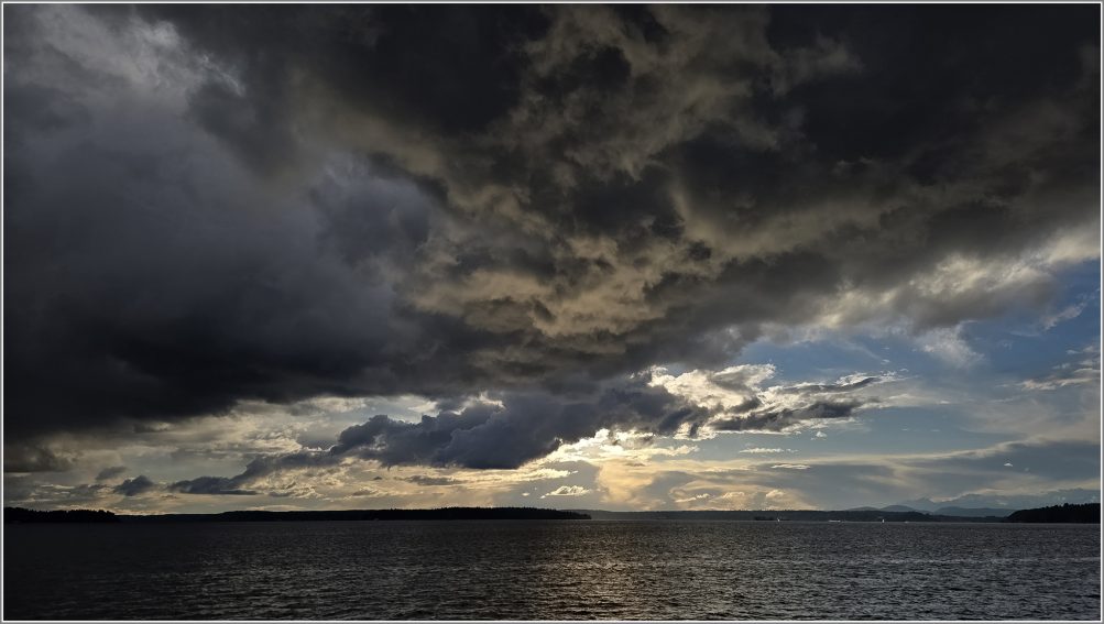
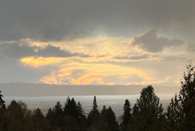
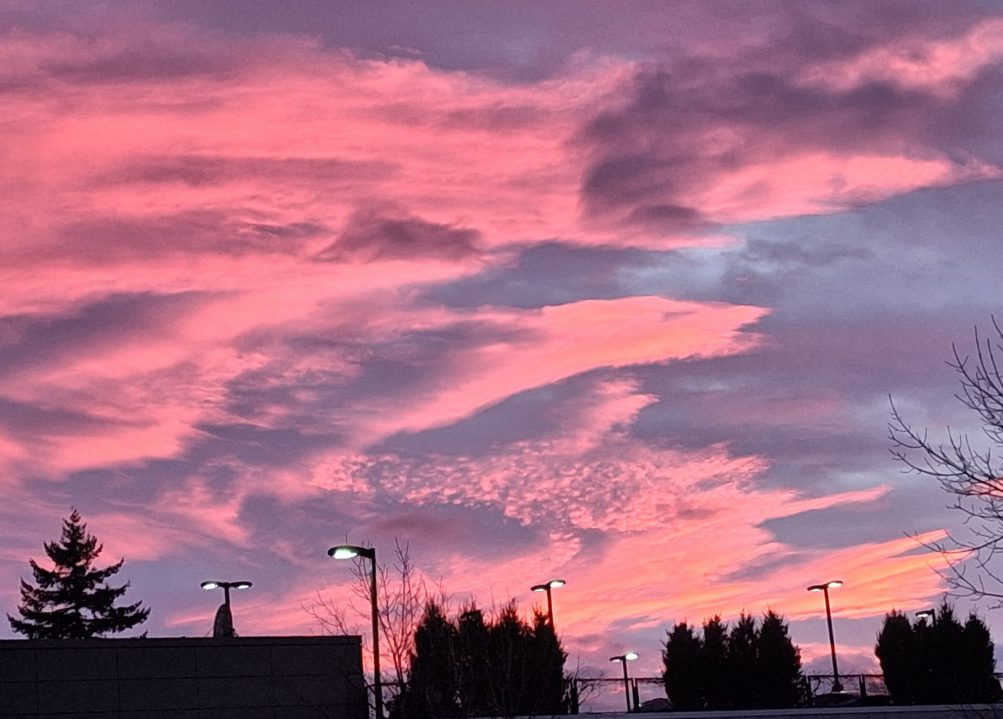
Clouds staged a double feature this afternoon, both dark and bright. The first two photos are from David Hutchinson – the very dark wall of clouds to the east, eventually followed by a thinner dark line to the west:
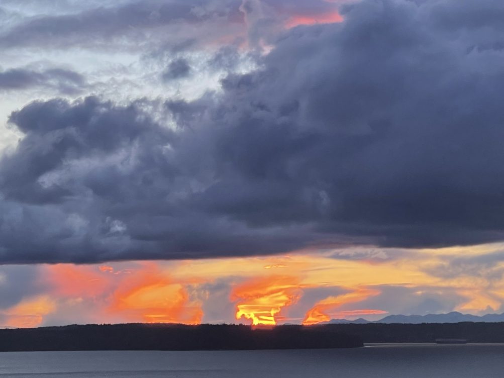
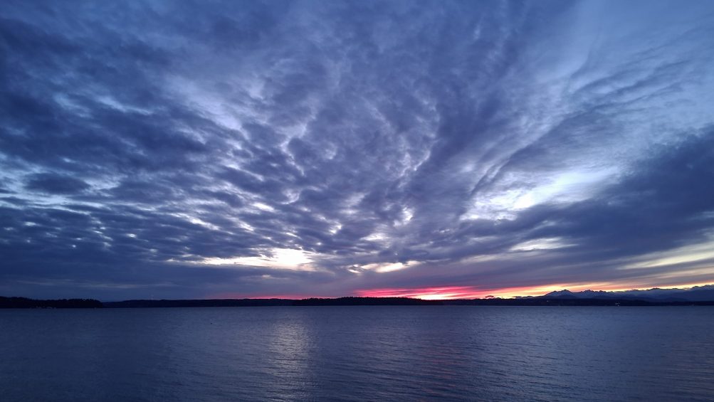
At sunset, they also made room for a burst of color – Brooke Gosztola is one of the photographers who caught that:
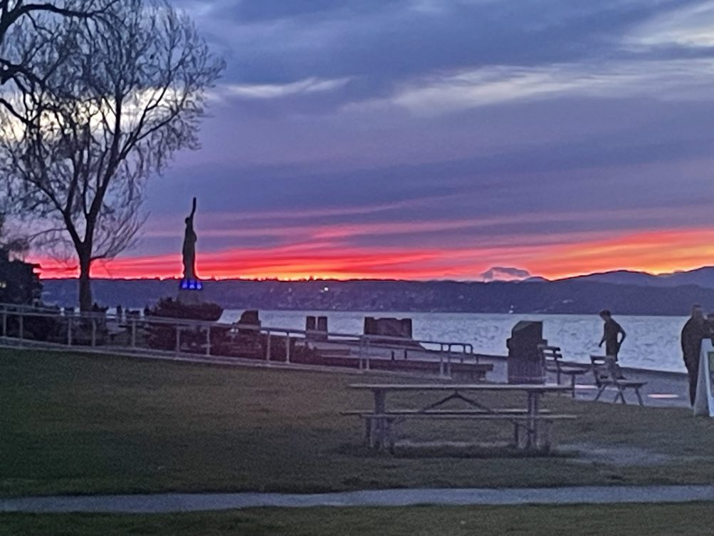
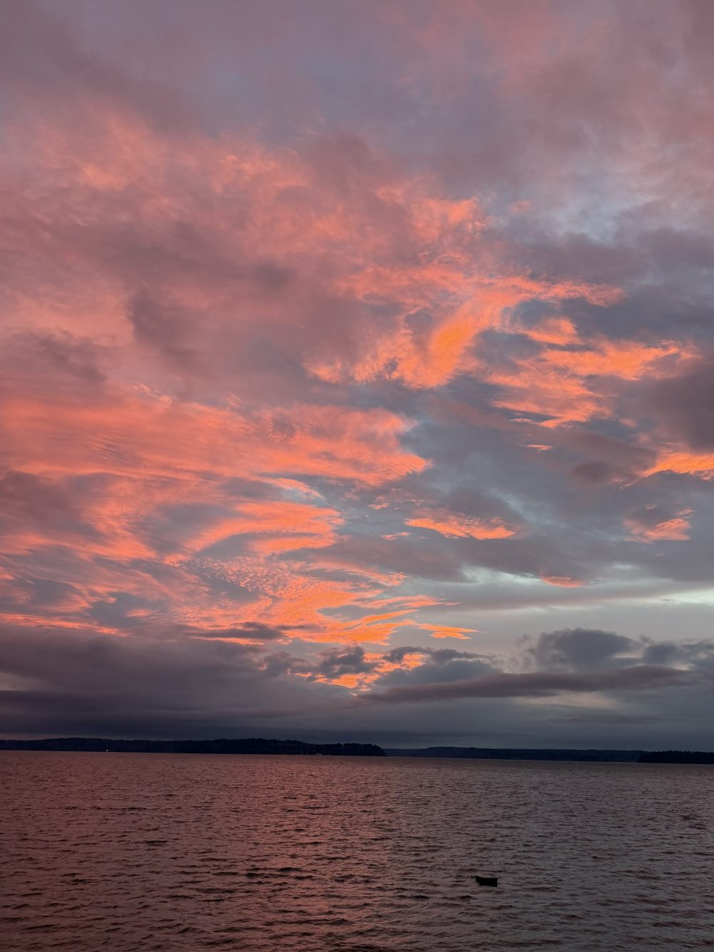
Penny photographed this pink breakthrough:
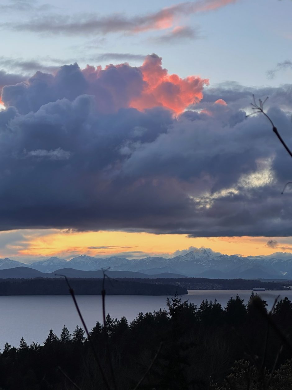
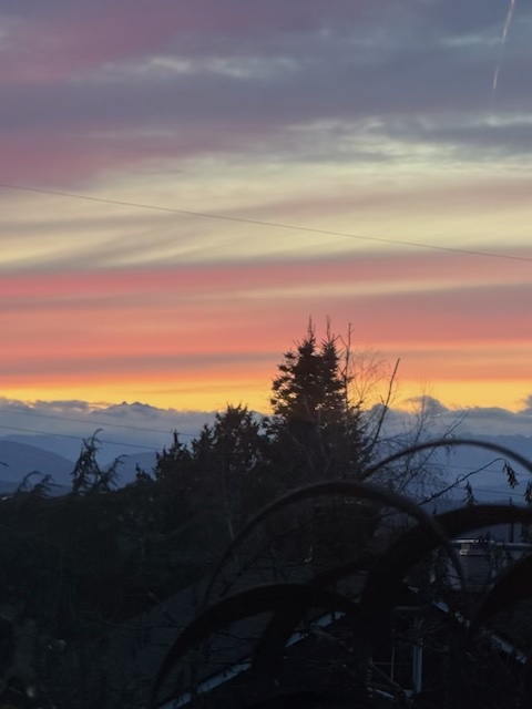
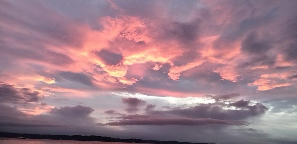
And April K caught the colors fading:
Following all that, we’re already in the 30s, and a rain/snow mix remains a possibility until early afternoon, the forecast says.
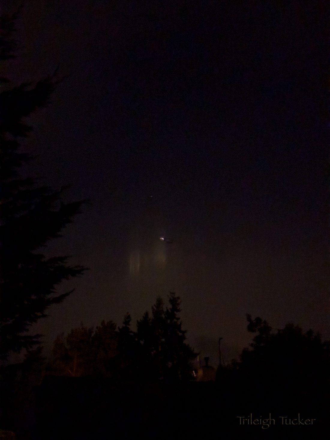
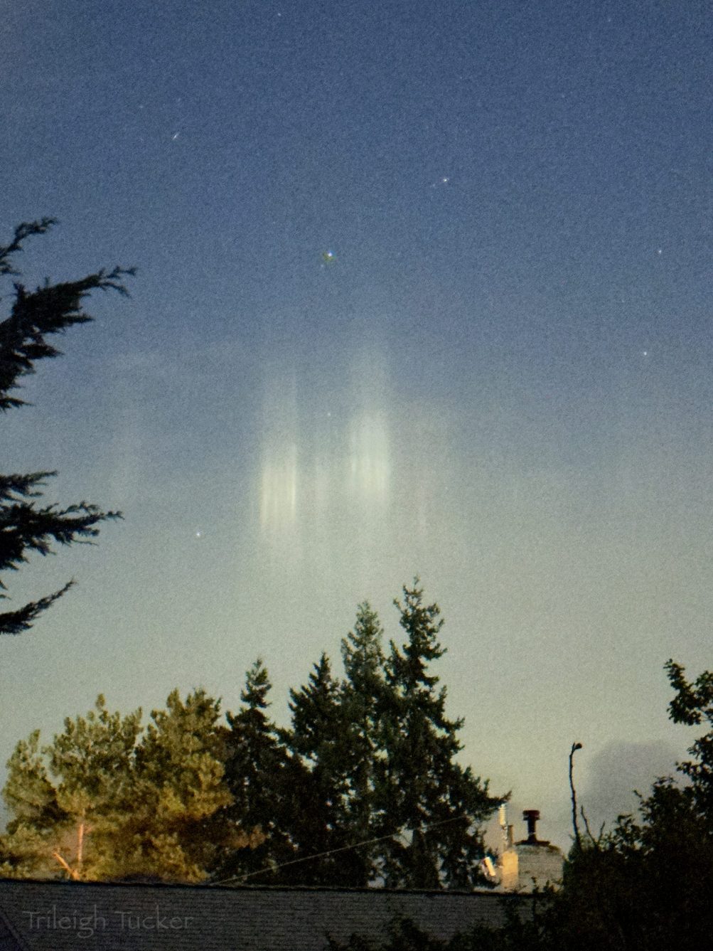
Also from the early-morning beat, the photos and report were sent by Trileigh Tucker:
When I woke up this morning and wandered into our kitchen to make tea, I looked out the window to see if there were any stars—and saw this unusual display to the west! These are “light pillars,” and form when the atmosphere is cold enough that any moisture in the air freezes into flakes. Since “flakes float flat,” they act as little mirrors that bounce surface light to our eyes, which we perceive as vertical pillars. Wikipedia does a good job of explaining them.
I think this is the first time I’ve found them “in the wild”! It was a pretty exciting way to start my day, science/nature nerd that I am.
The first photo shows them as I saw them (the plane flying past them helped the camera to focus in the dark), and the second (one was) automatically lightened by my phone and shows more detail.
 (Photo sent by Ian)
Snow-coated Mt. Baker – 140 miles away – was in clear view from Alki this afternoon. If the forecast holds, we might finally see a bit of snow here before the week’s out. No advisories or alerts, but the National Weather Service‘s forecast suggests a rain/snow mix is possible in just about any daypart from Monday night until next Saturday. The NWS Forecast Discussion says snow levels could be down to 200 to 500 feet – which includes much of the peninsula – by Tuesday. But the qualifier phrase “little to no accumulation expected” appears in the forecast too.
Thanks for sending the sunset photos – a peek of pink on Valentine’s night – the top photo is by Bob Burns, the one below is from Greg Moore.
(added) This one’s via text from Arbor Heights:
This sunset was also notable as the first one after 5:30 pm (5:31, to be exact) as we roll toward spring, now less than five weeks away – Friday, March 20. Before then, the clock will “spring forward” when Daylight Saving Time returns in just three weeks, at 2 am March 8 (meaning, among other things, that the sunset that night will be at 7:04 pm).
 (Photo by James Bratsanos)
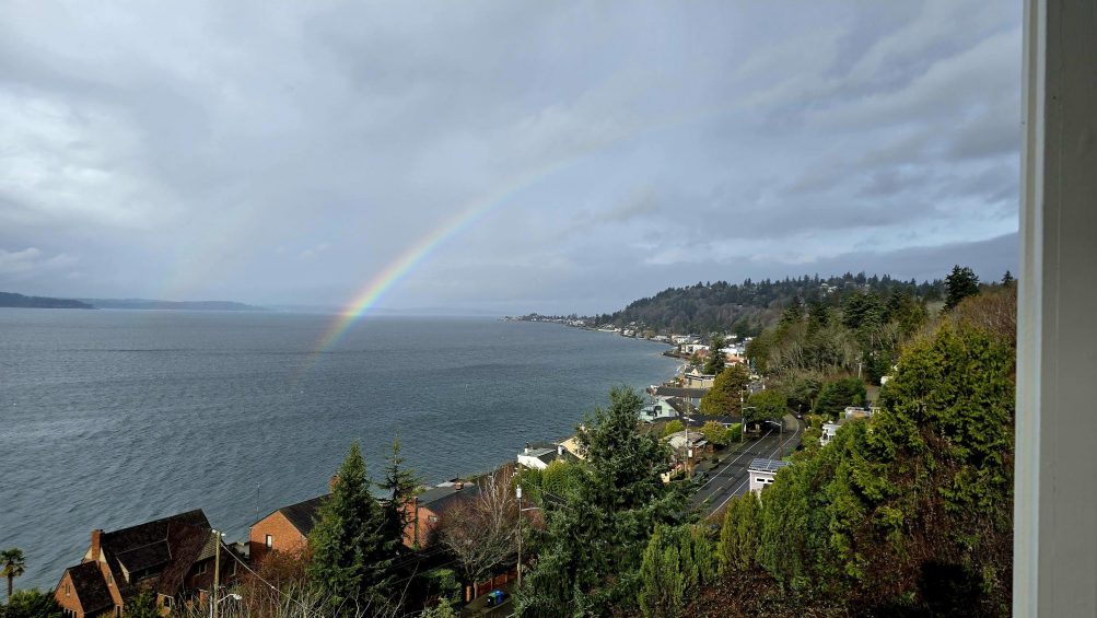
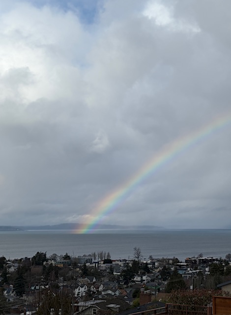
1:10 PM: Today, the mythical pot of gold at the end of the rainbow is apparently underwater – or afloat – judging by the rainbow photos we’ve received (thank you!).
 (Reader photo via text)
Meantime, the National Weather Service says the weather’s warming up – Tuesday through Friday, the highs are predicted to be in the upper 50s!
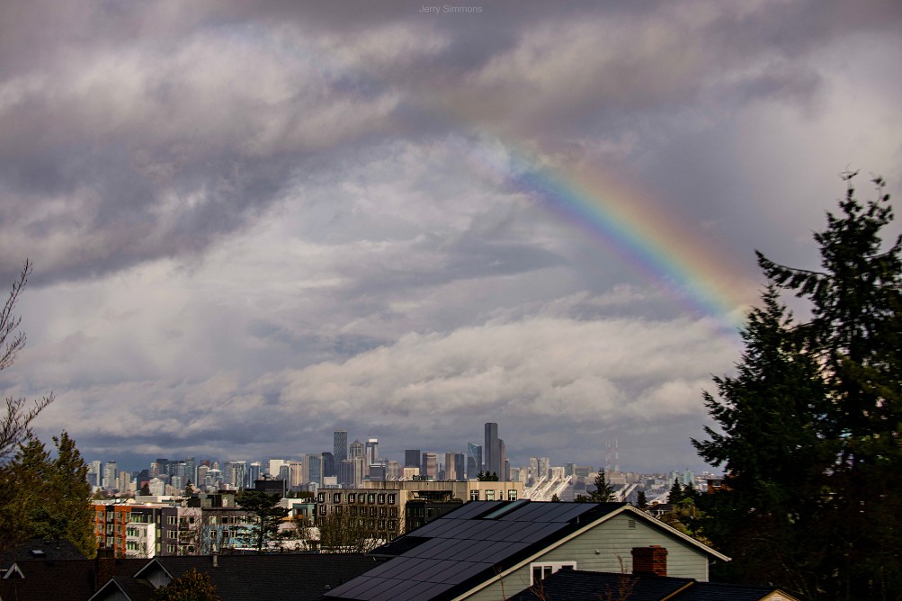
3:24 PM: One more view, from Jerry Simmons, showing “the other end” of the rainbow:
Thanks to James Bratsanos for the photo of tonight’s sunset, notable not just for its beauty, but – as we’ve been noting in our weekday weather/traffic roundups – because it’s the last one in the 4 pm hour until next fall. Tomorrow’s official sunset time is 5 pm. Meantime, the National Weather Service has issued another Cold Weather Advisory alert for midnight to 9 am. The NWS did the same thing last night, saying the temperature could get down below 25 degrees; the official overnight low was 31. Separate from the advisory, tonight’s forecast low is 32.
One more “week ahead” preview – this time, what’s in two types of forecasts:
SUN’S NOT DONE: Jen sent that photo of tonight’s sunset reflected off the downtown skyline. It’s a reminder that precipitation doesn’t return to the forecast until Thursday. Sunshine is expected tomorrow; then clouds are expected tp start their comeback, but “a chance of rain or snow” doesn’t appear until Thursday night. Temperatures are likely to remain in the normal range – upper 40s highs, upper 30s lows.
KING TIDES’ FINAL APPEARANCES: The morning high tides will be above 12 feet all week, peaking at 12.6 feet on Thursday, Friday, and Saturday mornings (January 22-24), then again on February 2nd, 3rd, and 4th, with the highest high tides dropping below 12 feet entirely by late March.
You didn’t have to be by the water to see tonight’s pastel-pink sunset. Bob Burns took the top photo from near Admiral Safeway. But we did get water views too, this one from Carol Ann:
And this one from Chris:
Thanks as always to everyone who sends photos – westseattleblog@gmail.com unless it’s breaking news, in which case you can text us at 206-293-6302. The sunset show comes at the start of a warmer week, with highs near or above 50 in the forecast every day. (Today’s high was 52, four degrees above tomorrow; tomorrow is expected to be in the mid-50s!)

Thanks to Mark Erskine for the photos! This is what Lincoln Park‘s shore looked like at high tide shortly after 7 am, at 13.0 feet the highest predicted high tide of the year (along with next December 26).
The actual water level was a bit higher than predicted, according to this NOAA chart, but nothing calamitous. Tomorrow’s predicted high tide is almost as high as today’s – 12.9 feet at 7:43 am.
This morning’s predicted high tide is 13.0 feet – tying next December 26 for the highest predicted high tide of the year. This one’s likely to be higher than predicted due to atmospheric conditions – the red line on this graph tracks it. High tide arrives at 7:08 am; a Coastal Flood Advisory alert is in effect 4 am to 9 am, but no major problems are expected.
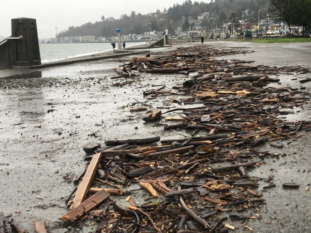 (December 25 reader photo of high-tide aftermath on Alki promenade)
The next round of “king tides” – the year’s highest high tides – peaks in the next several days, and low atmospheric pressure could mean higher water levels than predicted. First, here’s what the tide tables predict for our area:
Saturday: 12.8 feet, 5:51 am
Sunday: 12.9 feet, 6:30 am
Monday: 13.0 feet, 7:08 am
Tuesday: 12.9 feet, 7:43 am
Wednesday: 12.8 feet, 8:17 am
WSB reader Lura points out that atmospheric conditions can push the water levels higher than predicted – see the red line on this chart, for example – and she notes that if forecast conditions bear out, that could mean 14-foot high tides ahead. The National Weather Service has a Coastal Flood Advisory alert for 4 am-8 am Saturday; along the Duwamish River, the city says “… river overtopping is not forecasted. However, significant street flooding in the industrial area of South Park is expected on the mornings of Saturday, January 3rd and Sunday, January 4th.”
11:03 PM: The National Weather Service has another Dense Fog Advisory in effect until 10 am New Year’s Day. If you were thinking of going out to see the Space Needle fireworks, sorry, no view from West Seattle unless there’s a midnight miracle – we came down to Harbor/Alki Aves to check if the bay’s socked in – yes, it is. (Only positive thing to report is that street-level fog is a lot thinner down here – uphill it’s thick.)
12:03 AM: The TV stream of the Needle fireworks shows they’re even fogged in for the cameras right beneath.
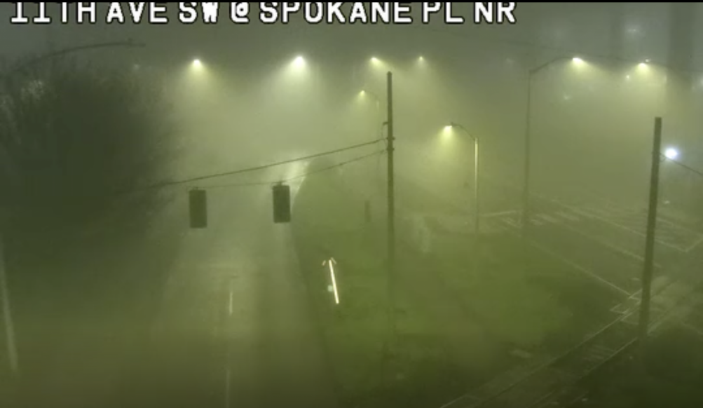 (SDOT traffic-cam screengrab from right before we published this story)
3:12 AM: Perhaps 2025 just wants to vanish into the fog. The National Weather Service has a Dense Fog Advisory alert in effect for our area until 10 am. This not only could mean visibility problems, but also the possibility of icy streets, as the fog meets near-freezing temperatures. So give yourself extra time to get wherever you have to go.
9:22 AM: The advisory has been extended until noon – forecasters believe the fog will linger longer.
Thanks to Brooke Gosztola for that view of tonight’s sunset! The original forecast for a mostly cloudy day didn’t bear out, but just enough clouds sneaked in by day’s end to catch the color. So far, the forecast looks dry all the way until New Year’s Day night! Not too cold either – daytime highs in the mid-40s, nighttime lows in the mid-30s. (And water temperature in the mid-to-upper 40s, if you’re planning on Thursday morning’s Polar Bear Swim!)

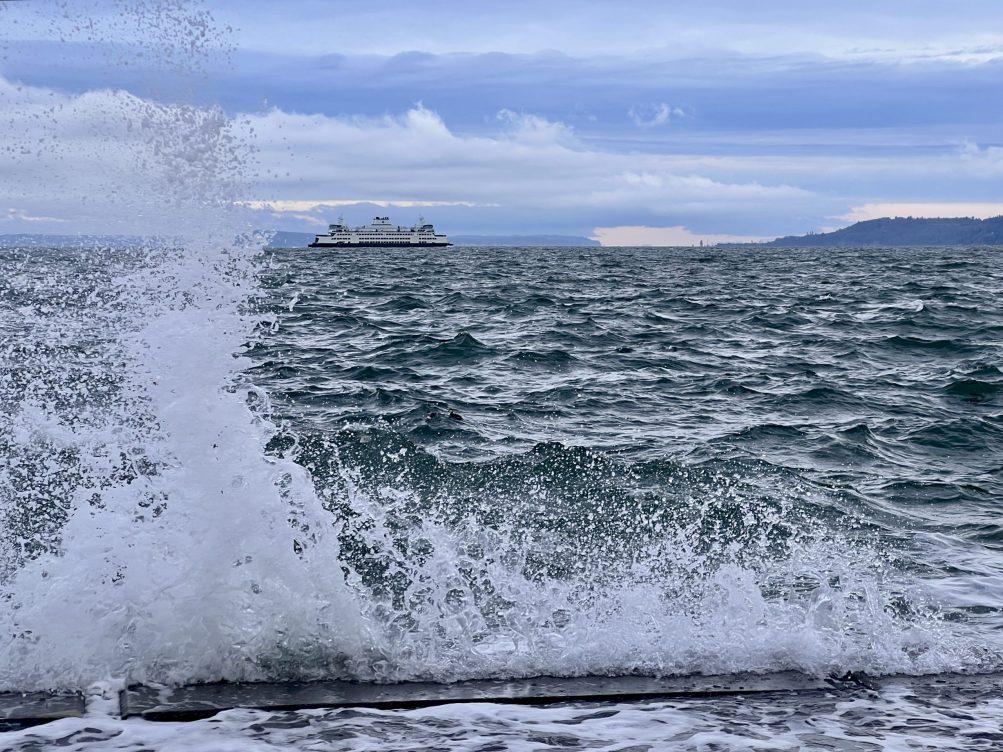
High tide plus north wind brought seawall waves again this morning along the West Seattle waterfront. Above is Tom Trulin‘s photo from the north shore of Lincoln Park; below, an Alki photo by Mike Burns:
No alerts in the forecast right now, but some potential highlights include the ever-popular “wintry mix” Friday night if precipitation remains in the area as temps drop into the 30s, and Saturday at this point is predicted to be mostly sunny.
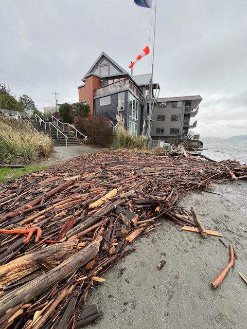
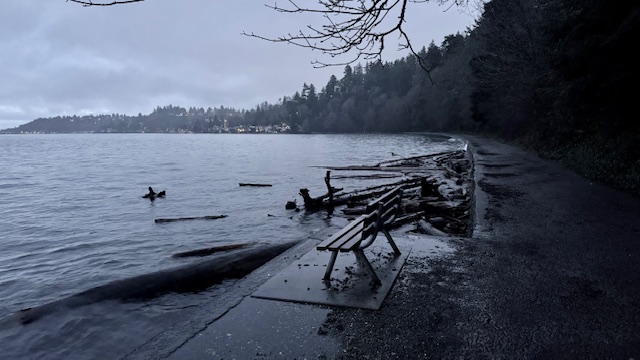
Thanks to Clare Brooks for the photo! That pileup of driftwood at the west end of the Alki promenade is at least in part thanks to the high tide wind-and-saves action shown here. The National Weather Service had a Coastal Flood Advisory in effect for “minor” overflow this morning and has another one up for 7 am-1 pm Thursday, when the predicted high tide is again 12.4 feet (9:01 am this time, with calmer atmospheric conditions less conducive to overflow).
9:54 AM: Thanks to Amy Bannister for sending that video from Alki Statue of Liberty Plaza, where wind and high tides combined for wave action against the seawall early this morning.
Meantime, speaking of wind, the National Weather Service has again changed the alert level for what it believes is on the way. Now it’s downsized to the lowest level of alert, Wind Advisory, still in effect 10 am-7 pm: “South winds 20 to 30 mph with gusts up to 45 mph expected,” possibly a bit higher close to the water. (But of course, that’s just a forecast, so don’t get complacent – stay charged and stay safe!)
1:08 PM: Now the NWS has canceled the alert altogether. The breeze is picking up a bit out there, though, so it won’t be entirely still.
12:36 PM: It’s been a windy December and it’s not done yet. The National Weather Service has a High Wind Watch alert for our area for tomorrow (Wednesday, December 24), 10 am-7 pm. Here’s what forecasters think will happen:
* WHAT…East to northeast winds of 10 to 20 mph with gusts to 30 mph will suddenly shift to southerly Wednesday afternoon with wind speeds of 25 to 35 mph and gusts of 50 to 60 mph possible.
A High Wind Watch is one step up in intensity from a Wind Advisory, which is the most-common type of alert we’ve seen so far these past few months.
9:31 PM: As commenter B points out, the NWS has upgraded this to a High Wind Warning, though the time frame – 10 am to 7 pm Wednesday – and the details – “South winds 25 to 35 mph with gusts 50 to 60 mph expected” – are similar. Main change is “possible” to “expected.”
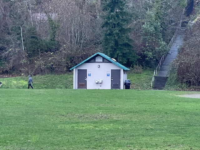
Seattle Parks is out today with its list of park restrooms winterized this year, including eight that Parks says will remain open in winter for the first time because of Park District funding. Three of those eight are in West Seattle – the Fairmount Park restroom building (shown in our photo above), Riverview Playfield, and Roxhill Park. The full list is here; Parks adds this caveat:
While we strive to keep these restrooms open for the winter, there may be times when we must close them for repair or due to extreme low temperatures. Some restrooms that are normally open year-round are not included in the list … because they are currently closed for capital improvement projects or repairs.
Parks added three West Seattle restrooms to the year-round list a year ago, too.

3:50 PM: Winter has arrived with true Seattle wintry weather – rain. Nevertheless, Alice Enevoldsen is at Solstice Park for her quarterly sunset watch, despite the sun being highly unlikely to make even a brief appearance this time. So if you want to commemorate the change of seasons and learn about the solar-system machinations behind it, come on over to the park’s plateau, uphill from the tennis courts at 7400 Fauntleroy Way SW. (The sun sets – out there beyond the clouds somewhere – behind the trees and mountains around 4:05, officially at 4:20 pm.)
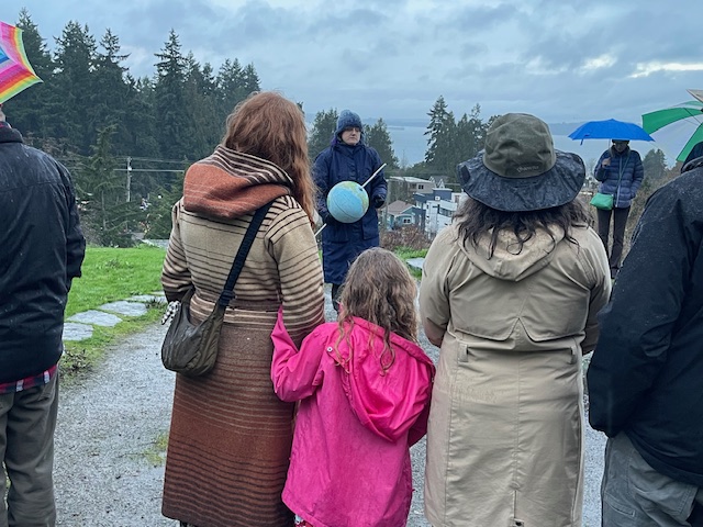
4:10 PM: More than two dozen people showed up!
4:26 PM: Among the questions Alice has been asked, how much more light do we get today now that the days are getting longer? Less than a minute, Alice explained. Meantime – the rain has stopped!
P.S. Alice calculates this was her 67th sunset watch. Our archived coverage of them dates back to 2009!
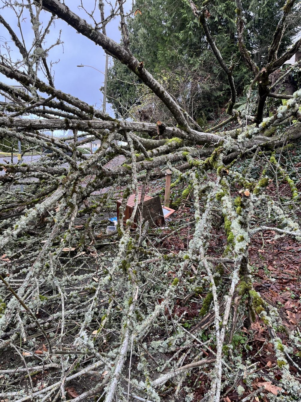
In the midst of that tree debris along 48th SW uphill from Lowman Beach is – was – Little Free Library #8702. Gay sent the photo and reports, “Super bummed that a neighboring tree fell on the Little Free Library on 48th south of Graham. We are glad no one was hurt. We take great care with the ivy and undergrowth. Thanks to all who have reached out to us.” We mentioned the 48th tree loss in our morning-traffic report but didn’t know at the time about the LFL. Weather authorities have warned that trees are more susceptible to falling because the ground is saturated, but the forecast has some reason for optimism – just calling for “showers” in our area over the next several days
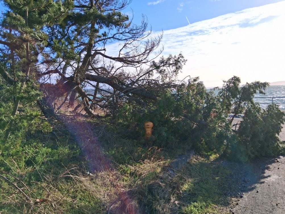 (Wednesday photo sent by Michelle – downed tree segment, blocking a hydrant by Constellation Park)
After a brief window without a wind alert for our area, the National Weather Service has another one taking effect at noon: A Wind Advisory for 12 pm to 7 pm, predicting “south winds 20 to 30 mph with gusts up to 45 to 50 mph.” If you’re evaluating plans for Alki tonight, with the Christmas Ship and Alki Holiday Lights events, it’s worth noting that south wind primarily affects the west-facing shores, as with the photo above; north-facing Alki is likely to be calmer.
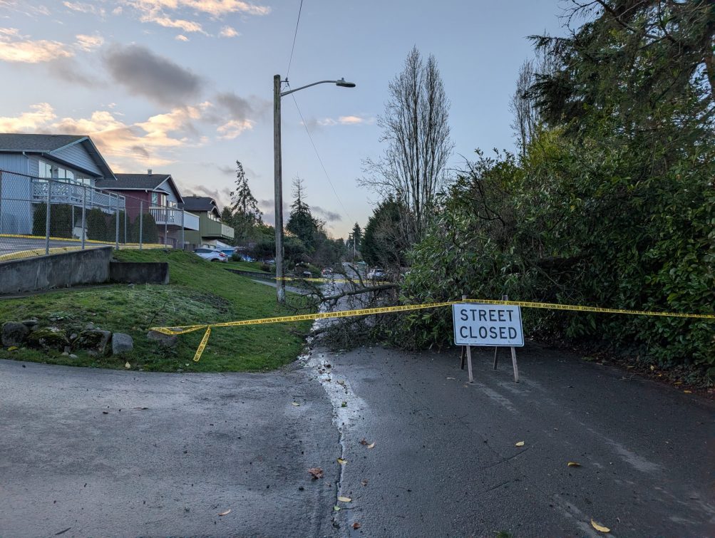
Thanks to Colleen for the photo. She reports, “Downed tree blocking 22nd Ave between Cambridge and Roxbury. Access to Community School West Seattle is from Roxbury only.” (Here’s a vicinity map.)
| 1 COMMENT