
West Seattle, Washington
05 Wednesday
 (Photographed Saturday at Alki by Theresa Arbow O’Connor)
We usually start Sundays with a list of what’s happening; today it will include what’s NOT happening because of our 2-day, 11-inch snowfall, and we’ll add to this with any closures/changes reported during the day. For starters:
CHURCH SERVICES: Today our updated list includes word of several churches canceling services – online and/or in-person – because of the snow.
HAPPY ANNIVERSARY, C&P: Today is the 18th anniversary of C&P Coffee Company (5612 California SW; WSB sponsor) opening for business! If you want to congratulate them while getting beverages and/or treats, they’ll be open 8 am-4 pm today.
ALSO OPEN TODAY: Here are businesses we’ve heard from:
Sound & Fog – open 8 am-3 pm
Youngstown Coffee – open 9 am-3 pm
HeartBeet Café – open 9 am-3 pm
Alair Gift Shop – open at 10 am
Mission Cantina (WSB sponsor) – 11 am-8 pm
My Three Little Birds (WSB sponsor) – noon-4 pm
WEST SEATTLE FARMERS’ MARKET CANCELED: As announced Saturday, this week’s market is canceled. If you had ore-ordered online via What’s Good, the market says your order will be canceled and refunded.
WEST SEATTLE TOOL LIBRARY: Open 11 am-4 pm on Sundays – WSTL was open yesterday, so as far as we know, they’re open today too. For drivers, they advise entering from the south side at Delridge/Oregon. (4408 Delridge Way SW)
Any other open/closed reports, please email or text us – westseattleblog@gmail.com, 206-293-6302 – thank you!
(SNOW LINKS: Metro buses on snow routes … traffic cams … map of what’s been plowed … plowing-priority map … BUSINESS LIST IN MORNING COVERAGE)
 (Fauntleroy ferry dock, photographed by Michael Burke)
1:25 PM: The promised “tapering” of the snowfall is happening – much lighter, at least here in Upper Fauntleroy, as we move to pm coverage (here’s the morning report). As we continue, a reminder about driving safely – for many reasons, from treacherous conditions to people walking, sledding, skiing in the street:
 (3200 block California SW, photographed by Christopher Boffoli)
We’ve also had a report of a Seattle Fire truck that got stuck, on Dawson east of California.
 (Texted photo)
INFO LINKS
Metro – all buses remain on snow routes; no 125
SDOT snow-routes map
SDOT “live” map updating where plows have gone
King County’s “live” map (White Center included)
West Seattle traffic cams
Seattle Public Library curbside services closed today
Seattle Parks snow info
*Businesses’ open/closed announcements that we’ve received are still being updated in today’s first report
It’s a work day for many, regardless of snow – from Susanna Moore of Niederberger Contracting (WSB sponsor), a photo and “Shout out to our hard-working US Postal Service in North Admiral”:

And of course, the SDOT snowplow drivers:
 (Photo tweeted by @jana_obscura)
As noted in the link list above, you can use this map to see where they’ve been. … More snow fun, too. This morning we featured videos of ducks and a dog playing in the snow – now, for equal time:
@westseattleblog what about kitties in the snow? pic.twitter.com/K1hblVcCVC
— 🐋🍂 (@kazzmere) February 13, 2021
As for humans, many are out sledding and skiing. Tom and Finn did the latter at Lincoln Park:

Another view of Lincoln Park, from John Borba:

2:40 PM: Just announced: Tomorrow’s West Seattle Farmers’ Market is CANCELED. (If you had pre-ordered for pickup via the What’s Good ordering system, WSFM says, your order will be canceled and refunded.)
2:57 PM: First lost/found pet report of the day – remember, we have a year-round page featuring West Seattle lost/found pets – if you’re missing a dog near 35th/Avalon, maybe this one’s yours. … Adding this to the business list in our morning coverage – Admiral Theater is closed today/tonight.
 (Near Longfellow Creek – photo by Rebekah LaSala)
3:28 PM: No media briefing today but the city has published a roundup of storm updates from its departments – see it here. One update of note: Seattle Public Utilities says transfer stations have closed for the day. … Another early closure: Whole Foods Market.

4:05 PM: Still lots of people out having fun in the show – above, another reader photo, featuring a wee one in an improvised ride in Arbor Heights. The afternoon forecast update is in – the Winter Storm Warning is now extended until 9 tonight. The forecast calls for a chance of another inch or so tomorrow, but otherwise, the big snow wallop is over.

5:04 PM: Lots of bird photos today – above, a tree full of robins in Seola Beach, photographed by Waikikigirl. We plan a “snowbird” gallery tonight or tomorrow. And just in from Brandon – Softy the snow sea lion:

5:34 PM: Holy Rosary has canceled in-person Mass for tonight and tomorrow but will have video on its Vimeo page. (Reminder, we update 20+ local churches’ online services weekly and include the link in our Sunday morning preview lists. Any local faith institutions who’d like to be in our calendar can email info to westseattleblog@gmail.com.) … Two scenes from Longfellow Creek, first via Twitter:
Salmon Bone Bridge
Seattle, Washington@westseattleblog pic.twitter.com/cedUFhSLzZ— Anthony (@amay206) February 14, 2021
And via text:

6:15 PM: Late word of online entertainment tonight – the West Seattle High School drama program is presenting “Twilight Zone Radio Dramas” tonight at 7 pm – several link options for watching. Go here.
Speaking of art:

Jeff Jolly says his creation is titled “Patiently Waiting for Summer.” … And, texted from Glenn Way west of The Junction, a simpler statement in snow:

Also creative – rearranged holiday lights, shining a Valentine’s heart under the snow at this Genesee Hill-area home, photographed by Julia Chase:

Yet another round of thanks to everyone who has emailed, texted, tweeted photos since the snow began falling – westseattleblog@gmail.com or 206-293-6302 – any time!
 (Alki this evening, photographed by James Tilley)
6:44 PM: The official snowfall total so far today at Sea-Tac Airport, according to the National Weather Service – 8.9 inches. That’s about what we measured here at HQ, and it’s an official record for this calendar date.
7:03 PM: Two road notes – Alice says the signal at 35th/Myrtle is out (no power outage on the map, so it seems to be an isolated problem); texter say.a bus is stuck at Fauntleroy/Alaska.
(SNOW LINKS: Metro buses on snow routes … traffic cams … map of what’s been plowed … plowing-priority map)
 (Delridge at Henderson – texted photo)
7:18 AM: Good morning! After 12+ hours of snow, we have at least half a foot – unofficially. The National Weather Service says the snow will continue this morning before tapering off this afternoon. We’ll be covering the weather all day – let us know what it’s like in your part of West Seattle! 206-293-6302 text or voice, westseattleblog@gmail.com – thank you.
 (Route 128 on California SW – photo by David French)
INFO LINKS
Metro – all buses remain on snow routes; no 125
SDOT snow-routes map
SDOT “live” map updating where plows have gone
King County’s “live” map (White Center included)
West Seattle traffic cams
Seattle Public Library curbside services closed today
Seattle Parks snow info
8:10 AM: Texted from 48th/Hanford, a scene of sheer joy:
That’s Mavis playing in the snow. It’s not all play today – many of your local small businesses are open for those who can get there safely – walking to your nearest coffee shop, for example.

8:54 AM: Barbara G measured 7 inches of snow near The Junction (added: Mark in Admiral has 11″). Still steadily snowing, and breezy. No major problems reported – just challenging conditions for getting around, even with plows on patrol. And as for the non-arterials, forget it – this is SW Edmunds, photo sent by Sonja:

And if you have to travel on Delridge Way, the cones in the next photo – taken near SW Willow – are a reminder, be very careful because all the ongoing paving work and detours may be hard to see under/in the snow:

9:15 AM: Business notes:
*We Sweat Infrared Sauna (WSB sponsor) – update, CLOSED
*Arthur’s – Open, with indoor and outdoor (“for the adventurous,” says proprietor Rebecca, adding, “tons of heaters”) dining.
*Fresh Flours in South Delridge – open until 5 pm
*Mission Cantina (WSB sponsor) – open
*Bebop Waffle Shop – open
*Kid Friendly Footwear – open until 4 pm, lots of kids’ snow gear
*West Seattle Cellars – open today until 6 pm
*Whole Foods Market closed early
*Admiral Theater is closed today/tonight
*The Alley in The Junction is open (5 pm-11 pm)
*Thunder Road Guitars & The Bass Shop (WSB sponsors) are closed today. Still making music, though – TRG proprietor Frank sent this pic:

(Did you see them in Save The Stone Cottage‘s “Karaoke Rock Concert” last night? Watch for our followup.)

9:54 AM: Let’s talk parks! Above, that’s Schmitz Park, and below, Alki Beach, both photographed by Jay Gewin:

Seattle Parks says golf courses including West Seattle are “open for snow play” today, as are athletic fields. Other snow impacts are noted here.

10:39 AM: More pets, as the snow continues falling. Above, via text, Fidel the cat, “deciding to stay in.” (Update: Later, Fidel changed course and headed out after all.) Below – ducks!
Addy Nachtrieb sent that video, and the caption: “Ducks in snow to make your day! Indian Runner Ducks, Mala and Prima, see snow for the first time. You can see more videos of Mala and Prima at @MalaAndPrima on TikTok.” We have received a few bird photos, too, and will plan on a separate “snowbird” gallery as we’ve done in past storms. But for now – bird tracks, sent by Mike:

11:25 AM: How about a road check? The first photo is from Mark Jaroslaw;

Mark reports, ‘Just returned from along the Alki/Harbor/Avalon/Fauntleroy/California/Admiral loop. All roads are now either compacted or scraped and are passable at slow speeds. Markets, gas stations, coffee shops open.” Next, two photos from Beach Drive – first one is from Carol Ann:

Next one is from Creighton, who reports 10-year-old Carson was en route to “First nordic skiing lessons” at Me-Kwa-Mooks.

Need a snow shovel? The West Seattle Tool Library is open and still has some in stock. (Only $1 to rent!) The WSTL says drivers should use the south entrance at Delridge/Oregon today. … Also pertinent to the snow (and adding to the business list above), Kid Friendly Footwear in The Junction (WSB sponsor) has “plenty of waterproof gloves & mittens, cozy socks, jackets + all kinds of new & gently used boots for babies & kids! Open today until 4 pm, sorry, free local delivery temporarily suspended for a few days.”
Thanks for all the photos and info – we’ll be launching afternoon coverage in a bit. (Added – Find it here.)
(SNOW LINKS: Metro buses on snow routes … traffic cams … map of what’s been plowed … plowing-priority map)
 (Fauntleroy Park photo by John Skerratt)
6:08 PM: As Thursday’s half-inch-or-so snowfall lingered throughout the day, city departments continued preparing for what’s to come. The mayor said that some forecasts, if borne out, could amount to a ‘snownami.” So let’s start with the forecast. Light snow is falling now. But the Winter Storm Warning isn’t in effect until 10 pm – the National Weather Service predicts up to eight inches of snow through tomorrow, and a chilly wind from the east. Whatever happens, city leaders say they’re ready:
Mayor Durkan led another media briefing this afternoon. SDOT says it’s had everyone on 12-hour shifts, pre-treating roads since Wednesday, and they’ve also been working on protected bike lanes, trails, pedestrian overpasses, and stairways. Their mechanics are on duty too so vehicle troubles won’t be a setback. Seattle City Light crews are ready. The city’s virtual Emergency Operations Center plans to activate at 8:30 am Saturday, according to new Emergency Management director Curry Mayer. The Human Services Department says three emergency shelters have been opened and none are maxed out yet. (None in West Seattle.) WSDOT plans to keep express lanes open. We asked SDOT director Sam Zimbabwe if low-bridge restrictions would be suspended so that people who absolutely had to cross the river in the snow wouldn’t have to drive a few miles extra. His answer: No. Metro and Sound Transit, meantime, remind you that they have to maintain reduced capacity, and masks are mandatory. One other note for getting around. The city promises to maintain access to COVID testing and vaccination sites as best it can – that includes the one in West Seattle (2801 SW Thistle, on a major plow route – see the citywide plow-routes map here, and the “live” map here). Here’s the full city multidepartmental roundup published after the briefing.
P.S. As always, we’ll start our coverage when the snow starts falling big time, and we’ll continue coverage all weekend. Photos, tips, info – text/voice 206-293-6302, or westseattleblog@gmail.com – thank you!
7:35 PM: Still snowing. Our side street’s coated. Some snow visible in the traffic cams showing arterials, too:
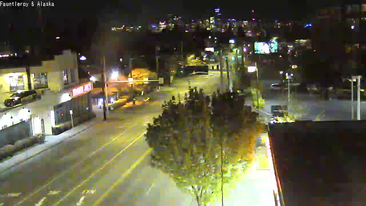
See all the West Seattle traffic cams here.
8:50 PM: Metro is now running on snow routes. Also: South Seattle College (WSB sponsor) is closing its campus tomorrow – there would normally be a few Saturday classes.
9:15 PM: Traffic report via text: Drivers are already having trouble on the Edmunds hill at 40th. Note that’s NOT a major plow route (see last page of this guide) – use SW Alaska to get from Triangle to Junction. … Also via text, Sam warns that people are getting stuck on Sylvan Way, too. … Also, trouble on SW Genesee east of Avalon, and Bonair above Alki.

9:36 PM: Alki at sea level is plenty snowy too – thanks to David Hutchinson for the photo.
11:29 PM: More photos – first, from SeanO at 36th/Hanford:

And really, stay off the hills. Here’s a contributed photo showing Lincoln Park Way:

It’s windy as well as snowy, and down into the mid-20s.
SATURDAY MORNING NOTE: Our snowstorm coverage continues here.
6:07 AM: Good morning. The next wave of snow isn’t likely until pm, but it’s been a sub-freezing night, so beware of icy roads.
ROAD MAP: See where SDOT crews have been. (7:51 AM UPDATE: We’ve been out. Bare dry arterials.)
TRANSIT: Check for Metro changes here.
Now, our usual checks:
BRIDGES
Low Bridge: Fifth week for automated enforcement cameras, while restrictions are in effect 5 am-9 pm daily. Here’s a bridge view:
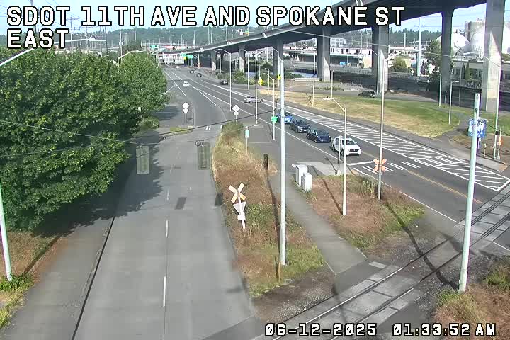
West Marginal Way at Highland Park Way:
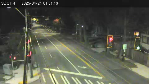
Highland Park Way/Holden – with a new left-turn signal for northbound HP Way, turning to westbound Holden:
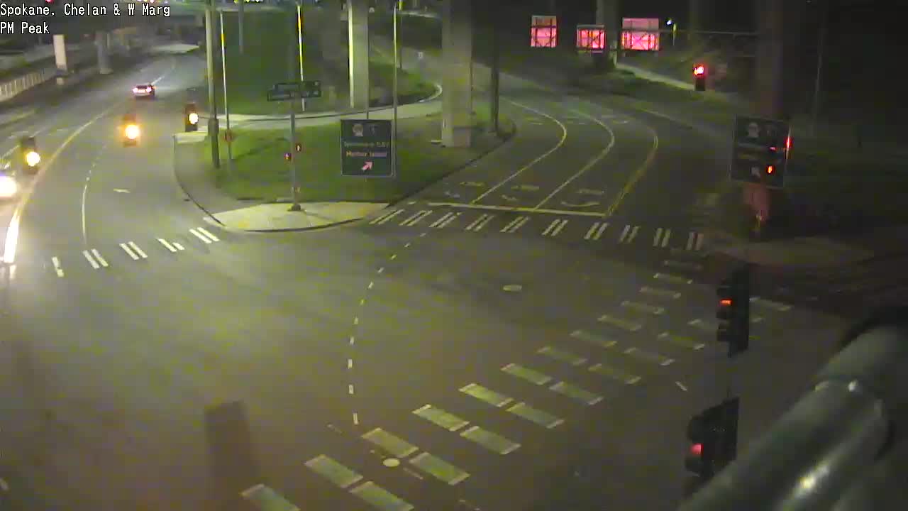
The 5-way intersection (Spokane/West Marginal/Delridge/Chelan):
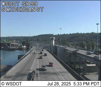
The 1st Avenue South Bridge (map):
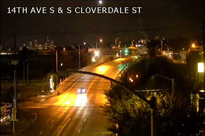
For the South Park Bridge (map), here’s the nearest camera:
To check for bridges’ marine-traffic openings, see the @SDOTBridges Twitter feed.
You can view all local traffic cams here; locally relevant cameras are also shown on this WSB page.
Trouble on the roads/paths/water? Let us know – text (but not if you’re driving!) 206-293-6302.

2:03 PM: No, that’s not snow in our photo – it’s salt, seen on SW Thistle east of California SW, as SDOT crews continue their pre-treatment of roads. However, we’ve been hearing about flurries all day – thanks to everyone who’s texted/called (206-293-6302 is our 24/7 hotline), emailed, and/or tweeted, from North Admiral to south of White Center. The light snow we’re seeing right now is exactly what was forecast, and the National Weather Service does NOT expect snow to accumulate today/tonight (though the temperature’s only in the mid-30s). The heavier snow is still predicted for tomorrow afternoon and beyond. We’re awaiting the mid-afternoon forecast updates, though, so we’ll see if anything changes!
 (Photo sent by Karen Therese near 25th/Roxbury)
3:14 PM: We ARE seeing some light accumulation on the ground where we are (300+ feet elevation). The alert level is still Winter Storm Watch. The NWS forecast for Seattle begins:
TONIGHT…Snow likely in the evening, then cloudy with a chance of snow after midnight. No snow accumulation. Lows in the mid to upper 20s. East wind 10 to 20 mph.
FRIDAY…Cloudy with a chance of snow. Highs in the lower to mid 30s. East wind 10 to 15 mph with gusts to 25 mph.
FRIDAY NIGHT…Snow likely in the evening, then snow after midnight. Snow accumulation of 3 to 5 inches. Lows in the mid to upper 20s. East wind 10 to 20 mph.
Here’s the full updated forecast. Meantime, snowplow sighted on our 2-arterial nearby corner, though nothing to plow yet:

Snow photos/reports? westseattleblog@gmail.com – thank you!
4:45 PM: Roads are still bare and wet. The snow has slowed down, too.
 (Photo sent by Madeline Hoover on Puget Ridge)
6:29 PM: Still no need to plow – but SDOT de-icer trucks are out. This map shows which roads have been treated and how recently, if you have to make a decision about heading out.
 (West Seattle Stadium – photo by Jason Hubbard)
8:55 PM: Forecast now suggests the major snow will arrive Friday night.
 (Beach Drive shore – photo by Diane McGee)
5:39 PM: No formal alert for our area so far, but the National Weather Service is still saying we’re likely to see snow in the days ahead – maybe flurries tonight, more likely an accumulation of up to half a foot starting Friday night. As usually happens when a forecast of serious snow is looming, the city held a media briefing, with regional transportation agencies, to talk about how they’re getting ready. The video above is from this afternoon’s briefing, led by Mayor Jenny Durkan, with department heads including SDOT, Human Services, and Emergency Management, as well as Metro, Sound Transit, and WSDOT. Of note: The mayor said snow routes have been updated to reflect the bridge closure. The citywide map is here, showing “gold” and “emerald” routes – the goal is to clear all travel lanes on the former, one lane each way on the latter. Here’s the West Seattle section:

After the snow starts, this map will show you where crews have been. The city also says it is ready to clear pedestrian paths and bike lanes as needed – but reminded residents and businesses that they are responsible for the sidewalks alongside their homes. (And if you have a disabled or elderly neighbor, lend a hand and clear their stretch of sidewalk.) If you encounter a road obstacle such as a fallen tree, report it to 206-684-ROAD
For bus riders, Metro’s storm info will be at metrowinter.com.
For people experiencing homelessness, the city and county are opening some emergency spaces, but nothing in West Seattle was mentioned. We checked with the West Seattle Veterans’ Center in The Triangle; they can’t open their emergency shelter because they had a COVID case and had to move people to a county-operated quarantine site. So call 211 if you need help or need to help someone find it.
P.S. Here’s the city news release with full multidepartmental reports on what’s being done to get ready.
8:34 PM: Now there’s an alert for our area and beyond – a Winter Storm Watch (read it here), Friday afternoon through Saturday afternoon.
 While we await the mid-afternoon forecast update to get the latest on snow probability, many are preparing, just in case. The West Seattle Tool Library wants you to know it has 12 snow shovels available for rent, first-come first-served, for just $1. The Tool Library is on the northeast side of Youngstown Cultural Arts Center, 4408 Delridge Way SW. Executive director Eric Renn adds, “Also note that kindness is key in these challenging times, and if you’ve got neighbors that are elderly or unable, please help them out and shovel their sidewalks or vehicles.” The Tool Library is open 5 pm-8 pm today and its inventory is online at wstools.org.
 (Seasonally garbed gargoyle on 36th SW – photo sent by Paul Winters)
All eyes are on the forecast, wondering if we really might see serious snow by Valentine’s Day. Mid-afternoon always brings a new round of forecasts, and here’s what they are predicting now. The National Weather Service, in its latest “forecast discussion,” says:
Models are starting to converge on the next weather system slated to arrive on Thursday with a surface low potentially making landfall near the mouth of the Columbia late Thursday night. This is the “sweet spot” for a surface low to move onshore in terms ofsnow. With plenty of cold air in place and low dewpoints initially, significant accumulating snowfall looks like a good bet…especially for areas south and west of Seattle. Between midday Thursday and midday Friday, 3 to 8 inches of snow look likely from Pierce County southward and over by Hood Canal with lighter amounts elsewhere.
There may be something of “lull” in snowfall Friday afternoon before another system arrives late Friday night and Saturday. And this one could be quite significant with snowfall.
One of our area’s best-known independent weather analysts, Cliff Mass, is a little less restrained. Among other points, his newest update says one model suggests Seattle COULD see a foot and a half of snow by late Monday. But he too stresses that the outlook could change. So don’t go panic-buy just yet. Do refresh your memory on dealing with weather-related problems – SDOT has transportation-related info, and City Light has outage advice, for starters. And commenter Suzanne has advice about preparing your plants.
 (Photo by James Bratsanos)
You’ve seen the snow on the mountains, and if you were up early this morning, you might have seen some down here. Might we see more? The first official National Weather Service alert of the week has been issued this afternoon – a Special Weather Statement:
Cold air over British Columbia is likely to push south into Western Washington this week. … After the colder air arrives, a front might reach the area with a chance of snow Thursday and Friday.
You know how often local forecasts change, so don’t get too excited and/or worried yet. But do be ready. Snow or no snow, overnight lows are expected to dip into the 20s.

Thanks to James Tilley for the photo of tonight’s sunset – just hours after all those wind-fueled waves. Tonight’s low is expected to be in the normal 40-ish vicinity, but then the forecast warns of cold nights on the way – 30s at night until Wednesday, Thursday, and Friday, when 30s are expected in the daytime, 20s at night, maybe a chance of a bit of snow … “most likely our coolest temps of the season so far,” says the National Weather Service.

9:58 AM: Thanks to Lucas for that photo of a tree that fell on Murray Avenue SW near Lowman Beach [map], first reported casualty of today’s wind. (Added: City Light has a 4-customer outage there.) The National Weather Service has a Wind Advisory in effect for our area through 10 pm, warning it’ll be more blustery than previously forecast – “southwest wind 20 to 35 mph, with gusts up to 45 mph.” If you have tree, power, or other trouble, please let us know – text or call 206-293-6302 or email westseattleblog@gmail.com – thank you!
12:10 PM: We went to Constellation Park shortly after high tide, which wasn’t mega-high today (11.6 feet):
Thanks to Eileen for sending this photo from that same area:
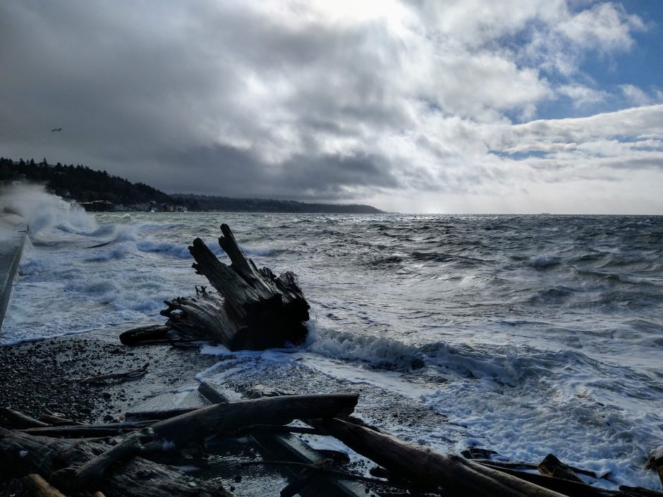
Meantime, further south, the Murray Avenue power is back on, according to the SCL map, but 10 homes are out on Beach Drive.

Thanks to everyone who sent photos of the double rainbow that appeared about two hours ago – here are two: Keith‘s view from Marine View Drive is above, and Jessie‘s view from Highland Park is below:

Jessie wrote, “The brighter mornings and evenings have been giving me so much hope, and this rainbow was an extra gift!” If you read closely you know we’ve been tracking that too; tonight’s sunset is at 5:17 pm, which is a full hour later than the earliest sunset of winter, back in December.
Now on to the weekend weather outlook: Did you hear the wind early this morning? Tonight and tomorrow could bring it back, according to the forecast – southwest wind, 10 to 20 mph with gusts to 30 mph overnight, 15 to 30 mph with gusts to 40 mph Saturday. Off-and-on chances of rain (although we’re enjoying a big sunbreak right now). Then next week – cold nights/mornings with “a slight chance of rain and snow” mentioned for Monday and Thursday. 42 days left in winter!
11:52 PM: After a day and night of almost-nonstop rain, a slide is reported – this time behind at least one building in the 1200 block of Alki Avenue SW. SFD and SPD are checking it out for starters; it’s reported to have taken out some trees.
ADDED 10:31 AM: Thanks to Lynn Hall for the photo:

Lynn explains, “Last night’s Alki slide is next door to the even larger slide that occurred last summer and is being repaired by the City of Seattle (plastic on slope is part of that restoration).”
ADDED 11:06 AM: Thanks also to Stewart L. for checking out the scene:

Note the yellow tape; a notice is posted warning people to stay out of the back yard because of the tree danger:

We will be checking with the city later today.

Thanks to Jerry Simmons for that view of this morning’s sunrise … a colorful start to what ended as a gray day. Still a chance we might see a few snowflakes, but our neighbors across Puget Sound – Bremerton, Hood Canal vicinity – have the highest probability. Nonetheless, the forecast discussion says we have a chance, especially on the highest hills – the Myrtle Reservoir Park vicinity holds the highest elevation in the city. The forecast summaries note a chance of rain and snow tonight and tomorrow morning. (Just in case of snow, SDOT says its crews are ready.)

While the sun was setting with a golden flourish in the southwest, we caught that cloud putting on a show in the northwest. And for all those who, like us, have been observing the passage of time more closely than ever during this pandemic year, we wanted to note a milestone: Tonight was the first 5 pm sunset of the winter. (That’s 42 minutes later than the earliest sunset of winter, 4:17 pm December 7th through 13th.)
P.S. “Slight chance of rain and snow after midnight,” says the forecast.

Sub-freezing temperatures have been scarce this winter – but this morning’s official low (at Sea-Tac) was 29, explaining the ice-skating the Steller’s Jay was attempting in the photo above by Jerry Simmons. If you have a bird bath, you’ll want to keep it defrosted it in the days ahead, because more extra-chilly weather is on the way, including what the National Weather Service calls “a chance of spotty light snow at times in the lowlands.”
 (Photo by Lynn Hall)
As for the near-term, tonight’s NWS “forecast discussion” says: “Clouds will increase tonight and areas of precip should start by daybreak. The hills might pick up a little wet snow tomorrow morning, but accumulations should be mainly in the grass rather than the pavement.”
 (Frosty roof and foggy sunrise, by Coleman Smith)
After that, “Another front or two arrive late in the week–but it is too early to say much about that other than a low snow level is likely, but nothing yet looks like a slam dunk for the lowlands.” Snow or no snow, Monday, Tuesday, and Wednesday nights may get down to freezing again.

That’s a view of tonight’s sunset from Upper Fauntleroy, photographed by 6-year-old Ethan. We’re taking the occasion to check in on the weather chatter about the possibility of a little snow this weekend. The National Weather Service “forecast discussion” says in part:
A stronger, more organized frontal system will … drop SE into the area Saturday night into early Monday. We’re still keeping an eye on the possibility of lowland snow with this system as snow levels drop to near 500 feet and possibly to sea-level in some spots. About half the ensemble members continue to indicate a rain/snow mix or light snow in the Seattle metro but have backed off slightly on potential accumulations …
So don’t get too excited (or worried) yet. Between now and then, cloudy but dry until possible Thursday rain, then two more sunny days are expected.

If you go to local parks this weekend, you might encounter the aftermath of this past week’s storms. Above and below are photos Mike Munson took at Lincoln Park, where, he explains, he found the above sign “at the bottom of the trail from the cliff to back of the pool at Point Williams, on the old road grade.” He also saw this:

That, Mike said, was “a small slide developing along the beach trail north of the pool. Some brush has been pushed a little way into the trail, and fresh gray goo is visible behind, upslope. It’s probably done sliding, but maybe more to come?” Parks crews also have been busy with downed trees. Today, we saw that this one is still on its side in the big field at Roxhill Park:

No notable rain or wind in the forecast – though note that mention of a possible snowflake or two next Friday.

So far today, the clouds are a little more ordinary than the formations Jerry Simmons photographed (above) on Thursday. But the good news, unless you’re a major fan of rain, is that things are drying out, at least for a day or so – the forecast suggests Saturday will be mostly dry, until a chance of rain returns Saturday night and lingers through Sunday until a partly sunny King Day on Monday. As of early this morning, the official rain total (at Sea-Tac) was almost three times normal for this time of year, 7.58 inches (the National Weather Service says the seasonal norm is 2.64). More good news for fans of light:

While there’s no telling yet whether tonight’s sunset will be as photogenic as the Thursday sunset photographed by Dan Ciske (above) and others (thank you, everyone!), the 4:45 pm official sunset time is almost half an hour earlier than the earliest sunset of winter.
 (Alki photo by James Tilley)
The overnight windstorm stole the spotlight from this morning’s “king tide,” but tomorrow’s a rerun – 12.8 feet at 6:40 am. No “coastal flood advisory” alert this time, though, as the weather has calmed down – tomorrow midday is likely to look like this:
 (Photo by Troy Sterk)
A mostly sunny Thursday is predicted, high around 50, maybe some light rain tomorrow night, but tonight is expected to stay dry.
 (The Brothers, seen from Alki this morning – photo by WSB’s Patrick Sand)
11:18 AM: It’s the near-calm after the storm … but more than 4,500 homes/businesses in West Seattle are still without power after the outages began just before midnight. Here’s a screengrab of the current Seattle City Light map:

South of the big outage in Alki/Admiral/Genesee/North Delridge, most of those markers represent single-digit outages. SCL peaked at 72,000+ customers out and has now halved that, but that still means many hours of work, and as we’ve seen in many other outages, the work can be complicated and take longer, depending on what tree went into what line, affecting what part of the system … etc. Please remember that the estimated restoration times on the SCL map are only guesses – you could get yours back much sooner or much later.
12:54 PM: SCL has provided a detailed update here, including an explanation of how it prioritizes repairs in situations like this. It should also be noted that cable/internet services have been experiencing outages, too – we’ve heard from some customers. Those outages tend to be more hyperlocalized. We did see several Comcast and CenturyLink crews out while we were traveling around the peninsula at midmorning.
1:54 PM: Commenters and texters are telling us the power’s back in most if not all of the large-outage area, after 14 hours. The map should catch up shortly. … Update: About 200 people are still out in scattered outages around WS.
2:24 PM: Still lots of tree-cleanup work to be done, along with the trouble spots we showed earlier. Sarah sent this photo from 39th/Monroe in Gatewood:

And from Aaron, south of Admiral:

Tree trouble led Seattle Parks to tweet this reminder: “Following last night’s windstorm, we encourage all visitors to use caution in our outdoor spaces and please stay out from under trees and avoid forested park areas. To report a downed tree or maintenance issue, contact 206-684-7250.”
6:13 PM: Here’s one of the trees Parks lost – texter just sent this photo of a tree down at Roxhill Park:

6:44 PM: Checking the SCL map again, numerous scattered outages still have almost 500 customers out in West Seattle. Systemwide, nearly 6,000.
8:50 PM: About 300 more people lost power in west Admiral/upper Alki earlier this hour. Though we don’t have any official information beyond the map confirmation, keep in mind that repair work sometimes sparks new outages as crews work on rerouting/reconnection; this is by the scene of the tilting pole and downed wires at 49th/Waite. There’s also a pocket that lost power on the west side of Delridge south of Thistle earlier this evening.
9:20 PM: The Alki/Admiral outage is now at about 500 customers.
8:22 AM: Seattle Public Schools just announced this via Twitter: “Due to a citywide power outage, there won’t be live instruction today, Jan. 13. Please have your student work on independent assignments. Meal sites will remain open.”
11:11 AM: Here’s a district news release addressing what some commenters mentioned – that some educators had already started classes when the “no classes” announcement came out:
– Live remote instruction for Seattle Public Schools students is not occurring today due to storm-related power outages in Seattle.
The outages impacted about 30 percent of SPS staff and families, along with 13 SPS school buildings (where some SPS staff continue to work each day).
Based on the significant impact of the outages, it was determined that district-wide live remote instruction would not be conducted. Some educators had already begun live remote teaching prior to the district’s announcement this morning. Those educators can continue with their live remote teaching. Otherwise, families are asked to direct students to focus on independent assignments.
Meal distribution sites remain open, with the exception of the site at Beacon Hill Elementary School. Meals can be accessed at other SPS meal distribution sites.
| 6 COMMENTS