West Seattle, Washington
19 Monday
One more “week ahead” preview – this time, what’s in two types of forecasts:
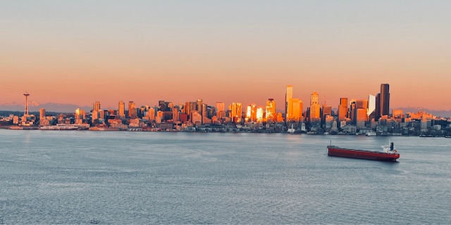
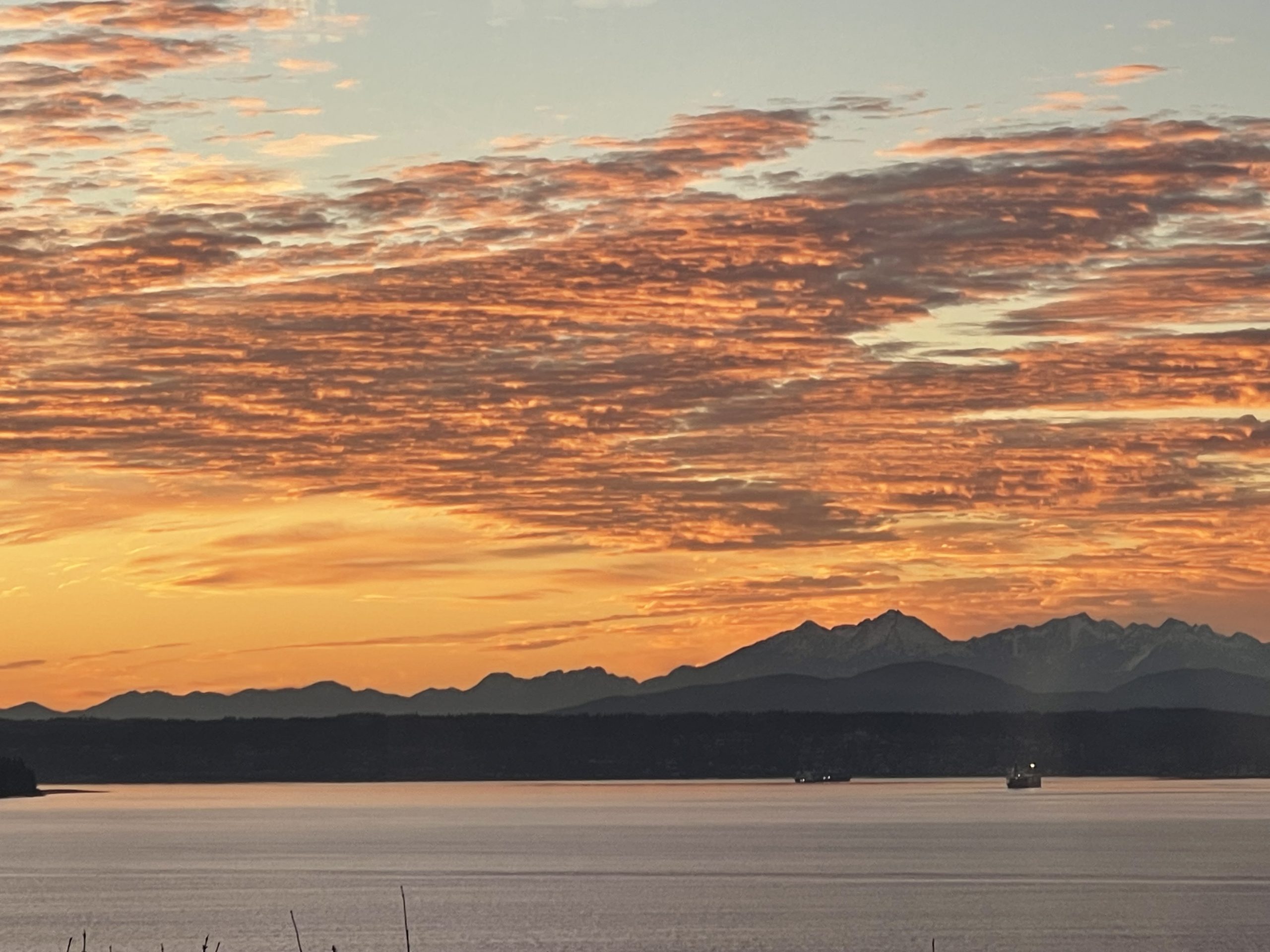
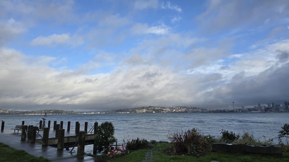
SUN’S NOT DONE: Jen sent that photo of tonight’s sunset reflected off the downtown skyline. It’s a reminder that precipitation doesn’t return to the forecast until Thursday. Sunshine is expected tomorrow; then clouds are expected tp start their comeback, but “a chance of rain or snow” doesn’t appear until Thursday night. Temperatures are likely to remain in the normal range – upper 40s highs, upper 30s lows.
KING TIDES’ FINAL APPEARANCES: The morning high tides will be above 12 feet all week, peaking at 12.6 feet on Thursday, Friday, and Saturday mornings (January 22-24), then again on February 2nd, 3rd, and 4th, with the highest high tides dropping below 12 feet entirely by late March.
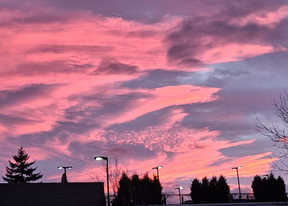
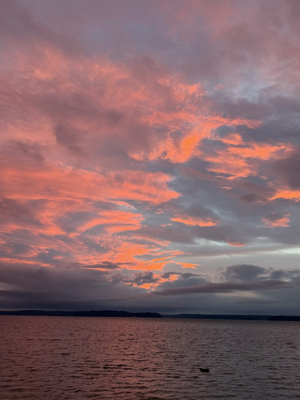
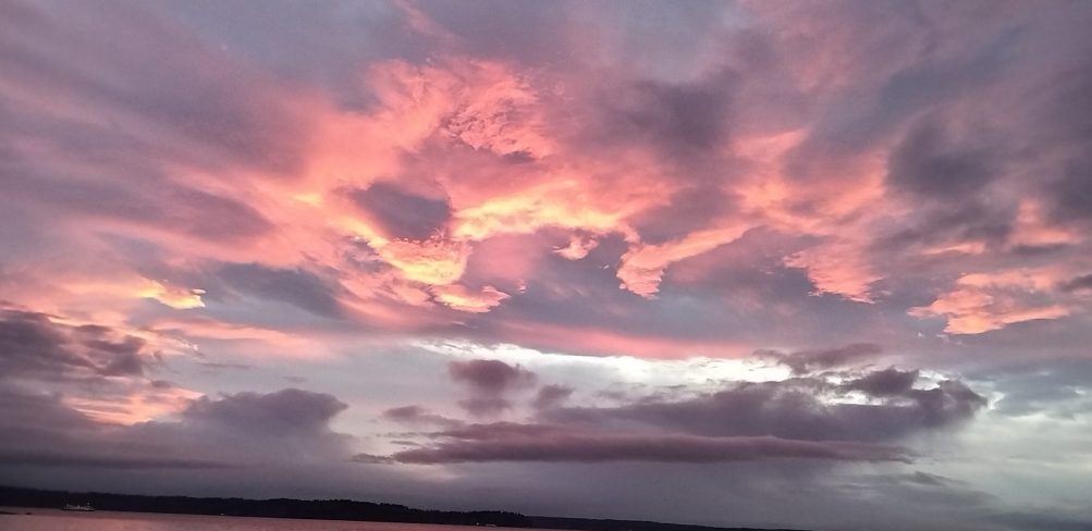
You didn’t have to be by the water to see tonight’s pastel-pink sunset. Bob Burns took the top photo from near Admiral Safeway. But we did get water views too, this one from Carol Ann:
And this one from Chris:
Thanks as always to everyone who sends photos – westseattleblog@gmail.com unless it’s breaking news, in which case you can text us at 206-293-6302. The sunset show comes at the start of a warmer week, with highs near or above 50 in the forecast every day. (Today’s high was 52, four degrees above tomorrow; tomorrow is expected to be in the mid-50s!)

Thanks to Mark Erskine for the photos! This is what Lincoln Park‘s shore looked like at high tide shortly after 7 am, at 13.0 feet the highest predicted high tide of the year (along with next December 26).
The actual water level was a bit higher than predicted, according to this NOAA chart, but nothing calamitous. Tomorrow’s predicted high tide is almost as high as today’s – 12.9 feet at 7:43 am.
This morning’s predicted high tide is 13.0 feet – tying next December 26 for the highest predicted high tide of the year. This one’s likely to be higher than predicted due to atmospheric conditions – the red line on this graph tracks it. High tide arrives at 7:08 am; a Coastal Flood Advisory alert is in effect 4 am to 9 am, but no major problems are expected.
 (December 25 reader photo of high-tide aftermath on Alki promenade)
The next round of “king tides” – the year’s highest high tides – peaks in the next several days, and low atmospheric pressure could mean higher water levels than predicted. First, here’s what the tide tables predict for our area:
Saturday: 12.8 feet, 5:51 am
Sunday: 12.9 feet, 6:30 am
Monday: 13.0 feet, 7:08 am
Tuesday: 12.9 feet, 7:43 am
Wednesday: 12.8 feet, 8:17 am
WSB reader Lura points out that atmospheric conditions can push the water levels higher than predicted – see the red line on this chart, for example – and she notes that if forecast conditions bear out, that could mean 14-foot high tides ahead. The National Weather Service has a Coastal Flood Advisory alert for 4 am-8 am Saturday; along the Duwamish River, the city says “… river overtopping is not forecasted. However, significant street flooding in the industrial area of South Park is expected on the mornings of Saturday, January 3rd and Sunday, January 4th.”
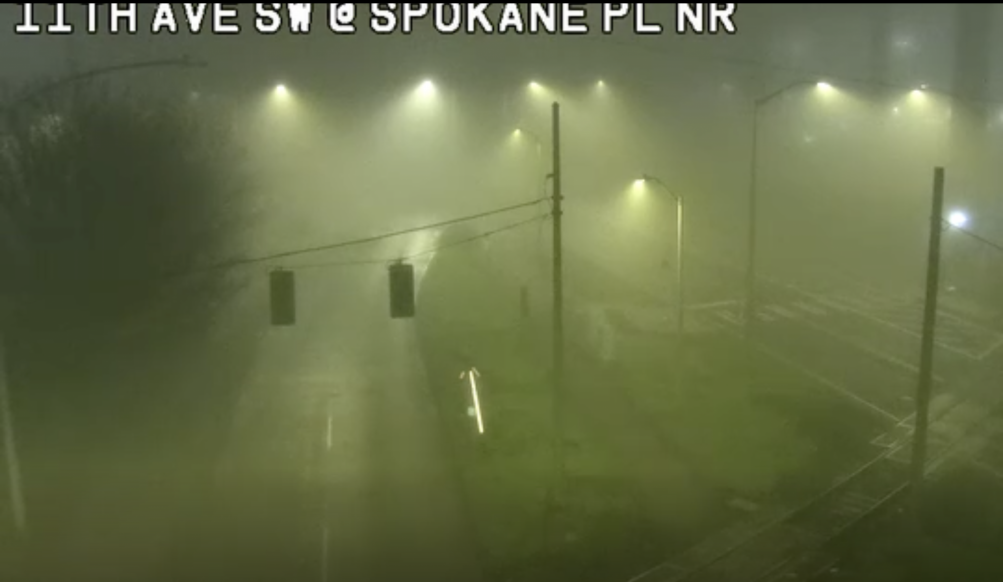
11:03 PM: The National Weather Service has another Dense Fog Advisory in effect until 10 am New Year’s Day. If you were thinking of going out to see the Space Needle fireworks, sorry, no view from West Seattle unless there’s a midnight miracle – we came down to Harbor/Alki Aves to check if the bay’s socked in – yes, it is. (Only positive thing to report is that street-level fog is a lot thinner down here – uphill it’s thick.)
12:03 AM: The TV stream of the Needle fireworks shows they’re even fogged in for the cameras right beneath.
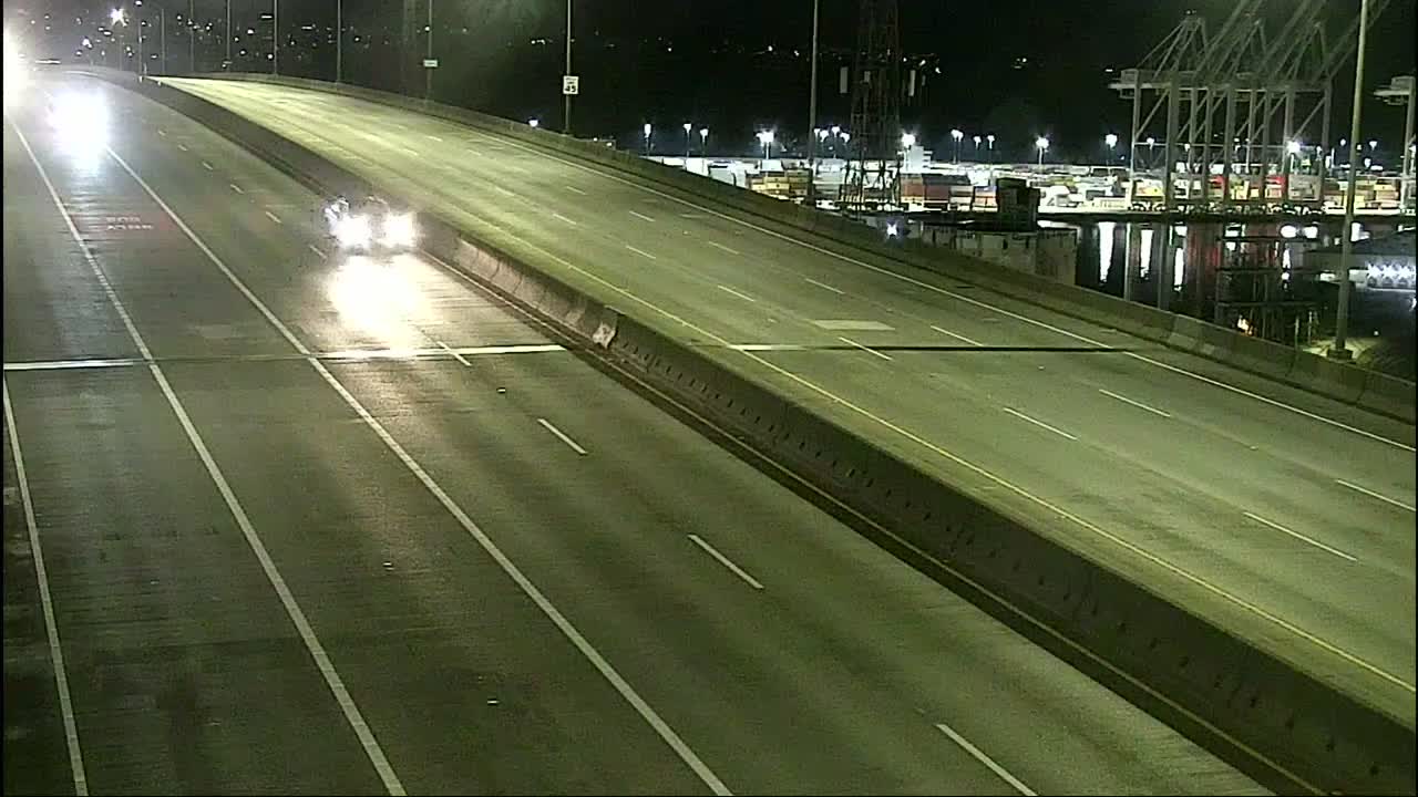
 (SDOT traffic-cam screengrab from right before we published this story)
3:12 AM: Perhaps 2025 just wants to vanish into the fog. The National Weather Service has a Dense Fog Advisory alert in effect for our area until 10 am. This not only could mean visibility problems, but also the possibility of icy streets, as the fog meets near-freezing temperatures. So give yourself extra time to get wherever you have to go.
9:22 AM: The advisory has been extended until noon – forecasters believe the fog will linger longer.
Thanks to Brooke Gosztola for that view of tonight’s sunset! The original forecast for a mostly cloudy day didn’t bear out, but just enough clouds sneaked in by day’s end to catch the color. So far, the forecast looks dry all the way until New Year’s Day night! Not too cold either – daytime highs in the mid-40s, nighttime lows in the mid-30s. (And water temperature in the mid-to-upper 40s, if you’re planning on Thursday morning’s Polar Bear Swim!)

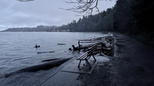
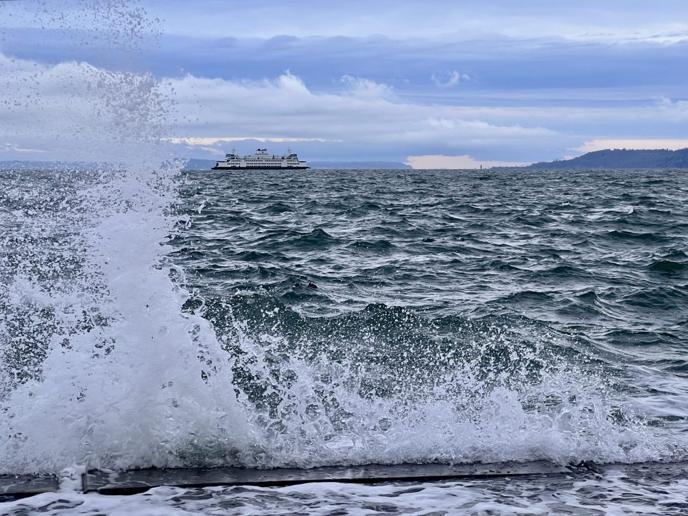
High tide plus north wind brought seawall waves again this morning along the West Seattle waterfront. Above is Tom Trulin‘s photo from the north shore of Lincoln Park; below, an Alki photo by Mike Burns:
No alerts in the forecast right now, but some potential highlights include the ever-popular “wintry mix” Friday night if precipitation remains in the area as temps drop into the 30s, and Saturday at this point is predicted to be mostly sunny.
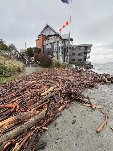
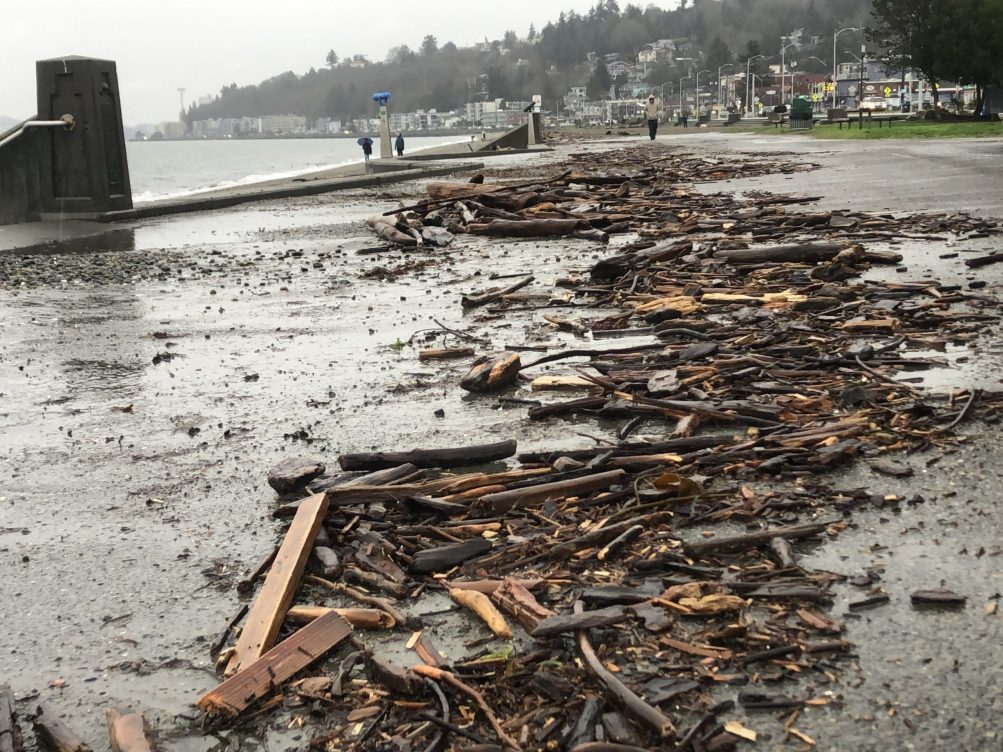
Thanks to Clare Brooks for the photo! That pileup of driftwood at the west end of the Alki promenade is at least in part thanks to the high tide wind-and-saves action shown here. The National Weather Service had a Coastal Flood Advisory in effect for “minor” overflow this morning and has another one up for 7 am-1 pm Thursday, when the predicted high tide is again 12.4 feet (9:01 am this time, with calmer atmospheric conditions less conducive to overflow).
9:54 AM: Thanks to Amy Bannister for sending that video from Alki Statue of Liberty Plaza, where wind and high tides combined for wave action against the seawall early this morning.
Meantime, speaking of wind, the National Weather Service has again changed the alert level for what it believes is on the way. Now it’s downsized to the lowest level of alert, Wind Advisory, still in effect 10 am-7 pm: “South winds 20 to 30 mph with gusts up to 45 mph expected,” possibly a bit higher close to the water. (But of course, that’s just a forecast, so don’t get complacent – stay charged and stay safe!)
1:08 PM: Now the NWS has canceled the alert altogether. The breeze is picking up a bit out there, though, so it won’t be entirely still.
12:36 PM: It’s been a windy December and it’s not done yet. The National Weather Service has a High Wind Watch alert for our area for tomorrow (Wednesday, December 24), 10 am-7 pm. Here’s what forecasters think will happen:
* WHAT…East to northeast winds of 10 to 20 mph with gusts to 30 mph will suddenly shift to southerly Wednesday afternoon with wind speeds of 25 to 35 mph and gusts of 50 to 60 mph possible.
A High Wind Watch is one step up in intensity from a Wind Advisory, which is the most-common type of alert we’ve seen so far these past few months.
9:31 PM: As commenter B points out, the NWS has upgraded this to a High Wind Warning, though the time frame – 10 am to 7 pm Wednesday – and the details – “South winds 25 to 35 mph with gusts 50 to 60 mph expected” – are similar. Main change is “possible” to “expected.”
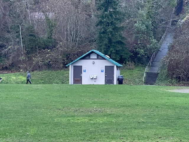
Seattle Parks is out today with its list of park restrooms winterized this year, including eight that Parks says will remain open in winter for the first time because of Park District funding. Three of those eight are in West Seattle – the Fairmount Park restroom building (shown in our photo above), Riverview Playfield, and Roxhill Park. The full list is here; Parks adds this caveat:
While we strive to keep these restrooms open for the winter, there may be times when we must close them for repair or due to extreme low temperatures. Some restrooms that are normally open year-round are not included in the list … because they are currently closed for capital improvement projects or repairs.
Parks added three West Seattle restrooms to the year-round list a year ago, too.

3:50 PM: Winter has arrived with true Seattle wintry weather – rain. Nevertheless, Alice Enevoldsen is at Solstice Park for her quarterly sunset watch, despite the sun being highly unlikely to make even a brief appearance this time. So if you want to commemorate the change of seasons and learn about the solar-system machinations behind it, come on over to the park’s plateau, uphill from the tennis courts at 7400 Fauntleroy Way SW. (The sun sets – out there beyond the clouds somewhere – behind the trees and mountains around 4:05, officially at 4:20 pm.)
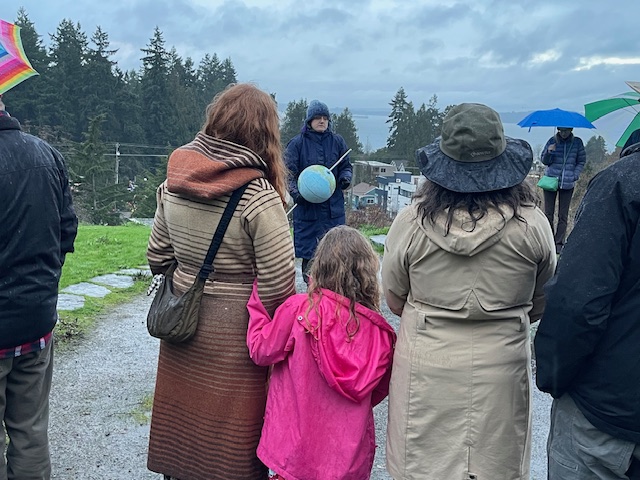
4:10 PM: More than two dozen people showed up!
4:26 PM: Among the questions Alice has been asked, how much more light do we get today now that the days are getting longer? Less than a minute, Alice explained. Meantime – the rain has stopped!
P.S. Alice calculates this was her 67th sunset watch. Our archived coverage of them dates back to 2009!
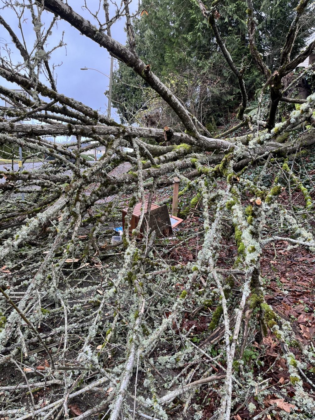
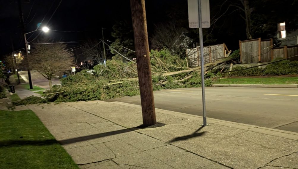
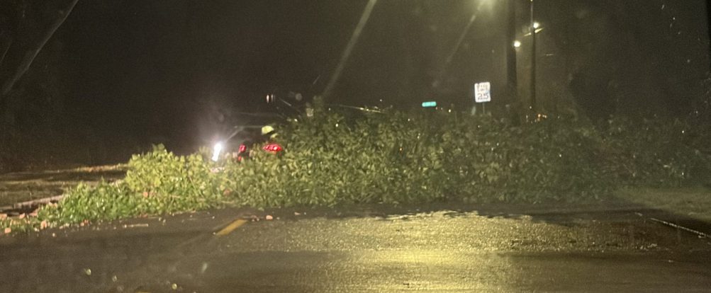
In the midst of that tree debris along 48th SW uphill from Lowman Beach is – was – Little Free Library #8702. Gay sent the photo and reports, “Super bummed that a neighboring tree fell on the Little Free Library on 48th south of Graham. We are glad no one was hurt. We take great care with the ivy and undergrowth. Thanks to all who have reached out to us.” We mentioned the 48th tree loss in our morning-traffic report but didn’t know at the time about the LFL. Weather authorities have warned that trees are more susceptible to falling because the ground is saturated, but the forecast has some reason for optimism – just calling for “showers” in our area over the next several days
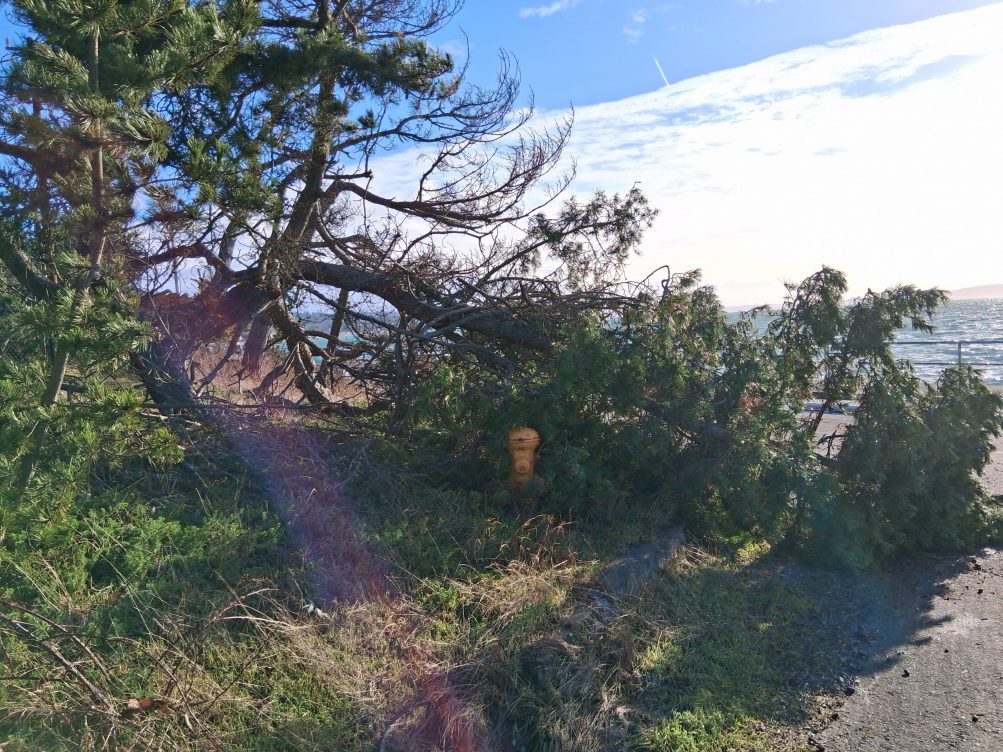 (Wednesday photo sent by Michelle – downed tree segment, blocking a hydrant by Constellation Park)
After a brief window without a wind alert for our area, the National Weather Service has another one taking effect at noon: A Wind Advisory for 12 pm to 7 pm, predicting “south winds 20 to 30 mph with gusts up to 45 to 50 mph.” If you’re evaluating plans for Alki tonight, with the Christmas Ship and Alki Holiday Lights events, it’s worth noting that south wind primarily affects the west-facing shores, as with the photo above; north-facing Alki is likely to be calmer.
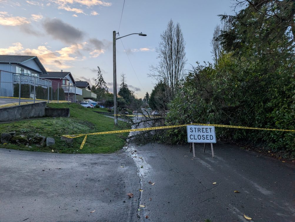
Thanks to Colleen for the photo. She reports, “Downed tree blocking 22nd Ave between Cambridge and Roxbury. Access to Community School West Seattle is from Roxbury only.” (Here’s a vicinity map.)
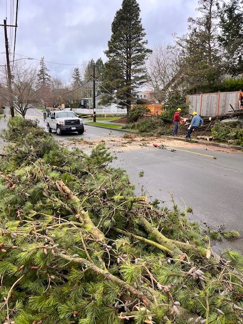
Thanks to SeanO for the pic and update – the tree that’s been blocking SW Hanford near 39th SW since last night is almost cleared away.
6:37 PM: Thanks to everyone who has sent photos of that tree down, blocking SW Hanford near 39th. (The photo above is from Angela.) Forecasters warn that as the rain/wind waves keep coming through, we’re likely to see more trees tumble, as the ground is saturated.
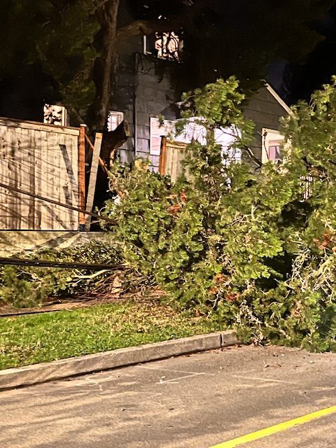
6:58 PM: A texter just sent that closer-up view of where the tree fell through a fence.
P.S. A crew was on scene a bit later in the evening so we’re hopeful it’ll be cleared by morning – if it’s not, please let us know – text or voice 206-293-6302.
 (First two photos by James Bratsanos)
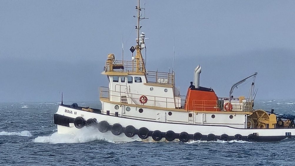
4:08 PM: A bit of a headwind for that tug on Elliott Bay, as seen above – but we’ve escaped without too much overall weather drama here on the peninsula this afternoon, and the sun and blue sky have made appearances.
Even a rainbow:
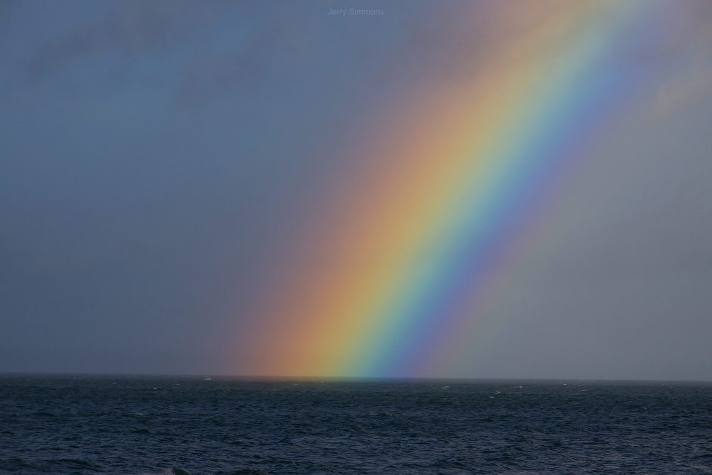 (Photo by Jerry Simmons)
But as we first mentioned in the morning traffic/weather watch, there’s another wind alert for Tuesday pm. This afternoon it was downsized from a High Wind Watch to another Wind Advisory – and it’ll kick in a little earlier, 4 pm tomorrow, with maximum gusts possibly around 45 mph. (Read the new version here.)
ADDED 6:42 PM: We’ve had it easy compared to people along flooded rivers around Western Washington. King County leaders and weather authorities held a mid-afternoon briefing after the Green River levee breach; WSB contributor Anne Higuera watched it in case of information relevant here too – here’s her summary:
Impacts from the relentless rainfall of the last week aren’t letting up, with a levee breach on the Green River this morning (shown above in King County Sheriff’s Office aerial video), water ponding on some approaches to the West Seattle bridge and a traffic tangle for anyone heading south of 405 into the Kent Valley, where a portion of Highway 167 is closed. And there’s more: Wind advisories for today and tomorrow and more rain in the forecast through the end of the week. At a news conference this afternoon about the levee breach, King County Executive Girmay Zahilay called it a “very serious and emerging situation.”
Repairs are already under way on the Desimone levee, near Olympic Avenue South in Tukwila. The King County Department of Natural Resources and Parks had been monitoring that area, so when a stream of water started flowing out, they were able to act quickly to order evacuations and start working on a fix. “It’s not typical to have these levees have this much water behind them for this long, which is why we’re paying close attention,” said Director John Taylor. Right now the county is using a variety of resources, from National Guard troops to drones and the county’s Guardian One helicopter, to monitor levees throughout the area for potential trouble spots. No one was injured in the breach, and those who evacuated should stand by, says county Emergency Management Director Brendan McCluskey. “Once we can safely let people go back in, we’ll let them know.”
For everyone else, the standard warnings apply, to not drive through standing water or on roads that are closed, and to take common-sense steps given the conditions. “We are not done with this event yet,” said Reid Wolcott with the National Weather Service. “This is one small event in a greater disaster going on across the Pacific Northwest.” Wolcott, who is an NWS warning coordination meteorologist, pointed to the current Wind Advisories calling for gusts up to 45 mph. “That does not sound like a lot, but our soils are not normally this saturated. We have a very high risk of trees coming down.” There’s also an active flood watch issued, along with a special weather statement about potential landslides.
The website www.kcemergency.com will be updated with any new alerts from King County’s Office of Emergency Services. Seattle’s Office of Emergency Management has not issued any alerts since last August.
6:13 AM: Texter warns of much water in eastbound WS Bridge outside lane to 99 ramp.
6:30 AM: Another texter reports police with a possible stalled car blocking the ramp to NB 99.
6:38 AM: SDOT says the ramp has reopened.
Earlier:
6:00 AM: Good morning! It’s Monday, December 15, 2025.
WEATHER + SUNRISE/SUNSET, WITH TWO WIND ALERTS
The National Weather Service now has two wind alerts for our area:
*Wind Advisory still in effect until 10 pm tonight, with a chance of sustained 20-30 mph southwest wind, gusting to 55 mph
*High Wind Watch for 7 pm Tuesday through 10 am Wednesday, with possible sustained southwest wind 25 to 45 mph, gusting as high as 65 mph
*Meantime, in the forecast – rainy with a chance of pm thunderstorms, windy, high in the upper 50s.
Sunrise will be at 7:51 am; sunset at 4:18 pm.
TRANSIT TODAY
Washington State Ferries – WSF says the Triangle Route will continue on two boats for up to two more weeks. WSF’s alerts page has the details; Vessel Watch will show you which boat is where.
Metro buses – They’re on the regular weekday schedule and routes in our area.
West Seattle Water Taxi – regular West Seattle service, fall/winter schedule.
SPOTLIGHT TRAFFIC CAMERAS (Note – SDOT’s system is having trouble as of 6 am)
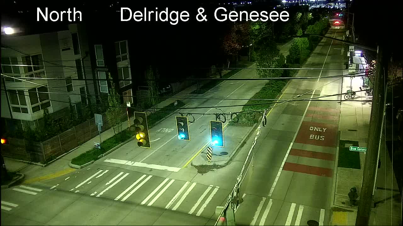
High Bridge – Here’s the main camera, followed by the Fauntleroy-end camera:
Low Bridge – Here’s the view looking west. Also note, maritime-opening info is again available via X (ex-Twitter):
1st Avenue South Bridge:
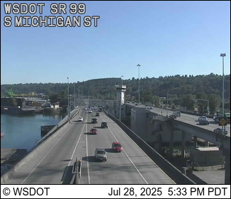
Delridge cameras: In addition to the one below (Delridge/Genesee), cameras are also at Delridge/Juneau, Delridge/Henderson, Delridge/Oregon, and video-only (so you have to go to the map), Delridge/Holden and Delridge/Thistle.
MORE TRAFFIC CAMS: All functioning traffic cams citywide are here (including links to live video for most); for a quick scan of West Seattle and vicinity-relevant cameras, see this WSB page.
See a problem on the bridges/streets/paths/water? Please text or call our hotline (when you can do it safely, and after you’ve reported to authorities if they’re not already on scene) – 206-293-6302. Thank you!
Another Wind Advisory alert from the National Weather Service – this time, for 10 pm tonight (Sunday, December 14) through 10 pm Monday. The NWS alert advises expecting south winds 20 to 25 mph with gusts 45 to 50 mph. And it adds, “Given the very saturated ground, expect that impacts may be more widespread than normally associated with these particular wind speeds.” Charge everything!
SIDE NOTE: Tonight marks the 19th anniversary of the 2006 Hanukkah Eve Windstorm – which threw thousands of West Seattleites out of power for days, us included.
Perla sent that photo of a tree down on 48th SW between Eddy and Beach Drive. She says it came down a few minutes after 9 and just missed her and her husband. She’s reported it to 911.
| 0 COMMENTS