
West Seattle, Washington
12 Sunday

So far, mountain-peak peeks – like the view above from Alki on New Year’s Day – have been the closest thing to snow sightings we’ve had this winter. But that might change later this week. Here are two updates:
-Weather analyst Cliff Mass breaks it all down here, saying late Thursday/early Friday might bring light snow, and Monday looks POTENTIALLY snowier.
-The National Weather Service‘s forecast discussion thinks the late Thursday/early Friday possibility is more a “north of Everett” thing, adding, “Uncertainty remains for the prospect of lowland snow early next week …”
Meantime, city leaders plan a snow-readiness media briefing on Thursday, and we’re planning to cover it, so if you have questions about how the city will handle the next snowstorm (whenever it happens), let us know so we can get answers!
You’ve probably heard by now that we MIGHT see some snow next weekend. Too soon, stlll, to really go into all-out Snow Panic Mode, but not too soon to contemplate whether you’re ready for it. In particular, the video above points out one thing that often comes up in WSB comment discussion when things get snowy: If there’s a sidewalk adjacent to your residence or business, you need to be ready to clear the snow/ice. More specifics here. We’ll talk more about snow readiness if the flakes stay in the forecast as the week proceeds. P.S. Need inspiration? Here’s a fun February flashback.

1:20 PM: Blustery weather continues – though there’s no wind advisory in effect, we’ve noticed some strong gusts, and one has apparently taken down some lines in Gatewood. Seattle Fire has checked out the report at 41st/Southern [map] and assessed one wire as electrical, so Seattle City Light is being summoned. No outage reported, though.
5:17 PM: Just got a chance to go back and look; tape’s down, road’s open.
Our video is from Constellation Park, south of Alki Point, at high tide, just after noon, and shortly after the sun overpowered what had been hours of drippy weather. Aside from the sunbreak, looks like more breezy/rainy weather for the start of back-to-school (etc.) week.
P.S. Though there’s been some talk of snow chances next weekend, the National Weather Service isn’t making much noise so far.
 We noted back on Sunday that New Year’s Eve might be windy and rainy. Now the National Weather Service is going all in on that – the NWS has expanded its regional Wind Advisory to include Seattle, 10 am today to 4 am Wednesday, with wind expected out of the southwest at 20 to 35 mph, gusting up to 45 mph.
So whether you’re going out or staying in, charge everything ASAP!

Thanks to James Tilley for the photo – looking northeast from Harbor SW, Cascades peaks reflecting sunset glow. After a partly sunny Sunday, the forecast heads back toward clouds and rain, and on Tuesday night, New Year’s Eve could be downright stormy – south wind up to 30 mph as well as rain. Not too cold, though – low in the 40s.

Beautiful sunset as Christmas Day gives way to night – thanks to Don Brubeck for the photo! Cold night ahead, according to the newest forecast, and sunshine tomorrow.

Before sunset on this Christmas Eve-Eve and second night of Hanukkah, a rainbow! Three reader photos arrived via email – above, by Dan Ciske; below, from the Zemkes (taken on 14th SW in White Center):

And this one’s from Lynn Hall:

And via Twitter, Dené Miles called this one to our attention:
Christmas Eve eve rainbow #seattle #rainbow #chrismas2019 pic.twitter.com/kJsrRg71zw
— Dené Miles (@DeneMiles) December 24, 2019

… are views like these. Above, David Hutchinson‘s photo of the Olympics during a weekend sunbreak. Below, Bob Bollen‘s recent view of the Mount Rainier vicinity, with the West Seattle Bridge in the foreground.

As for our forecast down here in the lowlands … you might see the mountains again later today, if the “partly sunny” projection comes true.

The rain has stopped – for a while. For the first time in two days, the National Weather Service has recorded an hour in Seattle with no more than a trace of rain. Despite 3+ inches Friday alone, no major problems in our area – but it’s definitely left its mark. Above, a reader just texted that photo of trees down across the bluff trail at Lincoln Park that leads to/from Colman Pool. (Slide risk is high because of the rain, so be watchful if you’re near a slide-prone slope.) Below, what Longfellow Creek looked like from the SW Yancy footbridge at midday:
Here’s how the creek looked Friday, as tweeted by Mark from a point a short distance south:
@westseattleblog Longfellow Creek near Dragonfly Pavilion pic.twitter.com/EJIXRxmUCC
— Mark Tiedemann (@pdxmark77) December 20, 2019
We’re off now to enjoy the break in the train by covering Alice‘s winter-solstice sunset watch (a quarterly tradition even when the sun doesn’ show up).
It’s back to business as usual at Duke’s on Alki today (2516 Alki SW) after repairs to a pipe that broke in subfreezing weather Friday morning. (That’s the situation that was logged as “major water job” on the SFD log, though their crews weren’t there for long.) Duke’s management contacted us this morning to get the word out that they have fixed the problem and are back open regular hours today, 11 am-11 pm.

If you missed the waxing crescent moon and its planetary companions just after sunset – here’s the view courtesy of David Hutchinson, who explains, “View from Constellation Park. Venus is closest to the Moon, with Jupiter further to the right and slightly down.” Tomorrow should bring a clear view, too; Friday’s moonset will be 7:15 pm, an hour later than tonight.
Wild waves indeed. pic.twitter.com/pzEh0h1sDV
— West Seattle Blog (@westseattleblog) November 27, 2019
4:28 PM: North winds and high tide combined for a show on Alki this past hour.
 (This photo and next by WSB’s Patrick Sand)
The forecast looks good – though cold – for Thanksgiving Day and Friday, sunny with a high near 40, but the s-word has crept back into the forecast for the weekend …
SATURDAY NIGHT…Mostly cloudy. A slight chance of rain and snow after midnight. Snow level near sea level. Lows near 30.
SUNDAY…Mostly cloudy. A chance of rain and snow in the morning, then a slight chance of rain in the afternoon. Snow level near 300 feet in the morning. Highs in the lower 40s.
Just a chance – and shortlived if it happens, the “forecast discussion” elaborates – but you are hereby forewarned.

6:45 PM: Photos added from this afternoon’s waves.
 (Photo by Theresa Arbow-O’Connor)
There could be a repeat tomorrow, as north winds are expected again; afternoon high tide is at 4:56 pm.

So grateful to Bob Bollen for capturing this and sending his photo – we spotted the big burst of color while driving in The Junction; turned westward in hopes of getting down to the water for a clear view, but it vanished too quickly.

With hours to go until Daylight Saving Time ends (2 am Sunday, we “fall back” an hour), another stunning sunset. Thanks for sending photos! Above, from Kersti Muul; below, from Kath Dedon:

No rain in the forecast until late next week.

(WSB photo, Alki slide in 2013)
Though our current run of dry weather might lull you into complacency, now that it’s November, it’s landslide season – and West Seattle is often a trouble spot, with so many slopes. Here’s a seasonal reminder from the city:
Did you know that most landslides occur between the months of November and March? As snow melts and rainfall continues to increase throughout the winter, the threat of landslides will continue to rise.
Landslide season is approaching, so the City of Seattle is urging residents to take preventive measures to protect themselves and their property from possible landslides.
Most landslides are caused by water (e.g. rainfall, uncontrolled stormwater) or human activity that increases the weight at the top of the slope or reduces the stability at the bottom of the slope.
With 20,000 Seattle properties (mostly residential) in landslide-prone areas, Seattle’s Department of Construction and Inspections (SDCI) encourages property owners to take preventive measures to protect themselves from landslides by:
Checking downspouts; making sure they are functioning/routed to a safe location
Maintaining drainage systems by clearing away leaves and debris
Inspecting sloped areas for indications of soil movement and erosion
Shutting off irrigation systems and inspecting them seasonally
Keeping fill and yard waste off slopes
Knowing when to seek professional help for hillside projectsVisit our Emergency Management website to understand if you’re at risk and how to be prepared.
Helpful tools include:
Landslide tutorial
Interactive GIS Map
Landslide Prone Area Map
Do’s & Don’tsIf a landslide damages your property and you have an immediate concern for your safety, leave the premises and call 9-1-1. Seattle property owners with structures that may be affected or endangered by a landslide should also contact SDCI at 206-615-0808 so that a building inspector can respond and perform an initial assessment of the structure.
Visit the USGS website to view the current conditions of the USGS rainfall threshold for landslides.
Early next year we will be providing presentations on landslide awareness during our annual Seattle Home Fair in north and south Seattle. More information will be shared in the coming months.
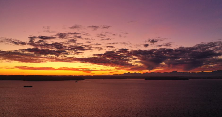
Thanks to Jamie Kinney for sending the photo of tonight’s sunset! By the end of this weekend, the sun will be setting before 5 pm, since we “fall back” an hour at 2 am Sunday. (You can always check the sunset/sunrise/moonset/moonrise times on the WSB West Seattle Weather page.)

That photo texted by a reader on Gatewood Hill shows a reading below 30 degrees early this morning. Just south of the Gatewood line, our birdbath froze over. Tomorrow morning will be even colder – possibly into the mid-20s. Any pre-winter prep you haven’t done yet, might be a good time to get it done. The dry weather will continue through Halloween – still cold Thursday night but probably about 10 degrees up from tonight.
 (Photo by Chris Frankovich)
Thanks for the photos from tonight’s sunset! One West Seattleite even sent an aerial view:
Coming in for a landing at SeaTac on @United Flight 1641 from Chicago and #IACP2019. Lake Washington foreground, then Seattle downtown and Elliott Bay (center) with West Seattle to the left. Then Puget Sound, Bainbridge Island and the Olympic Mountains distant. @westseattleblog pic.twitter.com/mzXgWTF8vE
— Bill Schrier (@billschrier) October 28, 2019
Two things worth noting:
-This was the last Sunday of Daylight Saving Time this year; 2 am next Sunday (November 3rd), we “fall back” an hour and move into Pacific Standard Time.
-If you have a vehicle parked outdoors, you might need your ice scraper. Tonight’s low is forecast in the 30s, then possibly into the 20s Monday and Tuesday nights.
 (Photo by Marc Milrod)
Surf’s up in West Seattle @westseattleblog pic.twitter.com/dV7e3mUDU3
— Ron Creel (@roncreel) October 26, 2019
Thanks to Ron for tweeting the video from Alki as this afternoon’s high tide approached, with wind out of the north. Good news – the clear weather is forecast to continue tomorrow (West Seattle Junction Harvest Festival and Fauntleroy Fall Festival day) and maybe even on through Halloween!
4:37 PM: Thanks to JayDee for the photo:

 (Added: WSB photos)
6:56 PM: The thunderstorms that moved through this past hour have done some damage. Seattle Fire is on scene in the ~10700 block of Marine View Drive SW, where residents report lightning hit multiple houses; no fire, but some damage is reported. In that area, more than 200 homes are without power, according to the City Light map.

7:56 PM: We’ve been to two of the homes with lightning damage.

In both cases, glass was broken, but no one was hurt.

Some tree damage too. At one home, the damage was focused on a detached dwelling unit which had no one inside at the time.

9 PM: Photos added. The residents report the lightning strike was colorful – they saw red at one point – as well as powerful.
12:33 AM: Could be more overnight, says @WestSeaWx.
 (Photo by Robert Spears)
What a way to wrap up the first weekend of fall! Thanks to everybody who sent photos.
 (Photo by Kanit Cottrell)
This view reveals the moon:
A 1 percent illuminated moon setting over the Olympics tonight. @westseattleblog @NWSSeattle pic.twitter.com/7GwLJyvReh
— Ethan Owens (@Twixted1) September 30, 2019
And a panorama:
 (Photo by James Bratsanos)
One more closeup:
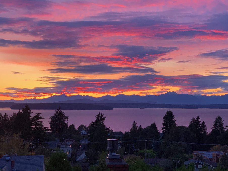 (Photo by Tom Stoner)
The National Weather Service says some clear weather is on the way – if the Olympics indeed are in full view, you’ll see fresh snow!
Texter says a tree is down in the southbound lanes of Admiral on the hill north of the West Seattle Bridge.
| 12 COMMENTS