
West Seattle, Washington
26 Wednesday
 (Photo by David Hutchinson)
Good morning and welcome to the holiday weekend! Thanks to everyone who sent photos from last night’s sunset, seen through the wildfire smoke that arrived from California.
 (Photo by Chris Frankovich)
Nothing like what we’ve seen in some recent years, though. And as for the temperatures, the first two days of the weekend are forecast to be seasonable – in the 70s.
 (Photo by James Tilley)
Monday is when the temperature kicks it up a notch – into the 80s.
 (Photo by Tiff Rivera)
Then at midweek, we could be close to 90.
 (Photo by Theresa Arbow-O’Connor)
The smoke is supposed to clear out over the weekend, so the deja-vu sunset might have been one of a kind.
 (Photo by James Bratsanos, this morning)
The sun, moon, and sky continue their late-summer showing off, so we’re featuring more reader photos along with this holiday-weekend weather update.
 (Texted photo, moon & osprey nest)
Still no hint of rain any time soon – the sky will be clear (aside from that wildfire smoke that appears to have arrived) at least into next week.
 (Photo by David Hutchinson, Wednesday’s sunset)
After the holiday, the newest “forecast discussion” observes, we might even see record highs.
 (Photo by Jim Borrow, Wednesday’s sunset)
But until then, the forecast looks more or less seasonably warm, as it was this time last year. (But unlike, say, the Southwest U.S., with a heat wave that could go 20+ degrees above normal.)
Weather notes – and some cool photos from this morning that came in too late for our daily preview:
 (Photo by Elaine Dale)
The fog and full moon made for some breathtaking scenes – thanks to everyone who sent photos! The forecast suggests we might see more fog in spots tomorrow morning.
 (Photo by Chris Frankovich)
Something else you might see tomorrow and beyond: Smoke. The Puget Sound Clean Air Agency warns that a plume of smoke from California wildfires is headed this way,. Tomorrow it will be overhead and likely to have minimal impact, but if it lingers through the weekend, we could have air-quality challenges. On the bright side, the weather is expected to be warm through Labor Day!
 (Photo by Diana)
Temperatures may get into the 80s tomorrow and Tuesday, and highs are forecast as “near 80” for the days inbetween.
 (Photo from the Erskines)
Tomorrow morning’s moonset is 7:48 am.
 (Photo sent by Dave McDorman)
The sun has set on a record-tying hot day – 98 degrees at Sea-Tac – though the Jefferson Square temp/time sign counted a few bonus degrees:
 (Photo sent by Jason Hubbard)
The cooldown is bringing a few surprises – raindrops, for example – and a texter says there’s lightning on the radar, headed this way.
 (Photo sent by Kersti Muul)
The National Weather Service just posted this update minutes ago:
…high based thunderstorms have sprung up in and around the Seattle metro area. The concern with this type of convection is that due to their high based nature, not a lot of precipitation is expected out of them, but they are producing a fair amount of lightning, which can be fire starters. The prolonged period of hot and dry weather has dried the fuels out, therefore it would not take much to ignite some of these fuels that have had ample time to dry out and become much more combustible. The main message for the next few hours is to play it safe with lightning and stay indoors.
Tomorrow’s high is still predicted to be 80ish.
 (Thursday’s sunset, photographed by Theresa Arbow-O’Connor)
The heat alert for Sunday has expanded by a few hours. The National Weather Service now has a “Heat Advisory” for 7 am Sunday through 2 am Monday. Same outlook, though: “Very hot conditions with afternoon temperatures in the 90s expected.” Today, meantime, we could get into the mid-80s – same for Monday and Tuesday.
 (Recent sunset, photographed by Theresa Arbow-O’Connor)
You’ve probably heard another mini-heat wave is on the way. The National Weather Service has confirmed it by issuing an “Excessive Heat Watch” alert for Sunday. The alert warns, “Very hot conditions with afternoon temperatures in the 90s.” Just one extra-hot day, though – the forecast projects a drop into the 80s on Monday.
Some beautiful photos have arrived in the past ~22 hours. First – an unidentified texter sent this early today:
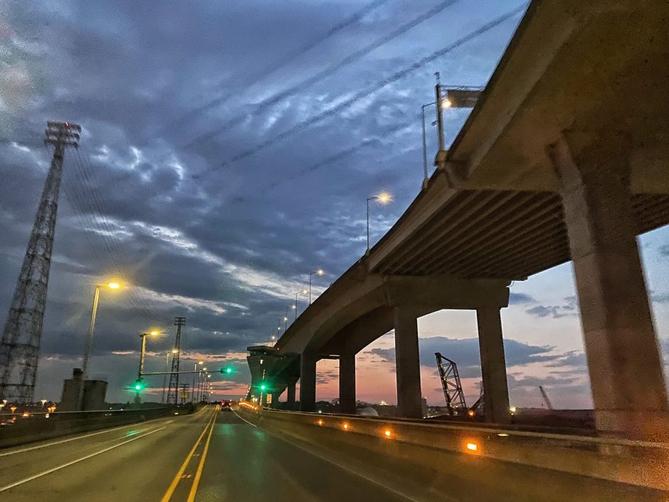
The rest are views of Thursday’s sunset, which happened while we were out covering a protest. From Jan Pendergrass:

From Jim Borrow:

From Curry Gibson:

And from Kanit Cottrell:

Some wildfire smoke contributed to the color – weather analyst Cliff Mass explains.
 4:29 PM: The 4 pm temperature at Sea-Tac hit 92 – and this is the hottest day of the year so far, first day in the 90s since a little over a year ago. The National Weather Service‘s Heat Advisory alert continues until 8 pm, and after that, things should start cooling a bit, and tomorrow shouldn’t get past the low 80s.
ADDED 5:06 PM: Now 93. (Dahlia photo by Theresa Arbow-O’Connor)
 (Recent Lincoln Park sunset, photographed by Theresa Arbow-O’Connor)
One day after we noted that Monday’s high temperature could rise into the 90s, the National Weather Service has issued an alert: Our area has a “Heat Advisory” for 9 am-8 pm Monday, with the NWS saying it could get up to 93 degrees. Read the full alert here.

We’ve had cooling clouds around quite a bit recently, as photos from Jim Borrow (above) and Theresa Arbow-O’Connor (below) show …

… but forecasters say that we’re in for a change. The weather will start warming up in a major way, and Monday could get to – or beyond – 90 degrees. (Weather analyst Cliff Mass explains why.) So unless you’re a fan of hot weather, there’s a big reason to appreciate the more-seasonal weather forecast for this weekend, with highs likely in the 70s. We haven’t been in the 90s for more than a year, though, and the upcoming heat isn’t expected to hang around long, subsiding again after Monday.
Spotted this on Twitter: The National Weather Service wants your opinion on the wording it uses for alerts. Should they drop the use of terms like advisory, watch, and warning? Here’s a survey you can take to tell the NWS what you think. It’s open until August 21st, so save it for later if you’re too busy now!

Thanks for the photos of what you could call a rainless rainbow – actually, an iridescent cloud, as explained here. The photo above is from Jessica in Seaview, looking south; the one below was tweeted by Shannon in White Center:

Still lots of sunshine in the forecast for today and tomorrow, the final two days of spring.

Breathtaking sunset tonight! Thanks to James Bratsanos (above) and Stephen Nielsen (below) for sending photos.

The forecast says we might see rain again tomorrow.

Even if you didn’t see this morning’s thunderstorm, you probably heard it! Thanks to everyone who sent photos of the storm, and what preceded it. Above, Kersti Muul caught lightning on camera. Below, the clouds themselves put on a show – first, from Lance Merkin @ Alki:

Next, James Tilley‘s photo shows the rain advancing toward that formation:

And from Shorewood, Jim Edwards sent this view:

Deb Barker scanned the sky for this video view:
A few hours before the storm, @WestSeaWX tweeted this gorgeous sunrise view:

As for the forecast, the thunderstorms have passed, but more rain is on the way, and breezy conditions too.
 (Friday night sunset, sent by Paige, “above Alki”)
Might be blustery tonight, so this is a reminder to be sure you haven’t left anything outside these past few warm days that you wouldn’t want to see caught in a storm. The forecast says it’ll be very rainy – potentially more than an inch! – tonight, and breezy too, out of the south/southwest.
ADDED 8:17 AM: Yes, that’s thunder!

Thanks to James Tilley for the photo, taken from Alki, looking south – he identifies those as Kelvin-Helmholtz clouds, explained here. Otherwise, the big news about the weather is that the next three days are expected to bring highs at least in the 70s – possibly 80s on Thursday.
Friday ended on the gray side. So we’ll start the holiday weekend with some views shared by your West Seattle neighbors earlier in the week:

Some beautiful sunsets – above is Theresa Arbow O’Connor‘s photo from Thursday night; below, Lynn Hall‘s photo from Monday night:

Tuesday night, Nicole Neufeld recorded this timelapse:
And three views with vessels:

Above, John Hinkey photographed a barge in a sunbreak Tuesday night; below, David Hutchinson noted an outbound cargo ship with the Olympic Mountains as a post-sunset backdrop Friday night:

And Dan Keller caught the fireboat’s show off Alki on Wednesday:

Thanks again to everyone!
 (Wednesday’s sunset at Alki, photographed by Eugene Lee)
For the first time this spring, truly summer-like weather is on the way. The forecast is for sunshine through Sunday; while today’s high is expected to be seasonal – in the 60s – the next three days could get near or past 80. Sunday in particular – possibly the mid-80s. Then on Monday, clouds are expected to return.
Thanks for the views of tonight’s sunset!

Above, from Kersti Muul at Me-Kwa-Mooks; below, from Stephanie:

And from Lynn Hall:

(added) And Andy Rottler caught this view while out paddleboarding:

It’s a little far off for forecast accuracy … but next Saturday might hit the 80s.

Great views of the squall that swept through with rain and hail – in the sunshine! – earlier this evening. Above, tweeted by Kevin Freitas; below, tweeted by @WestSeaWx:

Sue Bell shared this view of the blue/gray line over Madison Middle School:

Next one is a view we caught from Alki avenue SW:

The National Weather Service says thunderstorms are possible tonight.

12:39 PM: We’ve seen sun, rain, and now hail today – the photo above is how the street looked outside WSB HQ a short time ago. Could be wild weather off and on all afternoon – the forecast calls for possible thunderstorms.
P.S. For contrast – a reader near Lincoln Park shared this photo from just a few hours ago:

12:51 PM: The NWS shares a high-level view:
A look at the shower over West Seattle from the @space_needle. Several reports of small hail rolling in! #wawx pic.twitter.com/aGW0hQSoaK
— NWS Seattle (@NWSSeattle) March 30, 2020
ADDED 2 PM: More photos and video – thank you! First, from Stephen @ Lowman Beach:

Video from Troy in Gatewood:
 (Photo by Scott Scowcroft – Alice’s spring-equinox sunset watch in March 2019)
Virus or no virus, the earth keeps turning, and spring will arrive this Thursday (March 19th). Like many other events, West Seattle astronomy educator Alice Enevoldsen‘s change-of-seasons sunset watch will go online this time around. Alice says you’re invited to join it via Zoom – 6:30-7:30 pm on Thursday. She will post the link here (and of course we’ll remind you too) that day.

The first of three consecutive “supermoons” brought breathtaking sights, and we have three to share. Above, Greg Snyder photographed the Monday morning moonset over the Olympic Mountains’ iconic Brothers. Below, Dan Ciske‘s view of the Monday evening moonrise over the Cascades, from Duwamish Head:

Just a bit further southeast, David Hutchinson was along Harbor Avenue:

Just a week and a half until spring arrives – 8:49 pm Thursday, March 19!
| 1 COMMENT