West Seattle, Washington
25 Wednesday
Summer’s over but things just don’t seem to slow down. So SDOT is continuing to issue these alerts. The big one, as mentioned yesterday – Saturday morning’s Alaskan Way Viaduct closure for the Puget Sound Heart Walk (though SDOT has a different start time – we’re following up to see which is right – update, SDOT says 8:15-11:30 is correct). Read on for the full list:Read More
In ongoing coverage of the Spokane Street Viaduct widening project (plus the new “ramp to Costco“), it’s been mentioned before that westbound lower Spokane Street would close – now a date is set – read on to see the city’s announcement:Read More
Just in from Washington State Ferries, a reminder that a fare increase will take effect at the same time as a decrease a week from Sunday – read on:Read More
For SODO drivers on 4th S – the latest on those repairs near the stadiums that had WSDOT suggesting you avoid the area: It’ll all be done by morning, according to the latest bulletin:Read More
For everyone who uses southbound 4th Avenue S. by the stadiums while heading home from work (or other business) — the traffic advisory re: repair work has just been updated – read on:Read More
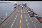
(Live Fauntleroy dock camera)
Washington State Ferries says a “power problem” is detouring Fauntleroy ferries to downtown TFN. (Thanks to Christine for the original tip on this.) More shortly. 10:12 AM UPDATE: WSF just announced the power problem has been fixed and service will be back to normal starting with the 10:20 am run – but they’re warning of some delays while the ferries get back into position.
One month ago, we reported that Metro promised the 42nd/Alaska bus stop removed during construction of Capco Plaza (home of the new QFC store) would be back. Since the store’s been open almost 2 weeks but the bus stop’s not back yet, we asked Metro’s Linda Thielke for an update this morning; her reply: “The city will be the agency re-installing the bus stop at 42nd & Alaska. We expect it to be done within two weeks.”
If you heard about emergency repair work on 4th Avenue S. and worried that it would affect going to tomorrow’s football game, or commuting beyond, there’s good news tonight – read on:Read More

Several people have e-mailed us recently to ask why the city’s West Seattle Bridge cameras – including the one we’ve had linked in our sidebar for a long time – just don’t seem to show the traffic any more (example above). We in turn asked SDOT‘s communications chief Richard Sheridan, and also threw in an inquiry about the status of additional cameras that had been in the works for West Seattle. Here’s his reply, including news of 4 new cameras on the way (we had reported plans for 3 more in May but looks like one’s joined the list):
The (bridge) structure’s north and south side cameras are controlled using wireless operation and have proven to be unreliable. The south side camera will be upgraded with a fiber optic control system as part of a larger project that starts next week. So your readers will be able to see bridge images shortly. We also want a fiber optic system for the north side and are trying to find money in this year’s budget for it.
With the work underway next week, we will install two other West Seattle cameras beyond the south bridge camera. They will be at Fauntleroy Way SW and SW Cloverdale (near Lincoln Park/Fauntleroy Ferry) and at the West Seattle Bridge near the pull-out by the [Walking on Logs] sculpture (east of the pedestrian overpass.)
Two other cameras will be installed in early- to mid-October and will be operational in November (along with several other locations not in West Seattle.) Those cameras will be located at SW Alaska St and 42nd Ave SW, and SW Alaska and California Ave SW.
So we’ll take the bridge-cam link out of the sidebar till SOMETHING is working – and will keep an eye out for those extra cameras. Here’s the city page where you can find all SDOT cams; the state cams (I-5 etc.) are separate, and can be found here; the county’s cams are here. We’ll also update the WSB Traffic page when those new/fixed ones come online.

This project — for most of the section of The Bridge between 99 and I-5 — is considered a key component of the road improvements that will keep West Seattle from being stuck in total gridlock when Alaskan Way Viaduct work starts in earnest – so the contract is big news – read on for the announcement (plus, here’s the project page on the city website, and here’s our archive of project coverage):Read More
FAUNTLEROY/CALIFORNIA SIGNAL: You may recall our story from last week, in which the city’s project manager for the now-virtually-complete Fauntleroy Way road rebuild/repave/rechannelization, Jessica Murphy, said crews would be out this week to fix the Fauntleroy/California signal timing. According to longtime WSBer and nearby resident Mike, looks like they have been (we’re checking to see if SDOT will confirm 12:26 pm – just got confirmation from Murphy, “Fauntleroy and California has been restored to normal operation”).
SOUTHWEST POOL: Last week, the city Parks Department warned that a problem detected during federally mandated drain-upgrade work could further delay the reopening of West Seattle’s only city-run year-round pool. According to a note on the Southwest Pool home page, that seems to be the case – reopening is now tentatively scheduled for October 19; by then, the shutdown will have lasted almost two months.
 From last night’s meeting of the West Seattle Junction Parking Project Committee (photo left): 19 months after first word of the parking study in the greater Junction area, SDOT has one more recommendation (besides the announcement two months ago that pay stations would NOT be suggested: The city is now proposing adding 2-hour zones in several spots, including most of California SW between Edmunds and Dawson, 44th SW between Edmunds and Alaska, a section of California north of Genesee, much of 42nd between Alaska and Oregon, the south half of 41st between Alaska and Oregon, and the south side of Alaska between 40th and 41st. In addition, two blocks of 1-hour zones on Alaska between 36th and 38th would be changed from 1-hour zones to 2-hour zones. A rough-draft map was shown at last night’s meeting as well as a West Seattle Junction Association meeting earlier in the day; project manager Dante Taylor says an official version of the map is in the works right now so it can be shared publicly as soon as possible. He told the group that the message emerging from the Junction parking study was a need for consistent time limits on parking – and this would be a way of achieving that. The city found that most people who come to The Junction are there for no more than three hours. This still doesn’t address the major concern of residents in the residential zones along 41st and 42nd between Alaska and Oregon – daytime parking taken up by workers from nearby construction projects, for example – so they remain interested in Restricted Parking Zone (RPZ) deployment; the Junction Neighborhood Organization and Junction Association will need to discuss possible boundaries and hours, it was noted. Next step: The proposal is scheduled to be presented at the Southwest District Council‘s next meeting, 7 pm October 7th, board room at South Seattle Community College; more background info is available on the project’s official website.
We’ve gotten alerts from both Metro and SDOT, so for everyone who drives along 4th into downtown, we’re sharing word of work that starts on Monday and its potential effects – read on:Read More
Not sure if it’s planned work or unscheduled outage but we just drove through California/Edmunds and the light’s out, crews are working, and an officer is directing traffic – so if you head that way, may take you a bit longer than usual.

That’s the stretch of 16th SW that’s been completely rebuilt north of South Seattle Community College (WSB sponsor) – just one crew left at its north end this morning, when we checked it out because of this “rave!” in the WSB Forums – no more detours. Meantime, the city has officially declared the Fauntleroy Way repaving/reconstruction/rechannelization done (except for a few loose ends) – no new info beyond what we reported here last week, but the announcement is a milestone just the same.

(Photo added 6:30 pm, looking south on California from just north of Fauntleroy)
As a followup to our Monday report about the Fauntleroy Way repaving/reconstruction/reconfiguration, we asked SDOT‘s project manager Jessica Murphy a question that many have been wondering about: What’s up with the signal at Fauntleroy/California? (For those who don’t drive through it much if at all, things used to flow well, but since the road work, the timing has seemed “off,” often in a way that leads to major backups.) Murphy’s reply this morning:
The signal at California and Fauntleroy is still in pre-timed mode. Crews have to come out to switch it back to normal operation where the traffic loops detect each vehicle and cycle through the signal accordingly. We had hoped to consolidate this with other signal work at Edmunds and Alaska but due to complications at Edmunds, that hasn’t happened yet. So….. I’m having the crews come out next week to get the California signal up and running as it was before the project.
The project overall will be deemed “substantially complete” this week, Murphy says, while explaining that doesn’t mean it’s completely done: “Several notable things still outstanding are the traffic curb on the east side at California (to prevent left turn out of the Thriftway parking lot), the median island at the new crossing at Juneau, and a few other odds and ends.”

(Wednesday rainbow courtesy of Jerry at JetCityOrange)
Another one of those weekend traffic alerts to share from SDOT – and this one includes two West Seattle events, the Evergreen State Barbecue Championships on Alki (no roads closed but you’ll see barbecuers lining the boardwalk starting Friday night and running till Sunday evening) and the West Seattle Junction Car Show (co-sponsored by WSB) on Sunday (closing California SW from Genesee to Edmunds, and Alaska from 42nd to 44th). Here’s the full alert:Read More
As soon as SDOT announced the Fauntleroy Way road work – repaving, rebuilding, “rechannelizing” – was almost done, the questions began, including, why isn’t it all blacktop? We arranged to chat and stroll with SDOT project manager Jessica Murphy to get some answers as the work wrapped up.

(looking north across Fauntleroy at 42nd SW, foreground in shadows)
By Tracy Record
West Seattle Blog editor
Now that the end of the Fauntleroy Way repaving/rebuilding work between Edmunds and Holly is here – and so are the “rechannelization” lines – new questions have surfaced (as have new features).
SDOT explained along the way that the stretch of Fauntleroy covered in this $3+ million dollar project (first revealed here last October, with the lane-reconfiguration “rechannelization” plan first made public in November) is a three-section road: Concrete on each side, asphalt down the middle where a gap once existed with thoughts a streetcar track would be built.
When I sat down with SDOT’s Jessica Murphy – a West Seattleite, by the way – at a Morgan Junction coffee shop last week to talk about the project, she brought along a few more specifics about that history – the east section of the road was built in 1927; the west, 1949; and the last major work on the road, including the section where the streetcar track never got built, was 1984.
The roots of what you see today – some spots that are blacktop adjoining some spots that are not – are in 1984, when sections of cement roadway were overlaid in asphalt. It’s particularly noticeable stretching west from Fauntleroy/Graham (map):

Murphy says the asphalt overlay is not considered necessary any more – the asphalt doesn’t add any “structural benefit,” but does add cost — putting it over the west stretch, for example, would have cost $200,000 more, but “added no lifespan.”
That said, two points are worth noting: Once a road is overlaid with asphalt, she says, it needs to stay that way, in no small part because the utilities and other features are built to work with the road at that height (generally two inches over the concrete road base). Also, perhaps most notably, even though your eyes would tell you otherwise, nothing has changed in this project – the section where you see asphalt now is where there was asphalt before – the section where you don’t, didn’t have it. Over time, the two-tone look will soften, she says, adding that the black marks on some of the concrete, blamed on trucks driving over the “tack,” will go away too.

(iPhone photo by Tony Welch)
About a dozen riders have just left from Morgan Junction, according to WSB photojournalist Christopher Boffoli, and if they follow the route posted on a Google Map earlier, they’ll be heading north through The Junction, Admiral, and on to Alki. Updates to come. 2:40 PM: Stephen sent another photo from right before the riders took off:

We got one report via Facebook that they’ve passed through The Junction. 3:01 PM: Here’s our clip as they passed through The Junction – halfscreen because this is a G-rated site – as you’ll hear, they got some honking and hollering:
3:20 PM: This is getting some buzz on Twitter, too. Sample: @ClutchSeattle noted, “World Naked Bike Riders on CA Ave bring fits of giggles to entire family. 3 yr old says someone stole their underwear.” Offered by @marykir, “Hope they are using plenty of sunscreen.” And according to @playwildgames, the riders have passed through Admiral.
3:37 PM: WSB photojournalist Christopher Boffoli caught the group on the north end of The Junction, passing the Senior Center of West Seattle:

In a Facebook discussion, some have asked, what’s the point? The “exuberant joy of cycling,” says the WNBR Seattle website (note, NOT a G-rated site). ADDED 6:43 PM: Click to see Christopher’s video. 10:19 PM NOTE: Looks like the embed code for that may work now:
So many West Seattleites travel through SODO, we’re passing along city traffic alerts for that area – like this one about the Microsoft annual meeting at The Safe tomorrow – read on:Read More
Per the Seattle Times (WSB partner), the state Transportation Commission just approved a 2.5% ferry-fare increase that takes effect in a month. But commissioners said no to a proposed 10 percent summer surcharge on top of the current peak-season surcharge. Here’s the full story.
Just back from our interview with Jessica Murphy, who you might call the road-rebuilding/paving guru for SDOT. We arranged to speak with her regarding the Fauntleroy reconstruction/repaving/rechannelization project now that it’s almost over, and we’re writing that story next, but in the short run, we first asked how the 16th SW reconstruction north of South Seattle Community College is going, 6 weeks into the project. Answer: Going well, on schedule, “hoping to have final paving done before the fall quarter starts at SSCC,” Murphy told us – that’s September 29, according to the SSCC calendar. She says the section of 16th SW that’s being rebuilt between Brandon and Findlay is a “fully reconstructed full-depth asphalt road” – up to 10 inches of asphalt atop a crushed-rock base – wider, too, and SDOT has worked with Seattle Public Utilities to fix the drainage problems that were partly to blame for the road’s condition – standing water after rain, compounded by heavy bus usage. Here’s how part of that stretch of 16th looked on Google Street View BEFORE the reconstruction project:
Fauntleroy report coming up.
From the city’s SODO traffic alert e-mail list tonight – “final paving” means nighttime closures next week:
Final paving Tuesday – Friday, September 8-11: overnight closures from 9 p.m. – 6 a.m. required. 1st Ave S will be closed to traffic in both directions between S Stacy and S Horton streets. During the paving, traffic will not be allowed to cross 1st Ave S east- or westbound in the work zone. North-and southbound 1st Ave S traffic will be detoured over to 4th S via S Holgate and S Horton streets. Alternate route: Use East Marginal Way S via S Atlantic and S Spokane streets. S Occidental and S Utah – the non-arterials that flank 1st Ave S – will also remain open.
If you’re not subscribed to the SODO traffic list, you can sign up from the bottom of this page.
| Comments Off on The ever-popular citywide weekend traffic alert from SDOT