West Seattle, Washington
03 Monday

(WSB photos)
Way back in January, when the Seattle Schools Traffic Safety Committee convened at the Boren Building, they heard K-5 STEM parents and staffers warn that existing safety challenges in and around the parking lot would only intensify when Arbor Heights Elementary moved in starting this fall. And it’s indeed been busy, to say the least – so this morning, volunteers gathered for a “parking-lot party” to fix what they could – a lot of painting, for example (top photo), and weeding/de-mossing.

Bigger issues remain to be solved, beyond the scope of a weekend work party – see our report on this past week’s Delridge District Council meeting for more on that – but progress is progress, one step (or paintbrush) at a time.
@westseattleblog 5000 block of 35th sve sw pic.twitter.com/Ls0CLqVzQG
— Clark Gilbert (@coachclarkruns) September 9, 2014
Thanks to Clark for the photo from a reported car/motorcycle collision near Camp Long, in the 5000 block of 35th SW, northbound side. He says traffic is getting through, with only the outside northbound lane blocked. The SFD dispatch was for an “aid response,” lowest level of medic callout, so that likely means no major injuries; we’re checking.
That quick video clip’s all about something Puget Sound Energy is sending out to more than a million customers via postal mail (in this case, e-mail just wouldn’t work), as explained in this announcement:
Billing statements from Puget Sound Energy arriving in mailboxes over the coming weeks might smell a little rotten.
A newly designed natural gas safety brochure is being sent out to more than 1.1 million PSE customers throughout September. In addition to lots of important information about what to do if there’s a suspected gas leak, there’s a scratch-and-sniff section that’s a reminder of the rotten egg odor associated with natural gas.
To help detect gas leaks more easily, PSE and other natural gas utilities add an odorant called mercaptan to the natural gas, which is naturally odorless and colorless. Everyone in a family needs to recognize the stench, and know what to do if they smell it:
It’s September, and the community groups that took all or part of the summer off would usually be getting back to their normal schedules. But two of them have a different plan for this month. Tonight, the first Tuesday, would usually be the regular meeting night for Westwood-Roxhill-Arbor Heights Community Council, but here’s what’s on the schedule instead, as announced by Joe Szilagyi:
One more month of a slightly different WWRHAH schedule!
No meeting tonight as we’ve mentioned — the next one will be a joint meeting with the Highland Park Action Committee at their meeting space on Wednesday, September 24 at 630 pm. This meeting will be dedicated to and focusing on Seattle Police across our two areas and South Delridge. Bring your questions — we’ll have all the key staff from the Southwest Precinct there!
Meeting: HPAC & WWRHAH joint SPD meeting
Date: Wednesday, September 24, 2014
Time: 630 pm-830 pm
Location: Highland Park Improvement Club, 1116 SW HoldenHere’s the Facebook event if you want to join that or share it.
If you live in one of those areas and have concerns/questions for SPD, that meeting will be particularly crucial, as the West Seattle Crime Prevention Council has canceled its September meeting because of health challenges among its leadership.

SDOT has announced that design is done and construction will start this fall – possibly as soon as October – on the long-sought signal at 47th SW and Admiral Way, and that it will be accompanied by four striped crosswalks, as seen in the new design graphic above. This fall will mark three years since the Admiral Neighborhood Association ramped up its campaign for the signal with a rally in memory of 26-year-old Tatsuo Nakata, killed at the intersection in fall 2006. It took a lot of pushing to get funding committed – in early 2012, SDOT was still saying 47th/Admiral wasn’t high on the list. Then last year, the City Council made changes in then-Mayor McGinn’s spending plan in order to find full funding for the signal.

Here are key parts of the finalized plan, according to SDOT:
*Installing a new traffic signal
*Adding four additional striped crosswalks
*Upgrading six curb ramps at key corners of the intersection to be compliant with current American Disability Act (ADA) standards
*Replacing the existing center-turn lane with left-turn-only pockets on SW Admiral Way
*Removing minimal parking up to 50 feet from the intersection approaches on the north and south sides of 47th Avenue SW and SW Waite Street
*Removing the existing pedestrian signal
According to SDOT’s Maribel Cruz, “We anticipate construction will begin late this fall and will last for approximately three months, depending on weather conditions. The project team plans to host a community drop-in session at a nearby café in October, prior to the start of construction, and will continue to keep the community informed as the project progresses.” More information is online at this newly updated project page.
P.S. We should note that this intersection will be a lot busier soon, with Aegis Living planning to build a new retirement center on the 4700 SW Admiral Way site of the former Life Care Center, proposed to include 48 assisted-living apartments and 33 memory-care apartments..
FIRST REPORT, 6:03 PM: Night Out is on! We’re visiting block parties around West Seattle again this year and will add updates here. Since we can’t get to them all, we’d love one from yours if you care to share – editor@westseattleblog.com (or Twitter/Instagram, where the hashtag is #SeattleNightOut and we are at @westseattleblog) – thanks; updates ahead!

FIRST STOP, ARBOR HEIGHTS – in the block where we attended a Seattle Police Living-Room Conversation at Block Watch Captain JoDean Edelheit‘s home two years ago. (That’s JoDean in the back row, third from right.) This block is getting busier, as it’s near the undergoing-renovations future home of Westside School (WSB sponsor) at 34th/104th.

SECOND STOP, SUNRISE HEIGHTS: Carole invited us to stop by; her husband Michael is Block Watch Captain and has also recently gone through a round of preparedness training, so he’s leading the neighborhood in getting everybody organized to start working on a neighborhood plan. That’s why there’s preparedness info at their party:

They’re hoping not only to be, well, more prepared as a result, but also to inspire other neighborhoods. (Have we mentioned lately – lots of preparedness info at westseattlebeprepared.org, including the location of your nearest Emergency Communication Hub.)
7:20 PM UPDATE: Thanks to Marcia for tweeting this photo from her neighborhood’s party:
@westseattleblog the 9000 block of 13th Ave SW is having a blast tonight for #neighborhoodnightout! pic.twitter.com/E888uKnSxg
— Marcia Ventura (@marciaventura) August 6, 2014
Via text, more preparedness, at 23rd and Cambridge, including this photo:

The texter (206-293-6302 any time!) says neighbor Patty Doty got a grant to “put together emergency kits to distribute tonight to our neighbors!” Meantime, back onto our travels:
OUR THIRD STOP, GATEWOOD: Sue‘s neighborhood has an annual “flags of all nations” display:

The biggest flag there in the middle synergizes with the sign – the flag is for Hawaii, the sign says No Ka Oi (Hawaiian for “is the best”) Party. We also discovered while visiting that Jeff is an award-winning amateur winemaker:

As we continue our travels, we’re noting MANY side streets closed off for block parties – way to go! And closing streets takes some logistics – and signage:
OUR FOURTH STOP, HANSEN VIEW: The sign above is from Hansen View just south of The Mount, where Night Out always means a big party. Including bluegrass band The Mighty Fallen.

We just missed visiting firefighters. Lots of neighbors having a great time!

Hansen View is home neighborhood to West Seattle Block Watch Captains Network leaders Deb Greer and Karen Berge, who we’ll see again – and you should come too! – at Delridge Day this Saturday. Meantime, a photo texted from Gatewood:

The band is Woodland, playing near 35th and Rose – thanks for the photo!
OUR FIFTH STOP, FAIRMOUNT: We were leaving Hansen View, headed to Junction Plaza Park (stop #6), when we noticed two Seattle Fire vehicles at a block party, so we pulled over, and got a group shot including the visiting firefighters:

This is Fairmount, south of The Triangle, not to be confused with Fairmount Park or Fairmount Springs. Then it was north to …
OUR SIXTH STOP, JUNCTION PLAZA PARK: The re-activated Junction Neighborhood Organization threw a party in the park … we didn’t arrive until it was almost over, but caught the small spirited group that remained:

West Seattle Bike Connections joined JuNO for the party. Police and fire had visited earlier too, as had City Councilmember Tom Rasmussen, who was making West Seattle rounds. JuNO had water balloons, too … now THAT is a party. JuNO’s director René Commons says they hope next Night Out will bring their SECOND annual party in the park.
ADDED 9:23 PM – OUR SEVENTH AND FINAL STOP, SEAVIEW: 5900 block of 44th and vicinity – thanks to Kelli for inviting us. A 1970 El Camino was a canvas for chalk art:

Heather from Sparklez Face and Body Art was creating art too:

And the group:

(added) WE STOPPED HERE TOO: Thanks to Sarah for kindly pointing out in comments that we had neglected to publish anything from one of our stops, 6000 block of 37th – and this was actually the first invite we’ve received, from Aaron. Found the pic!

(back to Tuesday night in-progress report) Next: Photos from the inbox – thanks for sharing! First:

That’s from Steve at 16th and Trenton. One block over, at 15th and Trenton, a party photo from Chris:

Next, from Leslie on Canada Drive SW:

Tweeted by Jason in Admiral:
40th Ave SW block party! (Hanford/Hinds) @westseattleblog #SeattleNightOut pic.twitter.com/65xuyLGRWa
— Jason G (@jgrotel) August 6, 2014
Lots of kid activities at tonight’s parties. Even a bouncy house in Belvidere, on 36th SW – thanks for this e-mailed photo:

Further south on 36th SW, here’s the group photo from Jenny‘s neighborhood (“between Findlay and Brandon, best block EVER!” she declared):

Also very proud of their block:
We love our neighborhood and thought you might like a glimpse of our amazing gathering. 61st Ave SW – between Hinds and Spokane St.
Mary Pyper and Janinne Brunyee, Block Watch Co-Captains
Pigeon Point always has a big bash, and Pete Spalding shared photos – here he is with Southwest Precinct commander Capt. Steve Wilske:

Deputy Chief Mike Washburn also stopped by, as did a Seattle Fire engine:

But neighborhood mingling remained the big draw, as it was with parties from north to south, east to west:

Next, we head all the way to the other end of West Seattle – Jim Edwards of West Seattle Big Band and West Seattle Grand Parade fame shares a photo from North Shorewood:
A first-time event in North Shorewood on 102nd SW. The west end of the block is the City of Seattle. The east end of the block, unincorporated King County. From 28th SW to 30th SW. We are also participating in an informal radio net with the West Seattle Radio Club.
Next year … maybe a band appearance? If you live out that way, keep watch for flyers next summer! Heading back north, to Gatewood again, Long B. Nguyen photographed his SW Portland neighbors:

From the 6300 block of 41st SW, Fairmount Springs vicinity, Jenny explains the next photo as “not everyone at our block party, but still a picture of neighbors enjoying each other.”

From the 3400 block of Belvidere Avenue, Erika shares a photo of the youngest neighbors, noting, “We had another fantastic night of community gathering with our neighbors and the gang of kiddos had so much fun riding bikes and scooters, as well as jumping in a bouncy house! We love National Night Out and look forward to it all year!”

From 46th SW between Walker and Hill in North Admiral, a photo texted earlier in the night:

And from Rutan Place SW, John shares a photo of his well-attended block party:

ADDED WEDNESDAY MORNING: Two more – first, from Diane, the late crowd on 45th SW between Alaska and Edmunds:
The block party had double this amount in attendance earlier, with games, bubbles, a balloon artist, & sidewalk chalk for the kids. Most had headed home by this late hour to get little ones to bed and missed the photo. The block party also had 2 musicians who sang for them through the evening, accompanied with a guitar and double bass cello. A great block party for 45th Street!
And Don‘s neighborhood in Fairmount Springs had visitors who brought goodies – the Ben & Jerry‘s truck that’s making Seattle rounds this month:

Thanks again for sharing glimpses of awesome West Seattle neighborhoods.
By Tracy Record
West Seattle Blog editor
The proposal for rechannelization – aka “road diet” – for Southwest Roxbury’s westernmost arterial mile was no longer a surprise when it was explained last night for the second time in five nights. At least some of the ~30 people at the second meeting about the design proposals for SDOT’s SW Roxbury Safety Project had clearly checked out news of the plan that circulated after the first meeting last Thursday.
Road diets have their critics, but this proposal did not draw an angry crowd to last night’s meeting at the Greenbridge YWCA in White Center, led by SDOT’s Jim Curtin, who also presented last Thursday’s briefing. One person voiced open concern about possible traffic congestion as a result. Several others, though, asked why the rechannelization couldn’t cover the entire arterial stretch of Roxbury, all the way east to Olson. And the general mood of questions/comments was in favor of something even more restrictive than SDOT is suggesting.
But before we get to that: In case you missed it, rechannelization – one lane each way, with a center two-way turn lane, west from 17th to 35th – is part of what SDOT is proposing. We detailed the entire plan in our coverage of last week’s meeting – please read that for full details; we went to last night’s meeting mostly to check out the questions/comments the second time around – it was scheduled as a rerun rather than a followup. Here’s the SDOT slide deck, same thing last night that was shown last Thursday:
One more note from last night’s meeting about SW Roxbury – a stack of cards casually announced the launch date for the other major “road-safety corridor project” in the works: 35th SW. You have almost three months’ warning for this one – 6:30 pm October 22nd at Neighborhood House‘s High Point Center. Meantime, browse the background links on the left side of the project page.

By Tracy Record
West Seattle Blog editor
Rechannelization (aka a “road diet”) for the mile of SW Roxbury between 17th and 35th SW (map) is a big part of what SDOT is proposing to do, to fix what it acknowledges are “horrible” conditions for everyone from drivers to pedestrians:

Other proposals and plans for the road, between Olson and 35th, have just been revealed too – a mix of paving, painting, signage, and signals.
It was all unveiled by SDOT’s neighborhood traffic liaison Jim Curtin (who also happens to live in the area) in a meeting tonight at Southwest Library, with more than 20 neighbors in attendance, including leaders of neighborhood groups that campaigned for the city to finally get something done. (See the full slide deck here.)
As Curtin prefaced, SW Roxbury from Olson to 35th is a very busy road, a “principal arterial,” with 13,000 cars a day on average at 35th, almost twice that (25,000) at Olson Place SW. Speed studies show that most drivers are going at least five mph over the speed limit, Curtin said, adding that alongside Roxhill Elementary, 85 percent of vehicles are going more than 11 mph over the 30 mph limit, and, as he pointed out, speed is the number one factor in crashes – of which there have been 223 in the past three years, with 112 people hurt. The eastern section is more crash-prone than the western section. 11 crashes involved vehicles and pedestrians; two involved vehicles and bicycles.
Long-term proposals unveiled, under design right now into early 2015, with the “final determination” to be made before year’s end, and work to be done next year:
They’ll look at the corridor in three sections, he said, western, then White Center, then eastern. For the western segment, the most dramatic proposal:
*Rechannelization between 17th SW and 35th SW, one lane each way, middle lane for turns, shared bus lane with a potential new bus-layover zone near Roxhill Elementary, signage improvements, spot pavement repairs, but no “bike facilities” yet. He says that stats show that rechannelization works well on streets carrying fewer than 25,000 vehicles per day – and as noted above, that defines this stretch (16,000 at the most along the rechannelization-proposed segment). As if on cue, an attendee said, “This is the same thing that was successful on Fauntleroy, right?” and Curtin had a slide ready for that:

It showed 31 percent fewer collisions on Fauntleroy Way after that change five years ago, while it carries a bit more than the 17,600 vehicles a day that it did before the rechannelization. Travel times are unchanged, from four more seconds to 1.2 minutes; “top-end speeders” are down 13 percent.
Curtin says this will make for a better pedestrian situation, eliminates the “multiple threat” collision danger, so more crosswalks might result. Right and left turns will be safer too, he says. He also points out a five-foot buffer planned for each side of the road – and acknowledges that could be the future bike-lane space, after a question from an attendee.
Why can’t this stretch through the White Center area at 15th-17th? he was asked. Travel times there would go up “to unacceptable levels,” Curtin says they found out, through an analysis. But they do plan pavement repair between 17th and 18th, plus “new curb ramps and accessible pedestrian signals at 17th,” as well as signage improvements (like the ones now up at Fauntleroy/California, warning that turning vehicles need to stop for pedestrians and bicycles). “We’re going to go out there and take care of business,” Curtin declared. And yes, he told an attendee who asked, they are in communication with the county (SDOT is actually responsible for Roxbury up until the curb on the county side of the road, even though the boundary technically goes through the middle). A “crosswalk design” might be possible at that spot, Curtin suggests – not part of the formal plan but “if anyone’s interested in talking about it … we can partner up and make it happen.”
The parking alongside Roxbury right by downtown White Center will not be affected by this – business owners “fought really hard to keep it,” Curtin notes. In addition, the parking has NOT been a factor in any crashes, he said.
Now, for the eastern section of Roxbury:
It’s the road with two of West Seattle’s three most-crash-plagued intersections – and after two neighborhood councils said, “Enough!”, the city committed to making changes on SW Roxbury. As announced a week and a half ago, tomorrow’s the night you can get the first look, and offer some first comments, at the first round of possibilities. 6 pm, Southwest Library (35th/Henderson), upstairs meeting room – early enough you can still get out in time for a sunset walk/ride/drive.
One more nudge: One week from tonight, thousands of people all around the city will be out having block parties, as part of Night Out 2014 – the official time slot is 6-9 pm Tuesday, August 5th. Provided you’re not on a major arterial, if you’d like to close your street for the occasion, you need to sign up – here’s the place to start. As we do every year, we’ll be out covering West Seattle’s Night Out, and we’re always happy to hear where you’re having your party, so we can stop by for a photo and add your neighborhood to our coverage – editor@westseattleblog.com.
After a campaign launched by community advocates one year ago, the city promised to make SW Roxbury safer. Wondering how? SDOT is almost ready to unveil options. It’s announced two meetings at which it plans to show “several different engineering options to improve safety for all modes.” The first one is on the West Seattle side, Thursday, July 31st, 6 pm at Southwest Branch Library. Second one is on the White Center side, Monday, August 4th, 6 pm at the Greenbridge YWCA. These meetings were promised during a round of community meetings last winter (WSB coverage here). The project’s official page is here; check out the maps linked from the left side, including this one showing speeds, volumes, and intersections with the most crashes.

Big turnout for this summer’s second Firefighter Storytime in West Seattle, this morning at the Seattle Public Library branch in Admiral. The mission is to teach fire safety, but of course the lesson is folded up in a fun story:

“No Dragons for Tea,” which Lt. Joe Clegg is holding in the photo, is the classic Firefighter Storytime book. A little girl makes friends with a fire-breathing dragon; he accidentally starts a fire. What matters is how she and her family react. Afterward, everybody headed outside, where Engine 29 from North Admiral’s Station 29 was parked in front of the library.

The engine and its crew couldn’t stay too long – they were summoned to check out a fire alarm.

It’s been almost ten months since SDOT announced it was shelving and redesigning a plan to widen the bike lane and buffer on the Admiral Way hill north of the West Seattle Bridge – here’s the last thing we published, back in September. The city said residents had voiced concerns about loss of parking spaces and time restrictions on what remained. At the time, they said a new version would be out “early” this year. It’s just arrived today:
As you know, SDOT has been studying how to make the uphill bicycle lane on SW Admiral Way safer and more inviting by widening the bike lane and buffer from SW City View Street to 80 feet south of 3508 SW Admiral Way. We originally proposed to restrict on-street parking on the east side of SW Admiral Way within this section to allow for the improvement. After receiving concerns about the impacts, we delayed implementation of the project to work on an alternative that would preserve some on-street parking.
The attached revised design preserves on-street parking in front of the residences, while restricting parking in the green belt area. Time restrictions will not be installed. The work is expected to be completed this summer.
Here’s a closer look at each of the color-coded configurations:


See all of the above in one PDF with the configurations next to the map here. And if you want to compare it to what SDOT originally proposed in May 2013, you can see that map here.
P.S. Speaking of SDOT, Mayor Murray is set to announce at 11 am today who he’s chosen to be the department’s next director.
Seattle Parks is again planning to keep the lights on at synthetic-turf fields to discourage fireworks, and says security will monitor for extended hours, too. This time, it’s planned for both Thursday and Friday (July 3-4). Three West Seattle fields are on the list for security monitoring 9 pm-4 am and lights 8:45-11 pm: Delridge, Hiawatha, and Walt Hundley, all of which have been renovated in recent years. We’re adding this to the WSB West Seattle 4th of July page, still open for other holiday info if you have something to share – editor@westseattleblog.com – thanks!
As promised, Mayor Murray convened the City Council this afternoon for a speech about public safety, and declared his intent for this to be a “Summer of Safety.” You can see video of his speech above, and read the full text (as prepared) here. The mayor acknowledged, “After years of fragmentation and disorganization, our city today faces a crisis of confidence in public safety,” while also asserting that “public safety is not something provided to the community by the government.” Among the action steps he promised were “creation of a joint enforcement team to ensure that across City departments we have a coordinated response to chronic nuisance businesses and property owners who create hotspots for crime and disorderly behavior – and who disrupt the quality of life in our neighborhoods.” He also announced plans for community walks to identify specific problems in such hotspots and get them fixed, starting in Central/Southeast Seattle. This document lists other points of the “Community Safety Strategy” he outlined, such as directing new Seattle Police Chief Kathleen O’Toole “to deliver a Community Safety Plan for every neighborhood.”

(SDOT screengrab from Tuesday, tweeted about 20 minutes after the crash)
Questions remain regarding Tuesday’s 5-hour closure of 4 miles of the southbound Alaskan Way Viaduct/Highway 99 while Seattle Police investigated a head-on crash south of the West Seattle Bridge. Our first followup on Wednesday on some early answers – such as, that SPD is solely responsible for making road-closure decisions in cases like this, and believed this was the safest, fastest way to keep traffic away from the crash scene. Also in that first followup, Councilmember Tom Rasmussen, the West Seattleite who chairs the council’s Transportation Committee, told us he would be following up. He has just sent this to acting SDOT Director Goran Sparrman and acting SPD Chief Harry Bailey. Following the letter, you’ll also see the results of our latest inquiry with SPD. First, Rasmussen’s letter:
Many questions have been raised regarding Tuesday’s decision by the Seattle Police Department (SPD) to close all southbound lanes and access to the Highway 99 Viaduct, from the northern end of the Battery Street Tunnel to the West Seattle Bridge. The closure was to investigate a car accident that occurred in the southbound lane at the intersection of East Marginal Way and S. Nevada Street at approximately 1:45 p.m. South of the Spokane Street Viaduct. The entire route was closed until about 7:00 PM.
I understand the importance of creating a safe site and undisturbed conditions to allow officers to conduct a thorough investigation of the automobile crash. However, there are lingering questions as to why this length of SR-99 remained close for so many hours when the accident occurred south of Spokane Street and there are exits from SR-99 at the West Seattle Bridge and at Atlantic Street.
Please provide the following information:

(December 2013 WSB photo by Christopher Boffoli)
After James St. Clair was hit and killed walking across 35th at Graham in the High Point area last December, longstanding concerns about 35th were aired again – and in February, the city announced a road-safety project. Today, SDOT sends word of a change ahead even before the safety project officially begins this fall:
SDOT is moving forward with operational changes at the intersection of 35th Avenue Southwest and Southwest Graham Street [map] this month. Residents living nearby will receive the attached postcard later this week in regard to this work.
SDOT will be installing “right turn only” signs on Graham Street at the junction with 35th. This operational change will improve safety for pedestrians, bicyclists and drivers. Once the signs are installed, drivers going from Graham to 35th will be limited to right turns only.
The signs will be installed before the end of June and additional changes to this
intersection will be considered through the 35th Avenue Southwest Road Safety Project which will kick off in October.
35th/Graham also was the site of the collision that killed Susanne Scaringi in fall 2006.

We took that photo this morning after WSB’er Kevin McClintic pointed out new “photo-enforced” signage on Roxbury, though SDOT had been saying the new school-zone speed cams by Roxhill Elementary and Holy Family School were not going in until fall. Turns out, they’re going in now – but won’t be activated until September, with warnings being issued for a month before ticketing begins in October. Here’s the announcement just in from SDOT:
To improve pedestrian safety, contractors working for the City of Seattle will be installing photo enforcement cameras at five locations during May and June. They will be located near the following schools: Roxhill Elementary and Holy Family School in West Seattle, Dearborn Park Elementary in Southeast Seattle, Bailey Gatzert Elementary in Central Seattle, and Eckstein Middle School in Northeast Seattle.
The cameras will issue citations to drivers that exceed the school zone speed limit of 20 mph. The school zone speed limit is in effect for typically one hour in the morning as students arrive at school, and one hour in the afternoon when the school day ends. Flashing beacons have been installed to emphasize the times when the school zone speed limit is in effect. The cameras will issue warnings for 30 days beginning September 2 and will start issuing citations in early October.
According to SDOT’s construction flyer (see it here), work on the Roxhill and Holy Family cameras starts tomorrow. Revenue from the cameras goes to safety improvements in school areas, by city law.
P.S. The city first announced almost a year ago that these two cameras were on the way. The Gatewood Elementary zone on Fauntleroy Way already has speed enforcement, in place for a year and a half.
Two Level 3 sex offenders have moved to West Seattle, and Southwest Precinct crime-prevention coordinator Mark Solomon has sent an advisory to let you know about them:
In an effort to keep you informed, and in our constant attempts to reduce future victimization, we want to let you know about level 3 sex offenders that have moved into Southwest Precinct neighborhoods in recent weeks.
· Micheal Barron, a 25-year-old white male, is a level 3 sex offender who has recently moved to the 5600 Block of 21st Avenue SW. Mr. Barron is currently under Department of Corrections supervision. [Editor’s note: You can see his photo & other info here]
· Nikolai Greff, a 52-year-old white male, is a level 3 sex offender who has recently moved to the 2600 Block of 49th Avenue SW. Mr. Greff is no longer under Department of Corrections supervision. [Editor’s note: See his photo & other info here]
Detective Fields from the Seattle Police Department’s Sex Offender Detail is assigned to check on these offenders and verify their information. To learn more about these offenders, please visit the King County Sheriff’s Office Sex Offender website and search by their names. You will also find personal safety tips and resources on this site.
If you have further questions about these offenders, contact Michelle McRae of the Seattle Police Sex Offender Detail at 206-684-5581 or e-mail at michelle.mcrae@seattle.gov.
To register to receive an email alert whenever a published offender registers within one mile of your desired addresses, go to (this) link.
Click ahead to read general safety information that Solomon has shared with similar advisories in the past:

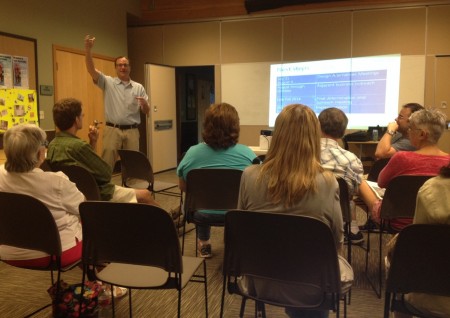
Tuesday night at Southwest Branch Library, a handful of community members met with SDOT reps and consultants to brainstorm the city’s in-the-works School Road Safety Plan for next year and beyond. Whatever emerges in the future plan will get funding from the city’s increasing arsenal of school-zone speed cameras, noted SDOT’s Jim Curtin, who recapped the pre-existing plan to add two more in West Seattle this fall, both on Roxbury, near Roxhill Elementary and Holy Family School. The plan remains to have them in place by September, with a monthlong grace period and ticketing starting in October. Those are two of five to be added at schools around the city this year, joining 4 in place, 1 of those in West Seattle, on Fauntleroy by Gatewood Elementary (existing cameras are in black on the SDOT map below, with the next round of additions in blue):

More than a dozen additional ones are expected around the city next year, Curtin said, with 60 schools being studied right now. The camera revenue has to go to school-safety improvements by order of the City Council.
The consultants at the meeting were from Toole Design Group, which is working with SDOT on the plan. They explained that this is in the opinion-gathering stage, and collected reaction to some possible plan components including traffic calming and different types of crosswalk signals. They promised more meetings in West Seattle; tonight’s attendees suggested one of those meetings be held on a weekend so that people with school-age children might be more likely to attend.
What’s in the works to improve safety along the roads and sidewalks leading to local schools – and what isn’t, but should be? Join a discussion this Tuesday night (May 20th) in West Seattle to help design the city’s School Road Safety Plan. Thanks to Cathy Tuttle from Seattle Neighborhood Greenways for sharing news of the meeting, which she calls “simply the most important road-safety meeting you can attend this year.” It’s one of three meetings around the city, and it’s set for 6-7:30 pm Tuesday at Southwest Branch Library (35th/Henderson); more details in this Facebook event invite.
The p-word – preparedness – is big around here. We know it’s tough to take time to plan or learn something you hope to never have to use – but this Sunday, if you can spare *half an hour*, it’ll be well worth it. A free city-presented mini-workshop at Southwest Branch Library will teach you what you need to know about handling household utilities in case of disaster, 1:40-2 pm:
In just 30 minutes, find out how to safely power down your household electric panel and how and when to turn off your natural gas at the meter. Join us for hands-on practice using real equipment and pick up other tips on how to secure your household water supply. Class is free, no RSVP. Come one and all.
The SW Library is at 35th/Henderson.
P.S. Also in the preparedness vein – remember that local volunteers are having a drill at Ercolini Park tomorrow morning (9-noon), so don’t be startled if you happen onto it!


| 3 COMMENTS