
West Seattle, Washington
15 Saturday
 Though right now it just looks like nothing-out-of-the-ordinary rain, the National Weather Service has a “special weather statement” in effect for our area and much of the region, warning that this could bring two to four inches of rain to the lowlands today and tomorrow. Despite the recent dry spell, the NWS warns, “the predicted rainfall by itself will be enough to raise the landslide risk to ‘moderate’.”
P.S. Think you’re totally slide-savvy? Check this city info-sheet, which includes maps of the 8.4 percent of Seattle that is slide-prone, as well as factoids (January is the month with the highest slide risk). The image at left is taken from that map – the dots show the locations of past slides, while the salmon-shaded areas show what are considered to be “potential slide areas.”
12:20 PM: Thanks for the reports – we’re hearing of snow flurries, at least in north West Seattle. The National Weather Service says it’s getting reports from around Western Washington but is *not* expecting accumulation.
1:47 PM: No further flurry reports. Looks like even the chance of rain is diminishing – until sometime late tomorrow.

(Click image for larger view)
There’s your view over West Seattle on the first day of 2015, southward toward Mount Rainier, courtesy of Long Bach Nguyen. If the forecast bears out, it’s our last chance at that view for a while. If you’re in the mood for one more look back, here’s the National Weather Service‘s 2014 Western Washington Year In Review (with one update, the recent cold weather has dropped the year’s average high to 55.1, according to an NWS tweet earlier today). If you’re looking for what’s happening now and in the hours/days ahead, check out the WSB West Seattle Weather page – available any time, with more than just weather information; it includes sunrise/set, moonrise/set, tides, even the UV index (by request).
ADDED 10:53 PM: Bonus photo just in from David Hutchinson:

That was the view from Seacrest (and from nearby Don Armeni, where we were, about that same time) during the first sunset of 2015.

Thanks to Chris Frankovich for the photo – his caption: “Great sunset for a great Seahawks win!” (20-6 over St. Louis, last regular-season game, in case you missed it.) Meantime, the forecast has changed a bit – while cold weather is still on the way, clouds are lingering, and the National Weather Service sees a chance of snow showers after midnight and into the morning, before the clouds clear Monday afternoon and stay away all the way until New Year’s Day (Thursday) pm.

6:51 PM: Thanks to JayDee for the photo of tonight’s beautiful sunset, as seen from Upper Alki.
7:55 PM P.S. – If you have a view of the southwestern sky, check out the crescent moon before it sets.

9:52 AM: So far we haven’t heard of any major damage in West Seattle resulting from last night’s wind, but we did find out this morning about another tree that came down – this one behind C & P Coffee Company (WSB sponsor). Barista George tells us it fell around closing time last night; no one was hurt. We’ll be checking back later on their removal plans; C & P has an arts-and-crafts fair scheduled both days this weekend – indoors, but take note you might only be able to enter from the front door.
11:28 AM UPDATE: Just checked back – cleanup is actually proceeding quickly. Proprietors Cameron and Pete have chainsaw-and-pickup-equipped friends helping:

They’re feeling lucky the tree fell northward, missing nearby structures, including the classic Craftsman that houses their shop.
(RESOURCES: Outage? Call City Light: 206-684-3000 … 7:36 PM: Tree/debris on road/sidewalk? Call SDOT: 206-684-ROAD)

(Added: Big branch down on SW Cloverdale in Westwood outage area, south of ex-Denny site)
7:36 PM: The wind’s been steadily strengthening for a while, so we’re officially opening storm coverage. Here’s what well-known weather analyst Cliff Mass is saying in his “nowcast,” for starters: Likely peaking 10 pm-ish. We hope the wind will pass through without power outages, downed trees, or other trouble, but if something does happen in your neighborhood, please let us know (after you’ve notified authorities, etc.) – comment here, or use our voice/text hotline 206-293-6302, or e-mail editor@westseattleblog.com.
8:05 PM: Checking the City Light outage map, looks like we have our first power-less pocket of note – 88 customers east of 35th, centered mostly around SW Trenton. SCL says a tree is to blame.
8:44 PM: Back from checking the outage zone. Added photo of a tree-size branch down on SW Cloverdale just east of 30th SW. The gusts are intermittent, no really strong sustained wind while we were out.
9:13 PM: No new reports of trouble around here. North Seattle seems to be getting hit harder – but this hasn’t peaked around here just yet, the weather experts say. Still, it’s not exactly a mild breeze – the top-of-hour numbers, for example, show Alki Point with sustained winds at 38, gusting to 52 (look for K91S here).
9:46 PM: No new outages in West Seattle/White Center, and the one north of Westwood is down to 57 customers. In the rest of the city, 12,000 homes/businesses are out, and tens of thousands more around the region. Note – our Lost/Found Pets page is busier than usual tonight; if you have lost or found a pet, send info, and photo if available, to editor@westseattleblog.com and we’ll post it. Just added a dog found in North Admiral, and about to add a dog lost in Highland Park.
10:48 PM: Still on watch – but for West Seattle, tonight, so far, no news is good news.
1:16 AM: One more small West Seattle pocket without power – shown on the SCL map as seven residences, at 35th/Marine View Drive and just southeast in Seola. The wind hasn’t entirely quieted yet – at the top of the hour, Alki Point clocked 33 mph sustained, 51 mph gusts.
2:57 AM: The wind warning is no longer in effect. Only weather alert that IS, is a “special weather statement” warning of increased landslide risk today, with all the rain we’ve had.

(Added: Photo from Alki this morning, by Brian Youngstrom)
Minutes ago, the National Weather Service upgraded the weather alert for this afternoon/evening to a “high wind warning.” It’ll officially be in effect 4 pm-4 am, but the wind isn’t expected to hit our area until after 6 pm. The NWS says the wind is expected to rise to south/southwest 25-40 mph, with gusts possible to 60. Read the full alert here.
The wind that forecasters have been warning about isn’t expected to get here before Thursday evening, so the newest version of the National Weather Service‘s “high wind watch” for our area will be in effect 4 pm Thursday to 4 am Friday. South/southwest wind at 30-40 mph is possible, gusting to 65 mph, so charge everything just in case and keep flashlights nearby. A “coastal flood advisory” is up for waterfront areas tomorrow morning, too, with a 13.5-foot tide expected 9-10 am (lower than today).

The big blast of wind isn’t expected until tomorrow. But we got a preview late this morning – strong gusts that among other things caused a “duck” to fly the coop. Patricia shares the story and photos:
My wife and I have a large rubber-duck collection and recently discovered an inflatable for Christmas – a rubber duck with a Santa cap. Only thing was that there was only 1 in Washington, in Puyallup. I drove down the next day to adopt it and proudly display in our yard.
Today, with the high winds, I heard a loud noise and discovered the duck was gone!!!! Had someone stolen it???
After a quick search I saw yellow through the houses. The duck had flown the coop, over our house and into the trees on our slope!! I couldn’t reach it and it was tangled in the trees. Then I noticed it… a utility truck with a cherry picker was just up the street. I scooted over to the nice gentleman and asked him the strangest question.. “Can you help me get my duck out of the trees?”
The nice man was Sean, and he turned his truck around and lined it up to the swinging duck.
In moments he had plucked it from the tangled branches and returned it to the safety of the ground. I made repeated attempts at a tip, but he wouldn’t take it, saying it was his pleasure to help.
Sean, thank you for your help in saving our runaway duck!
Patricia Throop and Angela Bennett
Be sure to get YOUR ducks in a row, to be ready for tomorrow, when the High Wind Watch will be in effect, with possible gusts to 65 mph.
The newest round of weather alerts is out, and they start with another “coastal flooding advisory” for tomorrow morning, upgrading to a “coastal flood watch” Wednesday night/Thursday morning. This time, the tide is expected to be about a half-foot higher than today, which means more than half a foot past the level where “minor flooding” can happen. This morning, it was about 13.6 feet, but in the absence of strong wind, Alki and vicinity didn’t look anything like a week and a half ago. Tomorrow, though, it’s projected at about 14 feet around 8 am, and then on Thursday around 9 am, 14.5 feet, possibly with a “storm surge.”
Even if you’re not right on the water, take note of a “high wind watch” announced for Thursday, 4 am to 10 pm, with south-to-southwest winds of 30 to 40 mph, possibly gusting to 65 mph. More rain is on the way, too, according to the forecast.
5:14 PM: The National Weather Service has just published a “special weather statement” alert that warns of major rain in the next few days – leading to a landslide threat if you’re on a slope/bluff – and possibly strong wind on Thursday. See the alert’s full text here.
7:59 PM: Lura points out that people near the water will want to take note of the “coastal-flooding advisory” for Tuesday morning, too. The stormy weather will compound the already-high high tide forecast for 7:22 am (12.2 feet) to 13.6 feet, which is just above the “minor coastal overflow” threshold, as noted in the text of the alert.
Wondering about the weather and roads tonight? No more snow/rain expected – just a clear, cold night, into the 20s. SDOT has been treating the West Seattle Bridge with salt and magnesium chloride, according to information shared by City Councilmember Tom Rasmussen. This city map shows de-icer’s been used on some other routes, too.
(SCROLL DOWN for updates)

(Car hood, 5:10 am)
5:02 AM: What’s falling right now – at least where we are, on the hill east of Lincoln Park – started around 4:45 as something more like sleet, and now it’s intensified to wet snow. Until now, the snow reports had all been from points north, but commenters spotted renegade flakes in the last few hours, and the temperature’s been falling, now 34 at Sea-Tac.
5:31 AM: It’s all but stopped. The “winter weather advisory” remains in effect until 11 am.

7:25 AM: More snow since then, and everything is covered. Photo above this line is from Tiana at Youngstown Flats (WSB sponsor) in North Delridge. And from Jason in Admiral:
@westseattleblog Fluffy flakes blowing sideways in Admiral, 720am pic.twitter.com/OZoVvfgH36
— Jason G (@jgrotel) November 29, 2014
What’s it like where you are? More pics welcome at editor@westseattleblog.com – thanks!

7:47 AM: Above, looking north at California from Thistle. SDOT tweets, “… Road temps still high so no accumulations yet. Crews will check and treat roads as needed.” The forecast still says the snow chances should end in a few hours.
9 AM: Some blue sky out there! Breezy too. Beware slick roads – there’s a multi-car crash on the eastbound bridge right now, which our tipster says is VERY slick. Thanks to everyone who’s sent photos – Linda shares this view of Lincoln Park’s frosted forest:

From Puget Park on Pigeon Point, Ben shares this photo of a snow fan:

Ben observes, “Not enough to sled but sure is pretty.” Meantime, Alki has wind-and-high-tide-fueled waves again this morning:

Thanks to Cheney for the photo. Now, our first snowperson photo:
Reagan in Fauntleroy shared that with a hearty “Go, Dawgs!”
9:29 AM: The SFD response for the bridge crash closed quickly, indicating no serious injuries.
2:11 PM NOTE: Thanks to everyone who’s been sharing photos, particularly of the spectacular surf and spray at Alki – we’re putting together a separate galley – and we’ll start a pm weather story, including information on SDOT’s plans for the roads, given the below-freezing temps. (We did travel some of the main routes earlier and noted that aside for a few shady spots, they’re mostly dry.)
9:13 PM: Just a quick weather note in case you are wondering: While the regional “winter weather advisory” mentioned in our earlier storm coverage is now in effect, the Arctic air that was headed south is reported to have slowed down. So the temperature has held steady in the upper 30s since mid-afternoon, and even the convergence zone north of the city isn’t likely to see any snow before morning. Bottom line, if you’re worried about getting around in the city late tonight/in the wee hours, it does NOT look like you’ll find icy roads, let alone snow.
4:16 AM: The temperature has finally started drifting downward, and so has a bit of snow – our friends in Ballard and Queen Anne have seen a bit, though the somewhat-serious stuff has remained toward the Snohomish/King line and points north. The latest “forecast discussion” envisions the potential for snow continuing to drift this way, with the advisory in effect through 11 am. Regardless of whether we get snow, we have wintriness – the temps are not expected to get any higher during the day – bundle up.
(SCROLL DOWN for newest photos, info)

10:14 AM: We’ve been mentioning water woes on local roads in our ongoing traffic/weather report – and now, check this out! Thanks to Mike Mulligan for sharing the views from Alki Statue of Liberty Plaza and Alki Bathhouse as wind and rain combined with a 12.3-foot high tide this morning.

Reminds us of the big surge back in December 2012. This morning’s tide peaked at 9:41 am, and the rain is letting up a bit, but we’re off to check on some of this morning’s other reported swamped spots.
11:56 AM UPDATE: Just back.

(WSB photos/video from here on)
Even an hour and a half after high tide, the Alki Bathhouse/promenade was still getting deluged, as our Instagram clip shows:
To the east at Seacrest, very high water – the floating dock for the water taxi is almost up to the level of the fishing pier:

Perhaps lucky the Water Taxi’s not running today (extra holiday) – that would be a wild ride. You’ll also notice if you’re in that area, Elliott Bay has a taupe tinge to it today with so much stormwater rushing in. Meantime, back on the roads/paths, the Delridge onramp to the bridge is still flooded and closed:

If you veer to the left, you’ll find another spot of high water on that side of the road, too. And while traveling the peninsula’s periphery, we noticed numerous flooded spots – thanks to the texter who pointed us to this one, Fauntleroy Way between Raymond and Findlay:

Wherever you’re going – be careful, as some of the deep-water spots aren’t visible until you get right up to their edge. We’ll continue to update throughout the day; let us know if you’re seeing new troublespots (text/voice 206-293-6302 – thank you!).
1:50 PM: Just back from a journey through eastern West Seattle. A firefighter (we didn’t see which engine, and it’s not on the 911 list) was wading into the Delridge onramp mess – a WSB Facebook commenter says cars are now getting around the water and onto the bridge (we’ll check back before dusk). Along Delridge itself, deep water at intersections including Holden and Myrtle, on the northbound side; also the usual big puddle on southbound West Marginal Way just north of the Highland Park Way hill.
4:07 PM: Commenter Chuck says the ramp is open now. Meantime, the newest weather alert is out, and it’s a “winter weather advisory” for 9 pm tonight until 11 am tomorrow, still suggesting some snow – though it sounds far more likely north of Seattle, than here, but be ready anyway!
(SCROLL DOWN for updates on weather-related trouble)
7:50 AM: Good morning! 4-day holiday weekend for so many people, the bridges are relatively clear:


Notes for getting around, plus the latest on the weather:
TRANSIT: Reduced weekday/no UW schedule today for Metro … No Water Taxi service today … Regular schedule for Sound Transit, and regular schedule for Washington State Ferries.
CITYWIDE ALERTS, INCLUDING DOWNTOWN PARADE: The SDOT holiday-weekend roundup includes road-closure info for downtown’s two big events today, the Macy’s Parade this morning and the Star Lighting tonight. (If you’re going to the parade, keep an eye out for local participants! We haven’t found the full lineup yet.)
WEATHER UPDATE: Rainy/breezy this morning, and temperatures are continuing to fall from yesterday’s unseasonable peak near 60. The National Weather Service‘s updated “special weather statement” says the possible snow you’ve heard about is more likely to the north tonight, maybe some over Seattle on Saturday morning. Here’s the newest forecast.
9 AM NOTE: Texter says the Delridge onramp to the bridge is flooded and all but unusable. We’ll be checking on it shortly.
9:22 AM NOTE: Another deep-water alert via text: “Large puddle, nearly reservoir, on Admiral Way eastbound at Schmitz Park.” (Thanks again for the alerts – text or call 206-293-6302 with urgent info any time.)
9:56 AM: Thanks to another texted tip – a semi-truck is on its side on the railroad-track overpass bridge at East Marginal Way S., just south of the West Seattle Bridge.
10:18 AM: Seattle Fire says the overturned tractor-trailer is “stable” but they have been working to free the driver’s arm, which is reported to be trapped under a seat.
10:52 AM: Major water over NB Fauntleroy south of Findlay.

12:42 PM: Thanks to John for the rainbow photo, looking toward the Fauntleroy ferry during one of today’s sunbreaks. This Thanksgiving Day is already making history – as of two hours ago, the National Weather Service tweeted, Sea-Tac Airport had already tied the record high for this date, 58 degrees. We don’t know if it went any higher, but right now, it’s a few degrees lower, and it’s going to keep sliding, with temps in the 30s expected by Friday night, along with a chance of snow – a chance that remains in the forecast up until about mid-morning Saturday. See the newest outlook here.

ADDED 3:06 PM: Thanks to Janna for sharing the new rainbow photo – taken at Alki!
ADDED 5:13 PM: Now there’s a special weather statement about the possible snow. So far, NWS says it’s more likely to the north on Friday night but might be more widespread Saturday morning.
The #Jeep says no problem! #Commander #jeeplife @westseattleblog tree down on #delridge pic.twitter.com/1XyCebd6fC
— Dillon (@ddh1876) November 13, 2014
Thanks to Dillon for sharing that photo via Twitter – a tree down across Delridge about a block north of Roxbury. City crews were on the scene when we went by a little while ago, and looked as if they’d be finishing cleanup before long. Forecast calls for breezy conditions to continue – let us know of any weather trouble you spot, 206-293-6302, text/voice 24/7.
Hope you saw it! If not, from the past half-hour …

5:19 PM: That’s from Christopher Frankovich, and the next is from Ghazal Sharifi:

Before sunset, it was a little unsettling to see the Olympic Mountains devoid of snow, as we head into mid-November. Perhaps that will change – next week, the forecast warns of a cooldown, with daytime highs in the 40s.
ADDED 9:40 PM: Two more photos – moonrise from Carolyn Newman:

And one more look at the sunset colors, from JayDee in Upper Alki:
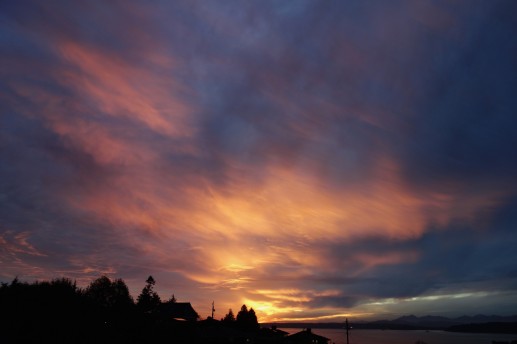
Thanks to everyone who shares photos, from sunset sights to breaking news (and more along the way)!

12:51 PM: That’s the first big problem reported so far during our wind-advisory afternoon – a big evergreen down in Seaview, across 49th SW at Graham (map). Seattle City Light reports one customer there has lost power. Thanks to the person who texted the photo/report – 206-293-6302 is our 24/7 text/voice line, and editor@westseattleblog.com works too. The wind advisory, warning of gusts up to 50 mph, is in effect until 6 pm. More storm updates to come.
1:12 PM: The SCL map now shows four homes without power by the downed tree. Meantime, on the water:

The photo above was shared by Dan Ciske, who caught a flock of birds passing a sailboat that he says had its sails torn away in the wind.
Back to the tree:

2:39 PM: SCL and SDOT crews are at the scene of the downed tree, which blocked 49th completely, on the south side of Graham. They expected repairs/clearing would take a few hours.

3:10 PM: Just added photos from the tree cleanup.

(Added: Photo by Deb Barker)
Meantime, we’ve also been over to Constellation Park south of Alki Point, where the waves are hitting the seawall:

High tide is still about 20 minutes away.
4:09 PM: The stormy weather – which has been coming and going these past few hours – has spooked a few dogs, apparently; we’ve just published listings for three separate found dogs on the WSB Lost/Found Pets page.
4:25 PM: The Fauntleroy/Vashon/Southworth ferry run has been about 20 minutes behind because of the weather, says WSF, and now they say the runs between south Vashon and Tacoma are canceled TFN because there’s no power at south Vashon (Tahlequah), which will mean heavier traffic through north Vashon.
7:27 PM: Within an hour of that last update, the Tahlequah-Point Defiance run was back in business. Meantime, a couple photos from the WSB inbox:

That’s from Laura Goodrich, who went down to Constellation Park to wave-watch – check the driftwood! Next, from MM, who caught the colorful sunset:

If you ever need the sunset/sunrise times (moon, tide, etc. too), check the WSB West Seattle Weather page.
Given what happened last time it got windy – we’re sharing this heads-up for possibly blustery conditions tomorrow. (Charge everything!) The National Weather Service has posted a “special weather statement” (caps are theirs):
Blustery winds are likely on Thursday … A vigorous cold front will sweep through Western Washington on Thursday. It will likely be windy in many areas. This weather system might be strong enough for wind advisories in some areas. A High Wind Watch is in effect for the coast, where strong and damaging winds are possible. This weather system will develop overnight, so stay tuned to updated forecasts.
Next update is expected around 9 pm; we’ll update if and when the alert changes.

(WSB photo from 2009 – slide behind condo building in 1200 block of Alki SW)
If you live in a potential slide zone – it’s time to take note and take precautions: Seattle Public Utilities says the wet weather has brought our area to the brink of what’s considered slide season, which means time for a few important reminders:
With more than an inch of rainfall forecast for Seattle over the next two days, the city is expected to cross the official U.S. Geological Survey (USGS) landslide threshold for the first time this year.
“Historically, the end of October is the start of landslide season,” said Seattle Public Utilities (SPU) meteorologist James Rufo-Hill, who writes a blog on local weather conditions. “Despite the fact that we have yet to experience widespread flooding or soil saturation this season, October is already much wetter than normal, so it shouldn’t be much of a surprise that landslide season is here.”

| 10 COMMENTS