West Seattle, Washington
20 Saturday
You’ve been hearing talk of possible Christmas Eve/Day snow for days – and now the National Weather Service has issued an alert saying it’s looking quite likely. From the “Winter Weather Advisory” alert, which will be in effect 7 pm tonight through noon tomorrow:
… Snow expected. Plan on road conditions becoming slippery tonight. Total snow accumulations of up to 3 inches expected with the higher amounts in locations around 500 feet and above with less than an inch near the water. …
The highest elevation within city limits – near the 35th/Myrtle reservoir – is just over 500 feet. Meantime, let us know if/when you see snow – 206-293-6302 text or voice – thanks!
 (Photo by David Hutchinson -Olympics, Puget Sound, and vehicle carrier Midnight Sun on Wednesday)
We’ve seen the snow on the mountains – and maybe as soon as tonight/early tomorrow, we might see some here in the lowlands. So says the National Weather Service, and if not this round, maybe Christmas Eve/Day – and/or maybe after that. The big word is “maybe,” as the newest Forecast Discussion explains, and there’s a Special Weather Statement too. They are NOT talking major snow – maybe just a “dusting” – but still … if and when you see snow, our 24-hour hotline, text or voice, is 206-293-6302 – thank you!

It’s a spectacular sunny day, with the Olympic Mountains fully in view, and James Bratsanos shared these photos. So we are sharing them in turn while we head out to check on a few stories. Here’s his view north to Alki Point:

And more Olympics.

Looks like clear skies at least through winter’s official arrival tomorrow.
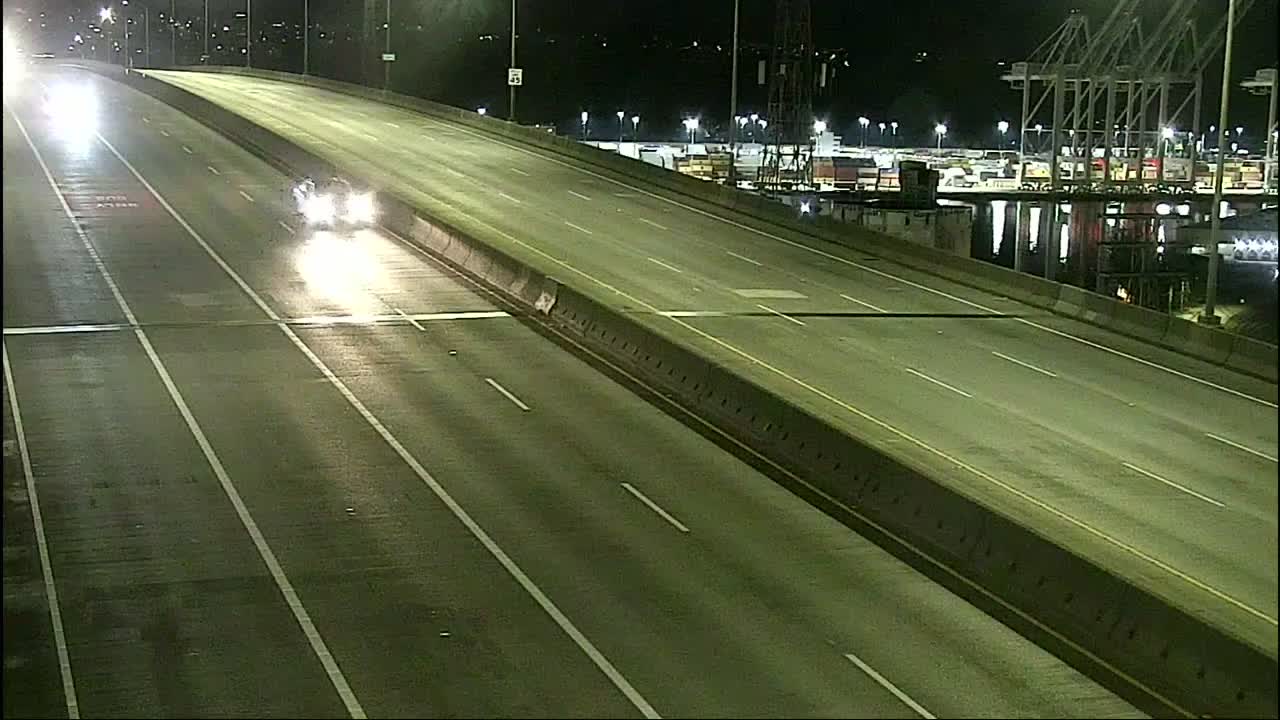
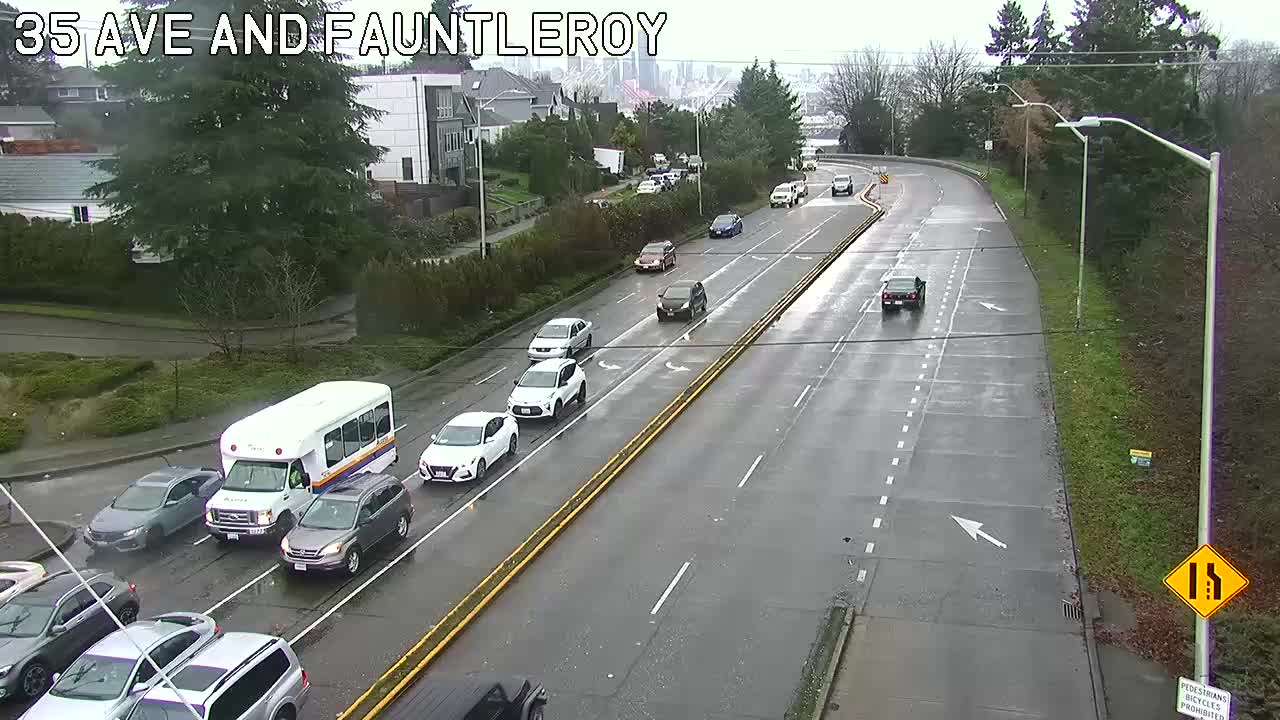

(SDOT MAP with travel times/video links; is the ‘low bridge’ closed? LOOK HERE)
7 AM: Good morning! It’s the week before Christmas, and school’s out. No incidents in/from West Seattle reported so far.
WEATHER: Rainy this morning. It gets much colder later this week and as @WestSeaWx pointed out early today, there’s a possibility of snow in a few days – late Thursday/early Friday.
7:35 AM: WSDOT reports a crash on NB I-5 near Seneca.
8:11 AM: Crash reported at Admiral/Olga.
9:05 AM: If you monitor regional news, you have likely heard about the Amtrak derailment that has closed I-5 in south Pierce County. Washington State Ferries is warning that its system traffic might increase as people divert.
10:19 AM: The current closure is southbound and per WSP expected to continue through the day.

2:56 PM: Two sky notes: First, that cloud formation – Byron asked us on Twitter about a “vortex” and we had no idea what he was referring to until we saw that photo e-mailed by Jeff Kaufer. Official name for this formation, anyone? (Update: See comments.)
Also: Possible meteor-watching tonight, Alice Enevoldsen reminds us via Twitter:
Geminids will be occurring all night Dec 13th (Thu) and 14th (Fri), starting low in the East with a few spectacular ones between sunset and 10pm. Then 10pm-2am you'll have the chance to see a lot more directly overhead… 1/2 @westseattleblog https://t.co/koBhHNUyy8
— Alice's AstroInfo (@AlicesAstroInfo) December 13, 2017
ADDED 3:10 PM: Another view, from Tori:

The Puget Sound Clean Air Agency says the burn ban in King County (and Snohomish too, if you’re keeping track) will end as of 2 pm this afternoon – the air quality is improving and the wind is expected to pick up tonight, to keep pollution in check.
The Puget Sound Clean Air Agency is adding King County to its burn-ban list. As of 2 pm today, a Stage 1 burn ban will be in effect. Here’s what that means:
*No burning is allowed in wood-burning fireplaces, uncertified wood stoves or uncertified fireplace inserts unless this is your only adequate source of heat.
*Even those using a certified device or those for whom this is their only adequate source of heat cannot generate visible smoke.
*All outdoor burning is prohibited, even in areas where outdoor burning is not permanently banned. This includes wood- and charcoal-fueled recreational fires.
Also, the National Weather Service‘s air-stagnation advisory continues.

Yes, there’s an air-stagnation advisory … but the still, foggy air also has brought scenes of beauty, like this one photographed by Jim Edwards. (Big thanks to Jim and everyone who has been sharing memorable West Seattle images here for 10 years now.)
FIRST REPORT, 8:50 PM: It’s not yet on the City Light map, but there’s a power outage in eastern West Seattle. We’ve heard from Highland Park and High Point so far. More info to come.

8:52 PM: In the time it took us to type that, the map updated – more than 4,100 customers out.
8:57 PM: No word yet on the cause. Even if you didn’t lose power, you might have noticed a flicker about the time the outage started at 8:46 pm – we did, here on the Upper Fauntleroy/Gatewood line. (And thanks to everyone whose texts immediately afterward tipped us to the outage!)
9:06 PM: As you can see on the map (screengrab above), a pocket of South Park is out too. In case this lasts a while, City Light has some helpful advice toward the end of this page.
9:11 PM: The map now has a restoration guesstimate of 1:33 am – we call it that because even the utility acknowledges it’s something of a guess. Could be sooner, could be later.
9:31 PM: If you are out or have to go out, remember that when a stoplight’s out, it’s an all-way stop. For one, as mentioned by Harvey on Twitter, Delridge/Henderson is out.
9:35 PM: Some High Point residents report via comments and texts that they’re back on. Anywhere else?

9:40 PM: The map has updated, now showing 2,700+ customers still out, so the restoration reduced the original outage by about a third. (Adding the new map above.)
9:48 PM: The cause is now described on the map as “equipment failure.”
9:54 PM: More report via comments and texts that the power’s back. And SCL elaborates on the cause via Twitter, “Breaker tripped at substation.”
9:57 PM: Map shows that everyone’s back on, and SCL confirms. If yours is NOT, be sure to call 206-684-3000 and be sure they know.

The photo is from Ben, whose home is among the dozen-plus in West Seattle that have yet to get power back after losing it during the Monday afternoon/evening windstorm. Ben tells WSB, “Going on our 3rd day without power! 47th and Hanford. Okay, it was fun for awhile, a little adventure for the kids. But we’re ready for power now! :) What with the home office and all …” The Seattle City Light map shows Ben’s neighborhood as the northernmost, and largest, remaining outage pocket (5 customers):

Citywide, as of right now, SCL still has 39 outages totaling 110 customers. And the utility is requesting that those still out be sure to re-report the outages.
(SCROLL DOWN for updates … City Light outage map HERE … Power outage tips HERE)
Emma Schmitz Overlook. pic.twitter.com/lbFxreMmR2
— West Seattle Blog (@westseattleblog) November 14, 2017
(Added: Late afternoon video from Emma Schmitz Memorial Overlook on Beach Drive)
3:02 PM: After the midday lull, the storm is back at full force, with rain and wind. Since the homeward commute is getting close, we’ll be tracking weather, traffic, and transit closely for the next few hours; the National Weather Service expects the wind to continue through “early this evening.” Updates to come.
4:07 PM: 25-customer power outage in north Morgan Junction, first one in West Seattle this storm. We have been out checking the wind and waves on Beach Drive. If you live there, you might find your trash/recycling bin(s) in the street.

Thanks to the texter who just shared that photo of tree trouble at Alki Playfield.
And a big puddle near Weather Watch Park. pic.twitter.com/7JUGXNdJN0
— West Seattle Blog (@westseattleblog) November 14, 2017
4:36 PM: Beware of deep road puddling – Harbor Avenue a block north of the bridge and Beach Drive by Weather Watch Park (video above) are two spots we’ve been through so far. (Added) Also, the bottom of the SW Genesee hill between Avalon and Delridge. And there’s a 35-customer power outage south of Schmitz Park.
4:47 PM: Add a Delridge outage south of Thistle. Not mapped yet.
 (Photo tweeted by @skwash)
Remember, if stoplights are out, it’s an all-ways stop!
5:04 PM: Thanks for all the updates in comments. We have been stuck in outage traffic on Delridge. Can confirm the outage starts just south of Juneau.

5:24 PM: Back at HQ. Sylvan/Morgan was out until just east of 35th; then on 35th, heading southbound, power went out at Othello. Citywide, more than 64,000 customers are out of power; the big West Seattle outage has at least 3,500 out and commenters are mentioning multiple transformer fires. Other smaller outages too – the Beach Drive area now has a 78-customer outage. Again, as we just experienced firsthand, driving/riding is very slow going and precarious right now – if you can stay where you are for a while, that would be a good thing.

Thanks to Christine for that photo of the tree that fell across north Marine View Drive.
5:46 PM: The Vashon Water Taxi is done for the night, a few runs early, because of “weather-related issues.” But West Seattle IS still running … Also, JRR says in comments that tonight’s Friends of Roxhill Elementary meeting is moved to TOMORROW (Tuesday) because there’s no power at the school. If you have any cancellations/postponements/closures for tonight, please let us know, whether by comments or our other messaging channels, thanks!
Seattle Public Library confirms what a commenter mentioned, that the Southwest Branch has closed early because of the outage. Westwood Village is also reported to be out – we have our crew heading over to check if it’s the entire center.
6:18 PM: Just reported the Westwood Village assessment here. Staples appears to be the biggest store without power:

But it’s NOT a centerwide outage. … UPDATES ON OTHER OUTAGES: Beach Drive is now up to 113 customers, with a midnight restoration estimate (remember that the “estimates” are really just guesses, per City Light, which still has 61,000+ customers out citywide in 138 separate outages) … Three more road notes: Our crew that went to Westwood says Barton has a serious puddle near the crossing from the RapidRide stop; SDOT says a tree is down near California Way/California Lane … and we’re just hearing a dispatch for a tree reported down near 13th and Roxbury. Speaking of Roxbury:
Safeway on Roxbury is on generators but still open. pic.twitter.com/fcqfzyZxlQ
— Theresa (@thibbs) November 14, 2017
“No frozen foods, but the liquor section is open!” Theresa adds.
6:51 PM: When you get your power back, please let us know via comments or our hotline (text/call 206-293-6302) – we’re watching the City Light map but it doesn’t retain info on when outages end. Meantime, though most of north West Seattle still has power, it has other wind trouble – Mike sent this from 48th/Oregon:
And near California/Hill, a power pole is leaning, and the sender was concerned that there had not been an emergency response there yet, at least as of about half an hour ago:

7:19 PM: Something that’s NOT canceled or postponed tonight – the West Seattle Education Fair (which we’re co-sponsoring) IS on as scheduled, since there’s no outage trouble in The Junction. Until 9 pm at 40th/Edmunds.
Meantime, taking a closer look at the outage map, it appears the big mostly-east West Seattle outage is actually considered two, with a total of more than 7,500 customers. And there are more than half a dozen smaller outages around West Seattle alone, from one customer to more than 100; the restoration guesstimates are all in the 11 pm to midnight vicinity. … The outages might affect your cable even if you have electricity; Michael in North Admiral is only getting one channel, for example.
7:39 PM: From the scanner, 20-foot tree reported down blocking 21st SW in 4100 block [map] on Pigeon Point.
8:46 PM: We’ve been out checking on a few things. The wind has calmed considerably. But the West Seattle power outages haven’t been fixed yet; the eastern half of the biggest one shows a new restoration guesstimate of 2 am. Other repairs will take a while too – just got this photo of a streetlight down on 36th between Andover and Dakota:

There’ll be a lot of sweeping and raking to do tomorrow – lots of leaves and twigs evident on some of the residential streets we just drove.
9:18 PM: Thanks to everyone who has commented/texted to say your power’s back. Should be reflected on the map soon so we know who’s still out.
9:25 PM: Not showing yet so … Highland Park, High Point, Sunrise Heights, Westwood, South Delridge are the areas we’ve heard from so far, as well as southeast Fauntleroy. And … while we haven’t lost power tonight, our lights just flickered. Hoping that’s for a good reason like more restoration. Citywide, City Light now has 46,000 customers left without power.
Meantime, it should be noted that the weather alert has expired as scheduled (it was in effect through 9 pm), so forecasters indeed see things getting back to normal. But there’s still a lot to clean up and repair; firefighters for example have just been sent to the 10100 block of 31st SW for the latest “wires down” call.
10:01 PM: The City Light map now reflects more of the restored areas, with the smaller near-half of the big outage now no longer shown.
MIDNIGHT: SCL still shows more than 4,500 West Seattle customers without power. If you’re among them, please let us know when you get it back.
5:58 AM: Looks like the last major outage pocket is along Delridge north of Orchard/Sylvan.
(SDOT MAP with travel times/video links; is the ‘low bridge’ closed? LOOK HERE)
6:35 AM: As predicted, the wind has kicked up. No incidents reported so far. One transit alert:
Transit Alert – Route 116 to downtown Seattle due to leave the Fauntleroy Ferry Terminal at 7:30 AM will not operate this morning.
— King County Metro🚌 (@kcmetrobus) November 13, 2017
Please let us know about any weather/traffic trouble you see (including power outages), when you can do so safely – text/call 206-293-6302. Thank you.
7 AM: Still no incidents/outages – one person reports a Comcast outage in Belvidere, no way to know if it’s weather-related but they want to remind you to report cable outages too so repair crews will be dispatched quicker. Meantime, the wind advisory is in effect through 7 tonight.
8:05 AM: At least where we are, the wind has quieted somewhat, for now. Still no local incidents reported.
8:23 AM: This is apparently just a break in the wind – the NWS has upped the alert to a High Wind Warning, with possible gusts to 60 mph, in effect through 9 tonight.
9:52 AM: Crash reported, three vehicles, with at least one person hurt, on NB Highway 99 at Yesler.
4:19 PM: Get everything charged, just in case … the National Weather Service has a Wind Advisory for our area, covering 7 am-7 pm Monday. It’s predicting “South (wind) 25 to 35 mph, with gusts 50 to 55 mph.” You can read the full alert here.
MONDAY MORNING NOTE: As of just before 8 a Monday, the alert has been raised to a High Wind Warning, with gusts possible to 60 mph, in effect through 9 pm.
(SDOT MAP with travel times/video links; is the ‘low bridge’ closed? LOOK HERE)
6:30 AM: Good morning! The temperature’s above freezing and no reports of iciness in our area. But it’ll be a chilly day – highs in the 40s.
SHORT SCHOOL WEEK: Since Veterans Day is on a Saturday this year, it will be observed this Friday (November 10th) by many, including Seattle Public Schools.
7:35 AM: Still no incidents reported in/from West Seattle.

ORIGINAL REPORT, 8:24 PM: That’s a screengrab from SDOT’s Winter Weather Response map (click the image to go to the “live” map), showing where city crews have pre-treated roads in this area in the past few hours. The National Weather Service has issued a Special Weather Statement alert warning about potentially icy roads:
Rain and snow showers will end across the lowlands of Western Washington this evening. Skies will begin clearing later tonight, allowing low temperatures to dip to near or below freezing in many areas. The coldest temperatures in the mid and upper 20s are expected in outlying areas away from the water. Some roads that are still wet or slushy will freeze late tonight and Monday morning. Icy roads should be anticipated for the Monday morning commute. Lows in the metro areas may also reach near freezing and some side roads or hills could also have icy spots.
After this, the forecast warms up gradually throughout the week, toward a high around 50 on Friday.
MONDAY MORNING: The alert was lifted overnight – temperatures have remained above freezing.
6:37 AM: Good news if you were worried about getting around today, bad news if you were hoping for a chance to throw a few snowballs: No snow so far, just rain. The National Weather Service canceled its alert a few hours ago and explained in the “forecast discussion”:
What needed to happen to get snow in the lowlands early this morning was a combination of the winds becoming northerly cooling the air mass down before the moisture from the frontal system moved out of the area. What happened was the surface low associated with the system instead of ending up near the mouth of the Columbia river is now just west of Grays Harbor. This difference in the low position has kept the winds from Everett southward easterly overnight instead of the winds becoming northerly. In these marginal low snow level scenarios for the Puget Sound region the low level easterlies are a killer. The little bit of downslope warming from the easterlies keeps the temperatures warm enough to keep the precipitation type as rain and that is what happened overnight.
The forecast still suggests the possibility of snow showers.
7:24 AM: One of those showers has arrived.
5:39 PM: We’ll have an update later, but in the short run – the NWS now warns things could be icy Monday morning.
The National Weather Service just updated its Winter Weather Advisory alert for the area, and it’ll be in effect midnight tonight through 10 am Sunday (which is really an 11-hour period because of the time change). The basics:
* WHAT…Rain and snow will increase this evening. Snow levels will fall to near 500 feet after midnight and 200 feet or lower Sunday morning. Accumulation up to 2 inches above 200 feet.
* WHERE…Above 200 feet away from the water, mainly on colder or grassy surfaces.
That covers much of West Seattle (our area includes the highest point in the city, 35th/Myrtle, 518′ – see it on an elevation map that you also can use to check the elevation where you are). If and when you see snow, please let us know – 206-293-6302, text or voice, 24/7 – thank you!
(SCROLL DOWN for Friday pm updates – traffic trouble, even though the weather’s improved!)
 (Photo texted from High Point)
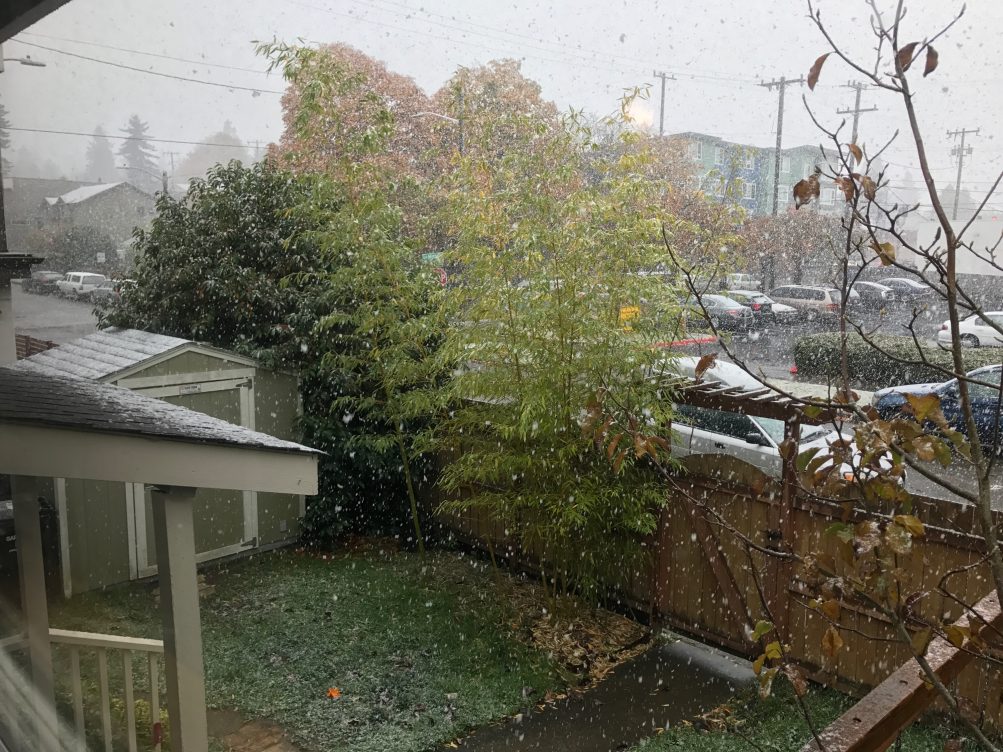
12:46 PM: As we’ve been tracking with your help since early morning, we’ve been seeing the season’s first snow – not really sticking, but seriously showery at times. The National Weather Service has just issued a “special weather statement” saying tomorrow night could bring a few inches of wet snow in the hillier areas around the city. More to come!
Hello climate change. Snow in #Seattle @westseattleblog @KSeattleWeather #winterishere #pacificnorthwest pic.twitter.com/iXudyARU7k
— CJ Barker (@cjbarkbark) November 3, 2017
(Video tweeted by @cjbarkbark)
1:57 PM: The snow has stopped, at least where we are. But some of it definitely stuck to yards, planting strips, and cars during the noon-hour shower, as we saw when headed back south from The Junction, through Morgan, Gatewood, and Upper Fauntleroy. We’ll be adding afternoon notes here for a while. Such as:
HELPLINE GALA STILL ON: The folks at West Seattle Helpline called and wanted to be sure that everyone knows their Neighbors Helping Neighbors dinner/auction tonight at The Hall at Fauntleroy IS ON – regardless of snow, rain, whatever the weather.
2:20 PM: A few flakes are back. SDOT has in the meantime sent an afternoon update, saying it’s assessed pavement throughout the city, and:
All pavement is currently bare and wet. And while the city is experiencing light to heavy flurries, road temperatures remain above freezing between 35 and 37 degrees. SDOT has deployed large plows and spreader at high elevation areas throughout the city and will continue to evaluate and monitor.
If you see SDOT snow equipment, let us know/send a pic (206-293-6302 – thanks for the other pics and clips too).

3:16 PM: Thanks to Brian for sending that photo – taken at Fauntleroy/Edmunds around noon. Meanwhile, if you are worried about the drive/ride home – no reason to be. We have just traveled south through Westwood, Arbor Heights, and White Center – the snowiest area we saw was SW White Center but even there, nothing on the roads. We do have word of a crash just reported – 35th and Thistle, blocking northbound lanes.
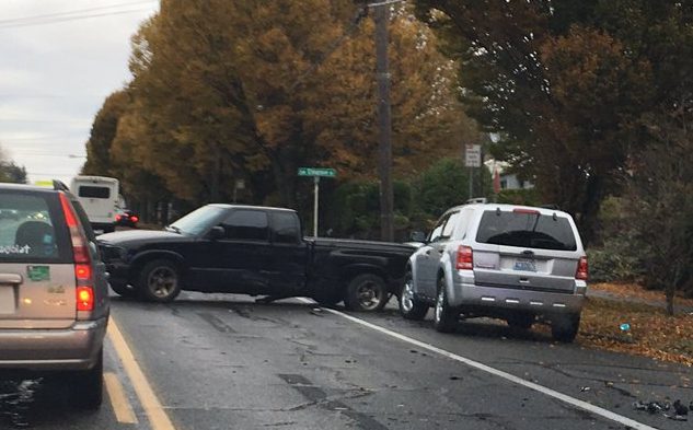
3:58 PM: Heading back north on 35th, the northbound lane is still blocked by a sideways pickup truck. SFD closed out of the call fairly quickly, though, so no serious injuries. No snow or even rain right now, with the cloud layer higher and thinner, so looks like it’ll be an OK drive/ride home.
4:51 PM: Several people have reported being stuck on the westbound bridge. No alerts yet nor crash reports but one camera shows a few vehicles on the shoulder. We’re monitoring.
5:01 PM: This tweet reveals what the problem was:
Dumpster in the road near 35th. pic.twitter.com/iiVJJnuMbq
— BW (@bwwigen) November 3, 2017
5:07 PM: Here’s what the backup looks like – Catherine texted this view (thanks!):

5:28 PM: SDOT just sent another update, saying all’s well so far, but it has people and equipment on standby just in case:
•Plows and trucks on standby
•Crews on standby for rush hour throughout the evening
•Night crews staffed (in the event temperatures drop to freezing)
ORIGINAL REPORT, 3:22 PM THURSDAY: The afternoon forecast is out and the National Weather Service put the “s-word” back in for late tonight and tomorrow morning – at least, on the highest hills. Possible rain/snow showers after midnight tonight, with the snow level around 500 feet (that’s the highest point in the city, just southwest of High Point, 35th/Myrtle), dropping to around 400 feet tomorrow morning. And SDOT reminds you it has winter-weather maps – both interactive (showing where salting, sanding, plowing has happened) and printable – linked here.
ADDED FRIDAY MORNING: Some snow did fall on the higher hills, as noted in our morning traffic/weather coverage.

Thanks to James Bratsanos for the view of tonight’s sunset – a peek of golden sunshine before another round of stormy weather moves in. The National Weather Service has the entire county under a Flood Watch alert for Saturday afternoon through Sunday night – so check those storm drains in the morning!

The rainy season is here, and Seattle Public Utilities is getting to the next phase of deciding where to install 7-10 blocks of natural drainage systems – such as roadside raingardens – for the Longfellow Natural Drainage Systems Project. It’s hosting drop-in discussions at two spots next Wednesday (October 25th). From SPU spokesperson Brian Mickelson:
For these drop-in sessions, SPU is most interested in hearing from folks that live along the blocks we’re considering installing natural drainage. That includes 30th Ave SW between SW Barton St down to just below SW Roxbury St, 29th Ave SW between SW Barton St and SW Roxbury St, 25th Ave SW between SW Barton St and SW Roxbury St, and the area immediately surrounding 24th Ave SW and SW Kenyon St (we sent the attached postcard to those neighbors specifically). That said, we are of course happy to chat with anyone that wants to stop by.
The drop-in discussions will be 4-6 pm Wednesday at 30th/Barton and 24th/Kenyon. For more backstory, see the project FAQ here. The city announced the project back in May, saying that construction is expected in 2019.
5:33 PM: The wind arrived in time for the Wednesday commute home, as forecast. So far, here are the closest problems we’re hearing about:
 (Added: Washington State Patrol photo)
-NB Highway 509 is reported to be blocked at Cloverdale (just east of West Seattle) by downed power lines.
-Power’s out in southeast White Center and parts south for more than 3,800 customers.
The National Weather Service‘s wind-advisory alert remains in effect through 11 pm. We’ll update with any other storm-related problems we hear about – please let us know about anything you see, text/voice 206-293-6302. Thanks!
5:52 PM: According to the scanner, a tree is blocking westbound Sylvan Way at Orchard – that would be just west of Delridge Way SW.
7:22 PM: According to the City Light map, most of the people who lost power in White Center and points south now have it back – that outage is down to ~200 customers.

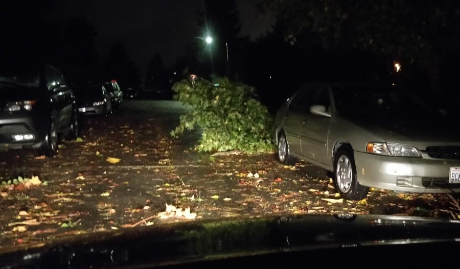
9:24 PM: The photo is from Xana, who explains she heard a huge crack/pop sound from her apartment in the 2300 block of Bonair SW around 7 pm:
I walked out back to where the walkway meets the parking lot and shazam! Was shocked to see the tree in our back courtyard broke and fell and is blocking the entire walkway. If someone had been walking there they would have been crushed or impaled!
The person in her photo is posed by the downed tree to show the scale.
MIDNIGHT UPDATE: WSDOT says in an e-mail update that NB 509 has reopened.
You’ve been hearing that stormier weather is on the way: Tomorrow (Wednesday), the National Weather Service has a “wind advisory” in effect for our area, 11 am-11 pm. What that means:
*WIND…Southeast 20 to 30 mph with gusts 40 mph. …
*TIMING…Winds will increase early Wednesday afternoon and peak during the evening commute.
Heavy rain is likely tomorrow night too, and power outages are possible, so keep everything charged!
| 8 COMMENTS