West Seattle, Washington
20 Friday
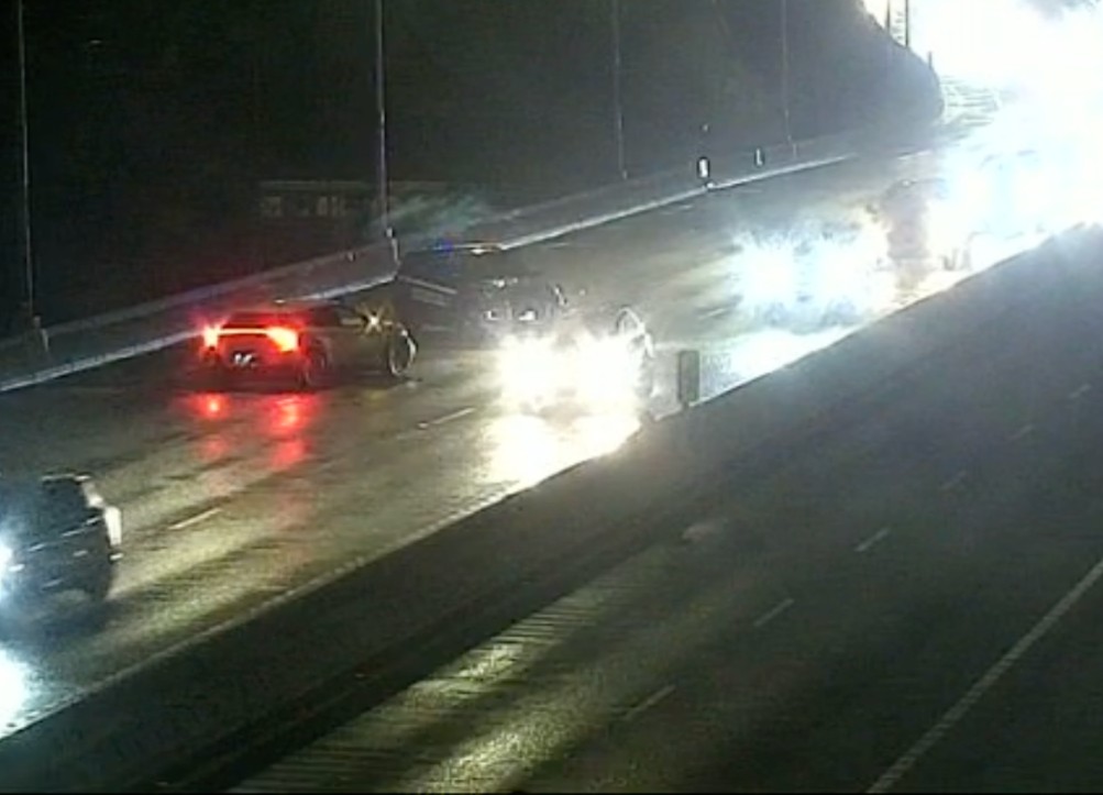 (Screengrab of traffic cam before SFD and other SPD arrived at bridge scene)
11:13 PM: Part of the westbound West Seattle Bridge is blocked just before the Delridge exit after what police have told dispatch they believe is a hit-run crash. An officer reported that a black vehicle likely to have “major front-end damage” is believed to have exited the bridge at Delridge or some point further west.
11:17 PM: Officers believe they’ve found that car on the Delridge offramp. The driver is believed to have initially walked away but is returning, they’ve told dispatch.
11:22 PM: The Delridge offramp is reported to be completely blocked.
12:07 AM: Offramp’ll be blocked a while for cleanup.
12:27 AM: Or not; police say they’re reopening the ramp. We’re meantime following up on injuries.
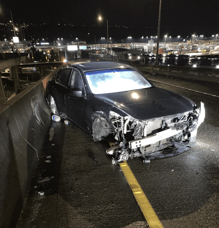
ADDED MONDAY: This update is from SPD Blotter:
Seattle police officers arrested a 17-year-old boy following a hit and run collision on the West Seattle Bridge Saturday night.
On Oct 11, at about 11:00 p.m., a patrol officer witnessed a car travelling a high rate-of-speed with no headlights on, westbound, on the West Seattle Bridge. The car crashed into another vehicle, also going westbound, on the bridge.
Officers arrived, and found the occupants of the victim vehicle, a man and a woman, both 45, with minor injuries. The Seattle Fire Department (SFD) arrived and provided them with medical aid.
The suspect vehicle fled the crash and then struck a barrier at the Delridge Way Southwest off-ramp, disabling the car. The vehicle’s occupants ran away on foot.
While police investigated the crash, the fleeing occupants returned to the scene of the crime. Police arrested the 17-year-old driver for hit and run and reckless driving. Two of the passengers had minor injuries, and they were treated by SFD and taken to the hospital.
Police issued the teen driver a citation for failure to provide insurance, and having mismatched license plate and car registration. Officers released him from custody to a family member at the Southwest Precinct.’
(Seattle Police photo)
Police impounded the arrestee’s car from the roadway, as it sustained significant damage.
Back on Thursday night, we featured artist Tyson Foster in our coverage of this month’s West Seattle Art Walk, He was at Junction 47 for his exhibit’s opening reception. Usually the artwork stays up all month at host venues – but you won’t find some of Foster’s work at Junction 47 tonight, because it’s been stolen:
The reader who reports this says the security video images aren’t available yet but they showed “a tall white man with a blond ponytail and handlebar mustache, wearing a blue jacket, breaking into the apartment lobby of the west building with a black garbage bag, from 8-9 am.”
They sent images of some of the stolen work, and that’s what’s shown here, including this “casket-shaped painting.”

All work is signed and dated, we’re told. The thief may have been seen in The Triangle later in the morning near “the veterans’ office,” according to two witnesses who said “he did still have the paintings with him and he left with two older white women with their hoods up (…) he walked behind that building with the women and then they saw a car drive out of that back area seconds later.” If you have any info, the SPD incident # is 25-297867.
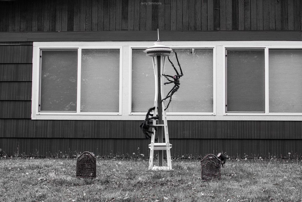
Some Halloween displays fill yards/decks with various creeply creatures. Then … there are some with sparse elegance. Like this one. The centerpiece is the heart of this Halloween display, spotted by Jerry Simmons along 35th Avenue SW (and requiring him to turn around and go back for the photo!). Got a decoration pic to share, yours or someone else’s? westseattleblog@gmail.com as we continue nightly features for three more weeks! (What we’ve already shown is in the WSB Halloween archive.)
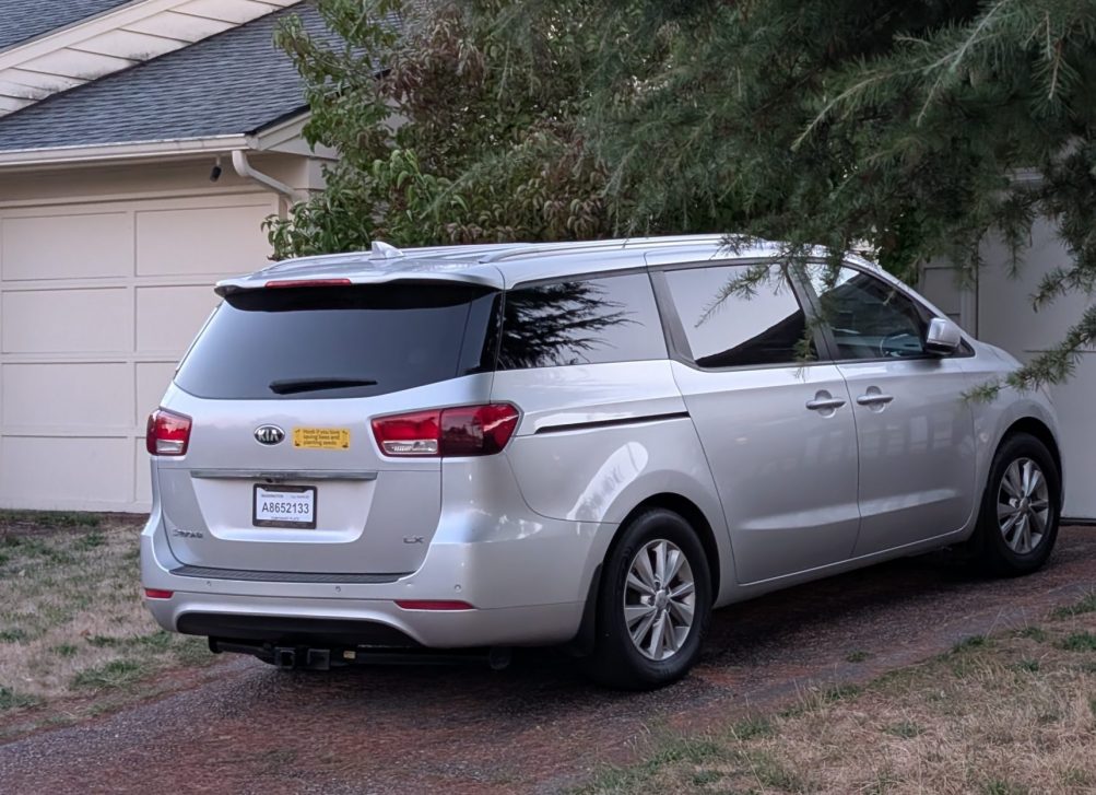
FIRST REPORT, SATURDAY: Cameron hopes you’ll be on the lookout for this stolen van:
Van stolen from near Roxhill Park, from driveway. Any info appreciated!
2016 Kia Sedona
Silver
Unique bumper sticker (“Honk if you love saving bees and planting seeds”)25-297781 is the incident number
Call 911 if you find it and refer to that case #.
SUNDAY UPDATE: See comments – it’s been found, crashed at nearby Southwest Teen Life Center.
Police are at two collision scenes in West Seattle right now:
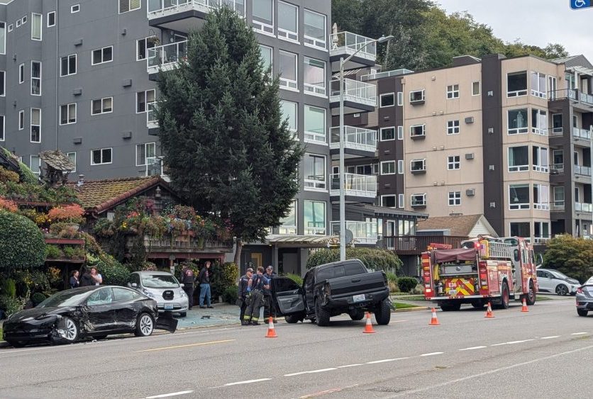
Thanks to Jan for that photo of the scene of a crash involving three vehicles by the Alki Avenue “flower houses” in the 1300 block [vicinity map]. It’s partly blocking the south/east direction.
Meantime, no photo, but police report both directions of Sylvan Way are blocked at SW Holly [map] because of a crash described as a driver hitting a tree.
SFD has responded to both scenes, though not major responses, so injuries are likely not life-threatening. One person is reportedly being transported to a hospital from the Sylvan Way crash via AMR (private ambulance).
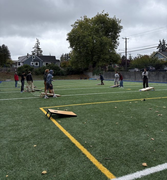
Thanks to Kevin for sending the photos! The cornhole tournament happening at West Seattle High School today isn’t just for fun – it’s also for fundraising so the new WSHS Cornhole Club can buy more boards. Kevin’s daughter Dora is one of the organizers:
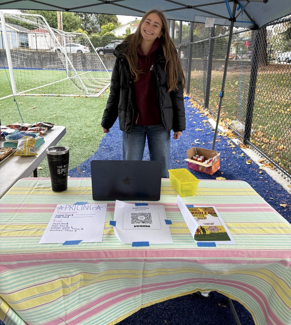
You’re welcome to stop by during the tournament and cheer them on and/or donate – they’re selling refreshments too. It’s on the WSHS side field until 4 pm.
Story and photos by Jason Grotelueschen
Reporting for West Seattle Blog
If you live in or visit the Arbor Heights neighborhood, then you’ve undoubtedly noticed the limited number of sidewalks.
The $1.55 billion Seattle Transportation Levy (approved by voters last November) includes funding for the construction of 350 new sidewalk blocks in the city in the next eight years as part of the Sidewalk Development Program. Current plans call for 10-15 of those blocks to be built in Arbor Heights.
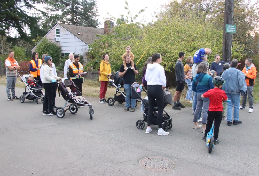
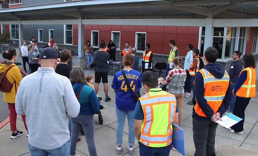
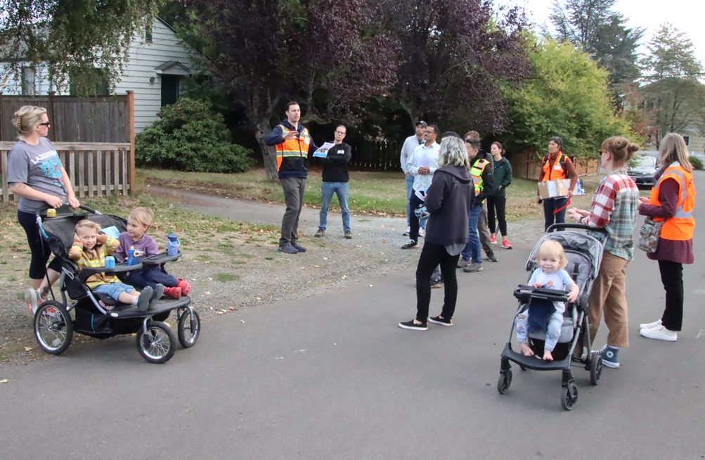
On Wednesday afternoon, neighbors of all ages met at Arbor Heights Elementary to embark on a walking tour led by representatives from the Seattle Department of Transportation (SDOT) to learn about sidewalk/walkway options, feasibility, opportunities and challenges, and to share feedback and perspectives with SDOT staff.
The event began at the school with a welcome and overview from SDOT staff, including deputy director of project development Brian Dougherty (speaking, below):
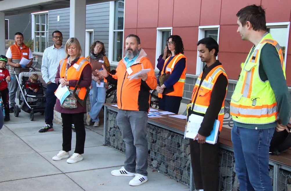
Dougherty and staff said the goal of the afternoon was to gather priorities for new sidewalks and walkability improvements funded by the transportation levy. Options for improvement include where to build sidewalks and walkways, plus related needs such as crosswalks, lighting, stop signs, and other traffic calming measures to improve accessibility and safety.
District 1 City Councilmember Rob Saka was also in attendance. He welcomed neighbors and thanked them for their participation, saying that the turnout was the largest crowd he’d seen at similar walks in the city:
Saka chairs the council’s Transportation Committee, and cited the citywide sidewalk gaps: “27% of neighborhoods across this city do not have a sidewalk on either side of their street,” but he said that the current pace of adding sidewalks has been far too slow. Saka said that Mayor Bruce Harrell proposed a significant sidewalk investment in the transportation levy, and that Saka “doubled that amount during Council deliberations” about the levy. He emphasized gratitude to voters.
Saka said that at least 20-22% of new sidewalks in Seattle are designated for our district (West Seattle/South Park/Georgetown/Pioneer Square and vicinity), but based on criteria adopted in the Seattle Transportation Plan (such as Safe Routes to School, equity, and transit proximity), D1 may receive “even more than that minimum.”
Dougherty gave quick introductions of SDOT staff (wearing bright orange vests):
The team talked about how feedback will be gathered for the project during the walks, via printed comment cards as well as notes taken by SDOT staff. Some staff members also had measuring tape and other tools, and would be gathering information during the tour about width of streets and right-of-ways and other data points.
They also had requests for the community: If you were on the tour but have additional feedback, submit it here. If you were unable to join the tour but have questions or comments about the idea, take a look at the Sidewalk Development Program website to learn more, and contact the team at levysidewalks@seattle.gov or 206-900-8718.
SDOT staff will be merging community input with their own staff notes, to identify 10-15 priority blocks to work on for sidewalk plans, initiate preliminary designs, and then will publish a summary report describing the list of prioritized blocks “within one to two months.”
They also added that for any feedback they receive that isn’t directly related to sidewalks but is still of interest to the neighborhood (such as traffic calming), they will be compiling and routing those to the proper teams and personnel for consideration.
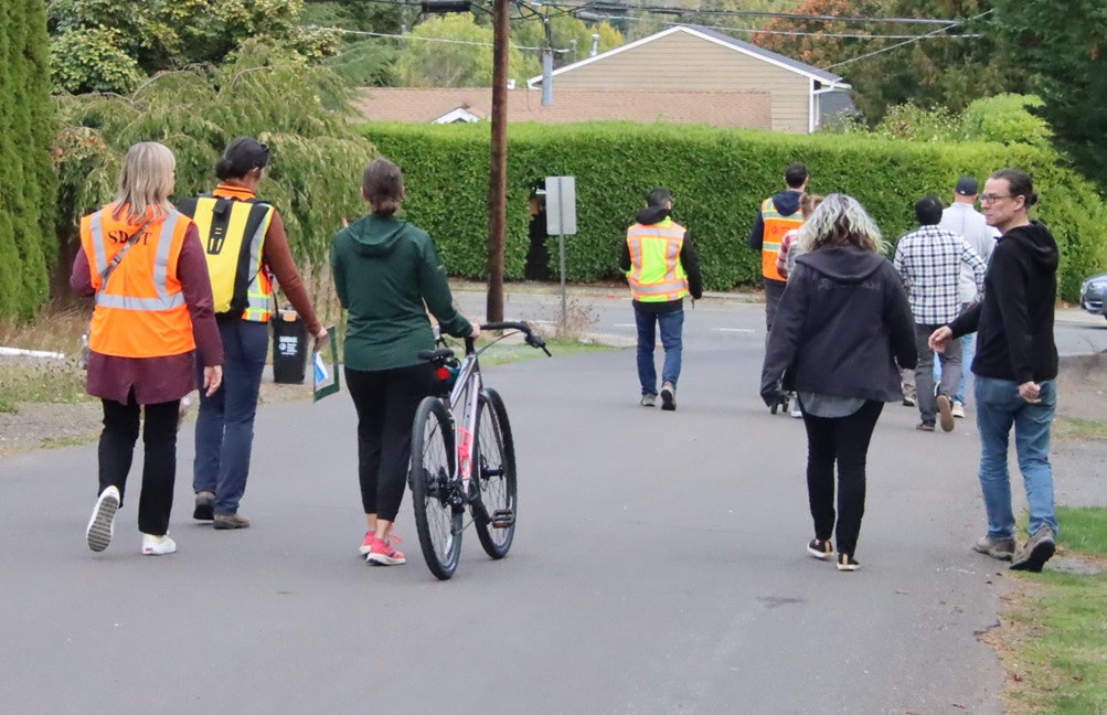
SDOT staff then asked attendees to divide into two smaller groups, to walk two different routes through the neighborhood:
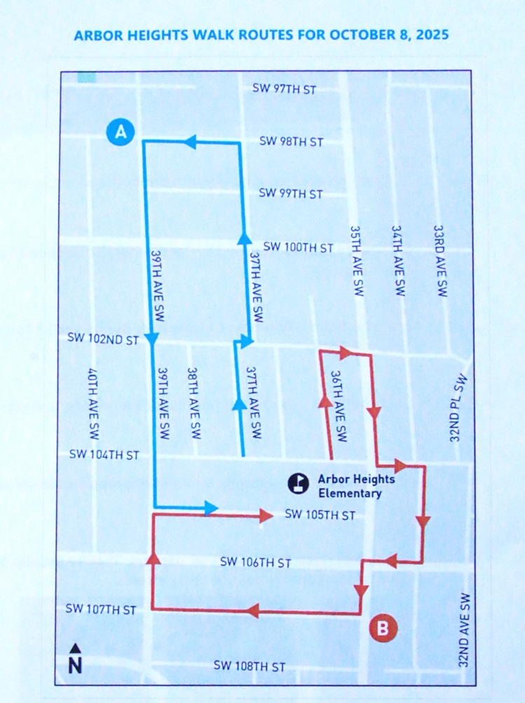
Staff emphasized that these were merely suggested routes, with flexibility to take detours based on resident requests, and they added that SDOT can return on later dates to assess additional locations, problem spots, bus-boarding areas on walkways, locations where asphalt walkways are being used for parking, and locations not reachable on this particular day for whatever reason (such as parked vehicles or construction). They also stressed that just because a block of Arbor Heights wasn’t included the tour’s walking routes doesn’t mean that it wouldn’t be under consideration for sidewalks/walkways — they chose the walking routes based on initial assessments and feedback, but are open to all ideas for all areas.
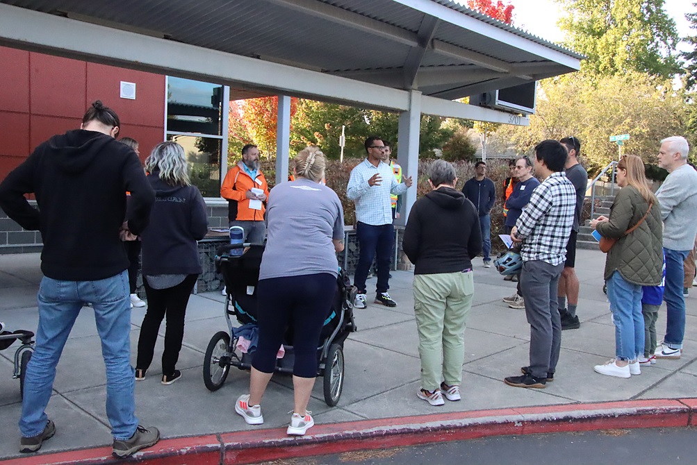
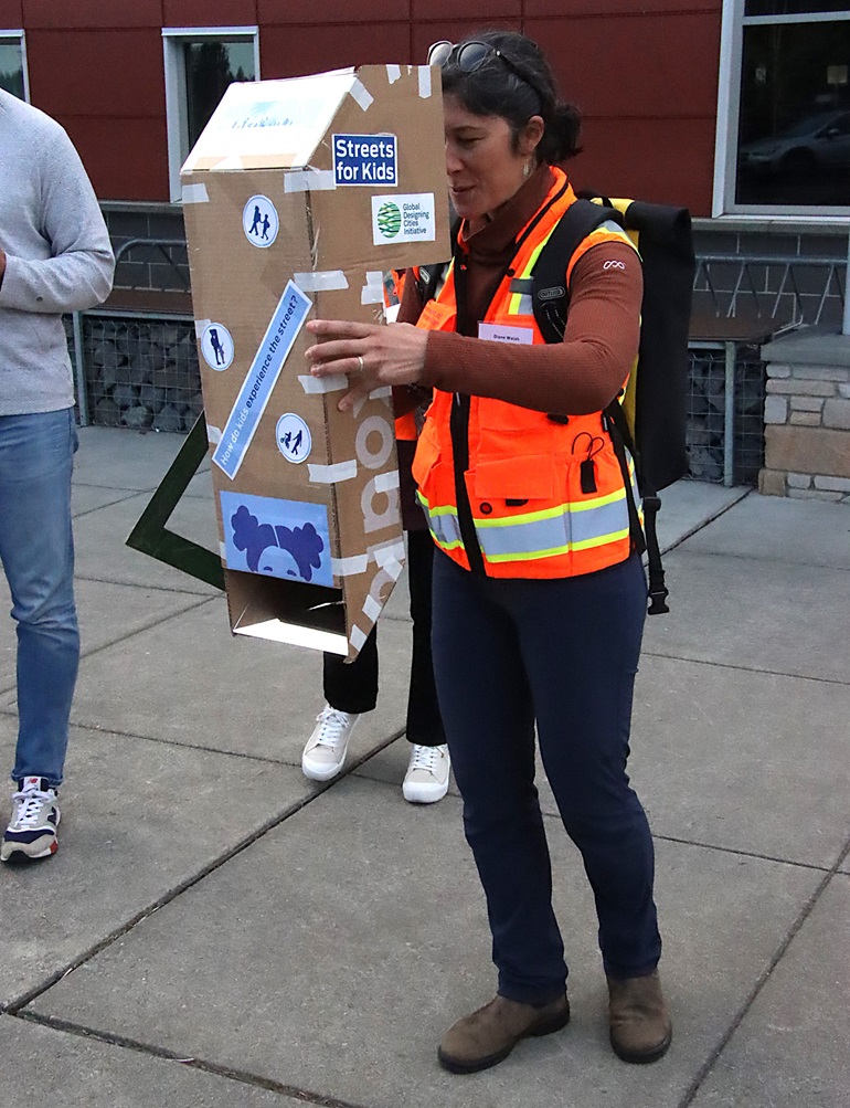
Each of the groups then gathered and went on their way. We started by tagging along with “Group B,” but before they departed, SDOT’s Diane Walsh, who works with the School Streets and Safe Routes to School programs, did a quick demonstration of tools that the team uses to capture on-site feedback, including a modified “periscope” allowing adults to get the perspective of young kids walking in the neighborhood and trying to navigate streets safely:
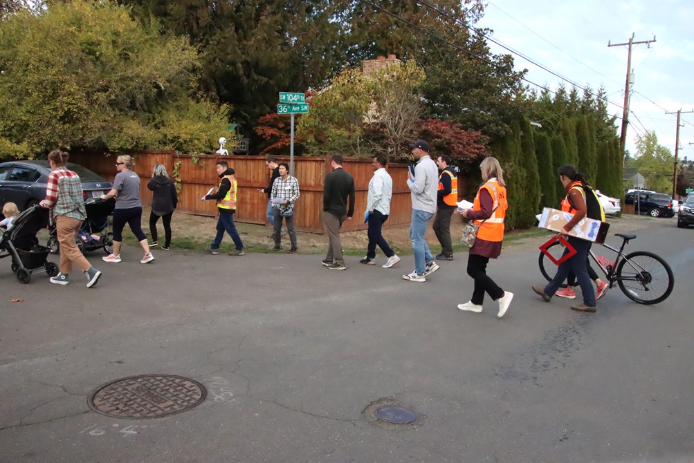
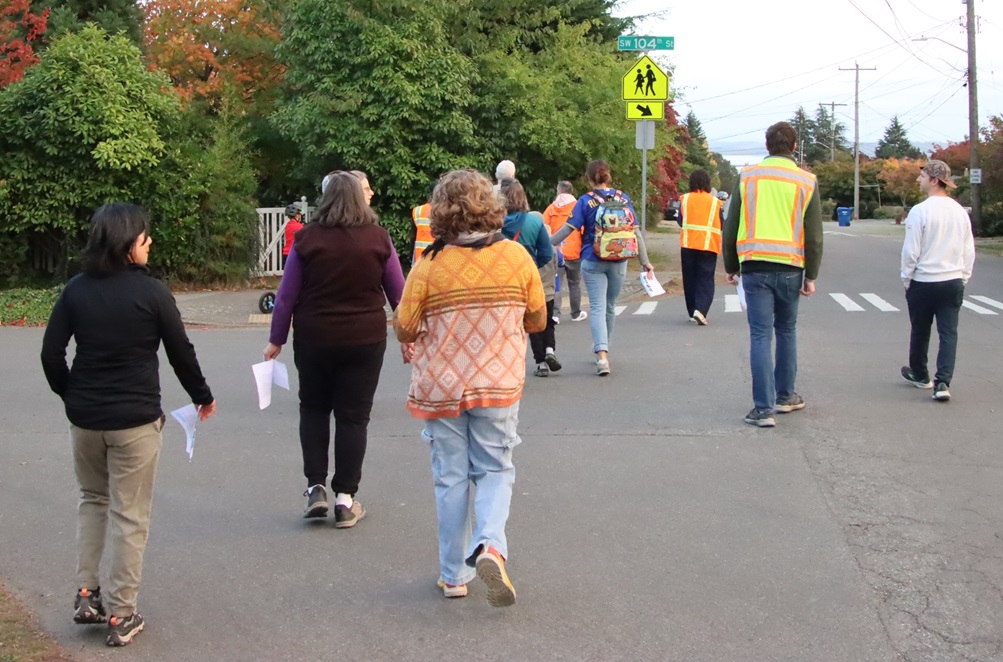
With that, Group B (which included Saka) was off and running (well, mostly walking, or on wheels) starting by taking 36th Ave north to SW 102nd St before looping east/south on 35th and 34th:
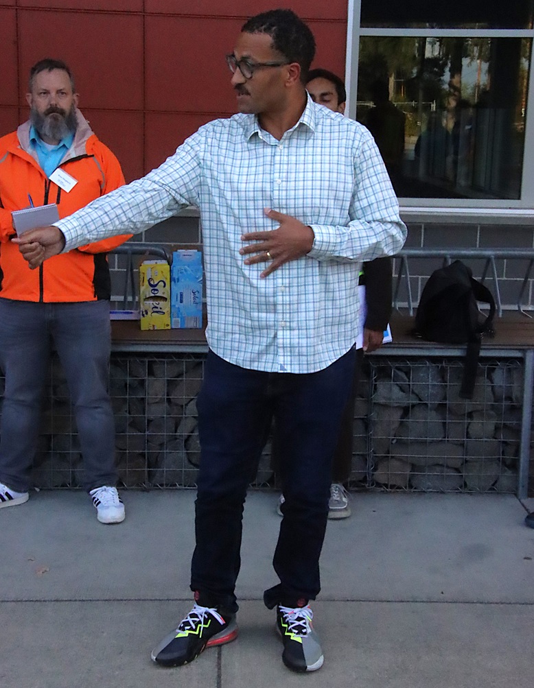
Kartheiser paused at various spots to talk about the city’s process for assessing the need and feasibility for walkways, including the factors that go into determining priorities:
He said there are a range of treatments used citywide including traditional concrete curb-and-gutter sidewalks, at-grade asphalt walkways, gravel shoulders, painted walking lanes, and in some places no formal walkway. The actual design choices implemented in each area depend on site conditions (e.g., steep drop-offs, drainage).
Some notes from Q&A between Kartheiser and the “Group B” walkers:
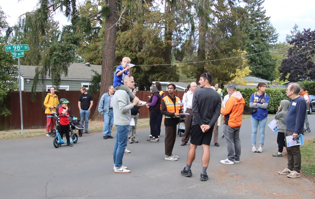
As Group B headed toward 35th, we hustled northwest to catch up with “Group A” on their walk, as they proceeded north on 37th, crossing the busy 100th St (which does have sidewalks in some stretches, unlike other areas of Arbor Heights, and serves a conduit for school buses and for Metro bus route 21/22).
Group A made its way northwest to the intersection of 39th Ave SW and SW 98th St, before looping back south:
Some notes from discussions between Dougherty and other SDOT staff and neighbors on the Group B leg of the tour:
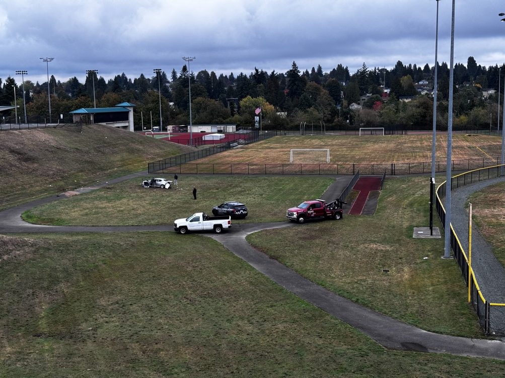
SATURDAY REPORT: Thanks to David for the photo. This scene at Nino Cantu Southwest Athletic Complex followed reports in the 4 am hour of an unoccupied car rolling downhill, doors open, near 29th/Cloverdale, and of two drivers doing donuts in the NCSWAC lot, with one reportedly crashing through a fence. We’ve listened to archived police communication related to the incident; officers called in a white Hyundai Elantra that hadn’t been reported as stolen but had months-expired registration. David says reckless driving/vehicle stunts in the NCSWAC parking lot and vicinity “has been an ongoing problem in this neighborhood for years.”
SUNDAY UPDATE: David says neighbors reported a second car was rolled down the embankment too, but towed quickly, so only one was left by the time the photo above was taken.
(11:28 AM UPDATE: Added SR3 event, which was already in our calendar, and White Center/South Delridge Haunted Marketplace, which was not)
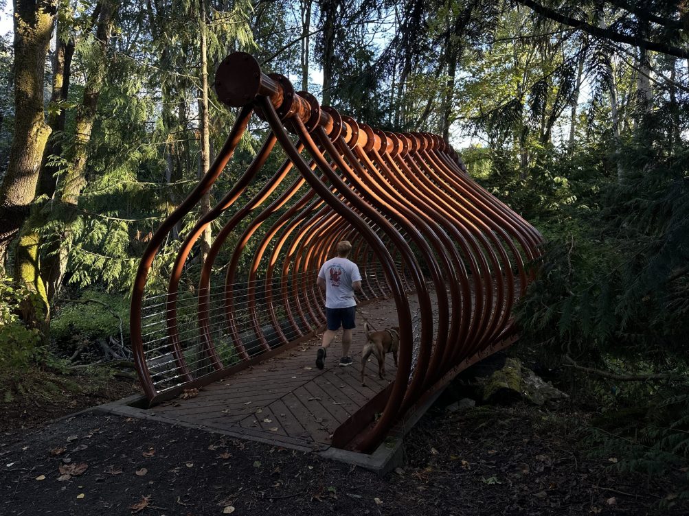 (Recently reopened Salmon Bone Bridge over Longfellow Creek – photo by Manuel Valdes)
Here’s our West Seattle list for your Saturday, from the WSB West Seattle Event Calendar and inbox:
SATURDAY GROUP RUN: Kick-start your weekend with a run! West Seattle Runner (2743 California SW; WSB sponsor) leads Saturday 8 am free group runs!
VACCINE CLINIC: 9 am-3 pm at Madison Middle School (3429 45th SW), open to all, but follow that link to get an appointment first.
URBAN FARMING WORKSHOP: 9 am at Puget Ridge Edible Park (18th/Brandon), second-to-last workshop in a series that will teach you about growing food in an urban community garden, as previewed here. Today’s topic: “Spring gardening. Be ready for the growing season.”
FREE FIT4BABY CLASS: Prenatal fitness at FIT4MOM Studio (2707 California SW), 9 am.
HEAVILY MEDITATED: Free 9 am community meditation at Inner Alchemy Sanctuary/Studio (3618 SW Alaska) – register here.
INTRODUCTORY WALK: First of two sequential weekly walking events – meeting at the same spot, 47th SW and Fauntleroy Way, first at 9:30 am for a flat-terrain 1-mile walk.
WALKING FOR WELL-BEING: That’s followed by this 10 am walk, which you can join even if you didn’t go on the introductory walk. Meet at 47th SW and Fauntleroy Way.
SSC GARDEN CENTER: The Garden Center at South Seattle College (6000 16th SW, north end of campus), is open 10 am-3 pm.
TOT DISCO: $2 for your little one to dance at Delridge Community Center (4501 Delridge Way SW), 10 am-11:30 pm. Adults free)
DELRIDGE FARMERS’ MARKET: Third-to-last week to shop at this market! Open 10 am-2 pm, Saturdays through October, in and around the courtyard at Hope Academy in South Delridge (9421 18th SW). Fresh produce, cooked-on-site food, sweet treats, body-care products, more, with a focus on BIPOC farmers/vendors!
MORNING JAZZ AT THE COFFEEHOUSE: 10:30 am-noon at C & P Coffee (5612 California SW; WSB sponsor), Theo Mcgaughey Jazz Trio performs.
FAMILY STORY TIME: 10:30 am at High Point Library (3411 SW Raymond).
FREE WRITING GROUP: On hiatus; no gathering until mid-October
ALKI HISTORY WALK: Last one of the year, 11 am – openings remain as of early this morning. Meet at the Log House Museum. (61st/Stevens)
FAMILY READING TIME: At Paper Boat Booksellers, 11 am family reading time. (4522 California SW)
NO KINGS 2.0 PRE-RALLY: One week before the next mass “No Kings” demonstrations, West Seattleites will meet up at Alki Statue of Liberty today and walk around drumming (etc.) to spread the word, starting at noon. (61st SW and Alki SW)
FRESH HOP BEER FEST: Today is the most celebratory day of this three-day festival at Beveridge Place Pub (6413 California SW) – noon to 11 pm, more than 40 fresh-hop beers on tap, with tasting tickets and a four-ounce commemorative glass. DJ spins 2-6 pm.
WHITE CENTER HAUNTED MARKETPLACE: Starting at noon, businesses in White Center and South Delridge welcome you for special seasonal events!
LOG HOUSE MUSEUM: The home of West Seattle’s history is open noon-4 pm on Saturdays. (61st SW/SW Stevens)
VIETNAMESE CULTURAL CENTER: The center is open to visitors noon-3 pm, as explained here. (2236 SW Orchard)
VISCON CELLARS TASTING ROOM/WINE BAR: Tasting room open for you to enjoy wine by the glass or bottle – 1-6 pm at Viscon Cellars (5910 California SW; WSB sponsor).
SUPER SMASH SATURDAYS: Three Saturdays a month at Fourth Emerald Games (4517 California SW), open 1 pm-10 pm.
NORTHWEST WINE ACADEMY TASTING ROOM, WINE BAR, STORE: On the north end of the South Seattle College (6000 16th SW; WSB sponsor) campus:
The Northwest Wine Academy Tasting Room, Wine Bar, and Retail Store are open Thursday-Saturday from 1-6 pm. Come taste and purchase our student-produced wine! The Northwest Wine Academy features a large tasting room and retail store. While tasting one of our current releases, you can request a tour of our barrel room and bottling area.
MEET SR3 AT ALKI COFFEE: 2 pm, find out about the sea-life work of SR3, which operates a marine-mammal hospital/rehab center – they’ll be at Alki Coffee (2742 Alki SW).
FREE MASSAGE: 3-5 pm walk-in clinic offering short, specific massages at Nepenthe. (9447 35th SW)
GRRRIZZLY LIVE AT EASY STREET: 7 pm record-release show for GRRRizzly live in-store (4559 California SW), free, all ages.
COMEDY AND AXE THROWING: That’s what Axe Kickers in Top Hat invites you in for tonight, starting at 7 pm. (10843 1st Ave. S.)
‘THE ROOMMATE’ AT ARTSWEST: 7:30 pm curtain, third weekend for the current play at the Junction playhouse; ticket link in our calendar listing. (4711 California SW)
LIVE AT THE SKYLARK: 8 pm (doors at 7) tonight it’s Picador, Auntie Death, Bandski, $10. (3803 Delridge Way SW)
REVELRY ROOM DJ: Saturday spinning starts at 9 pm – tonight it’s DJ Cray at Revelry Room. (4547 California SW).
SATURDAY NIGHT SK8 PARTY: 9 pm-midnight, with rotating DJ Josh and DJ NightMere, 21+, at Southgate Roller Rink (9646 17th SW, White Center).
KARAOKE AT TALARICO’S: Our Saturday list concludes as usual with 10 pm karaoke at Talarico’s Pizzeria. (4718 California SW)
Got a West Seattle event coming up? If community members are welcome, your event is welcome on our calendar! Please email info to westseattleblog@gmail.com – thank you!
| 7 COMMENTS