(TO SEE OUR SATURDAY AFTERNOON COVERAGE, go here)
In case you missed the Periscope. Wind & waves. Downpour now, too. Stay home. pic.twitter.com/wBweq5fywq
— West Seattle Blog (@westseattleblog) October 16, 2016
(Our Twitter video from Emma Schmitz Viewpoint as the wind and waves kicked up before dusk)>
6:46 PM: The wind has arrived, and some big rain has too. We’ve just been out in it, starting in Delridge before sunset (checking on sandbag supplies at the Community Center – plenty now), then heading toward Beach Drive, where Seattle Fire was checking on boarders and kayakers (everyone accounted for), and stormwatchers were at Emma Schmitz Viewpoint. (added) Here’s a photo from Greg, with an overview of Constellation Park at about the same time, a mile north of Emma Schmitz:

It’s nasty out there in some areas – Arbor Heights was getting walloped while we were checking on something else. Now is definitely the time to stay home. We’re back at HQ, for now, to track storm effects through the night.
7:15 PM: Sounds a little calmer out there right now. Just a few scattered, small power outages in West Seattle so far (here’s the City Light map) – including the one Amber mentioned in comments, six customers in Puget Ridge.
7:43 PM: Via Twitter, the National Weather Service is cautiously saying that seems to have been the worst of it:
The threat for strongest winds –over northern areas, not metro area. The storm track does not favor Seattle area for damaging winds. #wawx
— NWS Seattle (@NWSSeattle) October 16, 2016
The next of the NWS’s four-times-a-day “forecast discussions” should be out within an hour and a half or so, for the latest on whether we can all stand down and get back to regular fall weather. One thing that escaped attention because of the wind worries, Friday set a rainfall record for October 14th in Seattle, 1.36 inches, almost twice the previous record (.77 in 1990). At the midpoint of October, the month has almost triple its average rainfall, 4.43 inches through yesterday (1.11 is “normal”).
9:04 PM: Just back from a north-to-south tour and … definitely not stormy. The rain returned a few minutes ago, not too intense, though. And to underscore it, the National Weather Service has canceled the “high wind warning” and swapped it for a lower-level “wind advisory” through early am. Meantime, we’ve received some great videos and photos from the brief burst of stormy weather earlier:
Time lapse, from Ethan Owens:
Waves at Constellation Park, from Scott Krager:
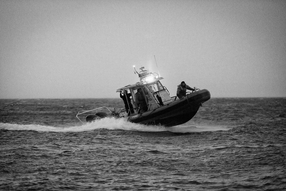
Seattle Fire crew off Beach Drive checking on boarders/kayakers, photo by Erik Bell:
Kerriann Gill caught the storm rolling in:
The storm rolling in @westseattleblog pic.twitter.com/Zi9QAaMiEs
— Kerriann Gill (@kerrikgill) October 16, 2016
(added) Texted to us – this clip of a sailboarder trying to get out of the water at Emma Schmitz Viewpoint:
9:58 PM: And here’s the NWS “forecast discussion” looking ahead. The next few days are expected to be showery but nothing like the record-setting rain of the past few days.

| 36 COMMENTS