West Seattle, Washington
20 Saturday
FIRST REPORT, 6:47 PM SATURDAY: Eight years ago today, Seattle recorded its highest temperature ever – 103 degrees. @WestSeaWx pointed that out on Twitter earlier today with a heads-up that very hot weather is predicted next Tuesday-Thursday. And tonight, the National Weather Service has issued a Special Weather Statement, which warns of exactly that. While we might not crack 100, the NWS says, Thursday might get close.
10 AM SUNDAY: The alert level has been raised to Excessive Heat Watch – same time frame.
7:11 AM MONDAY: The alert level has been raised again. Now it’s an Excessive Heat Warning, for 2 pm Tuesday through 9 pm Friday.
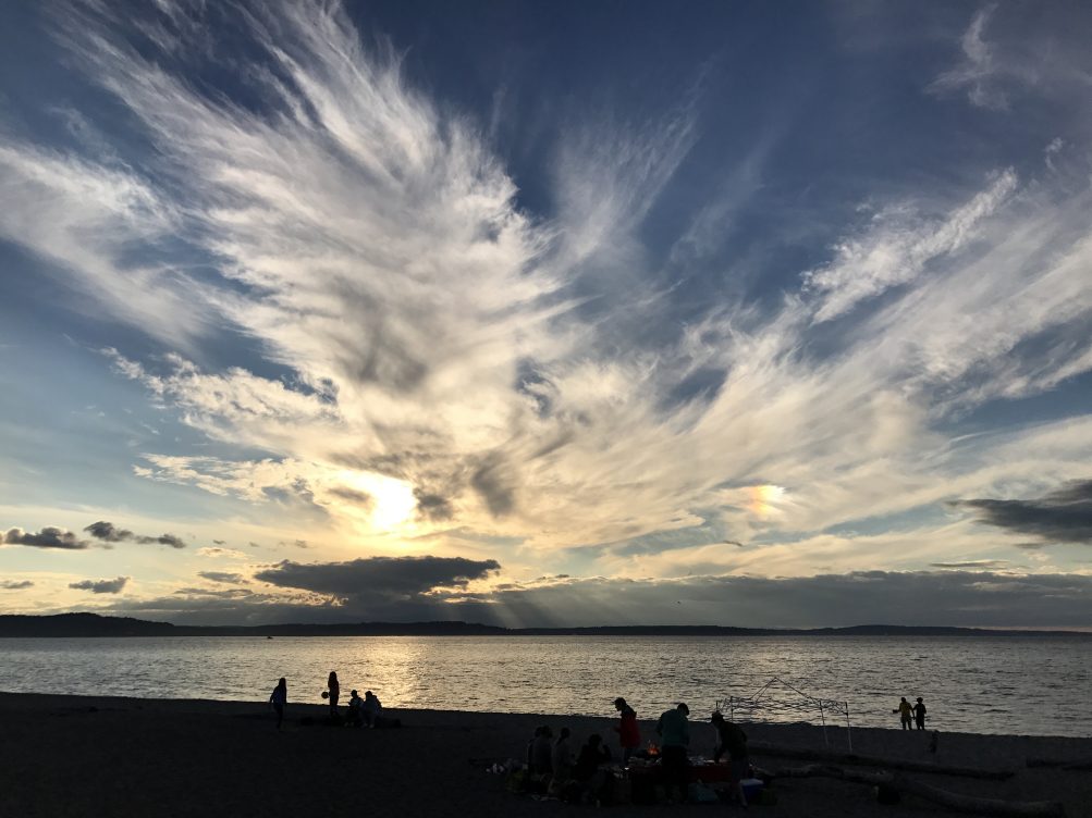
Thanks to everyone who sent views of tonight’s sunset! The one above is from Alki, courtesy of Donna Benaroya. Looks like we’re in for a warm weekend, some clouds, mostly sun. Alki is among the neighborhoods hosting big events this weekend – the 20th-anniversary Alki Art Fair this Saturday and Sunday – and we have a preview coming up later tonight.

9:53 PM: It’s been a great week for spectacular sunsets. In case you didn’t have a full view of tonight’s sunset – the photo above is courtesy of David Hutchinson.
ADDED 10:16 PM: More! Thanks to Greg Snyder for this time-lapse view of the golden pre-sunset transforming into a pink post-sunset:
And James Tilley captured the sun just before it finished disappearing behind the Olympics:

ADDED 11:30 PM: From Jim Borrow:


(Photo by Kevin Callahan, from Seaview)
Thanks for the sunset photos! Not only is the first weekend of summer 2017 concluding, so is the record-setting heat – hottest June 25th on record at Sea-Tac, 96 degrees (old record 92 in 2006).

(Photo by Don Brubeck, from Upper Alki)
The “heat advisory” has expired, and the high tomorrow is expected to be in the 70s. And if that’s still too warm for you, take solace in the fact we are now just six months from Christmas.
5:42 PM: As noted last night along with a view of that spectacular sunset, thunderstorms were in the forecast – and now they’re here. After half a dozen rounds of rumbling, the rain’s just begun.
6:16 PM: Short-lived thunderstorms! Calm out there now.

After a holiday weekend full of sun … clouds returned before sunset. But they returned in a beautiful formation – altocumulus clouds, according to @WestSeaWx. The photo above is from Kevin Callahan in Seaview; thanks also to Philip, Stephanie, and David for similar views.
P.S. Forecast says we have a chance of thundershowers tomorrow afternoon/evening!
With the temperature expected to go into the 80s tomorrow, we’ve received notes from several readers worried about people endangering their pets by leaving them in cars, and asking us to share this seasonal reminder. One sent along this link with the numbers, including: “On an 85-degree day, it only takes 10 minutes for the inside of your car to reach 102 degrees.” Leaving the windows open an inch or two will NOT prevent the interior from getting dangerously hot.
(UPDATED EARLY FRIDAY with more lightning photos – scroll down)

(Added: Photo by Kevin Callahan, from Seaview)
3:57 PM: Just in time for the commute home – the predicted thunder and lightning have arrived. The National Weather Service has a “short-term forecast” alert, warning that “small hail and heavy downpours” are possible. And as we get ready to publish this – the downpour has arrived. Updates to come.

(Added: Photo by Kersti Muul, from Me-Kwa-Mooks)
4:13 PM: While it’s brightening a bit, @WestSeaWx – who has been tracking this on Twitter for days – says another thunderstorm, currently warned to be “severe,” is moving this way from the Olympia area.

(Photo by Michelle Blakeslee, from Upper Alki, as the storm approached)
For our area right now, there’s an updated short-term alert.
4:58 PM: More thunder.
5:22 PM: And the rain followed. Also a potentially related traffic alert: Colby tells us via Twitter that the traffic signal at 26th/106th/107th is flashing red.
Downpour & thunder pic.twitter.com/xgWXRsjzrm
— West Seattle Blog (@westseattleblog) May 5, 2017
5:54 PM: Our short video clip is more for the audio than the video – pouring rain, and some thunder. We’re waiting for it to calm before heading out to our evening meeting coverage. Looks like the clouds are lifting to the west. (added) Sound Transit just sent an alert saying its express buses, including West Seattle/White Center-serving Route 560, are delayed because of the storm.

(Another photo from Kevin Callahan – cloud-to-cloud lightning)
6:01 PM: If your pet got lost in the storm – or if you found someone else’s pet – remember that WSB has the only all-West Seattle lost/found pets page – e-mail us photo, info, phone #. Just added lost dog Shasta a minute ago.
7:58 PM: The weather’s calm now but one last thing – not sure if it was weather-related or not but it wasn’t too long after that last big burst, a car flip on the Delridge offramp from the westbound West Seattle Bridge:

Thanks to “Westwood Charlie” for the photo. No details but checking the SFD log for the response to this incident, no medic or aid unit was in service long enough to transport someone, which means no major injuries.
ADDED EARLY FRIDAY: More lightning views! The first is a frame from video by David Hutchinson:

From Chris Frankovich, lightning in the clouds:

@westseattleblog we live in the prettiest place! The view from Alki moments ago! pic.twitter.com/TXAKG7EpeL
— Lindsay (@Lindsaylew03) April 19, 2017
Tuesday evening brought a mix of sun, rain, and rainbows. Many lovely photos were shared with us via Twitter … thought we would close out the night by re-posting this one here.

Thanks for all the rainbow photos! At the end of an afternoon that toggled between sun and rain, with thunder along the way, it was a beautiful sight from many angles. The top photo is by Andria Hoover, who explained, “We just happened to be driving by Belvedere Park when we saw this full rainbow. It was only there for a few mins, but was beautiful!!”

From some places, the full double rainbow was visible – Judah Stevenson sent the photo above, saying, “Can’t say I’ve ever seen such a distinct perfect rainbow. The photo was taken from Avalon area looking east.”

The Elliott Bay view above is from Tiff Rivera. And this next one is from Tammi Doyle, west of The Junction:

Finally, a view from the low bridge, over the Duwamish, tweeted by Russ Walker:

Tuesday’s forecast suggests sunshine!

4:52 PM: Thanks to Susan for sending the tip about this while we still had a crew in Admiral, post-fire … SW Lander is blocked at 42nd SW on the north side of Hiawatha Community Center/Park while Seattle Parks crews take down a storm-damaged tree that’s near the sidewalk, by the tennis courts. This is the first notable storm damage we’ve heard of in West Seattle today; more photos to come. The National Weather Service has, meantime, extended the wind advisory to 1 am.

5:40 PM: Above, our photo of the crew working on the tree; below, nearby resident Sacha sent a wider look:

And from North Admiral, Amy sent the next photo, a fence crunched by a big falling branch:

Because the rain-saturated ground potentially has destabilized trees that are still standing, you’re advised not to go walking/running in treed areas like park while the wind is still gusting.
11:52 AM THURSDAY: The National Weather Service now has a High Wind Watch up for our area for tomorrow – 9 am to 8 pm Friday. NWS forecasters say we could see south wind 20 to 40 mph, with gusts up to 60 mph. Read the alert here.
7:57 AM FRIDAY: The alert is now downgraded a bit to a “wind advisory” as of this morning, 9 am-10 pm, predicting 25-35 mph wind with gusts to 55 mph. Read the updated alert here.

(WSB photo by Patrick Sand)
Instead of a colorful sunset, colorful umbrellas were in view during Alice Enevoldsen‘s 32nd quarterly change-of-seasons sunset watch at Solstice Park tonight. Light rain had begun, but it takes a downpour to cancel, so as Alice put it on Twitter afterward, “It was cold, and the sun was a no-show, but we had fun and discussed the summer eclipse.” (That’s coming up on August 21st.)

(Photo by Scott Scowcroft)
Maybe the sun will show up for summer solstice – exactly three months away! (9:24 pm our time Tuesday, June 20th.)

Thanks to Chris Frankovich for that view of winter’s last sunset. Spring arrives in seven hours – 3:29 am our time – and we might just have another colorful view for Alice Enevoldsen‘s spring-equinox sunset watch tomorrow night.

Thanks to Aaron Wells for that sunset photo from Thursday – one of just a few days since February 1st without rain, according to the latest stats tweeted tonight by the National Weather Service:
Seattle February & March precipitation now 13.73″, 4th wettest in over 120 years. Since February 1, precip on 36 days and 40 out of 45 70%+ cloud cover.
As of right now, though, the forecasts for Sunday and Monday both contain the phrase “mostly sunny.”

(WSB photo from March 2015 – Alice @ spring-equinox sunset watch)
After an exceptionally soggy winter, spring officially starts at 3:29 am our time Monday. That means West Seattle’s own NASA Solar System Ambassador Alice Enevoldsen will lead her quarterly change-of-seasons sunset watch at Solstice Park on Monday night. From Alice’s announcement:
It’s time for the 32nd seasonal sunset watch!
When: Monday, March 20 at 7:10 pm (so come at 6:45 pm)
Actual sunset is supposed to be at 7:23 pm, but we have noticed that the Sun sets about 10 minutes earlier than the USNO says, because of the horizon altitude.
Where: Solstice Park – all the way up the hill from the tennis courts
Who: Everyone welcome, as usual. (Please do leash your dogs as we usually have a good number of people, kids, and other dogs around.)
I’ll be there even if it is cloudy because sometimes the Sun peeks through just as it begins to set, but if it is driving rain or a thunderstorm, I’m staying home with some tea!
So far, the weather looks non-rainy!
P.S. As always, this event will be free, fun, low-key – drop in, drop out.
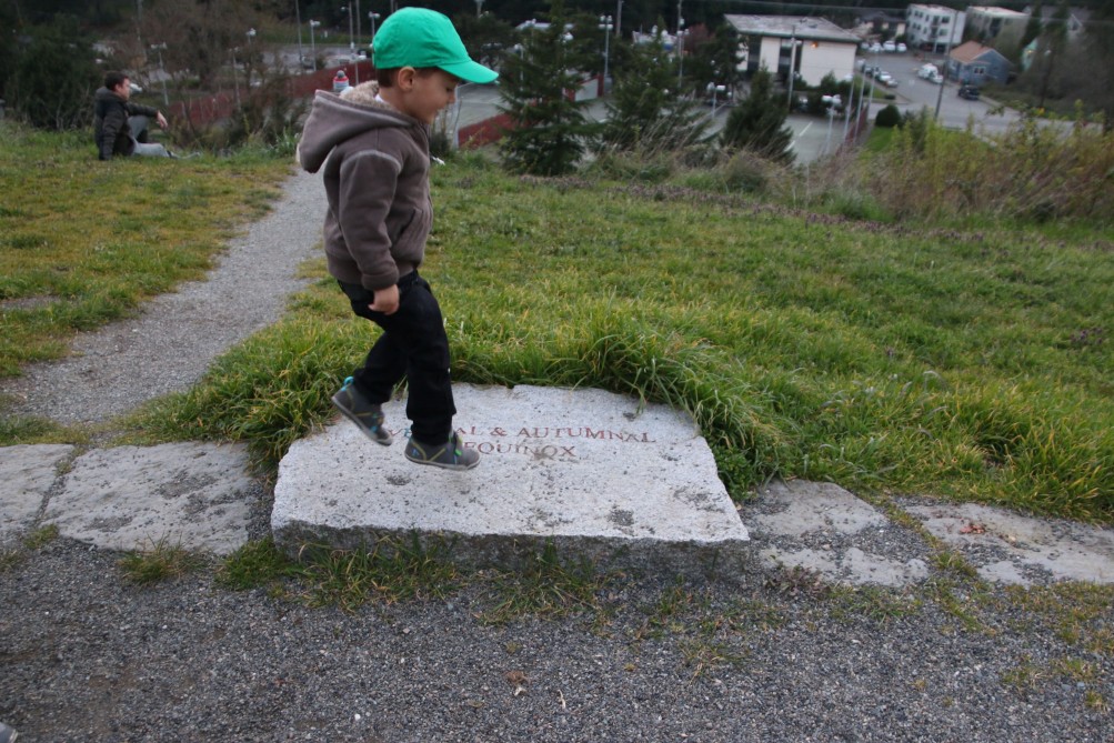
(Scene from spring 2016 sunset watch – Luca leaping onto the equinox marker at the park)
The park’s official address is 7400 Fauntleroy Way SW.
The good news: The newest National Weather Service forecast discussion says, “Drier weather is possible Sunday and Monday.” The bad news: Rain off and on until then. And as a result, a Special Weather Statement is out, warning of increased slide risk, because: “Continued wet weather over many weeks has kept the soils of western Washington near saturation.” So if you’re in a slide-prone zone (here’s the official city map) – be extra-watchful. Here are slide-related do’s and don’ts.
11:02 PM: The wind’s kicking up and that’s a reminder of the Wind Advisory alert that the National Weather Service has in effect for our area from 1 am-10 am Friday. Could gust up to 50 mph, out of the southwest. We hope this passes without problems; if your power goes out or you see other problems like trees across streets/sidewalks, after you’ve alerted the authorities – 206-684-3000 for outages or 206-386-1218 for trees/debris blocking streets/sidewalks – let us know too, 206-293-6302 text/voice any time.
6:08 AM: We checked multiple times during the night; the wind was roaring in the 3-4 am vicinity but there are no reports of damage, and no local power outages. The advisory remains in effect, slightly revised overnight to predict gusts up to 40 mph, and: “Winds will ease late morning.”

(SDOT MAP with travel times/video links; is the ‘low bridge’ closed? LOOK HERE)
7:02 AM: No current incidents in/from West Seattle.
Weather-wise, it’s a little murky this morning, and the weather alert for tomorrow was upgraded overnight to a Wind Advisory, 1 am-10 am Friday.
Advance alerts: The SDOT roundup includes the St. Patrick’s Day Parade downtown on Saturday afternoon (local schools’ bands are part of it!) and the St. Patrick’s Day Dash downtown on Sunday.
8:59 AM: And one more advance reminder … we “spring forward” early Sunday, one hour, to start Daylight Saving Time.
9 AM: Traffic note too – police are being dispatched to NB 99 at Lander for a reportedly stalled vehicle.
Thanks to @westseawx for the alert: The National Weather Service is out with a Special Weather Statement warning that it could be extra-windy on Friday morning – sustained wind 20 to 30 mph, gusts to 50 mph. Most likely timeframe – 3 to 9 am.
Winter still has two-plus weeks to go, and a National Weather Service alert warns us all that snow could hit again “at almost any time” Saturday through Monday:
… A return to cold and showery weather is expected from Friday night through Monday morning. The air mass should be sufficiently cold to support snow showers over the lowlands, especially during the cooler morning hours from Saturday through Monday.
It is too early to pinpoint specific snowfall amounts and locations. So the main message right now is simply to expect hit-and-miss snowfall accumulations of 1 inch or so at almost any time from Saturday through Monday. The cooler morning hours represent the more likely time of day to get accumulating snow. Air temperatures will generally be above freezing, so any snow accumulations are likely to melt a few hours after occurring.
Read the full Special Weather Statement here. (Thanks to @westseawx for the heads-up!)
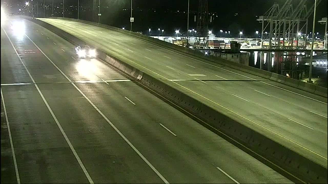
(SDOT MAP with travel times/video links; is the ‘low bridge’ closed? LOOK HERE)
(Click any view for a close-up; more cameras on the WSB Traffic page)
6:34 AM: Good morning. While it’s just a few degrees above freezing, our area didn’t get any significant snow overnight that we have seen/heard, and everything’s open/running on time so far. The National Weather Service has a Special Weather Statement out warning of potential slickness, though.
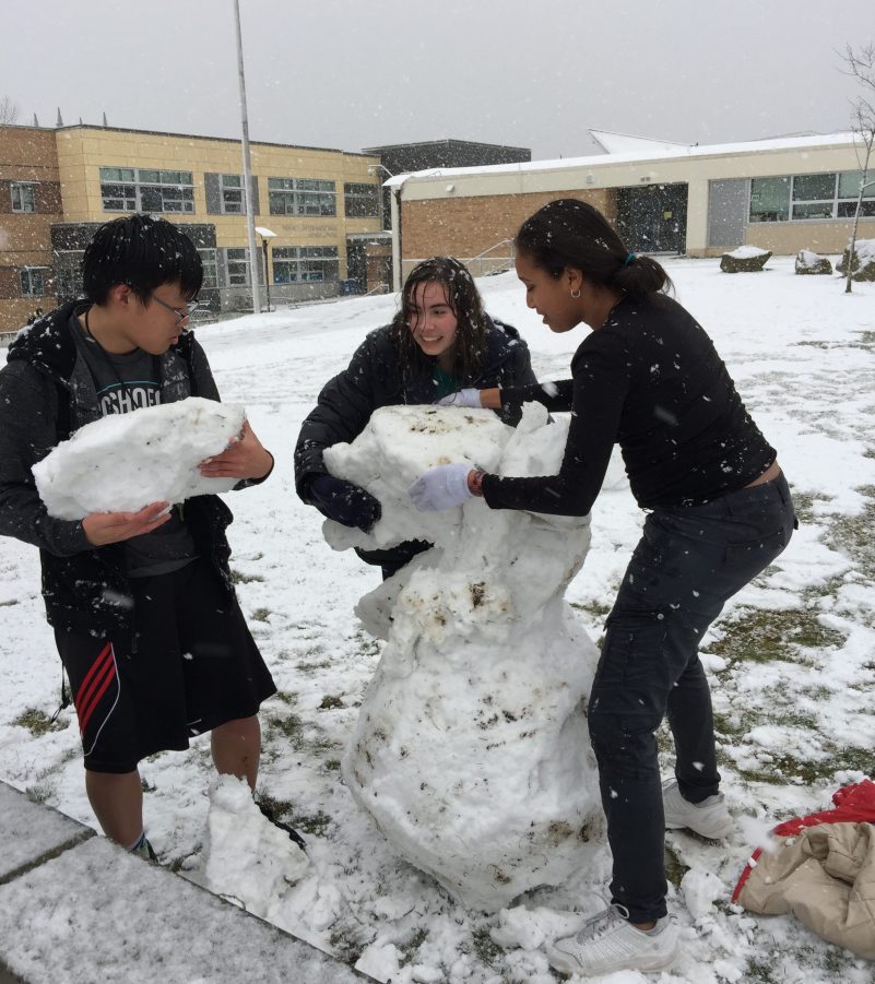
As shown in that photo texted to us from the Sealth/Denny campus after school let out, the snow this afternoon had its fun side, too. Tonight we are showing a few more photos from this afternoon, along with a weather update: The National Weather Service has extended its Winter Weather Advisory alert until 4 am, saying there’s a chance of more snow showers like the ones we saw this morning and afternoon.

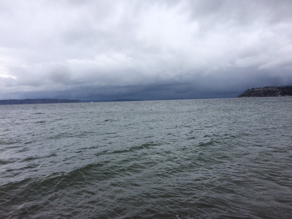
Thanks to Ann Anderson for that photo from Admiral. Here’s how it looked on approach from Burien’s Seahurst Park, photographed by Amanda Kay:
We will of course be watching overnight for the possible snow encore, and in the early morning for any possible school (etc.) changes. We also appreciate your updates – texting or calling 206-293-6302 is always the fastest way to get us.
| Comments Off on WEST SEATTLE WEATHER ALERT: Heat wave expected, starting Tuesday