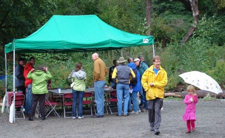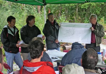
(photo courtesy Scott C)
Shortly after that photo was taken, more than a dozen people sat down under that canopy at Orchard Street Ravine on Saturday morning – subsequently besieged by rain and wind – to hear city Parks Department managers unveil a new proposal for the 38th SW “connector” into the ravine – and some were aghast. Previously, the department was looking at building a stairway into the ravine along what is technically 38th Ave SW right-of-way – now, suddenly, it’s proposing a simpler trail instead. What galled many of the people who gathered to hear about this was the amount of money, and time, spent to get to a point that some consider being almost back at square one. Read on:

First, a little backstory. If you’re not familiar with Orchard Street Ravine, lostdogonline.com summarizes it well: “… a 2.2 acre site comprised of two Parks-owned parcels of land separated by an unimproved street right-of-way (38th Ave SW), with another unimproved right-of-way (SW Orchard St.) bordering the northeast side of the site also included in the greenspace,” also noting: “The forest type found at Orchard St. is one that is fairly scarce in Seattle – data reveals that only 52 acres out of 2700 acres of Seattle’s urban forest in Parks ownership that was surveyed contains the conifer-madrone forest that is present …” Ultimately, it’s envisioned that this area, and access through it, can enable people to make their way through the “Green Crescent,” from Myrtle Reservoir’s future park land, all the way to the shores of Puget Sound.
In the project that Saturday’s meeting — which came long after other meetings in 2006 and 2007 — focused on, the 38th right-of-way was the focus, leading from this street end on 38th south of Myrtle above the ravine (map):

Now, back to Saturday morning’s community meeting, held exactly one week before Mayor Nickels is scheduled to visit the ravine as part of a Parks-organized dedication/celebration (noon-2 pm next Saturday):

Under the canopy, those four Parks Department reps offered a lot of verbal sword-falling. Left to right, Michael Shiosaki, landscape architect/project manager Joe Neiford, Kevin Stoops, and landscape architect Ted Holden. Said Stoops, “We want to stop the bleeding in the design process.” That would be financial bleeding – according to a budget/cost summary sheet handed out, the city has spent more than $70,000 — more than half the project’s budget — over the past two years, trying to design the difficult-to-engineer staircase that’s now being scrapped in favor of a 3-foot-wide compacted, crushed gravel walkway, with some “stairs” made from landscaping timber and gravel, described as a “low-tech approach we can build fairly quickly,” with labor provided by Seattle Conservation Corps, and a bench along the way. Stoops described it as involving some “site disturbance, not a large-scale intrusion.” Here’s the plan shown at the meeting (click for a larger version):

By meeting’s end, attendees were generally supportive of the plan, but critical of the time and money wasted to reach this point. The Parks Department reps laid some blame at the feet of the previous Parks administration (this all began well before current superintendent Tim Gallagher took the reins, and there has been a lot of internal turnover on the Orchard Street Ravine project too). Almost exactly two years ago, in fact — October 10, 2006 — then-Superintendent Ken Bounds issued a letter settling on the route of the connector and acknowledging community controversy. But subsequently, the trouble moved on to what would be done along that route, more than the route itself: “Part of the problem is that whoever came up with the project budgeted it badly,” Neiford said on Saturday, and since it was impossible to build stairs that worked within that budget – he talked about a difficult process of trying to solve problems caused in turn by solutions to previous problems – “we tried to make a square peg fit a round hole.”
Apologies weren’t enough for some attendees, such as John Nuler, who had been trying for months to get updates from the city, and said at Saturday’s meeting, “Why has there been such a revolving door? Where are the people who got us here? Three years later, nothing’s happened, our money’s been spent. I’m outraged; we’ve been cheated.”
Another attendee was similarly aghast. “We’re pushing $90,000 (in project spending, counting other expenditures) for just some drawings?”
Vlad Oustimovitch sounded a note of recap and regret: “In some ways, we’re really at the beginning. In an early meeting (years ago), I suggested a trail just like this, and said it could be done for less than $50,000, and the people who were on the project then just laughed at me. The community erupted into a divisive battle. Now, money’s been wasted. I prefer this plan (the trail) to a stairway … (but) I have an issue with the amount of money that’s been thrown over the transom.”
Not only is construction of the pathway needed, Oustimovitch said, but so is community “healing.” Cindi Barker of the Morgan Community Association turned to the crowd to suggest consensus, and didn’t get anyone expressing opposition to the new plan. The meeting ended with the Parks Department offering a “guarantee” that the trail will be built in the next “four or five weeks,” though some attendees suggested that if the weather turns horrific or other factors intrude, they wouldn’t want to see the city rush the project just in an effort to get some kind of closure. Parks reps say this plan for the connector will leave some money left for more restoration work in the ravine, which like many of West Seattle’s greenspaces is plagued by invasives.
The city also promised the neighbors would get regular updates from hereon out; you can check the project website at www.seattle.gov/parks/ProParks/projects/orchardStRavine.htm (if you received a postcard about Saturday’s celebration/dedication event — again, it’s noon-2 pm — you’ll note the Web address is a bit different, but Parks says this is the accurate one).

| 12 COMMENTS