
West Seattle, Washington
26 Saturday
6:14 AM UPDATE: If you look at the regional map on the National Weather Service‘s Seattle home page, you’ll notice various types of weather alerts are in effect almost everywhere – but NOT here in the city. Nonetheless, the newest forecast says it’ll be very windy, to say the least (and you might already have heard evidence of that in the very early morning hours). As always, we’ll keep watch through the day, with updates if things go beyond general blusteriness. (And if you have anything to report – 206-293-6302, any time, text or voice; thank you!)
8:37 AM UPDATE: As commenter/meteorologist Patrick notes, a wind advisory is now up for our area. See it here.
9:08 PM UPDATE: The wind advisory expired this afternoon without anything serious happening. But the weather is still unsettled, and some snow might be mixed in with overnight/morning showers. Here’s the newest forecast.
11:21 AM: We’ve been watching the National Weather Service outlooks since the local NWS first issued a “special weather statement” on Friday; the newest version technically includes our area, but if you read the fine print, the strong winds discussed for tomorrow are mostly expected out on the ocean coast. However, this morning’s regional “forecast discussion” says that as the approaching “cold front” gets closer – “This looks like the sort of system that will actually give something more like … a genuinely blustery day for all of Western Washington Monday.” If that holds through the next few forecast updates (three to four times daily), they’ll issue a wind advisory, so be on the lookout.
5:38 PM UPDATE: The “special weather statement” has been dropped because, for now, NWS says that our area doesn’t look to be in for much more than typical March bluster. So far.

Thanks to Cheryl Nellis for sharing her photo of the full moon rising tonight. If you’ve been keeping an eye on the sky because of the predictions of aurora visibility – Spaceweather.com explains tonight why that didn’t happen last night, but might still be in the cards (that link includes an amazing photo from Iceland).

Thanks to Emily Austin for the photo of tonight’s super sunset – apparently with “light pillar.” Gives us a reason to mention something you might want to look for tonight and tomorrow, if the sky is clear enough – local expert Alice Enevoldsen of Alice’s Astro Info mentioned it in e-mail, citing Spaceweather.com: Activity from a solar flare is expected to “reach our planet” just before 10:30 tonight, and that could mean auroras (aka Northern Lights) “at all latitudes,” Alice notes. We’ll be watching!

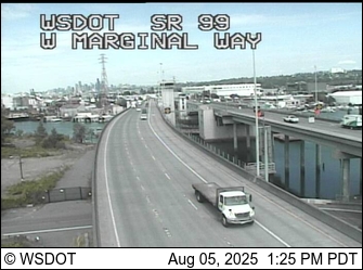
(Refresh for latest pic from WS Bridge & 1st Ave. S. Bridge cams, more on the WSB Traffic page)
More snow showers are possible by mid-morning, according to the National Weather Service’s “Winter Weather Advisory.” So far, no major commute effects of the snowfall we covered overnight, though; no changes for area schools, either. We’ll keep tabs on conditions in the next few hours and update as needed.
1:04 AM: A wave of it is moving through, headed north to south, west to east. Seeing it yet?
1:30 AM UPDATE: It’s been here for about 10 minutes – and as one commenter describes it, it’s more like snow-sleet – you can hear it. Just added video.

1:55 AM UPDATE: Going on an hour now, still snowing. The photo above shows a non-arterial street near WSB HQ, with the snow sticking – but it’s deceptive – without cars passing, you can hear meltwater going into the storm drains.

2:56 AM UPDATE: No longer snowing. Maybe half an inch accumulated (we’re at about 330 feet up) on the cars and the plants; the street-sticking snow didn’t stick around for long. We’ll see in a few hours what the morning commute’s like, though – we’ll be covering that in a separate story.

(Photo by Laura James, added 6:21 pm; click for larger image)
The last few warnings about possible metro-area snow didn’t lead to anything much for West Seattle – one or two quick bursts of flakes – but nonetheless, we need to tell you that our area is covered by a “Special Weather Statement“ that the National Weather Service issued this afternoon, regarding a “strong cold front” late tonight into tomorrow … maybe even some Tuesday morning icing before things warm up.
9:23 PM UPDATE: The “Special Weather Statement” is still in effect, but weather analyst Cliff Mass‘s latest assessment has led him to publish an update titled “Snow Threat Evaporates.”
10:06 PM UPDATE: The alert is now canceled. The NWS’s latest “forecast discussion” explains it, as does WS-residing meteorologist Patrick in comments – the cold temps and the moisture just aren’t synching up in the outlook any more.
Just so you’re not surprised if it happens this time – after today’s flurries … weather experts are talking about the possibility of up to an inch of snow in the morning-rush-hour vicinity tomorrow, before things finally warm up a bit. This has been mentioned in a few places; for one, comment-section fans know Patrick the meteorologist, who brought it up on the WSB Facebook page an hour ago; it’s in the late-night National Weather Service “forecast discussion,” too.
3:38 AM: Heard the wind, looked out the window – and saw it was accompanied by snow. Light at first, but a bit more serious at the moment.
3:44 AM: Minutes later, it’s over. Still chilly enough to see showers like that off and on for a day or two, says the forecast.
7:20 AM: Just had another flurry. Nothing stuck, though.

Thanks to Bob A for the glorious view of the Olympic Mountains, Puget Sound, and a state ferry, photographed today from North Admiral. Though we escaped the snow that hit some Western Washington areas over the weekend, the National Weather Service suggests another chance is heading this way – see the latest “forecast discussion” here. P.S. The spring equinox is just three weeks away – 10:14 pm our time on March 19th.
10:10 PM: The National Weather Service has just issued a “special weather statement” to underscore its concern about subfreezing temperatures overnight and potentially icy roads tomorrow morning. See the alert here. SDOT says its night crews will be out to treat roads/bridges “as needed.”
4:34 AM: Iced-over windows on street-parked cars … looks like a scraper morning. Latest official temp reading from Sea-Tac – 30.
(ADDED SUNDAY: Another photo of the sky show; scroll down!)
3:06 PM: No snow so far, and the wind advisory has been called off, but a bit of wild weather just moved through – an ice-pellet shower, which we caught on video in case the experts want to offer the proper ID (we still haven’t sorted out hail vs. sleet vs. graupel, etc.). According to the newest forecast, there’s still a chance of snow showers between now and Monday.
6:24 PM NOTE: The sky show mentioned in our morning preview – the moon and Mercury, Venus, and Jupiter – is clearly visible right now in the twilight sky – look west, and up. (Here’s info from Space.com.)

6:43 PM UPDATE: Thanks to Melissa for the photo. Jupiter is in the far upper left; Venus is below the moon.
SUNDAY MORNING ADDITION: Thanks to David Hutchinson for the view from Alki Statue of Liberty Plaza!

 1:28 PM: We’ve been watching the forecast since mentioning way back on Monday that weather experts foresaw a chance of snow this weekend. Now that the weekend’s almost here, the National Weather Service is still saying there’s a chance – more likely to see some flakes mixed in with showers, but could be a bit more. The city says it’s ready “just in case,” including preparing for the possibility of icy roads Sunday night/Monday morning. We’ll be updating all weekend long, of course, as things happen (or don’t)…
5:20 PM UPDATE: Wait – before we get to possible snow, there’s a wind advisory in effect for most of Saturday, starting at midnight tonight.

(Photo by Christopher Boffoli for WSB)
Gusty winds are in the forecast, and they’ve led to some high surf, as you can see at Beach Drive Blog. Meantime, there’s a rescue callout along Beach Drive right now – WSB contributor Christopher Boffoli is there and says that somebody reported a sailboarder possibly in trouble, though they’re believed to be OK.
This might be completely ruled out by the time we get to midweek – or not – but just in case you haven’t heard, there’s a bit of a chance of snow next weekend. Here’s how famous forecaster/analyst Cliff Mass breaks it down; here’s the National Weather Service’s “forecast discussion.”
Lori from Nuvelocity shared that time-lapse of tonight’s moonrise on the WSB Facebook page, and it’s lovely enough to share here too.

Every shopping-center or supermarket parking lot seems to have one – a big pile of dirty snow left over from last week’s storm. Scott Ryan photographed this one, and e-mailed it to us late last night:
If anyone in West Seattle has aspirations of summiting Mt. Rainier, but would rather avoid the park fees and oxygen deprivation, there’s a limited window right now to climb a pile of snow that is impersonating Mt. Rainier in the Roxbury Safeway parking lot at 28th SW & Roxbury. At about eight feet, Mini Mt. Rainier is the largest of Safeway’s half a dozen snow piles, which are still resisting the warm front that defeated last week’s paralyzing snow attack.


12:23 PM: Even as some cope with new wind damage today, the city is continuing to take care of loose ends from last week’s snow/ice storm. One week ago, we showed you Beth Stone‘s photo (above left) of a street sign that came down at 47th/Admiral; on Tuesday, Admiral Neighborhood Association vice president Karl de Jong photographed an SDOT crew (above right) fixing it. In less than an hour, Mayor McGinn is scheduled to discuss another part of the cleanup/fixup plan – what’ll be done about post-storm potholes. We’ll add that information when it’s available (you can also watch here at 1 pm).
2:18 PM UPDATE: The mayor says four “Pothole Rangers” crews are out and about taking care of post-snow/ice potholes. More details in the city news release. (If you want to report one, you can do it online, here.)
Just in case you’re waking up and wondering … the forecast says it’ll be breezy today, but not “advisory” level. Last night’s wild wind did cause some damage in West Seattle over the course of about eight hours; we chronicled it all, including photos and video, here. But this morning, so far, all seems to be relatively well (no power outages of note, either).
(TOPLINE: Scroll down for ongoing updates … Wind advisory extended till 4 am …)

(Here’s what the City Light power-outage map looked like during outage’s peak around 7:32 pm – click for “live” version)
6:14 PM: As the wind picks up, hours after the National Weather Service issued a “wind advisory,” a few power outages have popped up in West Seattle, . Right now, Seattle City Light reports more than 100 homes out between spots in Arbor Heights, mostly centered around 28th SW between SW 98th and 100th, and Westwood – here’s the latest map (which may lag reality a bit, so keep us posted). We’ll be tracking that and any other storm-related news throughout the evening. (Thanks for the tips – 206-293-6302 or editor@westseattleblog.com any time.)
6:22 PM: Text says the signal is out at SW Trenton on busy 35th SW. We’re off to check on other traffic effects. (added) Confirmed Trenton/35th out – and 35th/Barton too.
6:47 PM: We checked Westwood Village; so far, it appears to be OK (a sign flickering here and there). We’ve been asked about Arbor Heights Elementary; it appears to be in the dark – though homes nearby are not. The updated “wind advisory” says strong wind is likely to continue till about 9 pm, and the advisory is set to expire at midnight. Meantime, City Light has about 600 customers out around the city, almost all in Westwood/Fauntlee Hills/Arbor Heights per their map and what we’re seeing, roaming that area. A few businesses too – like Gasco at 35th/Henderson – though as you can see on the left edge of the photo, the nearby streetlight still has power:

7:06 PM UPDATE: The City Light map now has a total of 1,300+ homes/businesses without power in West Seattle. We caught up with a crew just south of Westside School (WSB sponsor), which DOES have power:

7:30 PM UPDATE: We have a report that police are putting out flares by a “wires down” report that is on the 911 log as near 35th/100th in Arbor Heights – we’ll check that out shortly. City Light has now revised the number of customers out to just under 900.
8:17 PM UPDATE: Took a quick trip out to check on things – and that’s when the power came back on. Just a handful left now. The lights on 35th are all working again; businesses at Westwood and nearby are all on; Arbor Heights Elementary has power too.
10:20 PM UPDATE: As commenters are noting, the wind has kicked up again in a big way. One WSB’er says via Twitter that it’s torn off her patio roof in the High Point area. The National Weather Service’s latest advisory still says it’ll calm after midnight. No new power outages reported in the West Seattle area, though there’s a new one with a few hundred people out in Burien.

10:52 PM UPDATE: Kate and Mac both reported the barricade barrels on the westbound West Seattle Bridge had been blowing around – we just took the screengrab (above) from the SDOT camera, showing what appears to have been a brief detour so they could be picked up (the live camera is clear now).
11:29 PM UPDATE: Keva tipped us via Twitter to the damaged 7-11 sign on the south end of The Junction, in pieces on the sidewalk with a police guard nearby. Video (you can hear the wind):
12:26 AM UPDATE: As discussed in comments, the wind advisory is now extended till 4 am. There is a big new outage in City Light territory but outside the city limits, mostly in Burien but stretching up to part of White Center/Top Hat.
12:46 AM: A utility pole has come down on the west edge of The Junction, along Glenn Way, reports WSB contributor Katie Meyer, who saw it “crash down” – she took this photo:


(January 16th WSB photo, de-icer truck during “the calm between the storms“)
Just wrapped up at the City Council Transportation Committee‘s meeting, chaired by West Seattle-residing Councilmember Tom Rasmussen, the first preliminary briefing on how the city handled last week’s snow/ice storm. SDOT reps summarized it as a “really challenging week.” By the numbers:
$2.2 million = city’s budget for storm response
$1.35 million = projected total cost of storm response
($1.18 million costs confirmed so far)
55,353 = gallons of liquid salt brine used
(46,000 gallons kept in stock year-round)
5,015 = labor hours
3,941 = hours of equipment usage
3,372 = tons of rock salt used
946 = lane miles plowed/de-iced/etc.
100+ = emergency calls handled by SDOT from SPD, SFD
$100 = how much a ton of rock salt costs the city
Other notes from the briefing, ahead:Read More
It’s calm right now – and the forecast doesn’t call for the wind to kick up till evening – but you should know in case you haven’t heard yet, the National Weather Service has another wind advisory up, in effect till 3 am.

(Photo by JayDee, taken near The Junction last Wednesday)
Tomorrow morning, the City Council’s Transportation Committee, chaired by West Seattle-residing Councilmember Tom Rasmussen, is scheduled for a preliminary discussion of how the city handled last week’s snow and ice. How do YOU think it went? You are of course welcome to discuss it here, but most importantly, there’s a simple way to share your opinion with the city – just go here. P.S. While Councilmember Rasmussen’s focus is on issues such as keeping major streets passable, there are other city services you might want to discuss: For example, the city’s Chief Technology Officer Bill Schrier (also a West Seattleite) has written about “Tech Lessons from the Seattle Snowstorm.” This was the first tryout, for example, for the “which streets have been plowed/de-iced” map. Back to tomorrow’s discussion – the committee meets at 9:30 am (agenda here).
| 9 COMMENTS