West Seattle, Washington
14 Sunday

(WSB photo from fall 2014: Looking south down 5900 block Delridge Way)
Big news tonight for the parents and staffers who have been pushing for safety improvements on Delridge Way at the Boren Building, permanent home of K-5 (soon K-8) STEM and temporary home of Arbor Heights Elementary: The city Department of Transportation has finally officially confirmed that two crosswalks will be built.
The STEM community got unofficial word more than a month ago, and we’ve been seeking SDOT confirmation ever since; the city, however, had to finalize some details, and finally this evening, senior transportation planner Brian Dougherty had an official announcement to share, not just in response to our most recent inquiry but also with those in the school community who had worked so hard to make it happen:
SDOT will be installing two new marked crosswalks near the Boren building for Arbor Heights and K-5 STEM. One crosswalk will be provided near the front door of the school, connecting the school to the Longfellow Creek Trail. Another crosswalk will be provided at 24th Avenue SW, connecting the school to Metro bus stops and High Point via the Graham Street stairs.
Both projects are tentatively scheduled to be constructed this year with funding provided through a combination of Safe Routes to School and Neighborhood Park and Street Fund.
The crosswalk to the front entrance was requested in a community proposal for use of the NPSF, as reported here last year, when we also covered the Seattle School Traffic Safety Committee convening at STEM and hearing firsthand about the safety challenges that school was facing, even before another full elementary-school population joined them, if only for two years.
In case you’re wondering, Dougherty’s note to school reps mentions one more thing: “Both crosswalks will have some form of push-button-activated stop light or warning light.”

(Image from SDOT camera on the bridge, saved early Monday – note the dark zone in the center)
If you have driven the West Seattle “high bridge” after dark/before dawn in the past week or so, you’ve no doubt noticed the stretch of non-working lights between Highway 99 and the bridge crest. (And this isn’t the first trouble since the LED lights were installed last year.) After multiple inquiries, we mentioned last Friday that city sources had confirmed Seattle City Light was on it. So why aren’t they fixed yet? We followed up today with SCL, whose Scott Thomsen tells WSB:
After we got reports of the lights being out, we had a line service crew do a patrol and inspect the lights that were out. They determined that the cause for the majority of them was a failed piece of equipment called a breaker/contactor. The part is on order. It is scheduled to be delivered Jan. 5 and will be installed as soon as it arrives. Then, the crew will do another patrol to assess any remaining lights that are still out.
One week has now gone by since WSDOT disclosed new “settling” of, and near, the Alaskan Way Viaduct and the hole being dug to reach the Highway 99 tunneling machine for repairs.
After the ensuing week of various updates, discoveries, and concerns, today’s update is out, and in it, WSDOT says “to date, no significant settlement has been observed beyond the initial settlement we reported publicly on Dec. 5. The viaduct remains safe for travel.” The update also says that so far, ground-based radar hasn’t shown any “voids” under the crack scrutinized on King St. in Pioneer Square on Thursday. (E-mail from WSDOT to reporters adds, “The crack in the middle of King Street has been there for some time, as seen in a Google Maps picture from 2011. Given the absence of prior settlement data on this particular street, it may take a while to fully understand what may have caused pavement to shift.)
Meantime, the City Council‘s agenda for next Monday morning has been revised to start with WSDOT execs’ updating the council on the “settling” at 9:30 am, followed by a 9:50 am discussion with state and city officials about what would happen if the Viaduct had to be closed, short term or long term. The agenda section for the latter item includes this existing document that discusses closure in the context of an earthquake.
Four West Seattle Crime Watch reader reports:
HIT-AND-RUN: Reported tonight by Emily:
I was walking my dog around the block near my house. Because it is twilight, I lit the bright green light that I attach to her leash. I was crossing Admiral at 63rd on the east side of the intersection, walking north. A woman driving a dark brown car (I think it was a Ford Taurus) was driving north on 63rd and turned right on to Admiral. She ran the stop sign, which unfortunately happens a lot at this intersection. When she saw me, she slammed on her brakes but slid into my legs. Thankfully I was not seriously hurt, but I can tell I will have some spectacular bruises tomorrow. What I’m most upset about is that the woman did not stop to see if I (or my dog) needed help.
MYSTERY CREDIT-CARD FRAUD: From Alan:
We just found out that our credit card had fraudulent purchases made on it (Wednesday). We were told that the card was scanned for the purchases, so the person made a copy of our card. One was for over $500 at Rite-Aid. We know the purchases were in Seattle, but we don’t know if they were in West Seattle. We do know that we haven’t charged anything outside of the West Seattle area in the last week. The furthest away were two restaurants in Georgetown and they are places we normally go. We did use our credit card twice yesterday and both places (one small restaurant and one large retailer – not Rite-Aid) were places we have not been before. The large retailer seems unlikely, as the card never left our view and it seems unlikely the checker could have had a copy device in the reader. Sadly, that makes us suspect the small restaurant. It is certainly possible that someone made the copy some time ago and is just now using it.
With shopping season upon us, I would encourage people to watch their accounts. I’m just happy that something about the charges being spotted by our credit card company. No loss to us, except for some trust.
(MONDAY UPDATE: See Alan’s comment – after comparing notes with someone who had something similar happen, he now suspects this happened OUTSIDE West Seattle after all.)
(back to original report) ‘NOT JUST PACKAGES BEING STOLEN‘: From Amanda:
Wanted to warn folks that it’s not just packages being stolen. I had $100 worth of grocery delivery taken from my porch early this morning. I’ve been an Amazon Fresh customer since the beginning (7 years?), and have never had anything stolen before. But when I went to get my deliver off the porch, all but one small bag of food was gone. The thievery must have taken place between 4 and 6 am.
She added in a postscript that Amazon refunded the full value, even though she told them it was a theft.
PACKAGE-THEFT SIDE NOTE: If it’s happened to you lately, please read this comment following our previous Crime Watch roundup.
CAR VANDALISM (OR PROWL?): Reported tonight by Bill:
My wife took our kids to the West Seattle YMCA and parked outside the front door on 36th Ave. SW with our Toyota Highlander. 4:30 PM. Returned at 5:45 PM to find the passenger side rear window smashed out. Nothing apparently missing. Just letting you know in case other reports come in about vandalism in that area.
He reported it online – which you can do with some categories of crime; the start page is here.

Though the city had said as recently as September that work would start on the 47th/Admiral traffic signal this fall, it won’t be any sooner than winter, since the project is only just now out to bid. The solicitation on the city website and in public notices says bids are due December 10th, which is two weeks from tomorrow. The notice projects the signal will cost up to $350,000. It has long been in the works, with the campaign to improve safety at the intersection tracing back to the death of 26-year-old Tatsuo Nakata, hit and killed by a driver eight years ago this month; in summer of 2013, after then-Mayor McGinn proposed an incremental improvement at the intersection, the City Council found funding for a full signal. Whenever work starts – we have a message out to ask about the new projected timeframe – the city estimates that the signal construction will last about three months.
ADDED: In response to our inquiry, SDOT says that the current plan is to start construction in February.
In case you haven’t already seen this in our calendar, or heard about it via your child’s school: Kids 9+ and their families are invited to increase what they know about online safety – from cyberbullying to social networking to gaming, and beyond – at a free event tomorrow night. It’ll be hosted by Denny International Middle School, starting at 7 pm Monday in the auditorium at Chief Sealth International High School next door (2600 SW Thistle). The presenter is Stefanie Thomas, a victim advocate with the Seattle Police Internet Crimes Against Children Task Force, and there’s more info on the official flyer.
6:10 PM: Thanks to the Arbor Heights Elementary and K-5 STEM parents who forwarded this, which they said they’ve received from school staff via e-mail and robo-call this past hour or so:
There has been a report of an attempted child luring in the vicinity of our school. The vehicle is a black F-150 Ford pickup, driven by a heavy-set, older black male. The license of the truck is B060—. The police were notified, and the subject is a registered sex offender. The suspect has not been apprehended. Please be aware and talk with your children about keeping safe. More information to follow tomorrow.
That’s the entirety of the notice, at least in the version forwarded to us. STEM and AH are currently sharing the Boren Building at 5950 Delridge Way SW. We are checking with police, who will be at tonight’s Crime Prevention Council meeting (7 pm at the precinct, Delridge/Webster) if we don’t reach them sooner.
7:06 PM UPDATE: Precinct commander Capt. Steve Wilske has been looking into this for us. He finally found the incident report and says it happened yesterday – it was originally called in as a different type of incident, and while investigating that, they say, a child told them of being approached by the person described in the alert, so they are now looking for that person. (We only had a quick comment to speak with him before the WSCPC meeting – if we’re able to get any more info afterward, we’ll add.)
8:49 PM UPDATE: So far what we’ve found out, from covering the Crime Prevention Council meeting, is that this was reported yesterday afternoon and the report is categorized missing child/suspicious vehicle (again, the child is safe, and was not abducted or otherwise harmed, we’re told). The registered sex offender who is believed to be the suspect does not live in the West Seattle area. The report carries the address 26xx SW Kenyon, which is the Denny IMS vicinity, but short bits of info on police reports can carry the address from which an incident is reported instead of where it happened, so we’re still awaiting confirmation of where exactly the child was approached. (Added: 6900 block Delridge, per police)
WEDNESDAY MORNING UPDATE: We’re continuing to follow up with police and Seattle Public Schools. In comments, two STEM parents have shared this text of a followup message from their principal:
I received several inquiries about a school messenger sent out by Arbor Heights yesterday concerning an alleged child luring incident. The information contained in the message was shared by a parent, and we were not able to confirm several details after conferring with SPS security or the police, and so we were advised not to send an alert. Because of the questions, I am sending out an update of information we were able to confirm.
.
On Monday, November 17 the driver of a black Ford 150 truck with a roof rack was acting suspiciously while talking with a 7th grade Denny Scholar on his walk to school. The driver was reported as being a heavy set older African American male. The incident was reported to the police.
.
As always, communicate with your children regarding good safety practices.
9:09 AM: We’ve been talking with SPS spokesperson Stacy Howard over the past hour. She confirms that a local parent saw the suspicious vehicle, reported it to police, and then directly contacted schools. Howard says there is supposed to be a protocol for what steps are gone through to send a school-wide alert, and they are sending a reminder to school administrators about that today.

The second of two meetings for the 35th Avenue SW Safety Project has wrapped up at Southwest Branch Library. We stopped by during the feedback session, post-presentation (if you missed the former, our report on the first meeting includes both video of the entire presentation plus the slide deck). SDOT’s project manager Jim Curtin says about 40 people attended – that’s what we counted at meeting #1 – but this group had some different interests, including parking. Listening to attendees who were invited to look at drawings of the road and write their thoughts next to specific areas, we heard continuing concerns that a “road diet” is in the cards. And again, Curtin said no plan’s been drawn up yet, but if a road diet is tried and doesn’t work – as happened in The Junction some years back – it can be undone by repainting the road.
WHAT’S NEXT: SDOT plans to continue “outreach” while creating design concepts, November through January; then in February (no specific dates announced yet) design alternatives will be unveiled and reviewed during another round of meetings. Questions or comments? jim.curtin@seattle.gov is the address to use.

A sinkhole is blocking the northbound side of 45th SW between Alaska and Edmunds (map) west of The Junction. After two reader tips (thank you!) we arrived just as an SDOT worker was putting out cones and tape to block off the sinkhole. One neighbor says it happened, at a previously patched spot in the road, around 8 am. No repair ETA yet; the worker told us that, as you might have guessed, many crews are out dealing with downed trees right now. Though there’s enough room for a car to squeeze by in the southbound lane, that’s still very close to the sinkhole’s edge and we’d advise avoiding the road unless you live on that block and have to get to/from home.
ADDED MONDAY NIGHT: We went back to check on the sinkhole just as it was getting dark. A Seattle Public Utilities crew was there to do some investigating:

We’ll check in with SPU and SDOT tomorrow.
By Tracy Record & Patrick Sand
West Seattle Blog co-publishers

(September 2006 reader photo, memorial at 35th/Graham)
Susanne Scaringi …
Their names weren’t all spoken during Wednesday night’s launch meeting for the 35th SW Road Corridor Safety Project. But the knowledge that five crashes on “I-35” had ended their lives – five deaths in seven years – hung heavy.
“There are so many reasons we want to eliminate these serious crashes,” said SDOT‘s Jim Curtin, opening the first “issue identification” meeting for the project, which he is managing. “… We want to create a street that’s more forgiving, so when people do make mistakes, the consequences aren’t so tragic.”
What began Wednesday night – 8 months after it was promised – is intended to result in changes and improvements within a year, along the three miles of 35th between Avalon and Roxbury – three miles that have seen 1,065 crashes in the past 10 years, Curtin said.

(May 2013 crash at 35th/Roxbury: WSB photo by Christopher Boffoli)
Distraction is blamed for about a third of the crashes. After that: Speeding, impairment, failure to grant right-of-way. Despite the absence of a major safety campaign, there has been progress.

(October 2008 speed sign at 35th/Willow, where recent studies showed the highest average speed)
The speed limit along the project area is 35 mph; studies from the past year show that speeds have “come down considerably since 2007,” Curtin said, but they are still over the limit. 85 percent of the traffic is going almost 41 mph at SW Willow, 38.5 mph at SW Brandon, 36.5 mph at SW Roxbury. At those speeds, “we’re rolling the dice .. pedestrians do not typically do well” if hit at those rates of speed.
Backing up: He began with a presentation; not recommendations or suggestions, but instead, the project’s goals and facts. We recorded those first 46 minutes on video, including some Q/A:
Below, you’ll see the slide deck Curtin walked through during that opening presentation:
Curtin stressed that 35th is “a neighborhood” – 488 parcels along the three-mile stretch in the project zone, 73 percent of them single-family homes, 11 percent apartments/condos/townhouses – so when there are crashes, they are virtually (and sometimes literally) “in people’s front yards”:

(January 2010 crash at 35th/Cloverdale – WSB reader photo by Bruce)
While he stressed repeatedly that “tonight, we’re not jumping into solutions at all,” it was clear that some are eager, even ravenous, for solutions. One man who said he’s had two cars “totaled, absolutely totaled” decried people who drive on 35th SW “as if it were the Indianapolis 500,” particularly in the years since it became the last north-south two-lanes-each-way road through the heart of West Seattle.

(Seen April 2010 at 35th/Webster, shared by MAS)
He continued, “If you put 35th on a road diet, you won’t need more people to enforce (the speed limit).” (He was challenged loudly by other attendees and Curtin had to put the brakes on what almost accelerated into a shout-down.)
The speed van and radar trailers are among the measures implemented since 2007 that have brought speeds down somewhat, “but there is still room for improvement,” Curtin declared. (Our archives include this long list of changes made as of a 2008 discussion (note that a road-diet study was mentioned then, six years ago).
Police enforcement has brought some progress over the years.

(WSB photo: April 2011 emphasis patrol on 35th)
Southwest Precinct commander Capt. Steve Wilske told attendees about an enforcement period in which SPD made contact with 200 drivers over four months, with 70 pulled over for “talking on a cell phone while driving,” 40 for speeding, and the other 90 for “various violations” (including other forms of distracted driving). He said they might be back on 35th, and they are hoping to “do the same thing … in different areas.” The overtime is covered by grants they seek.
In Q/A, Curtin and Wilske were asked how road design might affect the stated major causes of crashes, distraction and impairment. “The way we design our streets have a huge impact on how people behave on our streets,” Curtin replied. “We have great big wide streets,” and, for example, that encourages people to speed, he says. “That’s why in Seattle our neighborhood streets are designed to be 25 feet wide with parking on both sides,” very little room to speed.
One resident of 35th mentioned that other drivers “don’t like their momentum broken” by, for example, his necessary turns into his own driveway, or buses slowing/stopping to pick up people. He suggested it would be worse “with three lanes” – referring to widespread suspicion that a “road diet” (rechannelization) is already decided. “Nobody’s said anything about three lanes at this point,” said Curtin, reiterating that this is the discussion stage, not the design stage.
But the topic came up again and again, and Curtin mentioned something he’s said before – that while Seattle has “done more than 30 road diets,” usually preceded by “gloom and doom,” the latter does not come to pass. (Fauntleroy Way SW, rechannelized in 2009, is a frequent example.)
Another point he made: While every intersection is a legal crosswalk – and you’re required to stop – SDOT won’t mark them “on roads like 35th” unless there is a signal. If they “change things significantly on 35th,” that would allow more marked crossings, he noted.
Was there ever a traffic change that didn’t work out? Curtin was asked. He brought up California SW, “which we put on a road diet twice, in 1970s and 1990s,” and while, he said, it worked well along most of the stretch, it did not work in the heart of The Junction, so they reversed it. “And that’s the beauty of a road diet – it’s just paint,” so if it doesn’t work out, the road can be repainted.
That led to a question about the state of SW Alaska, westward from 35th. Curtin pointed out its status as a bus route – “every time a RapidRide bus passes you, that’s hundreds of people who would (otherwise) be in cars” – as some solace for traffic concerns.
After those 46 minutes of presentation plus Q/A, breakout conversations were offered for topics including a proposed neighborhood greenway on 34th SW, which will be studied, Curtin said, next year – and what Curtin acknowledged might be “difficult choices” involving hot topics such as parking and channelization.

The 40-plus people in attendance were invited to offer their thoughts at three tables – broken geographically into the north, central, and south sections of 35th. Notes were written on huge sheets of paper mapping section of I-35.
WHAT’S NEXT: Curtin couldn’t stress enough that this is the input phase – offer your comments and concerns now, before something is designed/proposed. Next big chance to do that is meeting #2, same format as this one, though Curtin promised “tweaks”: 3:30 pm next Tuesday (October 28th), 3:30-5 pm at Southwest Branch Library, which, unlike Wednesday night’s venue, is on 35th (at SW Henderson) … a spot where we’ve covered a few crashes in the past year alone, including this one exactly one year ago:

(WSB photo: October 2013 crash at 35th/Henderson)
In February of next year, SDOT expects to unveil and circulate “design alternatives,” with a decision to be made in spring. In the meantime, if you have something to say, say it, urges Curtin: “If anyone feels they’re not being heard at these meetings, send me an e-mail at any time (jim.curtin@seattle.gov) … I’d be happy to come out and walk the corridor with you … I’d be happy to meet with you whenever and wherever.”
What would YOU do to make 35th SW safer? Come tell SDOT Tuesday – or via the contact options here.

(WSB photo from 2008: One of many safety rallies/demonstrations on ‘I-35’)
Just in from SDOT: Two meetings are now planned to kick off the 35th SW safety-improvement program. The 6:30-8 pm meeting next Wednesday (October 22nd) at Neighborhood House’s High Point Center was announced back in August; now, they’re adding a meeting on Tuesday, October 28th, 3:30-5 pm at Southwest Branch Library. Plans for the “multi-year” safety project were first announced back in February, after years of crashes and concerns along what’s been dubbed “I-35.”
Out of the WSB inbox, from Beth:
I was just in Schmitz Park talking to the park warden and he asked if we could get some info up on the blog. People had a campout under the bridge (last night) and left all their supplies/ garbage strewn about. They had a large amount of chicken wings and he is working on getting it all picked up but wants people who bring their dogs in to be aware that there may be chicken parts he can’t reach around the bridge/going down the ravine; they can cause a choking hazard/ digestion problems for the dogs.
Local libraries host storytimes every week – but every so often, there’s an extra-special edition featuring Seattle Fire Department reps, always firefighters, sometimes others, all the way up to Fire Chief Gregory Dean. Another round of Firefighter Storytimes – fun events to teach little ones about fire safety – has just been announced, and it includes a West Seattle visit: High Point Branch Library, 11:30 am, October 23rd.
ORIGINAL REPORT, 2:18 PM: Several parents messaged us about Chief Sealth International High School “sheltering in place” for a while this afternoon. It was related to a report that a teenager had been seen in the Westwood Village area with what looked like a gun. Seattle Public Schools spokesperson Stacy Howard says police found the teen, who turned out to have an Airsoft gun, but was not threatening anyone. She says Sealth, Denny International Middle School, and Roxhill Elementary sheltered in place for less than half an hour, and it’s over now.
ADDED 8:50 PM: Denny assistant principal Patricia Rangel has forwarded the letter that Denny and Sealth parents will get explaining the situation:
Keeping unneeded, unwanted, and/or expired prescription medicine around the house is a bad idea for a variety of reasons. Tossing it in the trash or emptying it down the drain is a bad idea, too. So what to do? Get rid of it this Saturday (September 27th), 10 am-2 pm, during the next Take-Back Day. The official local drop-off spot will once again be the Seattle Police Southwest Precinct at Webster/Delridge.

(WSB photos)
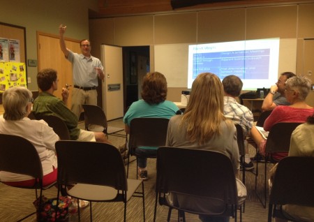
Way back in January, when the Seattle Schools Traffic Safety Committee convened at the Boren Building, they heard K-5 STEM parents and staffers warn that existing safety challenges in and around the parking lot would only intensify when Arbor Heights Elementary moved in starting this fall. And it’s indeed been busy, to say the least – so this morning, volunteers gathered for a “parking-lot party” to fix what they could – a lot of painting, for example (top photo), and weeding/de-mossing.

Bigger issues remain to be solved, beyond the scope of a weekend work party – see our report on this past week’s Delridge District Council meeting for more on that – but progress is progress, one step (or paintbrush) at a time.
@westseattleblog 5000 block of 35th sve sw pic.twitter.com/Ls0CLqVzQG
— Clark Gilbert (@coachclarkruns) September 9, 2014
Thanks to Clark for the photo from a reported car/motorcycle collision near Camp Long, in the 5000 block of 35th SW, northbound side. He says traffic is getting through, with only the outside northbound lane blocked. The SFD dispatch was for an “aid response,” lowest level of medic callout, so that likely means no major injuries; we’re checking.
That quick video clip’s all about something Puget Sound Energy is sending out to more than a million customers via postal mail (in this case, e-mail just wouldn’t work), as explained in this announcement:
Billing statements from Puget Sound Energy arriving in mailboxes over the coming weeks might smell a little rotten.
A newly designed natural gas safety brochure is being sent out to more than 1.1 million PSE customers throughout September. In addition to lots of important information about what to do if there’s a suspected gas leak, there’s a scratch-and-sniff section that’s a reminder of the rotten egg odor associated with natural gas.
To help detect gas leaks more easily, PSE and other natural gas utilities add an odorant called mercaptan to the natural gas, which is naturally odorless and colorless. Everyone in a family needs to recognize the stench, and know what to do if they smell it:
It’s September, and the community groups that took all or part of the summer off would usually be getting back to their normal schedules. But two of them have a different plan for this month. Tonight, the first Tuesday, would usually be the regular meeting night for Westwood-Roxhill-Arbor Heights Community Council, but here’s what’s on the schedule instead, as announced by Joe Szilagyi:
One more month of a slightly different WWRHAH schedule!
No meeting tonight as we’ve mentioned — the next one will be a joint meeting with the Highland Park Action Committee at their meeting space on Wednesday, September 24 at 630 pm. This meeting will be dedicated to and focusing on Seattle Police across our two areas and South Delridge. Bring your questions — we’ll have all the key staff from the Southwest Precinct there!
Meeting: HPAC & WWRHAH joint SPD meeting
Date: Wednesday, September 24, 2014
Time: 630 pm-830 pm
Location: Highland Park Improvement Club, 1116 SW HoldenHere’s the Facebook event if you want to join that or share it.
If you live in one of those areas and have concerns/questions for SPD, that meeting will be particularly crucial, as the West Seattle Crime Prevention Council has canceled its September meeting because of health challenges among its leadership.
SDOT has announced that design is done and construction will start this fall – possibly as soon as October – on the long-sought signal at 47th SW and Admiral Way, and that it will be accompanied by four striped crosswalks, as seen in the new design graphic above. This fall will mark three years since the Admiral Neighborhood Association ramped up its campaign for the signal with a rally in memory of 26-year-old Tatsuo Nakata, killed at the intersection in fall 2006. It took a lot of pushing to get funding committed – in early 2012, SDOT was still saying 47th/Admiral wasn’t high on the list. Then last year, the City Council made changes in then-Mayor McGinn’s spending plan in order to find full funding for the signal.

Here are key parts of the finalized plan, according to SDOT:
*Installing a new traffic signal
*Adding four additional striped crosswalks
*Upgrading six curb ramps at key corners of the intersection to be compliant with current American Disability Act (ADA) standards
*Replacing the existing center-turn lane with left-turn-only pockets on SW Admiral Way
*Removing minimal parking up to 50 feet from the intersection approaches on the north and south sides of 47th Avenue SW and SW Waite Street
*Removing the existing pedestrian signal
According to SDOT’s Maribel Cruz, “We anticipate construction will begin late this fall and will last for approximately three months, depending on weather conditions. The project team plans to host a community drop-in session at a nearby café in October, prior to the start of construction, and will continue to keep the community informed as the project progresses.” More information is online at this newly updated project page.
P.S. We should note that this intersection will be a lot busier soon, with Aegis Living planning to build a new retirement center on the 4700 SW Admiral Way site of the former Life Care Center, proposed to include 48 assisted-living apartments and 33 memory-care apartments..
FIRST REPORT, 6:03 PM: Night Out is on! We’re visiting block parties around West Seattle again this year and will add updates here. Since we can’t get to them all, we’d love one from yours if you care to share – editor@westseattleblog.com (or Twitter/Instagram, where the hashtag is #SeattleNightOut and we are at @westseattleblog) – thanks; updates ahead!

FIRST STOP, ARBOR HEIGHTS – in the block where we attended a Seattle Police Living-Room Conversation at Block Watch Captain JoDean Edelheit‘s home two years ago. (That’s JoDean in the back row, third from right.) This block is getting busier, as it’s near the undergoing-renovations future home of Westside School (WSB sponsor) at 34th/104th.

SECOND STOP, SUNRISE HEIGHTS: Carole invited us to stop by; her husband Michael is Block Watch Captain and has also recently gone through a round of preparedness training, so he’s leading the neighborhood in getting everybody organized to start working on a neighborhood plan. That’s why there’s preparedness info at their party:

They’re hoping not only to be, well, more prepared as a result, but also to inspire other neighborhoods. (Have we mentioned lately – lots of preparedness info at westseattlebeprepared.org, including the location of your nearest Emergency Communication Hub.)
7:20 PM UPDATE: Thanks to Marcia for tweeting this photo from her neighborhood’s party:
@westseattleblog the 9000 block of 13th Ave SW is having a blast tonight for #neighborhoodnightout! pic.twitter.com/E888uKnSxg
— Marcia Ventura (@marciaventura) August 6, 2014
Via text, more preparedness, at 23rd and Cambridge, including this photo:

The texter (206-293-6302 any time!) says neighbor Patty Doty got a grant to “put together emergency kits to distribute tonight to our neighbors!” Meantime, back onto our travels:
OUR THIRD STOP, GATEWOOD: Sue‘s neighborhood has an annual “flags of all nations” display:

The biggest flag there in the middle synergizes with the sign – the flag is for Hawaii, the sign says No Ka Oi (Hawaiian for “is the best”) Party. We also discovered while visiting that Jeff is an award-winning amateur winemaker:

As we continue our travels, we’re noting MANY side streets closed off for block parties – way to go! And closing streets takes some logistics – and signage:
OUR FOURTH STOP, HANSEN VIEW: The sign above is from Hansen View just south of The Mount, where Night Out always means a big party. Including bluegrass band The Mighty Fallen.

We just missed visiting firefighters. Lots of neighbors having a great time!

Hansen View is home neighborhood to West Seattle Block Watch Captains Network leaders Deb Greer and Karen Berge, who we’ll see again – and you should come too! – at Delridge Day this Saturday. Meantime, a photo texted from Gatewood:

The band is Woodland, playing near 35th and Rose – thanks for the photo!
OUR FIFTH STOP, FAIRMOUNT: We were leaving Hansen View, headed to Junction Plaza Park (stop #6), when we noticed two Seattle Fire vehicles at a block party, so we pulled over, and got a group shot including the visiting firefighters:

This is Fairmount, south of The Triangle, not to be confused with Fairmount Park or Fairmount Springs. Then it was north to …
OUR SIXTH STOP, JUNCTION PLAZA PARK: The re-activated Junction Neighborhood Organization threw a party in the park … we didn’t arrive until it was almost over, but caught the small spirited group that remained:

West Seattle Bike Connections joined JuNO for the party. Police and fire had visited earlier too, as had City Councilmember Tom Rasmussen, who was making West Seattle rounds. JuNO had water balloons, too … now THAT is a party. JuNO’s director René Commons says they hope next Night Out will bring their SECOND annual party in the park.
ADDED 9:23 PM – OUR SEVENTH AND FINAL STOP, SEAVIEW: 5900 block of 44th and vicinity – thanks to Kelli for inviting us. A 1970 El Camino was a canvas for chalk art:

Heather from Sparklez Face and Body Art was creating art too:

And the group:

(added) WE STOPPED HERE TOO: Thanks to Sarah for kindly pointing out in comments that we had neglected to publish anything from one of our stops, 6000 block of 37th – and this was actually the first invite we’ve received, from Aaron. Found the pic!

(back to Tuesday night in-progress report) Next: Photos from the inbox – thanks for sharing! First:

That’s from Steve at 16th and Trenton. One block over, at 15th and Trenton, a party photo from Chris:

Next, from Leslie on Canada Drive SW:

Tweeted by Jason in Admiral:
40th Ave SW block party! (Hanford/Hinds) @westseattleblog #SeattleNightOut pic.twitter.com/65xuyLGRWa
— Jason G (@jgrotel) August 6, 2014
Lots of kid activities at tonight’s parties. Even a bouncy house in Belvidere, on 36th SW – thanks for this e-mailed photo:

Further south on 36th SW, here’s the group photo from Jenny‘s neighborhood (“between Findlay and Brandon, best block EVER!” she declared):

Also very proud of their block:
We love our neighborhood and thought you might like a glimpse of our amazing gathering. 61st Ave SW – between Hinds and Spokane St.
Mary Pyper and Janinne Brunyee, Block Watch Co-Captains
Pigeon Point always has a big bash, and Pete Spalding shared photos – here he is with Southwest Precinct commander Capt. Steve Wilske:

Deputy Chief Mike Washburn also stopped by, as did a Seattle Fire engine:

But neighborhood mingling remained the big draw, as it was with parties from north to south, east to west:

Next, we head all the way to the other end of West Seattle – Jim Edwards of West Seattle Big Band and West Seattle Grand Parade fame shares a photo from North Shorewood:
A first-time event in North Shorewood on 102nd SW. The west end of the block is the City of Seattle. The east end of the block, unincorporated King County. From 28th SW to 30th SW. We are also participating in an informal radio net with the West Seattle Radio Club.
Next year … maybe a band appearance? If you live out that way, keep watch for flyers next summer! Heading back north, to Gatewood again, Long B. Nguyen photographed his SW Portland neighbors:

From the 6300 block of 41st SW, Fairmount Springs vicinity, Jenny explains the next photo as “not everyone at our block party, but still a picture of neighbors enjoying each other.”

From the 3400 block of Belvidere Avenue, Erika shares a photo of the youngest neighbors, noting, “We had another fantastic night of community gathering with our neighbors and the gang of kiddos had so much fun riding bikes and scooters, as well as jumping in a bouncy house! We love National Night Out and look forward to it all year!”

From 46th SW between Walker and Hill in North Admiral, a photo texted earlier in the night:

And from Rutan Place SW, John shares a photo of his well-attended block party:

ADDED WEDNESDAY MORNING: Two more – first, from Diane, the late crowd on 45th SW between Alaska and Edmunds:
The block party had double this amount in attendance earlier, with games, bubbles, a balloon artist, & sidewalk chalk for the kids. Most had headed home by this late hour to get little ones to bed and missed the photo. The block party also had 2 musicians who sang for them through the evening, accompanied with a guitar and double bass cello. A great block party for 45th Street!
And Don‘s neighborhood in Fairmount Springs had visitors who brought goodies – the Ben & Jerry‘s truck that’s making Seattle rounds this month:

Thanks again for sharing glimpses of awesome West Seattle neighborhoods.
By Tracy Record
West Seattle Blog editor
The proposal for rechannelization – aka “road diet” – for Southwest Roxbury’s westernmost arterial mile was no longer a surprise when it was explained last night for the second time in five nights. At least some of the ~30 people at the second meeting about the design proposals for SDOT’s SW Roxbury Safety Project had clearly checked out news of the plan that circulated after the first meeting last Thursday.
Road diets have their critics, but this proposal did not draw an angry crowd to last night’s meeting at the Greenbridge YWCA in White Center, led by SDOT’s Jim Curtin, who also presented last Thursday’s briefing. One person voiced open concern about possible traffic congestion as a result. Several others, though, asked why the rechannelization couldn’t cover the entire arterial stretch of Roxbury, all the way east to Olson. And the general mood of questions/comments was in favor of something even more restrictive than SDOT is suggesting.
But before we get to that: In case you missed it, rechannelization – one lane each way, with a center two-way turn lane, west from 17th to 35th – is part of what SDOT is proposing. We detailed the entire plan in our coverage of last week’s meeting – please read that for full details; we went to last night’s meeting mostly to check out the questions/comments the second time around – it was scheduled as a rerun rather than a followup. Here’s the SDOT slide deck, same thing last night that was shown last Thursday:
One more note from last night’s meeting about SW Roxbury – a stack of cards casually announced the launch date for the other major “road-safety corridor project” in the works: 35th SW. You have almost three months’ warning for this one – 6:30 pm October 22nd at Neighborhood House‘s High Point Center. Meantime, browse the background links on the left side of the project page.


| 17 COMMENTS