
At noontime today at Delridge Library, SDOT reps hosted their first of four West Seattle pop-ups to talk about the newly released draft Seattle Transportation Plan. You probably haven’t read it yet. You might not even have heard about it. But the city’s intent on getting your thoughts about it.

The draft plan – more than 1,000 pages long – went public Thursday, ostensibly (among other things) a prelude to the next transportation levy, and “a 20-year vision for the future of Seattle’s streets, sidewalks, and public spaces informed by thousands of people who live, work, and play in Seattle.” SDOT says it incorporates 18 months of community feedback, and the lengthy document features many recaps of that feedback. They’re looking for more feedback now before finalizing the plan; they’ve set up an “engagement hub” from which you can read and comment on it in a variety of formats, including the in-person pop-up events that started today. More on those later. First, here’s what you might consider the overview – six overarching goals, and the toplines of how SDOT hopes to achieve them:
Lead with Safety
Goal: Prioritize safety for travelers in Seattle, with no serious injury or fatal crashes
• S1: Reduce vehicle speeds to increase safety
• S2: Concentrate safety investments at the most collision-prone locations
• S3: Make all journeys safer, from departure to destination
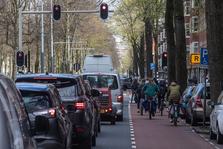
• S4: Provide safer routes to schools, parks, transit, community gathering spaces, and other common destinationsTransportation Justice is Central
Goal: Co-create with community and implement restorative practices to address transportation-related inequities
• TJ1: Center the voices of communities of color and underrepresented groups in planning and decision-making processes
• TJ2: Address inequities in the transportation system by prioritizing investments for impacted communities
• TJ3: Remove cost as a barrier so everyone can take the trips they need to makeClimate Action
Goal: Respond to climate change through innovation and a lens of climate justice
• CA1: Improve neighborhood air quality and health outcomes by promoting clean, sustainable travel options
• CA2: Green city streets with landscaping and street trees to better handle changing climate
• CA3: Foster neighborhood vitality and improved community health
• CA4: Support the transition from fossil fuel to electric vehicles for personal, commercial, and delivery trips
• CA5: Advance mobility management strategies to encourage walking, biking, and transit tripsMobility – Connect People and Goods
Goal: Provide reliable and affordable travel options that help people and goods get where they need to go
• PG1: Create seamless travel connections
• PG2: Make walking, biking, and rolling easy and enjoyable travel choices
• PG3: Create world-class access to transit and make service more frequent and reliable
• PG4: Enhance economic vitality by supporting freight movement and growth in deliveries
• PG5: Manage curbspace to reflect city goals and prioritiesLivability – Streets for People, Places We Love
Goal: Reimagine city streets as inviting places to linger and play
• PP1: Boldly reallocate street space to prioritize people while preserving access for goods delivery and emergency response
• PP2: Transform community and mobility hubs into welcoming places
• PP3: Co-create and enhance public spaces for playing and gathering to improve community health
• PP4: Activate and maintain public spaces to create a welcoming and age-friendly public realmMaintenance & Modernization – Streets that Work, Today and in the Future
Goal: Improve city transportation infrastructure and ready it for the future
• MM1: Transform city streets for safety and sustainable travel choices through optimal timing of asset maintenance and replacement
• MM2: Reduce neighborhood disparities in the quality of streets, sidewalks, public spaces, and bridges
• MM3: Ready city streets for new travel options and emerging trends and technologies
We grazed through all 1,000 pages looking for West Seattle specifics – or, at least, items of particular local interest. The most local components of the draft STP are maps used to illustrate numerous sections – from transit routes to bike routes to “high-collision” areas, and more. It does get into some specific proposals, especially regarding bicycle and pedestrian connections. In Highland Park, the plan envisions a “multi-use trail on the west side of Highland Park Way” as well as protected bike lanes on SW Holden. Heading further east, a multi-use trail is envisioned on Sylvan Way, and there’s a mention of a Junction connection to light rail via California and Alaska.
Also of West Seattle interest is a freight-lane pilot for the “South Spokane Street corridor,” including the low bridge, with a note that this would have to be suspendable if something on the high bridge required general traffic to use the low bridge.
The plan talks about how progress will be measured – for example, on page 103 of the first part, two major measurements will be moving toward zero fatalities – which has been the city’s stated goal for years now – and traveling “fewer vehicle miles,” with a higher percentage of trips taken using some mode other than cars. And new ways of evaluating streets are suggested, such as a “Pedestrian Crossing Level of Service.” The city’s need to improve pedestrian conditions is discussed in depth, including the observation that 26 percent of the city is missing sidewalks (there’s a map for that, too, and plan readers are also shown where existing sidewalks are too narrow).
The draft STP talks a lot about transit, though most of those services are provided by other governments/agencies – Metro, Sound Transit chief among them, even envisioning where light rail might be expanded beyond the current Seattle plan (West Seattle in 2032, Ballard in 2039).
And the plan talks about that thorny transportation topic, vehicle parking – at the very least, expand street parking, it suggests, also suggesting that RPZs be reviewed – with the thought of removing some altogether or modifying them. There’s even the idea of charging for all residential street parking, via a “resident vehicle fee,” which the plan says Chicago has.
When it gets to “emerging technologies” such as self-driving vehicles, the plan has a fairly sunny view, saying they could be less polluting, more safe, more affordable.
That’s just a bit of what you’ll find in the plan. If you want to go through it raw, here’s part 1 and here’s part 2 (the second part isn’t as long as it looks – the “elements” in the back include repeats of sections found earlier). Or you can graze it chapter by chapter at the Online Engagement Hub, where myriad ways to comment are offered too. If you check out all the tabs on that page, you’ll even find one with the maps we mentioned earlier.
If you want to comment and/or ask questions in person at SDOT’s upcoming pop-ups – here are the three yet to come in West Seattle:
*Thursday, August 31, 11 am-noon, West Seattle Library (2306 42nd SW)
*Tuesday, September 5, noon-1 pm, High Point Library (3411 SW Raymond)
*Wednesday, September 6, noon-1 pm, Southwest Library (9010 35th SW)
SDOT says the plan will be updated this fall after this round of community feedback – set to continue until October 23rd – and the plan eventually will go to the City Council for adoption late this year or early next year. As for what follows its adoption – that’s up to mayor/council budgeting as well as the next transportation levy; the current one, passed in 2015, expires next year.
| 51 COMMENTS