FOLLOWUP: SDOT explains new Andover/28th/Yancy bike-lane barriers, and where you’ll see them in West Seattle next

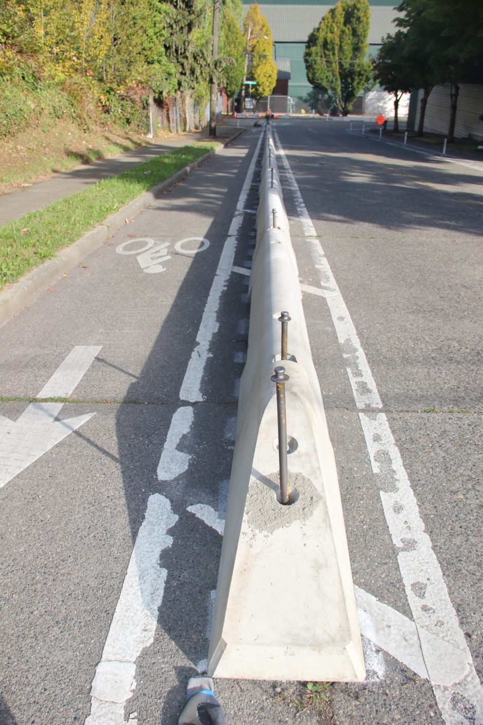
As reported here last night thanks to reader tips and photos, SDOT has just upgraded barriers on the Andover/28th/Yancy bike lane installed three years ago following a major RV-camp sweep. We followed up today as promised to ask if more work is ahead there – as the installation has some gaps – and to ask if any other West Seattle bike lane will get these barriers. Here’s the reply we received from SDOT’s Mariam Ali, accompanied by a photo:

The work you saw along Andover was part of our Better Bike Barriers (BBB) program — installing new wheelstop-style barriers to improve safety and comfort for people biking.

Our crews worked over the weekend to minimize weekday traffic impacts, and traffic control was in place. The Andover segment should wrap up within the next couple of days. You can find background and upcoming BBB locations on our public webpage: Better Bike Barriers Program.

SW Admiral Way from SW Spokane St to SW Olga St is included as a BBB project in your area, which we’re planning to deliver over the next year.

This is part of what the voter-approved Seattle Transportation Levy‘s $133 million for bicycle safety will cover over eight years. We’ve asked SDOT a followup question about the specific price tag for the barriers.

22 Replies to "FOLLOWUP: SDOT explains new Andover/28th/Yancy bike-lane barriers, and where you'll see them in West Seattle next"

  • Foop October 6, 2025 (5:33 pm)

    That admiral section is a really good candidate for these. We really need better protection on Delridge and we should build more east west connections like thistle to 34th or 30th. We could also really use better north south lanes along 35th and California. I try not to drive anywhere less that 5 miles from home but getting from Westwood the the junctions feels like a death wish.

    • Actualperson October 6, 2025 (6:37 pm)

      Foop. Agree! They’re doing the uphill section on the east side of Admiral. There’s NO protection there from the cars whizzing up Admiral inches away. And I agree with you the best thing the city could do is eliminate ALL parking on California from Morgan to Admiral junctions with that space being used for these barriers.

    • GH October 6, 2025 (7:07 pm)

      I would absolutely positively LOVE bike lanes along 35th if for no other reason than to keep people on lime bikes/scooters off the sidewalk. 

  • Actualperson October 6, 2025 (5:39 pm)

    Putting these barriers on Admiral will be a wonderful safety addition to the hundreds of riders that use that section daily.  It’s been very dangerous there.

    • Frog October 6, 2025 (7:43 pm)

      Wait, what?? I drive that section of Admiral frequently, and see about one cyclist per year.  I was going to say, this seems like an amazing (though typical SDOT) boondoggle given the tiny usage of the bike lane on the Admiral hill.

      • Pes October 6, 2025 (10:26 pm)

        As a biker I avoid roads that are dangerous, even if they would otherwise be the best route. Low usage under present unsafe conditions isn’t an argument against safety improvement.

        • North Admiral Cyclist October 7, 2025 (5:57 am)

          PES is right.  Many cyclists avoid using Admiral to climb the hill “westbound” from Spokane St headed for the Admiral Junction  or Alki  areas even though it is the most direct route.  The westbound bike lane  on Admiral ends just before the most dangerous part of Admiral Way – going past the view point and around the curve and over the bridge before you get to California Ave. – especially since 90% of drivers ignore the speed limit.  The lack of a safe, protected bike lane on this section of Admiral forces cyclists destined to North Admiral to ride the section of California Ave with the hairpin curve coming up from Harbor Ave, or they must go all the way around to Admiral over in the Alki neighborhood.  Neither is a good option.  Still, hundreds per day make the trip.  It would be helpful if the City of Seattle regularly counted bicycle (and pedestrian) “traffic”, like they do with car traffic, but so far, the City only counts bicycles and pedestrians sporadically for special projects.  

          • Frog October 8, 2025 (6:11 pm)

            OK, so in other words, spending a lot of money on barriers for the cycle lane on the hill doesn’t even solve the problem you identified that is keeping cyclists from riding that way.  Sounds like  a boondoggle to me.  The only way to have a protected cycle lane all the way to California would be to remove a traffic lane from Admiral between Olga and California.  Bad news, I think another faction of anti-car warriors has beaten you to it, with schemes to run the Rapid Ride H line up Admiral starting in 2073 when the light rail is completed.  Meanwhile, if you want a quiet route up the hill, and don’t mind beastly slopes, why not go up Manning?

          • cwit October 9, 2025 (12:58 pm)

            Anti-car warriors – nice, anyone that wants safer bike options are automatically anti-car warriors because it’s all one or the other.I’m gonna make bumper stickers that say: “My other bike is a car”

      • Foop October 7, 2025 (1:12 am)

        When I used to live up in admiral I rode this hill twice a day, to and from work. It’s a beast of a hill but you get used to it fast. You never get used to the traffic trying to kill you. I can’t imagine why making bike lanes safer for more people would upset you.

      • WS bike commuter October 7, 2025 (5:44 am)

        I use this route frequently on my commute, and I see fair number of other bikers using it too. It’s the most direct way to get to Admiral from the low bridge, and on mornings when I’m trying to make it to a meeting on time I’ll go down it against the bike arrows because it’s also the fastest way. BTW going down the hill bikers are supposed to be mixed in with you crazy drivers. Wouldn’t you rather we be separated from you?

  • K October 6, 2025 (6:27 pm)

    Delridge next please!!

  • Avalon October 6, 2025 (8:56 pm)

    Avalon also badly needs these, the plastic noodles they have up on Avalon are mainly destroyed by cars, and fully ineffective at protecting cyclists.

    • GH October 7, 2025 (7:36 am)

      Agreed, but unfortunately this seems impossible at the most dangerous parts of that route: the right-turn crossovers at genesee and yancy. 

  • Eric 44 October 7, 2025 (7:04 am)

    I’m a cyclist and do not use any of those lanes Even the ones all through downtown I will just ride on the road with the cars those lanes are very narrow especially with those plastic noodles which are ugly and atrocious looking like all the one on Alki and just plastic waste of tax payer money 

  • WestSeattleDerm October 7, 2025 (9:40 am)

    Admiral is such a huge priority to solve.  Car traffic isn’t going away.  No one respects the 25 MPH speed limit and SPD won’t ticket speeders.  I’m typically biking with a kid on the back of the bike and just can’t risk my life and my child’s attempting to bike up or down Admiral hill until safeguards are in place.  The perception that “no one bikes on Admiral” is correct in that many cyclists are actively avoiding this section because most every driver is  unwilling or able to drive at the 25 MPH speed limit.It would be wonderful if we just built a dedicated bike lane into the grass/vegetation along the west side Admiral Way.  It’s city property already.  Cars and bikes don’t need to be fighting over a traffic lane on the descent. 

    • Tom October 7, 2025 (2:58 pm)

      100% this. I live at the top of Admiral hill and would love to bike up/down, but have seen too many close encounters between bikes and cars/potholes there to risk my life. 

      • Kathy October 8, 2025 (11:18 am)

        There is an obvious solution to the dead end bike lane on Admiral Way coming uphill from Spokane Street. Make a safe bike crossing from Manning Street to the east side of Admiral Way. Reduce Admiral Way uphill general traffic lanes to a single lane which will naturally slowdown traffic. Make a 2 way bike lane on the east side of Admiral Way from the Manning Street to Walnut Street just west of the Fairmount Ravine bridge. Then Admiral Way can be returned to a 4 way road to handle the traffic and turn lanes at the lights. Rarely do you see a traffic backup before you get to the lights although there may be some left and right turners that will hold up traffic. Those planting meridians could also be eliminated to make more room for a safe bike route home. Flashing pedestrian activated beacons at the intersections could help pedestrians safely cross Admiral Way.

  • Joe Z October 7, 2025 (12:05 pm)

    Bike lakes on southbound Fauntleroy and all of California are desperately needed. There is plenty of street space if they take out the center turn lanes. Avalon is perfectly fine without a center turn lane and it seems like traffic goes slower because the street is narrower. The safer detour routes are not as direct and have big hills. 

    • bolo October 8, 2025 (10:29 am)

      Yes! but for now at least repaint the faded/worn into nonexistence sharrow markings along S/B Fauntleroy. I have made several report requests over the last few years. Maybe SDOT is waiting for more requests from others?

  • Kathy October 8, 2025 (11:20 am)

    If they put these barriers on the north side of Andover I hope they leave a space for bikers turning left into the West Seattle Health Club.

  • bolo October 8, 2025 (8:47 pm)

    They already installed the barriers on the north side of Andover, Sorry, I don’t recall if there are specific cutout gaps across from the health club entrance. TBH, as an avid cyclist– and this stretch is on one of my frequent routes– I don’t see the need for the new barriers here.

    IOW, the recent (painted) dedicated bike lane there was plenty of improvement, and I was never challenged by (light on this street) vehicle traffic encroaching even near into the bike lane. The main dangers I have experienced on that stretch was from anxious self-centered impatient drivers exiting the convenience store parking lot right into my path, too close for comfort.

    Of course, conditions could change, for example if the area becomes more heavily up-developed and dense which would draw more vehicle traffic. Maybe that is the plan?

Leave a Reply to Tom Cancel reply

Your email address will not be published.