West Seattle, Washington
24 Sunday
6:07 AM: It’s Monday, December 7th, the 259th morning without the West Seattle Bridge.
ROAD (ETC.) WORK
Delridge project: Here’s what’s planned for this week, including closing SW Thistle between Delridge and 20th.
South Park Bridge: Inspection closures planned this week, Wednesday and Thursday nights, 10:30 pm-6 am.
TRANSIT
Metro – Regular schedule.
 (Photo by Marc Milrod)
Water Taxi – Back on regular schedule today after weekend dock work.
CHECK TRAFFIC BEFORE YOU GO
West Marginal Way/Highland Park Way:
Highland Park Way/Holden:
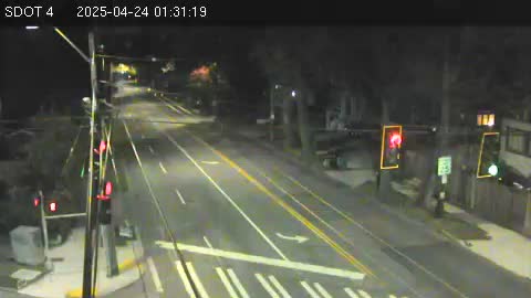
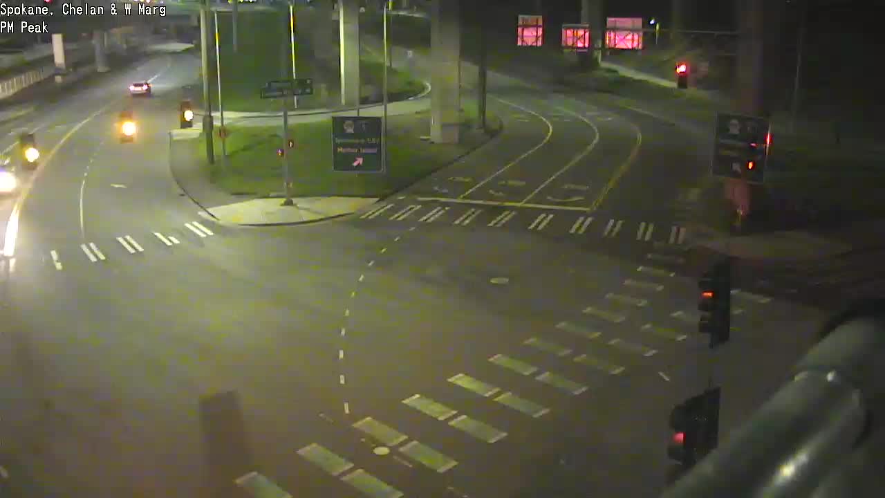
The 5-way intersection (Spokane/West Marginal/Delridge/Chelan):
Restricted-daytime-access (open to all 9 pm-5 am) low bridge (note: camera ticketing will NOT start today):
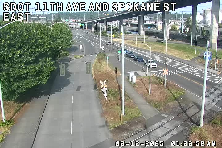
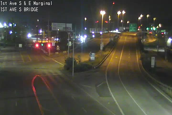
The main detour route across the Duwamish River, the 1st Avenue South Bridge (map) . Here are two cameras:
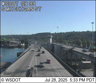
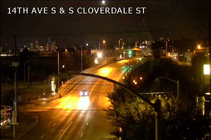
The other major bridge across the river – the South Park Bridge (map). Here’s the nearest camera:
Going through South Park? Don’t speed. (Same goes for the other detour-route neighborhoods, like Highland Park, Riverview, and South Delridge.)
Checking for bridges’ marine-traffic openings? See the @SDOTBridges Twitter feed.
You can see all local traffic cams here; locally relevant cameras are also shown on this WSB page.
Trouble on the roads/paths/water? Let us know – text (but not if you’re driving!) 206-293-6302.

Just east of that intersection at Delridge Way SW, SW Thistle will be closed for several weeks, starting as soon as tomorrow. That’s part of what’s coming up in the ongoing street/utility work preparing for next fall’s RapidRide H Line launch. SDOT says its contractor will close SW Thistle between Delridge and 20th “to complete temporary signal work and to demolish and rebuild the sidewalk.” Some driveways will be affected intermittently. Other notes include:
*Once SW Hudson reopens, SW Brandon will be closed on the east side of Delridge. This too will include some driveway impacts
*Puget Blvd SW near the Delridge P-Patch is expected to reopen this week
*Electrical upgrades at the bus stop on the west side of SW Andover are expected to start this week
*Electrical work continues in the sidewalk between SW Orchard St and 21st Ave SW
*Vehicle-detection loop installation and concrete work at the intersection of SW Oregon and Delridge has been rescheduled to mid-December
See the full update of what’s happening now and next by going here.
 (Photo sent by Elizabeth)
9:40 AM: Thanks for the tips and photos! That crash scene is attracting attention along northbound West Marginal Way SW [map], with a pickup-truck driver hitting and breaking a utility pole.
 (Photo sent by Bradly)
The SFD log shows this was reported before dawn, just after 5:30 this morning. Texters say repairs are still under way; we are headed that way to look shortly. The log also indicates no medic unit dispatched, so apparently no major injuries, but we are following up with SFD to confirm.
10:24 AM: Truck and pole are still there, and the NB lanes are coned off, but traffic is getting by both ways. The City Light map also shows a 2-customer outage in the area.
1:12 PM: SFD spokesperson David Cuerpo says the driver was an 18-year-old man with no reported injuries.
6:03 PM: Via @essrez on Twitter, pole repairs were under way at dusk.
6:16 AM: It’s Friday, December 4th, the 256th morning without the West Seattle Bridge.
ROAD (ETC.) WORK
Delridge project: The work to get ready for RapidRide H Line continues; see the current plan here.
Highway 99 tunnel: Southbound closure tonight into tomorrow (Saturday) morning, 10 pm-7 am, for maintenance.
TRANSIT
Metro – Regular schedule.
Water Taxi – Reminder – no afternoon/evening service TODAY because of dock work
CHECK TRAFFIC BEFORE YOU GO
West Marginal Way/Highland Park Way:
Highland Park Way/Holden:
The 5-way intersection (Spokane/West Marginal/Delridge/Chelan):
Restricted-daytime-access (open to all 9 pm-5 am) low bridge (note: camera ticketing will NOT start today):
The main detour route across the Duwamish River, the 1st Avenue South Bridge (map) . Here are two cameras:
The other major bridge across the river – the South Park Bridge (map). Here’s the nearest camera:
Going through South Park? Don’t speed. (Same goes for the other detour-route neighborhoods, like Highland Park, Riverview, and South Delridge.)
Checking for bridges’ marine-traffic openings? See the @SDOTBridges Twitter feed.
You can see all local traffic cams here; locally relevant cameras are also shown on this WSB page.
Trouble on the roads/paths/water? Let us know – text (but not if you’re driving!) 206-293-6302.
6:12 AM: Welcome to Thursday, December 3rd, the 255th morning without the West Seattle Bridge.
ROAD (ETC.) WORK
Delridge project: More paving and utility work; see this week’s plan here.
Highway 99 tunnel: Southbound closure this Friday night-Saturday morning, 10 pm-7 am, for maintenance.
TRANSIT
Metro – Regular schedule. Also of note, interim general manager Terry White now has the permanent job.
Water Taxi – Reminder – there will be no Friday afternoon (12/4) service because of dock work
CHECK TRAFFIC BEFORE YOU GO
West Marginal Way/Highland Park Way:
Highland Park Way/Holden:
The 5-way intersection (Spokane/West Marginal/Delridge/Chelan):
Restricted-daytime-access (open to all 9 pm-5 am) low bridge (note: camera ticketing will NOT start today):
The main detour route across the Duwamish River, the 1st Avenue South Bridge (map) . Here are two cameras:
The other major bridge across the river – the South Park Bridge (map). Here’s the nearest camera:
Going through South Park? Don’t speed. (Same goes for the other detour-route neighborhoods, like Highland Park, Riverview, and South Delridge.)
Checking for bridges’ marine-traffic openings? See the @SDOTBridges Twitter feed.
You can see all local traffic cams here; locally relevant cameras are also shown on this WSB page.
Trouble on the roads/paths/water? Let us know – text (but not if you’re driving!) 206-293-6302.
6:07 AM: Welcome to Wednesday, December 2nd, the 254th morning without the West Seattle Bridge.
ROAD (ETC.) WORK
Delridge project: Paving and utility work continues; see this week’s plan here.
Parking-lot repaving: Work is expected to wrap up today in the lot at West Seattle Thriftway (WSB sponsor)
Highway 99 tunnel: Southbound closure this Friday night-Saturday morning, 10 pm-7 am, for maintenance.
TRANSIT
Metro – Regular schedule
Water Taxi – Regular schedule, but note that there will be no Friday afternoon (12/4) service because of dock work
CHECK TRAFFIC BEFORE YOU GO
West Marginal Way/Highland Park Way:
Highland Park Way/Holden:
The 5-way intersection (Spokane/West Marginal/Delridge/Chelan):
Restricted-daytime-access (open to all 9 pm-5 am) low bridge (note: camera ticketing will NOT start today):
The main detour route across the Duwamish River, the 1st Avenue South Bridge (map) . Here are two cameras:
The other major bridge across the river – the South Park Bridge (map). Here’s the nearest camera:
Going through South Park? Don’t speed. (Same goes for the other detour-route neighborhoods, like Highland Park, Riverview, and South Delridge.)
Checking for bridges’ marine-traffic openings? See the @SDOTBridges Twitter feed.
You can see all local traffic cams here; locally relevant cameras are also shown on this WSB page.
Trouble on the roads/paths/water? Let us know – text (but not if you’re driving!) 206-293-6302.
6:07 AM: Welcome to Tuesday, December 1st, the 253rd morning without the West Seattle Bridge.
ROAD (ETC.) WORK
Delridge project: Work continues; here’s this week’s plan.
Parking-lot repaving: Work continues today in part of the lot at West Seattle Thriftway (WSB sponsor)
Highway 99 tunnel: Southbound closure this Friday night-Saturday morning, 10 pm-7 am, for maintenance.
TRANSIT
Metro – Regular schedule
Water Taxi – Regular schedule
CHECK TRAFFIC BEFORE YOU GO
West Marginal Way/Highland Park Way:
Highland Park Way/Holden:
The 5-way intersection (Spokane/West Marginal/Delridge/Chelan):
Restricted-daytime-access (open to all 9 pm-5 am) low bridge (note: camera ticketing will NOT start today):
The main detour route across the Duwamish River, the 1st Avenue South Bridge (map) . Here are two cameras:
The other major bridge across the river – the South Park Bridge (map). Here’s the nearest camera:
Going through South Park? Don’t speed. (Same goes for the other detour-route neighborhoods, like Highland Park, Riverview, and South Delridge.)
Checking for bridges’ marine-traffic openings? See the @SDOTBridges Twitter feed.
You can see all local traffic cams here; locally relevant cameras are also shown on this WSB page.
Trouble on the roads/paths/water? Let us know – text (but not if you’re driving!) 206-293-6302.

4:37 PM: Avoid Delridge/Holden for a while – Seattle Fire has arrived to deal with a vehicle fire and has alerted dispatch that some help will be needed directing traffic for a while. The fire, however, is already out.
4:50 PM: Adding a photo sent by Kersti Muul, showing it’s a commercial van. No reports of injuries, but we’ll be doublechecking with SFD.
5:12 PM: SFD has closed out the call.
6:07 AM: Welcome to Monday, November 30th, the 252nd morning without the West Seattle Bridge.
ROAD WORK
Delridge project: Work is scheduled to resume today; here’s this week’s plan.
Highway 99 tunnel: Southbound closure this Friday night-Saturday morning, 10 pm-7 am, for maintenance.
TRANSIT
Metro – Back to regular schedule
Water Taxi – Back to regular schedule
CHECK TRAFFIC BEFORE YOU GO
West Marginal Way/Highland Park Way:
Highland Park Way/Holden:
The 5-way intersection (Spokane/West Marginal/Delridge/Chelan):
Restricted-daytime-access (open to all 9 pm-5 am) low bridge:
The main detour route across the Duwamish River, the 1st Avenue South Bridge (map) . Here are two cameras:
The other major bridge across the river – the South Park Bridge (map). Here’s the nearest camera:
Going through South Park? Don’t speed. (Same goes for the other detour-route neighborhoods, like Highland Park, Riverview, and South Delridge.)
Checking for bridges’ marine-traffic openings? See the @SDOTBridges Twitter feed.
You can see all local traffic cams here; locally relevant cameras are also shown on this WSB page.
Trouble on the roads/paths/water? Let us know – text (but not if you’re driving!) 206-293-6302.
6:07 AM: Welcome to Friday, November 27th, the 249th morning without the West Seattle Bridge.
NO ROAD WORK
Delridge project: Crews are not scheduled to work today, SDOT says.
TRANSIT
Metro – Regular weekday schedule today.
Water Taxi – No service again today
CHECK TRAFFIC BEFORE YOU GO
West Marginal Way/Highland Park Way:
Highland Park Way/Holden:
The 5-way intersection (Spokane/West Marginal/Delridge/Chelan):
Restricted-daytime-access (open to all 9 pm-5 am) low bridge:
The main detour route across the Duwamish River, the 1st Avenue South Bridge (map) . Here are two cameras:
The other major bridge across the river – the South Park Bridge (map). Here’s the nearest camera:
Going through South Park? Don’t speed. (Same goes for the other detour-route neighborhoods, like Highland Park, Riverview, and South Delridge.)
Checking for bridges’ marine-traffic openings? See the @SDOTBridges Twitter feed.
You can see all local traffic cams here; locally relevant cameras are also shown on this WSB page.
Trouble on the roads/paths/water? Let us know – text (but not if you’re driving!) 206-293-6302.
6:07 AM: Welcome to Wednesday, November 25th, the 247th morning without the West Seattle Bridge.
ROAD WORK
Delridge project: No work Thursday and Friday, says SDOT. Here’s what’s happening until then (and beyond).
TRANSIT
Metro – Sunday schedule on Thanksgiving.
Water Taxi – No service Thanksgiving or the day after.
CHECK TRAFFIC BEFORE YOU GO
West Marginal Way/Highland Park Way:
Highland Park Way/Holden:
The 5-way intersection (Spokane/West Marginal/Delridge/Chelan):
Restricted-daytime-access (open to all 9 pm-5 am) low bridge:
The main detour route across the Duwamish River, the 1st Avenue South Bridge (map) . Here are two cameras:
The other major bridge across the river – the South Park Bridge (map). Here’s the nearest camera:
Going through South Park? Don’t speed. (Same goes for the other detour-route neighborhoods, like Highland Park, Riverview, and South Delridge.)
Checking for bridges’ marine-traffic openings? See the @SDOTBridges Twitter feed.
You can see all local traffic cams here; locally relevant cameras are also shown on this WSB page.
Trouble on the roads/paths/water? Let us know – text (but not if you’re driving!) 206-293-6302.
6:07 AM: Welcome to Tuesday, the 246th morning without the West Seattle Bridge.
ROAD WORK
Delridge project: No work on Thursday and Friday this week. Here’s what’s happening until then (and beyond).
CHECK TRAFFIC BEFORE YOU GO
West Marginal Way/Highland Park Way:
Highland Park Way/Holden:
The 5-way intersection (Spokane/West Marginal/Delridge/Chelan):
Restricted-daytime-access (open to all 9 pm-5 am) low bridge:
The main detour route across the Duwamish River, the 1st Avenue South Bridge (map) . Here are two cameras:
The other major bridge across the river – the South Park Bridge (map). Here’s the nearest camera:
Going through South Park? Don’t speed. (Same goes for the other detour-route neighborhoods, like Highland Park, Riverview, and South Delridge.)
Checking for bridges’ marine-traffic openings? See the @SDOTBridges Twitter feed.
You can see all local traffic cams here; locally relevant cameras are also shown on this WSB page.
TRANSIT
Metro – Fare collection has resumed.
Water Taxi – Also charging again.
Trouble on the roads/paths/water? Let us know – text (but not if you’re driving!) 206-293-6302.
6:16 AM: Welcome to Monday, the 245th morning without the West Seattle Bridge, which closed exactly eight months ago today.
ROAD WORK
Delridge project: More paving and utility work, and no work on Thursday and Friday this week. Here’s the preview for this week.
CHECK TRAFFIC BEFORE YOU GO
West Marginal Way/Highland Park Way:
Highland Park Way/Holden:
The 5-way intersection (Spokane/West Marginal/Delridge/Chelan):
Restricted-daytime-access (open to all 9 pm-5 am) low bridge:
The main detour route across the Duwamish River, the 1st Avenue South Bridge (map) . Here are two cameras:
The other major bridge across the river – the South Park Bridge (map). Here’s the nearest camera:
Going through South Park? Don’t speed. (Same goes for the other detour-route neighborhoods, like Highland Park, Riverview, and South Delridge.)
Checking for bridges’ marine-traffic openings? The @SDOTBridges Twitter feed is working again.
You can see all local traffic cams here; locally relevant cameras are also shown on this WSB page.
TRANSIT
Metro – Fare collection has resumed.
Water Taxi – Also charging again.
Trouble on the roads/paths/water? Let us know – text (but not if you’re driving!) 206-293-6302.
 (SDOT photo)
The Delridge road-work crews that are paving the way for RapidRide H Line will take next Thursday/Friday off for the holiday, but otherwise it’s full speed ahead through fall and winter. More closures are ahead, SDOT says – from the weekly update, the status of side streets:
Side street closures on the east side of Delridge Way SW during demolition and paving
Currently closed (timing is weather-dependent and may change):
SW Alaska St (reopening date not yet determined; thank you for your patience)
SW Hudson St (through the end of November)
23rd Ave SW (through the end of November)
Puget Blvd SW near the Delridge P-Patch Community Gardens (through the end of roadway paving)Closing soon (timing is weather dependent and subject to change)
SW Brandon St (closed when SW Hudson reopens)
SW Willow St (closed when 23rd Ave SW reopens)
SW Thistle St (beginning of December)
Paving between Edmunds and Hudson may move to an additional lane as soon as tomorrow. Then next week, paving will start between Hudson and Puget. The full update for the week ahead is here.
6:16 AM: Welcome to Friday, the 242nd morning without the West Seattle Bridge. (Maybe another ~540 to go.)
ROAD WORK
Delridge project: Paving and utility work continue. Here’s the bulletin for this week, with next week’s update expected later today.
CHECK TRAFFIC BEFORE YOU GO
West Marginal Way/Highland Park Way:
Highland Park Way/Holden:
The 5-way intersection (Spokane/West Marginal/Delridge/Chelan):
Restricted-daytime-access (open to all 9 pm-5 am) low bridge:
The main detour route across the Duwamish River, the 1st Avenue South Bridge (map) . Here are two cameras:
The other major bridge across the river – the South Park Bridge (map). Here’s the nearest camera:
Going through South Park? Don’t speed. (Same goes for the other detour-route neighborhoods, like Highland Park, Riverview, and South Delridge.)
Checking for bridges’ marine-traffic openings? The @SDOTBridges Twitter feed is working again.
You can see all local traffic cams here; locally relevant cameras are also shown on this WSB page.
TRANSIT
Metro – Fare collection has resumed.
Water Taxi – Also charging again.
Trouble on the roads/paths/water? Let us know – text (but not if you’re driving!) 206-293-6302.
6:12 AM: Welcome to Thursday, the 241st morning without the West Seattle Bridge – the day the mayor will announce the plan for its future. (Added: 9 am.)
ROAD WORK
Delridge project: Paving and utility work continues in multiple areas. Here’s the bulletin for this week.
CHECK TRAFFIC BEFORE YOU GO
West Marginal Way/Highland Park Way:
Highland Park Way/Holden:
The 5-way intersection (Spokane/West Marginal/Delridge/Chelan):
Restricted-daytime-access (open to all 9 pm-5 am) low bridge:
The main detour route across the Duwamish River, the 1st Avenue South Bridge (map) . Here are two cameras:
The other major bridge across the river – the South Park Bridge (map). Here’s the nearest camera:
Going through South Park? Don’t speed. (Same goes for the other detour-route neighborhoods, like Highland Park, Riverview, and South Delridge.)
Checking for bridges’ marine-traffic openings? The @SDOTBridges Twitter feed is working again.
You can see all local traffic cams here; locally relevant cameras are also shown on this WSB page.
TRANSIT
Metro – Fare collection has resumed.
Water Taxi – Also charging again.
Trouble on the roads/paths/water? Let us know – text (but not if you’re driving!) 206-293-6302.
6:07 AM: Welcome to Wednesday, the 240th morning without the West Seattle Bridge.
ROAD WORK
Delridge project: Here’s the bulletin for this week.
CHECK TRAFFIC BEFORE YOU GO
West Marginal Way/Highland Park Way:
Highland Park Way/Holden:
The 5-way intersection (Spokane/West Marginal/Delridge/Chelan):
Restricted-daytime-access (open to all 9 pm-5 am) low bridge:
The main detour route across the Duwamish River, the 1st Avenue South Bridge (map) . Here are two cameras:
The other major bridge across the river – the South Park Bridge (map). Here’s the nearest camera:
Going through South Park? Don’t speed. (Same goes for the other detour-route neighborhoods, like Highland Park, Riverview, and South Delridge.)
Checking for bridges’ marine-traffic openings? The @SDOTBridges Twitter feed is working again.
You can see all local traffic cams here; locally relevant cameras are also shown on this WSB page.
TRANSIT
Metro – Fare collection has resumed.
Water Taxi – Also charging again.
Trouble on the roads/paths/water? Let us know – text (but not if you’re driving!) 206-293-6302.
6:16 AM: Welcome to Tuesday, the 239th morning without the West Seattle Bridge.
ROAD WORK
Delridge project: Here’s the weekly bulletin
16th SW: Paving work near SSC was expected to continue into this morning – possibly longer because of the weather.
CHECK TRAFFIC BEFORE YOU GO
West Marginal Way/Highland Park Way:
Highland Park Way/Holden:
The 5-way intersection (Spokane/West Marginal/Delridge/Chelan):
Restricted-daytime-access (open to all 9 pm-5 am) low bridge:
The main detour route across the Duwamish River, the 1st Avenue South Bridge (map) . Here are two cameras:
The other major bridge across the river – the South Park Bridge (map). Here’s the nearest camera:
Going through South Park? Don’t speed. (Same goes for the other detour-route neighborhoods, like Highland Park, Riverview, and South Delridge.)
Checking for bridges’ marine-traffic openings? The @SDOTBridges Twitter feed is working again.
You can see all local traffic cams here; locally relevant cameras are also shown on this WSB page (we’ve added the new Highland Park Way cameras).
TRANSIT
Metro – Fare collection has resumed.
Water Taxi – Also charging again.
Trouble on the roads/paths/water? Let us know – text (but not if you’re driving!) 206-293-6302.
Three quick traffic notes:
OLSON/2ND CRASH: Thanks for the tips – police are headed to a two-vehicle crash at the east end of the SW Roxbury corridor. One car is reported to be “facing the wrong way.” No SFD dispatch so far so apparently no major injuries.
CALIFORNIA/STEVENS LIGHT: Thanks for the tip on this – the light at California/Stevens is out; SDOT is reported to have arrived on scene. Reminder that out/flashing signals are all-way stops.
16TH SW WORK: SDOT says this weekend work is continuing into the week: “Crews continued paving work on 16th Ave SW near the north entrance to South Seattle Community College. This work will continue early this week until approximately Tuesday at 10:00 a.m. 16th Ave SW will remain one lane in each direction on the east side of the road (the northbound lanes), which means the capacity is maintained, but parking will remain restricted.” Today’s rain might stretch that out further (we’re checking).
6:12 AM: Welcome to Monday, the 238th morning without the West Seattle Bridge.
ROAD WORK
Delridge project: Interesting notes in the weekly bulletin include the installation of temporary traffic counters on 26th and on Delridge to help guide the decision about diverters on 26th.
CHECK TRAFFIC BEFORE YOU GO
West Marginal Way/Highland Park Way:
Highland Park Way/Holden:
The 5-way intersection (Spokane/West Marginal/Delridge/Chelan):
Restricted-daytime-access (open to all 9 pm-5 am) low bridge:
The main detour route across the Duwamish River, the 1st Avenue South Bridge (map) . Here are two cameras:
The other major bridge across the river – the South Park Bridge (map). Here’s the nearest camera:
Going through South Park? Don’t speed. (Same goes for the other detour-route neighborhoods, like Highland Park, Riverview, and South Delridge.)
Checking for bridges’ marine-traffic openings? The @SDOTBridges Twitter feed is working again.
You can see all local traffic cams here; locally relevant cameras are also shown on this WSB page (we’ve added the new Highland Park Way cameras).
TRANSIT
Metro – Fare collection has resumed.
Water Taxi – Also charging again.
Trouble on the roads/paths/water? Let us know – text (but not if you’re driving!) 206-293-6302.

That Seattle City Light truck is the reason SW Charlestown is closed west of 46th SW – and a block away, SW Spokane is closed in the same spot. Planned work, according to the SCL map, which shows a 34-customer outage as a result of the work. No word how long it will last – the map shows the power in the area was expected to be restored four hours ago.
We asked SDOT about weekend road work. Here’s what they’re planning:
Crews will continue paving work on 16th Ave SW near the north entrance to South Seattle Community College and, weather-permitting, add striping on the Low Bridge. You can expect:
Paving work on 16th Ave SW: Southbound lanes of 16th Ave SW to be closed from 7:00 a.m. Saturday to 5:00 a.m. Monday. During this work, one lane will stay open to traffic in each direction on the eastern half of the street.
(Image: SDOT camera, 5-way intersection)
Striping on the low bridge: Crews will restripe the left-turn only lane to Terminal 5 where the markings have faded on the two lanes used to exit the low bridge and approach the 5-way intersection at SW Spokane St. One lane will be maintained in each direction during this work.
6:12 AM: Welcome to Friday, the 235th morning without the West Seattle Bridge.
ROAD WORK
Delridge project: 23rd SW remains closed at Delridge. Here’s the weekly bulletin, with next week’s preview due later today.
Weekend road work: Nothing major announced – let us know if you’ve heard otherwise!
CHECK TRAFFIC BEFORE YOU GO
West Marginal Way/Highland Park Way:
Highland Park Way/Holden:
The 5-way intersection (Spokane/West Marginal/Delridge/Chelan):
Restricted-daytime-access (open to all 9 pm-5 am) low bridge:
The main detour route across the Duwamish River, the 1st Avenue South Bridge (map) . Here are two cameras:
The other major bridge across the river – the South Park Bridge (map). Here’s the nearest camera:
Going through South Park? Don’t speed. (Same goes for the other detour-route neighborhoods, like Highland Park, Riverview, and South Delridge.)
Checking for bridges’ marine-traffic openings? The @SDOTBridges Twitter feed is working again.
You can see all local traffic cams here; locally relevant cameras are also shown on this WSB page (we’ve added the new Highland Park Way cameras).
TRANSIT
Metro – Fare collection has resumed.
Water Taxi – Also charging again.
Trouble on the roads/paths/water? Let us know – text (but not if you’re driving!) 206-293-6302.

| 1 COMMENT