West Seattle, Washington
22 Wednesday
There’s been a lot of talk about wintry weather this weekend, but the only official National Weather Service alert for our area so far is one that warns of wind – 7 am-7 pm Saturday, a “wind advisory” with gusts possible up to 45 mph. See the full advisory here.

Thanks for the photos! Above, Jim Spraker‘s view of the sunset; below, Lynn Hall‘s look at The Brothers in the sunshine, and JayDee’s wider morning view of the Olympics.


With clearing skies, temperatures are already into the 30s, and the forecast warns of a “chance of rain and snow showers in the morning.”

… as soon as we saw a hint of sun and a glimpse of the Olympics’ famous peaks The Brothers, we ran out with the camera. The enthusiasm is justified by these stats:
Seattle had a total of 30 days in January that were either cloudy (22) or partly cloudy (8). Good news! It's February…so the most we can rack up this month is 28. #wawx
— NWS Seattle (@NWSSeattle) February 1, 2018
But if you’re no big fan of cold weather, you might have enjoyed January – the NWS also tweeted that only one day had a low temperature below freezing.
1 AM: Just in case you wondered … yes, that was thunder, and lightning. So far we’ve seen at least two big bolts to the west, not long after a short but major downpour. While the basic forecast didn’t mention thunderstorms, they were in the regional “forecast discussion.”

6:40 AM: Thanks for the tip – the City Light map says almost 100 Arbor Heights homes lost power overnight because of a downed tree. The current projected restoration is around 8 am.
7:22 AM Power’s back.

7:11 PM: Passing Don Armeni Boat Ramp just before sunset tonight, on our way back from the Alki kitchen fire, we noticed many photographers awaiting the rise of the “supermoon,” aka the Wolf Moon. Thanks to those who have shared the images that resulted – above, from David Hutchinson; below, from Chris Frankovich:

The next full moon also will be a “supermoon” – moonrise that night will be at 5:42 pm. In the meantime, this moon is scheduled to set after 8 am tomorrow – could be a good show if the western sky isn’t cloudy.
ADDED 8:32 PM: Thanks to Susan Numbers for this later view:

And to Jamie Kinney for a close-up look at the star of the show:

ADDED 9:36 PM: Just received this from Jon Shields, who photographed the supermoon from Anchor Park:

As West Seattle’s expert skywatcher Alice Enevoldsen points out, January 31st also will bring a lunar eclipse – partial in our area.

8:31 PM: Thanks to Peter Commons for catching the last sunset and moonrise of the year in one reflective scene. The official full moon is tomorrow – and that’ll be followed by “king tides” of 13 feet (or slightly higher) on Wednesday (13.1′ at 6:26 am), Thursday (13.2′ at 7:11 am), Friday (13.2′ at 7:55 am), and Saturday (13′ at 8:39 am).
ADDED 9:52 PM: Thanks to Alice Enevoldsen for the moon-halo photo, taken in Arbor Heights:

Alice explains that this is caused by ice crystals high in the sky – more info here.

FRIDAY NIGHT: Those Seattle Parks vehicles are the only hint you’ll see in the 1300 block of Alki Avenue SW that there’s a slide behind one of the residential buildings across the street. We got a tip tonight (thank you!) about the slide. The Parks crews explained that it’s on a city-owned slope, and they are trying to access it to assess what’s happened. (The tipster said it was affecting one building’s rear entry but we weren’t able to get a look.) Parks says it’s the same area as a past slide; our archives show one in the same block in November of last year.
SATURDAY AFTERNOON: By daylight, here’s how the slide aftermath looks from a nearby building’s driveway:

Looks like a windy night ahead, according to a National Weather Service alert issued this morning – a Wind Advisory for sustained wind up to 30 mph and gusts up to 45 mph, expected between 6 pm tonight and 4 am tomorrow. So make sure everything’s charged. And check around outside for anything in danger of getting blown around.
Just in from Metro: Buses are back to their regular routing after a day on snow routes. Separate from the weather, remember that it’s “reduced weekday” service this week.

Thanks to WSB reader photos, we’ve been able to show you many views of this first West Seattle “white Christmas” in nine years – but none like these! Trileigh Tucker photographed these jewel-like closeup views of snowflakes last night.

That snowflake was caught on a strand of spider web.

Beautiful – but when not glimmering on the shrubbery, it’s potentially treacherous, since night is falling, with a forecast low below freezing, so what’s left on the roads and sidewalks is likely to turn to ice. Hope you can stay home, cozy, safe, and warm.
 (Fauntleroy Park, photographed by Jamie Kinney)
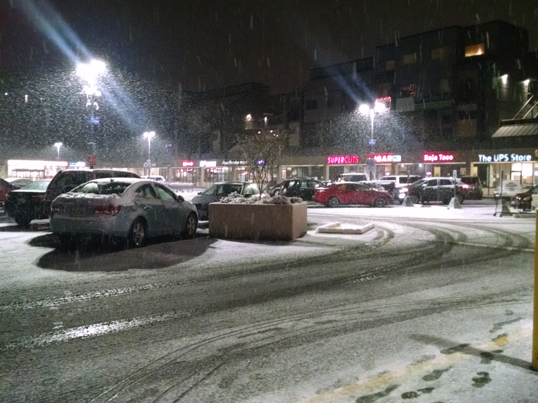
11:57 AM: Thanks for the photos and video! The snow just stopped, again, with more than 2″ officially on the ground, 20 hours after the first flakes, and it’s time to take a good long look before the great meltdown (already four degrees above freezing where we are). Here’s an aerial view:
 (Admiral area, photographed by WSB’s Christopher Boffoli)
A view from the water, passing Alki on a ferry to Bremerton:
@westseattleblog 40 seconds of a snowy West Seattle from the 8:30 ferry to Bremerton pic.twitter.com/v8pzb7swMC
— Ravenna Blog (@RavennaBlog) December 25, 2017
(Video tweeted by Rebecca @ravennablog)
Back on land, first chance in a while for some serious snowman-building:
 (Photo by Ann Limbaugh)
And contemplation of peaceful scenes, like this one in Morgan Junction:
 (Photo by Maggie)
And in North Delridge:
 (Photo via text)
Along Admiral Way:
 (Photo tweeted by @karizma23)
In Highland Park:
 (Photo by Deborah Kasperson)
And in Seaview:

That photo was texted by Kevin, as was this:

Maybe if Al‘s cat Star knew there were “snow rats,” it wouldn’t have been such a difficult decision about going outside:

By the way, if you find (or lose) a pet today – or any other day of the year – remember that our West Seattle Lost/Found Pets page is here, and you can e-mail us info (with a photo if you have one) at editor@westseattleblog.com. Same address for snow photos, road info, whatever, or text 206-293-6302 … thank you!
ADDED 4:13 PM: Two more photos – the snow as it fell last night:
 (Jefferson Square on Christmas Eve – photo by Ben Hutchinson)
And another snow creation:

That one arrived only with the caption: “52nd Avenue snow.” (Added 5:21 pm) We’ve since learned that’s the skull’s sculptor, Sean Devenney, in the photo.
 (Photo by Cynthia Reid – Charlestown Hill sledding)
Before we move on to Christmas Day coverage – you might be wondering how much snow fell, and whether we’ll see more. The National Weather Service says the official Christmas Eve total measured at Sea-Tac was 1.6 inches.
 (Photo by Danny McMillin – near 47th/Genesee)
That would place this at #3 on the NWS’s list of recorded Christmas Eve snowfalls:
1. 2.6″ 2008
2. 2.5″ 1926
3. 1.6″ 2017
4. 1.5″ 1911
5. 0.8″ 1965
6. 0.4″ 1902
7. 0.3″ 1971
The NWS says we could see up to one more inch of snow this morning – the Winter Weather Advisory remains in effect until 10 am. After that? Here’s the forecast: Rain and snow showers possible this afternoon; then a cold, cloudy night; and Tuesday has another chance of snow showers before (relatively) warmer rain returns later in the week.
ADDED MONDAY NIGHT: Historic!
For the first time in over 120 years of records Seattle had at least 1" of snow on both Christmas Eve and Christmas. Official snowfall amounts for Seattle-Tacoma airport 1.6" on the 24th and 1.0" on the 25th. #wawa #wasnow #whitechristmas2017
— NWS Seattle (@NWSSeattle) December 26, 2017
And we could see a little more Tuesday night.
(SCROLL DOWN FOR UPDATES. LINKS: SDOT traffic cameras/alerts … Metro on snow routes … Forecast … Our grocery stores/restaurants/etc. info)
 (Texted photo from High Point, ~3:25 pm)
2:58 PM: It’s light – but it’s snow. Thanks for the texts – we’ve heard from High Point, and we’re seeing light snow here on the Fauntleroy/Gatewood line, too.
3:06 PM: We’re hearing from points north, too, including The Junction. And even before the snow arrived, SDOT had sent a media advisory saying it “has increased crews for night shift deployment, and will continue to monitor, evaluate and treat Seattle roads this evening accordingly.”
3:28 PM: It’s sticking – on cars, rooftops, roadsides.

3:48 PM: But as that photo shows, the roads up here (about 340′ – check your elevation on this map) are still bare and wet. The National Weather Service‘s updated forecast predicts about 1″ of snow.
4:29 PM: That’s changing. Photo texted from near California/Hanford:

Be careful if you’re driving somewhere post-game. Meantime, one more pre-dusk scene, from Kim at Alki:
Snow looks to be about half an inch deep where we are.
5:26 PM: Continuing to snow lightly. SDOT reports a crash at 30th/Brandon; apparently no injuries, as there’s no SFD dispatch. Up here, snow on the road, though not deep:
Still lightly snowing. pic.twitter.com/2D5M5KwcKZ
— West Seattle Blog (@westseattleblog) December 25, 2017
And there are de-light-ful scenes, as Diane described it with this photo:

Thanks to everyone who’s sent photos/video! 206-293-6302 or editor@westseattleblog.com.
5:57 PM: Road report from WSB’s Christopher Boffoli:
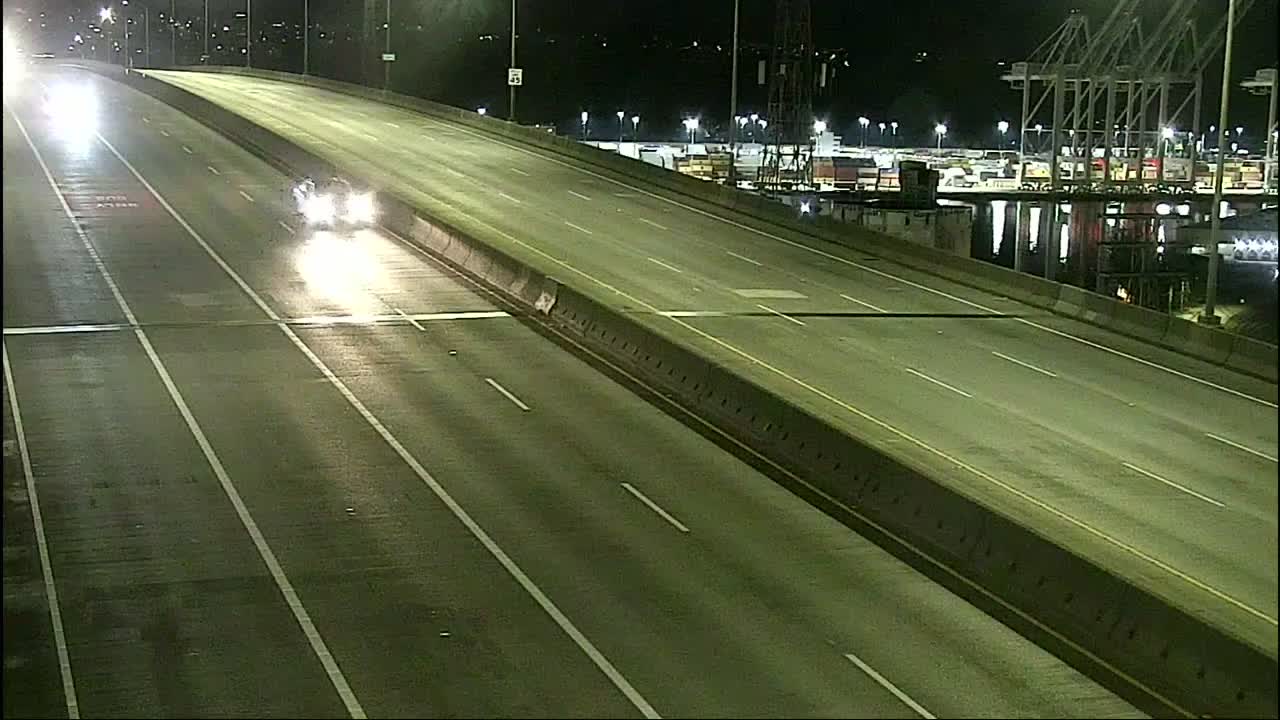
I just drove back to the peninsula from Capitol Hill and I thought I’d give you a quick street report. I-5 appears to have been salted and is just wet. Traffic was light. No issues there (including on and off ramps which were fine. In my short ten minute drive I did see state plows on the freeway (though with plows up as they weren’t needed). The West Seattle bridge was mostly wet with a bit of frosty slush building up around the Delridge exit.
City streets are a different story. Most of the city streets have a light coating of snow and are pretty slick. I have an all wheel drive car – which is very sure-footed – but I definitely stepped on the brakes hard once or twice to test it and I was able to break the tires free and slide very easily. I also saw a car on Hanford, on the hill just east of California, sideways with hazards on. I didn’t see any SDOT salters or sanders at all. So I’d recommend that people exercise caution, slow down, and leave themselves plenty of distance between other cars and avoid the steeper hills if you can at this point.
We mentioned a 30th/Brandon crash earlier; we’ve since heard police (via scanner) mention closure signs on that hill, which goes between Delridge and High Point [map].
6:57 PM: Metro just sent an alert that its South Seattle area – which includes West Seattle – is on snow routes. (Find yours here.)
7:45 PM: Sue texted to say that Westside Unitarian Universalist Congregation in Gatewood has canceled its 9 pm candlelight service because of the weather. (Anyone else with changes/cancellations? Let us know so we can add.) Meantime, Vika tweeted this West Seattle snowman photo:

8:11 PM: Light snow is still falling, and we’d gauge it at about an inch deep here on the Fauntleroy/Gatewood line.
9:44 PM: Hills continue to be the trouble spots on roads. A texter sent photos of cars that got into trouble on – and off – the SW Spokane hill by 48th earlier this evening:

We will be starting a new story soon for late night/early morning info, since this one has been running since mid-afternoon.
You’ve been hearing talk of possible Christmas Eve/Day snow for days – and now the National Weather Service has issued an alert saying it’s looking quite likely. From the “Winter Weather Advisory” alert, which will be in effect 7 pm tonight through noon tomorrow:
… Snow expected. Plan on road conditions becoming slippery tonight. Total snow accumulations of up to 3 inches expected with the higher amounts in locations around 500 feet and above with less than an inch near the water. …
The highest elevation within city limits – near the 35th/Myrtle reservoir – is just over 500 feet. Meantime, let us know if/when you see snow – 206-293-6302 text or voice – thanks!
 (Photo by David Hutchinson -Olympics, Puget Sound, and vehicle carrier Midnight Sun on Wednesday)
We’ve seen the snow on the mountains – and maybe as soon as tonight/early tomorrow, we might see some here in the lowlands. So says the National Weather Service, and if not this round, maybe Christmas Eve/Day – and/or maybe after that. The big word is “maybe,” as the newest Forecast Discussion explains, and there’s a Special Weather Statement too. They are NOT talking major snow – maybe just a “dusting” – but still … if and when you see snow, our 24-hour hotline, text or voice, is 206-293-6302 – thank you!

It’s a spectacular sunny day, with the Olympic Mountains fully in view, and James Bratsanos shared these photos. So we are sharing them in turn while we head out to check on a few stories. Here’s his view north to Alki Point:

And more Olympics.

Looks like clear skies at least through winter’s official arrival tomorrow.
(SDOT MAP with travel times/video links; is the ‘low bridge’ closed? LOOK HERE)
7 AM: Good morning! It’s the week before Christmas, and school’s out. No incidents in/from West Seattle reported so far.
WEATHER: Rainy this morning. It gets much colder later this week and as @WestSeaWx pointed out early today, there’s a possibility of snow in a few days – late Thursday/early Friday.
7:35 AM: WSDOT reports a crash on NB I-5 near Seneca.
8:11 AM: Crash reported at Admiral/Olga.
9:05 AM: If you monitor regional news, you have likely heard about the Amtrak derailment that has closed I-5 in south Pierce County. Washington State Ferries is warning that its system traffic might increase as people divert.
10:19 AM: The current closure is southbound and per WSP expected to continue through the day.

2:56 PM: Two sky notes: First, that cloud formation – Byron asked us on Twitter about a “vortex” and we had no idea what he was referring to until we saw that photo e-mailed by Jeff Kaufer. Official name for this formation, anyone? (Update: See comments.)
Also: Possible meteor-watching tonight, Alice Enevoldsen reminds us via Twitter:
Geminids will be occurring all night Dec 13th (Thu) and 14th (Fri), starting low in the East with a few spectacular ones between sunset and 10pm. Then 10pm-2am you'll have the chance to see a lot more directly overhead… 1/2 @westseattleblog https://t.co/koBhHNUyy8
— Alice's AstroInfo (@AlicesAstroInfo) December 13, 2017
ADDED 3:10 PM: Another view, from Tori:

The Puget Sound Clean Air Agency says the burn ban in King County (and Snohomish too, if you’re keeping track) will end as of 2 pm this afternoon – the air quality is improving and the wind is expected to pick up tonight, to keep pollution in check.
The Puget Sound Clean Air Agency is adding King County to its burn-ban list. As of 2 pm today, a Stage 1 burn ban will be in effect. Here’s what that means:
*No burning is allowed in wood-burning fireplaces, uncertified wood stoves or uncertified fireplace inserts unless this is your only adequate source of heat.
*Even those using a certified device or those for whom this is their only adequate source of heat cannot generate visible smoke.
*All outdoor burning is prohibited, even in areas where outdoor burning is not permanently banned. This includes wood- and charcoal-fueled recreational fires.
Also, the National Weather Service‘s air-stagnation advisory continues.

Yes, there’s an air-stagnation advisory … but the still, foggy air also has brought scenes of beauty, like this one photographed by Jim Edwards. (Big thanks to Jim and everyone who has been sharing memorable West Seattle images here for 10 years now.)
FIRST REPORT, 8:50 PM: It’s not yet on the City Light map, but there’s a power outage in eastern West Seattle. We’ve heard from Highland Park and High Point so far. More info to come.

8:52 PM: In the time it took us to type that, the map updated – more than 4,100 customers out.
8:57 PM: No word yet on the cause. Even if you didn’t lose power, you might have noticed a flicker about the time the outage started at 8:46 pm – we did, here on the Upper Fauntleroy/Gatewood line. (And thanks to everyone whose texts immediately afterward tipped us to the outage!)
9:06 PM: As you can see on the map (screengrab above), a pocket of South Park is out too. In case this lasts a while, City Light has some helpful advice toward the end of this page.
9:11 PM: The map now has a restoration guesstimate of 1:33 am – we call it that because even the utility acknowledges it’s something of a guess. Could be sooner, could be later.
9:31 PM: If you are out or have to go out, remember that when a stoplight’s out, it’s an all-way stop. For one, as mentioned by Harvey on Twitter, Delridge/Henderson is out.
9:35 PM: Some High Point residents report via comments and texts that they’re back on. Anywhere else?

9:40 PM: The map has updated, now showing 2,700+ customers still out, so the restoration reduced the original outage by about a third. (Adding the new map above.)
9:48 PM: The cause is now described on the map as “equipment failure.”
9:54 PM: More report via comments and texts that the power’s back. And SCL elaborates on the cause via Twitter, “Breaker tripped at substation.”
9:57 PM: Map shows that everyone’s back on, and SCL confirms. If yours is NOT, be sure to call 206-684-3000 and be sure they know.

The photo is from Ben, whose home is among the dozen-plus in West Seattle that have yet to get power back after losing it during the Monday afternoon/evening windstorm. Ben tells WSB, “Going on our 3rd day without power! 47th and Hanford. Okay, it was fun for awhile, a little adventure for the kids. But we’re ready for power now! :) What with the home office and all …” The Seattle City Light map shows Ben’s neighborhood as the northernmost, and largest, remaining outage pocket (5 customers):

Citywide, as of right now, SCL still has 39 outages totaling 110 customers. And the utility is requesting that those still out be sure to re-report the outages.
| Comments Off on WEST SEATTLE WEATHER: Wind alert for Saturday