West Seattle, Washington
08 Sunday
Last night, we reported that a Washington State Ferries alert said the route will be back on the two-boat schedule next Monday because of boat moves. In today’s weekly report, WSF said that may last longer because of the repairs necessitating the boat moves:
This week brought another reminder of how fragile our ferry system is. We simply don’t have enough vessels available to cover unexpected issues. Tuesday night, Kitsap had to be removed from service because of an engine issue. That left our Mukilteo/Clinton route with only one boat yesterday and this morning. In a timely coincidence, Walla Walla was cleared for service late yesterday following successful sea trials, allowing that ferry to replace Chimacum this morning as our Seattle/Bremerton route’s single vessel. We then moved Chimacum to replace Sealth as the #3 boat at Fauntleroy/Vashon/Southworth, so Sealth can join Tokitae at Mukilteo/Clinton this afternoon.
Kitsap moved to our Eagle Harbor Maintenance Facility yesterday so our employees can fix an engine issue.
As we have done the past several weeks, tomorrow night we’ll move our “Triangle” route’s #3 boat, which does not run on winter weekends. That allows Chimacum to serve alongside Walla Walla to provide two-boat service at Seattle/Bremerton Saturday and most of Sunday. Walla Walla must then go in for scheduled maintenance and required inspection on Monday. With Chimacum remaining at Seattle/Bremerton as the route’s single ferry after the weekend, Fauntleroy/Vashon/Southworth will be on its two-boat weekday schedule next week. We expect Salish to return from its maintenance and inspection period next week and when it does, we will send it to the “Triangle” to serve as the unscheduled, bonus boat.
We should know more in the coming days about how long repairs to Kitsap will take. Our service plan for Monday and beyond may adjust depending on vessel availability.
By Tracy Record
West Seattle Blog editor
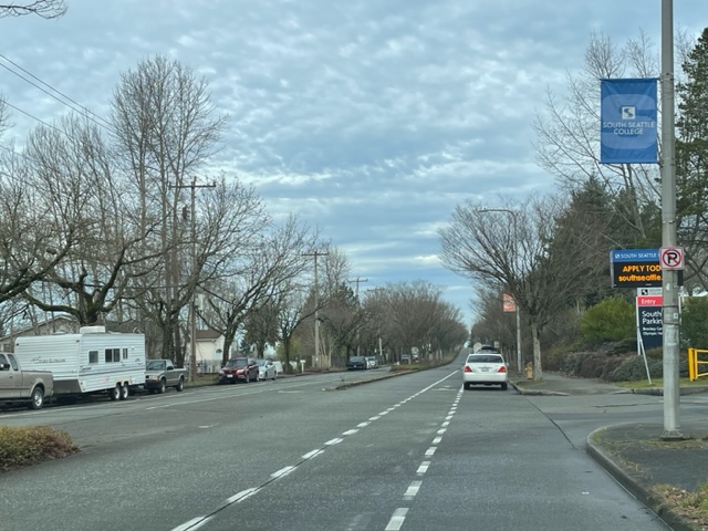
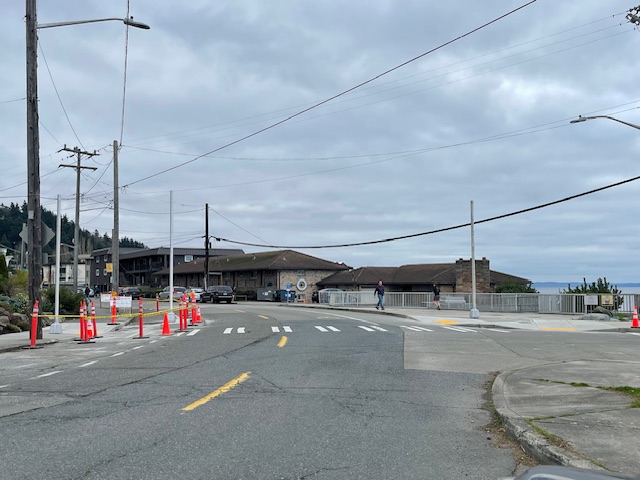
More than 50 people filled a room at South Seattle College‘s Cascade Hall last night for a “community conversation” about parking along 16th Avenue SW in front of the campus.
The west side of the median-divided street is lined with single-family homes, and the street parking is relatively devoid of signage, so in addition to the vehicles of students and staff – who have to buy permits to park in campus lots – street parking is also used by RV/trailer/truck residents. The number fluctuates but we counted 10 on a visit earlier this week.
While that wasn’t mentioned in the meeting announcement, that was clearly what everyone was there to discuss – though not all agreed on what was at the heart of it. A panel of city reps included Tom Van Bronkhorst from the Unified Care Team; Mike Estey from SDOT; and Laura Fox from SPD Parking Enforcement (a listed panelist from the city’s “unsheltered services” program did not show up). SSC communications director Ty Swenson facilitated. Also there but not seated with the panel in front of the room were SSC president Dr. Monica Brown and District 1 City Councilmember Rob Saka‘s new policy adviser, Brendan Kolding.
The college wants to be “more than a neighbor in name … also a neighbor in deed,” said Dr. Brown in brief welcoming remarks. Swenson said SSC was trying to “approach this conversation” with a better understanding of “the needs of our unhoused population.” He said the conversation’s goals included the “opportunity to share your experiences” and to learn about the city’s approach to “supporting the unhoused population” and “parking enforcement” – tincluding the options that might be available for the latter.
Fox was the first city panelist to speak and said she empathized with the situation. Estey said, “We keep getting introduced as experts (but) it’s hard to be an expert on this issue.”
Swenson then provided “background from the college perspective,” saying Van Bronkhorst had contacted SSC last fall about possibly installing parking-restriction signage. “One of the things (he shared) was that these days the city most commonly puts up 2- and 4-hour signs” but that might not work for students, so SSC was looking for a wider range of possibilities. Swenson said they also were concerned that restrictions would just move RVs “further down the road.”
Van Bronkhorst spoke next, explaining the Unified Care Team – representatives from 10 city departments, “one part of the city’s overall response to homelessness … working on restoring access to public spaces” among other things. The UCT is “not a first-responding group” and “our mission is not to solve homelessness,” he clarified.
Fox said Parking Enforcement works with UCT, coming out during remediations and giving three-day warnings (those familiar orange notices). But they usually don’t move, and don’t get towed because people are living in them, she explained.
An attendee then spoke out about observing a recent situation where no-parking signs went up, people in RVs left, “and they came back.” Another attendee then voiced concern for trauma to the people who have been swept. Another attendee stood up and said she wants everyone to have someplace to live, and she’s paid taxes for that. But “we’ve dealt with so many things in the city in the past five years.” So has she, saying for example, she had to replace her fence, had to call police for someone peeping into her home. “Are there conseaquences when people are offered shelter (and don’t take it)?” She mentioned streets in other neighborhoods with barriers such as rocks. She said the city’s had five years to collect data but all she sees is the UCT “replacing propane canisters … The frustration is, I want everybody to be housed, you have the data, where is the plan? Do something …” She also said she was frustrated that Councilmember Saka himself was not in attendance. “He should be here,” she said, her voice continuing to intensify. Many in the room applauded when she was finished.
The next person to speak said, “There should be campers outside Rob Saka’s house … there should be campers outside all our houses” until things were equalized. Others in the room demanded to know whether the speaker owns property. The speaker replied, repeatedly, “I live here.”
Next person: Why aren’t tickets being given out, considering that the RVs block the bike lanes? Parking Enforcement supervisor Fox said there’s a rule for that but a ticket isn’t going to remove the RV. “There has to be someone calling in, we’re not just driving around looking,” She added that parking enforcement officers have safety concerns. She said that precinct officers often assist PEOs, and promised to “try to get out here more often.”
Another attendee said RV dwellers have been “aggressive” and also voiced concern that notification of the meeting hadn’t been distributed widely enough. They were followed by a person who said she had had more than half a dozen people in her family experiencing homelessness. “These people are being left out there to die … There is nothing compassionate (about that) …” She said at least one person had died in the area. “I would like the developers, the city, to fix th housing crisis” but believes that’s not going to happen any time soon. She thinks “a light, tight mobile camp” would be better, without room for big RVs – otherwise people are “sitting out there as bait for predators.”
The open-mic type of sequential commenting continued. Next was a resident identifying himself as a homeowner who said he’d put up a camera for six months to record what’s happening on the street. He said he had recorded some doing things he doesn’t like, but others are doing good things. “We ought to be forming relationships with them.” He says he has footage of people causing trouble for the RV residents – “we need to come up with a solution and not” treat them like outcasts. “They have nowhere to go. … We need to solve this problem at a housing level,” not at a level of making RV dwellers the enemy.
But almost every time someone suggested the need for that solution, someone else declared that wasn’t the point of the meeting, parking was. The next speaker declared she’s :empathetic’ but is fed up with problems such as a couple in one RV who frequently fight, with the disruption spilling out into the neighborhood. She added that she herself is an immigrant and naturalized citizen and “came here with nothing.” Then she suggested that there “are two different kinds of unhoused” … one type who “truly wants the help,” the other type who does not.
Shortly thereafter, Van Bronkhorst explained the outreach process and its limitations. “We don’t have a lot of great housing options .. we offer shelter, services, that are not great for a lot of people … we offer tiny house villages” but usually vacancies are rare because tiny houses are so popular. For RVs, they first try to clean up the area before a removal, “we’ll talk to them about their needs to keep their vehicles moving.” That’s when Van Bronkhorst spoke of the RV-safe-lot/tiny-house village plan we broke the news about last week (up to 72 RVs, 20 tiny houses), though he had few details.
SDOT’s Estey (who is the department’s curb-space manager) then took the mic to steer the focus back to the parking restriction issue. He said they’ve been installing 4-hour limits in places where people with RVs might want to park – “the (signs) tend to be self-enforcing.” (He is ‘curb space manager’ for the city. He also acknowledged that restrictions would “push the RVs to other places.” They tend to install such signage just on the commercial side (which in this case would be the east side, in front of SSC) because on the residential side there are more impacts. “There’s probably not a permit solution,” he said, for those wondering about RPZs, since there are specific conditions that need to be met. They could do a study, he said, to verify whether an RPZ would be justified. And he acknowledged that, yes, overnight parking is illegal, but SPD isn’t staffed overnight to enforce that.
Could they put jersey barriers every 30 feet or so? he was asked. “Our preference is not to have to default to something like that,” or putting eco-blocks in the right of way, Estey said, “but we also understand why they end up there because people feel a sense of desperation.” Van Bronkhorst said the last mayoral administration did not enforce removal of ecoblocks but he doesn’t know what “the new administration” thinks. He mentioned some neighborhoods putting out metal planters. “That’s not legal,” several attendees said, while others quickly pointed out no one was enforcing that. (A little while later, someone else mentioned that the arrival of ecoblocks after a sweep on Highland Park Way seemed to have preceded RVs’ move to 16th. They said they’d reported street obstructions via Find It Fix It but “they’re still there.”)
Another person wondered whether there should be special consideration here since SSC is a school. Estey observed that “it’s unique that you have a college with single-family (homes) across the street.” He said parking enforcement would likely come out more often if there were signs. “We need parking restrictions on both sides of the street,” an attendee said. “And at Sanislo Elementary,” added another, referring to Puget Ridge’s other school.
Van Bronkhorst mentioned another signage tactic, putting up signs asking for voluntary compliance “be a good neighbor, kids live here too.”
Then an attendee who said they’ve lived in the area for 32 years read a statement about her “personal experience.” She said crime problems had arrived with the RVs. “I don’t think sweeping is the answer, but we’re not here to solve the housing crisis.” She said her car had been stolen, and several others spoke up to say theirs had too. She said she is not comfortable walking in the neighborhood any more and declared “this isn’t about punishing pople who live in vehicles, this is about public safety.”
The next speaker countered by declaring that everyone is a neighbor, including renters, and RV dwellers. She said parking restrictions would likely push RV dwellers into places “in front of people’s homes” while currently they tend not to be “in front of people’s entryways.”
“What about the north lot, could they park there during the day?” A college rep explained that tudents pay $50/quarter for permits and the north lot is open to them at any time. “Why not open that up and let the students park there for free?” Soeone asked how many students pay for parking passes; 700 was the guess.

A few murmurs around the room started coalescing around signage with 11 pm to 5 am restrictions like on Harbor Avenue (as shown above in a WSB photo from September 2023). An attendee who said they had worked on signage for a variety of concerns countered, “Signs in this case do not solve the fundamental (problem) we’re trying to deal with … I don’t think signs are going to solve the problem.” They said someone does park in front of their residence and “I do not want them swept.” Signs are being deployed to push people out of the area, they said. They support the north lot parking idea. Others in the room said they felt signage would help the situation. Then again, the point and counterpoint, some saying “we’re not here to solve the housing crisis” and others saying, “You should be.”
Fox from Parking Enforcement said most vehicle dwellers don’t have registration. She thinks RV “safe lots” are the solution. “That way all the services come to them.” Someone wanted to know if RV dwellers will be “compelled” to go to the safe lot once open. That attendee claimed people in a few of the RVs are “running criminal enterprises” and won’t want to. “When they say no … what are you going to do?”
Van Bronkhorst replied, “Well, people have a choice” and also mentioned potential obstacles that kept some people in RVs from being able to access such lots in the past, such as having to prove their ownership of the vehicle and being on a pathway toward housing and eventually giving up their RV. He isn’t sure if that’ll be the policy. But no, he reiterated they’re not going to force people into the lots. (The request came later, though, that West Seattle RV dwellers get priority at the West Seattle lot.)
So, the discussion turned back to, what signage might be tried in the area?
“No overnight parking … both sides of the street.” voices said from around the room.
Then again came a reminder that the problem goes beyond parking, advocating for state legislation supported by the Seattle/King County Coalition on Homelessness.
Another man stood up and said, “We give way too much services to these people, 60 percent don’t even come from this area.”
That led to further points and counterpoints – including whether the topic was parking or homelessness, another attendee suggesting that government “has a spending problem,” another suggesting enforcement is needed rather than more signs, yet another wondering about a “no camping” ordinance, and someone else turning the attention to the Highland Park downhill-lane removal and wondering how many were aware SDOT is planning on that. “I just wanted to say that out loud,” he said. “SDOT ran surveys, most people are against (the project), and they’re going to do it anyway.” Estey said he’d “take that sentiment back” to SDOT HQ.
That in turn segued into questions about how feedback from this meeting will be conveyed to decisionmakers. Any other routes for providing community input? they wondered. Another attendee suggested, “The folks (who park) are there because they (consider that) their best option – we can either make this option worse or make other options better … I think the compassionate choice is to make other options better.” A “no camping” ordinance would be irrelevant, he said, because “they’re not camping … this is their house … you can’t stop camping if that’s your house.”
Then Estey took on the followup question. He said people can contact the city. Van Bronkhorst asked for contact info from 16th SW residents: “I think we’ve heard enough options we could make some suggestions … to remediate the situation as it currently is … it seems neighbors have been asking for a ‘now’ answer … we can come up with some options, send them to (Swenson at SSC), and get some feedback.” He declined to hone in on just one idea immediately, and would not commit to a timeline for a proposal and action, even acknowledging, with uneasy laughter, that the response was basically a “non-answer.”
The addresses provided were two contacts at SSC:
brian.jellum@seattlecolleges.edu (security)
ty.swenson@seattlecolleges.edu (communications)
From the city:
mike.estey@seattle.gov
tom.vanbronkhorst@seattle.gov
Announced tonight by Washington State Ferries:
Due to necessary vessel repairs, we need to move vessels and adjust the Fauntleroy/Vashon/Southworth schedule the next few days.
Thursday, Feb. 5: Around midday, the 144-vehicle Chimacum will replace the 90-vehicle Sealth as the #3 vessel.
Friday, Feb. 6: The following #3 sailings will be cancelled due to boat moves:
8 p.m. Southworth to Vashon
8:20 p.m. Vashon to Fauntleroy
8:50 p.m. Fauntleroy to Vashon
9:15 p.m. Vashon to Southworth
9:30 p.m. Southworth to Vashon
Saturday and Sunday, Feb. 7-8: Regular weekend winter schedule.
Monday, Feb. 9: Two-boat schedule due to timing of vessel moves. We’re working to add a third, unscheduled vessel in the afternoon.
Tuesday, Feb. 10: The route will return to the three-boat schedule.
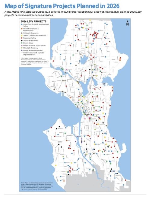
The question invariably arises – voters passed a levy, so how’s the money being spent? SDOT has just released its “draft plan” for spending Seattle Transportation Levy dollars this year. You’ll recall that voters approved the eight-year, $1.55 billion levy in fall 2024, so this is its second year. The draft 2-026 plan – see it in its entirety here – will be presented Thursday morning (February 5) to the Transportation, Waterfront, and Seattle Center Committee chaired by District 1 City Councilmember Rob Saka. It lists hundreds of projects/locations by name, though without specifics, so we went through it to get the West Seattle highlights, under the classifications used in the plan. Note that these are just the West Seattle mentions – and there are hundreds of projects listed from elsewhere in the city; projects are generally categorized in the plan as either being in design this year or starting construction:
VISION ZERO: Highland Park Way hill project, design
California/Oregon, construction
SW Barton between 26th and 29th, construction
West Seattle Bridge central eastbound span, construction
TRAFFIC CALMING: Harbor Ave from California to Spokane, construction
SAFE ROUTES TO SCHOOL: Projects for Denny IMS, Highland Park Elementary, Madison MS, Our Lady of Guadalupe, Roxhill Elementary zones
‘NEIGHBORHOOD INITIATED SAFETY PROJECTS’: Highland Park greenway/traffic calming, North Delridge all-way stop, South Delridge traffic calming and daylighting
‘NEIGHBORHOOD SCALE TRAFFIC SAFETY IMPROVEMENTS’: Planning will start for 26th between Brandon and Juneau. 63rd between Alki and Admiral, SW 100th between 35th and 44th, SW 106th between 35th and Marine View Drive, SSW Holden between 12th and 11th
SPOT PAVEMENT IMPROVEMENTS, ASPHALT: 35th SW, 108th to 111th; 106th, 32nd to 35th
SPOT PAVEMENT IMPROVEMENTS, CONCRETE: 30th/Genesee
TRANSIT SPOT IMPROVEMENTS: Barton/29th layover, construction; Fauntleroy/Rose, design
SIDEWALK CONSTRUCTION: Barton, 21st-23rd; Brandon, Delridge-23rd and 25th-26th; Hudson, Delridge to 26th
SIDEWALK DESIGN: 21st, Dawson to Graham; 22nd, Henderson to Thistle; Brandon, 26th to 30th
CURB RAMPS: 30th/Dakota, 31st/Barton, 45th/Charlestown, 47th/Frontenac, California at Ida, Austin, Webster
CROSSING IMPROVEMENTS: SW Charlestown, 45th to 55th; Delridge at Cloverdale, design
NEW SIGNAL: California/Walker
SIGNAL MAINTENANCE AND CROSSING IMPROVEMENT: California/Erskine/Edmunds
SIGNAL TIMING: Design for 47th/Admiral improvement
ACCESSIBLE PEDESTRIAN SIGNALS: 26th/Barton, Fauntleroy/Dawson, design
NEW PROTECTED BIKE LANE: Highland Park Way hill project, design
PROTECTED BIKE LANE UPGRADE: Admiral Way, Spokane to Lander, design
‘PEOPLE STREETS’: Lander, 18th, in design
FREIGHT: SW Manning crossing improvement, “derelict rail removal” on West Marginal Way
Some categories promised such a high number of projects – like sidewalk repairs – that they weren’t called out by name/location. Also keep in mind that this is not the entirety of what SDOT is working on – just what the levy is funding; they have other non-levy work too. Many of these led us to wonder “what exactly will be done THERE?” and so we have followup questions out to SDOT. Meantime, you can watch their briefing for the council committee at 9:30 am Thursday, either in person or via Seattle Channel. The agenda explains how to comment, though also keep in mind, this isn’t something they’ll be voting on. One more note: As for how they spent levy dollars in Year 1, this new “dashboard” might answer some questions.
 (Metro photo)
Route 128, which includes West Seattle, is one of the routes to which Metro will assign its newest battery-electric buses starting next week. The new GILLIG-manufactured buses, painted “electric yellow and seafoam blue,” are 40 foot long, with a capacity of up to 69 people, and they’re expected to be able to go up to 280 miles on a single charge. Metro’s announcement today also makes note of this distinctive feature:
The new buses are the first in Metro’s fleet to enter service with new operator safety partitions installed. The partitions include a reinforced lower metal panel extending to the operator’s platform, along with a two-part sliding glass system. A larger, extendable glass panel provides increased coverage and visibility, while an additional polycarbonate panel extends to the ceiling for added protection. The partition will remain closed at all times except when transit operators are assisting customers with mobility devices and meets industry safety standards for vehicle windows and operator compartments.
Metro will be adding charging capacity, starting this spring at its Tukwila base, which it says will be able to handle up to 120 battery-electric buses.
Alex Pretti, the man shot and killed by federal immigration agents in Minneapolis, is often just described as his professional role, a nurse, but he also was an avid bicycle rider. That’s why, Alki Bike and Board proprietor and community advocate Stu Hennessey tells us, a West Seattle ride is planned for Saturday in his honor:
Bike and Board is organizing a memorial ride for Alex Pretti. As a Surly dealer, we felt a strong connection to Alex, given his passion for the Surly bike community. While we are saddened by this tragedy, we are inspired by his courage and wish to honor his memory.
Here are the details for the ride:
The memorial ride will follow a casual five-mile loop including the Alki Beach Path and the Alki Point Healthy Street. The route is family-friendly, though it does include a mile-long steady grade up Admiral Way from Alki Point. We will maintain a group pace as we ride together in solidarity.
Saturday, January 31st. Meet at Alki Bike and Board at 11:00 am and start the ride at 11:15 am.
Here’s a page for it on the Everyday Rides website. The shop is at 2606 California SW.
One year ago, SDOT announced “next steps” for the Alki Point Healthy Street, including an upgraded crossing at its south end, at 63rd SW and Beach Drive SW. Crossing work has been done, as shown in our recent photo above, but the poles have been in place, beaconless, for a while. So we asked SDOT for an update. The reply: “The RRFB equipment for the upgraded crossing at the south end of the Alki Point Healthy Street has been ordered and we are waiting for them to be delivered.” No timeline estimate so far.
Good news for Fauntleroy-Vashon-Southworth ferry-route travelers – the route is back to three-boat service as of Monday, according to Washington State Ferries, which says the boats that broke down, cutting Triangle Route service (and elsewhere), are now fixed.
Vessel problems on other Washington State Ferries routes have left the Fauntleroy-Vashon-Southworth route on two-boat service, and that will continue tomorrow (Friday, January 23), according to this explanation from WSF boss Steve Nevey:
This week, a second large ferry had to be removed from service, leaving us with just 15 boats when we need 17 to run our full winter schedule. Yesterday, Wenatchee hit a log while sailing from Bainbridge to Seattle in the fog, bending one of its propellers. This morning, we moved Sealth to join Tacoma on our busiest route. This leaves both our Fauntleroy/Vashon/ Southworth and Seattle/Bremerton routes down a vessel. Repairs to Wenatchee are expected to take a few days, with a return to Seattle/Bainbridge service possible Sunday. That would allow us to relocate Sealth to our Bremerton route for the Seahawks playoff game, when we expect heavy travel to and from Seattle. Then late Sunday night, we plan to shift Sealth back to Vashon Island. This allows us to restore our “Triangle” route’s full three-boat weekday schedule on Monday. If Wenatchee is not ready, we will keep all ferries where they currently are.
As Nevey reiterated during Wednesday’s systemwide online community meetings (WSB coverage here), the system suffers chronically from an undersupply of boats, and unexpected problems tend to have domino effects like this.
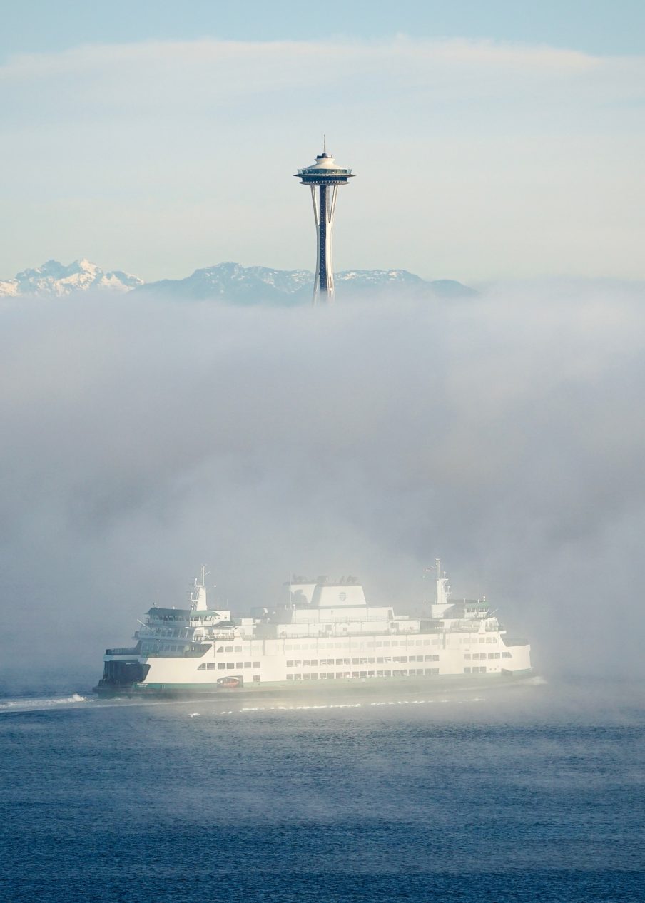 (Ferry in this morning’s fog – photo by Steven Rice)
By Tracy Record
West Seattle Blog editor
The Fauntleroy ferry-terminal project got a semi-quick mention during Washington State Ferries‘ first of today’s two online systemwide community meetings at noon today. So did a wide range of topics, including ICE-related policy and the ongoing pet pilot. We monitored the meeting and are presenting this report in time for you to tune in to the second one at 6 pm if interested. Here are the WSF executives who participated:
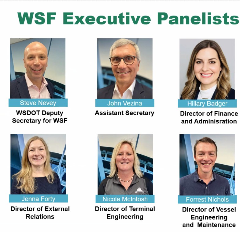
It was noted toward the start that about 80 people had signed in to watch. As has become customary for these online meetings, they began with quick polling about what route they used the most (only about 9 percent said “the Triangle Route”) and how often they ride (“a few times a month” was the top response).
Ferries boss Steve Nevey spoke first, with a recap of 2025 (here’s the official report). “We added thousands of sailings in 2025, and the number of cancellations went down.” Here’s the year “by the numbers”:
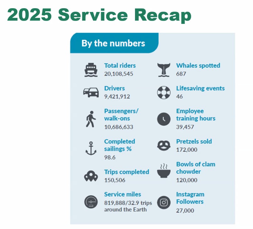
The ridership number, he said, was a million more than the year before. Now, the challenges and opportunities:
They’re short on vessels, and that isn’t going to change until the next new ones start coming online in 2030. The average age of the fleet is 35 – that’s 10 years past, for example, when a cruise ship might be looked at for retirement from a fleet. Nevey said the Legislative session is “going to be big for Washington State Ferries” because the governor is requesting $1 billion for three more new vessels (beyond the three now funded) and $150 million to keep the three oldest ones in service in the meantime. “That proposed investment from the governor is a huge deal.” They have 21 vessels now, 18 in service at any given time, and just one breakdown can wreak havoc on the whole system. (During the meeting, in fact, it was noted a vessel on the Bainbridge run has broken down, but should be fixed within hours.) He also said that rather than a “system electrification plan” the road they need to be on is a “fleet modernization plan.” For now, though, they are “laser-focused” on making the most of what they currently have. He also mentioned the terminal upgrades – without specifically naming Fauntleroy (which came up briefly later, in the Q&A) – saying they remain a vital part of the future plan.
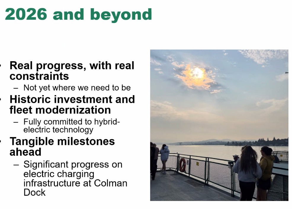
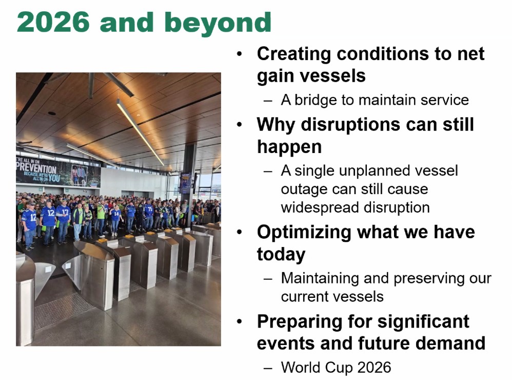
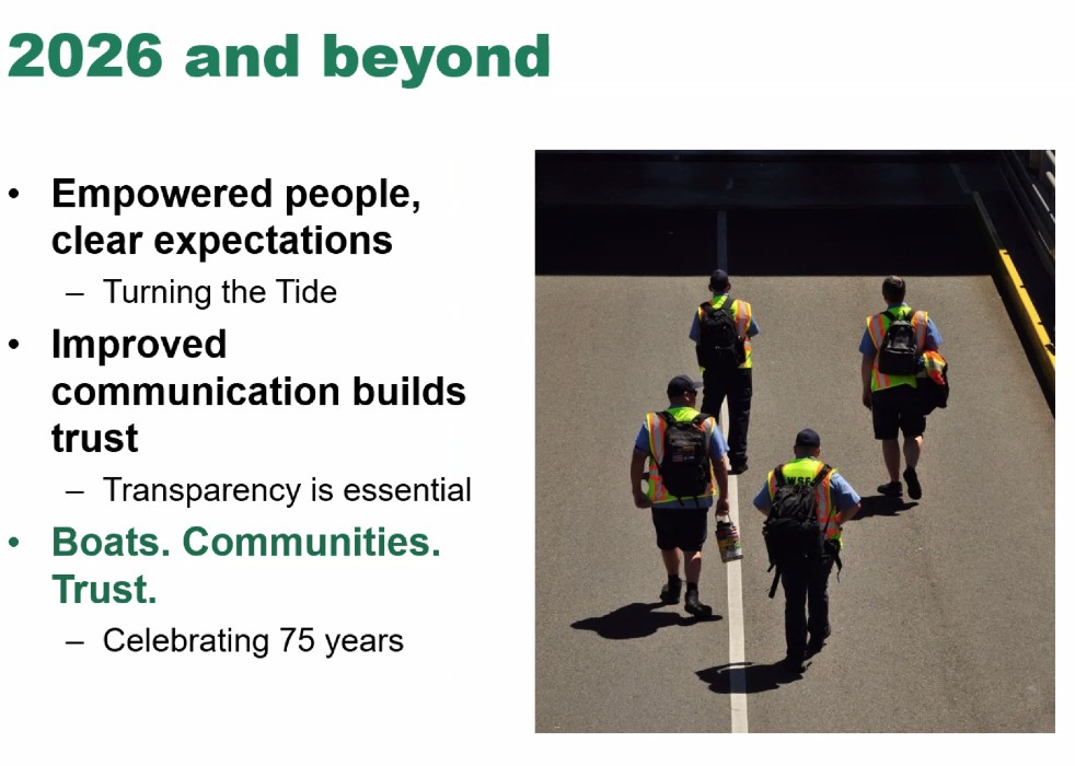
Regarding planning for the FIFA World Cup games in the region, “it’s going to be a pretty big deal” for WSF too, and they plan to have “all but one vessel” ready to be in service during that time this summer. He said culture change and communication improvement have been emphasized as well – for the latter, being clearer, and more timely, when decisions are made about changes such as “moving boats around.” Their focuses can be summarized as “boats, communities, trust.” And – this year marks WSF’s 75th anniversary.
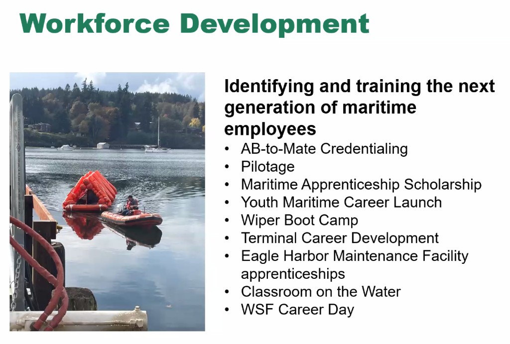
Next, the system’s second-in-command, John Vezina, took the mic. He opened with a recap of what WSF is doing for workforce development, getting new crew members in the pipeline, which is “getting better,” Vezina said.
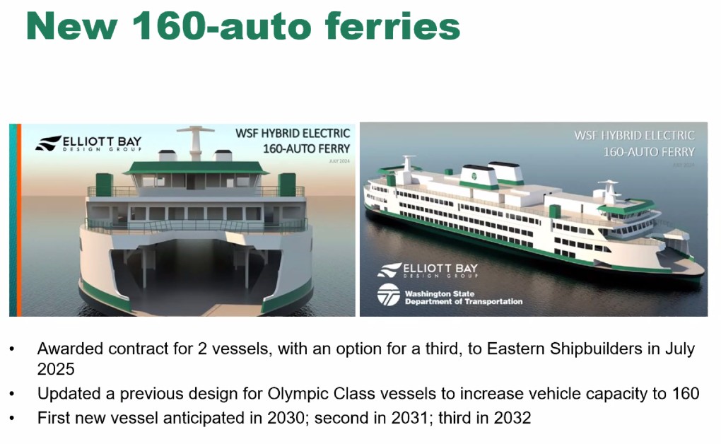
He also updated system electrification, recapping the choice of a Florida builder for two new hybrid-electric vessels and an option for a third, converting three vessels to hybrid (the Wenatchee is complete and timeline is TBA for two more), and setting up four terminals for charging capabilities, for starters. They expect to “cut steel and lay keel” for the first new vessel this summer; it’ll be a lot like the Olympic Class, but longer, and a higher vehicle capacity (16 more, total 160).
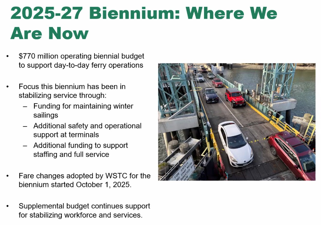
Next, finance leader Hillary Badger provided an update on WSF funding and what it’s being used for:
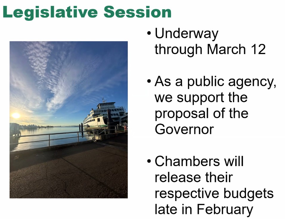
She was followed by Jenna Forty with legislative updates – mostly that they’ll find out in late February how the two chambers in Olympia will deal with the governor’s proposals for WSF funding. She noted that those proposals would be supported by bonds.
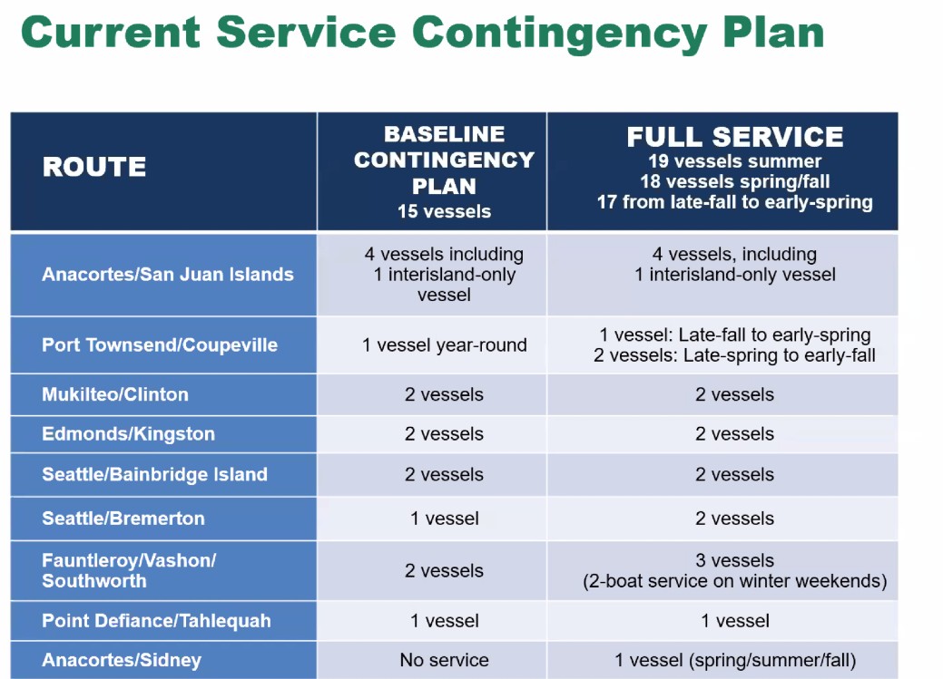
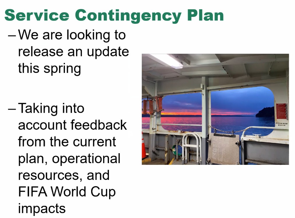
Forty also said WSF is overhauling its System Contingency Plan, taking “a holistic look at how we deploy our assets,” this spring – before the World Cup (she and others mentioned getting people to and from Fan Zones around the region as well as the Seattle matches).
Then, half an hour into the meeting, it was Q&A time – they took questions in writing, and moderator Tally Teal read them aloud. First one was a request for a recap of vessel numbers mentioned above. Next, if Legislature does approve funding for three more new vessels, what would the timeline be? Vezina said they’ll focus on that if they get the money – seeking to build them “as quickly as possible.” Forty said that would also be contingent on any policy direction from legislators and/or the governor.
Other questions of interest: Could/should the ferry system be privatized? Vezina noted the 75th anniversary and the decision made at the start for it to be a public service. “The governor and legislature certainly COULD decide to get out of the ferry business,” he said, but keep in mind that privatizing might lead to de-emphasizing service available even in the less-busy times. Forty also noted that a private company would look for profitability and fares would invariably be raised. Nevey talked about BC Ferries, which was privatized, and how they face that kind of expectation.
The next question was addressed to vessel-engineering director Forrest Nichols – how much will the double stack in the new ferries’ design affect their performance? The double stack’s sail area doesn’t result in much drag, he said, also considering that the added length of the new ferries will improve their performance. Nichols was also asked to explain crew quarters on the ferries; he said it’s necessary because crew members have to be available or early-morning sailings, among other things; Nevey added that snowstorms, for example, are a time when they want to keep crew aboard and not have them trying to commute.
Which terminals are first for charging capability? The new boats in 2030-2031 will be assigned to Mukilteo-Clinton, so that terminal is up for electrification; Seattle needs to be electrified to handle the Wenatchee; Bainbridge and Bremerton. Forty added that there’s no funding so far for electrification capability on the Triangle Route or the San Juans. Followup: When will Seattle be electrified? 2028 or 2029, was the reply.
Why has the Wenatchee had so many problems – today included – since returning to service following its hybrid conversion? “We’re marrying 30-year-old control systems with brand-new technology,” for one, he said, although today’s problem is with a “shaft seal,” which happens to all the vessels, he noted. “I would anticipate going forward that the Wenatchee will continue to improve on its reliability. (But) I would expect to see intermittent issues related to its being a boat.”
Then the Fauntleroy terminal project came up, briefly. Terminal-engineering director Nicole McIntosh talked about the reason Fauntleroy is getting replaced – it’s low, it’s small, it has creosote, it’s seismically vulnerable … She said they’re at 5% design now, going into the next environmental-review phase “shortly”; current estimate is for construction to be complete in 2031. Will it be electrified when upgraded? another attendee asked. Short answer: No.
As for other terminal projects, McIntosh said, Anacortes is not going to get a building replacement but they’re studying some upgrades/renovations.
Forty fielded a question that often arises at these meetings – when will WSF return to serving Sidney, B.C.? “We’re still aiming for 2030 when (the first new boat) comes online” but that’s not for certain. M/V Chelan used to be certified for Safety of Life at Sea, which is required for an international run, and Nichols said they’re working on restoring that, though it’s complicated – maybe other vessels in the fleet too.
Where’s the biggest need for new staff? Vezina said licensed deck and engine-room employees, though some changes – like the “AB to Mate” on-the-job training program and a scholarship program have helped alleviate that – but, he added, as they move employees through the system, that creates more entry-level jobs. He said this part of the workforce is diversifying, too.
One question was whether, after “modernization,” ticketing will still be available “on the computer,” not just via mobile phones. Vezina said yes.
He also was asked to field a question that’s been asked and answered at previous meetings – wouldn’t it just be faster to build new diesel boats? Vezina said no – they’re not faster to build, and they’d have to start design from scratch, as the previous round of new boats – the Olympic Class – was build on propulsion equipment that’s not available any more. Focusing on hybrid-electric vessels is actually the fastest path forward, “not the result of some ‘woke’ environmental agenda,” Vezina insisted.
Could the third boat on the Triangle Route be put into service for more hours? Vezina said they’re running it at the level they’re funded for.
Does WSF have a plan for dealing with ICE raids on vessels? That agency hasn’t asked for any “preferential loading,” said Vezina, and there’s no agreement for anything like that, but if it does, “we are prepared to contact the people we need to.”
With the Bainbridge and Bremerton schedules to be revised, has WSF considered hourly sailing times, for some consistency? Forty said, that’s one option they’re looking at, and also noted they’re recruiting for an advisory committee to be involved in this process.
Other questions included how – whether – they coordinate with Kitsap Transit passenger-ferry service, in times when they’re down boats on corresponding ferry routes, etc. Vezina says they see KT and King County Metro (Water Taxi) as “partners,” since WSF is prohibited from operating passenger-ferry service (which they used to do). Forty said they let KT and KCM know when they’re having unexpected service reductions, but those services can’t just change schedules at the drop of a hat.
Any plan to update the schedule for Tahlequah-Point Defiance (South Vashon to Tacoma)? Short answer – not any time soon.
How’s the pet-policy trial going? Vezina said they’ve had pro- and con- feedback and will decide “in the next couple weeks” what to do permanently. The policy might be, keep allowing them, but restrict them to a certain area of the passenger deck, so people who don’t want to be near them can keep their distance.
Time limits for multi-ride passes are likely to be extended to 90 days starting in May, Forty said.
In summary, Nevey said, this year will be about mazimizing and being realistic with the resources they have – “we’re doing all we can to make sure boats are available” though they don’t have enough of them. And, “I hope everybody understand we are on the fastest path to building new vessels. … If there were a faster path, we’d be pushing hard” to move to it. And WSF is working hard to keep its current fleet in service; he gave props to the engineering staff for “keeping these 50-to-60-year-old vessels going.”
WHAT’S NEXT: The 6 pm session of this meeting is expected to feature the same presentations and Q&A from whomever’s in attendance; register here to get the link. If you can’t watch that one live either, note that a recording of the meeting will eventually be posted here.
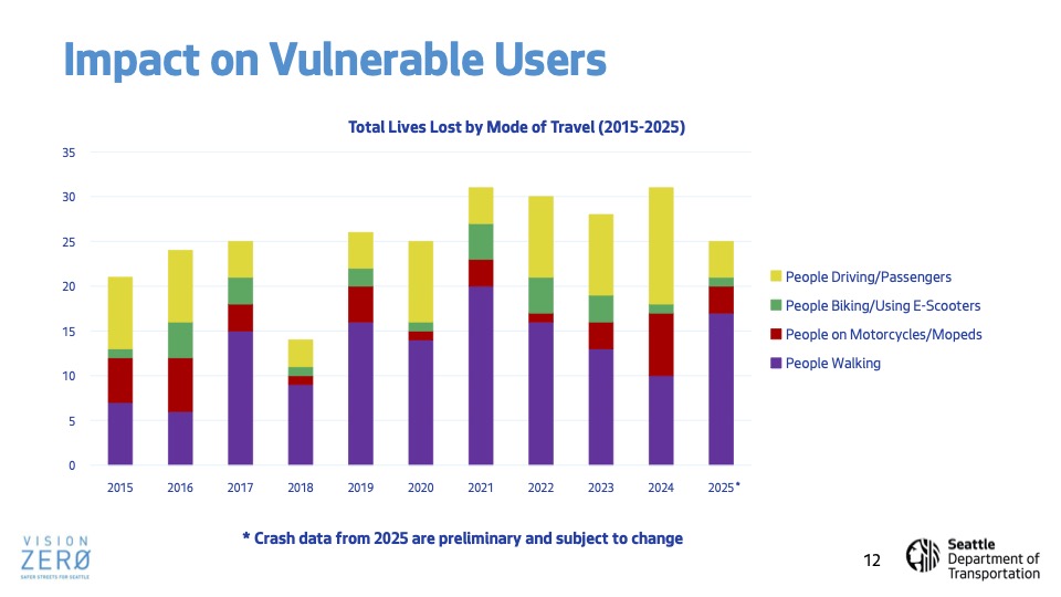
As previewed here, the newly expanded-in-scope committee chaired by District 1 City Councilmember Rob Saka got a general SDOT update during its first meeting of the year. The department’s new director Angela Brady was there for the meeeting of the Transportation, Waterfront, and Seattle Center Committee, but mostly to introduce chief transportation-safety officer Venu Nemani, who led most of the briefing. As shown in the slide deck presented during the meeting, 25 people were killed on Seattle streets last year, mostly people on foot:
In an attempt to reduce that, SDOT has continued expanding a variety of tactics:
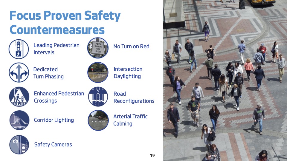
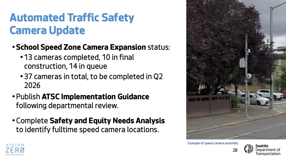
It’s added “no right turn on red” signage in more than 800 places, with fewer than 200 left to add, and is planning more “enhanced crossings” with marked crosswalks:
Speed cameras are still in the study mode, so don’t expect to see those soon.
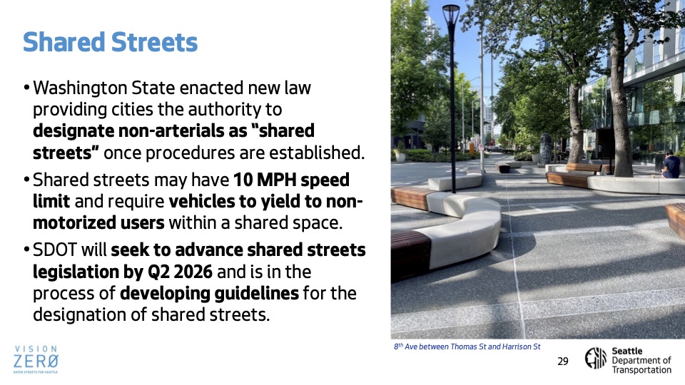
Also of note, the potential implementation of “shared streets,” which sound somewhat like Healthy Streets:
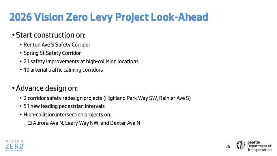
The presentation mentioned only one West Seattle-specific project, the plan to convert the outside downhill lane on Highland Park Way to a bike/foot path, described as in design this year:
(The project website hasn’t been updated since spring.) No votes at this meeting; it was just a briefing, but a window into where SDOT is focused right now.
As we reported last Tuesday, that’s a map of the blocks where SDOT plans “conceptual design” of potential new sidewalks and/or walkways, funded by the Seattle Transportation Levy. Full details are in this report, and SDOT is asking for feedback by tomorrow (Tuesday, January 20), so in case you didn’t have time last week, here’s your reminder. levysidewalks@seattle.gov is where to send your comments.
The Triangle Route has had some scheduling changes in recent weeks because of boat trouble around the Washington State Ferries system, and one more is ahead. Tomorrow (Monday, January 19), WSF says that “Due to the timing of boat moves, the route will be on the two-boat schedule with the Kittitas and Cathlamet.” But it’s expecting the Fauntleroy-Vashon-Southworth route to return to regular three-boat service as of Tuesday (January 20).
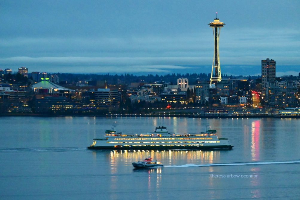 (Photo by Theresa Arbow-O’Connor – WSF and Kitsap Transit vessels on Elliott Bay)
Wednesday is the day for WSF’s next two systemwide community meetings, both to be held online, one at noon and one at 6 pm; we’ve published the announcement before, but here’s WSF’s reminder:
This is your chance to share feedback and ask us questions. Each meeting will start with a short presentation that looks back at 2025 and previews our 2026 service. We’ll cover topics including new vessel construction, terminal upgrades needed for charging vessels, our Service Contingency Plan, workforce development efforts, our budget, and what to expect in the 2026 Washington legislative session.
Both meetings will cover the same topics, and most of the time will be dedicated to answering questions. Registration is required. To learn more and register, visit our Community Participation webpage.
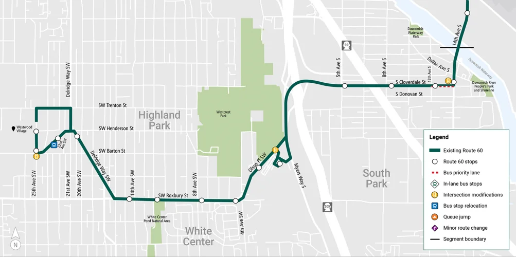
Metro is proposing changes affecting Route 60, which runs from Westwood Village to Capitol Hill via White Center, South Park, Georgetown, Beacon Hill, the International District, and First Hill. The changes could affect other transportation-corridor users, so you might be interested in offering feedback even if you’re not a bus rider. They’re asking for feedback via this survey, and detailing the proposals in four segments – here’s the summary of how the West Seattle (and vicinity) segment could change:
Segment 4: East Marginal Way & 16th Avenue South to Westwood Village (South Park, Westwood-Highland Park).
The East Marginal Way to Westwood Village segment includes portions of the South Park and Westwood-Highland Park neighborhoods. The route serves multiple community assets such as the Olson/Myers Park and Ride and Westwood Village.
Potential improvements to this segment may include:
-A new bus priority lane on Cloverdale Street approaching 14th Avenue South. This lane would help buses bypass long lines of traffic during morning and evening rush hours.
-Intersection improvements near the Olson Place and Myers Way Park and Ride to reduce travel time and improve bus reliability.
-Closure of the eastbound bus stop at Barton Place and 22nd Avenue Southwest. Removing this stop will help improve travel time and result in better stop spacing that aligns with Metro’s recommended guidelines.
All segments’ proposed changes are detailed here. Metro is asking for responses to its Route 60 survey by February 20.
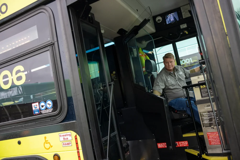
King County Metro is increasing service, and is now hiring for drivers to make sure they can keep up with an influx of tourists this summer and beyond. Part of the increase is for the World Cup, but there are longer-term increases in service too, including additional RapidRide lines. Metro plans to hire 375 part-time and 150 full-time drivers this year.
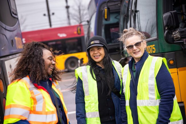 (King County Metro photo)
When hired, drivers go through up to 2 months of paid training, including getting the license that allows them to drive busses. There is also a bonus available and a starting wage of $31.39 after training.
The deadline for applications for part-time positions is next Friday, January 23rd. More information can be found on Metro’s website.
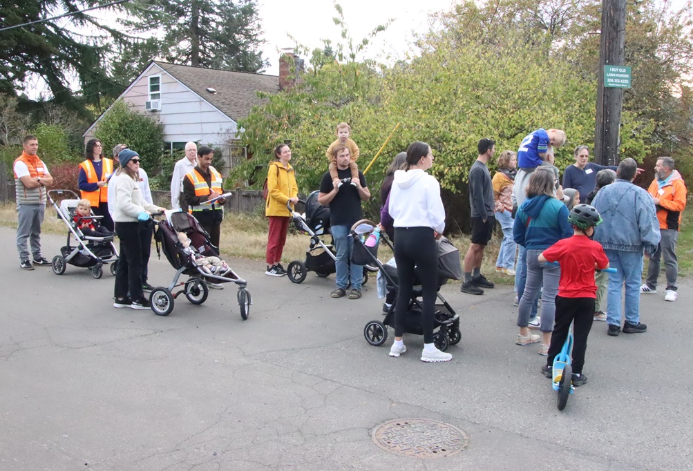
(October WSB photo)
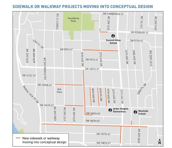
Three months after SDOT‘s Arbor Heights walking tour to talk about possibilities for new sidewalks/pathways (WSB coverage here), the department is out with its report on what it heard and what it plans to do. The report (see it here) includes this map showing blocks “moving into conceptual design” for potential new sidewalks/walkways:
The report was emailed with this brief note from SDOT:
After carefully considering and analyzing all input from the community, we have developed the draft design for the new sidewalks, walkways, and other related Arbor Heights neighborhood improvements. Please review the attached plan and let us know if you have comments by Tuesday, January 20.
The email didn’t include a specific address or survey link for feedback (we’re following up) but the program’s general feedback address is levysidewalks@seattle.gov – whichever blocks are chosen for new sidewalks/walkways, the funding will come from the voter-approved $1.5 billion, eight-year Seattle Transportation Levy, which included funding for 350 new blocks of sidewalks/walkways citywide.
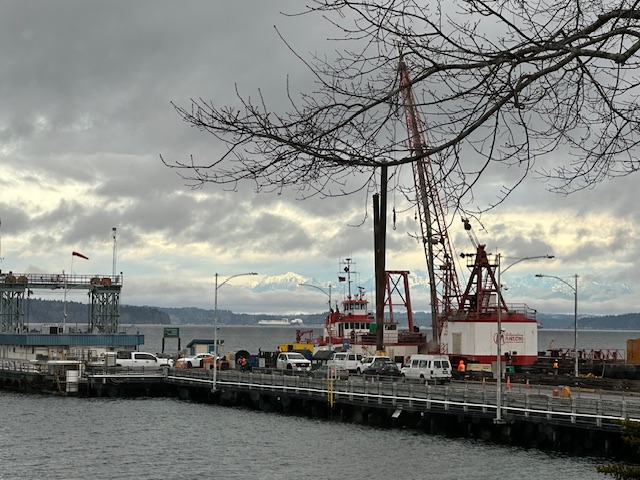
Thanks to the texter who sent that photo, wondering what’s up with the crane alongside the Fauntleroy ferry dock. We took the question to Washington State Ferries, and a spokesperson replied:
The crane at our Fauntleroy dock is part of a planned maintenance project at the terminal.
Manson Construction towed a derrick barge, a material barge, and a small tug to the site to begin repairs that started (today) and are expected to last about a week. The work includes driving two steel H-piles at the north and south edges of the timber trestle to replace deteriorated timber piles, adding structural steel, making repairs to the bridge seat and replacing damaged rub timbers along the south wingwall.
Most of the work won’t affect customers. However, there may be brief impacts when a new steel beam is installed, including possible single-lane vehicle loading on the transfer span or temporary vehicle weight limits.
We’ll keep a close watch on the work and coordinate with the contractor to limit any disruptions to service.
The old dock has to be kept in good working condition at least five more years; the current timeline for design and construction of its replacement is 2028-2031.
Checking the Washington State Ferries alert page to see if there’s been any change in the projection that Fauntleroy-Vashon-Southworth will be down to two boats until at least Tuesday, we see the system now has three boats out of service on Seattle (including West Seattle) routes: Seattle-Bainbridge is down to one boat because 28-year-old M/V Tacoma broke down; Seattle-Bremerton was already down to one boat because 52-year-old M/V Walla Walla is out of service; and Fauntleroy-Vashon-Southworth remains down to two boats because 46-year-old M/V Kittitas needs repairs. So if you’re planning to go just about anywhere via WSF any time soon, be aware they’re running on a much-reduced fleet right now – already below the number of vessels considered the desired baseline (currently 14 are in service per the real-time map). The alert page has links to the alternative schedules currently in use.
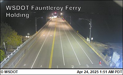
(‘Live’ image from WSF camera at Fauntleroy terminal)
In this morning’s traffic/transit/weather roundup, we mentioned that the Triangle Route was down to two ferries. WSF now says that’ll last at least until Tuesday:
The #1 vessel, Kittitas, is out of service due to necessary vessel maintenance. The route will be on two-boat service until further notice. Early this morning, Friday, Jan. 2, we discovered damage to an oil seal in the vessel engine room. We expect repairs to be completed early next week.
Fauntleroy/Vashon/Southworth service through Tuesday, Jan. 6:
Friday, Jan. 2: As of 11:20 a.m., we are now running the two-boat schedule with the #1 Cathlamet and #2 Sealth. Please expect some delays during this schedule change.
Saturday, Jan. 3 and Sunday, Jan. 4: Regular weekend two-boat schedule.
Monday, Jan. 5 and Tuesday, Jan. 6: Alternate weekday two-boat schedule.
 (Reader photo sent by CJ, December 14)
By Tracy Record
West Seattle Blog editor
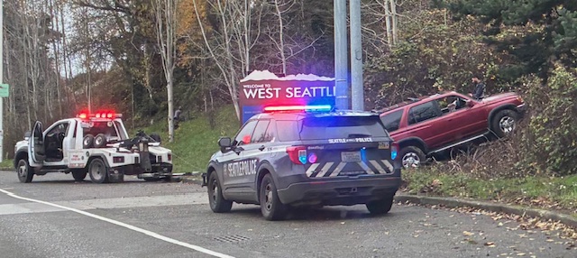
Is it the drivers’ fault or the pavement’s fault? The discussion reignites almost every time we report a crash toward the southwest end of the westbound West Seattle Bridge, in the general area of the pullout near the two remaining “Walking on Logs” sculptures and the “Welcome to West Seattle” sign. The “drivers’ fault” faction says people are just driving too fast. The “pavement’s fault” faction blames an inconsistency in the road surface right in that spot.
 (Reader photo sent by Mike, October 26)
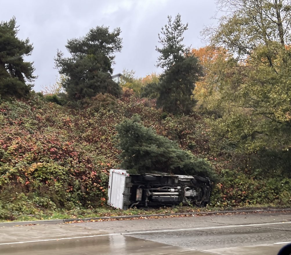
We don’t have hard-and-fast data on crashes at this location – the SDOT collision map is neither comprehensive nor (location-wise) precise, and our archives are not necessarily comprehensive either, nor is publicly visible data: The SFD 911 log will show a collision only if there was a dispatch for injuries, and the SPD police-data map if the crash was reported by a 911 caller. Plus, there’s no functioning traffic camera in that spot, so for visuals, we’re reliant on reader photos. But our archives alone show more than a dozen mentions of crashes in that spot just this year.
 (Reader photo, October 24)
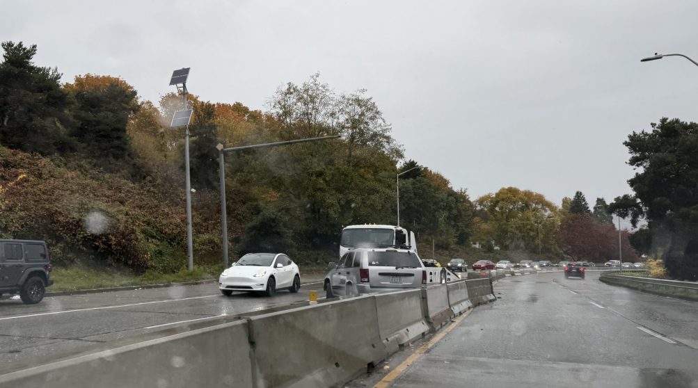
Back in February, we sought and reported on SDOT’s response to our inquiry about whether any action was planned regarding this area. A department spokesperson said at that time that they planned “to add safety enhancements to encourage drivers to approach the curve at a safer speed” and then might evaluate pavement work if that didn’t help. The timeline given was “this year.”
 (Reader photo, OMarch 24)
So now we’re at the end of “this year.” After more crashes in mid-December, we asked SDOT for an update. Here’s how they responded this time:
Based on recent crash activity and additional review, we will be installing two near-term safety enhancements to improve driver awareness of the curve:
-curve warning signs, and
-raised pavement markers to enhance visibility for approaching drivers.The work orders have been issued.
This represents a slight change from what was discussed earlier this year. While reflective markings on the existing guardrail were previously mentioned as a potential third treatment, that option is still under internal evaluation.
As we shared in February, our pavement engineers and Vision Zero team have also been evaluating longer-term solutions to improve traction in this area, including either grinding the top layer of pavement or installing a high-friction surface treatment. Those options remain under consideration and would need to be scheduled further out, taking into account resources, weather, crew availability, and traffic impacts.
We’ll continue to monitor conditions at this location and assess whether additional measures are recommended.
Some pavement work was done in that area during the 2020-2022 West Seattle Bridge closure, as we reported, and showed, in this story about a visit to the work zone toward the end of bridge-repair work.
 (Mid-December photo by Jerry Simmons)
One week into winter, Washington State Ferries will launch its winter schedule tomorrow. Here’s what WSF says will change:
Our winter sailing schedule starts Sunday, Dec. 28 and lasts through March 21, 2026. There will be schedule changes for two routes:
-The Seattle/Bremerton route will run a revised winter schedule due to terminal construction.
-The Fauntleroy/Vashon/Southworth route will switch to the two-boat weekend schedule used each winter.As a reminder, the Anacortes/San Juan Islands will continue with the fall schedule. This same schedule now runs in the fall, winter, and spring, moving the route to an improved, two-season schedule.
All other routes will operate on their regular winter schedule, available online now.
Looking ahead to New Year’s Eve, one week from Wednesday, Metro and various other transit agencies/services are going fare-free. Here’s the announcement:
King County Executive Girmay Zahilay announced today that Metro will join other regional transit agencies to provide free rides this New Year’s Eve, Dec. 31. Riders can travel without paying fares on King County Metro, Sound Transit, Community Transit, Everett Transit, Pierce Transit and the Seattle Streetcar as part of their holiday celebrations.
“Leaving the driving to us is becoming as great a New Year’s tradition as celebrating at the Space Needle,” said Executive Zahilay. “No matter where you plan to ring in the new year, you have access to free transit options to get you there!”
Regional transit agencies will operate on specific schedules to accommodate fare-free New Year’s Eve and riders are encouraged to check times beforehand.
The free Metro rides will continue until 3 am New Year’s morning. Details are here, including information on this week’s transit schedules too (as noted in our morning traffic roundup, Metro is on a Sunday schedule for Christmas Day and the Water Taxi won’t run that day).
 (File photo of M/V Kaleetan, by Gary Jones)
In Washington State Ferries‘ latest weekly update, WSF recapped that the Triangle Route, in its second week of 2-boat service, won’t be back to three boats “until another vessel is available.” That’s likely going to be a while, as one of its oldest boats, M/V Kaleetan (assigned currently to the San Juans), is undergoing emergency repairs that the weekly update says are likely to take until “late December.” As WSF boss Steve Nevey said in his own weekly update, “We need new boats.” The first of its next round of new boats isn’t expected to be ready until 2030. Meantime, WSF has set the date for its next online systemwide community meetings, which usually start with a variety of updates and then spend a significant amount of time on Q&A. They’ll have afternoon and evening versions of the same meeting on Wednesday, January 21: “WSF leaders will recap 2025, share updates on new boats and construction projects, and take questions from the public.” You can register for the noon meeting here, or the 6 pm meeting here. (Here’s our coverage of the most-recent one, back in October.)
| 3 COMMENTS