Story and photos by Jason Grotelueschen
Reporting for West Seattle Blog
If you live in or visit the Arbor Heights neighborhood, then you’ve undoubtedly noticed the limited number of sidewalks.
The $1.55 billion Seattle Transportation Levy (approved by voters last November) includes funding for the construction of 350 new sidewalk blocks in the city in the next eight years as part of the Sidewalk Development Program. Current plans call for 10-15 of those blocks to be built in Arbor Heights.
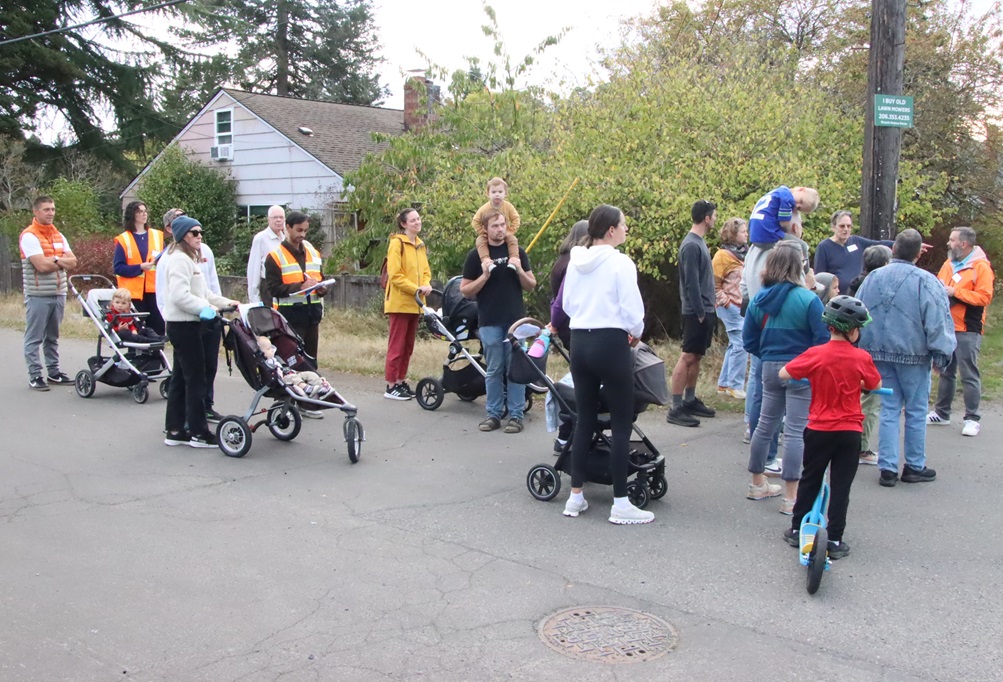
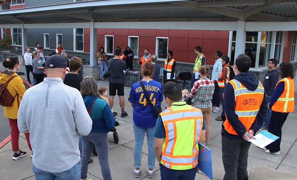
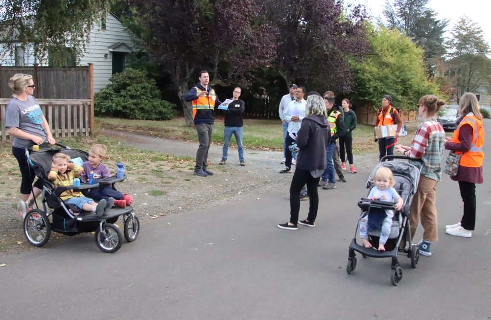
On Wednesday afternoon, neighbors of all ages met at Arbor Heights Elementary to embark on a walking tour led by representatives from the Seattle Department of Transportation (SDOT) to learn about sidewalk/walkway options, feasibility, opportunities and challenges, and to share feedback and perspectives with SDOT staff.
The event began at the school with a welcome and overview from SDOT staff, including deputy director of project development Brian Dougherty (speaking, below):
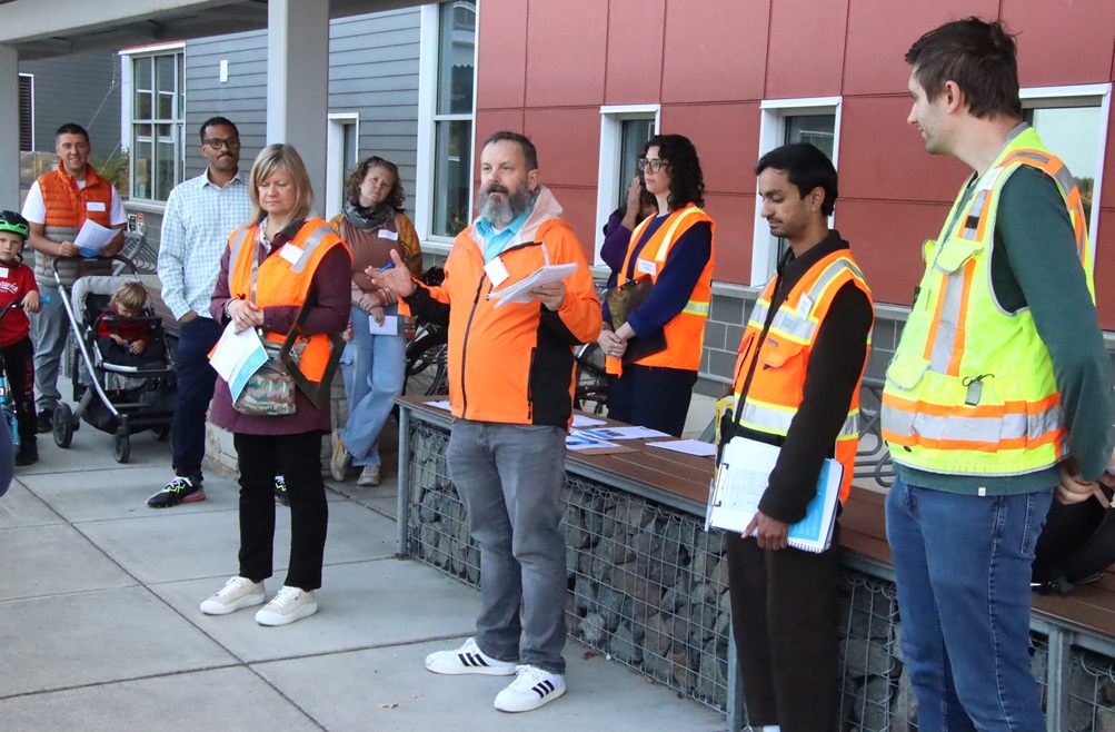
Dougherty and staff said the goal of the afternoon was to gather priorities for new sidewalks and walkability improvements funded by the transportation levy. Options for improvement include where to build sidewalks and walkways, plus related needs such as crosswalks, lighting, stop signs, and other traffic calming measures to improve accessibility and safety.
District 1 City Councilmember Rob Saka was also in attendance. He welcomed neighbors and thanked them for their participation, saying that the turnout was the largest crowd he’d seen at similar walks in the city:
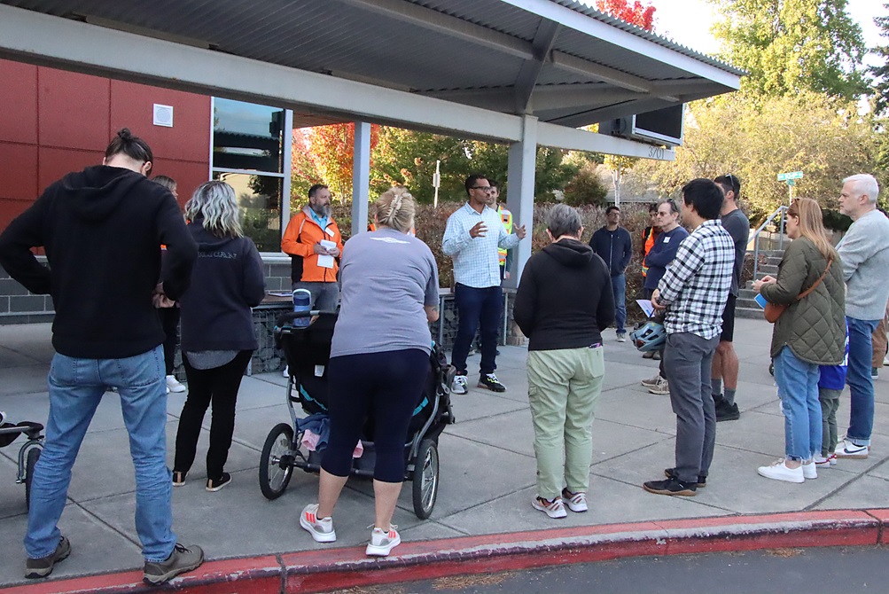
Saka chairs the council’s Transportation Committee, and cited the citywide sidewalk gaps: “27% of neighborhoods across this city do not have a sidewalk on either side of their street,” but he said that the current pace of adding sidewalks has been far too slow. Saka said that Mayor Bruce Harrell proposed a significant sidewalk investment in the transportation levy, and that Saka “doubled that amount during Council deliberations” about the levy. He emphasized gratitude to voters.
Saka said that at least 20-22% of new sidewalks in Seattle are designated for our district (West Seattle/South Park/Georgetown/Pioneer Square and vicinity), but based on criteria adopted in the Seattle Transportation Plan (such as Safe Routes to School, equity, and transit proximity), D1 may receive “even more than that minimum.”
Dougherty gave quick introductions of SDOT staff (wearing bright orange vests):
The team talked about how feedback will be gathered for the project during the walks, via printed comment cards as well as notes taken by SDOT staff. Some staff members also had measuring tape and other tools, and would be gathering information during the tour about width of streets and right-of-ways and other data points.
They also had requests for the community: If you were on the tour but have additional feedback, submit it here. If you were unable to join the tour but have questions or comments about the idea, take a look at the Sidewalk Development Program website to learn more, and contact the team at levysidewalks@seattle.gov or 206-900-8718.
SDOT staff will be merging community input with their own staff notes, to identify 10-15 priority blocks to work on for sidewalk plans, initiate preliminary designs, and then will publish a summary report describing the list of prioritized blocks “within one to two months.”
They also added that for any feedback they receive that isn’t directly related to sidewalks but is still of interest to the neighborhood (such as traffic calming), they will be compiling and routing those to the proper teams and personnel for consideration.
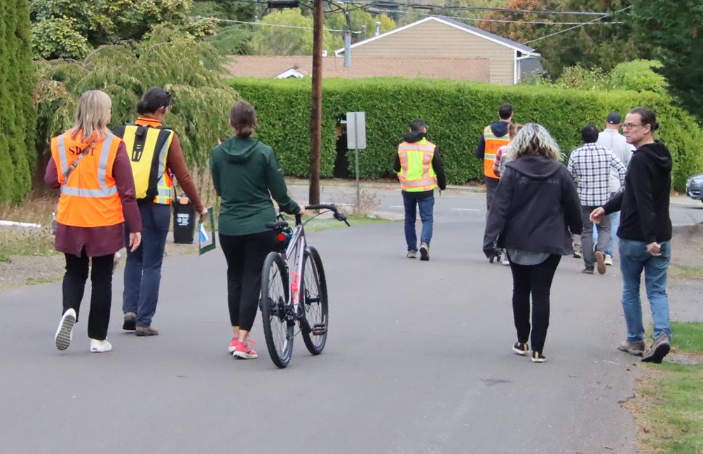
SDOT staff then asked attendees to divide into two smaller groups, to walk two different routes through the neighborhood:
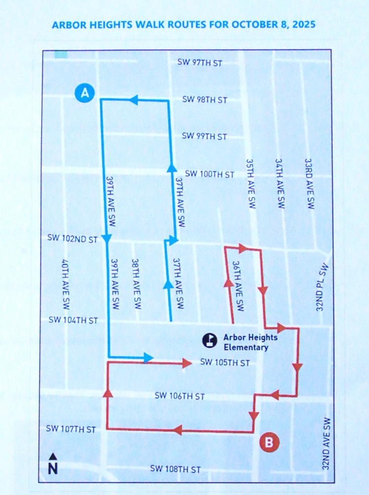
- Group A (led by Dougherty and other staff), heading north/northwest to SW 98th St and back, between 37th and 39th Ave SW.
- Group B (led by staff including Chris Kartheiser, who leads project development for new sidewalks), doing a loop east/south/southwest between SW 102nd and SW 107th, and 34th Ave SW and 39th Ave SW.
Staff emphasized that these were merely suggested routes, with flexibility to take detours based on resident requests, and they added that SDOT can return on later dates to assess additional locations, problem spots, bus-boarding areas on walkways, locations where asphalt walkways are being used for parking, and locations not reachable on this particular day for whatever reason (such as parked vehicles or construction). They also stressed that just because a block of Arbor Heights wasn’t included the tour’s walking routes doesn’t mean that it wouldn’t be under consideration for sidewalks/walkways — they chose the walking routes based on initial assessments and feedback, but are open to all ideas for all areas.
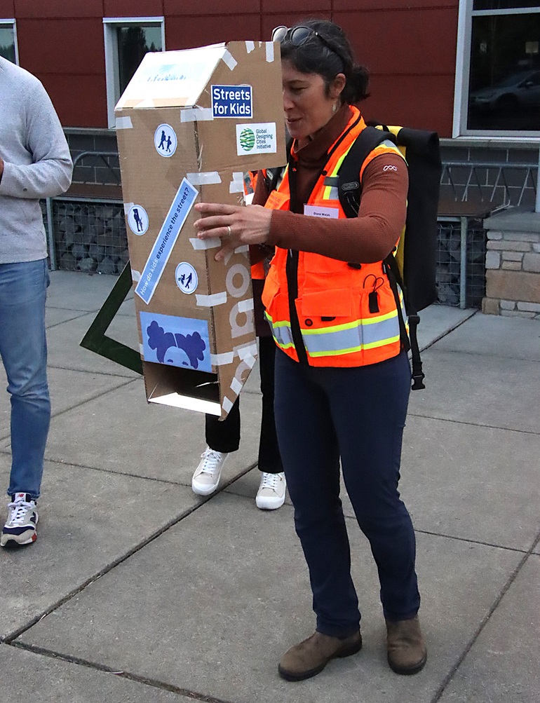
Each of the groups then gathered and went on their way. We started by tagging along with “Group B,” but before they departed, SDOT’s Diane Walsh, who works with the School Streets and Safe Routes to School programs, did a quick demonstration of tools that the team uses to capture on-site feedback, including a modified “periscope” allowing adults to get the perspective of young kids walking in the neighborhood and trying to navigate streets safely:
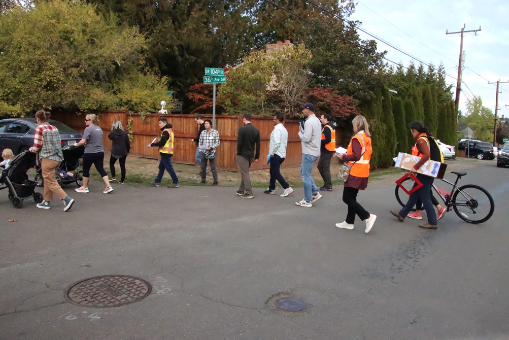
With that, Group B (which included Saka) was off and running (well, mostly walking, or on wheels) starting by taking 36th Ave north to SW 102nd St before looping east/south on 35th and 34th:
Kartheiser paused at various spots to talk about the city’s process for assessing the need and feasibility for walkways, including the factors that go into determining priorities:
He said there are a range of treatments used citywide including traditional concrete curb-and-gutter sidewalks, at-grade asphalt walkways, gravel shoulders, painted walking lanes, and in some places no formal walkway. The actual design choices implemented in each area depend on site conditions (e.g., steep drop-offs, drainage).
Some notes from Q&A between Kartheiser and the “Group B” walkers:
- Approach based on current levy funding: Kartheiser said that with current funding levels, a typical/likely approach for a block in an area like Arbor Heights would be that a walkway would be constructed on one side of the street, while the opposite side would remain gravel with existing maintenance conditions.
- Asphalt walkways being mistaken for parking: Residents reported drivers parking on at-grade asphalt walkways and suggested white striping to signal “don’t park there.” SDOT will assess locations during the walk and consider upgrades such as wheel stops or tree planting to “deter encroachment.”
- Bus boarding on walkways: A resident said Metro described some asphalt areas as “not being a sidewalk,” leading buses to pull onto it for boarding, which is a safety issue for anyone using the area just to walk/stand. Kartheiser said they would definitely look at the specific locations to evaluate improvements and prevent bus operations on walkways.
- Stop signs and traffic calming: Neighbors cited intersections with unclear or confusing right-of-way. Kartheiser said that SDOT has staff dedicated to traffic calming and signage, and that during today’s tours, staff would be capturing feedback from neighbors and sending it to those teams (for stop signs, speed humps, and related safety treatments).
- Parking and stormwater trade-offs: A resident noted (and others agreed) that adding sidewalks, while generally a very positive thing, does come with tradeoffs to consider: Adding new impervious surfaces can add/change stormwater drainage patterns, and can create a loss of on-street parking where homes lack driveways or have multiple cars, for example.
- Gaps near “jurisdictional edges”: A resident referenced sidewalk gaps around 30th Avenue, where the opposite side is in unincorporated King County (not Seattle), and there isn’t “connectivity” between the areas.
- “Seattle Streets Illustrated” guidance: Kartheiser reference the design and planning guidance that is part of Seattle Streets Illustrated, which serves as a “right-of-way improvements manual” that the city uses as a standard. It helps define and explain right-of-way constraints, material choices (such as asphalt vs. concrete), use of wheel stops vs. curbs, maintenance considerations, and examples of similar treatments. The section of the guide that’s specific to sidewalks is here.
- Kartheiser referenced the “six and six” standard, which essentially calls for (between the street and the residential/business property) a 6-foot width of pedestrian walkway, and a 6-foot width for landscaping and “furniture” (like benches or seating)
- Many of the standards are based on a 60-foot width of the right-of-way; for narrower streets (e.g. a right-of-way of 40 feet) or streets where standards can’t be met for various reasons, then a “deviations process” is used, and things get removed from consideration, which can include things like parking lanes.
- For non-arterials: Often, “wheel stops” are used as curb substitutes, with an asphalt walkway. Wheel stops are only installed into asphalt; not installed into gravel due to maintenance problems (such as sagging, and water erosion). SDOT had tried putting wheel stops into gravel in the past, but it did not perform well. Installation approaches include: Adding about a foot of asphalt to place wheel stops, or placing them within the existing roadway; and the new walkway would be asphalt.
- For arterials: This can be where traditional concrete “curb and gutter” sidewalks are an option.
- Material choice: Asphalt is used for almost all neighborhood yield walkways, unless part of the block already has a concrete sidewalk, in which case SDOT tries to match the concrete.
As Group B headed toward 35th, we hustled northwest to catch up with “Group A” on their walk, as they proceeded north on 37th, crossing the busy 100th St (which does have sidewalks in some stretches, unlike other areas of Arbor Heights, and serves a conduit for school buses and for Metro bus route 21/22).
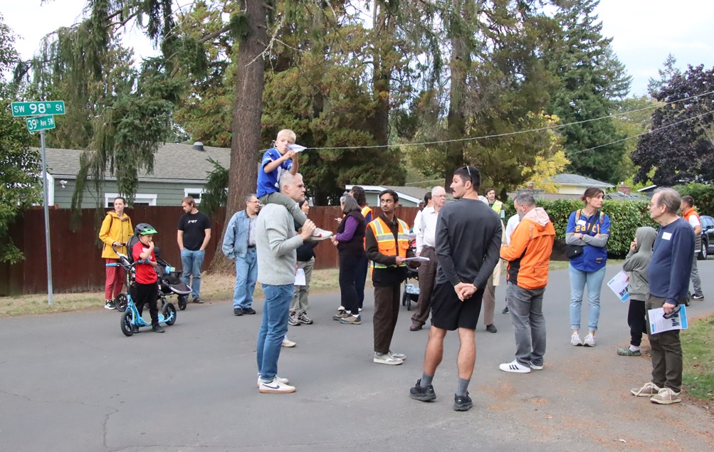
Group A made its way northwest to the intersection of 39th Ave SW and SW 98th St, before looping back south:
Some notes from discussions between Dougherty and other SDOT staff and neighbors on the Group B leg of the tour:
- Observed safety and accessibility issues: In some areas, bus stops on one side of the street are inaccessible. Parked cars force people to walk into the street to get around them; and of course the street is busy. In some areas, shrubs and landscaping are not kept trimmed, making the sidewalk “barely passable” (and in some cases, as noted by one neighbor, prone to create an environment for inadvertently walking through huge spider webs!)
- Funding priorities and opinions: One participant shared his view that if limited funding requires making choices for which walkways and areas to prioritize, he would prefer to “add more new stuff” rather than putting a lot of money toward maintenance of existing areas, considering most of the current areas to be “functional enough to keep people out of the road.” Other residents agreed, but some were concerned that some areas would start to deteriorate (or already are), but there was consensus acknowledgment that the area still does need to improve.
- Traffic patterns: Residents said that car traffic on the east-west through streets “feel fast and uncomfortable for walking.” For the north-south avenues, there was agreement that 39th is a key walking and bus route, and discussed design trade-offs among sidewalks, trees, parking, and lane configuration.
- East-west through streets carry more/faster traffic than north–south avenues, making them less comfortable for walking.
- 98th St: Has narrow pavement, drivers move fast, especially during peak commute/school times. Some walkers divert to 100th to avoid 98th at peak times.
- 100th and 102nd streets stay busy all the time because they go through. For 100th St in particular, there was discussion among participants about whether street parking should be allowed at all, given the fact that it’s major bus route with lots of pedestrian traffic but also fast-moving car traffic.
- 99th St: Traffic lighter because it dead-ends at the bottom.
- One neighbor wondered if putting sidewalks on any north-south avenues would be much of a “win,” because neighbors and kids have adapted to current conditions, and making lots of changes could have unintended consequences.
- Traffic circles vs. stop signs: Residents said small neighborhood traffic circles “don’t really do anything” to slow drivers; people cut them (taking a 90-degree turn rather than going around) and sometimes leave junk/freebie items there, which isn’t good for visibility. Several residents indicated a strong preference for stop signs because they clearly indicate the right-of-way.
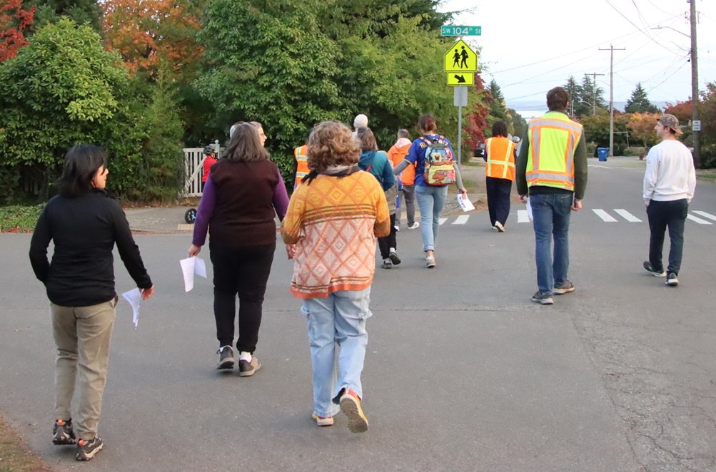
- Crossings and bus stops: One resident suggested a crosswalk at 39th and 100th; lots of crossing there especially involving school kids and families, a bus stop on the corner, and it’s “a bit of a blind corner.” The existing crosswalk across 100th is further away but “doesn’t match where most people cross.” At that same intersection, it was mentioned that bus stop upgrades could be helpful, similar to improvements that were made at 37th and 100th, perhaps even included a shelter area. Other residents felt that 100th had become too car-centric for a neighborhood like this; it has some sidewalks but not enough, and adding a lot more crosswalks (every other street) would improve walkability, but others said that 100th is still an important traffic/bus conduit and has to be treated as such.
- Sidewalk feasibility: Dougherty asked participants “which side should we build on?” as the group made some stops while walking south on 39th Ave. Preference was voiced for the “school side” (east) so children have one fewer street to cross. Dougherty reiterated the city standard: 6-foot wide sidewalk + 6-foot wide planting strip + parking at the curb (can narrow the sidewalk to about 4 feet in constrained spots to work around trees/obstacles).
- Obstructions/utilities/trees: Stumps can be removed (even if they’re large); and larger trees can usually be worked around and accommodated, when building walkways. The city definitely wants to plant new trees on planting strips as part of these projects (planters/trees can provide “visual pressure” that calms traffic when sidewalks aren’t feasible). Trees visually narrow the street and reduce speeds; however, some worry added street trees could crowd existing front-yard trees, creating a “double row. Residents noted the corridor already has many mature trees and shade; some felt functionality (safe walking space) should take precedence where space is limited. Power poles also need to be accommodated.
- Parking and lane configuration trade-offs: In the area, parallel parking on both sides is common; RV parking occurs in places. Dougherty asked about “one-lane versus two-lane” operations: if sidewalks and planting strips are added, then it narrows the street and (in some cases) creates narrow streets where it’s more difficult for two cars to pass each other going in opposite directions — he and other SDOT staff noted that, while sometimes inconvenient to have “pull over and let the other car pass” situations, it does become a means of effective speed reduction (staff noted that such streets typically keep speeds under ~20 mph). Tour participants had varying opinions on this, ranging from “yes, it’s worth it to slow traffic” to “I hate those narrow streets where only one car can pass; we should never do that here.” There were also concerns that restricting to one lane could shift traffic to adjacent streets during busy school hours. Dougherty said that in some cases the sidewalk or planting strip can be narrowed from the 6-foot standard, to avoid making the streets too narrow, and that we can retain two-way travel by removing parking on one side (keep trees and sidewalk on the school side).
- School considerations: One resident suggested that SDOT staff should consider coming back to observe traffic and walking conditions during school drop-off/pick-up times, and consider a school-focused outreach event for parents and students.
- Additional next steps and proposed actions: SDOT staff will measure street widths precisely to define what’s feasible in terms of making changes, and will develop sidewalk/walkway concepts for the area. On the “school side” (the east side, for north-south avenues) they could lean toward implementing standard 6’+6′ sections where possible. SDOT will compare options: one-lane with traffic calming vs. two-lane with reduced/omitted planting strip vs. removing parking on one side. Where sidewalks are not immediately feasible, teams can use planters/streetscape elements to visually narrow the roadway and calm speeds.
| 17 COMMENTS