West Seattle, Washington
19 Friday
Thanks for the photos!

Ann Adachi‘s image of the pre-sunset rainbow is the most vivid one we received. … Earlier in the day, before those glimpses of blue sky, clouds presided over a low-low tide:

Thanks to Lynn Hall for that view over Duwamish Head. Tomorrow’s low-low tide will be out to -2.0 feet, almost as low as today, at 2:19 pm. If you can’t get out to beachwalk until Saturday, it’ll be -1.4 feet at 3:07 pm. And all this is just a warmup for next month’s low-low tides – including -3.2 feet at 12:24 pm on May 9.

In case you missed it: For a while this afternoon, snow had the upper hand in the “wintry mix” that swept through. Gill Loring‘s photo above is from White Center; we saw it while traveling from North Admiral to south Gatewood. The clouds that brought it were quite dramatic, as Jason Grotelueschen‘s photo from The Junction shows:

More “wintry mix” (aka rain/snow) is in the forecast all the way through Tuesday, with highs continuing in the mid-40s (below the seasonal norms, which would be low 50s). Spring is only 17 days away!
 TUESDAY NIGHT: Get ready for another round of wind. Early Wednesday morning – 4 am, to be specific – a Wind Advisory alert from the National Weather Service takes effect, lasting until 7 pm. The NWS says we can expect “south winds 25 to 35 mph, with gusts up to 45 mph.” It’ll be raining, too – likely heavy rain at times – so things could get very sloppy. Thanks in advance for sharing any news of trouble in your neighborhood – once you’re sure the authorities know, text us if you can, 206-293-6302 – thank you! (Alert map from weather.gov)
WEDNESDAY NOTE: The alert has been extended until 11 tonight.

4:15 PM: Thanks to the texter who sent that photo from Arbor Heights. We’re getting an icy rain mix right now in Upper Fauntleroy – a variant of the “wintry mix” that’s been in the forecast – and getting reports from other areas too.

4:35 PM: Also from Arbor Heights, an even-more-wintry photo via text. Be careful if you have to head out soon, as streets and sidewalks are coated in areas. But it’s already clearing to the west, so this wave might not last too long.

4:50 PM: And White Center has a white coating too. Here in Upper Fauntleroy, the sun is breaking through – mixed with light snow.
5:30 PM: See the comments for some traffic trouble in Arbor Heights. Meantime, radar shows a stretch of clear sky, but it could get below freezing tonight, and the now-wet roads could turn to ice. There’s a possibility of more “mix” overnight, too.

4 PM: Thanks for the tip. On this blustery afternoon, a fallen tree/branch is blamed for that 46-customer power outage southeast of Westwood Village. The reader who texted us says, “We heard a loud boom and then everything went dead.” No other outages reported in West Seattle so far today.
5:31 PM: Our tipster tells us the power was restored around 5.

No sunset colors tonight, so let’s admire the sunrise! Thanks to everyone who sent photos of today’s early-morning show. Above, that’s from Liz; below, from Jerry Simmons:

And a panoramic view from James Tilley:

Though winter still has a month remaining – spring equinox is March 19 – before it’s done, we’ll be in Daylight Saving Time, which returns three weeks from tonight – 2 am Sunday, March 10.
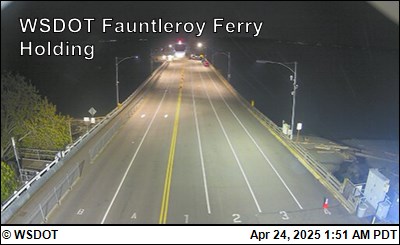
(View from West Seattle’s highest-elevation traffic camera)
6:00 AM: Good morning! It’s Thursday, February 15, and we got some surprise snow – not just a “wintry mix” – in the very-early morning hours. Not enough to cause major problems (on this side of the Sound, anyway), but be aware you might have to navigate some slush on the roads, sidewalks, and paths.
WEATHER + SUNRISE/SUNSET TIMES
Could see a bit more snow this morning, says today’s forecast, but by later this morning it’s expected to be all rain, heading for a high in the mid-40s. Today’s sunrise will be at 7:15 am, sunset at 5:32 pm.
TRANSIT NOTES
Metro today – Regular schedule so far; check advisories here.
Water Taxi today – Regular schedule. Check the real-time map if you need to see where the boat is. **Holiday note – Both Water Taxi routes are out of service on Presidents Day next Monday (February 19).
Washington State Ferries today – If you sail to Southworth, be aware that Kitsap County got more snow, and is dealing with the results. As for the ferries themselves, though, we have the usual 2 boats on the Triangle Route. Check WSF alerts for changes, and use the real-time map to see where your ferry is.
SPOTLIGHT TRAFFIC CAMERAS
Delridge cameras: Besides the one below (Delridge/Orchard), cameras are also at Delridge/Genesee, Delridge/Juneau, Delridge/Henderson, and Delridge/Oregon.
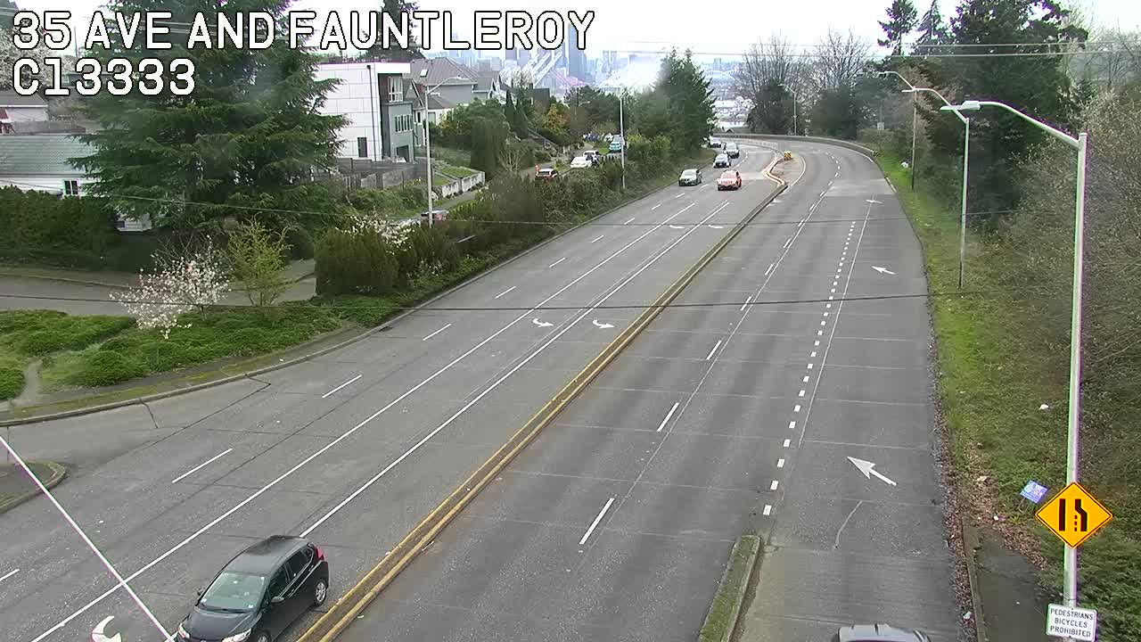
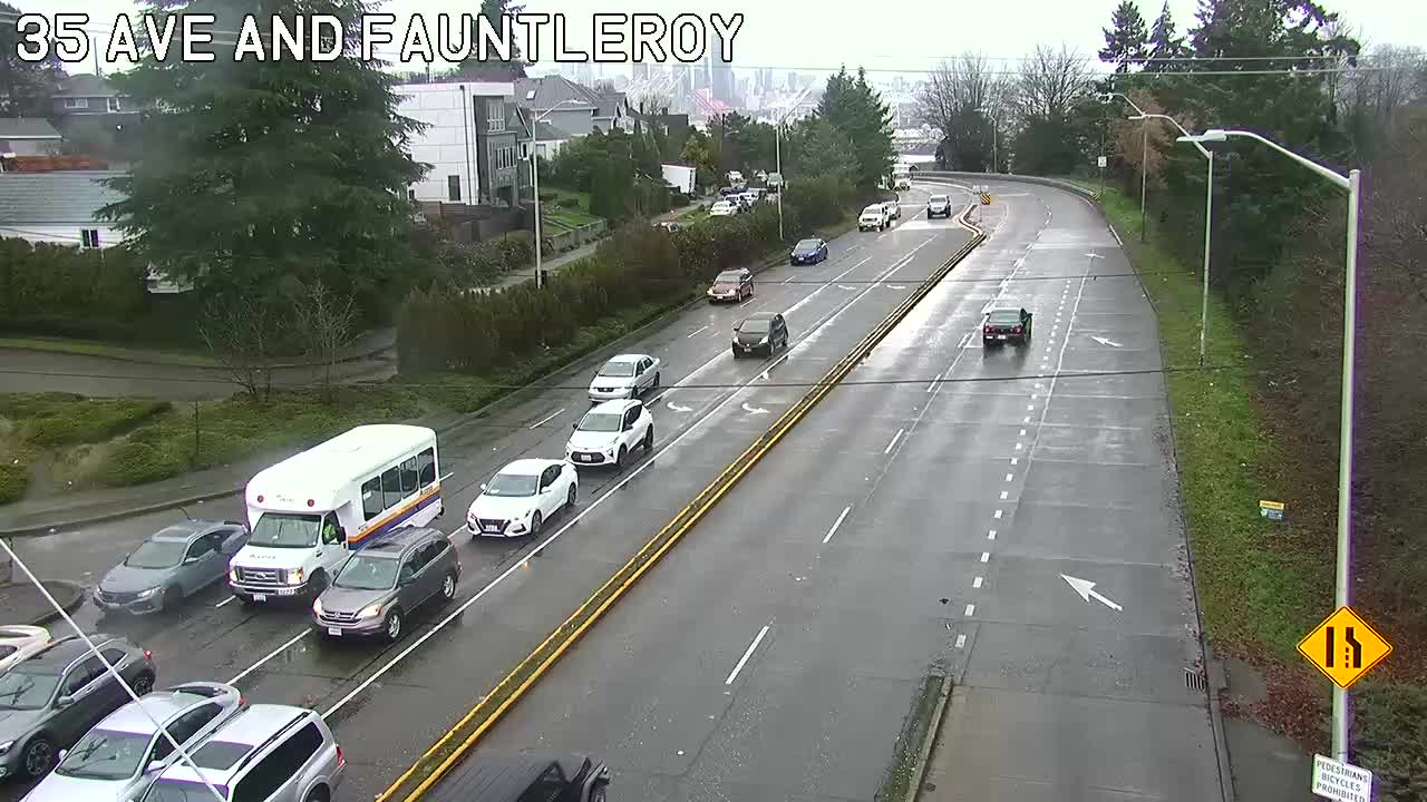
High Bridge – the main camera:
High Bridge – the view from its southwest end (when SDOT points the 35th/Avalon/Fauntleroy camera that way):
Low Bridge:
1st Ave. S. Bridge:
Highway 99: – northbound side at Lander:

MORE TRAFFIC CAMS: All functioning traffic cams citywide are here; West Seattle and vicinity-relevant cameras are on this WSB page.
BRIDGE INFO: The @SDOTBridges feed on X (ex-Twitter) shows whether the city’s movable bridges are opening for vessel traffic.
If you see a problem on the bridges/streets/paths/water, please text or call us (when you can do that safely, and after you’ve reported to authorities if they’re not already on scene). Thank you!
12:40 AM: Just got a text that it’s snowing in Highland Park; looked out the window here in Upper Fauntleroy and there’s a dusting on the ground and parked vehicles. Anybody else?

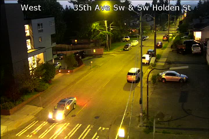
12:47 AM: The traffic camera at 35th/Holden isn’t far from the highest point in the city (35th/Myrtle), and it’s definitely snowy. But we’ve seen some in the streetlights on the Admiral and Junction cameras, too.
12:57 AM: Now the 35th/Holden camera shows it’s sticking on the road.
1:16 AM: 16th/Roxbury too:

Still no weather advisory … snow was considered more likely on the west side of the Sound and to the south.
1:51 AM: From Mel in Highland Park:

And the streets are even coated in The Junction:

2:29 AM: The snowfall’s much lighter now. Meantime, here’s the view at 35th/Roxbury just a moment ago:

2:55 AM: SDOT‘s winter-weather response map shows some crews out, though none in our area so far. So far the forecast hasn’t changed from “rain/snow mix,” so hard to tell how long this is expected to last.
 (Yard view, Upper Fauntleroy)
If you have any problems, changes, cancellations to report, please text or call us at 206-293-6302.
5:31 AM: Back at the keyboard after a couple hours away. Roads look mostly bare and wet – some slush on the 35th/Holden camera – but so far no major problems announced. We’ll launch the morning traffic/weather coverage at 6 am as usual.
One more West Seattle site still cleaning up after damage done in our freezing weather a week-plus ago: The Salvation Army‘s free playspace (Mondays, Wednesdays, Fridays, 3-5 pm) is canceled this week for pipe repairs that affected the South Delridge center’s “small gym.” They’re expecting to be able to offer the drop-in time for toddlers and caregivers again starting next Monday; we’ve updating our calendar’s standing listing (and today’s event list) to reflect.

Thanks to the texter who sent that photo of icy Seola Pond, perhaps one of the last such scenes we’ll see until and unless extra-cold weather returns. Tonight, rain is back, with a Winter Weather Advisory in effect until 1 am because it might be icy for a while before changing to just plain rain.
 (Photo by Gill Loring – Seattle Public Utilities crew on 21st SW just south of SW 98th today)
Emergency crews were still busy throughout the day dealing with pipe problems (such as the trouble that had Madison Middle School in online learning today, though in-person classes are expected to resume tomorrow). This afternoon’s high was 36, this morning’s low 26 (both 12 degrees cooler than what the National Weather Service describes as “normal.” Tomorrow’s forecast says we might reach the low 40s and are expected to stay above freezing overnight!

8:32 AM: Just in – Madison Middle School‘s principal has messaged families to announce that the school is going remote today because of a pipe problem. Here’s the message parents forwarded to us:
Overnight, a pipe burst in our building. Fortunately, the district facilities team is working to clean up the water and fix the pipe.
Because of this work, we will transition to remote learning today, January 16, with students at home engaged in remote learning.
Your student should have brought home their device last week. Please have your student sign in to their school accounts to look for updates and resources from their teacher or school staff.
Student Meals: families may pick up a sack meal at the school today from 10 a.m. until noon.
I will follow up with families as more information becomes available.
The message was timestamped less than an hour before the scheduled start of classes. We’re checking with the district to see when the problem was found and how extensive it is/was.
9 AM: Commenters say Madison families have just received another text saying that remote classes will start two hours late.
3:53 PM: The SPS media office says they won’t have answers to our questions, such as when the break happened, where, and how much damage was don, before tomorrow. They do say they expect word this afternoon on whether in-person classes will resume tomorrow.
5:30 PM: According to the SPS media office, in-person classes will resume tomorrow (Wednesday, January 17).
WEDNESDAY UPDATE: A district spokesperson responded today to our questions about when the break happened, where, and how much damage: “We can’t be sure when it actually broke, but it was found Tuesday morning. It broke in the ceiling above Classroom L221. There are 6 classrooms, an office, some mechanical spaces and a hallway impacted. Carpet, floor tile, walls and ceiling all got wet. There were also some books and other teaching materials that were damaged.”
7:01 AM: Emergency response at Delridge/Juneau.
7:48 AM: Most of that response has cleared; no traffic effects. Meantime, a Seattle Fire truck has responded to a bus shelter at 35th/Avalon (which side of 35th, we don’t know) for what’s described as a small “rubbish fire.”
7:59 AM: A rider tells us the fire was on the east side of 35th and that it was a “pretty good-sized fire,” with the burning materials including cardboard. SFD put it out quickly, though, and has already closed the call.
Earlier:
6:00 AM: Good morning. It’s Tuesday, January 16th. Schools and government offices are open again after the holiday, and we should be done with below-freezing temperatures, for now, later today – but beware of icy patches again this morning.
WEATHER + SUNRISE/SUNSET TIMES
After another night in the 20s, the forecast says we’ll get back into the mid-to-upper 30s, with increasing clouds, and possibly a rain/snow mix later. Today’s sunrise will be at 7:52 am, sunset at 4:46 pm.
TRANSIT NOTES
Water Taxi today – Back to regular schedule. Check the real-time map if you’re wondering where the boat is.
Metro today – Regular schedule; check advisories here.
Washington State Ferries today – 2-boat service on the Triangle Route. Check alerts for changes, and use the real-time map to see where your ferry is.
SPOTLIGHT TRAFFIC CAMERAS
(The video options on SDOT‘s camera map are working again.)
Delridge cameras: Besides the one below (Delridge/Orchard), cameras are also at Delridge/Genesee, Delridge/Juneau, Delridge/Henderson, and Delridge/Oregon.
High Bridge – the main camera:
High Bridge – the view from its southwest end (unless SDOT points the 35th/Avalon/Fauntleroy camera elsewhere):
Low Bridge:
1st Ave. S. Bridge:
Highway 99: – northbound side at Lander:
MORE TRAFFIC CAMS: See all working traffic cams citywide here; West Seattle and vicinity-relevant cameras are on this WSB page.
BRIDGE INFO: The @SDOTBridges feed on X (ex-Twitter) shows whether the city’s movable bridges are opening for vessel traffic.
If you see a problem on the bridges/streets/paths/water, please text or call us (when you can do that safely, and after you’ve reported to authorities if applicable). Thank you!
 (Photo by Stephen Nielsen, from Lowman Beach)
According to the National Weather Service, tonight’s painted-sky sunset ushered in our final below-freezing night – until the next time Arctic air gets this far south. But until there’s been some time to thaw, be careful on the streets and sidewalks – we noticed numerous ice patches while out this afternoon. Ice was even plaguing this hummingbird, photographed by Ashley B. Harrison as it tried to scratch an icicle off the underside of its beak:

Tomorrow is expected to start clear enough that we might get one more look at mountain views like these before the clouds start taking over:
 (This photo and next, by James Bratsanos, from Alki)

There’s still talk in the forecast of some snow or freezing rain mixed in with regular rain starting tomorrow night, but the NWS’s forecast discussion warns that’s not a sure thing. Meantime – today’s high was 38, low 21, respectively 10 and 17 degrees below normal for this date.
 (Photo by Michael Burke, from Fauntlee Hills)
Good morning. It’s Monday, January 15th, Martin Luther King Jr. Day – here’s info for this holiday:
WEATHER
Today we might see a high temperature above freezing. *The forecast is for sunshine and a high in the low-to-mid-30s.
TRANSPORTATION
(SDOT’s West Seattle Bridge camera)
*Metro: Regular weekday schedule
*No Water Taxi
*Fauntleroy-Vashon-Southworth state ferry route on usual 2-boat schedule – check for alerts here
*Here’s the service plan for Sound Transit
*Free parking today in areas of the city with on-street paid parking
*See citywide traffic cams here, West Seattle-relevant cams here
OTHER SERVICES/FACILITIES
*Schools and most government offices are closed
*No USPS services except Priority Mail Express
*Banking holiday
*Libraries are closed
*Most Seattle Parks facilities are closed
*Solid-waste service in our area remains on a normal schedule this week (some parts of the city served by a different contractor have changes, but NOT West Seattle)
HAPPENING TODAY/TONIGHT
*See the list on our West Seattle Event Calendar.
Got news? Text us at 206-293-6302,or email westseattleblog@gmail.com if non-urgent – thank you!

5:06 PM: We did get into the 30s today – but the temperature’s below freezing again already, and that’s still causing trouble. Thanks to the readers who’ve reported weather-related problems – for example, the sign up on the door at Spud Fish and Chips on Alki, closed because of broken pipes. We’ve also heard from a reader who reports:
We live on 35th between Brandon and Findlay. There seems to be some kind of water leak nearer Findlay that is running down the street and is now just a sheet of ice.
We pointed them to Seattle Public Utilities (206-386-1800). More weather notes to come.

6:25 PM: Though the weather was very cold, the views were beautiful again today. Above, Lynn Hall‘s photo of the Olympics early this morning; below, Kanit Cottrell‘s photo of the sunset colors and moon at day’s end:

We’ve also received yet another report of pipe trouble – a reader who says an apartment building in the Fairmount Park area is dealing with flooding after a break. And SPU’s water-outage map shows emergency repairs are under way in the 7700 block of 20th SW, with an outage affecting more than 70 homes. (The map also says the situation on 55th SW reported here last night was repaired by 12:30 am.) Today’s official high was 31, official low 19; normal would be 48/38.
7:30 PM: A commenter reports service has been restored in the 7700 block of 20th SW. A new problem has popped up – a reader emailed to say that water is flowing from the northwest corner of California/Juneau (former fitness studio) and down the street, so beware of possible road ice in that area.
Puget Sound Energy provides natural-gas service in our area (and electricity in many other areas outside Seattle). If you’re a customer, you probably got an email alert tonight, requesting conservation and saying in part:
This evening, we’re asking customers to set their thermostats at a lower setting and limit the use of hot water, such as dishwashing or clothes washing, dryers and other appliances.
What the notice didn’t mention is that a major gas-storage facility operated by PSE suffered an outage earlier today – Jackson Prairie Underground Natural Gas Storage Facility in Lewis County. After seeing this report, and a PSE quote here, we contacted the utility and received the same statement:
Jackson Prairie went offline around 2 p.m. today. It has steadily been coming back on since then.
Puget Sound Energy is asking customers to conserve natural gas and electricity use through the evening hours. Due to the extreme cold temperatures facing our area, regional utilities are experiencing higher energy use than forecasted, and we need to reduce strain on the grid.
PSE has not yet commented on what caused the facility to go offline.
 (Photo by Jerry Simmons)
4:14 PM: The snow-covered Olympics have shown themselves today, bringing in some pretty pictures to go with this update on our continuing colder-than-normal weather. Some good news this afternoon – the National Weather Service‘s newest forecast suggests it will NOT drop into the teens again tonight; the temperature is expected to stay about where it is now, the low 20s, before “warming” into the low 30s tomorrow.
 (Anonymously submitted reader photo)
Monday and Tuesday are expected to have highs in the mid-30, and a rain/snow mix is possible Tuesday and Wednesday. Meantime, no reports of major problems in West Seattle related to the mid-teens temperatures early this morning, though we did hear from someone whose pipes froze. That’s also been a problem today for Washington State Ferries, with a source telling us both terminals and boats have had trouble with frozen pipes; the official WSF alerts show the restrooms out of service at Vashon Island as a result.
4:20 PM: Moments after publishing this, we heard police report in to dispatch that SPU needs to be contacted about what appears to be a break beneath the 3800 block of 55th SW.
6:03 PM: Thanks to commenter SJ for posting the photo of what’s happening there:

Meanwhile, the day ended with a scenic sunset:

Thanks to Brooke Gosztola for that photo!
7 PM: Thanks to the texter who sent an update on the 55th SW water problem – and this photo:

As the sign shows, there’s a closure now at Charlestown/55th – both streets. (Added) And here’s video sent by David, showing the water bubbling up from road cracks:
1:35 AM: The NWS forecast proved a bit too optimistic – the temperature has fallen into the teens again after all. The Saturday early-morning low was 15 (not a record for the date – that was 11 in 1950) so we’ll see where this goes.

Off we go into a frosty night. David Hutchinson‘s photo, above, shows freezing mist “sea smoke” above Elliott Bay, as seen from Alki. This is forecast to be a dry but extremely cold night – low in the teens, wind chill as low as single digits. Also from Alki, another idea for keeping hummingbirds fed, as previously discussed:

Lance writes, “Using a lava lamp base and placing the hummingbird feeder on top to keep from freezing. Works great, even on windy Alki right now.” Meantime, SDOT crews continue treating the roads.

We photographed that plow-equipped truck on Thursday. We also learned from a reader that just in case of trouble, SDOT had crews staying at West Seattle’s only motel, The Grove, last night. We asked about that, and here’s how spokesperson Mariam Ali explained: “To facilitate seamless and safe operations, we have secured hotel accommodations for our crews throughout Seattle. Given that a majority of our team resides outside the city limits, this step is crucial in enabling them to reach their job sites promptly and safely. Our crews often work extended hours and face demanding schedules, and it is paramount to us that they have access to a nearby resting place.” SDOT has more than 100 people assigned to about 50 vehicles, including plows, de-icing trucks, and salt spreaders. You can find links to SDOT’s winter-weather maps here.
 (WSB photo, last month)
Weather like this is dangerous for many, and potentially deadly for people who live outdoors. As you probably know, West Seattle has only one emergency shelter, powered by volunteers and donations, and it could use some help – here’s an update from Westside Neighbors Shelter manager Keith Hughes:
My heartfelt thanks to the West Seattle Community for your overwhelming response to getting the shelter kitchen stocked up for the winter. Thanks to all of you we are now fully stocked with paper goods, coffee, creamer, peanut butter, and pancake syrup.
Now that the bitter cold has arrived, we are going to be open 24 hours a day at least through January 18th to meet the needs of our unhoused neighbors.
What we need now are stocking caps, gloves, warm clothing like sweatshirts, sweaters (washable) coats, and long underwear.
A friend of the shelter, Mike, adds this:
Note that shoes, socks, and blankets are not needed at this time.
Dropoffs can be made in person between 7 am – 5 pm:
Map can be found on the website.
3618 SW Alaska St.

Thanks to Debra Salazar Herbst for the first photos in from this deep-freeze Friday – both from a walk on Alki. Below, the north wind whipping waves against the seawall is what’s continuing to propel the cold air this way:

The temperature has fallen several degrees since daybreak – currently 19 degrees at SEA, 20 at Boeing Field, and the midday forecast update still foresees an overnight low no warmer than the teens.
7:41 AM: West Seattle and Vashon Water Taxis are canceled for the rest of the morning because of wind. Metro says the shuttle buses will keep running.
2:26 PM: From Metro – “The West Seattle Water Taxi will be resuming regularly scheduled service beginning with the 2:30 p.m. departure from Pier 50 in downtown Seattle.”
Earlier:
6:00 AM: Good morning. It’s Friday, January 12th, and the below-freezing air is here. Local roads are clear, though, as a dusting of snow is all we got (although some other areas around the region saw more).
WEATHER + SUNRISE/SUNSET TIMES
We’re in the 20s now and the forecast suggests that’s where we’ll stay all day, with the sky gradually clearing, and wind from the north, then an overnight low in the teens. Today’s sunrise will be at 7:54 am, sunset at 4:40 pm.
LOOKING AHEAD
Monday is Dr. Martin Luther King Jr. Day – school and government closures, and some transit changes.
TRANSIT NOTES
Water Taxi today – UPDATE: CANCELED Regular schedule. Check the real-time map if you’re wondering where the boat is. For Monday’s holiday, the WT will be out of service.
Metro today – Regular schedule; check advisories here.
Washington State Ferries today – 2-boat service on the Triangle Route. Check alerts for changes, and use the real-time map to see where your ferry is.
SPOTLIGHT TRAFFIC CAMERAS
(The video options on SDOT‘s camera map are working again.)
Delridge cameras: Besides the one below (Delridge/Orchard), cameras are also at Delridge/Genesee, Delridge/Juneau, Delridge/Henderson, and Delridge/Oregon.
High Bridge – the main camera:
High Bridge – the view from its southwest end (when SDOT points the 35th/Avalon/Fauntleroy camera that way):
Low Bridge:
1st Ave. S. Bridge:
Highway 99: – northbound side at Lander:
MORE TRAFFIC CAMS: See all working traffic cams citywide here; West Seattle and vicinity-relevant cameras are on this WSB page.
BRIDGE INFO: The @SDOTBridges feed on X (ex-Twitter) shows whether the city’s movable bridges are opening for vessel traffic.
If you see a problem on the bridges/streets/paths/water, please text or call us (when you can do that safely, and after you’ve reported to authorities if applicable). Thank you!
 (Morning view at Luna/Anchor Park, by Theresa Arbow-O’Connor)
4:44 PM: So far, doesn’t look like we have to worry much about serious snow, but that very cold air is arriving. The National Weather Service issued a Special Weather Statement alert this afternoon for our area, including:
Record-breaking cold temperatures are expected to spread across western Washington this afternoon and tonight and continue into at least early next week. The coldest temperatures and wind chills are expected Friday through Sunday followed by a very slow warming trend.
This cold snap will begin with rapidly falling temperatures this afternoon through tonight and could result in flash freezing of any wet surfaces including roadways. This could create rapidly deteriorating travel/commute conditions.
By Friday morning, extremely cold air will be in place across western Washington …
In addition to all the other preparation advice, we’ve been asked to remind you – keep your pets inside, and watch out for your neighborhood birds, too, like this one:
 (Photo by Jerry Simmons)
Reader Laura sent this advice if you have a hummingbird feeder:
Rather than bringing feeders inside at night, it is best to keep them up 24/7 and provide heat to keep the nectar thawed during sub-freezing temps. If you have some incandescent (non-LED) holiday lights you can simply wrap the lights around the feeder or put the bundled string of lights in an empty plastic nursery plant pot and hang it underneath the feeder (I use unfolded paperclips to connect from the perches on the feeder to a few holes punched along the rim of the pot). If your feeder has a bottle, slipping an old wool sock and/or bubble-wrap around the bottle helps too. If you keep feeders thawed by bringing them indoors periodically, this is best done by swapping them out (have at least 2) so there is always one available.
As always, thanks in advance for tips and photos enhancing our weather coverage – text 206-293-6302 or email westseattleblog@gmail.com any time!
5:31 PM: North winds are bringing in that cold air, and they’ve also led to the cancellation of the Vashon Island Water Taxi for the rest of the evening. (West Seattle is still running.)
6:30 PM: Very light snow, but it’s cold enough that it’s sticking to parked vehicles:

 (Photo by James Bratsanos)
Lowland snow? Maybe. Sub-freezing cold? Definitely. That’s the current forecast for what’s on the way. Starting tomorrow night, temperatures will drop below freezing, with daytime highs in the 20s on Friday and Saturday, overnight lows as cold as the upper teens on Friday and Saturday nights. So Seattle Public Utilities – which handles water service among other things – wants you to be ready. Today SPU invited media crews to a home in Seaview for demonstrations on simple steps you can take – like protecting outdoor faucets:
 (WSB photos/video from here)
In our photo is SPU’s Sabrina Clark-Bentley, who showed options for that – either a foam cover you can buy, or a DIY wrap with an old sock or towel, plastic bags, and tape:

Inside, SPU recommends turning on a faucet to a “slow drip” when it’s below freezing, so water keeps flowing in your pipes to reduce the chance of a break. In your kitchen, if your sink is against an exterior wall, open the doors beneath it to bring in warmer air:

And know where your water shutoff is, in case you need it. Other things to consider before the cold wave hits – storm-drain clearing. That’s part of what we discussed in a brief interview with SPU’s emergency-management program manager Chad Buechler:
Again, the number he mentioned for SPU-related emergencies, like water breaks and clogged street drains, is 206-386-1800 (same one we often mention for brown water).
| 1 COMMENT