West Seattle, Washington
19 Friday
 We asked SDOT what they were, we asked SCL, got nowhere, but finally the answer comes from one of our fellow community-news websites, MyBallard. Those mystery poles with two solar panels and a sensor belong to the Traffic.com network (this photo is from 99; there’s also one near Walking on Logs). We should have known this because our last “old media” employer, KCPQ, was a Traffic.com affiliate, and we knew they were expanding their detection network (which figures into travel-time calculation among other things) onto some of the roads not previously covered, like the Viaduct and the WS Bridge. (Traffic.com’s “latest incidents” updates, by the way, are permalinked from the WSB Traffic page, which also has West Seattle-relevant traffic cams.)
Just out from the city:
Weather permitting, Union Pacific Railroad will begin work this Saturday, May 10, from 7:00 a.m. to 5:00 p.m., removing, repairing and replacing railroad tracks and concrete approach panels on S Spokane St between 11th Ave SW and Klickitat Way on Harbor Island. Flaggers will direct traffic onto access roads around the work site. The work will be accomplished in three phases over the next three Saturdays. For more info please contact Jamie O’Shea at joshea@roadsafetraffic.com
No garage sales on Harbor Island, luckily; just stay on the peninsula and literally shop around.

This comment just came in below our report on last month’s contentious Alki sidewalk-project meeting; no one will see it on a five-week-old post, so we’re highlighting it here. From someone signing themselves “CS”:
As a property owner on Alki Beach – well, the enforcement of the sidewalk has already begun. We’ve been ticketed twice for parking on the “sidewalk†this past week, although we’ve been parking there without issue for decades. I called Parking Enforcement but their stance is – it was always illegal, and now we’re enforcing it due to public (anonymous) complaint. I called Theresa Casper, the Project Manager for the sidewalk proposal, but she denied having anything to do with it (ya, right). So there is no way for property owners to expect formal notice – if people start complaining – the police will start ticketing. However, our property extends into the water. We have never bothered enforcing the right to prevent people from walking on the beach. But we will now. So – the public can take the sidewalk back – but the property owners will take back the beach they own and you can bet I will be reporting any trespassers on it from now on.
In mid-April, the city told us design was proceeding, for now, on the sidewalk extension that the waterfront property owners are fighting, but hadn’t yet figured out how to handle one homeowner’s question about a process for getting the project stopped; sounds like it’s time for a check back with SDOT.

That’s a rendering of what the new 4th Avenue offramp from the eastbound Spokane Street Viaduct — the elevated roadway between the high bridge and I-5 — will look like. It’s one of the renderings we got after meeting a few days ago with city reps to find out full details on the two-phase project. We’re still working on the in-depth report but wanted to show you this after hearing that city councilmembers okayed the first installment of $ for the project today. This ramp will be the first part of the project to be built, starting this fall, and will exit onto 4th (with southbound and northbound turning options) across from City Light HQ. The second part of the project involves widening the SSV by building an entirely new section on its north side:

Our forthcoming report will also include details on the different impacts drivers will experience during the SSV work — with major closures for the lower part of Spokane Street, especially during the widening project, which is still more than a year away.
Just in from Patrick the Sales Guy – the Trenton (north) entrance to Westwood Village is closed for asphalt work, so if you’re going to WV, you need to use the east or south entrances.

Looks like the SLUT won’t have a sib on this side of the bay. The formal briefing’s later today, and we can’t find the docs online, but the citywide papers say the latest lineup of future streetcar routes does NOT include one for West Seattle. (Previous WSB coverage here, from three months ago when a WS line was in the running.)
4:13 PM UPDATE: As you can see in the traffic-cam shot below, looks like the crunch is easing:

ORIGINAL REPORT: The westbound commute may be a mess well into the formal start of rush hour. Just talked to Peg Nielsen at SDOT; she says it’ll be another half-hour or so till all the bricks and debris a truck spilled on the westbound high bridge at the high rise are cleared — here are photos of the truck (first one thanks to Josh Sutton from the West Seattle YMCA, another sponsor turned tipster; second one thanks to WSB contributing photojournalist Christopher Boffoli, who cameraphoned it while driving by):

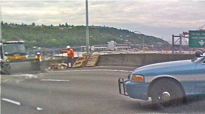
With traffic already backed up all the way to I-5, that means a real commute crunch. She says the low bridge problem briefly reported earlier this afternoon IS FIXED, so you can try the low bridge, or take 99 south past The Bridge and double back through White Center. We’ll keep you updated. Here’s the view westbound at the trouble spot:

Thanks to Rhonda Porter of The Mortgage Porter (WSB sponsor) for the tip: Accident on the westbound high bridge, west side of the rise, apparently involving a truck that lost its load. You can see the backup from this SDOT camera pointing east:
3:06 PM EYEWITNESS UPDATE FROM WSB TEAM MEMBER: What the truck spilled was a load of bricks, so the cleanup’s taking a while. The westbound backup goes all the way back to the exit from I-5.
Just found this in a city traffic advisory:
The March of Dimes March for Babies will occur on Sunday, May 4, with as many as 10,000 walkers participating. The northbound lanes of the Alaskan Way Viaduct will be closed to traffic from 9 to 11 a.m. The march will begin at Qwest Field at 10 a.m., move south on Occidental Avenue South to South Royal Brougham Street, west on Royal Brougham to First Avenue South, north on First onto the northbound lanes of the SR-99 Alaskan Way Viaduct, and north on the viaduct to approximately the Western Avenue off-ramp. Then they will make a u-turn and move back to Qwest field along the same route.
A member of Team WSB reports a stalled car on the eastbound high bridge is starting to slow things down. It’s stalled “roughly even with Nucor” so the Fauntleroy approach will be most affected.

While over near High Point a short time ago, we detoured to see if the 34th/Morgan crosswalk promised by the city — after a long fight by neighbors and pedestrian-safety advocates — was in place yet. As the photo above shows, we discovered the SDOT crew is on the scene right now painting the stripes. This is the same spot where our video report in January documented the dangerous situation for kids headed to West Seattle Elementary (a few blocks south on 34th) and for their crossing guard. The city noted in this WSB update 2 weeks ago that this is a “temporary” crosswalk, but those who have long wanted it are cheering for it nonetheless. Perhaps no coincidence, it should be done just in time for a walk-to-school event later this week. 4:05 PM ADDITION: City Councilmember Nick Licata, who visited High Point a few months back to look at some of the pedestrian-safety concerns, has just launched a website devoted to the topic, although if you’ve got any of the types of photos he’s talking about, send them to us too, since our turnaround time’s an awful lot quicker.
The city just sent out a traffic alert about three May Day marches tomorrow that might affect you even though they’re not in West Seattle – particularly if you use Alaskan Way or East Marginal Way – so we’re passing it along:Read More
Just passed a massive backup on the eastbound high bridge – radio report says it’s a car vs. motorcycle crash, nobody hurt but even as we saw the fire and police units just rushing to the scene about 10 minutes ago, the backup was already all the way to the 35th/Fauntleroy entrance. Not sure if Delridge/Admiral onramps are any better so if you have to use The Bridge, try alternate routes or just try waiting. Here’s the city cam looking westward over the eastbound backup (refresh this page for the newest image)
8:18 AM UPDATE: Radio report says the vehicles are now off to the side but the backup will persist a while.

Two things about that photo of the south side of Barton, alongside Roxhill Park across from Westwood Village, are notable — what you see, and what you don’t see. What you do see: Shiny new “4-Hour Parking” signs, as promised to the Westwood Neighborhood Council and other activists (here’s our report from earlier this month; there also had been an update last month when we covered the West Seattle Community Safety Partnership meeting). What you don’t see, as a result of the new signs: The makeshift used-car-sales lot (and RV park) eyesore and safety risk that this stretch had been (note the empty space in our photo – we pulled over just past the Metro bus parking zone on the west edge of the block).

(photo by WSB contributing photojournalist Christopher Boffoli)
We just checked in with Austin Pratt — regional bridge commander for the U.S. Coast Guard — to find out why the proposal to ban most openings of The Low Bridge during rush hours still hasn’t gone to official publication, and therefore public comment. We first told you about this last month — West Seattle-residing City Councilmember Tom Rasmussen‘s push for the restrictions to ease traffic troubles (March 3 WSB report), then the Coast Guard’s role in proposing and reviewing it (March 6 WSB report). As Pratt explained at the time, the proposal must be published in the Federal Register, and that launches a 60-day formal comment period and 30-day review period before a decision can be made; he was hoping that comment period would have started by now, but getting to the FR publication stage (which also will be reported in the USCG’s “Local Notice for Mariners“) required a series of approvals, and he told us a few minutes ago, “It’s on the Admiral’s desk today.” Barring any further delays, that means the comment period should finally open within a couple weeks; we will keep watch and let you know when it starts and how to make sure your voice is heard (which, as we reported last month, will require including the official “docket number” in your comment).

That photo, and report #1, from Arbor Heights Elementary teacher Mark Ahlness:
It’s finally happening! The sidewalk on the south side of SW 104th next to Arbor Heights Elementary School is almost finished. Many thanks to the Arbor Heights PTSA, who have worked for several years with the city to make this happen!
The Arbor Heights sidewalk project was first mentioned here last November.
Report #2: As Manuel noted in his e-mail, the issue he is following isn’t technically in West Seattle, but certainly affects a lot of WS drivers “who use South Spokane Street to go to Costco or work.” He continued:
I wrote SDOT inquiring about the poor condition of the concrete panels at the railroad crossings down there. Over time they sunk several inches, and drivers had to slow way down. They have since fixed the eastbound panels, but the westbound panels are currently pretty bad. Anyway, just passing along a well-thought-out response from our city.
Read on for the full text of the response that Manuel received and forwarded:Read More
Just in from the city Transportation Department:
A contractor for a private development will close the 2100 block of Bonair Drive SW in West Seattle to traffic next week to repair the roadway. The street will be closed between Alki Avenue SW and Halleck Avenue SW (map) for four to five days. Drivers will need to use an alternate route.
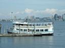 We asked the staff of West Seattle’s King County Councilmember Dow Constantine for some info-bits to add to our Elliott Bay Water Taxi countdown, and here’s one for starters — Take a close look at this year’s schedule; the “maintenance break” gap at midmorning is gone; King County staff worked with Argosy to shorten the time needed, so there’s now a 9:30 boat from Seacrest and a 10:30 boat from Pier 55. (The Water Taxi starts its season on Sunday; rides are free all day and there’s a celebration from noon-2 pm.)
One more event we’re counting down to – opening day for the Elliott Bay Water Taxi a week from tomorrow. (Full schedule here, including details on the opening-day festivities.) Rides are free all day that day, but for subsequent trips, there’s a coupon for a freebie on a postcard from West Seattle’s King County Councilmember Dow Constantine that’s landing in (postal) mailboxes now (we just got ours).

People returning home tonight from work to the Alki neighborhood along and around SW Stevens and 59th/60th environs will notice many new markings like that (as well as the word “locate”) on the curbs near driveways and corners, thanks to a city Transportation Department worker who was out there, wielding a can of white spray paint, this morning.

This is a busy parking street about to get busier, with the sign in the photo above heralding a teardown we’ve mentioned before, five units going up in its place, directly across 59th from Alki Elementary/Playground/Playfield. But the city marking project — delineating the areas around driveways/corners that must be kept clear — is the first step toward getting cars out of some illegal spaces on the street, for safety’s sake:Read More
Last night we published a letter on which we were cc’d, from Denise Sharify of High Point’s Neighborhood House, regarding some long-fought-for High Point-area pedestrian-safety improvements that are apparently finally on the way. This afternoon, we got the official details from SDOT communications boss Rick Sheridan and wanted to share that with you too:Read More
34th & Morgan is the High Point intersection – on the way to West Seattle Elementary – where we caught this school-crossing close call on video in January:
Neighborhood leaders and pedestrian-safety advocates have been trying to get that situation improved for a long time; in the story that originally accompanied that clip, we detailed some of their concerns. Then on April 1st, we told you about Denise Sharify, who works in High Point for Neighborhood House, pleading with the City Council’s Pedestrian Safety Committee to take action; we followed up the next day. Now tonight, we just got cc’d on this letter she wrote to them:
Dear Mr. Licata, Ms. Drago, Ms Clark, Mr. Conlin and Mr. Burgess:
I was walking to High Point this afternoon and discovered that Jim Curtin of SDOT was measuring this intersection for a temporary crosswalk. New student crossing signs will also be moved to appropriate locations. Two new signs to restrict parking were installed last week and Leah, the crossing guard reported that it is making a big difference for pedestrians and drivers. In addition, Mr. Curtin informed me that the half traffic light at 35th and Raymond will be changed to a full traffic light which is desperately needed.
I cannot thank you enough for you support and your commitment to making our pedestrians safer in this neighborhood. We will invite you to a celebration after the crosswalk is painted (and when the weather is nice).
Thank you very much,
Denise Sharify
Jim Curtin is the newly reassigned SDOT “community traffic liaison” who was part of the West Seattle Community Safety Partnership briefing we covered two nights ago. (The 35th/Raymond light upgrade is mentioned in that report; that addresses some of the challenges Councilmember Nick Licata witnessed firsthand during a High Point tour with Sharify and others [WSB video coverage here].)
Here’s the West Seattle version; unveiled today to accompany a mayoral news conference. (Some of what’s on the map is featured in our report from last night’s WSCSP meeting.)

| Comments Off on Mystery finally solved: THAT’S what those poles are for!