West Seattle, Washington
16 Tuesday
(SUNDAY AFTERNOON/EVENING NOTES: Since the weather is the big news, we are keeping this story atop the WSB home page. *But* we have published more, newer news too – scroll past this story to find those other stories while this remains at the top of the page. We’re updating this story too, until we start a new weather story around mid-evening – latest update: Metro will run SNOW ROUTING Monday morning.)
(Video added 2:10 pm, a few minutes after we shot it outside WSB HQ)
ORIGINAL 11:14 AM REPORT: Some flakes are falling in Upper Fauntleroy. That follows the 6 am-ish sighting in Sunrise Heights mentioned in our previous weather report, and a Twitter note reports light snow in Admiral about an hour ago. Seen any where you are? Meantime, the National Weather Service has changed its forecast again. Latest one (which is accompanied by a new “special weather statement”) says:
This Afternoon: Snow likely. Mostly cloudy, with a high near 37. Northwest wind 7 to 9 mph becoming east northeast. Chance of precipitation is 70%. Total daytime snow accumulation of less than a half inch possible.
Tonight: Snow showers likely, mainly after 4am. Mostly cloudy, with a low around 33. North northwest wind between 6 and 14 mph. Chance of precipitation is 60%. New snow accumulation of less than a half inch possible.
Monday: Snow showers likely, mainly before 10am. Partly sunny, with a high near 36. Windy, with a calm wind becoming north between 27 and 30 mph. Winds could gust as high as 36 mph. Chance of precipitation is 60%. New snow accumulation of 1 to 2 inches possible.
As for online forecaster Cliff Mass – as of a few hours ago, he was forecasting a north/south split.
2 PM UPDATE: A somewhat serious snow flurry? shower? up here right now. Recording video. Meantime, the National Weather Service has upgraded its alert to a Winter Weather Advisory.
2:27 PM UPDATE: The video we added atop the story is from our HQ, about 340 feet up, but it’s snowing close to sea level too – Lola shared this video from Fauntleroy/Findlay in Fairmount Springs:
Your photos, video, and info VERY MUCH welcome, as this goes on – not just “isn’t it pretty” but also, if it starts to affect roads (etc.), there’s huge value in showing what’s happening where you are – here’s all the ways to get it to WSB – thanks!
2:44 PM UPDATE: Just in from SDOT:
Temperatures are expected to drop later today on Seattle streets. Crews will begin late this afternoon applying anti-icing material on hills, curves and known icy spots. They will continue with anti-icing operations through the evening and night while continuing to carefully monitor the temperature and condition of the pavement. If any snow starts to accumulate Monday morning, the crews will begin to plow snow routes.
Still not sticking so far as we can tell. No sign of that in the cameras on the WSB Traffic page, either. (Remember that there are more cameras on that page than last time we saw snow, since the city has added “live” cameras in The Junction and Fauntleroy, among other places.)
3:21 PM UPDATE: Via Twitter, Rhonda from The Mortgage Porter (WSB sponsor) points out that the newest forecast says we might see wind gusts tomorrow as high as 47 miles per hour.
4 PM UPDATE: WSDOT is out with its “we’re ready” news release. Haven’t found it linked on their website yet and it’s a little long to run the whole thing here, so we’ve put it on a page here. Meantime, Danny Gawlowski of the Seattle Times (WSB partner) has compiled some scenes from around The Junction:
The artist you see, briefly, in Danny’s video is Linus Von Moos, painting outside Twilight Artist Collective – we’ve just published a separate story about what he’s doing. (Remember that for now, we’re keeping this atop the home page, but there are newer stories below it; when we’re ready to “unstick” this story later, it’ll fall back down into its chronological place.)
5:21 PM UPDATE: Just in from Metro’s Linda Thielke:
Due to the potential for snow during the morning commute, King County Metro Transit will start service on Monday with buses in all areas on snow routing. Metro has been monitoring the weather over the weekend and preparing for the possibility of snow. The Monday forecast from the National Weather Service indicates that cold temperatures and more moisture could cause snowfall in King County starting in the morning and lasting throughout the day. Check Metro Online at www.kingcounty.gov/metro/snow before traveling on Monday.

Our morning weather report carried a photo and information from JayDee about whitecaps and the north winds. This afternoon, once the tide rose, those winds brought these spectacular scenes. Thanks to David Hutchinson for the top photo and this next one:

And thanks to David Rosen of SlickPix Photography for sharing this video:
As for the latest forecast – here’s the link – the “s” word only makes a cameo; the National Weather Service also has a “special weather statement” in effect regarding the even-chillier temperatures on the way. 9:40 PM UPDATE: Cliff Mass has published his latest forecast within the past half-hour. Seattle snow? His answer: No. 6:01 AM UPDATE: Overnight, the NWS lifted the “special weather statement” – the lows don’t look to be heading quite so low. 6:27 AM UPDATE: Paul in Sunrise Heights reported a little light snow as of a little while ago – not seeing it here in Upper Fauntleroy, though.
(AFTERNOON UPDATE: A “special weather statement” now covers our area – scroll down)

Thanks to JayDee for sharing that Alki overview, photographed this morning – he calls attention to “the white caps and white stratus blowing from the north. The stratus has that reversed-incline that is the opposite of the surface wind direction — winds aloft are still from the south, which stretches the clouds northward.” Bottom line, he notes, it’s clear “the outflow from the Fraser is coming.” That’s the cold air from Canada that forecasters have been warning us about. Still no special warnings/alerts for our area, and the National Weather Service‘s latest map shows even the ones for other parts of Western Washington have largely been canceled. But popular online forecaster Cliff Mass wrote late last night about “uncertainty” – the cold seems certain, chances of snow, not so much. And the current NWS forecast for the city says it could dip into the upper 20s tonight. So focus on the freeze, make sure your pipes are ready, etc. (here’s lots of advice from Take Winter By Storm). We’ll be here 24/7 as always, to report/share weather, road, bus, school information as needed. 4:32 PM UPDATE: From David Rosen of SlickPix Photography, waves crashing over the Alki Beach seawall this afternoon:

The NWS now has a “special weather statement” covering the area – including the chance of snow – though it’s projecting that it’s not likely north of Tacoma; here’s the latest.
A “short-term forecast” alert is just out from the National Weather Service for the entire metro area (and then some):
A LINE OF SHOWERS EXTENDING FROM NORTHEAST OF THE PUGET SOUND REGION TO THE SOUTHWEST INTERIOR IS MOVING SLOWLY TO THE EAST. SOME OF THE SHOWERS HAVE BEEN HEAVY…WITH AMOUNTS BETWEEN A HALF TO THREE QUARTERS OF AN INCH IN LESS THAN AN HOUR. SOME LOCALIZED PONDING OF WATER AND URBAN FLOODING IS POSSIBLE WITH THESE SHOWERS. THESE SHOWERS WILL CONTINUE INTO THIS EVENING.

Sunset on Beach Drive – not nearly as chilly as it’ll be in a few days, with the forecast still mentioning “snow showers” as a possibility for the weekend (no sooner than Friday night). But first, it’s likely to be breezy – up to 25 mph in tomorrow’s forecast. And there’s analysis of last night’s windstorm, plus a brief look ahead to snow prospects, on Cliff Mass‘s site right now.
You’ve probably noticed the wind’s gotten even gustier – we’ve heard of gusts in the 40s, and now the National Weather Service has put out a “wind advisory” in effect till 1 am. Also have word so far of outages in Shorewood and Arbor Heights, though they’re not on the City Light tracker yet – it says 76 are out citywide but an SCL news release says 17,000. 10:51 PM UPDATE: Tracker’s working now and shows the 4,200+-out patch in Shorewood & beyond.
(video no longer available due to blip.tv shutdown)
Right around sunset – if sunset had been visible – wave-watchers dotted the guardrail south of Alki Point, including one man so exhilarated, he exclaimed repeatedly, “I love it!” The tide wasn’t high enough for the waves to crash against the seawall, but the wind was gusting in the 30s. And it’ll be that way through tonight, according to the newest forecast – which still mentions “a chance of snow showers” late in the weekend, by the way. One more note: No power outages right now in West Seattle (here’s where you’d find the information if there were). 9:25 PM UPDATE: As noted by William in comments, a few people are out of power in north West Seattle, according to City Light’s tracker – and there have been flickers many other places.

(WSB photos by Ellen Cedergreen)
With November so far being rainier than average – never mind that still-out-there possibility of snow showers this weekend! – the city wants people in landslide-prone areas to be on high alert (here’s one way the risk is tracked). This morning, they invited the media to an Admiral home for a demonstration of landslide-preparedness do’s and don’ts. Ellen Cedergreen was there for WSB; she reports that, in the top photo, Seattle Public Utilities landslide expert Bill Benzer is demonstrating the importance of keeping drains cleared – stormwater that has no place to go can run down slopes, adding to the landslide risk. Clearing drains tops this list of what to do:
1. Maintain drainage system (pipes, ditches, etc., on your property and keep street drains free of leaves and debris.
2. Direct stormwater away from steep slopes, if possible.
3. Perform periodic inspections of property before winter and during storms, keeping safety as the #1 concern.
4. Check weep holes on walls and keep them open.
5. Be alert during and following storms.
6. If you have an irrigation system, shut if off and check it out seasonally.
7. Keep fill and yard waste off slopes.
8. Leave stumps in ground on slopes
9. Call a professional if you have questions or a problem.
Part of the drainage check – annually checking downspouts for blockages:

Meantime, the landslide “don’ts”:
1) Don’t direct storm or other water onto a slope
2) Don’t denude vegetation on slope without a re-vegetation plan
3) Don’t cut into the toe (or bottom) of a slope.
4) Don’t remove tree stumps from slopes.
5) Don’t install a permanent irrigation system in landslide-prone areas
6) Don’t put fill or yard debris on a steep slope.
According to a study discussed at today’s event, 86 percent of landslides have some human involvement: broken pipes, uncontrolled storm water, excavating and filling holes. The city is taking a more active role in prevention since 1996-1997, when more than 300 landslides were reported, and no matter what kind of winter weather you’re facing, be ready! From the “Take Winter by Storm” campaign, Cornell Amaya showed off his emergency-preparedness backpack:

What should be in your kit? Here are some ideas (and don’t forget all the great resources at West Seattle Be Prepared). And you can get more tips about landslide awareness and prevention by going to a free city-sponsored workshop (previously mentioned here) that’s coming up on December 4th at South Seattle Community College‘s Judge Warren and Nobie Chan Education Center (across from the north parking lot), 10 am-noon.

(WSB photo by Ellen Cedergreen)
Just five days after SDOT invited the media to come see its winter-weather equipment and listen to the readiness plan … there seems to be a slight chance of its deployment within a week. Late today, the National Weather Service issued a “special weather statement” for much of Western Washington, including our area, raising the possibility — however small — of cold weather that could even bring a bit of snow. From the advisory (yes, it’s published in all-caps):
…A CHANGE TO MUCH COLDER CONDITIONS IS POSSIBLE FRIDAY INTO NEXT WEEKEND…
COLD AIR IS EXPECTED TO DEVELOP OVER WESTERN CANADA DURING THE UPCOMING WEEK. THERE ARE STRONG INDICATIONS THAT CHANGES IN THE WIND FLOW ALOFT TOWARD THE END OF THE WEEK WILL ALLOW SOME OF THIS COLDER AIR OVER WESTERN CANADA TO FILTER INTO WESTERN WASHINGTON FRIDAY OR SATURDAY.
WEATHER GUIDANCE ALSO SUGGESTS THAT THERE IS A RISK OF SNOW…OR MIXED RAIN AND SNOW SHOWERS OVER PORTIONS OF THE AREA FRIDAY OR SATURDAY. THE HIGHEST RISK WILL BE WHERE THE AIR IS COLDER…OVER THE NORTH INTERIOR.
WHILE WEATHER GUIDANCE HAS BEEN CONSISTENT IN SHOWING A CHANGE TO A COLDER WEATHER PATTERN…THEY HAVE BEEN UNEVEN IN SHOWING HOW COLD IT WILL GET AND HOW MUCH…IF ANY…SNOW WILL FALL.
NOW WOULD BE A GOOD TIME TO THINK ABOUT HOW YOU COULD PREPARE FOR THE FIRST POSSIBILITY OF WINTER WEATHER CONDITIONS IN THE LOWLANDS.
SDOT’s snow/ice-route maps are online here; here’s the direct link to the West Seattle segment. P.S. No word from famous forecaster Cliff Mass yet, at least as of 5:30 pm; we’ll keep checking.

Could be an omen, or not. Last year, when SDOT invited the media to its Charles Street yard to discuss its revamped and beefed-up snow plan, it was a brilliantly sunny day. Today, the same event happened on a day graced by a regional rainstorm. Mayor McGinn was there for the briefing; the photo above is from WSB contributing photojournalist Ellen Cedergreen, who’ll be sending more information and photos we’ll add to this report soon – snowplows and sand were part of the snow-fighting arsenal that was to be shown off. (Photo added – salt, too:)

In the meantime, SDOT has said that the revamped plan from last year — which never had to be deployed — is the basis for what’s in place this year; you can check out its Winter Storm information online here.
ADDED 2:25 PM: Just in, SDOT’s news release with highlights of the updated plan discussed today (including other city agencies, plus weblinks and phone numbers to keep handy in case of weather trouble) – click ahead:Read More
Before rainy season really kicks in, the city has advice for people on “landslide-prone” property – steps you can take immediately, as well as a free landslide-awareness workshop here in West Seattle in a few weeks (in addition to one in North Seattle). Read on for the city’s full announcement:Read More

One day after Metro‘s winter-weather briefing for the King County Council (our update with a link to the PowerPoint presentation is here) – which included an explanation of the “memorandum of understanding” between the city and county to make sure bus routes are prioritized during future snow – SDOT is doing snowplow practice again today, for at least the second time this fall. Thanks to Leah for the photo – one of 2 she saw on the Edmunds/41st hill – and also to Cheryl for a tip via Twitter. SDOT tells us its annual winter-weather briefing for the media will happen sometime next week; they drew up lots of new policies and procedures for last year, after Snowpocalypse/Snowmare woes in late ’08, but never got the chance to put them to use. No need to wait for that, though – this winter’s snow-routes map is already available online.

Via Twitter, Dartanyon sent that photo of a tree down across 21st SW, north of Myrtle, not far from Sanislo Elementary, within the past hour. We don’t have updated information yet on whether that tree is still blocking the road – we’ll be heading out to check – but wanted to show it as a general reminder that (a) with this heavy rain, you may run into sudden trouble, and (b) if you do, please share the news, since a localized problem likely won’t make it to the level of, say, an SDOT alert. Here’s how to reach us. P.S. While the latest forecast still suggests it’ll get windier later, that’s been downgraded a bit – the highest predicted wind speed is now 25 mph.

Thanks to Cheryl for catching the Monday rainbow on camera, mixed with a bit of fall colors. By this morning, the windiest and rainiest weather of this storm system is supposed to be behind us, but it’ll still be showery and breezy for much of the day, according to the current outlook. (If this first bout of semi-storminess has put you in the mood to make sure you’re ready for whatever the winter will bring, check out the info on the Take Winter By Storm site.)
10:46 AM: Our power just went out. Checking on the extent.
10:51 AM UPDATE: We’ll make this an overall storm update – also just received a text about trouble on the West Seattle Bridge, nothing on 911, though. Meantime, via Twitter and text, we hear power’s out in High Point – flickered in Fauntlee Hills and Fairmount Park area but didn’t go out. This is not on the new Seattle City Light outage tracker yet – we’ll see how long it takes to show up. We’ve also got someone driving around to see who’s out where – on California SW through Gatewood, it appears to be back around SW Holden; we’re checking 35th next.
11:06 AM UPDATE: We called City Light to be sure someone had reported this, since it’s still not on the outage tracker. The customer-service rep says it’s out in “patches” – 108 customers (each home/business is one “customer”) in this area. Most other areas checking in via comments here, Facebook, Twitter, and e-mail, say there were widespread “flickers” but the power stayed on for them.
11:23 AM UPDATE: The City Light outage tracker is showing this now (no cause or “estimated restoration time” yet). And this seems to be the only WS pocket right now, that same 108-customer count.
11:57 AM UPDATE: There are now two “pockets” listed by City Light in the West Seattle area, with more than 200 customers affected – besides this one, there’s a stretch immediately east of central Lincoln Park.
12 PM UPDATE: Our power just returned. But the windblown rain has just intensified …

(Photo added 5:17 pm, courtesy Jerry from JetCityOrange.com)
A few minutes ago, the National Weather Service sent out a “short-term forecast” alert:
A LINE (of) SHOWERS IS MOVING THROUGH THE PUGET SOUND REGION. SOME LIGHTNING AND THUNDER IS POSSIBLE WITH THESE SHOWERS DURING THE NEXT HOUR. BRIEF HEAVY DOWNPOURS ARE POSSIBLE AS WELL.
Overall, the latest forecast predicts gusts up to 24 miles per hour, but 40-mph gusts are possible tomorrow.

(Photo of this morning’s fog just over The Bridge, courtesy Rick)
Even famous forecaster Cliff Mass cautions, in bold type no less, “I don’t want to get anyone excited.” But there’s a possibility of noteworthy wind in the forecast this weekend, he and other weather experts say, and since that sort of weather has been known to lead to trouble around here, we just want to give you a friendly heads-up; even if this possibility doesn’t pan out, it’s not a bad idea to make sure you’re ready just in case, as we get further into the fall. Here’s what Cliff wrote about the POSSIBLE wind; the National Weather Service‘s forecast discussion mentions it too.

(2008 photo courtesy Nancy, partly blocked drain in North Delridge)
We start today’s preview with a public-service reminder suggested by Katie – go check (and clear, if necessary) your storm drains. With all this rain – right as autumn leaves start to fall – there could be big trouble, fast. Here’s some info from Seattle Public Utilities, specifically focused on its “Adopt-A-Drain” program … Another day of work parties: 10-10-10 events are catalogued by 350.org here – they include a tree-planting event in Schmitz Park starting at 10 am … As previewed here on Saturday, the TEDxRainier event will be streamed live at Hotwire Online Coffeehouse (WSB sponsor) in The Junction, 10 am-6 pm … Also in The Junction, the Sunday tradition – West Seattle Farmers’ Market, 10 am-2 pm.
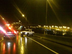 Via Twitter, @derekjlunde just shared that photo from what appeared to be a spinout toward the east end of the West Seattle Bridge. And that’s not the only mishap working at this hour – the 911 log also notes a fairly sizable callout right now for a crash on northbound 99 by Safeco Field (update: 2 people were hurt in that one-car crash, according to the scanner, including a 17-year-old girl). Since the forecast calls for off-and-on rain most of the weekend, it’s a good reminder about one thing – after a period without rain, the first major rainfall tends to lead to slicker roads as everything that’s been soaking in starts to float out. (One traffic alert this weekend – tonight and tomorrow night, overnight, Alaskan Way will be constricted south of the ferry dock as crews work to shore up the Washington Street Landing area where the West Seattle Water Taxi‘s Rachel Marie crashed two weeks ago.)

Thanks to David Rosen from SlickPix Photography for the sunset shot. Forecast suggests at least one more day of sun – and some chillier air early next week (lower-40s low on Monday night?).
 Though the sun’s out and there’s not a cloud in the sky, at least one snowplow has been traveling West Seattle roads this morning. Cheryl reported a sighting via Twitter, so we checked with SDOT, whose Marybeth Turner confirms: “We’re conducting a test run today so that drivers are familiar with the city’s snow routes and to make sure equipment is functioning properly.” (If you see one, send a photo!) Maybe a good thing they’re testing early, considering the outlook. (Photo at left is from last year’s test runs, while we see if anybody catches one on camera today.)

The clouds are back after four hours of sunshine graced the second half of the West Seattle Junction Car Show – but not before yielding a perfect rainbow arc over Elliott Bay. Kristina shares the photo above: Jerry from JetCityOrange shares the video below:
(added 7:47 pm) David Hutchinson shared a photo too:

And Jillian got the water-taxi perspective:

Thanks again to everyone who shared photos! You might not be surprised to hear famous forecaster Cliff Mass say that this may wind up as the wettest September on record.

The day that began cloudy, rainy, and murky, ended spectacularly. Thanks to Mike B for the sunset photo. Tomorrow, the forecast promises, er, suggests, we’ll see sun again in the afternoon!
| 39 COMMENTS