
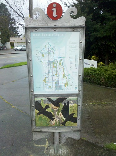
So much for “Pothole Drive” – the Beach Drive wayfinding-kiosk shell that briefly held the cardboard guerrilla art/road-conditions commentary has now been completed with its intended display. The photos are courtesy of Chas Redmond, pedestrian advocate (among other roles), long involved with the kiosk project and now reporting five more are in place. Another is across from Admiral Way Viewpoint:

And this one’s along the north end of Lincoln Park:

The other two new kiosks are in Alki and Admiral. Each has two different map views, including a closer look at the area where it’s been placed, along with different art on both sides. This is part of a wayfinding project that’s been in the works more than three years – its first phase was the West Seattle Trails map (here’s an early report from 2008).
| 6 COMMENTS